GR1: Sendero Histórico – A Journey Through Spain’s Medieval Heart
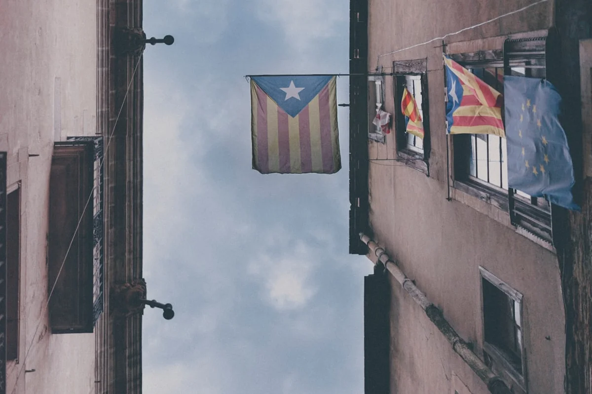
The GR1, famously known as the Sendero Histórico (Historical Path), is one of Spain’s most ambitious and culturally rich long-distance walking routes. Stretching approximately 1,250 kilometres across the northern reaches of the Iberian Peninsula, it offers a profound alternative to the more crowded Camino de Santiago. The trail begins at the ancient Greco-Roman ruins of Sant Martí d’Empúries on the Mediterranean coast of Catalonia and traverses the southern flanks of the Pyrenees and the Cantabrian Mountains, eventually reaching the Atlantic cliffs of Finisterre in Galicia. This is not merely a hike; it is a chronological odyssey through the "Reconquista" frontier, where every valley holds a fortified village, every ridge supports a Romanesque hermitage, and every river crossing tells a story of a thousand years of conflict and coexistence.
Unlike the high-alpine GR11 which hugs the Pyrenean crest, the GR1 winds through the Pre-Pyrenees—a landscape of dramatic limestone canyons, oak forests, and rolling agricultural plateaus. It is a route designed for the curious traveller, favouring historical depth and architectural splendour over sheer vertical gain, though its 39,000 metres of cumulative elevation ensure it remains a formidable physical challenge. The path is characterised by its solitude; walkers can travel for days through "España Vaciada" (Empty Spain), encountering abandoned hamlets and pristine wilderness that feel entirely disconnected from the modern world. For those seeking a deep immersion into the soul of rural Spain, the GR1 provides an unparalleled tapestry of natural beauty and human heritage.
- Distance: 1,250.0 km (approximate total length)
- Duration: 50–60 days for the full traverse
- Elevation Gain: 39,000 m (cumulative)
- Difficulty: Challenging (due to length, navigation, and remote sections)
- Best Time: Spring (April–June) and Autumn (September–October)
- Closest Major Hubs: Girona, Pamplona, Burgos, León
- Direction: Traditionally walked East to West (Mediterranean to Atlantic)
Overview
The GR1 Sendero Histórico is a masterclass in landscape diversity. By following the transitional zone between the high mountains of the north and the vast Ebro river basin to the south, the trail experiences a constant shift in geology, flora, and climate. In the east, the trail begins in the humid, Mediterranean environment of Catalonia, where cork oaks and volcanic landscapes dominate. As the walker moves west into Aragon, the terrain becomes more arid and rugged, defined by the spectacular "Mallos" (conglomerate rock towers) and deep limestone gorges carved by the Cinca and Gállego rivers. By the time the trail reaches Navarre and the Basque Country, the landscape softens into lush green valleys and beech forests, before entering the vast, high-altitude plains of the Meseta in Castile and León.
The defining characteristic of the GR1 is its "Historical" moniker. The route was specifically designed to link the most significant medieval sites of northern Spain. These towns—such as Besalú, Ripoll, Graus, Loarre, Sos del Rey Católico, and Olite—were once the front lines of the medieval kingdoms of Aragon, Navarre, and Castile. Walking the GR1 means passing through perfectly preserved Romanesque arches, sleeping in villages built entirely of golden stone, and crossing bridges that have stood since the 12th century. The trail avoids modern industrial centres, preferring the quiet dignity of the rural interior.
Physically, the GR1 is a test of endurance rather than technical climbing. While there are no glaciers to cross or sheer rock faces to scale, the constant "yo-yo" nature of the Pre-Pyrenean terrain—dropping into a river valley only to climb the next ridge—accumulates significant fatigue. Navigation can be a challenge; while the red-and-white blazes of a Gran Recorrido are present, they are often faded or obscured in the more remote sections of Aragon and Castile. This is a trail for the self-sufficient walker who values silence, history, and the slow revelation of a country’s hidden corners.
History and Cultural Context
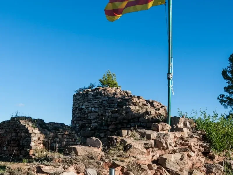
The GR1 is often referred to as the "Frontier Path." Its route roughly follows the shifting borders of the Christian kingdoms as they pushed south against the Caliphate of Córdoba during the Middle Ages. This historical reality has left a permanent mark on the landscape. The trail is dotted with "castillos" (castles) and "atalayas" (watchtowers) perched on inaccessible crags, designed to monitor the valleys below. The cultural heritage of the GR1 is predominantly Romanesque—a style of architecture that flourished between the 10th and 13th centuries, characterised by thick walls, rounded arches, and sturdy pillars. The Monastery of Santa Maria de Ripoll in Catalonia and the Castle of Loarre in Aragon are two of the most magnificent examples of this era found along the route.
Beyond the medieval, the trail touches on even deeper layers of history. The starting point at Empúries contains the remains of a Greek colony founded in 575 BC and a subsequent Roman city, marking the gateway through which classical civilisation entered the Iberian Peninsula. In the western sections, the trail crosses Roman roads and passes near prehistoric cave paintings. The GR1 also provides a window into the more recent, and often tragic, history of rural depopulation in Spain. Many of the villages the trail passes through are "pueblos abandonados"—settlements that were left behind during the industrial boom of the 20th century. Walking through these silent streets, where vines reclaim stone balconies, is a haunting and reflective experience that adds a layer of contemporary social history to the journey.
The trail was officially conceptualised and waymarked in the late 20th century by the Spanish Mountaineering Federation (FEDME) to preserve these ancient paths and promote sustainable tourism in neglected rural areas. It serves as a vital link between the diverse cultures of Spain—Catalan, Aragonese, Navarrese, Basque, Castilian, and Galician—each with their own distinct languages, culinary traditions, and architectural styles. To walk the GR1 is to witness the assembly of the Spanish nation, piece by piece, across a thousand kilometres of stone and soil.
Want more background? Read extended notes on history and cultural context → Learn more
Seasonal Highlights and Weather Reality
The GR1 is a trail of extremes, and timing is critical for a successful traverse. Because it stays at moderate altitudes (mostly between 500 m and 1,500 m), it is accessible for more of the year than the high Pyrenean routes, but it is subject to the fierce continental climate of the Spanish interior.
Spring (April to June): This is arguably the best time to walk the GR1. The wildflowers in the Pre-Pyrenees are spectacular, the rivers are full from snowmelt, and the landscape is a vibrant green. In Catalonia and Aragon, the temperatures are mild and pleasant for walking. However, late spring can bring heavy thunderstorms, particularly in the afternoons, and the mud in the Basque and Navarrese sections can be significant.
Autumn (September to October): Another prime window. The intense heat of the summer has faded, and the beech forests of Navarre and the vineyards of Castile turn brilliant shades of gold and red. The air is often crisp and clear, providing the best visibility for the distant views of the high Pyrenees to the north. Water sources may be scarcer in autumn after the dry summer, so careful planning is required.
Summer (July to August): Walking the GR1 in mid-summer is not recommended for the faint-hearted. Temperatures in the Aragonese canyons and the Castilian Meseta regularly exceed 35°C, and shade is often non-existent. The heat can be oppressive and dangerous, leading to heatstroke and dehydration. If you must walk in summer, start at dawn and finish by midday, and be prepared for very high water consumption.
Winter (November to March): While the GR1 does not reach the extreme altitudes of the GR11, many of its passes (puertos) exceed 1,200 m and will see significant snow. The days are short, and many rural hostels and services close for the season. The Meseta can be bitterly cold with piercing winds. Winter walking is possible for experienced hikers in the lower Catalan sections, but a full traverse requires specialist winter gear and a high tolerance for cold.
Recommended Itinerary
The GR1: Sectional Breakdown
Given the 1,250 km length, most walkers tackle the GR1 in sections. Below is a breakdown of the major geographical segments from East to West.
Section 1: The Catalan Mediterranean & Volcanic Zone (Empúries to Ripoll)
- Distance: 120 km
- Elevation: 3,200 m gain
- Time: 5–6 days
- Key Waypoints: Sant Martí d'Empúries, Besalú, Olot, Sant Joan de les Abadesses, Ripoll
- Highlights: Starting at the Roman ruins by the sea, crossing the medieval bridge of Besalú, and walking through the Garrotxa Volcanic Zone Natural Park.
- Terrain: Coastal plains transitioning into lush, forested hills and volcanic cones.
Section 2: The Pre-Pyrenees of Central Catalonia (Ripoll to Graus)
- Distance: 210 km
- Elevation: 7,500 m gain
- Time: 9–11 days
- Key Waypoints: Sant Llorenç de Morunys, Alòs de Balaguer, Pont de Montanyana, Graus
- Highlights: The dramatic limestone cliffs of the Serra del Cadí and the spectacular Congost de Mont-rebei (a narrow gorge carved into the rock).
- Terrain: Rugged limestone ridges, deep valleys, and remote mountain villages.
Section 3: The Aragonese Canyons & Castles (Graus to Sos del Rey Católico)
- Distance: 180 km
- Elevation: 5,800 m gain
- Time: 8–10 days
- Key Waypoints: Tierrantona, Alquézar, Loarre, Riglos, Sos del Rey Católico
- Highlights: The medieval village of Alquézar, the formidable Castle of Loarre (the finest Romanesque fortress in Europe), and the towering Mallos de Riglos.
- Terrain: Arid, red-rock canyons and high agricultural plateaus.
Section 4: The Kingdom of Navarre (Sos del Rey Católico to Estella)
- Distance: 140 km
- Elevation: 3,500 m gain
- Time: 6–7 days
- Key Waypoints: Ujué, Olite, Artajona, Estella
- Highlights: The Royal Palace of Olite, the fortified hilltop village of Ujué, and the historic streets of Estella (a major stop on the Camino de Santiago).
- Terrain: Rolling hills, vineyards, and historic fortress towns.
Section 5: The Basque Country & Upper Ebro (Estella to Reinosa)
- Distance: 220 km
- Elevation: 6,200 m gain
- Time: 10–12 days
- Key Waypoints: Santa Cruz de Campezo, Miranda de Ebro, Frías, Reinosa
- Highlights: The beech forests of the Izki Natural Park and the stunning medieval town of Frías, perched on a rock above the Ebro River.
- Terrain: Lush green forests, river valleys, and the transition to the Cantabrian Mountains.
Section 6: The Cantabrian Mountains & Picos Fringe (Reinosa to Villafranca del Bierzo)
- Distance: 240 km
- Elevation: 8,000 m gain
- Time: 11–13 days
- Key Waypoints: Cervera de Pisuerga, Guardo, Riaño, Boñar, La Robla
- Highlights: The wild landscapes of the Montaña Palentina and the dramatic reservoir of Riaño surrounded by limestone peaks.
- Terrain: High mountain pastures, oak forests, and remote mining valleys.
Section 7: The Galician Finale (Villafranca del Bierzo to Finisterre)
- Distance: 140 km
- Elevation: 4,800 m gain
- Time: 6–7 days
- Key Waypoints: O Cebreiro, Sarria, Santiago de Compostela, Finisterre
- Highlights: Entering the mist-shrouded hills of Galicia, the cathedral of Santiago, and the final cliffs of the Atlantic coast.
- Terrain: Deep green valleys, granite villages, and coastal heathland.
Important Notes:
- The GR1 is a long-distance commitment; ensure you have adequate rest days (one every 7–10 days).
- Water management is critical in the Aragon and Castile sections.
- Waymarking is inconsistent; always carry GPS and offline maps.
- Accommodation in "España Vaciada" can be sparse; book ahead where possible.
Planning and Bookings
Book Your Trip
Everything you need to plan your journey
Accommodation
Find places to stay near Pamplona
Flights
Search flights to Pamplona
Essential Preparation
Planning a 1,250 km walk requires meticulous logistical preparation. Unlike the Camino de Santiago, the GR1 does not have a dense network of dedicated pilgrim hostels (albergues). You will be relying on a mix of small village hotels, "casas rurales" (country houses), and the occasional municipal hostel. Fitness is paramount; you should be comfortable walking 20–25 kilometres per day with a 10–12 kg pack for multiple consecutive days. Training should include significant elevation gain to prepare for the Pre-Pyrenean ridges.
Logistically, the trail is best accessed via major cities like Barcelona or Girona for the eastern start, and Santiago de Compostela for the western finish. Pamplona serves as an excellent mid-way hub for those only walking specific sections. You must be comfortable with basic Spanish, as English is rarely spoken in the remote villages of Aragon and Castile. Carrying a physical or digital guidebook is essential, as the trail often deviates from the most logical or modern paths to follow historical routes.
Trail Accommodation
Accommodation on the GR1 is varied and requires more planning than on more popular routes. In many villages, there may only be one "casa rural" or a single pension. During the peak spring and autumn seasons, these can fill up with weekend tourists, so booking 24–48 hours in advance is highly recommended.
Types of Accommodation:
- Casas Rurales: Traditional village houses converted into guest houses. They offer high comfort and local food but can be expensive (€50–€80 per night).
- Hostales and Pensiones: Simple, budget-friendly rooms found in larger villages and towns (€30–€50 per night).
- Refugios: In the more mountainous sections (Catalonia and Cantabria), there are mountain huts, though these are less frequent than on the GR11.
- Municipal Albergues: Occasionally available in towns that intersect with the Camino de Santiago, but GR1 walkers do not always have priority.
- Wild Camping: Technically restricted in many regions (especially Natural Parks), but generally tolerated if you "bivouac" (set up at dusk, leave at dawn) and stay away from settlements and water sources.
Facilities: Most paid accommodation provides bedding, towels, and hot showers. In smaller villages, you may need to arrange dinner with your host in advance, as there may be no local restaurant or shop.
Required Gear
- Footwear: High-quality trekking boots or sturdy trail runners. The terrain is often rocky and abrasive; ensure they are well broken-in.
- Backpack: A 40–50 litre pack is usually sufficient if staying in accommodation. Include a high-visibility rain cover.
- Clothing: A layering system is essential. Include moisture-wicking base layers, a fleece or down mid-layer, and a high-quality waterproof shell (Gore-Tex or similar).
- Navigation: A dedicated GPS device or a smartphone with offline maps (e.g., Gaia GPS, Wikiloc). A paper map or guidebook is a vital backup.
- Sun Protection: High SPF sunscreen, a wide-brimmed hat, and quality sunglasses. The Spanish sun is intense, even in the shoulder seasons.
- First Aid: A comprehensive kit focusing on blister care (Compeed, tape), antiseptic wipes, and basic pain relief.
What to Bring
- Water Treatment: A lightweight filter (e.g., Sawyer Squeeze) or purification tablets. While many villages have "fuentes" (fountains), their potability is not always guaranteed in remote areas.
- Power Bank: To keep your navigation devices charged during long days in the wilderness.
- Universal Sink Plug: Useful for washing clothes in hostel sinks.
- Dry Bags: To keep your electronics and spare clothes dry during the inevitable spring or autumn downpours.
- Snacks and Emergency Food: Always carry at least one day's worth of emergency rations (nuts, energy bars, dried fruit), as village shops have unpredictable opening hours (the "siesta" is real).
- Cash: Many small village bars and pensions do not accept credit cards. Carry at least €100–€200 in small denominations.
- Trekking Poles: Highly recommended to save your knees on the constant steep descents into limestone canyons.
Permits
One of the great advantages of the GR1 is that no formal permits are required to walk the trail. It is a public right-of-way that passes through a mix of national parks, regional parks, and private land. However, there are several administrative and logistical "permits" in a broader sense that you should consider.
National Park Regulations: When passing through protected areas like the Garrotxa Volcanic Zone or the Picos de Europa fringe, strict regulations apply regarding wild camping and fires. Always check the specific rules for each "Parque Natural" you enter. Generally, camping is prohibited, but bivouacking above certain altitudes is allowed.
The Credencial: While the GR1 is not the Camino de Santiago, it intersects with it in several places (such as Estella and Villafranca del Bierzo). If you plan to stay in pilgrim albergues in these sections, you will need a "Credencial" (Pilgrim Passport), which can be obtained at major cathedrals or pilgrim offices for a few euros.
Insurance: While not a permit, having mountain rescue insurance is highly recommended. If you are a member of a national alpine club (like the BMC in the UK or the DAV in Germany), your membership often includes reciprocal rescue insurance in Spain through the FEDME (Spanish Mountaineering Federation).
Hunting Season: Be aware that the trail passes through many "Cotos de Caza" (hunting reserves). Hunting season typically runs from October to February. While the trail remains open, it is wise to wear bright colours and stay on the marked path during these months.
Other Activities in the Area
The GR1 passes through some of Spain's most culturally vibrant regions. Consider taking a day off to explore these attractions:
- Wine Tasting in Olite and Estella: The trail passes through the heart of the Navarra and Rioja wine regions. Many "bodegas" offer tours and tastings of their world-class Tempranillo and Garnacha wines.
- Canyoning in the Sierra de Guara: Near the village of Alquézar, the Sierra de Guara is world-famous for its turquoise pools and limestone narrows. Professional guides offer day trips for all levels.
- Bird Watching in Riglos: The Mallos de Riglos are home to one of Europe’s largest colonies of griffon vultures. Bring binoculars to watch these massive birds soar around the 300-metre rock towers.
- Romanesque Art Tours: In towns like Ripoll and Sant Joan de les Abadesses, you can spend hours exploring the intricate stone carvings and cloisters of ancient monasteries.
- Hot Air Ballooning in La Garrotxa: See the volcanic cones of Catalonia from above for a unique perspective on the start of your journey.
- Gastronomy Tours: Each region has its specialty—try "Migas" in Aragon, "Chuletón" in Castile, and fresh seafood in Galicia.
Safety and Conditions
Navigation and Remote Areas: The GR1 is not as well-trodden as the Camino de Santiago. In sections of Aragon and Castile, the waymarking can be poor or non-existent. It is easy to lose the trail in overgrown oak forests or on rocky plateaus. Always have a GPS track and know how to use a compass. Tell someone your daily plan, as you may not see another walker for days.
Water Scarcity: In the central sections of the trail, particularly in summer and autumn, water is a major safety concern. Some stages have no reliable water sources for 20 kilometres or more. Never pass a "fuente" without topping up your bottles, and carry at least 3 litres in hot weather.
Weather Extremes: Be prepared for rapid temperature shifts. A sunny morning in the Pre-Pyrenees can turn into a violent hailstorm by mid-afternoon. Hypothermia is a risk in the shoulder seasons if you get wet and the wind picks up on a high ridge. Conversely, heat exhaustion is a very real threat in the open plains of the Meseta.
Wildlife: You will encounter plenty of livestock—cows, sheep, and goats. Be respectful and give them space, especially if they have calves. Guard dogs (Mastins) are common in the mountains; they are large and loud but generally stay with their flock. If you encounter one, stay calm, keep your distance, and walk slowly around the herd. Wild boar and vultures are common, but they pose no threat to humans. Bears and wolves exist in the Cantabrian mountains but are extremely elusive.
Emergency Services: The emergency number in Spain is 112. Mobile signal is generally good on ridges but can be non-existent in deep canyons. Consider carrying a satellite messenger (like a Garmin inReach) if walking solo.
Side Trips and Points of Interest
Congost de Mont-rebei: This is perhaps the most spectacular natural feature on the entire GR1. Located on the border between Catalonia and Aragon, the Noguera Ribagorçana river has carved a sheer gorge through the Montsec mountains. The trail is literally hacked into the side of the cliff, hundreds of metres above the turquoise water. A side trip to cross the suspension bridges and climb the wooden stairs of Montfalcó is highly recommended.
The Castle of Loarre: Do not rush past this site. Built in the 11th century, it is one of the best-preserved Romanesque castles in the world. Its location, perched on a limestone outcrop overlooking the Hoya de Huesca plains, is breathtaking. Spend a few hours exploring its royal chapel, dungeons, and towers.
Alquézar and the Vero River: This medieval village is often voted one of the most beautiful in Spain. A popular side trip is the "Pasarelas del Vero"—a series of metal walkways suspended over the river at the bottom of the canyon, offering a close-up view of the incredible geology and crystal-clear pools.
The Monastery of San Juan de la Peña: Located near Jaca, this monastery is built directly under a massive overhanging rock. It was the spiritual heart of the early Kingdom of Aragon and is shrouded in legends of the Holy Grail. It requires a short detour from the main GR1 route but is architecturally and historically unique.
The Romanesque Churches of the Vall de Boí: While slightly north of the main GR1, this UNESCO World Heritage site is accessible via a short bus or taxi ride from the trail. It contains the highest concentration of Romanesque architecture in Europe, set against a stunning mountain backdrop.
Leave No Trace
The GR1 passes through fragile ecosystems and ancient cultural landscapes that are under increasing pressure from climate change and rural abandonment. As a walker, you have a responsibility to minimise your impact and support the local communities that keep these paths open.
Core Principles for the GR1:
- Respect the "España Vaciada": Many villages have very few residents, often elderly. Be quiet, respectful, and always ask before taking photos of people or private property.
- Support the Local Economy: Buy your supplies in village shops and stay in local "casas rurales." Your presence is a vital economic lifeline for these communities.
- Waste Management: There is no rubbish collection on the trail. Pack out all your trash, including organic waste like orange peels and nut shells, which decompose slowly in arid climates.
- Water Protection: Do not use soap (even biodegradable) in rivers or village fountains. Use a container to carry water 30 metres away from the source for washing.
- Fire Safety: Wildfires are a massive threat in Spain. Never light an open fire, and be extremely careful with camping stoves. In high-risk periods, the use of stoves may be prohibited entirely.
- Stay on the Path: To prevent erosion and protect crops, always stay on the marked trail. Many sections pass through private farmland; leave gates exactly as you found them (open or closed).