The Glyders Loop: Snowdonia's Majestic Mountain Circuit
The Glyders Loop is a quintessential mountain walk in the heart of Snowdonia National Park, North Wales. This challenging circuit takes you through some of the most dramatic and iconic scenery the UK has to offer, encompassing rugged peaks, vast glacial cirques, and breathtaking panoramic views. The route is renowned for its rocky terrain, steep ascents, and the sheer scale of its mountain landscapes, making it a rewarding experience for experienced hikers and seasoned mountaineers.
- Distance: 12.0 km
- Elevation Gain: 1000 m
- Duration: 5-6 hours
- Difficulty: Challenging
- Best Time: April-October
- Closest City: Bethesda
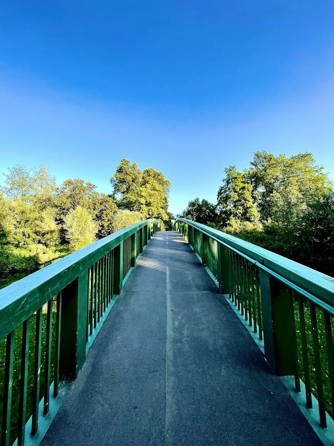
- Trailhead Access: Nearest city: Bethesda. From Bethesda, take the A5 east towards Capel Curig. Ogwen Cottage is a prominent landmark on the A5. Parking available at Ogwen Cottage (charges apply). Limited bus service. No permits needed. Road conditions are generally good. GPS: 53.1144, -4.0078
- Coordinates: 53.1216, -4.0560
Overview
The Glyders Loop is a demanding yet incredibly rewarding mountain circuit that showcases the raw beauty of Snowdonia. This route is not for the faint-hearted; it involves significant elevation gain, steep and often rocky ascents and descents, and requires a good level of fitness and navigational skill. The trail winds its way through a landscape sculpted by glaciers, featuring dramatic rock formations, scree slopes, and expansive views across the surrounding mountain ranges.
The loop typically starts from the popular Ogwen Cottage, a well-known hub for outdoor activities in the region. From here, the path ascends steeply towards the Glyder Fawr and Glyder Fach peaks, two of Snowdonia's most distinctive mountains. Glyder Fach is particularly famous for its unique rock formations, including the iconic 'Castell y Gwynt' (Castle of the Wind) and the 'Devil's Kitchen' (Twll Du), a dramatic chasm that offers a challenging but spectacular route.
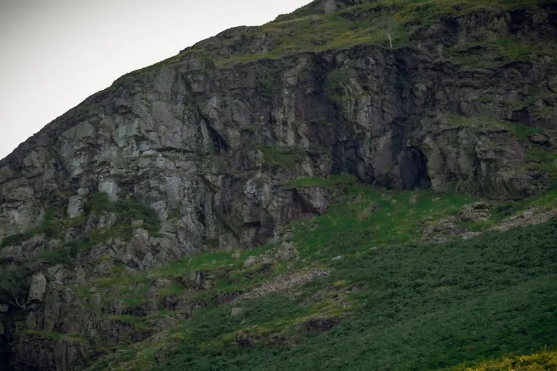
The terrain underfoot is predominantly rocky, with sections of scree and boulder fields. This necessitates sturdy footwear and careful foot placement. The higher sections of the loop are exposed to the elements, and weather conditions can change rapidly, making it essential to be prepared for all eventualities. The summit of Glyder Fach, at 994 metres, offers unparalleled 360-degree views, often encompassing Snowdon itself, the Carneddau range, and the distant Irish Sea.
The descent often takes a different path, perhaps via Llyn Idwal, a stunning glacial lake nestled in a dramatic corrie. The path around Llyn Idwal is well-maintained but can be slippery when wet. The overall experience is one of immersion in a wild, rugged, and awe-inspiring mountain environment. The Glyders Loop is a true test of endurance and a magnificent journey through the heart of Welsh mountaineering.
History and Cultural Context
The Glyders, like much of Snowdonia, have a long and rich history intertwined with human activity and natural forces. For millennia, these mountains have been a source of resources and a place of spiritual significance for the Welsh people. Evidence of early human presence can be found in ancient burial cairns and the remains of prehistoric settlements scattered throughout the region.
In more recent centuries, the mountains were a vital source of slate and stone, with quarrying operations shaping the landscape significantly. While the Glyders themselves are primarily natural formations, the surrounding areas bear the scars and legacy of industrialisation. The paths and routes that hikers now follow often originated as ancient drovers' routes or tracks used by quarrymen and shepherds.
The area around Ogwen Valley has been a focal point for mountaineering and outdoor pursuits for over a century. Ogwen Cottage itself has a history as a base for exploration and rescue. The dramatic scenery of the Glyders has inspired artists, poets, and writers, cementing its place in the cultural fabric of Wales. The Welsh language is deeply embedded in the place names, with 'Glyder' itself likely deriving from the Welsh word 'gludair', meaning a heap of stones or scree, a fitting description for these mountainous landscapes.
The establishment of Snowdonia National Park in 1951 further protected this unique environment, ensuring its preservation for future generations while facilitating public access for recreation. The Glyders Loop, therefore, is not just a physical journey but a walk through a landscape steeped in history, culture, and the enduring spirit of the Welsh mountains.
Seasonal Highlights and Weather Reality
The Glyders Loop is a mountain environment where weather dictates the experience. While accessible year-round, the optimal period for this challenging hike is generally from April to October, when daylight hours are longer and the risk of severe winter conditions is lower.
Spring (April-May): The landscape begins to awaken. Wildflowers may start to appear on the lower slopes, and the air can be crisp and clear. However, snow can linger on the higher peaks well into spring, and sudden cold snaps are not uncommon. The paths can be wet and muddy after winter snowmelt.
Summer (June-August): This is the most popular season, offering the longest daylight hours and generally the mildest weather. However, summer can also bring thunderstorms, particularly in the afternoons, which can be dangerous at higher altitudes. The paths can be busy, especially on weekends and during school holidays. Sandflies can be present, though less of an issue than in some coastal areas.
Autumn (September-October): Autumn can be a spectacular time to hike the Glyders. The heather and bracken turn to vibrant shades of red and gold, creating a stunning visual display. The air is often clear and crisp, offering excellent visibility. However, daylight hours shorten, and the weather can become more unpredictable, with increased chances of rain and wind.
Winter (November-March): This season presents significant challenges. Snow and ice are common on the higher ground, transforming the Glyders into an alpine environment. Navigation becomes more difficult, and the risk of avalanches increases. Only experienced winter mountaineers with appropriate equipment (ice axe, crampons) and knowledge should attempt the loop during winter. Huts and facilities may have reduced operating hours or be closed.
Weather Reality: It cannot be stressed enough that mountain weather in Snowdonia is notoriously changeable. Even on a clear summer day, conditions at the summit can be drastically different. Fog can descend rapidly, reducing visibility to mere metres, and temperatures can drop significantly. Always check the mountain forecast before setting out and be prepared for rain, wind, and cold, regardless of the season.
Recommended Itinerary
The Glyders Loop: A Challenging Day Hike
Early Morning: Start at Ogwen Cottage
- Begin your hike from the car park at Ogwen Cottage (postcode LL57 3LZ).
- Ensure you have checked the weather forecast and are fully equipped.
- The initial ascent is steep, heading towards the dramatic Devil's Kitchen (Twll Du).
- This section involves rocky steps and can be slippery when wet.
Morning: Ascend via Devil's Kitchen
- Navigate the Devil's Kitchen, a steep, rocky gully. This is a challenging scramble requiring careful hand and foot placement.
- Emerging from the Devil's Kitchen, you'll reach the plateau of Glyder Fach.
- The terrain becomes more open and rocky, with numerous large boulders and rock formations.
- Take time to admire Castell y Gwynt and other unique geological features.
- Continue towards the summit of Glyder Fach (994 m).
Midday: Summit of Glyder Fach and Traverse to Glyder Fawr
- Reach the summit cairn of Glyder Fach. Enjoy the expansive panoramic views.
- Take a break for lunch, ensuring you are sheltered from the wind.
- Begin the traverse across the plateau towards Glyder Fawr (999 m).
- This section involves navigating across a vast expanse of boulders and scree.
- The path is less defined here, requiring good navigational skills.
- The summit of Glyder Fawr offers further spectacular views.
Afternoon: Descent via Llyn Idwal
- From the summit of Glyder Fawr, begin your descent towards Llyn Idwal.
- The path can be steep and rocky, requiring concentration.
- Follow the signs or your map towards the lake.
- The route descends into the dramatic Cwm Idwal, a glacial cirque.
- Walk around the perimeter of Llyn Idwal. The path is generally well-maintained but can be uneven and wet.
- Admire the views of the surrounding cliffs and the lake itself.
- Continue the descent from Llyn Idwal back towards Ogwen Cottage.
Late Afternoon: Return to Ogwen Cottage
- Complete the final section of the walk back to the starting point.
- Allow ample time for the descent, as tired legs can increase the risk of slips.
- Arrive back at Ogwen Cottage, having completed a challenging and memorable mountain circuit.
Important Notes:
- This is a challenging route suitable for experienced hikers with good navigation skills.
- Weather can change rapidly; always check the forecast and be prepared for all conditions.
- Sturdy, broken-in hiking boots are essential due to the rocky and uneven terrain.
- Carry sufficient water and high-energy food.
- A physical map and compass are recommended, even if using GPS.
- Inform someone of your route and expected return time.
Planning and Bookings
Book Your Trip
Everything you need to plan your journey
Accommodation
Find places to stay near Bethesda
Flights
Search flights to Bethesda
Essential Preparation
The Glyders Loop is a serious mountain undertaking that requires thorough preparation. Before setting out, ensure you have a good understanding of the route, the potential weather conditions, and your own physical capabilities. Fitness is paramount; this hike involves sustained uphill and downhill sections over rough terrain, with a significant elevation gain of 1000 metres.
Logistics: The nearest major town is Bangor, but Bethesda is closer and offers more immediate amenities. From Bethesda, take the A5 east towards Capel Curig. Ogwen Cottage is a well-signposted and popular destination on the A5, with ample parking available (charges apply). Public transport options exist via bus services, but these can be infrequent, especially outside peak season. It is advisable to check bus timetables in advance if relying on public transport.
Base Town/City Information:
- Bethesda: A former slate quarrying town, Bethesda offers basic amenities, including shops, pubs, and some accommodation. It's a convenient starting point for accessing the Ogwen Valley.
- Bangor: A larger city with a wider range of accommodation, shops, and transport links. It's a good base if you plan to explore more of North Wales.
- Capel Curig: A small village situated between Bethesda and Betws-y-Coed, known for its outdoor activity centres and stunning mountain views.
Booking Coordination: No specific bookings are required for hiking the Glyders Loop itself, as it is a public mountain path. However, if you plan to stay in the area, booking accommodation in advance is highly recommended, especially during peak season (summer and school holidays).
Trail Accommodation
This is a day hike requiring no overnight accommodation. Hikers typically start and finish their journey from Ogwen Cottage within a single day.
Required Gear
- Sturdy Hiking Boots: Waterproof, with good ankle support and a well-worn sole for grip on rocky and uneven terrain.
- Waterproof Jacket and Trousers: Essential for protection against rain and wind, which can change rapidly in the mountains. Look for breathable, taped-seam options.
- Warm Layers: Including a fleece or insulated jacket, and a base layer made of merino wool or synthetic material. Avoid cotton, which loses its insulating properties when wet.
- Hat and Gloves: Even in summer, temperatures can be significantly lower at higher altitudes, and wind chill can be a factor.
- Navigation Tools: A physical map of the area (e.g., Ordnance Survey Explorer OL17) and a compass are crucial. Familiarise yourself with their use before your hike. A GPS device or smartphone with offline maps can be a useful supplement but should not be relied upon solely.
- Head Torch: With spare batteries, in case your hike takes longer than expected or you encounter unexpected delays.
- First Aid Kit: Including blister plasters, bandages, antiseptic wipes, pain relievers, and any personal medications.
- Sun Protection: Sunscreen, sunglasses, and a sun hat, as the sun's rays can be intense at higher altitudes, even on cloudy days.
What to Bring
- Food: High-energy snacks such as energy bars, nuts, dried fruit, and sandwiches. Pack more than you think you'll need, as mountain hikes can be demanding.
- Water: At least 2 litres of water per person. There are no reliable water sources on the main Glyders Loop route that are safe to drink without treatment.
- Water Treatment: If you intend to refill from streams (not recommended on this route due to potential contamination), carry a water filter or purification tablets.
- Toiletries: Biodegradable toilet paper, hand sanitiser, and any personal hygiene items. Pack out all used toilet paper.
- Mobile Phone: Fully charged, for emergency use. Note that mobile signal can be intermittent in the mountains.
- Emergency Shelter: A lightweight emergency bivvy bag or survival blanket can be a lifesaver in an unexpected situation.
- Whistle: For signalling in an emergency.
- Small Backpack: A comfortable day pack (around 25-35 litres) to carry all your gear.
Permits
No specific permits are required to hike the Glyders Loop. The paths are part of Snowdonia National Park and are open to the public. However, parking at Ogwen Cottage does incur a charge, and it is advisable to check current parking fees and regulations.
While no permits are needed for the hike itself, it is important to be aware of the park's regulations regarding:
- Camping: Wild camping is generally not permitted within Snowdonia National Park without landowner permission. Designated campsites are available in the surrounding areas.
- Fires: Open fires are strictly prohibited due to the risk of wildfires and damage to the fragile mountain environment.
- Dogs: Dogs are welcome on the Glyders Loop but must be kept under close control, especially in areas with livestock or near steep drops.
Respecting the natural environment and adhering to park guidelines ensures that this beautiful area remains pristine for all visitors.
Other Activities in the Area
The Ogwen Valley and surrounding Snowdonia National Park offer a wealth of activities for outdoor enthusiasts:
- Rock Climbing and Bouldering: The Glyders are a world-renowned destination for climbers, with numerous routes and bouldering problems catering to all skill levels.
- Scrambling: Beyond the Devil's Kitchen, other classic scrambles like Crib Goch (a serious undertaking requiring a head for heights and excellent scrambling skills) are accessible from the Ogwen Valley.
- Hiking and Hillwalking: Numerous other trails exist, from gentle valley walks to challenging ascents of neighbouring peaks like Snowdon (Yr Wyddfa) via various routes.
- Llyn Ogwen and Llyn Idwal: These lakes offer opportunities for photography and quiet contemplation. Llyn Idwal is particularly scenic and accessible via a well-maintained path.
- Caving: The region has several accessible cave systems, offering a different perspective on the underground geology of Snowdonia.
- Mountain Biking: While the Glyders Loop itself is not suitable for mountain biking, dedicated trails and centres exist elsewhere in Snowdonia.
- Visitor Centres: Ogwen Cottage and other visitor centres in the park provide information on local geology, flora, fauna, and safety advice.
Safety and Conditions
Pre-Departure Checks:
- Weather Forecast: Always check the mountain weather forecast specifically for the Snowdonia region (e.g., Met Office, MWIS - Mountain Weather Information Service). Pay close attention to wind speed, visibility, and precipitation.
- Trail Conditions: Be aware that paths can be affected by recent weather. Heavy rain can make rocky sections very slippery, and snow or ice can persist on higher ground well into spring.
- Route Familiarisation: Study your map and understand the key waypoints and potential hazards.
- Inform Someone: Let a friend or family member know your planned route, estimated return time, and who to contact if you do not check in.
Mountain Hazards:
- Weather: Rapidly changing conditions are the biggest hazard. Hypothermia is a risk even in summer if you get wet and cold. Fog can reduce visibility to near zero, making navigation extremely difficult.
- Terrain: The Glyders Loop is rocky and uneven. Steep ascents and descents, scree slopes, and the Devil's Kitchen scramble require careful foot placement and can lead to slips and falls.
- Navigation: In poor visibility, it is easy to lose the path. A good map and compass, and the ability to use them, are essential.
- Exposure: The higher sections are exposed to wind and weather.
- Crowds: During peak season, popular routes can be busy, which can sometimes lead to congestion on narrow sections.
Emergency Procedures:
- In case of an emergency, call 999 or 112 and ask for Police, then Mountain Rescue.
- Provide your location as accurately as possible (grid reference if known).
- Stay put if you are injured and cannot move. Keep warm and try to signal for help.
- If you have a mobile phone, conserve battery life.
Personal Locator Beacon (PLB): Consider carrying a PLB for remote areas where mobile signal is unreliable.
Side Trips and Points of Interest
Devil's Kitchen (Twll Du): This dramatic, steep gully is a key feature of the Glyders. It's a challenging scramble that requires good hand and foot technique. The rock formations within and around the Devil's Kitchen are impressive, and the views looking back down the valley from its upper reaches are spectacular.
Castell y Gwynt: Located on Glyder Fach, this is a striking collection of weathered rock pinnacles that resemble a castle. It's a popular spot for photography and a unique geological feature that adds to the otherworldly feel of the Glyders landscape.
Summit of Glyder Fach (994 m): The highest point of Glyder Fach offers a superb vantage point. On a clear day, the views stretch across Snowdon, the Carneddau, Moel Siabod, and out towards the coast. It's a perfect spot for a break and to appreciate the scale of the Welsh mountains.
Summit of Glyder Fawr (999 m): The slightly higher summit of Glyder Fawr provides an equally impressive panorama. The plateau between Glyder Fach and Glyder Fawr is a vast expanse of boulders and scree, offering a sense of wild remoteness.
Llyn Idwal: This beautiful glacial lake, nestled in a dramatic corrie, is a highlight of the descent. The surrounding cliffs, including the Idwal Slabs (a popular climbing venue), are imposing. The path around the lake is well-maintained and offers stunning reflections on calm days.
Cwm Idwal: The glacial valley containing Llyn Idwal is a designated National Nature Reserve and a prime example of glacial erosion. The sheer scale of the cirque and the surrounding peaks is awe-inspiring.
Leave No Trace
The Glyders Loop traverses a sensitive mountain environment within Snowdonia National Park. Adhering to Leave No Trace principles is crucial to preserving its natural beauty and ecological integrity for future visitors.
Your responsibility as a hiker:
- Pack It In, Pack It Out: Carry out all litter, including food scraps, wrappers, and any other waste. Do not bury or burn litter.
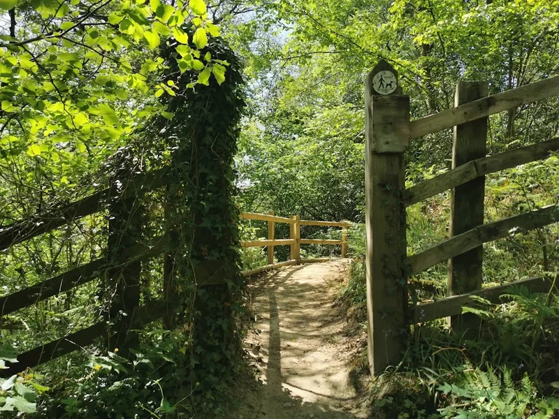
- Stay on the Path: Stick to marked trails to prevent erosion and protect fragile vegetation. The mountain environment can take a long time to recover from damage.
- Respect Wildlife: Observe wildlife from a distance and do not feed any animals, including birds. Feeding can disrupt their natural behaviour and diet.
- Dispose of Waste Properly: Use designated toilet facilities where available. If caught short in the wilderness, dig a cathole at least 60 metres away from water sources, trails, and campsites, and bury human waste. Pack out all toilet paper.
- Leave What You Find: Do not remove rocks, plants, or any other natural objects. Take only photographs and memories.
- Minimise Campfire Impacts: Campfires are prohibited on the Glyders Loop. If camping elsewhere in the park, use established fire rings and keep fires small.
- Be Considerate of Other Visitors: Keep noise levels down and yield to other hikers on narrow paths.
By following these principles, you help ensure that the Glyders Loop remains a wild and beautiful place for everyone to enjoy.