
Franconia Ridge Loop - White Mountains Classic
The Franconia Ridge Loop is a quintessential day hike in the heart of New Hampshire's White Mountains, offering a challenging yet incredibly rewarding experience for seasoned hikers. This iconic loop ascends to the exposed, windswept summit ridge of Franconia Ridge, one of the most celebrated and dramatic alpine environments in the northeastern United States. The trail traverses a spectacular, treeless ridgeline for over a mile, providing unparalleled 360-degree views of the surrounding Presidential Range, the Franconia Range, and the vast expanse of the White Mountain National Forest. It's a journey that demands respect for the elements, a good level of physical fitness, and a keen appreciation for raw, alpine beauty. The loop typically starts and finishes at the Lafayette Place Campground or the nearby parking areas, making it a popular, albeit strenuous, day trip.
- Distance: 14.4 km
- Elevation Gain: 1128 m
- Duration: 6–8 hours
- Difficulty: Challenging
- Best Time: Late spring to early fall (June–October)
- Closest City: Lincoln, New Hampshire
- Trailhead Access: Lafayette Place Campground, Franconia Notch State Park. Nearest airport: Manchester-Boston Regional (MHT). Drive north on I-93 to Exit 34A for Lincoln. Follow the Kancamagus Highway (Route 112) east for about 8.0 km to the Lincoln Woods Trailhead. Large parking lot available. No permits required for day hiking.
- Coordinates: 44.1624, -71.6506
Overview
The Franconia Ridge Loop is a demanding but immensely satisfying day hike that showcases the dramatic alpine scenery of New Hampshire's White Mountains. This circuit typically involves ascending Mount Lafayette, traversing the exposed Franconia Ridge, descending Mount Lincoln, and then continuing over Little Haystack before descending via the Falling Waters Trail or Old Bridle Path. The true highlight is the extensive section of exposed ridgeline walking, offering panoramic vistas that are among the best in the entire Northeast. On a clear day, you can see for miles, with the jagged peaks of the Presidential Range to the north and the rolling hills of the White Mountains stretching out in every direction.
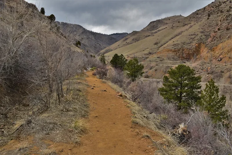
The trail is steep and rugged, particularly the ascents and descents. The section along Franconia Ridge itself is a true alpine environment, above the treeline, where weather can change with alarming speed. Hikers must be prepared for strong winds, rain, fog, and even snow or ice, regardless of the season. The granite slabs and rocky terrain require careful footing. The loop is often completed in a counter-clockwise direction, starting with the Old Bridle Path or Falling Waters Trail to ascend Mount Lafayette, traversing the ridge, and then descending via the other trail. This route offers a varied experience, from the dense forests of the lower elevations to the stark, rocky beauty of the alpine zone.
This hike is not for the faint of heart or the unprepared. It requires a good level of physical fitness, proper hiking gear, and a thorough understanding of mountain weather. However, for those who meet its challenges, the Franconia Ridge Loop offers an unforgettable experience, a true taste of high-altitude hiking in the East.
History and Cultural Context
The White Mountains, and Franconia Notch in particular, have a rich history intertwined with exploration, tourism, and the development of the Appalachian Trail. Indigenous peoples, including the Abenaki, utilized these mountains for hunting and travel for centuries before European settlement. The dramatic landscape of Franconia Notch, with its sheer cliffs and unique geological formations, captured the imagination of early explorers and naturalists.
The development of tourism in the 19th century led to the creation of trails and the establishment of hotels and inns in the region. The Franconia Ridge became a popular destination for those seeking grand mountain vistas. Early trails were often rough and rudimentary, carved out by hardy individuals. The Old Bridle Path, one of the main routes up Mount Lafayette, dates back to the late 19th century, originally intended for horses and carriages, hence its name. The Falling Waters Trail, known for its numerous cascades, was also established during this era, offering a more scenic, though steeper, ascent.
The Franconia Ridge itself became a focal point for hikers and mountaineers. Its exposed, treeless summit ridge provided a unique alpine experience in the eastern United States. The establishment of the Appalachian Trail, which traverses the ridge, further cemented its status as a premier hiking destination. The Franconia Ridge Loop, as it is commonly hiked today, evolved from these early trail networks, offering a comprehensive circuit that captures the essence of the Franconia Range's dramatic beauty. The area is now protected within Franconia Notch State Park, ensuring its preservation for future generations of hikers and nature enthusiasts.
Seasonal Highlights and Weather Reality
The best time to hike the Franconia Ridge Loop is from late spring to early fall, typically from June through October. During this period, the trails are generally free of snow and ice, and the weather is most favourable for alpine hiking.
Late Spring (June): While the lower trails may be clear, higher elevations, especially the exposed ridge, can still hold patches of snow and ice well into June. Early season hikers should be prepared for potentially hazardous conditions and check trail reports diligently. The forests are vibrant green, and wildflowers begin to bloom.
Summer (July–August): This is the peak hiking season. Days are long, and the weather is generally warmer. However, summer in the White Mountains can bring thunderstorms, often developing rapidly in the afternoon. Hikers should start early to avoid the worst of the heat and the risk of lightning. The ridge can be crowded on weekends.
Early Fall (September–October): Autumn offers spectacular foliage, with the forests ablaze in vibrant reds, oranges, and yellows. The air is crisp, and the weather can be stable. However, temperatures on the ridge can drop significantly, and early snowstorms are possible, especially in October. The window for pleasant autumn hiking can be short.
Winter (November–May): The Franconia Ridge Loop is a serious winter mountaineering challenge during these months. The trails are covered in deep snow and ice, and the exposed ridge is subject to extreme winds and sub-zero temperatures. Avalanche danger is a significant concern. This is strictly for experienced winter hikers with appropriate gear and skills.
Weather is the most critical factor for this hike. The alpine zone on Franconia Ridge is exposed and can experience rapid and severe weather changes. Always check the mountain forecast before you go and be prepared to turn back if conditions deteriorate.
Recommended Itinerary
Franconia Ridge Loop - Day Hike Itinerary
Option 1: Counter-Clockwise (Ascend Lafayette, Descend via Falling Waters)
- Early Morning (7:00 AM): Arrive at Lafayette Place Campground or designated parking area. Begin hike via the Old Bridle Path towards Mount Lafayette.
- Morning (7:00 AM - 11:00 AM): Ascend the Old Bridle Path. This trail is steep and rocky, gaining significant elevation through the forest.
- Late Morning (11:00 AM - 12:00 PM): Reach the summit of Mount Lafayette (1,600 m). Take time to enjoy the initial panoramic views and acclimatise to the altitude.
- Midday (12:00 PM - 2:00 PM): Traverse the Franconia Ridge. This is the highlight of the hike, a spectacular, exposed ridgeline walk connecting Mount Lafayette to Mount Lincoln. Be mindful of wind and footing.
- Early Afternoon (2:00 PM - 3:00 PM): Reach the summit of Mount Lincoln (1,550 m). Continue along the ridge towards Little Haystack.
- Afternoon (3:00 PM - 4:00 PM): Descend from Little Haystack (1,512 m) onto the Falling Waters Trail. This descent is steep and features numerous cascades and rocky sections.
- Late Afternoon (4:00 PM - 6:00 PM): Continue descending the Falling Waters Trail, passing several beautiful waterfalls.
- Evening (6:00 PM - 7:00 PM): Arrive back at the trailhead.
Option 2: Clockwise (Ascend via Falling Waters, Descend Old Bridle Path)
- Early Morning (7:00 AM): Arrive at Lafayette Place Campground or designated parking area. Begin hike via the Falling Waters Trail towards Little Haystack.
- Morning (7:00 AM - 11:00 AM): Ascend the Falling Waters Trail, enjoying the numerous waterfalls. This trail is steep and can be slippery.
- Late Morning (11:00 AM - 12:00 PM): Reach Little Haystack (1,512 m). Continue along the ridge towards Mount Lincoln.
- Midday (12:00 PM - 1:00 PM): Reach the summit of Mount Lincoln (1,550 m).
- Early Afternoon (1:00 PM - 3:00 PM): Traverse the Franconia Ridge to Mount Lafayette (1,600 m).
- Afternoon (3:00 PM - 6:00 PM): Descend Mount Lafayette via the Old Bridle Path. This trail is also steep and rocky.
- Evening (6:00 PM - 7:00 PM): Arrive back at the trailhead.
Important Considerations:
- Start early to avoid crowds and afternoon thunderstorms.
- The ridge is exposed; be prepared for rapid weather changes.
- Wear sturdy hiking boots with good ankle support.
- Carry plenty of water and high-energy snacks.
- This is a challenging hike; assess your fitness level realistically.
- Check the weather forecast immediately before your hike.
Planning and Bookings
Book Your Trip
Everything you need to plan your journey
Accommodation
Find places to stay near Lincoln, New Hampshire
Flights
Search flights to Lincoln, New Hampshire
Essential Preparation
The Franconia Ridge Loop is a significant undertaking that requires careful planning. Given its popularity, arriving early at the trailhead is crucial, especially on weekends and during peak season (summer and fall foliage). The primary trailhead is located at Lafayette Place Campground, which offers parking and access to both the Old Bridle Path and the Falling Waters Trail. Alternative parking may be available along the Kancamagus Highway or at the Cannon Mountain Aerial Tramway base, but these may require longer approaches or additional transport.
Fitness: This hike involves substantial elevation gain (over 1,100 metres) and a considerable distance (14.4 km) with a long, exposed ridgeline. Hikers should have a high level of cardiovascular fitness and strong leg muscles. Regular hiking, including climbs with a loaded pack, is recommended. Practice hikes on similar terrain and elevation are advisable.
Logistics: The closest major town is Lincoln, New Hampshire, which offers a range of accommodation, dining, and gear shops. For those travelling from further afield, Manchester-Boston Regional Airport (MHT) is the nearest major airport, approximately a 1.5-hour drive away. Rental cars are essential for reaching the trailhead from the airport or other major cities.
Trail Accommodation
This is a day hike requiring no overnight accommodation. Hikers typically start and finish at the trailhead within a single day.
Trailhead Facilities: Lafayette Place Campground offers campsites for those wishing to stay overnight before or after their hike. Reservations are highly recommended, especially during peak season. The campground provides basic amenities such as restrooms and water. There are no huts or lodges directly on the Franconia Ridge Loop itself.
Required Gear
- Sturdy Hiking Boots: Waterproof, with excellent ankle support and aggressive tread for grip on rocky and potentially slippery terrain.
- Backpack: A daypack of 25-40 litres capacity is sufficient for carrying essentials. Ensure it has a comfortable hip belt and sternum strap.
- Waterproof Outerwear: A high-quality waterproof and windproof jacket and trousers are essential. The ridge is exposed to severe weather.
- Warm Layers: Even in summer, temperatures on the ridge can be significantly colder due to altitude and wind chill. Bring a fleece or insulated jacket, a warm hat, and gloves.
- Navigation Tools: A map of the Franconia Ridge area, a compass, and a GPS device or smartphone with offline maps are highly recommended. Mobile phone service is unreliable in the mountains.
- Headlamp: With fresh batteries, in case of unexpected delays or an early start/late finish.
- First-Aid Kit: Comprehensive kit including blister treatment, bandages, antiseptic wipes, pain relievers, and any personal medications.
- Sun Protection: High SPF sunscreen, sunglasses, and a wide-brimmed hat. The sun is intense at higher altitudes, and there is little shade on the ridge.
What to Bring
- Water: Carry at least 2-3 litres of water per person. Water sources on the trail are limited and may be unreliable or contaminated, especially on the ridge. Water treatment (filter or purification tablets) is recommended if planning to refill.
- Food: High-energy, non-perishable food. This includes sandwiches, trail mix, energy bars, fruit, and nuts. Pack more than you think you'll need in case of emergencies or extended hiking time.
- Toiletries: Hand sanitiser, toilet paper (pack out used paper), and any personal hygiene items.
- Trekking Poles: Highly recommended for stability on steep ascents and descents, and for reducing impact on knees.
- Insect Repellent: Especially important during summer months to ward off black flies and mosquitoes.
- Emergency Shelter: A lightweight emergency bivy sack or space blanket can be a lifesaver in unexpected situations.
- Whistle: For signalling in emergencies.
Permits
No specific permits are required for day hiking the Franconia Ridge Loop. However, parking at Lafayette Place Campground may have a fee, and it is advisable to check the Franconia Notch State Park website for any current regulations or parking restrictions. During peak season, parking lots can fill up very early, so arriving before 7:00 AM is strongly recommended.
Parking Fees: A daily parking fee is typically charged at Lafayette Place Campground and other designated trailheads within Franconia Notch State Park. Fees are usually payable at self-service kiosks or via a mobile app. Check the New Hampshire State Parks website for the most up-to-date information on fees and payment methods.
Camping: If you plan to camp at Lafayette Place Campground, reservations are essential and can be made through the New Hampshire State Parks reservation system. These reservations are separate from any hiking plans and should be secured well in advance, particularly for weekend stays during the summer and fall.
Group Size: While there are no strict limits on group size for day hiking, larger groups should be mindful of trail etiquette and the impact on other hikers and the environment. Be aware of the carrying capacity of the trails and the potential for congestion, especially on the ridge.
Other Activities in the Area
Franconia Notch State Park and the surrounding White Mountains offer a wealth of activities for outdoor enthusiasts:
- Cannon Mountain Aerial Tramway: Ride to the summit of Cannon Mountain for spectacular views without the strenuous climb. The tramway offers access to hiking trails at the top and a visitor centre.
- Flume Gorge: A natural gorge extending 243 m long and 70 to 27 m deep. Walk along boardwalks and granite pathways through this impressive geological formation, complete with waterfalls and glacial boulders.
- The Basin: A unique geological feature, a large, smooth pothole carved by glacial meltwater over thousands of years. A short, easy walk leads to this interesting natural wonder.
- Echo Lake State Park: A beautiful lake offering swimming, picnicking, and scenic views of the surrounding mountains.
- Artist's Bluff Trail: A short, steep hike offering iconic views of Echo Lake and the Franconia Ridge, a popular spot for photography.
- Mount Pemigewasset (Indian Head): Another popular day hike offering excellent views of the Notch, though it does not involve the high alpine ridge.
- Kancamagus Highway: Drive this scenic byway for stunning vistas, numerous pull-offs, and access to other hiking trails and recreational areas.
- Rock Climbing: Franconia Notch offers some of the best rock climbing in New England, with routes for various skill levels.
Safety and Conditions
Weather: The most significant safety concern on the Franconia Ridge Loop is the unpredictable mountain weather. Conditions can change rapidly, with fog, high winds, rain, and even snow possible at any time of year. Always check the forecast from a reliable source like the Mount Washington Observatory or the National Weather Service specifically for the Franconia Notch area before and during your hike. Be prepared to turn back if conditions deteriorate.
Exposure: The ridgeline is entirely above the treeline, offering no shelter from the elements. Hypothermia is a serious risk, even in summer, due to wind chill and wet conditions. Ensure you have adequate layers, including waterproof and windproof outer shells, a warm hat, and gloves.
Terrain: The trails are steep, rocky, and can be slippery, especially the Falling Waters Trail and the descents. Proper footwear with good grip is essential. Loose rocks can be a hazard, so be mindful of your footing and avoid dislodging rocks onto hikers below.
Lightning: During summer afternoons, thunderstorms are common. If you hear thunder or see lightning, descend from the ridge immediately. Avoid open areas, tall isolated trees, and water. The Old Bridle Path and Falling Waters Trail offer some shelter in the forest, but the ridge itself is extremely dangerous during a storm.
Navigation: While the trails are generally well-marked, fog can reduce visibility to mere metres. Carry a map and compass and know how to use them. A GPS device or smartphone with offline maps can be a valuable backup.
Water: Carry sufficient water, as reliable sources are scarce on the ridge. Treat any water collected from streams or other sources before drinking.
Emergency: Cell phone service is unreliable in Franconia Notch. Consider carrying a personal locator beacon (PLB) or satellite messenger for emergencies. Know the location of emergency shelters or designated safe zones if available.
Fitness: This is a strenuous hike. Ensure you are physically prepared for the distance and elevation gain. Do not attempt this hike if you are not feeling well or are not adequately equipped.
Side Trips and Points of Interest
Franconia Ridge: The undisputed highlight of this loop. The 1.5-mile (2.4 km) section of exposed ridgeline connecting Mount Lafayette, Mount Lincoln, and Little Haystack is a world-class alpine experience. The panoramic views are breathtaking, encompassing the Presidential Range, the Franconia Range, and the vast forests of New Hampshire. The granite slabs and rocky terrain create a unique, rugged landscape.
Mount Lafayette Summit (1,600 m): The highest point on the loop, offering commanding 360-degree views. The summit is marked by a stone cairn and often features interpretive signs about the surrounding geology and history. The views from here are expansive, stretching for miles on a clear day.
Mount Lincoln Summit (1,550 m): While slightly lower than Lafayette, Lincoln offers equally stunning views, particularly looking back towards Lafayette and across the Presidential Range. The summit area is rocky and exposed.
Little Haystack (1,512 m): The southernmost peak on the ridge, serving as the transition point from the exposed ridgeline to the descent via the Falling Waters Trail. It provides excellent views of the entire ridge you have just traversed.
Falling Waters Trail Cascades: This trail is renowned for its numerous beautiful waterfalls and cascades, including the "Pool," "Fallen Waters," and "Mother Walker Falls." These offer refreshing sights and sounds during the descent and are excellent photo opportunities.
Old Bridle Path Views: While primarily a more direct ascent, the Old Bridle Path offers glimpses of the surrounding forest and occasional views through the trees as you gain elevation. The summit of Lafayette provides the primary reward for this approach.
Leave No Trace
The Franconia Ridge Loop traverses a sensitive alpine environment and a popular hiking corridor. Adhering to Leave No Trace principles is paramount to preserving its beauty and ecological integrity for future visitors.
Plan Ahead and Prepare: Research trail conditions, weather forecasts, and park regulations before your visit. Pack appropriate gear and sufficient supplies. Know your limits and choose a hike that matches your abilities.
Travel and Camp on Durable Surfaces: Stay on marked trails at all times. The vegetation above the treeline is fragile and slow to recover from damage. Stick to the established paths and designated viewpoints.
Dispose of Waste Properly: Pack out everything you pack in, including all food scraps, wrappers, and any other trash. Use designated restrooms or the "cathole" method (digging a hole 15-20 cm deep at least 60 metres from water, trails, and campsites) for human waste, and pack out all toilet paper.
Leave What You Find: Do not remove rocks, plants, or any natural objects. Take only photographs and memories.
Minimize Campfire Impacts: Campfires are not permitted on the Franconia Ridge Loop as it is a day hike and above the treeline. If camping elsewhere in the park, use established fire rings and follow all regulations.
Respect Wildlife: Observe wildlife from a distance. Never feed animals, as it can disrupt their natural behaviours and diets. Store food securely to prevent attracting animals.
Be Considerate of Other Visitors: Yield to other hikers on the trail, especially those going uphill. Keep noise levels down and avoid playing loud music. Respect the wilderness experience of others.