Fagaras Ridge Traverse - The Transylvanian Alps
The Fagaras Ridge Traverse is the ultimate mountain challenge in South-Eastern Europe—a high-altitude odyssey spanning approximately 70 kilometres across the highest and most rugged peaks of the Southern Carpathians in Romania. Known colloquially as the "Transylvanian Alps," this traverse is not merely a hike but a sustained test of endurance, navigation, and mental fortitude. The route follows the main spine of the Fagaras Mountains, staying almost exclusively above 2,000 metres for the majority of its duration. It connects the highest point in Romania, Moldoveanu Peak (2,544 m), with a series of jagged ridges, deep glacial cirques, and turquoise alpine lakes. Unlike many European mountain ranges that have been tamed by extensive cable car networks and luxury lodges, the Fagaras remains raw, wild, and demanding. Access is earned through significant vertical gain, and the weather is notoriously fickle, capable of shifting from sun-drenched vistas to violent electrical storms within minutes. For the experienced trekker, it offers a sense of isolation and grandeur that is increasingly rare on the continent.
- Distance: 70.0 km (main ridge line)
- Duration: 7–10 days
- Season: July–September (summer window is narrow due to persistent snow)
- Accommodation: Mountain huts (Cabanas) and basic unstaffed shelters (Refugiul)
- Highest point: Moldoveanu Peak (2,544 m)
- Elevation Gain: Approximately 5,000 m total cumulative gain
- Difficulty: Very Challenging (requires high fitness and basic scrambling skills)
- Direction: Typically East to West (Sambata de Sus to Turnu Rosu) or West to East
Overview
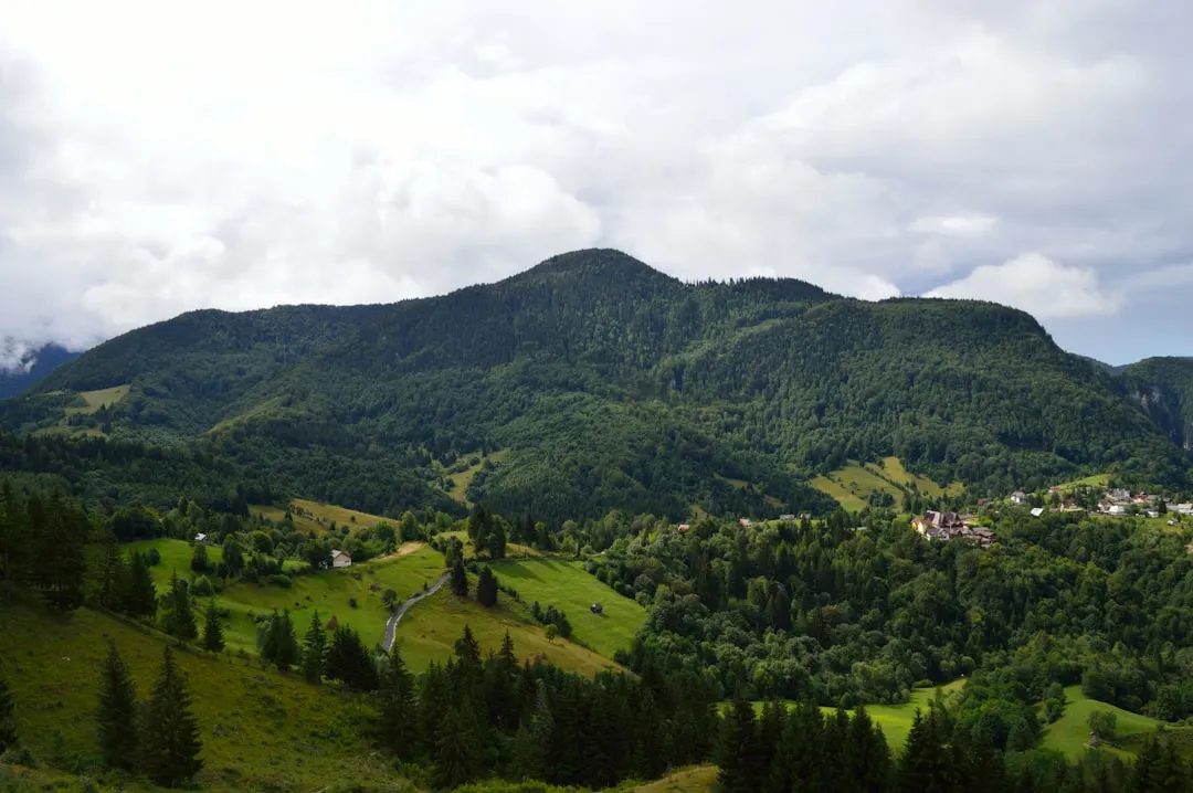
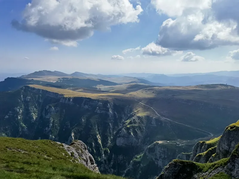
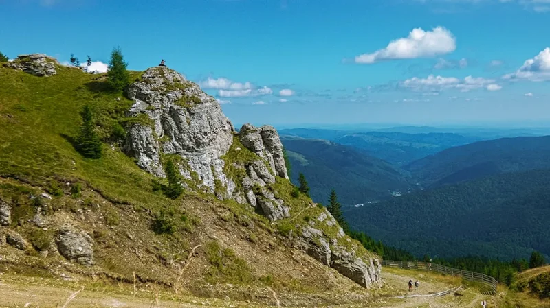
The Fagaras Mountains represent the most massive and alpine-like mountain group in Romania. The ridge traverse is a masterclass in glaciated topography, featuring a sawtooth profile that forces hikers into a relentless rhythm of steep ascents and knee-jarring descents. The journey is defined by its verticality; you are rarely walking on flat ground. The terrain transitions from dense beech and coniferous forests at the base to vast alpine meadows, and finally to the stark, grey granite of the high peaks where only the hardiest mosses and lichens survive. The scale of the range is humbling, with eight peaks exceeding 2,500 metres and dozens more surpassing 2,400 metres.
What sets the Fagaras apart from other European traverses is the commitment required. Once you are on the main ridge, exit points to the valleys are few and far between, often requiring several hours of steep descent to reach safety or civilisation. This creates a profound sense of "being in it," where self-reliance is paramount. The views are nothing short of cinematic: to the north, the Transylvanian Plateau stretches toward the horizon, dotted with Saxon villages and fortified churches; to the south, the Wallachian plains fade into the distance. Between them lies a labyrinth of ridges that look like the spine of a sleeping dragon.
The experience is also defined by the unique infrastructure of the Romanian Carpathians. You will alternate between "Cabanas"—staffed mountain huts offering hot meals and basic dormitory beds—and "Refugiul," which are small, unstaffed metal or stone shelters designed for emergency use or for those carrying their own supplies. This mix allows for a flexible approach to the traverse, though it requires careful planning regarding food and water. The Fagaras is also a stronghold for European wildlife; while sightings are rare due to the rugged terrain, the mountains are home to brown bears, wolves, lynx, and the agile chamois (capra neagra), which can often be seen skipping across the most precarious cliffs.
History and Cultural Context
The Fagaras Mountains have historically served as a formidable natural barrier and a symbolic border. For centuries, the ridge marked the frontier between the Principality of Transylvania to the north and Wallachia to the south. This "border on the clouds" was patrolled by frontier guards and used by outlaws, shepherds, and revolutionaries seeking refuge from the authorities in the valleys below. The cultural identity of the region is deeply tied to "transhumance"—the seasonal movement of livestock. Even today, you will encounter shepherds tending to vast flocks of sheep on the lower alpine meadows, accompanied by large, protective Carpathian Shepherd dogs. Their presence is a living link to a pastoral tradition that has remained largely unchanged for a millennium.
The development of the traverse as a recreational route began in the late 19th and early 20th centuries, spearheaded by the Siebenbürgischer Karpatenverein (SKV), the Transylvanian Carpathian Society. These early pioneers, largely from the German-speaking Saxon community, mapped the peaks, built the first rudimentary huts, and marked the trails with the distinctive vertical stripes and crosses still used today. During the communist era, mountain tourism was heavily promoted as a "healthy socialist activity," leading to the construction of more substantial huts and the famous Transfagarasan Road, which bisects the range. This road, built in the 1970s under Nicolae Ceausescu, was a strategic military route that now provides one of the few vehicular access points to the high ridge at Balea Lake.
Today, the Fagaras Mountains are a source of immense national pride for Romanians. Completing the "Magistrala Crestei" (the Ridge Mainline) is considered a rite of passage for local hikers. The names of the peaks—Moldoveanu, Negoiu, Vistea Mare—are etched into the national consciousness. While the range is becoming more popular with international trekkers, it retains an authentic, uncommercialised atmosphere where the mountain culture is defined by hospitality, resilience, and a deep respect for the unpredictable power of nature.
Want more background? Read extended notes on history and cultural context → Learn more
Seasonal Highlights and Weather Reality
The window for a safe and enjoyable traverse of the Fagaras Ridge is remarkably narrow. Due to its northern latitude and high elevation, the range retains snow well into the summer, and early autumn blizzards are not uncommon. The primary season runs from July to September, with August being the most popular month due to the most stable weather patterns.
Summer (July–August): This is the peak season. The alpine wildflowers, including the rare Edelweiss and various rhododendrons, are in full bloom, painting the slopes in vibrant colours. Days are long, providing ample time for the demanding daily stages. However, this is also the season of the "afternoon storm." Heat rising from the plains often triggers violent thunderstorms by 2:00 PM or 3:00 PM. These storms are the greatest danger on the ridge, as the exposed terrain offers no protection from lightning. Hikers must adopt an "early start, early finish" strategy.
Autumn (September): Many experienced hikers consider September the best month. The air is crisper and clearer, offering the best visibility for photography. The crowds at the main huts diminish, and the mosquitoes and flies disappear. However, the days are shorter, and temperatures at night frequently drop below freezing. By late September, the first significant snowfalls can occur, potentially making technical sections like the "Three Steps of Death" (Custura Saratii) impassable without winter gear.
Winter and Spring (October–June): During these months, the Fagaras Ridge is a serious mountaineering undertaking. The traverse becomes a technical expedition requiring ice axes, crampons, ropes, and extensive experience in avalanche assessment. Many of the staffed huts close or operate with minimal services, and the unstaffed shelters can be buried under several metres of snow. The Transfagarasan Road is closed to traffic during this period, usually from late October until late June, further isolating the range.
Recommended Itinerary
8-Day Fagaras Ridge Traverse (East to West)
Day 1: Sambata de Sus to Cabana Sambata
- Distance: 9 km
- Elevation gain: 800 m
- Time: 3–4 hours
- Start at the Sambata de Sus Monastery (accessible by taxi from Victoria or Fagaras)
- Follow the forest road alongside the Sambata River
- Gradual climb through ancient beech and fir forests
- Arrive at Cabana Sambata (1,401 m) nestled in a beautiful glacial valley
- This is a relatively easy "warm-up" day to transition from the lowlands to the mountain environment
Day 2: Cabana Sambata to Refugiul Vistea Mare
- Distance: 10 km
- Elevation gain: 1,100 m
- Time: 6–7 hours
- Steep ascent from the hut to the main ridge at "Fereastra Mare a Sambetei" (The Big Window of Sambata)
- First views of the high ridge stretching westward
- Traverse several peaks over 2,300 m, including Galasescu Mare
- Arrive at Refugiul Vistea Mare, a basic shelter located just below the climb to Romania's highest peaks
- Spectacular sunset views over the Moldoveanu-Vistea massif
Day 3: Vistea Mare to Cabana Podragu via Moldoveanu Peak
- Distance: 8 km
- Elevation gain: 500 m gain, 600 m loss
- Time: 5–6 hours
- The "Summit Day": Climb Vistea Mare (2,527 m) and cross the narrow ridge to Moldoveanu Peak (2,544 m)
- Stand on the highest point in Romania
- Descend back to the main ridge and continue westward over rugged, rocky terrain
- Pass the "Orzanele" saddle and descend to Cabana Podragu (2,136 m)
- Podragu is the highest staffed hut in the range, located by a stunning glacial lake
Day 4: Cabana Podragu to Balea Lake
- Distance: 12 km
- Elevation gain: 700 m
- Time: 6–7 hours
- Return to the main ridge from the Podragu cirque
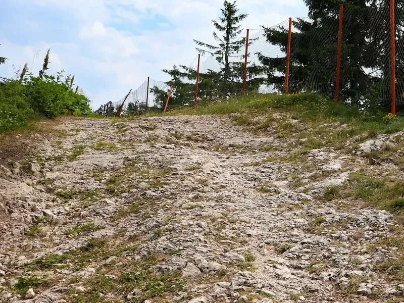
- Traverse the "Three Steps of Death" (Custura Saratii) - a technical section with fixed cables (requires focus and steady nerves)
- Pass Capra Lake, a crystal-clear alpine tarn
- Descend to Balea Lake (2,034 m), where the Transfagarasan Road reaches its highest point
- Multiple accommodation options here, from basic huts to more comfortable lodges
Day 5: Balea Lake to Refugiul Caltun
- Distance: 6 km
- Elevation gain: 500 m
- Time: 4–5 hours
- A shorter but very technical day
- Climb toward the Negoiu Massif, the second-highest peak in Romania
- Pass through "Strunga Dracului" (The Devil's Gully) - a steep, narrow chimney with cables (Note: check local status as this is sometimes closed due to rockfall; the alternative is "Strunga Doamnei")
- Arrive at Refugiul Caltun, a modern igloo-shaped shelter situated next to a deep glacial lake beneath the towering walls of Negoiu
Day 6: Refugiul Caltun to Refugiul Scara via Negoiu Peak
- Distance: 9 km
- Elevation gain: 800 m
- Time: 7–8 hours
- Ascend Negoiu Peak (2,535 m) for some of the most dramatic views in the Carpathians
- Traverse the "Custura Saratii," the most difficult and exposed section of the entire ridge
- Requires scrambling and use of hands; not for those with a severe fear of heights
- Continue to Refugiul Scara, a basic shelter in a remote section of the ridge
Day 7: Refugiul Scara to Cabana Suru
- Distance: 12 km
- Elevation gain: 600 m
- Time: 6–7 hours
- The terrain begins to soften slightly, transitioning from jagged rock to high alpine meadows
- Traverse the Scara and Avrig peaks
- Pass Avrig Lake, another beautiful spot for a break
- Final push to Cabana Suru (1,450 m), located on the western edge of the high massif
- Enjoy the return of the forest and the sound of running water
Day 8: Cabana Suru to Turnu Rosu
- Distance: 14 km
- Elevation loss: 1,100 m
- Time: 5–6 hours
- A long, steady descent through beautiful old-growth forests
- The trail follows the ridge as it gradually loses elevation toward the Olt River valley
- Finish in the village of Turnu Rosu
- Take a local train or taxi to Sibiu for a well-earned celebration meal
Planning and Bookings
Book Your Trip
Everything you need to plan your journey
Accommodation
Find places to stay near Brasov
Flights
Search flights to Brasov
Essential Preparation
The Fagaras Ridge Traverse is a serious undertaking that requires significant physical and logistical preparation. You should be in excellent cardiovascular shape, capable of hiking 6–8 hours a day with a 12–15 kg pack for multiple consecutive days. Training should include plenty of elevation gain and descent to prepare your knees for the relentless "staircase" nature of the trail. Logistics are complicated by the fact that the trail is a point-to-point traverse. Most hikers base themselves in Brasov or Sibiu. Brasov is better for accessing the eastern end (Sambata de Sus), while Sibiu is ideal for the western end (Turnu Rosu). Coordination with local mountain rescue (Salvamont) is highly recommended; you can register your itinerary with them at the start of the hike.
Trail Accommodation
Accommodation on the Fagaras is a mix of staffed "Cabanas" and unstaffed "Refugiul."
Staffed Cabanas (e.g., Sambata, Podragu, Negoiu, Suru):
- Dormitory-style bunk beds (blankets usually provided, but a silk liner or light sleeping bag is recommended for hygiene)
- Hot meals (usually soup, polenta with cheese, and basic meat dishes) and drinks available for purchase
- Basic pit toilets or shared bathrooms; showers are rare and often cold
- Booking: Essential during July and August. Most do not have online booking; you must call them (often requiring basic Romanian or a local to help)
- Cost: Approximately 60–100 RON (Romanian Leu) per night for a bed
Unstaffed Shelters (Refugiul):
- Basic metal or stone structures designed to protect from the elements
- No beds, just wooden or metal platforms (sleeping mat and warm sleeping bag essential)
- No food, water, or heating provided
- Free of charge, but space is first-come, first-served and can be very crowded in bad weather
- Intended for emergency use or for experienced self-sufficient trekkers
Required Gear
- Hiking boots: High-cut with excellent grip (Vibram soles recommended) and waterproof membrane. The terrain is rocky and often wet
- Backpack: 50–65L with a high-quality suspension system and rain cover
- Clothing layers: Moisture-wicking base layers (merino wool is best), a warm fleece or down mid-layer, and a high-quality hardshell jacket (Gore-Tex or similar)
- Navigation: Physical 1:50,000 scale map of the Fagaras Mountains and a compass. GPS apps (like Mapy.cz or Gaia GPS) are excellent but require offline maps and a power bank
- Safety gear: A whistle, a high-quality headlamp with spare batteries, and a basic first aid kit including blister care (Compeed)
- Trekking poles: Highly recommended to save your knees on the 1,000 m+ descents
What to Bring
- Water treatment: While there are springs, they can dry up in late summer. Bring a filter (Sawyer Squeeze) or purification tablets
- Food: Even if staying in Cabanas, bring 2 days of emergency rations (energy bars, nuts, dried fruit). If using Refugiul, you must carry all your food and a lightweight stove
- Sun protection: High-altitude sun is intense. Bring SPF 50 sunscreen, lip balm with UV protection, and polarized sunglasses
- Personal hygiene: Biodegradable soap, wet wipes (for "mountain showers"), and a small trowel for LNT practices if caught between huts
- Cash: Romanian Leu (RON) is essential. Huts do not accept credit cards, and there are no ATMs on the ridge
- Power bank: To keep your phone/GPS charged, as huts have limited or no charging outlets
Permits
Currently, no formal permits are required to hike the Fagaras Ridge Traverse. There are no entry fees for the mountain range itself, and you do not need to book specific "slots" to walk the trail. This freedom is one of the great draws of the Romanian Carpathians, but it comes with the responsibility of self-regulation and safety.
Important Considerations:
- Salvamont Registration: While not a permit, it is highly encouraged to check in with the Salvamont (Mountain Rescue) office in Victoria, Brasov, or Sibiu before you start. They can provide the most up-to-date information on trail conditions, snow levels, and weather warnings.
- Hut Bookings: While you don't need a permit to walk, you absolutely need to book the staffed Cabanas in advance during the peak summer months. These huts have limited capacity and are often the only safe place to stay in a storm.
- Camping: Wild camping is generally permitted in the Fagaras, provided you follow Leave No Trace principles. However, you should camp near the Refugiul or Cabanas where possible to minimize your impact on the environment and for safety (bears are less likely to approach areas with human activity).
Other Activities in the Area
The region surrounding the Fagaras Mountains is rich in history and natural beauty. Consider these additions to your trip:
- Sibiu Old Town: A former European Capital of Culture, Sibiu is one of the most beautiful cities in Romania. Explore the Large Square (Piata Mare), the Bridge of Lies, and the Brukenthal National Museum.
- The Transfagarasan Road: Even if you are hiking, a drive along this road is spectacular. It features dramatic hairpins and was famously called "the best road in the world" by Top Gear.
- Bran Castle: Located about 2 hours from the eastern end of the range, this is the famous "Dracula's Castle." While the connection to Vlad the Impaler is tenuous, the castle itself is a stunning piece of medieval architecture.
- Peles Castle: Situated in Sinaia, this neo-Renaissance masterpiece was the summer residence of the Romanian royal family and is widely considered one of the most beautiful castles in Europe.
- Bear Watching: Several eco-tourism operators in the Brasov area offer guided trips to hides where you can safely observe brown bears in their natural habitat.
Safety and Conditions
Weather and Lightning: The single greatest objective hazard on the Fagaras Ridge is lightning. The ridge is extremely exposed, and there is nowhere to hide if a storm catches you. If you hear thunder or see dark clouds building, descend from the ridge immediately. Do not wait for the rain to start. Aim to be off the highest peaks and at your destination by early afternoon.
Technical Sections: Sections like the "Three Steps of Death" (Custura Saratii) and "Strunga Dracului" require basic scrambling skills and a head for heights. In wet or icy conditions, these sections become significantly more dangerous. Always check the alternative routes (e.g., Strunga Doamnei) if you are unsure of your ability or the conditions.
Wildlife (Bears and Dogs): Romania has the largest population of brown bears in Europe. While they generally avoid humans, you should make noise while hiking through forested sections and never keep food in your tent. Perhaps more common are the shepherd dogs. These are large, working animals bred to fight off wolves. If you encounter a flock, stay calm, do not run, and wait for the shepherd to call them off. Keeping your trekking poles between you and the dogs can help maintain a "buffer zone."
Water: Water can be scarce on the main ridge line. Most reliable water sources are located 100–200 metres below the ridge in the glacial cirques. Plan your day around these sources and always carry at least 2–3 litres of capacity.
Emergency Contacts: The national emergency number is 112. For mountain-specific rescues, you can also contact Salvamont directly. It is highly recommended to download the "0salvamont" app, which allows you to send your GPS coordinates to rescuers in an emergency.
Side Trips and Points of Interest
Moldoveanu Peak (2,544 m): While part of the main traverse, the summit itself is a short detour from the main ridge line. Standing on the "Roof of Romania" is the emotional highlight of the trip. The summit is marked by a Romanian flag and offers a 360-degree view that, on a clear day, encompasses almost the entire Southern Carpathian range.
Balea Lake and Ice Hotel: If you are visiting in the very early or late season, Balea Lake is home to a famous Ice Hotel (built every winter). In summer, the area is a bustling hub of activity with local food stalls selling "kurtoskalacs" (chimney cake) and smoked cheeses.
The Glacial Lakes: The Fagaras is dotted with over 70 glacial lakes. Podragu, Caltun, Capra, and Avrig are the most famous. Each has its own character, from the deep, dark waters of Caltun to the turquoise hues of Podragu. Taking the time to descend to the shore of these lakes offers a peaceful reprieve from the wind-swept ridge.
The "Window" of Sambata: This dramatic gap in the ridge line provides one of the most iconic views of the range. It serves as the gateway from the lush Sambata Valley to the high alpine world and is a perfect spot for a long break on Day 2.
Leave No Trace
The Fagaras Mountains are a fragile alpine ecosystem. The short growing season means that damage to vegetation can take decades to heal. As the range becomes more popular, the impact of human waste and litter is becoming a significant concern.
Your responsibility:
- Pack it in, pack it out: This includes all food scraps (even biodegradable ones like orange peels, which don't decompose at high altitude) and all hygiene products.
- Human Waste: Use the toilets at the Cabanas whenever possible. If you must go on the trail, dig a "cathole" at least 15 cm deep and at least 60 metres away from any water source. Pack out your toilet paper in a sealed bag.
- Water Protection: Do not use soap or toothpaste directly in the alpine lakes or streams. Even biodegradable soap requires soil to break down.
- Stay on the Path: The ridge is rocky, but where there is soil and grass, stay on the marked trail to prevent erosion and the creation of "social trails."
- Respect Wildlife: Observe animals from a distance. Never feed the marmots or foxes, as this habituates them to humans and can lead to their death.