El Camino Real de Tierra Adentro - The Royal Road of the Interior Land
El Camino Real de Tierra Adentro, often referred to as the Silver Route, is one of the most significant historical arteries in North America. Stretching 2,560 kilometres from the heart of Mexico City to the northern reaches of San Juan Pueblo and Santa Fe in New Mexico, this thru-hike is a journey through three centuries of colonial history, diverse ecosystems, and the profound cultural fusion of Spanish and Indigenous traditions. Recognised as a UNESCO World Heritage site in Mexico and a National Historic Trail in the United States, the route traverses the high volcanic plateaus of central Mexico, the vast Chihuahuan Desert, and the rugged Rio Grande valley. This is not merely a physical challenge; it is a pilgrimage through the evolution of a continent, where every kilometre reveals the remnants of silver mines, mission churches, and ancient trade paths that predated European arrival.
- Distance: 2,560.0 km one-way
- Duration: 3 to 5 months (depending on pace and transport modes)
- Season: Spring (March–May) and Autumn (September–November)
- Accommodation: Colonial hotels, hostels, guesthouses, and designated campsites
- Highest point: Approximately 2,400 m (near Mexico City and high plateaus)
- Difficulty: Moderate to Strenuous (due to extreme distance and desert exposure)
- Direction: Traditionally South to North (Mexico City to Santa Fe)
Overview
The El Camino Real de Tierra Adentro is a monumental undertaking that challenges the modern traveller to engage with the landscape in the same way as the muleteers, soldiers, and settlers of the 16th century. The route begins in the bustling Zócalo of Mexico City, once the capital of the Aztec Empire and later the seat of the Viceroyalty of New Spain. From here, the trail strikes north, climbing onto the Mexican Plateau. The first third of the journey is defined by the "Bajío" region—a fertile, high-altitude basin dotted with some of the world’s most beautiful colonial cities, including Querétaro, Guanajuato, and Zacatecas. These cities were built on the immense wealth of silver extracted from the surrounding mountains, and the trail follows the very paths used to transport this precious metal to the coast.
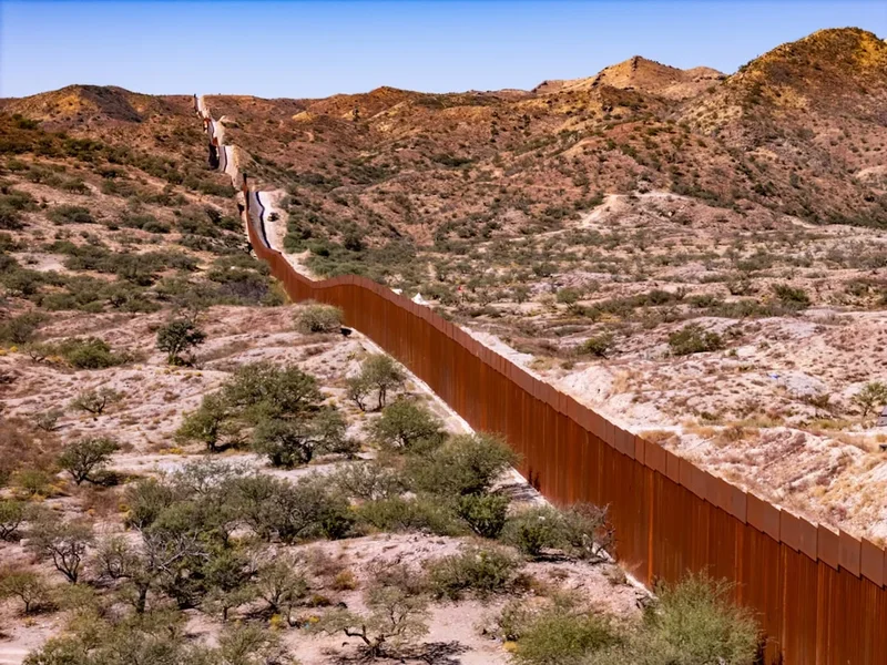
As the route progresses north of Zacatecas, the landscape undergoes a dramatic transformation. The lush valleys give way to the arid expanses of the Chihuahuan Desert. This is the most physically demanding section of the trail, where water sources are scarce and the sun is relentless. The trail passes through the states of Durango and Chihuahua, following the natural corridor created by the eastern slopes of the Sierra Madre Occidental. Here, the scale of the horizon becomes humbling, and the silence of the desert provides a stark contrast to the vibrant urban centres of the south. The crossing into the United States at El Paso/Ciudad Juárez marks a transition into the Rio Grande valley, where the trail follows the river’s life-giving waters through the high-desert landscapes of New Mexico.
Walking or cycling the El Camino Real is an exercise in endurance and cultural immersion. Unlike wilderness-only thru-hikes, this route is a "cultural corridor." You will find yourself walking through cobblestone streets of 400-year-old villages one day and navigating trackless desert scrub the next. The infrastructure varies significantly; in Mexico, much of the route follows secondary roads and historical paths that connect rural communities, while in the United States, the trail is managed by the National Park Service and Bureau of Land Management, with more formalised interpretive sites. The journey requires a high degree of self-reliance, particularly in the northern Mexican states and the "Jornada del Muerto" (Journey of the Dead Man) section in New Mexico, where the trail leaves the river to cross a waterless 145-kilometre stretch of desert.
History and Cultural Context
The history of El Camino Real de Tierra Adentro is a complex tapestry of exploration, exploitation, and exchange. While the formal Spanish route was established in 1598 by Juan de Oñate, the path largely followed existing Indigenous trade routes that had been used for centuries to transport turquoise, obsidian, and salt between the northern pueblos and the southern empires. The Spanish "Royal Road" was created to facilitate the colonisation of the northern frontier and, crucially, to provide a reliable conduit for the silver that fuelled the Spanish Empire’s global economy. For over 300 years, this was the longest and most important trade route in North America, remaining the primary link between the interior of Mexico and the remote northern outposts until the arrival of the railroad in the 1880s.
The cultural impact of the road is visible in every town along the way. The "Camino" brought about a unique syncretism of cultures. Spanish architectural styles were adapted using local materials and Indigenous techniques, resulting in the distinctive "Baroque of the North" seen in the cathedrals of Zacatecas and Chihuahua. The road also facilitated the spread of agriculture, livestock, and European technology, while simultaneously allowing Indigenous cultures to influence the language, food, and traditions of the settlers. However, this history is also one of conflict. The road was a site of resistance for the Chichimeca people in the 16th century and the Pueblo people during the Revolt of 1680. Understanding these layers of history is essential for any traveller on the route; the ruins of presidios (forts) and missions are not just landmarks, but witnesses to a turbulent and transformative era.
In 2010, UNESCO added 60 sites along the Mexican portion of the trail to the World Heritage List, recognising its "outstanding universal value" as a site of cultural exchange. In the United States, the trail was designated a National Historic Trail in 2000. Today, efforts are ongoing to preserve the remaining physical traces of the road—the "huellas"—which include original stone paving, ruts carved by heavy wagons, and the historic parajes (stopping places) that provided sanctuary to weary travellers for centuries.
Want more background? Read extended notes on history and cultural context → Learn more
Seasonal Highlights and Weather Reality
Timing is the most critical factor when planning a journey on El Camino Real de Tierra Adentro. Because the trail spans over 20 degrees of latitude and varies in elevation from sea level to over 2,400 metres, no single season offers perfect weather for the entire length. However, the shoulder seasons of Spring and Autumn are generally considered the most viable windows for a continuous thru-hike.
Spring (March to May): This is the preferred window for starting in Mexico City. The central highlands are pleasantly warm, and the desert sections in the north have not yet reached their peak summer temperatures. In New Mexico, the spring brings blooming cacti and wildflowers, though travellers must be prepared for high winds and occasional late-season snow in the northern mountains near Santa Fe. The primary challenge in spring is the increasing heat as you move north into the Chihuahuan Desert.
Autumn (September to November): This is an excellent time for the northern sections. The monsoon rains of July and August usually subside by September, leaving the desert landscapes surprisingly green and the air clear. Temperatures are milder, and the "Jornada del Muerto" becomes significantly safer to traverse. In the southern sections, the autumn brings harvest festivals and vibrant cultural celebrations, such as Día de los Muertos (Day of the Dead), which is particularly spectacular in the colonial cities of the Bajío.
Summer (June to August): Summer is dangerously hot for the desert sections of the trail. Temperatures in the Chihuahuan Desert and the Rio Grande valley frequently exceed 40° Celsius. This is also the season of the North American Monsoon, which can bring sudden, violent thunderstorms and flash flooding. Thru-hiking during this period is not recommended due to the extreme risk of heatstroke and dehydration. Winter (December to February): While the southern sections in Mexico are mild and pleasant, the northern sections in Chihuahua and New Mexico can be bitterly cold. Snow is common in Santa Fe and the surrounding mountains, and night-time temperatures in the desert often drop well below freezing. Winter travel requires heavy insulating gear and careful monitoring of mountain passes.
Recommended Itinerary

The Five Stages of El Camino Real
Stage 1: The Silver Cities (Mexico City to Zacatecas)
- Distance: 600 km
- Elevation gain: 3,500 m
- Time: 25–30 days
- Start at the Zócalo in Mexico City, heading north through Tlalnepantla.
- Traverse the fertile Bajío region, visiting the UNESCO cities of Querétaro and San Miguel de Allende.
- Follow the "Ruta de la Plata" (Silver Route) through Guanajuato, navigating its famous subterranean tunnels and steep alleys.
- Climb toward Zacatecas, a city built in a narrow ravine, dominated by the Cerro de la Bufa.
- Key waypoints: San Juan del Río, Hacienda de Pabellón de Hidalgo, and the Sanctuary of Atotonilco.
- This stage is rich in infrastructure, with frequent guesthouses and excellent food.
Stage 2: The Gateway to the North (Zacatecas to Durango)
- Distance: 290 km
- Elevation gain: 1,800 m
- Time: 12–15 days
- The landscape begins to open up into vast grasslands and high-altitude plains.
- Pass through Sombrerete, a beautifully preserved colonial town near the Sierra de Órganos National Park.
- Visit the archaeological site of Altavista (Chalchihuites), an ancient astronomical centre on the Tropic of Cancer.
- Arrive in Victoria de Durango, a city known for its baroque architecture and its history as a filming location for classic Westerns.
- The terrain is undulating but generally manageable, with increasing distances between water sources.
Stage 3: The Chihuahuan Desert (Durango to Ciudad Juárez)
- Distance: 850 km
- Elevation gain: 4,000 m
- Time: 35–45 days
- The most remote and challenging section of the Mexican portion.
- Follow the eastern edge of the Sierra Madre, passing through Mapimí and the "Bolson de Mapimí."
- Navigate the vast expanses of Chihuahua state, where the trail often follows long, straight stretches of historical road.
- Visit the UNESCO site of Paquimé (Casas Grandes), the most important archaeological site in northern Mexico.
- Reach the border at Ciudad Juárez/El Paso, the historic "Pass of the North."
- Logistics become difficult here; careful planning for food and water resupply is essential.
Stage 4: The Rio Grande Corridor (El Paso to Socorro)
- Distance: 310 km
- Elevation gain: 2,200 m
- Time: 14–18 days
- Enter the United States and follow the Rio Grande valley north through Las Cruces.
- The trail passes through the Mesilla Valley, famous for its pecan orchards and green chilli farms.
- Prepare for the "Jornada del Muerto," a 145 km stretch where the trail leaves the river to avoid its treacherous bends.
- This section requires carrying significant water or arranging for caches, as there are no reliable natural sources.
- Arrive in Socorro, home to the San Miguel de Socorro mission.
Stage 5: The High Kingdom (Socorro to Santa Fe)
- Distance: 510 km
- Elevation gain: 3,500 m
- Time: 20–25 days
- Continue north through the Albuquerque basin, following the river through ancient cottonwood forests (bosques).
- Pass through several Pueblo nations, including Isleta, Santo Domingo, and San Felipe (respect local regulations regarding access).
- Climb the "La Bajada" escarpment, a dramatic basalt cliff that separates the lower Rio Grande from the Santa Fe plateau.
- Finish at the Santa Fe Plaza, the historic terminus of the trail and the oldest state capital in the United States.
- Optional extension to San Juan Pueblo (Ohkay Owingeh), the original northern capital established by Oñate.
Important Notes:
- The route is a mix of hiking trails, dirt roads, and paved shoulders; high-visibility gear is recommended for road sections.
- Border crossing at El Paso/Juárez requires valid passports and necessary visas/permits (FMM for Mexico, ESTA/Visa for USA).
- Water management is the single greatest safety factor in Stages 3 and 4.
- Spanish language skills are highly beneficial for the Mexican sections.
- Respect private property and Indigenous lands; always seek permission where required.
Planning and Bookings
Book Your Trip
Everything you need to plan your journey
Accommodation
Find places to stay near Mexico City
Flights
Search flights to Mexico City
Essential Preparation
A thru-hike of El Camino Real de Tierra Adentro requires months of logistical preparation. Unlike well-marked trails like the Appalachian Trail, this route requires significant navigation skills and the ability to adapt to changing conditions. Physical fitness is paramount; while the elevation gain is moderate compared to alpine treks, the sheer distance and the stress of heat and sun require a high level of cardiovascular endurance and mental resilience. You should be comfortable walking 25–30 kilometres per day with a loaded pack.
Logistically, you must coordinate your border crossing. Most travellers start in Mexico City, which is easily accessible via Mexico City International Airport (MEX). From the Zócalo, the trail is urban for the first few days, requiring careful navigation through the metropolitan area. It is highly recommended to spend at least three days in Mexico City to acclimatise to the altitude (2,240 m) and finalise your supplies. Basic Spanish is essential for navigating rural Mexico, as English is rarely spoken outside major tourist hubs.
Trail Accommodation
Accommodation on El Camino Real is diverse, reflecting the "cultural corridor" nature of the route. There is no single booking system; instead, you will use a combination of hotels, hostels, and camping.
In Mexico:
- Colonial Hotels: In cities like Querétaro and Zacatecas, you can stay in historic buildings that once served as inns for travellers on the Camino. Costs range from 800 to 2,000 Pesos per night.
- Posadas and Guesthouses: In smaller villages, local families often offer basic rooms (posadas). These are affordable and provide a deep cultural experience.
- Wild Camping: Possible in the remote sections of Durango and Chihuahua, but must be done with caution. Always ask permission from local landowners (rancheros) before pitching a tent.
- Parroquias: Occasionally, local churches may offer shelter to pilgrims, though this is less formalised than on the Camino de Santiago.
In the United States:
- Campsites: Managed by the BLM or State Parks (e.g., Elephant Butte Lake, Leasburg Dam). These often have water and basic facilities.
- Motels: Common in towns like Las Cruces, Socorro, and Albuquerque. Costs range from US$60 to US$120.
- Trail Angels: A small but growing network of supporters in New Mexico may offer "hiker feeds" or a place to stay.
Required Gear
- Footwear: Sturdy, well-ventilated hiking shoes or boots. The terrain is often rocky and hot; avoid heavy, non-breathable leather boots.
- Backpack: 50–65L capacity with a high-quality suspension system. A reflective rain cover is useful for visibility on road sections.
- Sun Protection: Wide-brimmed hat, high-SPF sunscreen, and lightweight, long-sleeved UPF-rated clothing. The sun is the primary adversary on this trail.
- Navigation: GPS device with offline maps (Gaia GPS or FarOut), a compass, and physical map backups. The trail is not consistently marked.
- Shelter: A lightweight, freestanding tent with excellent ventilation and a high-quality mosquito net.
- Sleeping System: A 3-season sleeping bag (rated to -5°C for desert nights) and an insulated sleeping pad.
- Water Storage: Capacity to carry at least 6–8 litres of water for the desert sections.
What to Bring
- Water Treatment: A high-quality filter (e.g., Sawyer Squeeze) plus purification tablets for backup. In the desert, you may have to pull water from cattle tanks.
- Cooking System: A lightweight multi-fuel or canister stove. Note that canister availability can be spotty in rural Mexico; multi-fuel is more versatile.
- Food: High-calorie, lightweight supplies. In Mexico, you can resupply frequently in "tiendas," but selection is limited to basics like beans, rice, tortillas, and tinned tuna.
- First Aid: Extensive blister kit, rehydration salts (essential), tweezers for cactus spines, and any personal medications.
- Power: A large capacity power bank (20,000mAh+) and a portable solar charger for long desert stretches.
- Language Guide: A small Spanish-English dictionary or a translation app with offline capabilities.
Permits
The El Camino Real de Tierra Adentro does not require a single "trail permit," but because it crosses an international border, the legal requirements for entry and stay are the most important "permits" you will obtain. Failure to have the correct documentation can result in fines or deportation.
Mexico Entry (For those starting in the USA or flying into MEX):
- FMM (Forma Migratoria Múltiple): Most nationalities require this tourist card. It is usually issued for 180 days upon arrival at the airport. If crossing by land, you must stop at the INM (Instituto Nacional de Migración) office at the border to get your stamp and pay the fee (approx. 700 Pesos).
- Passport: Must be valid for at least six months beyond your intended stay.
USA Entry (For those heading north from Mexico):
- Visa/ESTA: International travellers must have a valid B1/B2 Visa or an approved ESTA (Electronic System for Travel Authorization) if from a Visa Waiver Program country.
- I-34°Corm: If entering the USA by land at El Paso, you must complete the I-94 form and pay the small fee at the port of entry.
- Customs: Be aware of strict regulations regarding the transport of food, seeds, and animal products across the border.
Land Use Permits:
- Bureau of Land Management (BLM): Most BLM land in New Mexico allows for dispersed camping without a permit for up to 14 days. However, some specific areas may have fees.
- State Parks: New Mexico State Parks require a daily entrance or camping fee (usually US$10–$15).
- Indigenous Lands: The trail passes through or near several Pueblos in New Mexico. These are sovereign nations. You must check their specific websites or visitor centres for permits required to cross or visit their lands. Some Pueblos are currently closed to outside visitors.
Other Activities in the Area
The El Camino Real passes through some of the most culturally rich regions of North America. Consider these detours to enrich your journey:
- Guanajuato Mummies: A macabre but fascinating museum in Guanajuato featuring naturally mummified bodies from the 19th century.
- Silver Mine Tours: Visit the Mina El Edén in Zacatecas or the mines in Guanajuato to see the conditions that created the wealth of the Camino.
- Hot Springs: Relax your tired muscles in the thermal waters of San Miguel de Allende or Truth or Consequences, New Mexico.
- White Sands National Park: A short detour from Las Cruces, this park features stunning dunes of white gypsum sand.
- Wine Tasting: The Mesilla Valley in New Mexico and the Parras Valley in Coahuila (near the trail) are some of the oldest wine-producing regions in the Americas.
- Ballooning in Albuquerque: If you arrive in October, the International Balloon Fiesta is a world-class spectacle.
Safety and Conditions
Environmental Hazards: The primary safety concern is the environment. Heat exhaustion and heatstroke are genuine risks. You must carry more water than you think you need—at least 1 litre for every 5 kilometres in the desert. Flash floods are a serious danger in "arroyos" (dry creek beds) during the monsoon season; never camp in a dry wash. Rattlesnakes and scorpions are present; always check your boots and be mindful of where you place your hands and feet.
Navigation and Remoteness: Large sections of the trail in northern Mexico and the Jornada del Muerto are extremely remote. Cell phone service is non-existent in these areas. A Personal Locator Beacon (PLB) or satellite messenger (like a Garmin inReach) is mandatory for safety. Ensure you have downloaded offline maps, as the trail is often poorly defined on the ground.
Social and Border Safety: While the vast majority of people you meet will be incredibly hospitable, the northern Mexican states have experienced issues with cartel-related violence. It is essential to stay informed about current travel advisories from your home country. Stick to the main corridor, avoid travelling at night, and do not display expensive gear or large amounts of cash. In the border region of El Paso/Juárez, be aware of increased security presence and follow all official instructions.
Water Quality: Never drink untreated water. In the desert, water sources may be contaminated by livestock or heavy metals from old mining operations. Use a high-quality filter and consider chemical treatment for viruses if sourcing from stagnant tanks.
Side Trips and Points of Interest
Paquimé (Casas Grandes): Located in Chihuahua, this UNESCO World Heritage site is the most significant archaeological remains of the Northwest Mexico/Southwest US culture. The site features complex multi-storey adobe structures and an advanced water system. It represents the northernmost influence of Mesoamerican cultures and is a vital link in the history of the Camino.
Sierra de Órganos: Near Sombrerete, Zacatecas, this national park features spectacular rhyolite stone pillars that resemble organ pipes. It was a frequent stopping point for travellers on the Camino and has served as the backdrop for numerous Western films. The hiking trails here offer a beautiful break from the long-distance trek.
The Jornada del Muerto: While part of the main route, this 145-kilometre stretch in New Mexico is a "point of interest" in its own right. It is one of the most feared sections of the historic trail. Walking it today allows you to see the original wagon ruts and the "Point of Rocks" landmark, where travellers would look for water in the distance. It is a place of profound silence and historical weight.
La Bajada Escarpment: Just south of Santa Fe, the trail climbs 200 metres up a steep basalt cliff. You can still see the various iterations of the road here, from the original footpaths to the colonial wagon road and the early 20th-century Route 66 switchbacks. The view from the top across the Rio Grande valley is one of the best on the entire trail.
Leave No Trace
The El Camino Real de Tierra Adentro passes through fragile desert ecosystems and irreplaceable historical sites. Adhering to Leave No Trace principles is essential to preserving the "huellas" (traces) of the road for future generations.
Protecting History: The most important rule on this trail is: Do not disturb historical artefacts. If you find pottery shards, old nails, or stone tools, leave them exactly where they are. Removing these items is illegal and destroys the archaeological context of the trail. Similarly, do not touch or deface historic inscriptions or buildings.
Desert Ethics: Desert soils are often covered in "cryptobiotic crust"—a living layer of cyanobacteria, mosses, and lichens that prevents erosion. A single footprint can destroy decades of growth. Stay on established paths or durable surfaces like rock and sand. Pack out all trash, including organic waste like orange peels, which decompose very slowly in arid environments. Dispose of human waste in "cat holes" at least 15–20 centimetres deep and 60 metres from any water source, or better yet, use a "WAG bag" in sensitive desert areas.