
Eagle Rock Loop - The Rugged Heart of the Ouachitas
The Eagle Rock Loop is widely considered the most challenging and rewarding multi-day trek in the state of Arkansas, and arguably the premier wilderness experience in the central United States. Spanning approximately 42.6 kilometres through the Ouachita National Forest, this circuit is not a single trail but a masterfully connected network comprising the Little Missouri, Athens-Big Fork, and Viles Branch trails. It offers a relentless physical challenge, characterised by over 1,524 metres of total elevation gain and more than 20 crossings of the Little Missouri River and its various tributaries. The route traverses a stunningly diverse landscape, from the deep, moss-covered river valleys and ancient hardwood forests to the windswept, rocky ridges of the Athens-Big Fork section, where hikers are rewarded with panoramic views of the rolling Ouachita Mountains.
Unlike many popular trails that follow gentle gradients, the Eagle Rock Loop is famous for its "verticality." The Athens-Big Fork segment, in particular, follows a historic postal route that climbs directly over eight distinct mountain ridges rather than contouring around them. This creates a "sawtooth" profile that tests the endurance of even the most seasoned walkers. However, the reward for this exertion is a profound sense of isolation and a chance to witness the unique geology of the region, including the spectacular novaculite formations at Winding Stairs and the namesake Eagle Rock Vista. This is a journey through a landscape that feels ancient and untamed, where the weather dictates the pace and the river levels determine the path.
- Distance: 42.6 km loop
- Duration: 2–4 days
- Season: October–April (best for cooler temperatures and manageable river levels)
- Accommodation: Dispersed backcountry camping (no huts or formal campsites)
- Highest point: Approximately 550 metres (Eagle Rock Vista / Athens-Big Fork ridges)
- Total Elevation Gain: 1,524 metres
- Difficulty: Challenging (due to steep climbs and numerous river crossings)
- Direction: Can be walked in either direction; clockwise is common to tackle the "peaks" early
Overview
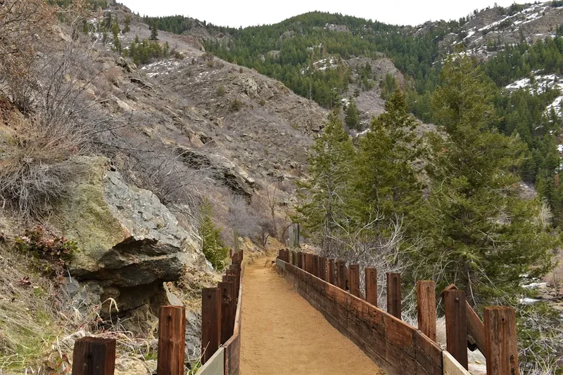
The Eagle Rock Loop is a masterclass in topographical variety. Located within the 1.8-million-acre Ouachita National Forest, the trail provides a concentrated dose of everything that makes this region unique. The loop is essentially divided into three distinct "personalities." The northern and eastern sections follow the Little Missouri River, where the path is relatively level but technically demanding due to the sheer number of river crossings. Here, the forest is lush, dominated by towering pines and ancient oaks, with the sound of rushing water providing a constant soundtrack. The river itself is a highlight, featuring crystal-clear pools, dramatic cascades, and the famous "Winding Stairs" area, where the water has carved deep channels through the jagged rock.
The western section of the loop, the Athens-Big Fork Trail, provides a stark contrast. This is the most physically demanding portion of the trek, where the trail leaves the river valley to scale a series of steep ridges. These climbs are short but incredibly steep, often exceeding 20% gradients. The terrain here is rocky and rugged, reflecting the unique east-west orientation of the Ouachita Mountains—a geological rarity in North America. From the summits of these ridges, particularly at Eagle Rock Vista, hikers can see for kilometres across a sea of green ridges that seem to ripple toward the horizon. The descent into the valleys between these ridges is equally taxing on the knees, requiring careful footwork over loose shale and exposed roots.
The southern section, following the Viles Branch Trail, offers a brief respite. This segment is flatter and more open, often following old forest roads and crossing meadows that provide a different ecological perspective. However, even here, the trail remains wild. The Eagle Rock Loop is not a "manicured" experience; it is a raw encounter with the elements. The river crossings are the defining feature of the loop. Depending on recent rainfall, these can range from ankle-deep hops to waist-high wades that require significant caution. There are no bridges on the main loop, meaning hikers must be prepared to get wet and must possess the judgement to turn back if the river is in flood. This combination of steep mountain climbing and river navigation makes the Eagle Rock Loop a true test of backcountry skill and physical fortitude.
History and Cultural Context
The land encompassing the Eagle Rock Loop has a rich and varied history that stretches back thousands of years. Long before the arrival of European settlers, the Ouachita Mountains were the ancestral home of the Caddo people. The region was highly valued for its deposits of novaculite—a hard, dense, fine-grained silica rock. The Caddo and other indigenous groups travelled from great distances to quarry this stone, which was prized for making high-quality arrowheads, knives, and scrapers. Evidence of these ancient quarries can still be found throughout the forest, and the jagged outcrops seen along the trail today are the same formations that provided essential tools for prehistoric inhabitants.
In the 19th century, the Athens-Big Fork segment of the loop served a very different purpose. It was originally established as a postal route, used by mail carriers on horseback to connect the small settlements of Athens and Big Fork. Because the mail had to be delivered regardless of the terrain, the trail was cut in a straight line over the ridges rather than following the easier, winding paths through the valleys. This "straight-up-and-over" philosophy is exactly why the trail remains so challenging for modern hikers. Walking this section today is a literal step back into the history of frontier logistics, where the physical landscape was a formidable barrier to communication.
The modern trail system was largely formalised and protected during the early 20th century with the establishment of the Ouachita National Forest in 1907—the oldest National Forest in the Southern United States. During the Great Depression, the Civilian Conservation Corps (CCC) played a vital role in developing the infrastructure of the forest, building roads, fire towers, and many of the original trail segments that now form the loop. The Eagle Rock Loop as a continuous circuit was the result of a collaborative effort between the U.S. Forest Service and local hiking groups who recognised the potential for a world-class long-distance trail. Today, the loop stands as a testament to both the ruggedness of the early pioneers and the enduring value of wilderness conservation in the American South.
Want more background? Read extended notes on history and cultural context → Learn more
Seasonal Highlights and Weather Reality
Timing is everything when planning a trip on the Eagle Rock Loop. The climate of the Ouachita Mountains is characterised by hot, humid summers and mild to cold winters, but the most critical factor for any hiker is the rainfall. Because the loop involves over 20 river crossings with no bridges, the water level of the Little Missouri River dictates whether the trail is a pleasant adventure or a dangerous impossibility.
Autumn (October to November): This is arguably the best time to hike the loop. The humidity of the summer has dissipated, temperatures are cool and comfortable for climbing, and the hardwood forests erupt in a spectacular display of red, orange, and gold. River levels are typically at their lowest and most stable during these months, making the crossings much easier. However, water sources in the higher elevations of the Athens-Big Fork section may dry up, requiring hikers to carry more water between river access points.
Spring (March to April): Spring offers another excellent window, with mild temperatures and the blooming of wildflowers and dogwood trees. The forest is vibrant and green, and the waterfalls are usually at their most impressive. However, spring is also the wettest season. Heavy thunderstorms can cause the Little Missouri River to rise rapidly. Hikers must be extremely vigilant about weather forecasts and river gauges during this time. A river that is 0.5 metres deep in the morning can easily reach 2 metres by the afternoon following a heavy downpour.
Winter (December to February): Winter hiking is popular for those who enjoy solitude and crisp air. The lack of foliage opens up even better views from the ridges. While snow is infrequent, it does occur, and temperatures can drop well below freezing at night. The main challenge in winter is the river crossings; wading through near-freezing water requires proper gear (like neoprene socks) and a plan to dry off and warm up immediately after crossing to prevent hypothermia.
Summer (May to September): Summer is generally the least desirable time to hike the Eagle Rock Loop. The heat can be oppressive, with temperatures often exceeding 32° Celsius and high humidity making the steep climbs of the Athens-Big Fork section exhausting. Furthermore, the region is home to a significant population of ticks, chiggers, and biting flies during the warmer months. If hiking in summer, an early start is essential to avoid the midday heat, and significant water capacity is required.
Recommended Itinerary
3-Day Eagle Rock Loop Itinerary (Clockwise)
Day 1: Shady Lake / Athens-Big Fork Trailhead to Little Missouri River
- Distance: 14 km
- Elevation gain: 750 m
- Time: 6–8 hours
- Start at the Athens-Big Fork Trailhead (North) or Shady Lake Recreation Area
- Immediately begin the "sawtooth" section, crossing the first four major ridges
- Climb Missouri Mountain and Hurricane Knob—the steepest sections of the entire loop
- Reach Eagle Rock Vista for the best panoramic views of the Ouachita National Forest
- Descend into the valley to meet the Little Missouri River
- Set up camp at one of the many dispersed sites near the river junction
- This is the most physically taxing day; starting early is essential to manage the steep gradients
Day 2: Little Missouri River to Winding Stairs
- Distance: 16 km
- Elevation gain: 450 m
- Time: 7–9 hours
- Follow the Little Missouri Trail heading south/east
- This section involves the highest density of river crossings (approximately 12–15 crossings)
- Pass through the "Winding Stairs" area—a stunning gorge with deep turquoise pools and jagged rock formations
- The trail meanders through ancient groves of shortleaf pine and white oak
- Navigate several technical rocky sections where the trail clings to the riverbank
- Pass the junction with the Viles Branch Trail
- Camp near the Winding Stairs area or further south along the river
- The focus today is on river navigation and enjoying the spectacular water features
Day 3: Winding Stairs to Trailhead via Viles Branch
- Distance: 12.6 km
- Elevation gain: 324 m
- Time: 5–6 hours
- Turn onto the Viles Branch Trail, leaving the main Little Missouri River
- The terrain becomes significantly flatter and more open
- Cross the Viles Branch stream multiple times (usually shallower than the Little Missouri)
- Pass through meadows and pine savannahs, offering a different ecological perspective
- Re-enter the Athens-Big Fork section for the final few ridges
- Complete the final climbs back to the Shady Lake or Athens-Big Fork trailhead
- Finish the loop and return to Mena for a well-earned meal
- This day is shorter and less intense, allowing for a steady pace back to the vehicle
Important Notes:
- River levels are the primary safety concern; check the Langley, AR gauge before starting
- There are no formal campsites; use existing fire rings and follow Leave No Trace principles
- Water is abundant along the river but must be treated
- The Athens-Big Fork section is very dry; fill up all containers before leaving the river
- Cell phone service is non-existent in the valleys and unreliable on the ridges
- Always carry a physical map and compass; the trail can be obscured by leaf litter
Planning and Bookings
Book Your Trip
Everything you need to plan your journey
Accommodation
Find places to stay near Mena
Flights
Search flights to Mena
Essential Preparation
The Eagle Rock Loop is a serious undertaking that requires a high level of physical fitness and backcountry experience. The combination of steep, sustained climbs and technical river crossings means that a 15-kilometre day on this trail feels significantly harder than on a flatter route. Hikers should be comfortable with "off-camber" walking, navigating slippery rocks, and managing their own safety in a remote environment. There is no "sweep" or regular ranger patrol on this trail.
Mena, Arkansas, is the closest city and serves as the primary base for logistics. It offers several motels, grocery stores, and outdoor supply shops. It is highly recommended to stay in Mena the night before your hike to ensure an early start. The drive from Mena to the various trailheads (Shady Lake, Little Missouri Falls, or Athens-Big Fork) takes between 45 minutes and an hour on winding forest roads. Ensure your vehicle has a full tank of petrol, as there are no services once you enter the National Forest area.
Trail Accommodation
The Eagle Rock Loop is a pure backcountry experience. There are no huts, lodges, or developed campsites along the 42.6-kilometre circuit. Accommodation is entirely self-provided through dispersed camping.
Camping Regulations:
- Camping is permitted anywhere within the Ouachita National Forest, provided you are at least 30 metres away from the trail and water sources.
- Numerous "established" dispersed sites exist, particularly along the Little Missouri River and near the Winding Stairs area. These sites often feature stone fire rings. Using these existing sites is encouraged to minimise environmental impact.
- There are no toilets, rubbish bins, or water taps on the trail.
- During periods of high fire risk, campfires may be prohibited. Always check the current Forest Service alerts.
- If you prefer a developed campsite for the night before or after your hike, the Shady Lake Recreation Area and Albert Pike Recreation Area (day-use only for the river area, but camping nearby) offer facilities like picnic tables and vault toilets for a small fee.
Required Gear
- Footwear: Sturdy hiking boots with excellent grip and ankle support are essential for the rocky ridges. Many hikers also carry a pair of lightweight water shoes or sandals for the river crossings to keep their primary boots dry.
- Navigation: A high-quality topographic map and a compass are mandatory. While the trail is marked with white (Little Missouri) and yellow (Athens-Big Fork) blazes, they can be sparse or obscured. A GPS device or a smartphone with offline maps (like Gaia GPS or AllTrails) is highly recommended.
- Shelter: A lightweight, weather-resistant tent or hammock system. Ensure your shelter can withstand high winds, which are common on the ridges.
- Sleep System: A sleeping bag rated to at least 0° Celsius for spring/autumn, or lower for winter. A sleeping pad is essential for insulation from the cold ground.
- Pack: A 50–65 litre backpack with a waterproof liner or rain cover. Given the river crossings, keeping your gear dry is a top priority.
- Lighting: A reliable head torch with spare batteries.
- First Aid: A comprehensive kit including blister treatment (moleskin/Leukotape), antiseptic, bandages, and any personal medications.
What to Bring
- Water Treatment: A reliable filter (hollow fibre or ceramic) or chemical purification tablets. While water is plentiful in the rivers, it must be treated to remove Giardia and Cryptosporidium.
- Food: High-calorie, lightweight meals and snacks for the duration of your trip. Bear canisters are not strictly required, but "bear bagging" your food or using an Ursack is essential to protect your supplies from bears, raccoons, and rodents.
- Cooking Gear: A lightweight backpacking stove and fuel. Ensure you have a reliable ignition source (waterproof matches or a lighter).
- Clothing Layers: Moisture-wicking base layers (merino wool or synthetic), an insulating mid-layer (fleece or down), and a high-quality waterproof shell. Avoid cotton, which loses its insulating properties when wet.
- Sun and Bug Protection: Sunscreen, sunglasses, and a hat. Insect repellent is crucial from late spring through early autumn to guard against ticks and mosquitoes.
- Trowel and Toilet Paper: For proper waste disposal (digging a 15–20 cm cathole at least 60 metres from water).
- Emergency Whistle and Signal Mirror: For use in the event of an injury or becoming lost.
Permits
One of the great appeals of the Eagle Rock Loop is its accessibility. Currently, there are no permits required for day hiking or overnight backcountry camping on the loop. There are no fees for entering the Ouachita National Forest or for parking at the primary trailheads (Athens-Big Fork North, Little Missouri Falls, or Winding Stairs).
Registration and Safety:
- While no formal permit is needed, it is highly recommended to register your trip. You can do this by visiting or calling the Mena Ranger District office. Providing them with your planned itinerary and expected return time is a vital safety measure.
- Always leave a detailed trip plan with a reliable person at home. Include your vehicle's make, model, and registration number, as well as the specific trailhead where you intend to park.
- Check for any "Special Orders" or temporary closures on the Ouachita National Forest website before you depart. These may include fire bans, trail maintenance closures, or road washouts.
Parking and Access:
- Parking is available at several points around the loop. The most popular spots are the Athens-Big Fork North Trailhead, the Little Missouri Falls parking area, and the Winding Stairs trailhead (near Albert Pike).
- Do not leave valuables in your vehicle. While the area is generally safe, remote trailheads can occasionally be targets for opportunistic theft.
- Ensure your vehicle is parked within designated areas and does not block forest service roads, which must remain clear for emergency vehicles.
Other Activities in the Area
The region surrounding Mena and the Ouachita National Forest offers numerous opportunities for those looking to extend their adventure:
- Talimena Scenic Drive: A 87-kilometre National Scenic Byway that runs along the crest of Rich Mountain and Winding Stair Mountain. It offers breathtaking vistas and is particularly famous for its autumn foliage.
- Queen Wilhelmina State Park: Located atop Rich Mountain, this park features the "Castle in the Clouds" lodge, a restaurant, and several shorter hiking trails with incredible views. It is a great place for a "recovery" meal after finishing the loop.
- Mountain Biking: The Ouachita Mountains are a premier destination for mountain biking. The Womble Trail and the Ouachita National Recreation Trail offer world-class singletrack experiences for various skill levels.
- Canoeing and Kayaking: When water levels are appropriate, the Little Missouri River and the nearby Cossatot River offer exciting whitewater opportunities. The Cossatot is known as one of the most challenging whitewater rivers in the region.
- Fishing: The Little Missouri River is a popular spot for trout fishing (stocked in certain areas) and smallmouth bass. Ensure you have a valid Arkansas fishing licence.
- Wolf Pen Gap: For those interested in motorised recreation, this area offers a massive network of trails specifically designed for ATVs and UTVs.
Safety and Conditions
Flash Flooding (The Primary Danger): The Eagle Rock Loop crosses the Little Missouri River and its tributaries more than 20 times. This river is notorious for rapid rising. In 2010, a tragic flash flood occurred in the Albert Pike area, demonstrating the sheer power of this watershed. Never attempt to cross a river if the water is above mid-thigh height or if it is moving too fast to maintain a stable footing. If heavy rain is forecast, the safest option is to stay on high ground or exit the trail. Check the USGS river gauge for "Little Missouri River near Langley, AR." A reading above 1.2 metres (1 m) generally indicates that crossings will be difficult or dangerous.
Steep Terrain and Physical Exhaustion: The Athens-Big Fork section is relentless. Heat exhaustion and dehydration are genuine risks, especially in the summer. Pace yourself, take frequent breaks, and ensure you are consuming enough electrolytes. The rocky nature of the trail also makes ankle sprains and falls a common occurrence. Trekking poles are highly recommended to provide stability on steep descents and during river crossings.
Wildlife: The Ouachita National Forest is home to black bears, timber rattlesnakes, and copperheads. While encounters are rare, hikers should be "bear aware" by storing food properly and making noise while walking. Watch your step on rocky outcrops and near fallen logs where snakes may be sunning or hiding. Ticks are a significant concern from spring through autumn; perform regular tick checks and consider treating your clothing with permethrin.
Communication: Do not rely on mobile phones. Signal is non-existent in the deep valleys where you will spend most of your time. A satellite messenger (like a Garmin inReach or Zoleo) is a wise investment for solo hikers or those tackling the loop in the off-season. In an emergency, your best chance of finding a signal is to climb to the highest ridge top.
Side Trips and Points of Interest
Winding Stairs: This is perhaps the most scenic spot on the entire loop. Located on the Little Missouri Trail section, the river here flows through a series of tight turns and narrow chutes carved into the dark novaculite rock. There are deep, clear pools perfect for a refreshing swim in the summer and several large, flat rock "porches" that make for ideal lunch spots. The area is surrounded by steep, forested bluffs, creating a secluded, cathedral-like atmosphere.
Eagle Rock Vista: Located on the Athens-Big Fork section between the Viles Branch junction and the northern trailhead, this vista provides the definitive view of the loop. From the rocky outcrop, you can look down into the Viles Branch valley and across to the ridges you have either just climbed or are about to tackle. It is the highest point on the trail and the perfect place to appreciate the geological scale of the Ouachitas.
Little Missouri Falls: A short walk from the main loop (or a popular starting point), these falls are a series of wide, stepped cascades rather than a single vertical drop. The area is beautifully maintained and offers a great example of the river's power and beauty. It is a popular spot for photography and a great place to cool off.
The "Hidden" Quarries: For those with a keen eye and an interest in archaeology, the ridges of the Athens-Big Fork trail contain several sites where ancient novaculite was quarried. Look for areas with an unusual amount of sharp, white or grey rock flakes—these are often "lithic scatters" left behind by indigenous toolmakers thousands of years ago. Remember that these are protected cultural sites; look but do not remove any artefacts.
Leave No Trace
The Eagle Rock Loop is a fragile ecosystem that faces significant pressure from its popularity. Because there are no formal facilities, the responsibility for preserving this wilderness falls entirely on the hikers. Following the seven Leave No Trace principles is not just a suggestion; it is essential for the survival of the trail's wild character.
Your responsibility as a walker:
- Plan Ahead and Prepare: Know the river levels and weather. Ensure you have the skills to navigate and survive in a remote area.
- Travel and Camp on Durable Surfaces: Use existing campsites and fire rings. Avoid trampling vegetation to create new sites. Stay on the marked trail to prevent erosion, especially on the steep ridges.
- Dispose of Waste Properly: Pack out ALL rubbish, including food scraps and hygiene products. Bury human waste in a cathole at least 20 cm deep and 60 metres from any water source.
- Leave What You Find: Do not remove rocks, plants, or historical artefacts. Leave the novaculite where it lies for others to discover.
- Minimise Campfire Impacts: Use a lightweight stove for cooking. If you must have a fire, use existing fire rings and keep it small. Ensure it is completely extinguished (cold to the touch) before leaving.
- Respect Wildlife: Observe animals from a distance. Never feed wildlife, as it habituates them to humans and can lead to dangerous encounters.
- Be Considerate of Other Visitors: The Eagle Rock Loop is a place for solitude. Keep noise levels down and yield to other hikers on the trail.