
Dusky Track - New Zealand's Ultimate Wilderness Challenge
The Dusky Track is widely regarded as the most challenging, remote, and rewarding tramping route in New Zealand. Stretching 84 kilometres through the rugged heart of Fiordland National Park, this is not a walk for the faint-hearted or the inexperienced. It is a journey into a prehistoric landscape of deep u-shaped valleys, sheer granite peaks, and vast areas of untouched temperate rainforest. Unlike the manicured paths of the Great Walks, the Dusky Track is a raw, visceral experience where the "track" often consists of knee-deep mud, tangled tree roots, and steep, slippery descents. It connects Lake Hauroko, New Zealand's deepest lake, with the West Arm of Lake Manapouri, crossing two demanding alpine passes and traversing the drainage systems of the Seaforth and Spey Rivers. For those with the fitness, skills, and mental fortitude to complete it, the Dusky Track offers a level of solitude and wilderness immersion that is increasingly rare in the modern world.
- Distance: 84.0 km one-way
- Duration: 8–10 days
- Elevation Gain: Approximately 3,000 m total
- Difficulty: Very Challenging / Expert
- Best Time: November to April
- Huts: 8 Department of Conservation (DOC) huts (non-bookable, first-come-first-served)
- Highest Point: Centre Pass (1,051 m) and Furkert Pass (970 m)
- Access: Boat transport required at both ends (Lake Hauroko and Lake Manapouri)
Overview
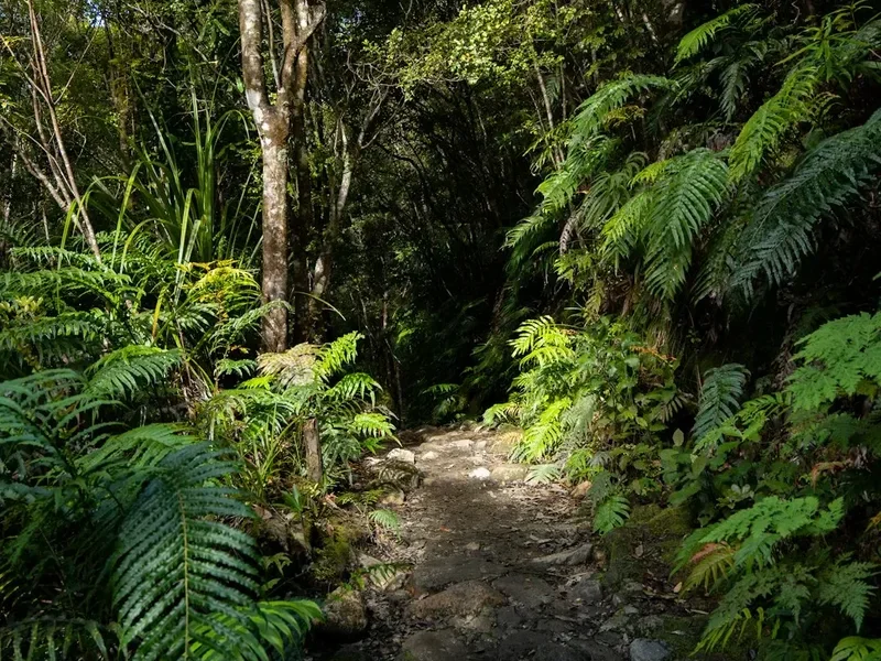
The Dusky Track is a legendary name in the New Zealand tramping community, often spoken of with a mix of reverence and trepidation. It is a landscape defined by extremes. Fiordland is one of the wettest places on Earth, and the Dusky Track sits right in the path of the prevailing westerly winds. Rainfall is measured in metres rather than millimetres, and this constant moisture defines every aspect of the trek. The "Dusky Mud" is a character in its own right—deep, black, and seemingly bottomless in sections of the Hauroko Burn and the Seaforth Valley. Walkers must be prepared to spend significant portions of their day with wet feet, navigating around (or through) bogs that can swallow a trekking pole whole.
The terrain is relentlessly physical. The track does not follow gentle gradients; it climbs straight up ridges and drops straight down into valleys. There are 21 three-wire bridges on the route—narrow, swaying structures consisting of one wire for your feet and two for your hands—which provide the only safe passage over the region's volatile rivers. When the rain falls heavily, which it frequently does, these rivers can rise with terrifying speed, turning small streams into impassable torrents and potentially stranding trampers in huts for days. This unpredictability is why a 10-day window is recommended for an 8-day walk.
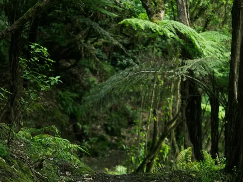
However, the rewards for this hardship are unparalleled. Standing atop the Pleasant Range on a clear day provides a 360-degree panorama of the Southern Alps, with the dark waters of Dusky Sound shimmering in the distance. The forest is a lush, emerald world of ancient beech and podocarp trees, draped in thick layers of moss and lichen. The birdlife is prolific; because of the area's remoteness and intensive predator control, you are likely to encounter the inquisitive South Island robin, the screeching kākā, and perhaps even the elusive whio (blue duck) in the fast-flowing mountain streams. This is New Zealand as it was before human arrival—vast, indifferent, and breathtakingly beautiful.
History and Cultural Context
The history of the Dusky Track area is a tapestry of Māori exploration, early European maritime discovery, and the dogged persistence of 19th-century surveyors. For Ngāi Tahu, the southern iwi (tribe), the fiords and inland lakes were vital seasonal resources. While the Dusky Track route itself was not a primary pounamu (greenstone) trail like the routes further north, the area was used for gathering mahinga kai (traditional foods), particularly forest birds and seals along the coast. The spiritual connection to this landscape remains deep, with the mountains and waters featuring in the whakapapa (genealogy) of the southern people.
European history in the area began in 1773 when Captain James Cook spent five weeks in Dusky Sound during his second voyage. Cook used the sound as a base to repair his ship, the Resolution, and to allow his crew to recover from scurvy. The "Resolution Island" visible from the Pleasant Range is named after his vessel. In the late 19th century, the area became a focus for conservation. Richard Henry, New Zealand's first state-sponsored wildlife ranger, lived on Pigeon Island in Dusky Sound from 1894 to 1908. He was a visionary who realised that introduced predators (stoats and weasels) were decimating native bird populations. He spent years rowing across the sound, catching hundreds of kākāpō and kiwi and moving them to the safety of Resolution Island—the world's first attempt at island sanctuary conservation.
The modern tramping track was largely established in the early 20th century. In 1903, the Tourist and Health Resorts Department commissioned the cutting of a track from Lake Manapouri to Dusky Sound to provide a "tourist" route. However, the sheer difficulty of the terrain and the relentless weather meant it never achieved the popularity of the Milford Track. It remained the domain of deer hunters and hardy explorers until the 1970s and 80s, when the Department of Conservation formalised the route and built the chain of huts that exists today. Walking the Dusky Track is, in many ways, a tribute to those early explorers who navigated this vertical wilderness without the benefit of modern waterproof fabrics or satellite communication.
Want more background? Read extended notes on history and cultural context → Learn more
Seasonal Highlights and Weather Reality
The Dusky Track is a seasonal undertaking. Due to its high alpine passes and the extreme flood risk of the Seaforth River, it is generally only attempted between November and April. Even within this window, weather is the primary factor determining success or failure.
Summer (December to February): This is the most popular time to walk. The days are long, with daylight lasting until 9:30 PM, providing ample time to navigate the slow, muddy sections. Temperatures are generally mild, ranging from 10°C to 20°C in the valleys, though it can still drop below freezing on the passes. This is also peak season for sandflies, which are particularly voracious at Loch Maree and Supper Cove. Heavy rain is possible at any time; a "summer storm" in Fiordland can drop 200 mm of rain in 24 hours.
Autumn (March to April): Many experienced trampers prefer autumn. The weather is often more stable, with crisp, clear days and a reduction in the number of sandflies. The forest colours are deep and vibrant. However, the days are shorter, and the risk of early snowfall on Centre Pass and Furkert Pass increases. If snow is present, the passes become significantly more dangerous and require alpine equipment and experience.
Spring (October to November): This is a volatile period. While the forest is bursting with new growth and birdlife is active, the rivers are often high from snowmelt. Remaining snow on the passes can be unstable, and the "avalanche season" in Fiordland often extends into November. Only well-equipped parties with high-level navigation skills should attempt the track during this time.
Winter (May to September): The Dusky Track is not recommended for tramping in winter. The passes are covered in deep snow, avalanche risk is high, and the huts are unheated. The short daylight hours make the long, muddy valley sections nearly impossible to complete safely. This is strictly the domain of experienced mountaineers.
Recommended Itinerary
8-Day Dusky Track Itinerary
Day 1: Lake Hauroko to Halfway Hut
- Distance: 12 km
- Elevation gain: 150 m
- Time: 4–6 hours
- Boat transfer from Lake Hauroko boat ramp to the Hauroko Burn trailhead
- The track follows the Hauroko Burn through dense beech forest
- Expect the first encounters with the famous Fiordland mud
- Cross several small streams and the first of many three-wire bridges
- Arrive at Halfway Hut (12 bunks), situated in a small clearing by the river
Day 2: Halfway Hut to Lake Roe Hut
- Distance: 8 km
- Elevation gain: 600 m
- Time: 4–6 hours
- A short distance but a significant physical shift as the track leaves the valley floor
- A steep, sustained climb up "The Hill" to the tree line
- The forest transitions from tall beech to stunted sub-alpine scrub
- Emerging onto the Pleasant Range provides the first expansive views of the Southern Alps
- Lake Roe Hut (12 bunks) is located in a stunning alpine basin near several tarns
- This is often cited as the most beautiful hut location on the track
Day 3: Lake Roe Hut to Loch Maree Hut via Centre Pass
- Distance: 12 km
- Elevation: 250 m gain, 900 m descent
- Time: 6–8 hours
- Traverse the Pleasant Range, an undulating alpine ridge with spectacular views
- Climb to Centre Pass (1,051 m), the highest point on the track
- The descent from the pass is notoriously steep and knee-shattering, dropping 900 m into the Seaforth Valley
- The track is often slippery and requires careful footwork among roots and rocks
- Loch Maree Hut (12 bunks) sits near the junction of the Seaforth River and the Deadwood Lagoon
- Warning: Sandflies at Loch Maree are legendary; keep the hut door closed!
Day 4: Loch Maree Hut to Supper Cove Hut (Optional Side Trip)
- Distance: 15 km
- Elevation: Minimal (mostly flat valley floor)
- Time: 6–8 hours
- This is a dead-end spur that takes you to the head of Dusky Sound
- The track follows the Seaforth River through some of the deepest mud on the entire route
- Navigate the "Deadwood" section, where the track weaves through a ghost forest of drowned trees
- Arrive at Supper Cove Hut (12 bunks), overlooking the dark, tidal waters of the fiord
- This day is essential for those wanting to see the sea and experience the true "Dusky"
Day 5: Supper Cove Hut to Loch Maree Hut
- Distance: 15 km
- Elevation: Minimal
- Time: 6–8 hours
- Retrace your steps back through the Seaforth Valley mud
- While the terrain is familiar, the perspective of the valley changes heading inland
- Return to Loch Maree Hut for the night
- Note: If skipping Supper Cove, this day is omitted, reducing the trip to 7 days
Day 6: Loch Maree Hut to Kintail Hut
- Distance: 11 km
- Elevation gain: 200 m
- Time: 6–8 hours
- Follow the Seaforth River upstream
- This section is highly prone to flooding; if the river is high, do not attempt to leave Loch Maree
- Cross several major three-wire bridges over the Seaforth and Gair Arm
- The track is a mix of river flats and forest sidles
- Arrive at Kintail Hut (12 bunks) at the base of the climb to Furkert Pass
Day 7: Kintail Hut to Upper Spey Hut via Furkert Pass
- Distance: 10 km
- Elevation: 750 m gain, 600 m descent
- Time: 6–8 hours
- A very steep climb out of the Kintail basin to Furkert Pass (970 m)
- The climb involves "root-climbing"—using tree roots as handholds on near-vertical sections
- Furkert Pass offers a dramatic view back down the Seaforth and forward into the Spey Valley
- The descent into the Upper Spey is steep and can be very slippery in the wet
- Upper Spey Hut (12 bunks) is a welcome sight in the valley floor
Day 8: Upper Spey Hut to West Arm (Lake Manapouri)
- Distance: 11 km
- Elevation: 200 m descent
- Time: 4–5 hours
- The final leg follows the Spey River downstream
- The track is generally better formed here but still has muddy patches
- The forest begins to open up as you approach the Manapouri Power Station
- Finish at the West Arm of Lake Manapouri
- Catch the pre-booked ferry across Lake Manapouri to Pearl Harbour (Manapouri township)
Important Notes:
- The itinerary is highly weather-dependent. Always carry 2 days of extra food
- Three-wire bridges are the only way to cross major rivers; never attempt to ford the Seaforth River
- The mud is unavoidable; gaiters are essential
- There is no mobile coverage anywhere on the track
- Huts are basic and operate on a first-come-first-served basis
Planning and Bookings
Book Your Trip
Everything you need to plan your journey
Accommodation
Find places to stay near Te Anau
Flights
Search flights to Te Anau
Essential Preparation
The Dusky Track requires a level of preparation far beyond a standard multi-day hike. Physical fitness is the most critical component; you must be comfortable carrying a 15–20 kg pack for 8 hours a day over vertical terrain and through deep mud. Mental resilience is equally important, as you will likely be wet, tired, and besieged by sandflies for several days in a row.
Logistics are complex. You must coordinate a shuttle or car drop-off at Manapouri, a shuttle to Lake Hauroko, a boat across Lake Hauroko, and a ferry across Lake Manapouri at the end. Most trampers base themselves in Te Anau, which has all the necessary services. You must book your boat transport well in advance, as the Lake Hauroko boat (Wairaurahiri Jet or similar) and the Manapouri ferry have limited schedules and capacities. It is highly recommended to notify the DOC Visitor Centre in Te Anau of your intentions and check the latest track conditions before heading out.
Trail Accommodation
There are eight Department of Conservation (DOC) huts on the Dusky Track: Halfway, Lake Roe, Loch Maree, Supper Cove, Kintail, Upper Spey, and two smaller shelters. These are "Standard" huts, meaning they are basic but functional.
Hut Facilities:
- Bunk beds with mattresses (usually 12 per hut)
- A wood-burning stove for heating (firewood is usually provided, but you may need to cut your own from the wood shed)
- A communal table and benches
- Rainwater tanks (treatment recommended)
- Long-drop (pit) toilets located a short walk from the hut
- No gas cooking facilities—you must carry your own stove and fuel
- No lighting or electricity
Booking and Costs:
- Huts cannot be pre-booked. They operate on a first-come, first-served basis
- Payment is made via Backcountry Hut Tickets or a Backcountry Hut Pass, which must be purchased from a DOC Visitor Centre before you start
- Cost: 1 ticket (NZ$10) per person per night, or use a seasonal pass
- Camping is permitted near the huts, but given the rainfall and mud, the huts are much preferred
Required Gear
- Boots: Sturdy, high-cut leather or synthetic tramping boots with excellent grip. They will get wet and stay wet
- Gaiters: Heavy-duty, full-length gaiters are non-negotiable for keeping mud and debris out of your boots
- Personal Locator Beacon (PLB): Essential. There is no cell service, and help is days away if you are injured
- Pack: 60–75L capacity with a high-quality rain cover and internal waterproof liners (dry bags)
- Clothing: Layers of merino or synthetic fabrics. No cotton. You need a high-quality waterproof shell (Gore-Tex or similar) and waterproof over-trousers
- Navigation: Topographic maps (NZTopo50 series: BW05, BW06, BX05) and a compass. A GPS with offline maps is a helpful backup
- First Aid: Comprehensive kit including blister care, antiseptic, and any personal medications
What to Bring
- Food: 10 days of lightweight, high-calorie food (dehydrated meals, nuts, chocolate, oats). Always carry 2 days of emergency rations
- Cooking: Lightweight gas or liquid fuel stove, fuel canisters, pot, and lighter
- Water Treatment: Filter, UV purifier, or chlorine tablets. While Fiordland water is generally clean, Giardia is a risk
- Sleeping Bag: A 3-season bag rated to at least -5°C. The huts can be very cold at night
- Sandfly Protection: The strongest DEET or Picaridin repellent you can find, plus a head net for camp
- Lighting: Headlamp with spare batteries
- Toiletries: Biodegradable soap, toilet paper, and hand sanitiser
Permits
Unlike the Great Walks, the Dusky Track does not require a specific "permit" to walk. However, you must have the correct hut tickets or passes. For the 2024–2025 season, the cost is NZ$10 per night for adults. These must be purchased in advance from a Department of Conservation Visitor Centre (Te Anau or Queenstown). You cannot pay at the huts.
Transport Bookings: While the track itself is open, the "bottleneck" is the transport. You must book the following:
- Lake Hauroko Boat: This is usually a scheduled jet boat service. It does not run every day, so your start date must align with their schedule.
- Lake Manapouri Ferry: This ferry connects the West Arm (Manapouri Power Station) to Manapouri township. It is primarily for tourists visiting Doubtful Sound, so trampers must book a spot in advance.
Intentions: It is standard practice in New Zealand to leave your trip intentions with a trusted contact or via the DOC intentions system. Given the 8–10 day duration and the risks involved, this is a critical safety step. If you do not emerge by your "overdue" date, the search and rescue process will be initiated based on this information.
Other Activities in the Area
Fiordland is a world-class destination with much more to offer than just the Dusky Track. Consider these activities to round out your trip:
- Doubtful Sound Overnight Cruise: After finishing at West Arm, instead of heading straight back to Manapouri, you can join a cruise into Doubtful Sound (Patea). It is much larger and more remote than Milford Sound.
- Te Anau Bird Sanctuary: A great place to see the rare, flightless takahē and other native birds in a relaxed setting.
- Kepler Track: If you have any energy left, this Great Walk starts right near Te Anau and offers easier gradients and stunning alpine ridgelines.
- Jet Boating the Wairaurahiri River: The boat that drops you at the start of the Dusky Track often offers a thrill ride down the Wairaurahiri River to the south coast—a great alternative for non-hiking companions.
- Lake Manapouri Kayaking: Explore the many islands and hidden coves of what is often called New Zealand's most beautiful lake.
Safety and Conditions
Safety on the Dusky Track is primarily about respect for the environment and honest self-assessment. This is an expert-level track where mistakes can have serious consequences.
Flooding: This is the single greatest danger. The Seaforth River and its tributaries can rise several metres in a matter of hours during heavy rain. Sections of the track become submerged, and even the three-wire bridges can become dangerous if the water level reaches the wires. Rule: If the water is rising, stay in the hut. Do not attempt to cross flooded ground. This is why carrying extra food is mandatory.
Hypothermia: Even in summer, Fiordland can experience "southerly busters"—cold fronts that bring freezing rain and snow. If you get wet and the wind picks up on the Pleasant Range or Furkert Pass, hypothermia can set in rapidly. Always have your waterproof layers easily accessible and change into dry clothes as soon as you reach a hut.
Three-Wire Bridges: These require a steady head and good balance. Only one person should be on the bridge at a time. In high winds, they can sway violently. Take your time and ensure your pack is well-balanced before crossing.
The "Dusky Mud": While mostly a nuisance, the mud can be dangerous. It hides roots and holes that can cause ankle or knee injuries. Use trekking poles to probe the depth of the mud before stepping in, and never rush through boggy sections.
Communication: There is no radio or cell coverage. A PLB is your only link to the outside world in an emergency. Ensure every member of your party knows where it is kept and how to activate it.
Side Trips and Points of Interest
Supper Cove: While technically an optional side trip, Supper Cove is the emotional heart of the Dusky Track. It is the only point where the track meets the sea. The hut sits right on the edge of the fiord, and at low tide, you can explore the shoreline. It is a place of profound stillness, where the only sounds are the lapping of the tide and the call of the bellbird. It adds two days to the trip but is highly recommended.
The Pleasant Range Tarns: Near Lake Roe Hut, the Pleasant Range is dotted with small alpine lakes (tarns). On a calm day, these act as perfect mirrors for the surrounding peaks. Taking an extra day at Lake Roe Hut to explore these tarns and the various viewpoints along the range is a highlight for many.
Deadwood Lagoon: Located near Loch Maree, this is a hauntingly beautiful area where a forest was drowned by a landslide centuries ago. The bleached skeletons of the trees stand in the dark water, creating a surreal, gothic landscape that is a favourite for photographers.
The Gair Arm: The walk between Loch Maree and Kintail Hut takes you past the Gair Arm of Dusky Sound. The transition from the freshwater river system to the tidal influence of the fiord is fascinating to observe, with changes in vegetation and birdlife.
Leave No Trace
The Dusky Track passes through some of the most pristine wilderness remaining on Earth. It is our collective responsibility to keep it that way. Because the track is so remote, there is no "cleaning crew"—what you leave behind stays there for decades.
- Pack it in, pack it out: This includes all food scraps, tea bags, and even orange peels, which do not decompose easily in this environment.
- Human Waste: Always use the hut toilets. If you are caught short on the track, bury waste at least 15 cm deep and at least 50 metres from any water source. Pack out your toilet paper in a sealed bag.
- Protect the Water: Do not use soap or toothpaste directly in the lakes or rivers. Even biodegradable soap can harm delicate aquatic ecosystems. Carry water 50 metres away from the source for washing.
- Respect Wildlife: Fiordland is home to many endangered species. Do not feed the birds, especially the kea, as it makes them dependent on humans and can lead to their death.
- Fire Safety: Only use the wood stoves provided in the huts. Never light an open fire outside, as the thick layer of peat and leaf litter can smoulder underground for weeks before igniting a forest fire.