
Druk Path Trek - A Journey Through the Clouds of Bhutan
The Druk Path Trek is Bhutan’s most iconic short-duration wilderness expedition, a 54-kilometre high-altitude traverse that connects the historic valleys of Paro and Thimphu. Winding through the rugged wilderness of the Inner Himalayas, this journey offers an unparalleled immersion into the "Land of the Thunder Dragon." Unlike the more gruelling month-long expeditions, the Druk Path provides a distilled essence of the Bhutanese trekking experience: ancient mountain fortresses (dzongs), crystal-clear alpine lakes teeming with trout, and dense forests of rhododendron and pine that give way to vast, windswept ridges. At its highest point, the trail reaches approximately 4,210 metres, offering walkers a front-row seat to the towering peaks of the Eastern Himalayas, including the unclimbed giant, Gangkar Puensum. This is a trek that balances physical challenge with profound spiritual serenity, following the same paths used for centuries by monks, traders, and nomadic yak herders.
- Distance: 54.0 km point-to-point
- Duration: 5–6 days
- Season: March to May (Spring) and October to November (Autumn)
- Accommodation: Fully supported wilderness camping (tents provided by tour operators)
- Highest point: Phume La Pass (4,210 m)
- Difficulty: Moderate (requires good cardiovascular fitness and altitude acclimatisation)
- Direction: Typically walked from Paro to Thimphu
Overview
The Druk Path Trek is frequently cited as the perfect introduction to Himalayan trekking. While it does not reach the extreme altitudes of the Snowman Trek, it demands respect for its rapid elevation gain and the thin air of the high ridges. The route is a masterclass in ecological transition. It begins in the lush, temperate valley of Paro, where apple orchards and terraced rice fields dominate the landscape. Within the first two days, walkers ascend through ancient forests of blue pine, hemlock, and over forty species of rhododendron, eventually emerging onto alpine moorlands where the only residents are nomadic herders and their yaks.
The defining characteristic of the Druk Path is its "ridge-walking" nature. Once the initial climb from Paro is completed, much of the trail follows the high spine of the mountains separating the Paro and Thimphu valleys. This provides constant, panoramic views of the Himalayan range to the north. The landscape is dotted with sacred alpine lakes, such as Jimilang Tsho and Simkotra Tsho, which are often shrouded in ethereal mist, adding to the mystical atmosphere that permeates Bhutan. These lakes are considered sacred by the local population, and the sight of prayer flags fluttering in the mountain breeze against the backdrop of turquoise water is a quintessential Druk Path experience.
Logistically, the trek is unique because of Bhutan’s "High Value, Low Volume" tourism policy. You cannot walk this trail independently; you must be accompanied by a licensed guide, a trekking chef, and a team of horsemen with pack animals to carry supplies. This level of support allows walkers to focus entirely on the landscape and the physical journey, while the "Sustainable Development Fee" (SDF) ensures that the trail remains pristine, uncrowded, and ecologically protected. It is a rare opportunity to experience a high-altitude wilderness that feels truly untouched by the modern world.
History and Cultural Context
The Druk Path is far more than a recreational hiking trail; it is a historical artery that once served as the primary communication link between the two most important administrative centres of western Bhutan. Before the construction of the national highway in the 1960s, this rugged mountain path was the quickest way for messengers, government officials, and monks to travel between the Rinpung Dzong in Paro and the Tashichho Dzong in Thimphu. Walking this route is, in many ways, a journey back to a time when the pace of life was dictated by the stride of a horse and the rhythm of the seasons.
The trail is anchored by significant religious landmarks, most notably Jili Dzong. Perched on a prominent ridge overlooking the Paro valley, this 16th-century fortress-monastery was built by Ngawang Chogyel, the cousin of the unifier of Bhutan, Zhabdrung Ngawang Namgyal. It served as a strategic lookout and a place of spiritual refuge. Legend says that the protector deity of the valley resides within its walls, and trekkers often stop here to receive a blessing for a safe journey. Similarly, the Phajoding Monastery complex, located near the end of the trek, dates back to the 13th century and remains one of the most important meditation centres in the kingdom. The presence of these ancient structures reminds walkers that they are traversing a landscape where the spiritual and natural worlds are inextricably linked.
The cultural heritage of the Druk Path is also kept alive by the nomadic yak herders who use these high pastures during the summer months. Their stone huts and grazing herds are a common sight along the ridges. For these communities, the mountains are not a "wilderness" to be conquered, but a home to be respected. The names of the lakes and passes—often translating to "Sand Ox Lake" or "Pass of the Juniper"—reflect a deep, ancestral connection to the land that predates modern cartography.
Want more background? Read extended notes on history and cultural context → Learn more
Seasonal Highlights and Weather Reality
Timing is everything when planning a Druk Path Trek, as the Himalayan climate is notoriously fickle. There are two primary windows for trekking, each offering a distinct aesthetic and atmospheric experience.
Spring (March to May): This is the season of rebirth. The lower reaches of the trail are transformed into a riot of colour as the rhododendron forests bloom in shades of scarlet, pink, and white. The weather is generally stable, with mild daytime temperatures in the valleys (15°C to 20°C) and crisp, cool nights at higher elevations. While afternoon clouds may occasionally obscure the highest peaks, the lushness of the forest and the abundance of wildflowers make this the preferred season for nature lovers. It is also the time of the Paro Tshechu, one of Bhutan’s most spectacular religious festivals, which many trekkers time their arrival to witness.
Autumn (October to November): For those seeking the most dramatic mountain views, autumn is the undisputed champion. Following the monsoon rains, the atmosphere is scrubbed clean of dust and haze, resulting in exceptionally clear skies. The views of the Himalayan giants—including Jomolhari, Jichu Drake, and Gangkar Puensum—are at their most sharp and consistent. The landscape takes on a golden hue as the grasses on the high ridges turn tawny, and the nights become significantly colder, often dropping well below freezing (down to -5°C or -10°C) at the higher campsites. This is the peak trekking season, offering the most reliable conditions for crossing the high passes.
The Monsoon (June to August): Trekking during the summer monsoon is generally discouraged. Heavy rains turn the trail into a muddy quagmire, leeches become a significant nuisance in the forested sections, and the mountain views are almost constantly obscured by thick cloud cover. However, the alpine meadows are at their greenest during this time. Winter (December to February): While the skies are often clear, heavy snowfall can block the high passes, and temperatures at the campsites become dangerously low for standard trekking setups. Only experienced winter trekkers with specialised equipment should consider this window.
Recommended Itinerary
6-Day Druk Path Trek Itinerary
Day 1: Paro to Jili Dzong
- Distance: 7 km
- Elevation gain: 1,090 m
- Time: 4–5 hours
- Start at Ta Dzong (National Museum) in Paro (2,480 m)
- Steep ascent through blue pine forests and apple orchards
- Pass through small farmhouses and the village of Damala
- Arrive at Jili Dzong campsite (3,480 m)
- Visit the historic Jili Dzong monastery perched on a ridge
- Views of the Paro valley and Mount Jomolhari in the distance
Day 2: Jili Dzong to Jangchulakha
- Distance: 10 km
- Elevation gain: 310 m
- Elevation loss: 50 m
- Time: 4–5 hours
- Follow the ridge through thick alpine forests and rhododendron bushes
- The trail undulates along the spine of the mountain
- Pass through areas where yak herders camp during summer
- Arrive at Jangchulakha campsite (3,770 m)
- Excellent views of the Paro and Bemang Rong valleys
- The forest begins to thin as you approach the treeline
Day 3: Jangchulakha to Jimilang Tsho
- Distance: 11 km
- Elevation gain: 330 m
- Elevation loss: 230 m
- Time: 4 hours
- The trail follows the ridge with spectacular views of the Himalayas
- On a clear day, Jichu Drake (6,794 m) is visible
- Descend to Jimilang Tsho (Sand Ox Lake) at 3,870 m
- Campsite is located right on the shores of the lake
- The lake is famous for its large trout, though fishing is generally restricted
- A serene, high-altitude environment surrounded by rocky peaks
Day 4: Jimilang Tsho to Simkotra Tsho
- Distance: 11 km
- Elevation gain: 820 m
- Elevation loss: 400 m
- Time: 4 hours
- The trail climbs through dwarf rhododendron and juniper bushes
- Pass Janetsho Lake and several smaller alpine tarns
- Ascend to a high ridge before descending to Simkotra Tsho (4,110 m)
- This is the highest campsite on the trek
- The air is noticeably thinner here; slow and steady pace is essential
- Dramatic rock formations and high-altitude flora dominate the landscape
Day 5: Simkotra Tsho to Phajoding
- Distance: 10 km
- Elevation gain: 130 m
- Elevation loss: 680 m
- Time: 4 hours
- The day begins with a climb to the Phume La Pass (4,210 m)
- Prayer flags mark the pass, offering views of Gangkar Puensum if clear
- Begin the long descent towards the Thimphu valley
- Pass through the Phajoding Monastery complex (3,640 m)
- Campsite is located near the monastery, offering a bird's-eye view of Thimphu city
- The monastery is a significant site for meditation and Buddhist study
Day 6: Phajoding to Thimphu (Motithang)
- Distance: 5 km
- Elevation loss: 1,130 m
- Time: 3 hours
- A steep, continuous descent through blue pine and oak forests
- The trail is well-maintained and used by locals for day hikes
- Finish at the Motithang Takin Preserve in Thimphu (2,500 m)
- See the Takin, Bhutan's national animal, at the end of the trail
- Transfer to your hotel in Thimphu for a well-deserved hot shower
- Celebratory dinner in the capital city
Important Notes:
- The itinerary can be compressed into 5 days by fit walkers, but 6 days is recommended for better acclimatisation
- All camping equipment and food are provided by your Bhutanese tour operator
- Pack animals (horses or yaks) carry your main luggage; you only carry a daypack
- Water is sourced from streams and boiled or filtered by the trekking crew
- Altitude sickness is a real risk; inform your guide immediately if you feel unwell
Planning and Bookings
Book Your Trip
Everything you need to plan your journey
Accommodation
Find places to stay near Paro
Flights
Search flights to Paro
Essential Preparation
Planning a trek in Bhutan is fundamentally different from most other destinations. Due to the "High Value, Low Volume" tourism policy, all visitors (except those from India, Bangladesh, and the Maldives) must book their trip through a licensed Bhutanese tour operator. You cannot "show up and hike." Your operator will coordinate your visa, the Sustainable Development Fee (SDF), all trekking permits, and the entire logistical support team. It is recommended to book at least 3–4 months in advance, especially for the peak spring and autumn seasons when Drukair and Bhutan Airlines flights into Paro sell out quickly.
Physical preparation is crucial. While the daily distances are not extreme, the elevation gain on Day 1 (over 1,000 metres) and the sustained altitude above 3,500 metres for several days put significant strain on the body. Focus on cardiovascular training (hiking, running, or cycling) and leg strength. If possible, spend at least 2–3 days in Paro (2,200 m) before starting the trek to begin the acclimatisation process. A popular and highly recommended "warm-up" is the hike to the Tiger’s Nest (Taktsang Monastery), which reaches 3,120 metres.
Trail Accommodation
There are no permanent huts, lodges, or teahouses on the Druk Path Trek. Accommodation is exclusively in wilderness campsites. However, because this is a fully supported trek, the "camping" experience is quite comfortable.
What is Provided by Your Tour Operator:
- Sleeping tents (usually high-quality 2-person mountain tents)
- Foam mattresses (though bringing an additional inflatable mat is recommended for comfort)
- A large dining tent with a table and chairs
- A kitchen tent where the chef prepares all meals
- A toilet tent (a small tent over a dug-out pit, filled in after use)
- All meals: hot breakfast, packed or hot lunch, and a multi-course dinner
- Boiled water for drinking and a small basin of warm water for washing each morning
What is NOT Provided:
- Sleeping bags (some operators rent them, but most trekkers bring their own for hygiene and warmth)
- Pillows (bring an inflatable one)
- Luxury items like hot showers or electricity (there are no charging points on the trail)
- Personal snacks or specialised energy gels
Required Gear
- Hiking boots: Sturdy, waterproof, and well-broken-in. The trail can be rocky and muddy.
- Sleeping bag: Rated to at least -10°C. Even in spring, temperatures at 4,000 m can drop below freezing.
- Down jacket: Essential for the cold evenings and mornings at camp.
- Waterproof layers: A high-quality Gore-Tex jacket and overtrousers. Himalayan weather is unpredictable.
- Daypack: 25–35L to carry your water, camera, rain gear, and extra layers.
- Trekking poles: Highly recommended for the steep descent on Day 6 and to save your knees on the ridges.
- Headlamp: With spare batteries for navigating camp at night.
- Sun protection: High SPF sunscreen, lip balm with SPF, and a wide-brimmed hat. The UV at 4,000 m is intense.
What to Bring
- Water treatment: While the crew provides boiled water, bringing a Steripen or purification tablets provides an extra layer of security.
- Personal First Aid Kit: Include blister pads (Compeed), ibuprofen, rehydration salts, and Diamox (consult your doctor regarding altitude medication).
- Toiletries: Biodegradable wet wipes (your "shower" for 5 days), hand sanitiser, and a quick-dry towel.
- Power bank: To charge your phone or camera. Keep it inside your sleeping bag at night to prevent the cold from draining the battery.
- Snacks: Trail mix, chocolate, or energy bars. While the food provided is plentiful, having your favourite comfort snacks is a great morale booster.
- Entertainment: A book, journal, or deck of cards for the long evenings in the dining tent.
- Cash: Small denominations of Ngultrum (BTN) or US Dollars for tipping your trekking crew at the end of the journey.
Permits
The permit process for the Druk Path Trek is handled entirely by your licensed Bhutanese tour operator. You do not need to apply for individual trekking permits yourself, but you must be aware of the regulatory framework that governs travel in the kingdom.
The Sustainable Development Fee (SDF): As of 2024, the SDF is US$100 per adult, per night (this is a 50% reduction from the previous US$200 rate, valid until August 2027). This fee goes directly to the government to fund free healthcare, education, and environmental conservation. This is in addition to the costs of your trekking logistics (guide, food, horses, etc.).
Visa Requirements:
- All international tourists (except Indian, Bangladeshi, and Maldivian nationals) require a visa.
- The visa fee is US$40.
- Your tour operator will apply for the visa on your behalf once the full payment for your trip (including the SDF) has been received.
- You will receive a visa clearance letter, which you must present at the airport when checking in for your flight to Paro. The actual visa is stamped in your passport upon arrival.
Trekking Permits: Your guide will carry a "Route Permit" which lists the specific trail and campsites you are authorised to visit. This is checked at various points by forest rangers or at police checkpoints near the start and end of the trail. Ensure you provide your operator with a clear scan of your passport well in advance to avoid delays.
Other Activities in the Area
Most trekkers spend time in Paro and Thimphu before and after the Druk Path. These areas offer some of Bhutan's most significant cultural experiences:
- Tiger’s Nest (Taktsang Goemba): The absolute "must-do" in Bhutan. This monastery clings to a cliff 900 metres above the Paro valley floor. It is the perfect acclimatisation hike before starting the Druk Path.
- Kyichu Lhakhang: One of the oldest and most sacred temples in Bhutan, located in Paro. It dates back to the 7th century and offers a peaceful atmosphere for reflection.
- Buddha Dordenma (Buddha Point): In Thimphu, visit one of the largest Buddha statues in the world. The interior houses 125,000 smaller Buddha statues, and the site offers panoramic views of the capital.
- National Memorial Chorten: A landmark in the centre of Thimphu where you can join locals in circumambulating the stupa, a daily ritual for many residents.
- Motithang Takin Preserve: Located at the end of the trek, this is the best place to see the Takin, a unique animal that looks like a cross between a cow and a goat, linked to Bhutanese mythology.
- Traditional Hot Stone Bath: After finishing the trek, treat your sore muscles to a traditional Bhutanese bath in Paro, where river stones are heated in a fire and dropped into a wooden tub filled with medicinal herbs.
Safety and Conditions
Altitude Awareness: The primary safety concern on the Druk Path Trek is Acute Mountain Sickness (AMS). The trail ascends from 2,400 m to nearly 3,500 m on the very first day. It is essential to "walk slow" (known locally as mely-mely). Symptoms of AMS include headache, nausea, dizziness, and loss of appetite. If symptoms persist or worsen, the only cure is descent. Your guide is trained to recognise these signs, but you must be honest about how you are feeling. Drink at least 3–4 litres of water daily to aid acclimatisation.
Weather Extremes: Even in the "best" seasons, the weather can change in minutes. A sunny morning on the ridge can turn into a freezing sleet storm by afternoon. Always keep your rain gear and a warm layer in your daypack, regardless of how the sky looks at breakfast. Hypothermia is a risk if you get wet and the wind picks up on the exposed ridges.
Trail Conditions: The path is generally well-defined but can be very muddy in the forested sections, especially if there has been recent rain. The descent on the final day is steep and can be hard on the knees; trekking poles are highly recommended. Be cautious when passing pack animals; always stand on the "uphill" side of the trail to avoid being accidentally bumped off the edge.
Emergency Evacuation: In the event of a serious medical emergency, helicopter evacuation is the only option from the higher ridges. Ensure your travel insurance specifically covers "trekking up to 4,500 metres" and includes "emergency heli-evacuation." Bhutan’s Royal Air Force operates the rescue services, but they require proof of insurance or a guarantee of payment before launching.
Side Trips and Points of Interest
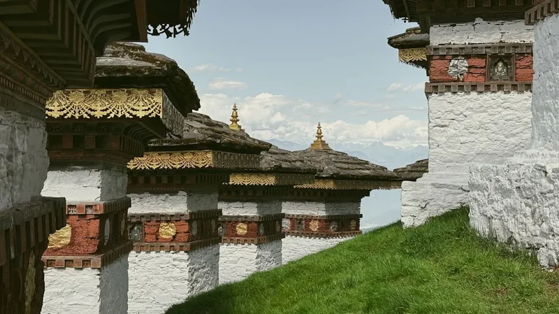
Jili Dzong: While it is a standard stop on Day 1, taking the time to go inside the monastery is a highlight. The central statue is of Buddha Shakyamuni, and the walls are adorned with ancient murals. The ridge itself offers a 360-degree view that is particularly stunning at sunrise.
Jimilang Tsho (Sand Ox Lake): This lake is steeped in legend. It is said that a giant bull once emerged from the lake and joined the cattle of a local herder. The lake is incredibly clear, and if you have the energy, walking around its perimeter offers different perspectives of the surrounding peaks. It is a place of immense quietude.
Phajoding Monastery: This is not just one building but a large complex of several temples and meditation houses. It was founded in the 13th century by Phajo Drugom Zhigpo. Many trekkers choose to spend extra time here talking to the monks or visiting the various temples scattered on the hillside above the main campsite. The view of Thimphu lighting up at night from this vantage point is unforgettable.
Janetsho Lake: Located between Jimilang Tsho and Simkotra Tsho, this smaller lake is often overlooked but offers a perfect spot for a quiet lunch. The reflections of the rugged mountains in the still water are a photographer's dream.
Leave No Trace
Bhutan is the world’s only carbon-negative country, and environmental conservation is one of the four pillars of Gross National Happiness. As a guest in this pristine landscape, you have a responsibility to maintain its integrity. The Druk Path Trek passes through sensitive alpine ecosystems that take years to recover from human impact.
Your responsibility as a walker:
- Carry out all non-biodegradable waste. While your trekking crew will manage the camp waste, ensure that no micro-trash (like candy wrappers or cigarette butts) is left along the trail.
- Stick to the established trail. Creating "social trails" or shortcuts damages the fragile alpine tundra and accelerates erosion.
- Respect the sanctity of the lakes. Do not swim in the alpine lakes or wash your clothes in them, as they are considered sacred (tsho) by the Bhutanese people.
- Do not collect plants or stones. The high-altitude flora, including rare medicinal herbs and blue poppies, should be left for others to enjoy.
- Use the provided toilet tents at camp. If you must go while on the trail, move at least 50 metres from water sources and bury your waste deeply.
- Respect the wildlife. Do not feed or harass the yaks, marmots, or birds you encounter.
- Be mindful of cultural etiquette. Always walk to the left of chortens (stupas) and prayer walls, and ask for permission before taking photos of people or inside monasteries.