Dientes de Navarino Circuit - The Southernmost Trek
The Dientes de Navarino Circuit, often referred to as the "Dientes," is a challenging multi-day trek located on Navarino Island in the Tierra del Fuego archipelago, Chile. This remote and rugged circuit is renowned for its wild, untamed beauty, offering a true wilderness experience for experienced hikers. It traverses a landscape of windswept peaks, pristine lakes, peat bogs, and dense subantarctic forests, all under the dramatic skies of the southernmost inhabited island in the world. Unlike more manicured trails, the Dientes demands self-sufficiency, strong navigation skills, and a high level of fitness due to its unpredictable weather, rough terrain, and lack of formal facilities.
- Distance: 53.4 km
- Elevation Gain: 2,500 m
- Duration: 4-6 days
- Difficulty: Very Challenging
- Best Time: November to March (summer in the Southern Hemisphere)
- Closest City: Puerto Williams
- Trailhead Access: Fly to Puerto Williams (WPU). Trailhead is accessible from town. Walk, taxi, or arrange transport. No official parking. Register with Carabineros before departure. No permits needed but notify park rangers.
- Coordinates: -55.0667, -67.6667
Overview
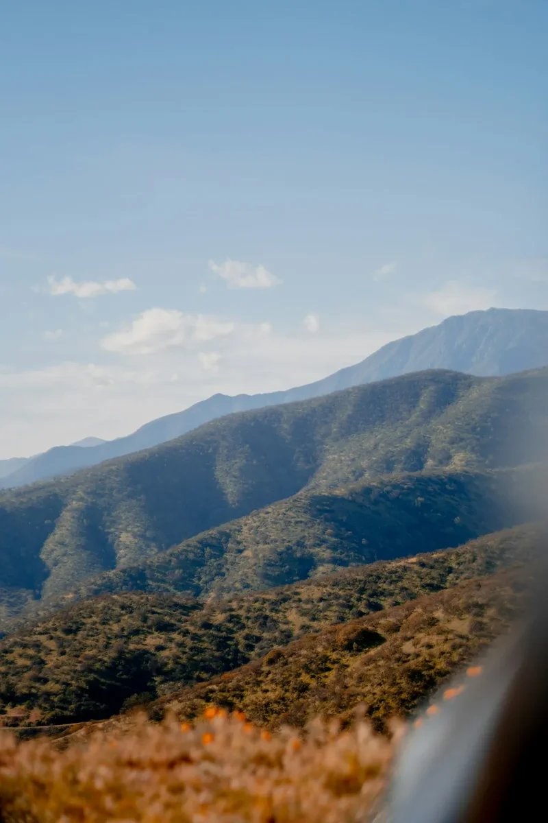
The Dientes de Navarino Circuit is a testament to the raw, elemental power of subantarctic landscapes. It is not a walk for the faint-hearted or the underprepared. The trail winds through a dramatic alpine environment, characterised by jagged peaks (the "Dientes" meaning "teeth" in Spanish), glacial lakes, and vast expanses of peat bogs. The weather is notoriously fickle, capable of shifting from brilliant sunshine to driving rain, snow, and gale-force winds within hours, regardless of the season. This unpredictability is a defining feature of the Dientes experience.
The circuit begins and ends near Puerto Williams, the southernmost town in the world, offering a unique cultural context to the wilderness adventure. Hikers will encounter a variety of terrain, from well-trodden paths in the initial sections to barely discernible routes across open moorland and boulder fields. Navigation is paramount, often relying on cairns, natural landmarks, and a compass or GPS device. The sense of isolation is profound; you are unlikely to encounter many other hikers, making self-reliance and preparedness absolutely critical.
The Dientes offers a stark contrast to more popular trekking destinations. It is a place where nature reigns supreme, demanding respect and rewarding those who embrace its challenges with unparalleled views, a deep connection to the wild, and the satisfaction of completing one of South America's most demanding and rewarding treks. The landscape is a mosaic of vibrant green mosses, stark grey rock, deep blue lakes, and the ever-present, often dramatic, sky.
History and Cultural Context
Navarino Island has been inhabited for millennia by the Yaghan (or Yámana) people, indigenous seafaring nomads who expertly navigated the treacherous waters and rugged terrain of Tierra del Fuego. Their deep connection to this land, its resources, and its challenging climate is an integral part of the island's history. While the Dientes circuit itself is not a traditional Yaghan route in the same way as coastal passages, the spirit of resilience and adaptation required to thrive in this environment is a legacy of their presence.
The modern exploration and charting of the Dientes region are more recent, largely driven by adventurers and surveyors in the 20th century. The establishment of Puerto Williams as a naval base and later a civilian settlement in the mid-20th century brought increased human presence to the island. However, the Dientes remained largely a wild and untamed area, accessible only to those with the skills and determination to navigate its challenging terrain.
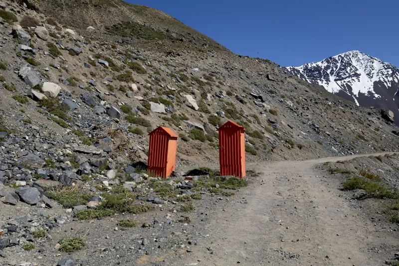
The development of the Dientes de Navarino Circuit as a recognised trek is a relatively recent phenomenon. It has gained a reputation among experienced trekkers seeking a true wilderness experience, far from the crowds of more famous trails. The lack of formal infrastructure—no huts, no marked paths for much of the route, and no regular patrols—contributes to its allure for those seeking solitude and a genuine test of their capabilities. The area is part of the Alberto de Agostini National Park, a protected area that safeguards its unique subantarctic ecosystems and dramatic landscapes.
Seasonal Highlights and Weather Reality
The Dientes de Navarino Circuit is best attempted during the Southern Hemisphere's summer months, from November to March. This period offers the highest probability of more stable weather, longer daylight hours, and slightly milder temperatures, though "mild" is a relative term in this region.
Summer (November to March): This is the primary trekking season. Daylight hours are long, extending well into the evening, which is beneficial for hiking. Temperatures can range from 5°C to 15°C, but can drop significantly with wind chill or at higher elevations. Snow is possible even in summer, especially on higher passes. Rain is frequent, and strong winds are a constant factor. The landscape is at its most vibrant, with hardy alpine flora in bloom.
Shoulder Seasons (October and April): These months can offer a mix of conditions. Days are shorter than mid-summer, and the weather is generally less predictable. Snowfall is more likely, and the risk of encountering icy conditions on passes increases. However, these months can also offer periods of stunning clear weather and fewer visitors.
Winter (May to September): The Dientes Circuit is generally not recommended for trekking during winter. The region experiences harsh winter conditions, including heavy snowfall, extreme cold, and prolonged periods of darkness. The passes can become impassable due to snow and ice, and avalanche risk is significant. Only highly experienced mountaineers with appropriate winter gear and expertise should consider attempting the circuit during this time.
Weather is the dominant factor on the Dientes. Hikers must be prepared for all conditions at any time of year, but especially during the recommended summer months. Hypothermia is a real risk, even on seemingly mild days, due to the combination of wind, rain, and low temperatures.
Recommended Itinerary
4-6 Day Dientes de Navarino Circuit Itinerary
Day 1: Puerto Williams to Laguna Esmeralda (or nearby campsite)
- Distance: Approximately 10-12 km
- Elevation gain: Variable, around 300-400 m
- Time: 4-6 hours
- Start from Puerto Williams, heading towards the trailhead near the Carabineros station.
- The initial section follows a relatively clear path through subantarctic forest and open moorland.
- The goal is to reach Laguna Esmeralda, a beautiful glacial lake, which offers a good first campsite.
- Terrain can be boggy in places.
- This day allows for acclimatisation and getting used to carrying a full pack.
Day 2: Laguna Esmeralda to Laguna de los Ventisqueros
- Distance: Approximately 10-12 km
- Elevation gain: Significant, around 600-800 m
- Time: 6-8 hours
- This is a challenging day, involving crossing the first major pass, Paso de la Paciencia (Patience Pass).
- The trail becomes less defined, requiring good navigation skills.
- Expect to traverse open moorland, rocky sections, and potentially snowfields depending on the season.
- Laguna de los Ventisqueros (Lagoon of the Glaciers) is a scenic camping spot.
- The views from the pass are spectacular but can be obscured by cloud.
Day 3: Laguna de los Ventisqueros to Laguna Guanaca
- Distance: Approximately 8-10 km
- Elevation gain: Significant, around 500-700 m
- Time: 5-7 hours
- Another demanding day, likely involving crossing another pass, such as Paso de las Dientes.
- The terrain is rugged, with steep ascents and descents, boulder fields, and peat bogs.
- Navigation is crucial as the route can be difficult to follow.
- Laguna Guanaca is a common camping location, offering a picturesque setting.
- This day truly tests your endurance and navigation abilities.
Day 4: Laguna Guanaca to Cerro Bandera area (or towards Puerto Williams)
- Distance: Approximately 10-12 km
- Elevation gain: Variable, with descents and ascents
- Time: 5-7 hours
- This day involves descending from the higher alpine areas and beginning the return towards Puerto Williams.
- You may traverse through more forested sections and open valleys.
- The exact camping spot will depend on your pace and energy levels, with areas near Cerro Bandera being a possibility.
- The terrain can still be boggy and challenging.
Day 5 (Optional/Contingency): Continue towards Puerto Williams
- Distance: Variable
- Elevation gain: Variable
- Time: Variable
- If you had a slower start or encountered bad weather, this day allows for a more relaxed pace or to cover the remaining distance back to Puerto Williams.
- The final sections may involve following river valleys or more established tracks as you approach civilisation.
Day 6 (Optional/Contingency): Final approach to Puerto Williams
- Distance: Variable
- Elevation gain: Variable
- Time: Variable
- This day is primarily for completing the circuit and returning to Puerto Williams, allowing for a buffer for unexpected delays or to enjoy the final leg of the journey.
Important Notes:
- This is a wilderness trek with no formal huts or marked trails for much of the route.
- Camping is wild camping; choose durable surfaces away from water sources.
- Navigation skills (map, compass, GPS) are essential.
- Be prepared for extreme weather changes at any time.
- Carry all necessary food, water treatment, and safety equipment.
- Inform the local Carabineros or park rangers of your intended route and expected return date.
Planning and Bookings
Book Your Trip
Everything you need to plan your journey
Accommodation
Find places to stay near Puerto Williams
Flights
Search flights to Puerto Williams
Essential Preparation
The Dientes de Navarino Circuit is a serious undertaking that requires meticulous planning and preparation. Unlike many popular treks, there are no booking systems for campsites or huts, as it is a wild camping experience. The primary focus of planning revolves around logistics, gear, and ensuring you have the necessary skills and physical fitness.
Logistics: Puerto Williams is the gateway to the Dientes. Access is typically via a flight from Punta Arenas. Upon arrival in Puerto Williams, you will need to arrange your transport to the trailhead, which is a short distance from town. This can be done by walking, taking a taxi, or arranging a ride with locals. It is crucial to register your intentions with the local Carabineros (police) before you depart and inform them of your expected return date. This is a vital safety measure. Consider spending a day or two in Puerto Williams before and after your trek to acclimatise, purchase any last-minute supplies, and gather local information.
Fitness: The circuit involves significant elevation gain and loss, often over rough and boggy terrain. A high level of cardiovascular fitness and leg strength is essential. You should be comfortable hiking for 6-8 hours a day with a heavy pack, over challenging ground, in potentially adverse weather conditions.
Skills: Strong navigation skills are non-negotiable. You must be proficient in using a map, compass, and GPS device, and be able to navigate in low visibility. Experience with wild camping, including selecting appropriate sites and managing waste, is also crucial.
Trail Accommodation
This is a wild camping trek. There are no designated huts, lodges, or official campsites along the Dientes de Navarino Circuit. Hikers are expected to practice responsible wild camping, selecting durable surfaces away from water sources and leaving no trace.
Camping: Hikers will need to carry their own tents and camping equipment. Suitable camping spots are typically found near lakes or in sheltered areas, but require careful selection to minimise environmental impact. Popular camping locations include areas around Laguna Esmeralda, Laguna de los Ventisqueros, and Laguna Guanaca, but these are not formal campsites and may not have any facilities.
What's Provided: Nothing. You must be entirely self-sufficient.
What's NOT Provided: All camping equipment, food, water, shelter, and any form of assistance.
Seasonal Availability: Wild camping is possible throughout the trekking season (November to March). Outside of this, conditions become significantly more challenging and dangerous.
Costs: There are no fees associated with camping on the Dientes Circuit, as it is a wild camping experience within a national park. However, you will incur costs for flights to Puerto Williams, local transport, and your own gear and supplies.
Required Gear
- Waterproof and windproof outer shell: A high-quality jacket and trousers are essential. The weather is unpredictable and can change rapidly.
- Sturdy, waterproof hiking boots: With good ankle support, well broken-in to prevent blisters.
- Warm layers: Including thermal base layers (merino wool is ideal), fleece or down mid-layers, and a warm hat and gloves. Hypothermia is a significant risk.
- Durable hiking trousers: Quick-drying and comfortable.
- Backpack: A robust pack of 60-75 litres, with a comfortable harness and a waterproof cover.
- Tent: A sturdy, 4-season tent capable of withstanding strong winds and heavy rain.
- Sleeping bag: Rated for sub-zero temperatures (e.g., -5°C to -10°C comfort rating) as nights can be very cold.
- Sleeping mat: For insulation and comfort.
- Navigation tools: Map of the area, compass, and a reliable GPS device with spare batteries. Ensure you know how to use them proficiently.
- First-aid kit: Comprehensive, including blister treatment, pain relievers, antiseptic wipes, bandages, and any personal medications.
- Head torch: With spare batteries.
- Sun protection: High SPF sunscreen, sunglasses, and a wide-brimmed hat, as the sun can be intense even on cloudy days.
- Insect repellent: Especially for sandflies, which can be present.
What to Bring
- Food: Lightweight, high-energy, non-perishable food for the entire duration of your trek, plus an extra day's supply for emergencies. Plan your meals carefully.
- Water treatment: A reliable water filter or purification tablets. While water sources are plentiful, treating all water is recommended.
- Cooking equipment: Lightweight stove, fuel, pot, mug, bowl, and utensils.
- Toiletries: Biodegradable soap, toothbrush, toothpaste, toilet paper, hand sanitiser, and a trowel for burying human waste (following Leave No Trace principles).
- Repair kit: Duct tape, cordage, needle and thread, safety pins, and gear repair patches.
- Emergency communication device: A satellite messenger or personal locator beacon (PLB) is highly recommended due to the lack of mobile signal.
- Trekking poles: Highly recommended for stability on uneven terrain and for reducing strain on knees during descents.
- Dry bags: To keep essential gear dry inside your backpack.
- Camera and spare batteries/power bank: To capture the stunning scenery.
- Book or journal: For downtime at camp.
Permits
No specific permits are required to hike the Dientes de Navarino Circuit. The area is part of the Alberto de Agostini National Park, and while park entry is free, hikers are strongly advised to register their intentions with the local Carabineros in Puerto Williams before commencing their trek. This is a crucial safety measure, as it allows authorities to know who is in the park and to initiate search and rescue operations if you fail to return as planned.
Registration with Carabineros:
- Visit the Carabineros station in Puerto Williams before your departure.
- Provide them with your full name, contact details, intended route (Dientes de Navarino Circuit), estimated start and end dates, and the names of anyone in your group.
- It is also advisable to check in with them upon your safe return.
Park Regulations: While no permits are needed, hikers are expected to adhere to national park regulations, which generally include:
- Practicing Leave No Trace principles.
- Not making open fires (use a stove).
- Respecting wildlife.
- Staying on established routes where they exist, and minimising impact when navigating off-trail.
No formal booking system exists for campsites or huts, as there are none. Hikers are responsible for carrying all their own camping gear and finding suitable wild camping locations.
Other Activities in the Area
Navarino Island and the surrounding region offer a wealth of activities for those who venture to this remote corner of the world:
- Exploring Puerto Williams: Visit the Martin Gusinde Anthropological Museum to learn about the Yaghan culture and the history of Tierra del Fuego. Enjoy the unique atmosphere of the world's southernmost town.
- Navarino Island Coastal Walk: A less demanding but scenic walk along the Beagle Channel, offering views of the surrounding mountains and opportunities to observe marine life.
- Fishing: The waters around Navarino Island are known for their excellent fishing, particularly for king salmon and sea trout.
- Birdwatching: The diverse habitats of Navarino Island support a variety of bird species, including various seabirds, waterfowl, and terrestrial birds.
- Yaghan Cultural Experiences: Engage with local guides to learn about the traditional Yaghan way of life, their connection to the land and sea, and their ancestral knowledge.
- Boat trips on the Beagle Channel: Explore the channel, visit nearby islands, and potentially spot sea lions, dolphins, and various seabirds.
- Day hikes from Puerto Williams: Shorter hikes can be undertaken in the vicinity of Puerto Williams, offering a taste of the subantarctic landscape without the commitment of the full Dientes circuit.
Safety and Conditions
Weather: The most significant safety concern on the Dientes de Navarino Circuit is the extreme and unpredictable weather. Hikers must be prepared for gale-force winds, heavy rain, snow, and fog at any time of year. Hypothermia is a serious risk. Always check the latest weather forecast before departing Puerto Williams and be prepared to postpone or alter your plans if conditions are unfavourable.
Navigation: The trail is poorly marked and often non-existent, especially in the higher alpine sections. Strong navigation skills using a map, compass, and GPS are essential. Getting lost in this remote terrain can have severe consequences. It is highly recommended to carry a Personal Locator Beacon (PLB) or satellite messenger for emergency communication.
Terrain: The circuit involves crossing challenging terrain, including steep ascents and descents, boulder fields, scree slopes, and extensive boggy areas. Trekking poles are highly recommended to aid stability and reduce strain on joints. Be aware of slippery surfaces, especially when wet.
Water: While water sources are generally abundant, it is crucial to treat all water to prevent waterborne illnesses. Carry a reliable water filter or purification tablets.
Remoteness and Self-Sufficiency: You will be far from any help. You must be entirely self-sufficient, carrying all your food, shelter, and safety equipment. Do not rely on encountering other hikers for assistance.
Wildlife: While there are no large dangerous animals on Navarino Island, be aware of potential encounters with foxes or birds. Sandflies can be a nuisance, so carry appropriate repellent.
Emergency Procedures:
- Inform the Carabineros in Puerto Williams of your detailed itinerary and expected return date.
- Carry a PLB or satellite messenger for emergencies.
- Know how to use your navigation equipment in adverse conditions.
- Be prepared to turn back or wait out bad weather if conditions become too dangerous.
- Have a contingency plan for delays.
Travel insurance that covers remote trekking and potential emergency evacuation is strongly recommended.
Side Trips and Points of Interest
Laguna Esmeralda: A stunning glacial lake that serves as a popular first camping spot. Its vibrant emerald colour, surrounded by rugged peaks, makes for a picturesque introduction to the Dientes landscape.
Paso de la Paciencia (Patience Pass): One of the key passes on the circuit, offering panoramic views of the surrounding mountain ranges and valleys. The name itself is a reminder of the need for perseverance in this environment.
Laguna de los Ventisqueros: Named for the glaciers that feed it, this lagoon is another beautiful alpine feature and a common camping location. The views of the surrounding peaks and potential glacial remnants are impressive.
Paso de las Dientes: This pass is central to the circuit, giving the range its name. It offers dramatic vistas and is often a challenging section of the trek, requiring careful navigation and footing.
Laguna Guanaca: A picturesque lake that provides a scenic backdrop for camping. The area around Laguna Guanaca is often a good place to appreciate the stark beauty of the subantarctic alpine environment.
Cerro Bandera: A prominent peak in the Dientes range, offering potential for more challenging day hikes or simply serving as a landmark during the trek. Views from higher points can be expansive, weather permitting.
Subantarctic Forests: The lower sections of the trek wind through unique forests dominated by species like lenga and ñire trees, often draped in mosses and lichens, creating an ancient and atmospheric environment.
Leave No Trace
The Dientes de Navarino Circuit traverses a pristine and fragile subantarctic wilderness. Adhering to Leave No Trace principles is not just recommended; it is essential for preserving this unique environment for future generations and for the safety of fellow trekkers.
Plan Ahead and Prepare: Research thoroughly, know the conditions, and be prepared for all weather. Carry appropriate gear and sufficient food. Inform the Carabineros of your plans.
Travel and Camp on Durable Surfaces: Stick to existing paths where they are present. When camping, choose established sites or durable surfaces like rock, gravel, dry grass, or snow. Avoid camping on fragile vegetation or near water sources.
Dispose of Waste Properly: Pack it in, pack it out. This includes all food scraps, wrappers, and any other refuse. Human waste should be buried at least 15-20 cm deep and 60 m (70 metres) from water, camp, and trails. Pack out all toilet paper.
Leave What You Find: Do not remove or disturb natural objects, plants, or cultural artifacts. Let others enjoy the natural and cultural heritage of the Dientes.
Minimize Campfire Impacts: Campfires are generally prohibited in national parks and are not recommended in this environment due to the risk of wildfires and the slow regeneration of vegetation. Use a lightweight stove for cooking.
Respect Wildlife: Observe wildlife from a distance. Never feed animals, as it can harm their health, alter their natural behaviours, and expose them to human-related diseases. Store food securely to prevent attracting animals.
Be Considerate of Other Visitors: While solitude is a hallmark of the Dientes, you may encounter other trekkers. Keep noise levels down, yield to others on narrow sections, and maintain a respectful distance.
The Dientes de Navarino is a place of profound natural beauty and solitude. By practising Leave No Trace, you help ensure its wild character endures.