Crozon Peninsula Circuit - The Rugged Heart of Brittany
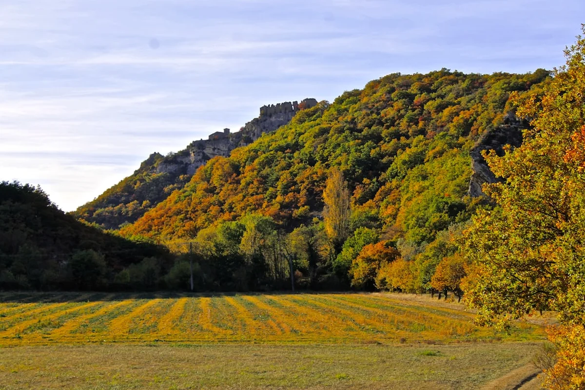
The Crozon Peninsula Circuit is a breathtaking 120-kilometre journey through the wildest landscapes of Finistère, France. Located at the westernmost tip of continental Europe, this trail forms a significant and spectacular section of the GR34, also known as the Sentier des Douaniers (Customs Officers' Path). The route traces the jagged, cross-shaped peninsula, offering a dramatic sequence of towering cliffs, hidden turquoise coves, expansive heathlands, and historic maritime fortifications. Unlike the flatter coastal paths of northern France, the Crozon Peninsula is defined by its constant undulation, with the trail rising and falling over ancient sandstone and quartz ridges that have resisted the Atlantic's fury for millions of years. This is a journey to the "End of the Earth"—the literal translation of Finistère—where the air is thick with salt spray and the horizon is dominated by the ever-changing moods of the Iroise Sea.
- Distance: 120.0 km loop
- Duration: 5–7 days
- Season: May to September (best weather and long daylight hours)
- Accommodation: Gîtes d'étape, campsites, and local hotels in coastal villages
- Highest point: Approximately 100 m (cliff tops), with a total elevation gain of 2,500 m
- Difficulty: Moderate (requires good stamina for constant elevation changes)
- Direction: Typically walked anti-clockwise from Camaret-sur-Mer, though reversible
Overview
The Crozon Peninsula Circuit is widely regarded as one of the most visually stunning coastal hikes in Europe. Situated within the Parc Naturel Régional d'Armorique and the Iroise Marine Nature Park, the trail offers a masterclass in geological diversity and maritime beauty. The peninsula's unique "cross" shape creates three distinct coastal environments: the sheltered, wooded shores of the Rade de Brest to the north; the wild, windswept Atlantic cliffs of the west; and the Mediterranean-like turquoise waters of the Baie de Douarnenez to the south. This variety ensures that no two days on the trail feel the same, as the landscape shifts from dense pine forests and calm estuaries to jagged granite needles and vast, heather-covered moors.
The physical challenge of the Crozon Peninsula Circuit lies not in high-altitude climbing, but in the relentless "sawtooth" profile of the coastal path. While the maximum elevation rarely exceeds 100 metres above sea level, the trail frequently descends to sea level to cross a beach or cove before climbing steeply back to the cliff tops. Over the course of 120 kilometres, these short, sharp climbs accumulate to a total elevation gain of 2,500 metres, testing the endurance of even seasoned walkers. The terrain is often rocky and uneven, requiring sturdy footwear and a steady foot, particularly on the exposed western sections where the Atlantic winds can be formidable.
Beyond the natural scenery, the trail is a living museum of European history. Walkers will encounter Neolithic menhirs, 17th-century Vauban fortifications, and the haunting remains of the Atlantic Wall from the Second World War. The peninsula has served as a strategic defensive bastion for centuries, protecting the vital naval port of Brest. Today, the circuit provides a sense of profound isolation and connection to nature, yet it remains accessible, passing through charming Breton villages like Camaret-sur-Mer and Morgat, where the local culture, language, and cuisine—including the famous galettes and cider—offer a warm welcome at the end of a long day's trek.
History and Cultural Context
The history of the Crozon Peninsula is inextricably linked to its geography. Its position jutting into the Atlantic has made it both a sacred site for ancient civilisations and a vital military outpost for modern nations. The earliest evidence of human habitation is found at the Lagatjar Alignments near Camaret-sur-Mer, where dozens of Neolithic standing stones (menhirs) remain, though many were toppled over the millennia. These stones suggest that the peninsula held significant spiritual importance for the prehistoric peoples of Brittany, likely serving as astronomical markers or ceremonial sites.
In the 17th century, the peninsula became a cornerstone of French maritime defence. Under the direction of Sébastien Le Prestre de Vauban, the military engineer for King Louis XIV, the "Tour Dorée" (Golden Tower) was constructed in Camaret-sur-Mer. This fortification played a crucial role in the 1694 Battle of Camaret, where French forces successfully repelled a massive Anglo-Dutch invasion attempt. The tower is now a UNESCO World Heritage site and stands as a symbol of the peninsula's strategic importance. Throughout the 18th and 19th centuries, further forts and batteries were built along the coastline to guard the entrance to the Goulet de Brest, the narrow strait leading to the naval base.
The 20th century brought darker chapters to the peninsula. During the Second World War, the German occupying forces integrated Crozon into the Atlantic Wall, building massive concrete bunkers and submarine pens. The peninsula saw heavy fighting during the Liberation of France in 1944, as Allied forces sought to capture the port of Brest. Today, many of these bunkers remain, slowly being reclaimed by the gorse and heather, serving as silent monuments to the conflict. Culturally, the peninsula remains a stronghold of Breton identity. You will see bilingual signs in French and Breton (Brezhoneg), and the local festivals, or "Pardons," continue to celebrate the region's deep-seated Celtic and maritime traditions.
Want more background? Read extended notes on history and cultural context → Learn more
Seasonal Highlights and Weather Reality
The Crozon Peninsula is subject to a maritime climate, meaning weather can be highly unpredictable and can change several times within a single day. The "best" time to visit is generally from May to September, but each season offers a distinct experience for the walker.
Spring (May to June): This is arguably the most beautiful time to hike. The clifftops are carpeted in a vibrant tapestry of yellow gorse and purple heather, and the air is filled with the scent of wildflowers. Temperatures are mild, typically ranging from 12°C to 18°C, making for comfortable walking conditions. However, spring can also bring "Crachin"—a fine, persistent Breton drizzle—so waterproofs are essential.
Summer (July to August): This is the peak tourist season. The weather is at its most stable, with temperatures often reaching 20°C to 25°C. The sea is at its warmest, inviting hikers to take a dip in the hidden coves. The downside is that the trail and villages are much busier, and accommodation must be booked months in advance. The Atlantic breeze usually prevents the heat from becoming oppressive, but sun protection is vital as there is very little shade on the cliff paths.
Autumn (September to October): September is a fantastic month for hiking, as the summer crowds disperse but the sea remains warm and the weather often stays settled. The light in autumn is particularly beautiful for photography, with golden hues reflecting off the quartz cliffs. By October, the risk of Atlantic storms increases, and many seasonal gîtes and campsites begin to close.
Winter (November to April): Hiking the circuit in winter is only for the experienced and well-equipped. The peninsula is lashed by powerful Atlantic gales and heavy rain. While the sight of massive waves crashing against the Pointe de Pen-Hir is spectacular, the trail can become slippery and dangerous. Many services are closed, and the short daylight hours limit the distance you can safely cover.
Recommended Itinerary

6-Day Crozon Peninsula Circuit Itinerary
Day 1: Camaret-sur-Mer to Roscanvel
- Distance: 20 km
- Elevation gain: 350 m
- Time: 5–6 hours
- Start at the Port of Camaret, passing the Vauban Tower and the boat graveyard
- Follow the northern coast of the Roscanvel peninsula
- Pass numerous 18th and 19th-century military fortifications
- Views across the Goulet de Brest to the Minou lighthouse
- Arrive in Roscanvel, a quiet village overlooking the Rade de Brest
- The terrain is relatively gentle compared to the western cliffs, passing through wooded sections
Day 2: Roscanvel to Lanvéoc
- Distance: 18 km
- Elevation gain: 300 m
- Time: 4–5 hours
- Continue along the sheltered eastern side of the peninsula
- Pass the Fort des Capucins, an island fortress connected by a stone bridge
- Walk through the Pointe des Espagnols, offering the best views of the city of Brest
- The trail follows the coastline of the Rade de Brest, with calmer waters and more vegetation
- Arrive in Lanvéoc, home to a naval air base and a small beach
- A shorter day allowing for exploration of the military ruins
Day 3: Lanvéoc to Telgruc-sur-Mer
- Distance: 22 km
- Elevation gain: 450 m
- Time: 6–7 hours
- The trail moves south towards the Baie de Douarnenez
- Pass through the marshes of Le Fret and along the pebble beaches of the eastern shore
- Climb towards the heights of Caon and the cliffs of Telgruc
- Spectacular views of the Menez Hom mountain in the distance
- Arrive in Telgruc-sur-Mer, situated slightly inland from the dramatic Plage de Trez Bellec
- This day marks the transition from the sheltered bay to the more rugged southern coast
Day 4: Telgruc-sur-Mer to Morgat
- Distance: 20 km
- Elevation gain: 500 m
- Time: 6–7 hours
- One of the most scenic days, following the high cliffs of the southern coast
- Pass the Pointe de l'Aber and the vast sands of the Plage de l'Aber
- The trail becomes more rugged with frequent climbs and descents
- Pass the sea caves of Morgat (accessible by boat or at very low tide)
- Arrive in Morgat, a popular seaside resort with excellent restaurants and a large marina
- Morgat is the perfect place for a mid-hike rest or a celebratory seafood dinner
Day 5: Morgat to La Palue (via Cap de la Chèvre)
- Distance: 22 km
- Elevation gain: 600 m
- Time: 7–8 hours
- The most demanding and spectacular section of the circuit
- Walk the entire perimeter of the Cap de la Chèvre, the southern "arm" of the cross
- Sheer cliffs drop 100 metres into turquoise water that looks almost tropical
- Pass the memorial to the French Naval Aviation at the tip of the Cape
- The trail is narrow, rocky, and exposed to the Atlantic winds
- Arrive at the Plage de la Palue, a world-famous surfing beach (swimming is forbidden due to currents)
- Stay in a local gîte in the hamlet of Saint-Hernot or nearby
Day 6: La Palue to Camaret-sur-Mer
- Distance: 18 km
- Elevation gain: 300 m
- Time: 5–6 hours
- Follow the wild western coast back towards the start
- Pass the Pointe de Dinan with its "natural fortress" rock formation and stone arch
- Walk along the massive cliffs of the Pointe de Pen-Hir and the "Tas de Pois" sea stacks
- Pass the Lagatjar Megalithic alignments as you approach Camaret
- Finish the loop back at the Port of Camaret
- A triumphant conclusion with some of the most iconic views in Brittany
Important Notes:
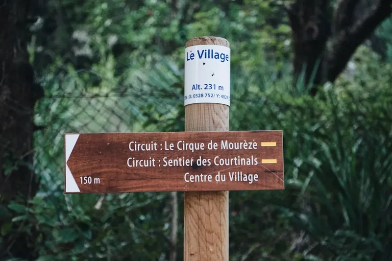
- The trail is marked with the red and white blazes of the GR34
- Water sources are scarce on the cliff tops; carry at least 2 litres per day
- Tides can affect access to certain beaches (e.g., Plage de l'Aber); check tide tables
- The western cliffs are highly exposed; avoid the edge during high winds
- Mobile signal is generally good but can drop out in deep coves
Planning and Bookings
Book Your Trip
Everything you need to plan your journey
Accommodation
Find places to stay near Brest
Flights
Search flights to Brest
Essential Preparation
The Crozon Peninsula Circuit requires a moderate level of physical fitness. While the elevations are not extreme, the constant "up and down" nature of the coastal path can be taxing on the knees and calves. It is recommended to undertake several day hikes with a weighted pack before attempting the full circuit. Logistics are relatively straightforward: the closest major city is Brest, which has an airport (BES) and a TGV train station with direct links to Paris. From Brest, you can reach the peninsula via the "Penn-ar-Bed" bus service (Line 34) or by taking the seasonal maritime shuttle (Le Brestoa) from the Port of Brest to Le Fret or Camaret-sur-Mer.
Camaret-sur-Mer serves as the primary base for the circuit. It offers supermarkets, pharmacies, outdoor gear shops, and a wide range of accommodation. It is advisable to spend a night here before starting to finalise your supplies. If you are travelling by car, there are several long-stay parking options in Camaret, though it is always wise to inform your first accommodation provider if you intend to leave a vehicle for a week.
Trail Accommodation
Accommodation on the Crozon Peninsula is varied, ranging from traditional hotels to hiker-friendly gîtes d'étape and numerous campsites. Because the peninsula is a popular holiday destination, booking in advance is essential during the summer months (July and August).
Gîtes d'étape: These are specifically designed for hikers and cyclists. They offer dormitory-style beds, shared kitchen facilities, and often the option for a communal dinner (table d'hôte). Notable gîtes include those in Saint-Hernot and Roscanvel. Expect to pay between €20 and €35 per night for a bed.
Campsites: There are many municipal and private campsites along the route, particularly near Morgat, Camaret, and Telgruc. Most offer excellent facilities, including hot showers, laundry, and small shops. Wild camping (bivouacking) is technically restricted within the Parc Naturel Régional d'Armorique, especially on the fragile cliff tops. It is always better to use designated campsites to protect the environment.
Hotels and B&Bs: For those seeking more comfort, Morgat and Camaret have several charming hotels and "Chambres d'Hôtes." These provide a higher level of service but at a significantly higher cost, especially in the high season.
What's NOT provided: Most gîtes provide blankets, but you are usually expected to bring your own sleeping bag liner or "sac à viande." Towels and toiletries are rarely provided in budget accommodation. In campsites, you must be entirely self-sufficient with your own tent and cooking gear.
Required Gear
- Hiking Boots: Sturdy, waterproof boots with good ankle support are essential. The trail is often rocky, and the quartz can be slippery when wet.
- Rain Gear: A high-quality waterproof jacket (Gore-Tex or similar) is non-negotiable in Brittany. Waterproof overtrousers are also highly recommended.
- Backpack: A 40–50L pack is usually sufficient for a 6-day trek if staying in gîtes. If camping, you will likely need 60L+. Ensure it has a waterproof cover.
- Navigation: While the GR34 is well-marked, carry the IGN Map 0418ET (Presqu'île de Crozon). An offline GPS app like Komoot or AllTrails is a useful backup.
- Sun Protection: Even on cloudy days, the Atlantic sun is strong. Bring SPF 50+ sunscreen, a wide-brimmed hat, and high-quality sunglasses.
- First Aid: Include plenty of blister plasters (Compeed), antiseptic wipes, and any personal medications. A tick removal tool is also recommended.
What to Bring
- Water Treatment: While tap water in villages is safe, you may need to refill from springs or taps in cemeteries. A filter bottle (like LifeStraw) provides peace of mind.
- Food and Snacks: Carry enough food for each day's lunch. High-energy snacks like nuts, dried fruit, and Breton "Palets" (butter biscuits) are ideal. You can restock in Camaret, Morgat, and Telgruc.
- Cooking Equipment: If camping, a lightweight gas stove (Jetboil or similar) and a small pot. Gas canisters (Campingaz is most common in France) can be bought in Camaret.
- Clothing Layers: Use a layering system. Merino wool base layers are excellent for moisture management. Bring a warm fleece or lightweight down jacket for cool evenings.
- Power Bank: To keep your phone and camera charged, as power outlets in gîtes can be limited.
- Cash: While most shops and restaurants take cards, some smaller gîtes or rural cafés may only accept cash.
Permits
One of the great advantages of the Crozon Peninsula Circuit is that no permits are required to hike the trail. The GR34 is a public right of way, and access to the coastal path is free for everyone. However, because the trail passes through the Parc Naturel Régional d'Armorique and several sensitive "Espaces Naturels Sensibles," there are strict regulations regarding your conduct on the land.
Key Regulations:
- No Wild Camping: To protect the fragile coastal vegetation and prevent erosion, wild camping is generally prohibited on the peninsula, particularly on the cliff tops and beaches. You are expected to stay in official campsites or gîtes.
- Fire Restrictions: Lighting fires is strictly forbidden due to the high risk of brush fires in the dry gorse and heather.
- Dog Access: Dogs are allowed on the GR34 but must be kept on a lead at all times to avoid disturbing nesting seabirds and local livestock. Some beaches have seasonal restrictions on dogs.
- Group Sizes: Large organised groups (usually 15+ people) may need to notify the local town halls (Mairies) if they plan to use specific facilities, but for individual hikers, no such notification is needed.
Booking Strategy: While you don't need a permit for the trail, you effectively need "permits" for your bed. If you are hiking in July or August, you should book your accommodation at least 3–4 months in advance. For May, June, and September, 2–4 weeks is usually sufficient. If you are camping, you generally don't need to book municipal campsites, but private ones can fill up during school holidays.
Other Activities in the Area
The Crozon Peninsula is an outdoor enthusiast's playground. If you have extra time, consider these activities:
- Surfing at La Palue: Known as one of the best surf spots in Brittany, the waves here are powerful and consistent. Several surf schools in Morgat offer lessons and equipment hire.
- Sea Kayaking: Exploring the sea caves of Morgat from the water is an unforgettable experience. Guided tours depart from Morgat harbour and take you into hidden grottos with vibrant mineral-coloured walls.
- Maison des Minéraux: Located in Saint-Hernot, this museum is dedicated to the unique geology of the peninsula. It's a great place to learn about the rocks you've been walking on all day.
- Cider Tasting: Visit a local "Cidrerie" to taste authentic Breton cider. The Rozavern cidery near Telgruc offers tours and tastings of their organic products.
- Diving: The Iroise Sea is famous for its clear water and numerous shipwrecks. Diving centres in Camaret offer trips for all levels.
- Menez Hom: A short drive from the peninsula, this 330-metre mountain offers 360-degree views of the entire region and is a popular spot for paragliding.
Safety and Conditions
Cliff Safety: The most significant hazard on the Crozon Peninsula Circuit is the height and instability of the cliffs. The trail often runs close to the edge. Erosion is a constant process, and sections of the path can occasionally collapse after heavy rain. Always stay on the marked trail and never bypass fences or "Sentier Interdit" (Path Forbidden) signs. In high winds, the gusts can be strong enough to knock a person off balance; if the wind is severe, it is safer to take inland roads.
Weather Awareness: Atlantic storms can roll in quickly. Check the "Météo France" forecast daily, specifically for the Finistère coast. If a "Vigilance Orange" or "Rouge" for wind or rain is issued, do not attempt the coastal sections. Hypothermia is a risk even in summer if you get wet and are exposed to the wind, so always carry your waterproofs.
Tides: While most of the GR34 stays above the high-water mark, some sections (like the crossing of the Aber estuary) are tidal. Attempting to cross these at high tide can be dangerous. Always check the tide times (available at local tourist offices or online) before setting out for the day.
Flora and Fauna: The peninsula is home to adders (Vipère péliade). While they are shy and rarely bite unless provoked, be careful when stepping through long grass or heather. Ticks are common in the ferns and can carry Lyme disease; check your body every evening and remove any ticks immediately with a proper tool.
Emergency Services: In case of an emergency, dial 112. This is the universal European emergency number. Be prepared to give your location based on the nearest "Pointe" or landmark on your IGN map.
Side Trips and Points of Interest
Pointe de Pen-Hir and the Tas de Pois: This is the most iconic landmark on the peninsula. The "Tas de Pois" (Heaps of Peas) are six massive sea stacks that extend into the Atlantic. The views from the 70-metre cliffs of Pen-Hir are staggering. Nearby, you'll find the Monument to the Bretons of Free France, a massive granite cross commemorating those who joined General de Gaulle in WWII.
Cap de la Chèvre: The southern tip of the peninsula feels like a different world. The vegetation is low-lying and wind-sculpted, and the water in the coves below is a brilliant turquoise. On a clear day, you can see across the bay to the Pointe du Raz and the Île de Sein. The memorial to lost airmen is a poignant place for reflection.
The Sea Caves of Morgat: These geological wonders are carved into the sandstone cliffs. The most famous is the "Grotte de l'Autel" (Altar Cave). While some are accessible on foot at very low tides, they are best seen by kayak or small boat to appreciate the "bleu de Morgat"—the way the light reflects off the water and the cave walls.
Landévennec Abbey: If you extend your hike slightly inland towards the mouth of the Aulne river, you can visit the ruins of the ancient Abbey of Saint-Guénolé. Founded in the 5th century, it is one of the oldest monastic sites in Brittany and features a beautiful medicinal herb garden.
Pointe de Dinan: Often overlooked in favour of Pen-Hir, Dinan offers a more "architectural" landscape. The rock formations here resemble a ruined castle, complete with a natural stone arch known as the "Château de Dinan." It is one of the best spots on the peninsula for sunset photography.
Leave No Trace
The Crozon Peninsula is a protected environment. The thin soil on the cliff tops is easily eroded, and the rare plants that grow here—such as the Armorican fescue and various orchids—are highly sensitive to trampling. With thousands of hikers visiting each year, following Leave No Trace principles is essential to ensure the trail remains beautiful for the future.
Your responsibility as a walker:
- Stick to the Path: Never take shortcuts, especially on the "zig-zags" of the cliff climbs. This causes rapid erosion and destroys the heather.
- Pack It Out: There are no bins on the coastal path. Carry all your rubbish, including organic waste like apple cores and banana skins, back to the villages.
- Respect the Silence: The peninsula is a nesting site for many seabirds, including peregrine falcons and choughs. Avoid loud noises and keep your distance from nesting areas.
- Sanitation: Use the toilets in villages or at campsites. If you must go on the trail, ensure you are at least 50 metres from the path and any water source, and bury your waste deeply. Carry out your toilet paper in a sealed bag.
- No Picking: It is illegal to pick wildflowers or remove stones and fossils from the protected areas. Take only photos, leave only footprints.