Refuge de la Croix du Bonhomme Loop
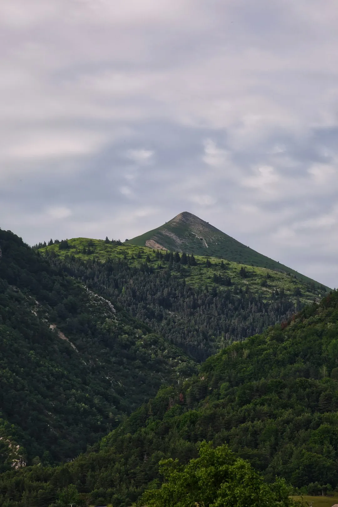
The Refuge de la Croix du Bonhomme Loop is a spectacular day walk nestled within the French Alps, offering a taste of high-altitude trekking without the commitment of an overnight stay. This route circles the imposing massif of the Croix du Bonhomme, a prominent peak in the Beaufortain massif, renowned for its dramatic landscapes, alpine flora, and panoramic views. The trail winds through a variety of terrains, from verdant mountain pastures dotted with wildflowers to rugged, rocky ascents that lead to breathtaking vistas. It’s a journey that encapsulates the raw beauty and challenging spirit of the Alps, making it a rewarding experience for seasoned hikers and those seeking a substantial day-long adventure.
- Distance: 16.0 km
- Elevation Gain: 850 m
- Duration: 6-7 hours
- Difficulty: Moderate
- Best Time: June to September, clear weather
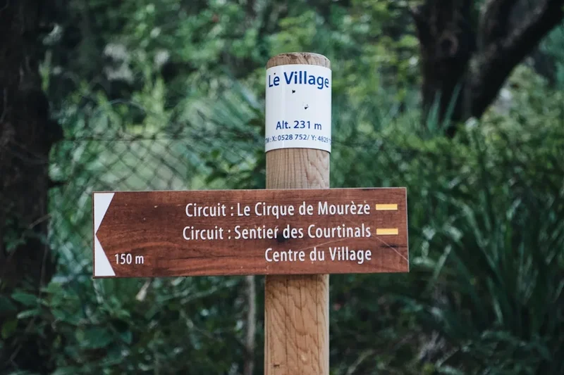
- Closest City: Les Contamines-Montjoie
- Trailhead Access: Nearest airport: Geneva (GVA). Drive to Les Contamines-Montjoie (approx. 1.5 hours). Follow signs to trailhead parking. Limited bus service available. Road conditions are generally good. Parking can be crowded in peak season. GPS: 45.7903, 6.7503 (approx. parking). No permits needed.
Overview
The Refuge de la Croix du Bonhomme Loop is a challenging yet immensely rewarding day hike that showcases the diverse beauty of the Beaufortain Alps. Starting from a convenient trailhead near Les Contamines-Montjoie, the path immediately begins to ascend, gradually gaining altitude through alpine meadows that burst with colour in the summer months. The air is crisp, and the scent of wild herbs fills the senses as you climb higher, with increasingly expansive views opening up behind you, revealing the valley below and the surrounding mountain ranges.
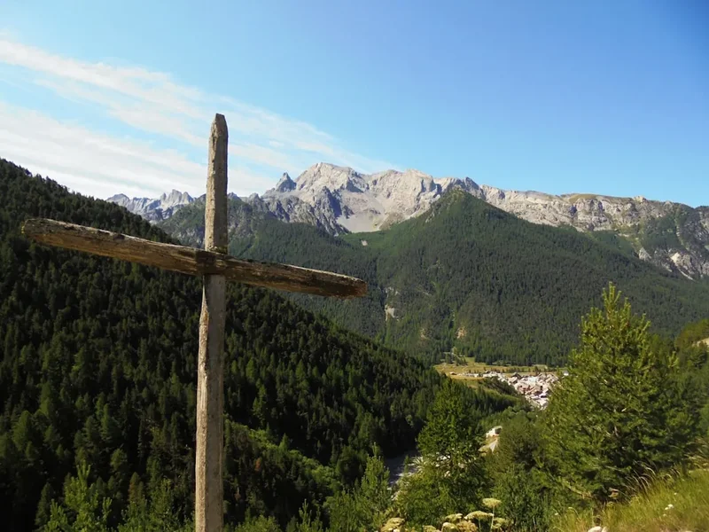
The trail is well-marked, though its steep sections and rocky terrain demand attention and a good level of fitness. As you approach the Refuge de la Croix du Bonhomme, the landscape becomes more alpine and rugged. The refuge itself, perched at a significant altitude, serves as a natural focal point and a welcome spot for a break, offering a chance to refuel and soak in the commanding 360-degree panoramas. From here, the route continues to circumnavigate the massif, often traversing high mountain passes and ridges. The descent offers a different perspective, winding through scree slopes and then back into more sheltered valleys, eventually returning you to your starting point.
This loop is particularly celebrated for its accessibility to such a high-altitude environment for a day trip. It provides a genuine alpine experience, complete with potential encounters with marmots and chamois, and a profound sense of solitude amidst the grandeur of the mountains. The changing light throughout the day can transform the scenery, making early morning or late afternoon particularly magical. The moderate difficulty rating reflects the sustained elevation gain and the nature of the terrain, making it suitable for those with prior hiking experience and a solid level of physical conditioning.
History and Cultural Context
The Beaufortain region, where the Croix du Bonhomme massif is located, has a rich history deeply intertwined with pastoralism and mountain life. For centuries, these high pastures have been used for grazing livestock, particularly cattle, which produce the famous Beaufort cheese, a protected designation of origin (AOC) product. The network of trails, including those that form this loop, often originated as ancient drovers' paths and routes used by shepherds moving their flocks between summer and winter pastures.
The Refuge de la Croix du Bonhomme itself has a history tied to providing shelter and sustenance for travellers and mountaineers. Refuges like this are vital points in the alpine landscape, offering a safe haven from the often-unpredictable mountain weather. They have evolved from simple stone shelters to more established mountain huts, serving as hubs for hikers, climbers, and locals alike. The presence of such refuges speaks to a long tradition of human interaction with these high-altitude environments, a relationship built on necessity, resilience, and a deep respect for the mountains.
The massif itself, while not as famous as some of its Mont Blanc neighbours, has been a subject of geological and geographical interest. Its formation and the surrounding landscape are a testament to the powerful forces of glaciation and tectonic activity that shaped the Alps over millennia. The trails around Croix du Bonhomme offer a journey through this geological history, with exposed rock formations and glacial features visible along the route. The cultural context of the area is also evident in the small hamlets and traditional architecture found in the valleys below, reflecting a way of life that has adapted to the mountain environment.
Seasonal Highlights and Weather Reality
The best time to undertake the Refuge de la Croix du Bonhomme Loop is generally from June to September. During these months, the snow has typically receded from the higher trails, and the alpine meadows are in full bloom, creating a vibrant and colourful landscape.
June: Early June can still see lingering snow at higher elevations, especially on north-facing slopes. Some higher sections of the trail might be impassable or require careful navigation. Wildflowers begin to appear, and the air is fresh and cool. The Refuge de la Croix du Bonhomme may have limited services early in the month.
July and August: These are the peak months for hiking in the Alps. The weather is generally warmer, and the trails are usually clear of snow. The alpine meadows are at their most spectacular, teeming with a diverse array of wildflowers. This is also the busiest period, so expect to encounter other hikers, especially around the refuge. The weather can be settled, but afternoon thunderstorms are common, so starting early is always advisable.
September: September offers a beautiful transition into autumn. The crowds thin out, and the landscape takes on golden hues. The air is crisp, and the light can be particularly beautiful for photography. While generally still good for hiking, the possibility of early snowfalls increases towards the end of the month, especially at higher altitudes. The Refuge de la Croix du Bonhomme may begin to reduce its operating hours or close towards the end of September.
Weather Reality: Mountain weather is notoriously unpredictable. Even in summer, conditions can change rapidly. Be prepared for all eventualities, including sunshine, strong winds, rain, and even snow, particularly at higher elevations. Temperatures can fluctuate significantly between the valley floor and the higher parts of the loop. Always check the local weather forecast before setting out and be ready to turn back if conditions deteriorate.
Recommended Itinerary
Refuge de la Croix du Bonhomme Loop - Day Hike Itinerary
Early Morning (Approx. 8:00 AM): Start at Trailhead
- Begin at the designated trailhead parking area near Les Contamines-Montjoie (GPS: 45.7903, 6.7503).
- Ensure you have all your gear, water, and snacks.
- The initial part of the trail involves a steady ascent through forested areas and then opens up into alpine pastures.
Morning (Approx. 8:00 AM - 12:00 PM): Ascent to Refuge de la Croix du Bonhomme
- Distance: Approx. 6-7 km
- Elevation Gain: Approx. 600-700 m
- Time: 3-4 hours
- Follow well-marked trails ascending towards the refuge.
- Pass through beautiful mountain meadows, observing diverse alpine flora.
- The terrain becomes rockier as you gain altitude.
- Enjoy increasingly spectacular views of the surrounding valleys and peaks.
- Arrive at the Refuge de la Croix du Bonhomme (2,443 m).
Midday (Approx. 12:00 PM - 1:00 PM): Break at the Refuge
- Take a well-deserved break at the refuge.
- Enjoy a packed lunch or purchase refreshments from the refuge if open.
- Soak in the panoramic 360-degree views from this high vantage point.
- Observe the massif of Mont Blanc in the distance on a clear day.
Afternoon (Approx. 1:00 PM - 4:00 PM): Traverse and Descent
- Distance: Approx. 7-8 km
- Elevation Change: Significant descent
- Time: 3 hours
- Continue the loop, often traversing high mountain paths and ridges.
- The trail may involve some rocky sections and scree slopes.
- Descend gradually, with opportunities for further scenic viewpoints.
- The path will lead you back into more vegetated areas and eventually towards the forest.
Late Afternoon (Approx. 4:00 PM - 5:00 PM): Return to Trailhead
- Distance: Final section of descent
- Time: 1 hour
- Complete the final descent back to the trailhead parking area.
- Reflect on the day's journey and the stunning alpine scenery.
Important Notes:
- This is a demanding day hike requiring good physical fitness.
- Start early to allow ample time and avoid afternoon thunderstorms.
- Carry sufficient water (at least 2 litres per person) and high-energy snacks.
- Wear sturdy hiking boots with good ankle support.
- Be prepared for rapidly changing weather conditions.
- Check the weather forecast and trail conditions before you depart.
Planning and Bookings
Book Your Trip
Everything you need to plan your journey
Accommodation
Find places to stay near Les Contamines-Montjoie
Flights
Search flights to Les Contamines-Montjoie
Essential Preparation
The Refuge de la Croix du Bonhomme Loop is a substantial day hike that requires careful planning to ensure a safe and enjoyable experience. Given its location in the French Alps, proximity to Geneva Airport (GVA) makes it relatively accessible. The drive from Geneva to Les Contamines-Montjoie takes approximately 1.5 hours, depending on traffic. Les Contamines-Montjoie is a charming alpine village that serves as an excellent base, offering various accommodation options ranging from hotels and gîtes to campsites. It's advisable to book accommodation in advance, especially during the peak summer season (July and August).
Logistics for the trailhead are straightforward. The most common access point is via a well-maintained road leading to designated parking areas. While public transport options exist, they are limited and may not align perfectly with optimal hiking times. Therefore, having a rental car is highly recommended for flexibility. Ensure your vehicle is in good condition, as mountain roads can be steep and winding. The parking area can become busy during peak season, so arriving early in the morning is a good strategy.
Before embarking on the hike, it is crucial to check the weather forecast specifically for the mountain region. Mountain weather can be highly variable and change rapidly. Familiarise yourself with the route using maps and GPS devices. Inform someone of your hiking plans, including your intended route and estimated return time.
Trail Accommodation
This is a day hike requiring no overnight accommodation.
Required Gear
- Sturdy Hiking Boots: Waterproof, with good ankle support and a well-worn sole for grip on varied terrain (rock, scree, grass).
- Waterproof and Windproof Jacket: Essential for protection against sudden rain showers and strong winds, which are common at altitude.
- Waterproof Overtrousers: To complement the jacket and keep legs dry.
- Warm Layers: Including a fleece or insulated jacket, and a base layer made of merino wool or synthetic material. Temperatures can drop significantly with altitude and wind chill.
- Hat and Gloves: Even in summer, a warm hat and gloves are advisable for higher elevations.
- Sun Protection: High SPF sunscreen, sunglasses, and a wide-brimmed hat or cap are crucial due to the intense sun at altitude.
- Navigation Tools: A detailed topographic map of the area, a compass, and a GPS device or smartphone with offline maps downloaded. Ensure your device is fully charged and consider a portable power bank.
- First-Aid Kit: Comprehensive kit including blister treatment, pain relievers, antiseptic wipes, bandages, and any personal medications.
- Head Torch: With spare batteries, in case of unexpected delays or an early start/late finish.
- Trekking Poles: Highly recommended for stability on ascents and descents, and to reduce strain on knees.
What to Bring
- Sufficient Water: Carry at least 2 litres of water per person. Water sources may be available but should be treated (filtered or purified) before consumption.
- High-Energy Food: Packed lunch, energy bars, nuts, dried fruit, and other snacks to maintain energy levels throughout the 6-7 hour hike.
- Toiletries: Small personal items, including hand sanitiser and biodegradable toilet paper.
- Emergency Shelter: A lightweight emergency blanket or bivvy bag for unexpected situations.
- Mobile Phone: Fully charged, for emergency use (note that signal coverage can be intermittent in mountainous areas).
- Small Backpack: A comfortable daypack (25-35 litres) to carry all your gear.
- Camera: To capture the stunning alpine scenery.
- Cash: For potential purchases at the refuge (if open) or for parking fees.
Permits
No specific permits are required for hiking the Refuge de la Croix du Bonhomme Loop. This is a public access trail within the French Alps, and as such, no entry fees or special permissions are needed for day hikers. However, it is always advisable to check local regulations or any temporary notices posted at the trailhead, especially concerning fire bans or specific access restrictions that might be in place due to environmental conditions or events.
While no permits are needed for the trail itself, if you plan to stay overnight at the Refuge de la Croix du Bonhomme (which is not part of this day hike itinerary but is an option for multi-day treks in the region), you will need to make a reservation directly with the refuge management. Reservations for mountain refuges are typically essential, especially during the peak summer season, as they have limited capacity. These reservations usually involve a fee for accommodation and sometimes for meals.
For this specific day hike, the primary requirement is preparedness. Ensure you have the necessary gear, sufficient food and water, and a good understanding of the route and weather conditions. The absence of permit requirements simplifies the planning process, allowing you to focus on the essential aspects of a safe and enjoyable mountain excursion.
Other Activities in the Area
The region surrounding Les Contamines-Montjoie and the Croix du Bonhomme massif offers a wealth of activities for outdoor enthusiasts:
- Mont Blanc Massif Exploration: Les Contamines is situated at the western end of the Mont Blanc massif, offering access to numerous trails and viewpoints of Europe's highest peak. Day trips to Chamonix are possible for cable car rides (e.g., Aiguille du Midi) and exploring the famous mountaineering town.
- Tour du Mont Blanc (TMB): While the full TMB is a multi-day trek, sections of it pass through the Beaufortain region, and day hikers can explore parts of this iconic route.
- Cycling: The Beaufortain is a paradise for road cyclists, with challenging mountain passes like the Col des Saisies and the Cormet de Roselend. Mountain biking trails are also abundant.
- Paragliding and Hang Gliding: The high altitudes and thermal conditions make this area popular for aerial sports, with local schools offering tandem flights and courses.
- Via Ferrata: Several via ferrata routes are available in the nearby valleys, offering a thrilling way to experience cliff faces with fixed cables, ladders, and bridges.
- Relaxation and Local Culture: Enjoy the amenities of Les Contamines-Montjoie, including its thermal baths (Thermes de Les Contamines), local markets, and traditional Savoyard cuisine.
- Lake Roselend: A stunning artificial lake with a picturesque dam, offering opportunities for photography and gentle walks along its shores.
Safety and Conditions
Pre-Departure Checks:
- Weather Forecast: Always check the most up-to-date mountain weather forecast for the Beaufortain region (e.g., Météo-France) before and on the morning of your hike. Pay close attention to wind speed, precipitation, and temperature at altitude.
- Trail Conditions: While this is a popular day hike, conditions can vary. Check with local tourist offices or the refuge (if open) for any recent reports on snow, landslides, or trail damage.
- Road Conditions: Ensure the road to the trailhead is clear and accessible. Mountain roads can be affected by weather or maintenance.
Altitude and Terrain Hazards:
- Altitude Sickness: While this is a day hike, the altitude (up to 2,443 m) can affect some individuals. Ascend gradually, stay hydrated, and be aware of symptoms like headache, nausea, and dizziness. If symptoms persist, descend.
- Steep and Rocky Terrain: The trail involves significant elevation gain and loss, with sections of loose scree and uneven rock. Proper footwear and trekking poles are essential for stability and to prevent slips and falls.
- Weather Changes: Mountain weather can shift dramatically and quickly. Be prepared for sudden drops in temperature, strong winds, fog, rain, or even snow, even on a sunny summer day. Hypothermia is a risk if you become wet and cold.
- Navigation: Although the trail is generally well-marked, visibility can be severely reduced in fog or cloud. Always carry and know how to use your map, compass, and GPS.
Wildlife:
- Marmots and Chamois: You may encounter marmots and chamois. Observe them from a distance and do not attempt to feed them.
- Insects: Be aware of biting insects, particularly in meadows during warmer months. Insect repellent can be useful.
Emergency Procedures:
- Emergency Numbers: In France, the general emergency number is 112. For mountain rescue, specific numbers may be available through local authorities or your mobile provider.
- Mobile Signal: Mobile phone coverage can be unreliable in mountainous areas. Do not rely solely on your phone for communication.
- Inform Someone: Always let someone know your hiking plans, including your route and expected return time.
Travel Insurance: It is highly recommended to have travel insurance that covers mountain activities and potential emergency evacuation.
Side Trips and Points of Interest
Refuge de la Croix du Bonhomme: The refuge itself is a significant point of interest. Perched at 2,443 metres, it offers a commanding position with spectacular 360-degree views. On a clear day, you can see the Mont Blanc massif, the Vanoise range, and the vast expanse of the Beaufortain landscape. The refuge is a vital hub for hikers and mountaineers, and its presence signifies the long history of human use of these high alpine pastures.
Alpine Flora and Fauna: The meadows surrounding the trail are rich in biodiversity, especially during the summer months. Keep an eye out for a variety of wildflowers, including gentians, edelweiss (though rare), alpine roses, and numerous other species adapted to the harsh alpine environment. You may also spot marmots whistling their alarm calls or chamois grazing on the slopes. The unique ecosystem is a highlight of the hike.
Panoramic Viewpoints: Throughout the loop, numerous natural viewpoints offer breathtaking vistas. As you ascend, the scale of the surrounding mountains becomes increasingly apparent. The descent provides different perspectives, often looking back towards the massif you've just circumnavigated. These spots are ideal for photography and for taking moments to appreciate the grandeur of the Alps.
Geological Formations: The massif itself is a product of complex geological processes. Observe the exposed rock strata and the effects of glaciation that have shaped the landscape over millennia. The ruggedness of the terrain is a testament to the powerful forces of nature at play in the formation of the Alps.
Leave No Trace
The Refuge de la Croix du Bonhomme Loop traverses a pristine alpine environment. To preserve its natural beauty and ecological integrity for future visitors, it is essential to adhere to Leave No Trace principles:
- Plan Ahead and Prepare: Understand the trail, weather, and your own capabilities. Pack appropriate gear and sufficient supplies.
- Travel and Camp on Durable Surfaces: Stick to marked trails to avoid damaging fragile alpine vegetation. Avoid creating new paths or shortcuts.
- Dispose of Waste Properly: Pack out everything you pack in, including all food scraps, wrappers, and any other litter. Use designated toilet facilities where available, or dig catholes at least 70 metres away from water sources, trails, and campsites if necessary (though this is a day hike, so waste disposal is primarily about packing out).
- Leave What You Find: Do not disturb or remove any natural objects, plants, or rocks. Take only photographs and memories.
- Minimise Campfire Impacts: Campfires are generally not permitted in alpine areas and are not relevant for this day hike.
- Respect Wildlife: Observe animals from a distance. Do not feed them, as it can alter their natural behaviour and diet, and can be harmful to their health.
- Be Considerate of Other Visitors: Keep noise levels down, yield to others on the trail, and maintain a respectful attitude towards fellow hikers.
By following these principles, you help ensure that the beauty and wildness of the Beaufortain Alps are protected for generations to come.