Coyote Gulch Loop - A Slot Canyon Adventure
The Coyote Gulch Loop is a spectacular day hike located in the heart of Utah's Grand Staircase-Escalante National Monument. This approximately 21.7 km (21.7 km) route offers a captivating journey through a classic desert landscape, culminating in the awe-inspiring experience of walking through a narrow, sculpted slot canyon. The trail descends into the canyon, following the dry wash of Coyote Gulch, which intermittently flows with water, creating a dynamic and ever-changing environment. Hikers will be treated to towering sandstone walls, natural arches, and the unique geological formations that define this region. The loop typically starts and ends at different trailheads, requiring a shuttle or a long walk back along a road, making it a full-day commitment for those seeking an immersive desert adventure.
- Distance: 21.7 km one-way (loop requires shuttle or road walk)
- Duration: 8-10 hours
- Season: Spring and Fall (March-May, September-October)
- Difficulty: Moderate to Strenuous (due to distance, potential water, and navigation)
- Elevation Gain: 213 m
- Closest City: Escalante, Utah
- Trailhead Access: Requires a high-clearance vehicle for the unpaved Hole-in-the-Rock Road.
Overview
The Coyote Gulch Loop is a quintessential Grand Staircase-Escalante experience, blending the vastness of the high desert with the intimate beauty of a slot canyon. The hike begins with a descent from the rim, often via the Crack-in-the-Wall route, which involves a short, steep scramble down into the main drainage. From here, the trail largely follows the sandy, rocky wash of Coyote Gulch. The canyon walls gradually close in, revealing intricate patterns carved by eons of flash floods. Sunlight filters down, illuminating the vibrant colours of the Navajo Sandstone, creating a cathedral-like atmosphere within the narrow confines of the slot.
Key features along the route include the iconic Jacob Hamblin Arch, a massive natural arch spanning the gulch, and the stunning Coyote Natural Bridge, another impressive sandstone formation. As the hike progresses, the canyon floor may become wet or even have flowing water, depending on recent precipitation. This adds an element of adventure, requiring hikers to navigate shallow pools or small stream crossings. The trail eventually leads to the confluence with the Escalante River, where the canyon opens up slightly before the final leg of the hike. The loop is completed by ascending out of the canyon system, often via a different drainage, or by walking a section of the unpaved Hole-in-the-Rock Road back to the starting point, depending on the chosen trailhead configuration.
This hike is best undertaken in the cooler months of spring and autumn. Summer temperatures can be dangerously high, and the risk of flash floods is significantly increased during monsoon season (July-September). The moderate elevation gain belies the strenuous nature of the hike, which is primarily due to its length, the uneven terrain, and the potential for challenging conditions within the canyon.
History and Cultural Context
The lands surrounding Coyote Gulch have a rich human history stretching back thousands of years. Ancestral Puebloans and later Fremont peoples inhabited this region, leaving behind evidence of their presence in the form of rock art, pottery shards, and ancient dwellings. These early inhabitants were adept at navigating and utilising the desert environment, understanding the seasonal water sources and the resources provided by the canyons and surrounding plateaus.
Later, Paiute and Ute tribes also utilized these lands for hunting and gathering. The area's rugged terrain provided both sustenance and shelter. The name "Coyote Gulch" itself likely reflects the presence of coyotes, common inhabitants of the desert ecosystem, and perhaps their significance to the indigenous peoples who lived here.
European-American exploration and settlement in the late 19th and early 20th centuries brought new uses to the land. Cattle ranching became prevalent, and the construction of the Hole-in-the-Rock Road, a historic pioneer trail, opened up access to previously remote areas. Jacob Hamblin, a prominent Mormon missionary and explorer, is associated with the area, and the large arch named in his honour stands as a testament to the early exploration of this rugged landscape. The designation of Grand Staircase-Escalante National Monument in 1996 aimed to protect the unique geological, paleontological, and cultural resources of this vast and wild region, ensuring that places like Coyote Gulch remain preserved for their intrinsic value and for future generations to experience.
Seasonal Highlights and Weather Reality
The best time to hike the Coyote Gulch Loop is during the spring (March to May) and autumn (September to October). During these periods, daytime temperatures are generally moderate, ranging from 15°C to 25°C, making for comfortable hiking conditions. The desert flora is often at its most vibrant in spring, with wildflowers blooming, adding splashes of colour to the arid landscape.
Summer (June to August) in this region is extremely hot, with daytime temperatures frequently exceeding 35°C. Hiking during the midday sun in summer is strongly discouraged due to the high risk of heatstroke and dehydration. While the slot canyon offers some shade, the approach and exit routes can be exposed and scorching. Furthermore, summer is also the monsoon season, bringing a significant risk of sudden and dangerous flash floods. Even if it's not raining at your location, a storm miles upstream can send a wall of water down the gulch.
Winter (November to February) can bring cooler temperatures, sometimes dipping below freezing at night. While daytime temperatures can be pleasant, snow is possible, though usually not persistent. The main advantage of winter is the absence of crowds and the significantly reduced risk of flash floods. However, water levels in the gulch may be lower, and some of the more adventurous aspects of the hike might be less pronounced.
Regardless of the season, weather in the desert can be unpredictable. Always check the forecast before you go, and be prepared for rapid changes. The dry washes can transform into raging torrents with little warning during rain events.
Recommended Itinerary
Coyote Gulch Loop - Day Hike Itinerary
Early Morning (Approx. 7:00 AM - 8:00 AM): Trailhead Arrival and Descent
- Arrive at the Crack-in-the-Wall trailhead (requires high-clearance vehicle).
- Register your hike at the trailhead kiosk if available.
- Begin the descent into Coyote Gulch. This often involves a short, steep scramble down a sandy slope or through a narrow opening known as Crack-in-the-Wall. Use caution and ensure your footing is secure.
- The initial descent offers expansive views of the surrounding desert landscape.
Morning (Approx. 8:00 AM - 12:00 PM): Journey Through the Canyon
- Once in the main wash of Coyote Gulch, the trail becomes more defined, following the sandy, rocky streambed.
- Walk downstream, enjoying the gradual narrowing of the canyon walls.
- Keep an eye out for the first major landmark: Jacob Hamblin Arch. This impressive natural arch is a significant feature and a great spot for photos.
- Continue following the gulch. You may encounter sections with flowing water or damp sand, depending on recent rainfall.
- The canyon walls will become increasingly sculpted, showcasing the power of water erosion.
Midday (Approx. 12:00 PM - 2:00 PM): Natural Bridge and Lunch Break
- Reach Coyote Natural Bridge, another spectacular geological formation. This is an excellent spot for a lunch break and further exploration.
- Take time to appreciate the scale and beauty of the bridge and the surrounding canyon.
- Assess water levels and conditions for the remainder of the hike.
Afternoon (Approx. 2:00 PM - 5:00 PM): Confluence and Ascent Preparation
- Continue downstream towards the confluence with the Escalante River.
- The canyon may widen slightly here before you prepare for the ascent out of the drainage system.
- Depending on your chosen loop configuration, you will begin ascending a side drainage or a designated trail leading out of the main canyon. This ascent can be steep and may involve navigating loose scree or sandy slopes.
Late Afternoon (Approx. 5:00 PM - 7:00 PM): Return to Trailhead
- Complete the ascent and reach the upper rim.
- If you have arranged a shuttle, you will meet your transport at the designated exit trailhead.
- If completing a loop that involves a road walk, you will navigate the unpaved road back to your starting point. This section can be long and exposed, so ensure you have adequate water and sun protection.
- Arrive back at your vehicle, having completed a memorable desert adventure.
Important Notes:
- This is a strenuous day hike due to its length and terrain. Start early to avoid the heat and allow ample time.
- Carry at least 3-4 litres of water per person, more in warmer weather.
- A high-clearance vehicle is essential for accessing the trailheads.
- Flash flood potential is a serious concern. Check the weather forecast meticulously and be prepared to turn back if conditions are unfavourable.
- Navigation can be challenging in the canyon. A GPS device or map and compass are recommended.
- Footwear should be sturdy, closed-toe hiking boots with good traction.
Planning and Bookings
Book Your Trip
Everything you need to plan your journey
Accommodation
Find places to stay near Escalante
Flights
Search flights to Escalante
Essential Preparation
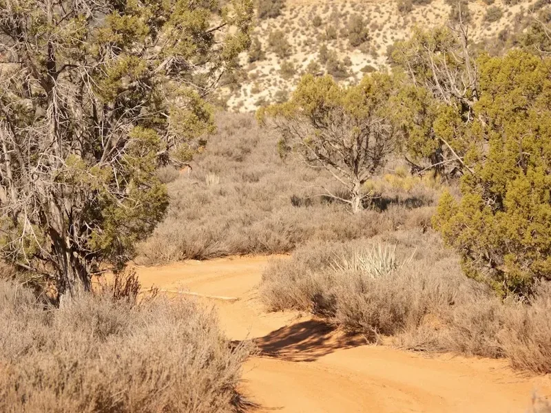
The Coyote Gulch Loop is a remote hike requiring careful planning. The primary logistical challenge is trailhead access and the need for a shuttle or road walk to complete the loop. The closest town with amenities is Escalante, Utah. Salt Lake City International Airport (SLC) is the nearest major airport, approximately a 4.5-hour drive from Escalante. Renting a car is essential, and a high-clearance vehicle (SUV or truck) is highly recommended, if not mandatory, for navigating the unpaved Hole-in-the-Rock Road, which leads to the trailheads. This road can be rough, sandy, and may have washouts, especially after rain.
Before embarking on the hike, it is crucial to check the weather forecast for flash flood potential. The Grand Staircase-Escalante National Monument is prone to sudden and dangerous storms. If there is any chance of rain in the forecast, even miles upstream, it is advisable to postpone the hike. Inform someone of your hiking plans, including your intended route and expected return time.
Trail Accommodation
This is a day hike requiring no overnight accommodation. Hikers typically base themselves in or near Escalante, Utah, which offers a range of lodging options from motels and inns to vacation rentals. Camping is also available in designated campgrounds within the Grand Staircase-Escalante National Monument, such as the Escalante Interagency Visitor centre Campground or dispersed camping in certain areas (check regulations). No specific accommodation exists along the Coyote Gulch trail itself.
Required Gear
- Sturdy, broken-in hiking boots with excellent ankle support and aggressive tread for navigating sandy washes and rocky terrain.
- Waterproof jacket and overtrousers (for potential rain and wind protection, though less critical than for alpine environments).
- Backpack (30-40 litre capacity) to carry essentials.
- Sun protection: wide-brimmed hat, sunglasses, high SPF sunscreen.
- Navigation tools: GPS device or smartphone with downloaded offline maps, compass, and a physical map of the area.
- First-aid kit: including blister treatment, bandages, antiseptic wipes, pain relievers, and any personal medications.
- Head torch with spare batteries (essential if starting very early or finishing late).
- Trekking poles (optional but highly recommended for stability on uneven terrain and descents/ascents).
- Water shoes or sandals (optional, for comfortable walking through shallow water if present).
What to Bring
- Water: At least 3-4 litres per person. Water sources within the canyon are unreliable and require treatment. Carry a water filter or purification tablets as a backup.
- Food: High-energy snacks and a packed lunch. Consider items that are easy to eat on the go and don't require cooking.
- Toiletries: Biodegradable soap, toothbrush, toothpaste, hand sanitiser, toilet paper, and a trowel for digging catholes if away from designated facilities (pack out all used toilet paper).
- Insect repellent: While not as prevalent as in some other environments, biting insects can be present.
- Camera and extra batteries/power bank.
- Small trowel for digging catholes if necessary (pack out all waste).
- Trash bags: To pack out all your rubbish, including food scraps and wrappers.
Permits
For day hiking on the Coyote Gulch Loop, no specific permits are generally required. However, it is always advisable to check the latest regulations with the Bureau of Land Management (BLM) or the Grand Staircase-Escalante National Monument Visitor centre before your trip, as regulations can change. The area is managed by the BLM.
Trailhead Registration: While not a permit, many trailheads in the Grand Staircase-Escalante National Monument, including those for Coyote Gulch, have a self-registration kiosk. It is highly recommended to sign in and out at these kiosks. This helps the BLM track visitor numbers, understand usage patterns, and provides valuable information in case of an emergency.
Overnight Camping: If you plan to camp overnight within the monument (not on the Coyote Gulch trail itself, as it's primarily a day hike), permits may be required for backcountry camping. These permits are typically obtained from the Escalante Interagency Visitor centre. Always verify current camping regulations and permit requirements well in advance of your trip.
Vehicle Access: Access to the trailheads often involves driving on unpaved roads, such as the Hole-in-the-Rock Road. While no specific permit is needed for driving these roads, ensuring you have a suitable vehicle (high-clearance) is crucial. Road conditions can vary significantly, and they may be impassable after rain.
Other Activities in the Area
The Grand Staircase-Escalante National Monument and the surrounding Escalante region offer a wealth of outdoor activities for those who appreciate the stark beauty of the desert:
- Hiking: Numerous other trails exist, ranging from short, accessible walks to multi-day backcountry expeditions. Popular options include Peek-a-Boo and Spooky Gulches (requiring a shuttle and known for their narrow slot canyons), Calf Creek Falls (a moderate hike to a beautiful waterfall), and various rim trails offering expansive vistas.
- Scenic Drives: The Hole-in-the-Rock Road itself is a historic and scenic drive, offering access to numerous trailheads and viewpoints. Highway 12, a designated All-American Road, provides breathtaking scenery as it winds through the region, including the famous Hogback section.
- Photography: The unique geological formations, vibrant colours, and vast landscapes make this area a paradise for photographers. Sunrise and sunset often provide the most dramatic lighting.
- Stargazing: The Grand Staircase-Escalante is designated as an International Dark Sky Park. With minimal light pollution, the night sky is incredibly clear and offers spectacular views of the Milky Way and countless stars.
- Geology and Paleontology: The monument is renowned for its rich fossil record, including dinosaur bones. Educational opportunities abound for those interested in the geological history of the region.
- Canyoneering: For experienced adventurers, the area offers opportunities for technical canyoneering, involving rappelling, scrambling, and navigating through more challenging slot canyons. This requires specialized gear and knowledge.
Safety and Conditions
Flash Flood Risk: This is the most significant hazard in Coyote Gulch. The dry washes can become raging torrents with little warning. Always check the weather forecast for the entire watershed, not just your immediate location. If there is any chance of rain, even miles upstream, do not enter the canyon. If you are in the canyon and hear thunder or see the water level rising rapidly, evacuate to higher ground immediately.
Heat and Dehydration: Desert temperatures can be extreme, especially during summer. Carry significantly more water than you think you will need (at least 3-4 litres per person). Drink frequently, even if you don't feel thirsty. Wear sun-protective clothing, a wide-brimmed hat, and sunglasses. Hike during the cooler parts of the day (early morning and late afternoon).
Navigation: While the main gulch is relatively straightforward, side canyons and the exit routes can be confusing. Carry a reliable map and compass, and consider using a GPS device or a smartphone with downloaded offline maps. Be aware of your surroundings and landmarks.
Terrain: The hike involves walking on sand, rock, and potentially through shallow water. Sturdy hiking boots with good ankle support are essential. Be cautious of loose rocks and slippery surfaces, especially during descents and ascents.
Wildlife: While large predators are rare, be aware of rattlesnakes, scorpions, and other desert creatures. Give them plenty of space and do not disturb them. Check your boots and gear before putting them on.
Vehicle Access: The unpaved roads leading to the trailheads can be rough and may require a high-clearance 4WD vehicle. Check road conditions before you go, as they can deteriorate rapidly after rain. Ensure your vehicle is in good condition and you have a full tank of fuel.
Communication: Cell phone service is extremely limited or non-existent in most of the Grand Staircase-Escalante National Monument. Consider carrying a satellite communication device (like a SPOT or inReach) for emergencies.
Side Trips and Points of Interest
Jacob Hamblin Arch: This massive natural arch is a prominent landmark within Coyote Gulch. It spans the gulch, creating a dramatic gateway. It's a popular spot for photos and a good place to take a break. The arch is named after the pioneering Mormon missionary Jacob Hamblin, who explored this region extensively.
Coyote Natural Bridge: Further down the gulch, you'll encounter Coyote Natural Bridge, another impressive sandstone formation. This bridge is larger and more imposing than Jacob Hamblin Arch and offers fantastic photographic opportunities. It's an ideal location for a lunch stop, allowing you to soak in the grandeur of the canyon.
Petroglyphs and Pictographs: While not always clearly marked, keep an eye out for ancient rock art left by the early inhabitants of the region. These petroglyphs and pictographs are a fascinating glimpse into the past and should be viewed with respect and from a distance. Do not touch or disturb them.
Water Features: Depending on recent rainfall, sections of Coyote Gulch may have flowing water, pools, or damp sand. These water features add to the dynamic beauty of the canyon and can create interesting reflections and photographic opportunities. Be mindful of the depth and current if you need to cross.
The Confluence with Escalante River: The point where Coyote Gulch meets the Escalante River is a significant geographical feature. The canyon may widen here, offering a different perspective before you begin your ascent out of the drainage. The Escalante River itself is a major artery of the monument, carving its own impressive canyons.
Leave No Trace
The Grand Staircase-Escalante National Monument is a fragile desert environment that requires careful stewardship. Practicing Leave No Trace principles is paramount to preserving its beauty and ecological integrity for future visitors.
- Plan Ahead and Prepare: Research the area, understand the risks (especially flash floods), and be prepared for the conditions. Know your route and have a backup plan.
- Travel and Camp on Durable Surfaces: Stick to established trails and washes. Avoid walking on fragile desert cryptobiotic soil crusts, which are vital for preventing erosion. When camping (if applicable), use designated sites or camp on rock, sand, or dry grass.
- Dispose of Waste Properly: Pack it in, pack it out. This includes all food scraps, wrappers, and any other trash. Use designated toilets where available. If not, dig catholes at least 60 metres (60 m) away from water, trails, and campsites, and at least 15-20 cm (6-8 inches) deep. Pack out all toilet paper and hygiene products.
- Leave What You Find: Do not remove rocks, plants, or artifacts. These are part of the natural and cultural heritage of the monument.
- Minimize Campfire Impacts: Campfires are often prohibited in this region due to the dry conditions and risk of wildfire. If permitted, use existing fire rings and keep fires small. Ensure fires are completely extinguished.
- Respect Wildlife: Observe wildlife from a distance. Never feed animals, as this can disrupt their natural behaviours and diets. Store food securely to prevent attracting animals.
- Be Considerate of Other Visitors: Respect the solitude of the desert. Keep noise levels down, yield to other hikers, and maintain a courteous attitude.
By adhering to these principles, you help ensure that the unique landscapes and cultural resources of Coyote Gulch and the Grand Staircase-Escalante National Monument are protected for generations to come.