Corfu Trail - A Journey Through the Emerald Isle
The Corfu Trail is Greece’s premier long-distance walking route, a 180-kilometre odyssey that traverses the full length of the island of Corfu, from the white cliffs of the south to the rugged limestone peaks of the north. Established in 2001, the trail was meticulously designed to avoid the island’s heavily developed tourist hubs, instead guiding walkers through a landscape of ancient olive groves, traditional mountain villages, Byzantine ruins, and secluded Adriatic coves. This is not merely a coastal walk; it is a deep immersion into the "Emerald Isle’s" diverse topography, where the air is thick with the scent of wild thyme and sage, and the silver-green canopy of millions of olive trees provides a shimmering backdrop to the journey. The route is traditionally walked from south to north, a strategic choice that leads hikers from the gentler, rolling landscapes of the south toward the increasingly dramatic and challenging mountain scenery of the north, culminating in the spectacular heights of Mount Pantokrator.
- Distance: 180.0 km one-way
- Duration: 8–10 days
- Season: April–May or September–October (avoiding the intense July–August heat)
- Accommodation: Village guesthouses, small hotels, and traditional tavernas
- Highest point: Mount Pantokrator (906 m)
- Total Elevation Gain: Approximately 6,000 m
- Difficulty: Moderate (requires good fitness for long days and mountain ascents)
- Direction: South to north (Kavos to Agios Spiridonas)
Overview
The Corfu Trail offers a rare opportunity to experience the authentic, rural heart of a Mediterranean island that many only know for its beach resorts. The trail’s brilliance lies in its pacing and variety. The journey begins at the southern tip of the island near Kavos, quickly leaving the neon lights behind to enter a world of quiet lagoons and sand dunes. As you progress northward, the terrain shifts from the flat, sandy expanses of Lake Korission to the central hills where the Venetian influence is most palpable in the architecture of villages like Sinarades and Pelekas. The final third of the trail is a true mountain adventure, crossing the karst plateaus of the north and ascending the island’s highest peaks, offering 360-degree views that stretch across the Ionian Sea to the mountains of Albania and the Greek mainland.
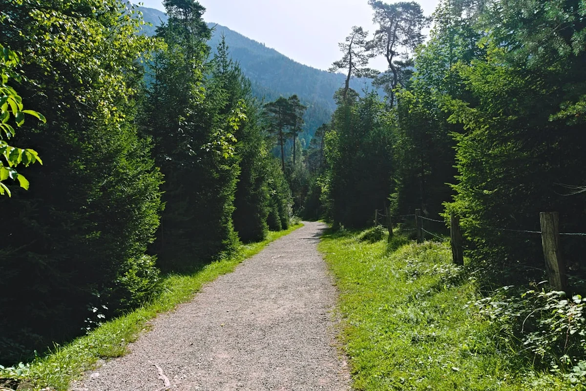
Walking the Corfu Trail is as much a cultural experience as it is a physical one. The route makes use of "monopatia"—ancient donkey paths and shepherd tracks that served as the island’s primary transport network for centuries before the arrival of modern roads. These paths lead you into the "plateia" (village square) of remote hamlets where life moves at a different tempo. You will encounter local farmers harvesting olives with traditional nets, hear the bells of goat herds echoing in the limestone valleys, and find yourself welcomed into family-run tavernas where the food is sourced from the surrounding hills. The trail is marked by yellow signs and "CT" directional arrows, though a keen eye and a good map are essential as the Mediterranean vegetation can be quick to reclaim the less-trodden sections of the path.
The landscape is defined by its flora. Corfu is home to over four million olive trees, many of them centuries old with gnarled, hollow trunks that resemble living sculptures. In the spring, the trail is a riot of colour, with wild orchids, anemones, and gladioli carpeting the forest floor. In the autumn, the heat of the summer has faded, the sea remains warm enough for a post-hike swim, and the harvest season brings a renewed energy to the villages. Whether you are standing atop the Byzantine ramparts of Angelokastro or descending through the cypress-studded valleys toward the turquoise waters of Liapades, the Corfu Trail provides a sense of scale and historical depth that is unique in the Mediterranean.
History and Cultural Context
The history of Corfu is a complex tapestry of occupation and influence, and the Corfu Trail serves as a physical timeline of this heritage. Unlike the rest of Greece, Corfu was never conquered by the Ottoman Empire. Instead, it remained under Venetian rule for over four centuries (1386–1797), followed by brief periods of French and British administration before joining the Greek state in 1864. This unique history is reflected in the trail’s surroundings: the Venetian-style bell towers of the village churches, the British-built manor houses, and the vast olive groves that were planted under a Venetian decree that paid locals for every tree they established.
The trail itself was the vision of Hilary Paipeti, a long-term resident and walking enthusiast who realised that the island’s ancient path network was at risk of being lost to neglect and modern development. In 2001, she and a small team of volunteers scouted and linked these historic routes to create a continuous traverse of the island. Many of the paths used by the trail are "monopatia"—stone-paved tracks that were the only way to move goods and people between the mountain villages and the coastal ports for over a thousand years. Walking these paths today is an act of preservation, keeping the history of Corfiot rural life alive.
Cultural landmarks are frequent along the route. You will pass the ruins of the Arkoudilas Monastery in the south, the 13th-century Byzantine fortress of Angelokastro perched on a precipitous cliff in the west, and the "ghost village" of Old Perithia in the north. Old Perithia, a high-altitude settlement built to hide residents from pirate raids, is a particularly poignant highlight; its stone houses and numerous churches are currently being painstakingly restored, offering a glimpse into a medieval way of life that was almost forgotten. The trail doesn't just show you the land; it tells the story of a resilient island people who have navigated the influences of East and West for millennia.
Want more background? Read extended notes on history and cultural context → Learn more
Seasonal Highlights and Weather Reality
Timing is critical when planning the Corfu Trail. The Mediterranean climate brings hot, dry summers and mild, wet winters, making the shoulder seasons the only viable windows for a comfortable long-distance trek. July and August should be avoided at all costs; temperatures frequently exceed 35°C, humidity is high, and the physical exertion of climbing 6,000 metres of elevation becomes dangerous under the intense Greek sun.
Spring (April to May): This is arguably the most beautiful time to walk. The island is exceptionally green, and the wildflowers are in full bloom, including rare endemic orchids. The temperatures are ideal for walking, ranging from 18°C to 24°C. However, the sea may still be a bit brisk for swimming, and April can occasionally bring "Medicanes" or heavy spring showers. Easter is a massive celebration in Corfu, and walking during Holy Week allows you to witness unique local traditions, though accommodation must be booked well in advance.
Autumn (September to October): This is the preferred season for many experienced hikers. The fierce heat of summer has broken, but the Ionian Sea remains warm (around 23°C), making the daily coastal finishes incredibly rewarding. The landscape is drier than in spring, but the light is softer and perfect for photography. October marks the start of the olive harvest, providing a fascinating look at local agricultural life. Be aware that some tourist facilities and tavernas begin to close toward the end of October.
Winter (November to March): While the temperatures are mild (10°C to 15°C), this is Corfu’s rainy season. The island receives significant rainfall, which can make the clay-based paths in the south extremely slippery and the mountain sections in the north treacherous. Many guesthouses and tavernas in the smaller villages close for the winter, making logistics difficult for a continuous 10-day walk.
Recommended Itinerary
10-Day Corfu Trail Itinerary
Day 1: Kavos to Potami
- Distance: 28 km
- Elevation gain: 450 m
- Time: 7–8 hours
- Start at the southern tip of Corfu near Asprokavos
- Visit the ruins of the Monastery of the Blessed Virgin Mary (Arkoudilas)
- Walk along the dramatic white cliffs overlooking the sea toward Paxos
- Descend through dense olive groves to the traditional town of Lefkimmi
- Finish in the riverside village of Potami
- A long opening day that quickly transitions from coastal views to rural agricultural heartlands
Day 2: Potami to Agios Georgios (South)
- Distance: 20 km
- Elevation gain: 200 m
- Time: 5–6 hours
- Cross the Gardeno River and climb into the hills above the southern coast
- Pass through the traditional villages of Vitalades and Perivoli
- Enjoy views of the coastline before descending to the wide sandy beach of Marathias
- Follow the shoreline to the resort of Agios Georgios South
- Relatively flat terrain makes this a good recovery day for the legs
Day 3: Agios Georgios to Paramonas
- Distance: 19 km
- Elevation gain: 150 m
- Time: 5–6 hours
- Walk through the unique ecosystem of Lake Korission, a coastal lagoon
- Navigate the "cedar" forest (actually juniper) and sand dunes between the lake and the sea
- Cross the Halikounas beach strip
- Climb slightly into the olive-covered foothills to reach the quiet bay of Paramonas
- Birdwatchers should look for flamingos and egrets in the lagoon
Day 4: Paramonas to Dafnata
- Distance: 13 km
- Elevation gain: 650 m
- Time: 4–5 hours
- The first significant climb of the trail as you move into the central massif
- Pass through the villages of Ano Pavliana and Vouniatades
- Ascend the slopes of Agii Deka (Ten Saints), the island's second-highest peak
- Visit the abandoned monastery near the summit for panoramic views
- Finish in the mountain village of Dafnata, perched high above the east coast
- Short distance but high intensity due to the elevation gain
Day 5: Dafnata to Pelekas
- Distance: 18 km
- Elevation gain: 400 m
- Time: 6–7 hours
- Descend from Dafnata into the central valley, crossing the "Sinarades Plain"
- Visit the Folklore Museum in the beautiful village of Sinarades
- Climb to the "Aerostato" viewpoint for spectacular vistas of the west coast
- Follow the cliff-top paths to the hilltop village of Pelekas
- Pelekas is famous for its sunsets; head to "Kaiser's Throne" for the best view
Day 6: Pelekas to Liapades
- Distance: 24 km
- Elevation gain: 500 m
- Time: 7–8 hours
- Descend to the beautiful Myrtiotissa Beach, once described by Lawrence Durrell as the loveliest in the world
- Climb a steep, zig-zagging path to the village of Vatos
- Cross the Ropa Valley, the island's largest agricultural plain
- Ascend through olive groves to the traditional village of Liapades
- A diverse day featuring beaches, meadows, and mountain tracks
Day 7: Liapades to Agios Georgios (North)
- Distance: 12 km
- Elevation gain: 400 m
- Time: 4 hours
- Climb the famous "Lakones steps," an ancient stone path rising from the sea
- Reach the "Bella Vista" viewpoint above Paleokastritsa
- Walk through the village of Lakones and follow the contour path to Krini
- OPTIONAL: Detour to the Byzantine castle of Angelokastro (highly recommended)
- Descend the spectacular stone-paved "kalderimi" to the bay of Agios Georgios North
- A shorter day with some of the most iconic views in Greece
Day 8: Agios Georgios to Rekini
- Distance: 14 km
- Elevation gain: 450 m
- Time: 5 hours
- Climb out of the bay toward the village of Pagi
- Follow a series of ridges through the villages of Vistonas and Makrades
- Enter the rugged northern limestone landscape
- Descend through quiet valleys to the road junction at Rekini
- The terrain becomes noticeably rockier and more "alpine" in character
Day 9: Rekini to Spartillas
- Distance: 12 km
- Elevation gain: 550 m
- Time: 4–5 hours
- Ascend the foothills of the Pantokrator massif
- Pass through the high-altitude villages of Sokraki and Valanio
- Walk along the edge of the northern escarpment with views toward the Albanian coast
- Finish in Spartillas, a village clinging to the mountainside with views over Corfu Town
- Preparation for the final ascent of the island's highest peak
Day 10: Spartillas to Agios Spiridonas
- Distance: 20 km
- Elevation gain: 600 m
- Time: 7–8 hours
- The grand finale: climb to the summit of Mount Pantokrator (906 m)
- Visit the monastery at the peak and enjoy views of the entire Ionian archipelago
- Descend across the high karst plateau to the "ghost village" of Old Perithia
- Follow the final descent through the northern hills to the sea at Agios Spiridonas
- Finish at the northernmost tip of the island, marked by the Antinioti Lagoon
- A challenging but immensely rewarding conclusion to the traverse
Planning and Bookings
Book Your Trip
Everything you need to plan your journey
Accommodation
Find places to stay near Corfu Town
Flights
Search flights to Corfu Town
Essential Preparation
The Corfu Trail requires a moderate level of physical fitness. While the elevations are not extreme by Himalayan standards, the cumulative gain of 6,000 metres over 10 days, often on rocky or uneven terrain, can be taxing. Walkers should be comfortable with 6–8 hours of movement per day. Navigation is a key component; while the trail is marked with yellow "CT" signs, these can be obscured by vegetation or missing at critical junctions. Carrying a dedicated GPS track or the official "Corfu Trail Companion" guide is highly recommended.
Logistically, Corfu Town (Kerkyra) serves as the primary hub. It is well-connected by international flights and ferries from the mainland (Igoumenitsa) and Italy. Most walkers spend a night in Corfu Town to organise supplies before taking a "Green Bus" (KTEL) to the southern trailhead at Kavos. It is essential to check the bus schedules in advance, as services to remote villages can be infrequent, especially on Sundays.
Trail Accommodation
Unlike many European long-distance trails, the Corfu Trail does not have a system of dedicated mountain huts or refuges. Instead, walkers stay in village guesthouses, small family-run hotels, or "rooms to let" (soom-ah-tee-ah) in the settlements along the route.
Accommodation Characteristics:
- Facilities: Most rooms include private bathrooms, linens, and towels. Air conditioning is standard but may not be needed in the shoulder seasons.
- Booking: During the peak shoulder seasons (May and September), it is vital to book accommodation at least 2–3 months in advance, as some villages have very limited bed capacity (e.g., Dafnata or Rekini).
- Costs: Expect to pay between €40 and €70 per night for a double room, depending on the location and season.
- Food: Most guesthouses are located near a local taverna where breakfast and dinner can be purchased. Some include a basic continental breakfast.
What is NOT provided:
- Communal kitchens: Unlike hostels, most Greek guesthouses do not have facilities for guests to cook their own meals.
- Laundry: While some hosts may offer to wash clothes for a small fee, dedicated self-service laundries are non-existent outside of Corfu Town.
Required Gear
- Hiking boots or trail runners: Must have excellent grip for limestone rocks and be well broken-in. Ankle support is recommended for the northern sections.
- Backpack: A 30–40L pack is usually sufficient if you are staying in guesthouses and not carrying camping gear.
- Waterproof jacket: Essential even in Greece; Mediterranean storms can be sudden and intense.
- Sun protection: A wide-brimmed hat, high-quality sunglasses, and SPF 50+ sunscreen are non-negotiable.
- Navigation: A smartphone with an offline GPS app (like Gaia GPS or AllTrails) and a backup power bank. A physical map of Corfu (1:50,000 scale) is a wise safety backup.
- First aid kit: Focus on blister care (Compeed), antiseptic wipes, and rehydration salts.
What to Bring
- Water capacity: At least 2–3 litres of carrying capacity. While you pass through villages, some stretches (especially on Day 10) have no water sources.
- Cash: Many small village tavernas and guesthouses do not accept credit cards. Carry enough Euros to cover 2–3 days of expenses.
- Snacks: High-energy trail mix, dried fruit, and local honey bars (pasteli) are excellent for sustained energy.
- Towel: A lightweight microfibre towel for mid-hike swims in the Ionian Sea.
- Swimwear: You will finish several days at the beach; don't miss the opportunity to soak tired muscles.
- Insect repellent: Mosquitoes can be active in the evenings, especially near Lake Korission and the Ropa Valley.
Permits
One of the great advantages of the Corfu Trail is that no official permits or entry fees are required to walk the route. The trail makes use of public rights of way, ancient communal paths, and quiet secondary roads. You are free to start and finish your journey at any time without registering with a central authority.
Important Considerations:
- Voluntary Support: While the trail is free to use, it is maintained by a small group of dedicated volunteers. You can support their work by purchasing the official "Corfu Trail Companion" guide or by staying in and supporting the local businesses that the trail was designed to help.
- Private Property: While the trail is public, it often passes through private olive groves. Always stay on the marked path, close any gates you encounter, and respect the work of local farmers.
- Wild Camping: It is important to note that wild camping is technically illegal in Greece. While it is occasionally practiced in remote areas, it is strongly discouraged on the Corfu Trail to prevent fire risks and to respect local landowners. Using the village guesthouses is the best way to ensure the trail remains welcomed by the local community.
- Group Sizes: There are no limits on group sizes, but large groups (10+) should coordinate with guesthouses well in advance, as many villages cannot accommodate large numbers of people simultaneously.
Other Activities in the Area
Corfu is a rich cultural destination; consider adding a few days to your itinerary to explore beyond the trail:
- Corfu Old Town: A UNESCO World Heritage site. Explore the Liston, the Old and New Fortresses, and the narrow "kantounia" (alleys) that feel more like Venice than Greece.
- Achilleion Palace: Built by Empress Elisabeth of Austria (Sisi), this neoclassical palace is famous for its gardens and statues of Achilles.
- Paleokastritsa Monastery: Perched on a hill overlooking the turquoise bays of the west coast, this 13th-century monastery is still active and houses a small museum.
- Boat Trips to Paxos and Antipaxos: From the southern port of Lefkimmi, you can take a day trip to these stunning smaller islands, known for their sea caves and crystal-clear water.
- Scuba Diving: The rocky coastline of northern Corfu offers excellent visibility and underwater caves, particularly around Paleokastritsa and Kassiopi.
- Corfu Beer Brewery: Located in the village of Arillas, this local craft brewery offers tours and tastings of their award-winning ales and lagers.
Safety and Conditions
Heat and Hydration: The most significant danger on the Corfu Trail is heat exhaustion. Even in May and September, the sun can be relentless. Always start your walking day as early as possible (6:00 AM or 7:00 AM) to cover the most difficult terrain before the midday heat. Drink at least 3 litres of water per day and use electrolyte replacements to prevent cramping.
Terrain and Footwear: The northern sections of the trail involve walking on sharp, eroded limestone (karst). This terrain is notoriously hard on footwear and can easily cause ankle rolls. Ensure your boots have a stiff sole and good protection. In the south, the clay paths can become impassable "gloop" after heavy rain; if it has rained recently, be prepared for slow progress and very messy gear.
Flora and Fauna: Corfu is home to the Nose-horned Viper (Vipera ammodytes), which is venomous. While they are shy and usually flee from human vibration, be careful when stepping over logs or into thick undergrowth. Wear long trousers in overgrown sections to protect against scratches and ticks. The island also has a large population of stray dogs; while most are harmless, some farm dogs can be territorial. Carrying trekking poles is a good way to keep a respectful distance if a dog becomes over-excited.
Emergency Services: The general emergency number in Greece is 112. Mobile signal is generally good across the island, but there are "dead zones" in the deep valleys of the north and on the slopes of Mount Pantokrator. Always inform your guesthouse host of your intended route for the day.
Side Trips and Points of Interest
Angelokastro (Castle of Angels): Located near the village of Krini on Day 7, this is one of the most important Byzantine castles in Greece. Perched on a steep cliff 305 metres above the sea, it served as a lookout for pirate raids and Ottoman invasions. The climb to the top is steep but the views of the Ionian Sea and the Diapontia Islands are unparalleled. The small chapel of St. Kyriaki, built inside a cave at the summit, is a peaceful place for reflection.
Old Perithia: Encountered on Day 10, this is Corfu's oldest permanent settlement. Located in a hollow on the slopes of Mount Pantokrator, it was built in the 14th century as a refuge from coastal attacks. At its peak, it had 130 houses and 8 churches. Today, it is a "Heritage Protected" site. Walking through its silent, stone-paved streets feels like stepping back in time. Several tavernas in the village serve traditional mountain dishes like "Pastitsada" (rooster in spiced tomato sauce).
Cape Drastis: While slightly off the main trail in the far northwest, a detour to Cape Drastis offers views of some of the most unusual geological formations in the Mediterranean. The white, sculpted sandstone cliffs and sea caves are best viewed from the cliffs above or by renting a small boat from nearby Sidari.
The Agii Deka Monastery: On Day 4, the trail passes near the summit of Agii Deka. The small, semi-abandoned monastery here is surrounded by ancient fruit trees and offers a cool, shaded spot for a break. The views from the monastery garden stretch across the central plain to Corfu Town and the fortress, providing a great sense of how far you have walked since the southern tip.
Leave No Trace
Corfu’s ecosystem is fragile, particularly during the dry months when the risk of wildfire is extreme. As a walker, you have a responsibility to protect this landscape for the local communities and future hikers.
Leave No Trace Principles for Corfu:
- Fire Safety: Never light a fire of any kind. A single spark can devastate thousands of hectares of ancient olive groves and threaten mountain villages. Dispose of cigarette butts responsibly (or better yet, don't smoke on the trail).
- Waste Management: Pack out all your rubbish. Do not leave fruit peels or nut shells, as they take a long time to decompose in the dry Mediterranean climate and can attract pests.
- Respect the Olive Harvest: During the autumn, you will see large nets spread under the trees. Never walk on these nets, as they are the livelihood of the local farmers.
- Water Conservation: Water is a precious resource in the Greek islands. Use it sparingly in guesthouses and never contaminate local springs or wells with soap or detergents.
- Stay on the Path: To prevent erosion and protect rare wildflowers (especially orchids), stick to the marked trail. Avoid creating "social trails" or shortcuts on the zig-zagging mountain paths.