
Copper Ridge Loop
The Copper Ridge Loop is a challenging, multi-day trek in the North Cascades of Washington State, USA, offering a spectacular immersion into alpine wilderness. This demanding circuit traverses high mountain passes, skirts pristine alpine lakes, and winds through ancient forests, providing breathtaking vistas of jagged peaks and glacial valleys. It's a route that tests endurance and rewards with unparalleled natural beauty, making it a premier destination for experienced backpackers seeking a true wilderness experience.
- Distance: 56.3 km
- Elevation Gain: 2133 m
- Duration: 4-5 days
- Difficulty: Challenging
- Best Time: July to September (snow-free)
- Closest City: Glacier, Washington
- Trailhead Access: From Seattle, drive north on I-5 to WA-542 E (Mount Baker Highway). Continue on WA-542 E for ~83.7 km to the town of Glacier. Turn left onto Forest Service Road 32. Drive 11.3 km to Hannegan Pass Trailhead. Road can be rough. Parking available, but fills up quickly. Northwest Forest Pass required.
- GPS Coordinates: 48.8407, -121.5189 (Trailhead)
Overview
The Copper Ridge Loop is a quintessential North Cascades backpacking adventure, renowned for its dramatic alpine scenery and rugged terrain. This circuit typically begins at the Hannegan Pass Trailhead, ascending through dense forests before breaking out into subalpine meadows and eventually reaching the high alpine ridges that define the loop. The trail offers a continuous panorama of the surrounding peaks, including Mount Shuksan and Mount Baker, with numerous opportunities to gaze upon turquoise alpine lakes and vast glacial cirques.
The loop is often completed in a counter-clockwise direction, starting with the climb to Hannegan Pass. From there, the route traverses the exposed ridges of Copper Ridge, a section that provides expansive views but can be challenging due to elevation changes and potential weather exposure. The descent often leads through the scenic Chilliwack River valley, eventually connecting back to the starting point. The elevation gain is significant, with multiple ascents and descents that contribute to the overall challenge and the spectacular views. This trail is best suited for those with strong physical conditioning and solid backcountry navigation skills.
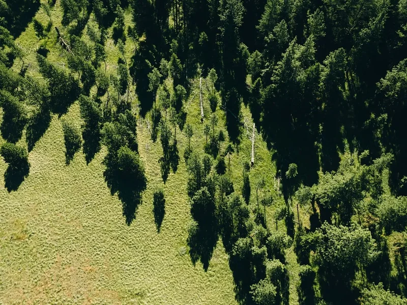
The flora and fauna of the region are diverse. In the lower elevations, you'll encounter old-growth forests of Douglas fir, western hemlock, and western red cedar, often draped in moss. As you gain elevation, these give way to subalpine meadows bursting with wildflowers in the summer months, followed by the stark beauty of the alpine zone. Wildlife sightings can include deer, marmots, pikas, and a variety of bird species. While black bears are present, sightings are less common. The remoteness and ruggedness of the Copper Ridge Loop ensure a true wilderness experience, far from the crowds.
History and Cultural Context
The lands traversed by the Copper Ridge Loop have a rich history, deeply intertwined with the indigenous peoples of the region, particularly the Nlaka'pamux and Coast Salish tribes. These ancestral territories were utilized for millennia, with trails and routes established for hunting, gathering, and trade. The high mountain passes and valleys provided seasonal resources, and the knowledge of these lands was passed down through generations. The presence of ancient trails and cultural sites underscores the long-standing human connection to this rugged landscape.
European exploration and settlement in the North Cascades began in earnest in the late 19th and early 20th centuries, driven by resource extraction, particularly mining and logging. The area around Mount Baker and the Chilliwack River was surveyed and explored by prospectors and adventurers seeking mineral wealth. While Copper Ridge itself may not have yielded significant commercial mining operations, the surrounding areas saw activity that contributed to the development of early trails and access routes. The establishment of the Mount Baker National Forest in 1908 played a crucial role in preserving these wild lands, though the infrastructure for recreational use, such as established trails and campsites, developed more gradually.
The Copper Ridge Loop, as it is known today, is a testament to the evolution of backcountry recreation. While not a formally designated "national park" trail, its popularity has grown among experienced hikers who appreciate its challenging nature and spectacular scenery. The trails are maintained by the U.S. Forest Service, often with the assistance of volunteer groups, ensuring that this wild corner of the Cascades remains accessible for future generations of backpackers. The loop’s route often follows segments of older, more rugged trails, reflecting its history as a route used by explorers and early settlers.
Seasonal Highlights and Weather Reality
The Copper Ridge Loop is a high-elevation trek, and its accessibility is dictated by snow conditions. The primary hiking season runs from July through September, when the snow has typically melted from the higher passes and ridges, making the route passable and safer for hikers.
July: Early July can still see significant snowpack at higher elevations, particularly on north-facing slopes and in shaded areas. Snow travel skills and navigation equipment may be necessary. Wildflowers begin to bloom in the subalpine meadows, and the days are long, offering ample daylight for hiking. Temperatures can be cool, especially at night.
August: This is often considered the prime month for the Copper Ridge Loop. Snow has generally receded from most of the trail, and the weather is typically more stable, though afternoon thunderstorms are always a possibility in the Cascades. Wildflower displays are at their peak in the meadows, and the alpine lakes are usually clear and inviting. Days are still long, and temperatures are generally pleasant, though nights can be cold.
September: September offers crisp, clear air and fewer crowds. The fall colours begin to emerge in the lower elevations, adding another layer of beauty to the landscape. However, the weather can become more unpredictable, with a higher chance of early snowstorms, especially later in the month. Daylight hours are shorter, and temperatures drop significantly, requiring warm gear for evenings and mornings.
Weather Considerations: The North Cascades are known for their rapidly changing weather. Hikers should be prepared for all conditions, including sun, rain, wind, and even snow, regardless of the season. Afternoon thunderstorms are common and can bring lightning, heavy rain, and hail. High winds can be a significant factor on exposed ridges. Temperatures can fluctuate dramatically between day and night, and at higher elevations.
Recommended Itinerary
4-Day Copper Ridge Loop Itinerary
Day 1: Hannegan Pass Trailhead to Boundary Camp
- Distance: 11.6 km
- Elevation Gain: 1000 m
- Time: 4–6 hours
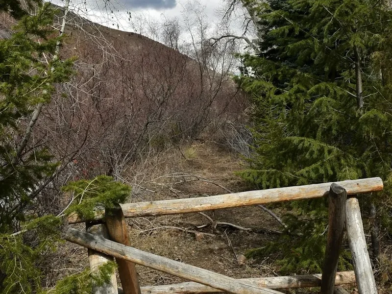
- Start at Hannegan Pass Trailhead (elevation 1000 m)
- Gradual ascent through dense forest, transitioning to subalpine meadows
- Pass through lush old-growth forest with towering firs and cedars
- Reach Hannegan Pass (1550 m) with views towards Mount Shuksan
- Descend slightly to Boundary Camp, located near the Canadian border
- Camp near the Chilliwack River
Day 2: Boundary Camp to Copper Lake
- Distance: 14.5 km
- Elevation Gain: 1100 m
- Time: 6–8 hours
- Continue along the Chilliwack River trail
- Begin a significant climb towards Copper Ridge
- The trail becomes steeper and more exposed as you gain elevation
- Pass through meadows with abundant wildflowers (in season)
- Reach the stunning Copper Lake (elevation ~2100 m)
- Set up camp at the designated campsite near Copper Lake
- Enjoy panoramic views of the surrounding peaks
Day 3: Copper Lake to Brush Creek Camp
- Distance: 16.2 km
- Elevation Gain: 600 m (net gain, with significant ups and downs)
- Time: 7–9 hours
- Traverse the high alpine terrain along Copper Ridge
- Experience dramatic, exposed ridgeline hiking with incredible views
- Descend into the Brush Creek drainage
- The trail can be rough and rocky in sections
- Arrive at Brush Creek Camp
- This is a challenging day with significant elevation changes
Day 4: Brush Creek Camp to Hannegan Pass Trailhead
- Distance: 14 km
- Elevation Loss: 1100 m
- Time: 4–6 hours
- Descend through forest and meadows
- Follow Brush Creek downstream
- The trail gradually becomes less steep as you approach the trailhead
- Rejoin the main Hannegan Pass trail
- Return to the Hannegan Pass Trailhead
Alternative 5-Day Itinerary:
For a more relaxed pace or to allow for exploration, consider adding an extra night at Copper Lake or a campsite along Copper Ridge. This allows for day hikes to nearby viewpoints or simply more time to soak in the alpine environment.
Important Notes:
- This is a challenging route requiring excellent fitness and navigation skills.
- Bear canisters are highly recommended due to bear activity.
- Water sources can be scarce on the ridge; plan accordingly.
- Permits are required for overnight stays in the Mount Baker-Snoqualmie National Forest.
- Be prepared for rapidly changing weather conditions.
Planning and Bookings
Book Your Trip
Everything you need to plan your journey
Accommodation
Find places to stay near Glacier, Washington
Flights
Search flights to Glacier, Washington
Essential Preparation
The Copper Ridge Loop is a serious backcountry undertaking. Thorough preparation is paramount. Begin by assessing your physical fitness; this loop involves significant elevation gain and loss over multiple days, with rugged terrain. Ensure you are comfortable hiking with a heavy pack for extended periods. Familiarise yourself with map and compass navigation, as cell service is non-existent and GPS devices can fail. Research current trail conditions through the Mount Baker-Snoqualmie National Forest Service and local hiking forums. The closest major city with comprehensive services is Seattle, approximately a 2.5 to 3-hour drive from the Hannegan Pass Trailhead. The town of Glacier, located on the Mount Baker Highway (WA-542), offers limited services, including a general store and a few lodging options, and is the last convenient stop for supplies before heading to the trailhead. Ensure your vehicle is in good condition, as Forest Service Road 32 can be rough and may require high clearance.
Trail Accommodation
Overnight accommodation on the Copper Ridge Loop consists of designated backcountry campsites. These are not developed campgrounds with amenities; they are simply areas where camping is permitted. Hikers are expected to practice Leave No Trace principles and camp in established or durable locations.
- Boundary Camp: Located near the Chilliwack River, this is a common first-night stop. It offers a relatively flat area for pitching tents. Water is available from the river (treatment required).
- Copper Lake Campsite: Situated near the stunning Copper Lake, this is a highly sought-after campsite due to its spectacular alpine setting. Campsites are typically dispersed around the lake. Water is available from the lake or nearby streams (treatment required).
- Brush Creek Camp: Located in the Brush Creek drainage, this camp serves as a stop on the descent. It is typically in a forested area with water available from Brush Creek (treatment required).
Booking Requirements: Overnight stays in the Mount Baker-Snoqualmie National Forest require a wilderness permit. These permits are often issued on a first-come, first-served basis or through a lottery system for popular areas. It is crucial to check the official U.S. Forest Service website for the Mount Baker-Snoqualmie National Forest for the most up-to-date permit information, application procedures, and any specific regulations for the Copper Ridge Loop area. Permits are typically required for each night of camping.
Facilities Provided: Designated camping areas. Access to natural water sources (streams, lakes). Natural waste disposal (pack out all trash, use catholes for human waste away from water sources).
What's NOT Provided: Toilets, picnic tables, fire rings (campfires are often prohibited in alpine areas), potable water, trash receptacles, charging stations, or any other developed campground amenities.
Seasonal Availability: Campsites are generally available from July to September, coinciding with the snow-free period. Outside of these months, snow can make access and camping impossible or extremely hazardous.
Costs: Permit fees vary. Check the U.S. Forest Service website for current pricing. There are no fees associated with the campsites themselves beyond the permit cost.
Required Gear
- Backpack: 60-75 litre capacity, with a comfortable suspension system and rain cover.
- Tent: Lightweight, durable, 3-season tent suitable for alpine conditions.
- Sleeping Bag: Rated to at least 0°C (0°C), preferably lower, as alpine nights can be very cold.
- Sleeping Pad: Insulated pad for warmth and comfort.
- Hiking Boots: Sturdy, waterproof, broken-in hiking boots with good ankle support.
- Waterproof Jacket: Breathable, waterproof, and windproof jacket (e.g., Gore-Tex).
- Waterproof Overtrousers: Essential for protection against rain and wind.
- Warm Layers: Fleece jacket or down/synthetic insulated jacket, thermal base layers (merino wool or synthetic).
- Navigation Tools: Topographic map of the area, compass, and a GPS device or smartphone with downloaded offline maps. Knowledge of how to use them is critical.
- Headlamp/Torch: With extra batteries.
- First-Aid Kit: Comprehensive kit including blister treatment, pain relievers, antiseptic wipes, bandages, gauze, medical tape, and any personal medications.
- Sun Protection: High SPF sunscreen, sunglasses, wide-brimmed hat or cap.
- Insect Repellent: Especially important for mosquitoes and biting flies, particularly in early to mid-summer.
- Trekking Poles: Highly recommended for stability on ascents and descents, and for reducing strain on knees.
- Bear Canister: Mandatory in many areas of the North Cascades for food storage. Check regulations for the specific area.
What to Bring
- Food: Lightweight, high-calorie backpacking meals for 4-5 days (breakfasts, lunches, dinners, snacks). Plan for an extra day's worth of food in case of delays.
- Water Bottles/Reservoir: Capacity for at least 2-3 litres per person.
- Water Filter/Purifier: Reliable method for treating all water from natural sources.
- Cooking System: Lightweight backpacking stove, fuel, pot, mug, spoon/spork.
- Toiletries: Biodegradable soap, toothbrush, toothpaste, small towel, toilet paper, trowel for catholes.
- Trash Bags: To pack out all waste, including food scraps and toilet paper.
- Repair Kit: Duct tape, cordage, safety pins, tent pole repair sleeve, multi-tool.
- Personal Items: Camera, book, journal, identification, cash for emergencies.
- Whistle: For signalling in emergencies.
- Emergency Shelter: Lightweight bivy sack or emergency blanket.
Permits
Overnight stays within the Mount Baker-Snoqualmie National Forest, including the Copper Ridge Loop area, require a wilderness permit. These permits are essential for managing visitor impact and ensuring safety. The specific permit system and availability can vary, so it is crucial to consult the official U.S. Forest Service website for the Mount Baker-Snoqualmie National Forest well in advance of your trip.
Permit Acquisition:
- Online Reservations: Some popular areas may offer online reservations through systems like Recreation.gov. These often become available months in advance and can be highly competitive.
- Walk-up Permits: For less competitive areas or remaining permits, walk-up options may be available at ranger stations. However, relying on walk-up permits for a popular route like Copper Ridge is not advisable.
- Specific Area Regulations: Always check the specific regulations for the Hannegan Pass/Chilliwack River area. Some zones may have quotas or specific campsite requirements.
Key Information to Note:
- Permit Type: Ensure you are obtaining the correct type of permit for overnight backcountry camping.
- Dates: Permits are typically issued for specific dates.
- Group Size Limits: There may be limits on the number of people allowed per permit or per campsite.
- Bear Canister Requirement: Many areas in the North Cascades, including those along the Copper Ridge Loop, mandate the use of approved bear-resistant food containers. Confirm this requirement and ensure you have a suitable canister.
- Campfire Restrictions: Campfires are often prohibited in alpine zones and during dry periods. Always check current fire restrictions.
Ranger Stations: The nearest ranger stations for obtaining information or potentially walk-up permits include the Mount Baker Ranger District. It is advisable to call ahead to confirm their operating hours and permit availability.
Importance of Permits: Failure to obtain the required permit can result in fines and being asked to leave the backcountry. Permits help the Forest Service monitor usage, manage resources, and ensure the safety of hikers.
Other Activities in the Area
While the Copper Ridge Loop is a significant undertaking, the surrounding Mount Baker region offers a wealth of other outdoor activities for those looking to extend their stay or explore further:
- Mount Baker Summit Climb: For experienced mountaineers, climbing Mount Baker (3,286 m / 3,286 m) is a challenging but rewarding objective. This requires advanced glacier travel and crevasse rescue skills.
- Day Hikes: Numerous shorter trails exist in the Mount Baker area, offering stunning views without the commitment of a multi-day trip. Examples include trails around Picture Lake, Artist Point, and the trails leading towards Shuksan Arm.
- Chilliwack Lake Provincial Park (Canada): If approaching from the north or extending your trip, this park offers hiking and camping opportunities on the Canadian side of the border.
- Fishing: Several alpine lakes and rivers in the region offer opportunities for trout fishing, provided you have the appropriate Washington State fishing license.
- Photography: The North Cascades are a photographer's paradise. Locations like Artist Point offer iconic views of Mount Shuksan and Mount Baker, especially during sunrise and sunset.
- Scenic Drives: The Mount Baker Highway (WA-542) itself is a scenic drive, with numerous pull-offs offering spectacular vistas.
Safety and Conditions
Pre-Trip Planning:
- Weather Monitoring: The North Cascades are notorious for unpredictable weather. Check the U.S. Forest Service and NOAA/NWS forecasts specifically for the Mount Baker area and alpine conditions immediately before and during your trip. Be prepared for rapid changes, including rain, snow, high winds, and thunderstorms, even in summer.
- Trail Conditions: Consult the Mount Baker-Snoqualmie National Forest Service website or contact the Mount Baker Ranger District for the most current trail condition reports. Snow can linger on high passes well into July, and early snow can occur in September.
- Navigation: This is a challenging route with sections of exposed ridgeline and potentially faint trails. Carry a detailed topographic map, a compass, and a GPS device or smartphone with downloaded offline maps. Ensure you are proficient in using all navigation tools.
- Communication: Cell service is non-existent in the backcountry. Consider carrying a Personal Locator Beacon (PLB) or satellite messenger for emergency communication.
On-Trail Hazards:
- Weather: Hypothermia is a risk due to rapid temperature drops and exposure to wind and rain. Afternoon thunderstorms can bring lightning, posing a serious threat on exposed ridges.
- Terrain: The trail is rugged, with steep ascents and descents, loose scree, and rocky sections. Falls are a significant risk.
- Wildlife: Black bears are present in the area. Proper food storage (bear canisters are often mandatory) is essential. While encounters are rare, maintain a safe distance and know how to react if you see a bear. Marmots and pikas are common in alpine areas.
- Water Sources: Water is generally available from streams and lakes, but it must be treated (filtered or purified) to prevent waterborne illnesses. Water sources can be scarce on exposed ridges, so carry sufficient water and know where your next reliable source is.
- River Crossings: Depending on the season and recent precipitation, some river crossings may be challenging. Assess each crossing carefully for depth, current, and stability of the streambed.
- Altitude: While not extremely high, the elevation can affect some individuals. Acclimatise if possible and be aware of the symptoms of altitude sickness.
Emergency Preparedness: Always inform someone of your itinerary, including your planned route, expected return date, and emergency contacts. Carry a well-stocked first-aid kit and know how to use its contents. Be prepared to self-rescue if necessary.
Side Trips and Points of Interest
Copper Lake: The jewel of the loop, Copper Lake is a stunning alpine tarn nestled beneath towering peaks. Its crystal-clear waters reflect the surrounding granite and snowfields, making it an ideal spot for photography and a peaceful place to camp. The views from the lake are simply breathtaking.
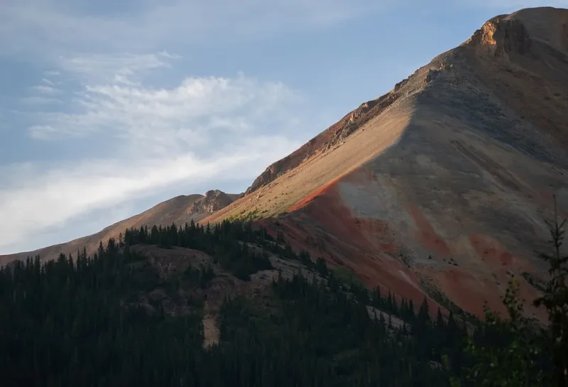
Copper Ridge: The traverse along Copper Ridge itself is a major highlight. This section offers expansive, 360-degree views of the North Cascades, including iconic peaks like Mount Shuksan and Mount Baker. The exposed ridgeline provides a true alpine experience, with dramatic drop-offs and sweeping vistas. Be prepared for wind and potential weather changes on the ridge.
Hannegan Pass: Marking the transition from forest to alpine terrain, Hannegan Pass offers a first glimpse of the grand scale of the surrounding mountains. It's a popular spot for day hikers and serves as a gateway to the more challenging backcountry routes.
Chilliwack River Valley: The initial and final sections of the loop wind through the lush Chilliwack River Valley. This area is characterized by dense old-growth forests, rushing water, and a more sheltered environment compared to the high alpine sections.
Wildflower Meadows: During the peak summer months (typically July and August), the subalpine meadows along the route burst into vibrant colour with a diverse array of wildflowers. These areas provide a beautiful contrast to the rugged granite and snow.
Potential for Wildlife Sightings: While not guaranteed, the remote nature of the Copper Ridge Loop increases the chances of spotting wildlife. Keep an eye out for marmots, pikas, deer, and various bird species. Bears are present, so proper food storage is crucial.
Leave No Trace
The Copper Ridge Loop traverses fragile alpine and subalpine ecosystems. Adhering to Leave No Trace principles is not just recommended; it is essential for preserving the beauty and integrity of this wilderness area for future generations. The North Cascades are a place of profound natural beauty, and our actions have a direct impact.
Your responsibility as a hiker:
- Plan Ahead and Prepare: Research the trail, understand regulations (permits, fire restrictions, bear canister requirements), and pack appropriately. Know the weather forecast and be prepared for changing conditions.
- Travel and Camp on Durable Surfaces: Stick to established trails and camp in designated or impact-resistant areas. Avoid trampling vegetation, especially in meadows and around water sources.
- Dispose of Waste Properly: Pack out everything you pack in, including all food scraps, wrappers, and toilet paper. Use catholes for human waste, dug at least 60 metres (60 m) from water, trails, and campsites.
- Leave What You Find: Do not remove natural objects such as rocks, plants, or flowers. Leave them for others to enjoy.
- Minimize Campfire Impacts: Campfires are often prohibited in alpine areas due to the risk of wildfire and the slow regeneration of vegetation. If fires are permitted, use existing fire rings and keep fires small. Ensure fires are completely extinguished.
- Respect Wildlife: Observe wildlife from a distance. Never feed animals, as this can disrupt their natural behaviours and diets, and can be dangerous for both humans and animals. Store food securely in bear-resistant containers.
- Be Considerate of Other Visitors: Keep noise levels down, yield to other hikers, and maintain a respectful distance. The goal is to enjoy the solitude and natural environment.
By following these principles, you help ensure that the Copper Ridge Loop remains a wild and beautiful place for everyone.
Useful Links
- Mount Baker-Snoqualmie National Forest - Hannegan Pass Trail
- Mount Baker-Snoqualmie National Forest - Recreation Passes and Permits
- National Park Service - Wilderness Permits (General Information)
- Recreation.gov (for potential permit reservations)
- NOAA/NWS - Mountain Forecasts (Seattle Area)
- Washington Trails Association - Copper Ridge Loop