The Colorado Trail - The Roof of the American Rockies
The Colorado Trail is a monumental high-altitude thru-hike stretching 789.6 kilometres across the spectacular backbone of the Colorado Rockies. Extending from the mouth of Waterton Canyon southwest of Denver to the historic mountain town of Durango, this trail is a masterclass in alpine grandeur, traversing eight mountain ranges, six national forests, and six wilderness areas. Walkers journey through a diverse tapestry of ecosystems, from the arid, scrub-oak foothills of the Front Range to the lush, wildflower-carpeted meadows of the Holy Cross Wilderness, and finally into the rugged, jagged peaks of the San Juan Mountains. With an average elevation of over 3,000 metres, the Colorado Trail offers a sustained "top of the world" experience that is physically demanding, logistically complex, and visually staggering.
- Distance: 789.6 km one-way
- Total Elevation Gain: 27,432 m
- Duration: 4–6 weeks
- Season: July to mid-September (snowpack dependent)
- Highest Point: 4,045 m (near Coney Summit in the San Juan Mountains)
- Lowest Point: 1,683 m (Waterton Canyon Trailhead)
- Difficulty: Challenging (due to altitude, weather, and sustained climbing)
- Direction: Typically walked East to West (Denver to Durango)
Overview
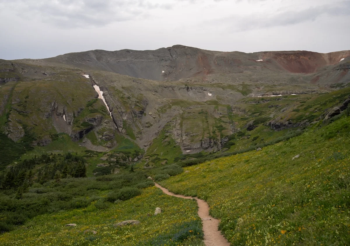
The Colorado Trail (CT) is often described as one of the most well-maintained and scenic long-distance trails in North America. Unlike the much longer Continental Divide Trail, which it shares approximately 320 kilometres with, the CT is specifically designed for a manageable yet epic thru-hiking experience. The route is divided into 28 official segments, each offering a distinct character. The journey begins in the semi-arid canyons near Denver, where the heat and lower elevation provide a rigorous introduction. As the trail moves west, it climbs into the high country, where the air thins and the landscape opens into vast alpine tundras and ancient pine forests.
The physical challenge of the Colorado Trail cannot be overstated. Walkers must contend with a staggering 27,432 metres of vertical gain—the equivalent of climbing Mount Everest from sea level three times. The average elevation remains consistently high, rarely dropping below 2,500 metres for the final 500 kilometres of the journey. This requires significant physiological acclimatisation and a deep respect for the mountain environment. The terrain varies from smooth, needle-covered forest paths to technical, rocky scree slopes above the treeline. In the Collegiate Peaks Wilderness, hikers face a choice between the "Collegiate East" (the original route) and the "Collegiate West" (a higher, more rugged alternative along the Continental Divide), both offering world-class vistas of Colorado’s "14ers"—peaks exceeding 4,267 metres.
Beyond the physical exertion, the Colorado Trail is a journey of profound solitude and natural immersion. While the trail has grown in popularity, the sheer scale of the wilderness ensures that walkers often spend hours, or even days, without encountering another soul. The silence of the high alpine is broken only by the whistle of marmots, the rustle of aspen leaves, and the occasional afternoon thunderclap. It is a landscape of extremes: brilliant blue skies can transform into violent electrical storms within minutes, and mid-summer temperatures can swing from 25° Celsius in the afternoon to below freezing at night. For those who complete the journey, the Colorado Trail is more than just a walk; it is a transformative endurance feat through the heart of the American West.
History and Cultural Context
The Colorado Trail is a relatively modern achievement in the world of long-distance trekking, but the land it traverses has been home to Indigenous peoples for millennia. The Ute (Nuche), Arapaho, and Cheyenne nations traditionally inhabited these mountains, following seasonal migration patterns and utilizing the high passes for hunting and trade. Many sections of the modern trail follow ancient routes used by these original stewards of the land. The cultural heritage of the region is still visible in the names of the peaks and valleys, and the trail serves as a reminder of the deep, enduring connection between the people and the high Rockies.
The concept of a continuous trail across Colorado was first envisioned in the early 1970s. The primary driving force behind its creation was Gudy Gaskill, often affectionately referred to as the "Mother of the Colorado Trail." Gaskill, an avid mountaineer and member of the Colorado Mountain Club, spent decades lobbying government agencies, organising volunteer crews, and physically scouting the route. Her vision was to create a trail that would allow people to experience the beauty of the Rockies without the commercialisation found in other mountain regions. Through her tireless efforts and the formation of the Colorado Trail Foundation, the final "golden spike" was driven in 1987, marking the official completion of the route.
The construction of the trail was a monumental feat of volunteerism. Thousands of individuals from across the globe contributed over 200,000 hours of labour to clear paths, build bridges, and install signage. This spirit of community remains a core part of the trail's identity today. The Colorado Trail Foundation continues to maintain the route, relying on "Trail Crew" volunteers who spend their summers repairing erosion and clearing fallen timber. Walking the CT is, in many ways, a tribute to this collective effort to preserve and share the wild heart of Colorado.
Want more background? Read extended notes on history and cultural context → Learn more
Seasonal Highlights and Weather Reality
The window for a successful Colorado Trail thru-hike is narrow, dictated entirely by the winter snowpack and the arrival of autumn storms. Most hikers begin their journey in July and aim to finish by mid-September. Attempting the trail outside of this window requires specialised winter mountaineering skills and equipment, as high passes can remain choked with snow well into June and receive fresh accumulations as early as late September.
July: This is the most popular starting month. The lower elevations are warm, and the high-country wildflowers—columbines, Indian paintbrushes, and lupines—are in full, spectacular bloom. However, lingering snow on northern slopes and high passes (particularly in the San Juans) can make navigation difficult and require micro-spikes or an ice axe. July also marks the beginning of the "Monsoon Season," characterised by predictable, daily afternoon thunderstorms that bring heavy rain, hail, and dangerous lightning.
August: Generally considered the prime month for the CT. The snow has usually melted from the highest points, and the weather becomes slightly more stable, though afternoon storms remain a constant threat. The days are long and warm, while the nights remain crisp. This is also the peak season for mosquitoes in the wetter valley sections, requiring diligent use of repellent and protective clothing.
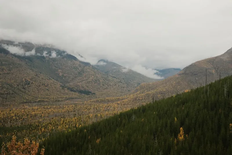
September: Early September offers some of the finest walking conditions. The air is drier, the mosquitoes have vanished, and the "Monsoon" pattern begins to break down. The highlight of this period is the changing of the aspens; entire mountainsides turn a brilliant, shimmering gold. However, the risk of early-season snowstorms increases significantly, and temperatures at night frequently drop well below freezing. By mid-September, many water sources begin to dry up, requiring more careful planning.
Weather Reality: Regardless of the month, weather in the Rockies is volatile. Hikers must be prepared for "four seasons in one day." Lightning is the most significant environmental hazard; being caught above the treeline during an afternoon storm is a life-threatening situation. The rule of thumb is to be off the high ridges and descending toward the safety of the forest by noon or 1:00 PM daily.
Recommended Itinerary
30-Day Colorado Trail Thru-Hike Itinerary
Day 1–5: The Front Range (Denver to Breckenridge)
- Distance: 168 km
- Elevation Gain: 5,800 m
- Key Waypoints: Waterton Canyon, South Platte River, Lost Creek Wilderness, Georgia Pass
- Start at Waterton Canyon (1,683 m) with a gentle 10 km gravel road walk alongside the river
- Climb into the burn scars of the Buffalo Creek area—hot and exposed, carry extra water
- Enter the Lost Creek Wilderness, featuring unique pink granite formations and lush meadows
- Cross Georgia Pass (3,532 m), your first major alpine crossing with views of the Tenmile Range
- Descend into the bustling ski town of Breckenridge for your first resupply
Day 6–10: The High Rockies (Breckenridge to Twin Lakes)
- Distance: 125 km
- Elevation Gain: 4,200 m
- Key Waypoints: Tenmile Range, Copper Mountain, Kokomo Pass, Tennessee Pass, Mount Elbert base
- A sustained high-altitude section beginning with a steep climb out of Breckenridge over the Tenmile Range
- Pass through Copper Mountain Resort and climb toward Kokomo Pass (3,742 m)
- Walk through historic Camp Hale, the WWII training ground for the 10th Mountain Division
- Traverse the base of Mount Elbert (4,401 m), the highest peak in the Rocky Mountains
- Arrive at the scenic Twin Lakes, a perfect spot for a "zero day" (rest day)
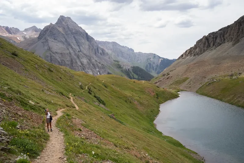
Day 11–17: The Collegiate Peaks (Twin Lakes to Monarch Pass)
- Distance: 135 km (Collegiate West Route)
- Elevation Gain: 6,100 m
- Key Waypoints: Hope Pass, Lake Ann, Cottonwood Pass, Tincup Pass, Monarch Crest
- The most spectacular and difficult section of the trail; the Collegiate West stays high on the Divide
- Climb Hope Pass (3,820 m) for breathtaking views of the Sawatch Range
- Navigate high alpine basins and rocky ridges, staying consistently above 3,300 m
- Pass through the ghost town of Tincup and follow the famous Monarch Crest Trail
- Resupply at Monarch Spur RV Park or hitch into the town of Salida
Day 18–23: The Cochetopa Hills and La Garita (Monarch Pass to San Luis Pass)
- Distance: 145 km
- Elevation Gain: 3,900 m
- Key Waypoints: Marshall Pass, Cochetopa Creek, San Luis Peak, Eddiesville Trailhead
- A transition into a more volcanic, rolling landscape with vast, open vistas
- The Cochetopa Hills offer easier gradients but can be dry; water management is crucial here
- Enter the La Garita Wilderness, one of the most remote sections of the entire trail
- Climb toward San Luis Peak (4,271 m), the only 14er that the trail passes directly near
- Experience profound silence and some of the darkest night skies in the lower 48 states
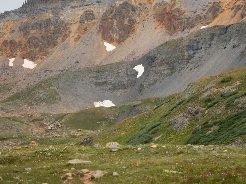
Day 24–30: The San Juan Mountains (San Luis Pass to Durango)
- Distance: 216.6 km
- Elevation Gain: 7,432 m
- Key Waypoints: Spring Creek Pass, Coney Summit, Silverton, Molas Pass, Indian Ridge, Junction Creek
- The grand finale: rugged, jagged peaks and sustained high-altitude walking
- Cross Coney Summit (4,045 m), the highest point on the Colorado Trail
- Descend into the Elk Creek drainage, featuring dramatic canyon walls and the Vestal Peaks
- Pass through Molas Pass and resupply in the historic mining town of Silverton
- Traverse the high, exposed Indian Ridge—spectacular but dangerous in bad weather
- A long, final descent through the Junction Creek valley to the finish line in Durango
Important Notes:
- This itinerary assumes an average of 26 km per day; adjust based on fitness and weather
- Resupply points are often 4–7 days apart; plan food carries carefully
- Afternoon thunderstorms are a daily reality; start your day at dawn (5:00 AM)
- Water sources can be seasonal; use a reliable GPS app for real-time water reports
- The Collegiate West route is highly recommended for scenery but is more strenuous than the East
Planning and Bookings
Book Your Trip
Everything you need to plan your journey
Accommodation
Find places to stay near Denver, Colorado
Flights
Search flights to Denver, Colorado
Essential Preparation
Preparation for the Colorado Trail should begin at least six months in advance. The primary challenge is not just physical fitness, but the logistical coordination of resupply and transport. Walkers must be comfortable with high-altitude environments and possess basic navigation skills, as snow or fallen timber can occasionally obscure the path. Physical training should focus on weighted hiking and cardiovascular endurance; if possible, spend time at altitude before starting to kickstart the acclimatisation process.
Denver and Durango serve as the primary gateways. Denver International Airport (DIA) is the most common arrival point. From Denver, hikers can use public transport (RTD) or ride-sharing services to reach the Waterton Canyon Trailhead. Durango, at the southern terminus, is a vibrant mountain town with a regional airport and bus connections back to Denver. Most hikers choose to mail "resupply boxes" to post offices or small businesses in trail towns (Breckenridge, Leadville, Twin Lakes, Salida, Lake City, Silverton) to ensure they have specific dietary needs met, though most towns have basic supermarkets.
Trail Accommodation
The Colorado Trail is primarily a wilderness camping experience. There are no "huts" in the traditional European or New Zealand sense along the majority of the route. Hikers must be self-sufficient with their own shelter system.
Accommodation Types:
- Wilderness Camping: Allowed for free along most of the trail. Hikers must camp at least 30 metres from water sources and trails. Established "stealth" sites are common and should be used to minimise impact.
- Developed Campsites: Occasionally found near trailheads or road crossings. These may have pit toilets and bear-proof bins but often require a small fee (US$15–25).
- 10th Mountain Division Huts: While a famous hut system exists in Colorado, they are primarily for winter use and are rarely located directly on the CT route. They require advanced booking and are often full months in advance.
- Town Lodging: Trail towns offer a range of hostels, motels, and hotels. Hostels (like those in Silverton or Salida) are popular with thru-hikers and offer laundry, showers, and bunk beds for US$40–60 per night.
What is NOT provided:
- There are no cooking facilities, bedding, or electricity provided anywhere on the trail itself.
- Water must be sourced from streams, lakes, or springs and MUST be treated.
- Trash must be carried out; there are no bins in the wilderness sections.
Required Gear
- Shelter: A lightweight, wind-resistant tent, tarp, or bivvy bag. It must be capable of withstanding heavy rain and hail.
- Sleeping System: A sleeping bag rated to at least -5° Celsius. Even in August, high-altitude temperatures can plummet. A high-R-value sleeping pad is essential for insulation from the cold ground.
- Backpack: A 50–65L pack with a comfortable suspension system. Total pack weight (including food and water) should ideally stay under 15–18 kg.
- Footwear: Trail running shoes or lightweight hiking boots. Ensure they are well broken-in. Many hikers go through two pairs of shoes during a full thru-hike.
- Navigation: A dedicated GPS device or a smartphone with the FarOut (Guthook) app and offline maps. A paper map and compass are essential backups.
- Bear Protection: An Ursack or a bear canister is highly recommended. In some areas, hanging food is difficult due to the lack of suitable trees.
- Rain Gear: A high-quality waterproof jacket with a hood. Waterproof trousers are also recommended for the San Juan sections.
What to Bring
- Food: High-calorie, lightweight meals (dehydrated meals, nuts, tortillas, peanut butter). Aim for 3,000–4,000 calories per day.
- Water Treatment: A hollow-fibre filter (like a Sawyer Squeeze) or chemical purification tablets. Giardia is present in many Colorado water sources.
- Cooking Gear: A lightweight canister stove (Jetboil or MSR Pocket Rocket), fuel, a titanium pot, and a long-handled spoon.
- Sun Protection: SPF 50+ sunscreen, polarised sunglasses, and a wide-brimmed hat. The UV radiation at 4,000 metres is intense and can cause severe burns quickly.
- Clothing Layers: Merino wool or synthetic base layers (no cotton!), a down or synthetic "puffy" jacket, and a fleece mid-layer.
- First Aid: Blister treatment (Leukotape or Compeed), ibuprofen, antihistamines, and any personal medications.
- Power Bank: A 10,000–20,000 mAh battery to keep your phone and GPS charged between towns.
- Toiletries: Trowel for digging "cat holes," biodegradable soap, and a small amount of toilet paper (which must be packed out).
Permits
One of the great appeals of the Colorado Trail is its accessibility. Unlike the Pacific Crest Trail or the John Muir Trail, there is currently no "master permit" required to walk the entire length of the Colorado Trail. However, hikers must adhere to the regulations of the specific wilderness areas they pass through.
Wilderness Permits:
- Most of the six wilderness areas (such as the Holy Cross, Mount Massive, and La Garita) require a self-issued permit. These are free and are typically found at a kiosk located at the wilderness boundary.
- Hikers simply fill out a form, attach one half to their pack, and drop the other half in the box. This helps the Forest Service track usage and assist in search and rescue if necessary.
- The Maroon Bells-Snowmass Wilderness (if you take certain side trips) has stricter requirements and may require advanced overnight permits, but the standard CT route avoids these restricted zones.
Group Size and Regulations:
- Group sizes are generally limited to 15 people and 25 pack animals in wilderness areas.
- Camping is prohibited in certain sensitive areas (usually within 30 metres of lakes or specific historic sites); look for posted signs.
- Waterton Canyon (the Denver terminus) is managed by Denver Water and has specific hours of operation. It is closed to dogs to protect the bighorn sheep population. Hikers with dogs must use the alternative "Indian Creek" start.
Costs: While the permits are free, hikers are encouraged to join the Colorado Trail Foundation. A small donation helps maintain the trail and supports the volunteer crews who keep the path clear of debris and erosion.
Other Activities in the Area
The Colorado Trail passes through some of the most active outdoor recreation hubs in the United States. Consider these additions to your journey:
- Peak Bagging (14ers): Colorado has 58 peaks over 4,267 metres (4,267 m). The CT passes very close to several, including Mount Elbert (the highest in the state), Mount Massive, and San Luis Peak. Many hikers take a "side day" to summit one of these giants.
- Mountain Biking: Most of the Colorado Trail is open to mountain bikes (except for the wilderness areas). It is considered one of the premier long-distance bike-packing routes in the world. Cyclists must use designated wilderness detours.
- Fly Fishing: The South Platte River, Cochetopa Creek, and numerous high-alpine lakes offer world-class trout fishing. A Colorado fishing licence is required.
- Hot Springs: After weeks on the trail, soaking in natural hot springs is a popular reward. Mount Princeton Hot Springs (near the Collegiate Peaks) and Orvis Hot Springs (near Silverton) are favourite stops for weary hikers.
- Historic Train Rides: In Durango or Silverton, you can ride the Durango & Silverton Narrow Gauge Railroad, a coal-fired, steam-powered train that has been in operation since 1882. It offers a spectacular way to see the Animas River Canyon.
Safety and Conditions
Altitude Sickness: Acute Mountain Sickness (AMS) is a genuine risk on the CT. Symptoms include headaches, nausea, and fatigue. The best prevention is a slow ascent and proper hydration. If symptoms persist or worsen into HAPE (High Altitude Pulmonary Edema), the only cure is immediate descent to lower elevation.
Lightning: Colorado is the lightning capital of the high Rockies. Afternoon storms are frequent and violent. If you are caught above the treeline, descend immediately. Avoid isolated trees, ridges, and wide-open meadows. If you cannot descend, crouch on your foam sleeping pad with your feet together to minimise contact with the ground.
Wildlife:
- Black Bears: Common throughout the trail. They are generally shy but will seek out human food. Proper food storage (bear canisters or Ursacks) is mandatory. Never sleep with your food.
- Mountain Lions: Present but rarely seen. If you encounter one, do not run. Make yourself look large, shout, and throw rocks if necessary.
- Moose: Often found near willow thickets and water. They are large, unpredictable, and can be more dangerous than bears. Give them a wide berth (at least 50 metres).
Water Scarcity: While much of the trail is well-watered, sections like the Cochetopa Hills and the Mineral Creek area can have long "dry stretches" of 20–30 km. Always check the latest water reports on the FarOut app and carry at least 3–4 litres of capacity.
Hypothermia: Even in mid-summer, a combination of rain, wind, and high altitude can lead to hypothermia. Always keep a set of dry "sleep clothes" in a waterproof dry bag and put on your rain gear before you get wet.
Side Trips and Points of Interest
The Collegiate West: While technically an official alternative, the Collegiate West is often treated as a "must-do" side trip. It adds more elevation gain but stays higher on the Continental Divide, offering 360-degree views of the Sawatch Range that the original "East" route (which stays lower in the trees) cannot match.
Mount Elbert Summit: Located near Segment 11, a well-marked side trail leads to the summit of Mount Elbert (4,401 m). It is a non-technical "walk-up" but requires significant effort. Standing on the highest point in the North American Rockies is a highlight for many thru-hikers.
Twin Lakes Historic District: A beautifully preserved 19th-century village at the base of the mountains. It offers a glimpse into Colorado's mining and resort history and provides a stunning backdrop for a rest day.
The Gila Wilderness Detour: For those interested in geology, the Wheeler Geologic Area (near the La Garita Wilderness) features incredible "ghost-like" volcanic formations. It requires a significant detour but is one of the most unique landscapes in the state.
Cataract Lake: A stunning alpine lake in the San Juan Mountains, often cited as one of the most beautiful campsites on the entire trail. The turquoise water is framed by towering red-hued cliffs.
Leave No Trace
The Colorado Trail traverses fragile alpine tundra and pristine wilderness areas that are under increasing pressure from human use. At 4,000 metres, the growing season is incredibly short; a single footprint off-trail can damage plants that take decades to recover. Adhering to Leave No Trace (LNT) principles is essential for the trail's survival.
Core Principles for the CT:
- Plan Ahead and Prepare: Know the regulations for each wilderness area and be prepared for extreme weather to avoid emergency situations that impact the land.
- Travel and Camp on Durable Surfaces: Stay on the established trail. When camping, use existing sites. Never camp on alpine tundra; look for bare dirt or pine needles.
- Dispose of Waste Properly: Pack out ALL trash, including orange peels and tea bags. For human waste, dig a "cat hole" 15–20 cm deep at least 60 metres from water. In high-use or high-alpine areas, consider using a "WAG bag" to pack out solid waste.
- Leave What You Find: Do not pick wildflowers or remove historic artefacts from mining sites.
- Minimise Campfire Impacts: Use a stove for cooking. Campfires are often banned due to high fire risk. If allowed, use only established fire rings and keep fires small.
- Respect Wildlife: Observe from a distance. Never feed marmots, grey jays, or bears.
- Be Considerate of Other Visitors: Yield to uphill hikers and pack animals. Keep noise levels low to preserve the sense of solitude.