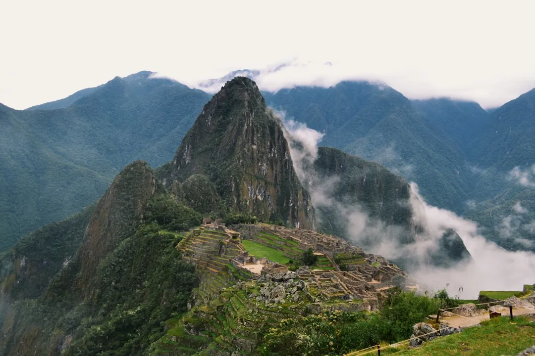
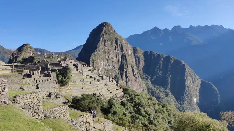
Colca Canyon Trek - Journey into the Heart of the Andes
The Colca Canyon Trek is one of Peru's most formidable and visually spectacular high-altitude adventures. Located in the Arequipa region of southern Peru, this trek takes adventurers into a geological marvel that is often cited as being twice as deep as the Grand Canyon in the United States. Reaching depths of approximately 3,270 metres, the canyon is a vertical world of dramatic contrasts, where snow-capped Andean peaks tower over a semi-arid landscape of giant cacti, pre-Inca agricultural terraces, and the rushing waters of the Colca River. This is not merely a walk; it is a profound descent into a living cultural landscape where the Collagua and Cabana peoples have maintained their traditional way of life for over a millennium. The trek is defined by its punishing gradients—a 1,200-metre vertical drop on the first day followed by a gruelling ascent of the same magnitude on the final morning—making it a true test of physical endurance and mental fortitude.
- Distance: 42.0 km (approximate loop depending on side trips)
- Duration: 2–3 days
- Season: April to October (Dry season; trekking is possible year-round but difficult in the wet season)
- Accommodation: Basic rustic lodges (posadas) in canyon villages and the Sangalle Oasis
- Highest point: Cabanaconde Trailhead (3,287 m)
- Lowest point: Colca River / Sangalle (approx. 2,100 m)
- Difficulty: Challenging (due to steep gradients and high altitude)
- Closest City: Arequipa (approx. 6 hours by bus)
Overview
The Colca Canyon is a landscape of superlatives. Carved by the Colca River over millions of years, the canyon cuts through the high volcanic plateau of the Andes, creating a rift that exposes the raw geological history of the region. For trekkers, the experience is a sensory immersion in the scale of the earth. The journey typically begins in the village of Cabanaconde, perched on the canyon's rim. From here, the trail plunges downward, zig-zagging across sun-baked slopes where the air grows warmer and thicker with every hundred metres of descent. The vegetation shifts from the sparse ichu grass of the puna highlands to a scrubland dominated by prickly pear cacti, agave, and hardy shrubs.
Unlike many wilderness treks, the Colca Canyon is a populated landscape. As you descend, you encounter ancient "andenes"—steeply stacked agricultural terraces that have been in continuous use since before the rise of the Inca Empire. These terraces are a masterclass in hydraulic engineering, still fed by complex systems of stone-lined channels that bring glacial meltwater from the peaks above. The villages within the canyon—San Juan de Chuccho, Cosñirhua, and Malata—are accessible only by foot or mule, preserving a sense of isolation and timelessness. Here, the rhythm of life is dictated by the sun and the agricultural cycle, and trekkers are often greeted by locals leading mule trains laden with supplies.
The physical challenge of the Colca Canyon Trek is significant. The descent is a relentless test of knee stability and quad strength, often conducted under a fierce Andean sun. However, the reward is the "Oasis" of Sangalle—a lush, green sanctuary at the bottom of the canyon where palm trees and swimming pools offer a surreal contrast to the surrounding desert walls. The final challenge is the "Big Climb"—a 1,200-metre vertical ascent back to the rim, usually undertaken in the pre-dawn darkness to avoid the heat of the day. It is a climb that demands a steady pace and rhythmic breathing, culminating in a triumphant return to the plateau as the first rays of sun hit the surrounding volcanoes.
History and Cultural Context
The history of the Colca Valley is a rich tapestry of indigenous resilience and colonial transformation. Long before the Spanish arrived in the 16th century, the valley was inhabited by two distinct ethnic groups: the Collaguas and the Cabanas. The Collaguas occupied the eastern part of the valley and were known for their skill in high-altitude camelid herding and stone masonry. The Cabanas lived in the lower, warmer western sections, focusing on the cultivation of maize and other crops. These groups were so distinct that they practiced cranial deformation to distinguish themselves—the Collaguas shaping their heads to be tall and thin like the volcano Mismi, and the Cabanas shaping theirs to be wide and flat.
When the Inca Empire expanded into the region under Pachacuti and later Huayna Capac, they integrated the Colca Valley into their vast network, recognising the strategic and agricultural value of the region. The Incas refined the existing terrace systems and built "tambos" (waystations) along the trails. The Spanish conquest brought dramatic changes; the indigenous populations were "reduced" into planned colonial towns with central plazas and ornate baroque churches, many of which still stand today in villages like Chivay, Yanque, and Maca. These churches, known as the "Colca Baroque" style, feature intricate carvings of local flora and fauna, representing a unique syncretism of Catholic and Andean beliefs.
The canyon remained largely unknown to the outside world until the 1970s and 80s. It was only in 1981 that a Polish expedition, Canoandes '79, successfully navigated the river and brought international attention to the canyon's depth, claiming it as the deepest in the world (a title it contests with the nearby Cotahuasi Canyon). Today, the trek is a vital part of the local economy, but the cultural heritage remains front and centre. Walkers will notice the traditional dress of the local women—intricately embroidered skirts and hats that differ in style between the Cabana and Collagua regions—marking a living connection to a heritage that has survived centuries of upheaval.
Want more background? Read extended notes on history and cultural context → Learn more
Seasonal Highlights and Weather Reality
The Colca Canyon is a region of climatic extremes, and timing your trek is essential for both safety and enjoyment. The year is divided into two primary seasons: the dry season and the wet season.
Dry Season (April to October): This is the peak trekking window. During these months, the skies are almost perpetually blue, and the risk of rain is minimal. This provides the best conditions for the steep, dusty trails. However, the lack of cloud cover means that daytime temperatures can be intense, often reaching 25°C to 28°C in the depths of the canyon. Conversely, night-time temperatures at the rim (Cabanaconde) can plummet to near freezing (0°C to 5°C). April and May are particularly beautiful as the landscape remains green from the recent rains, while June and July offer the clearest skies for stargazing.
Wet Season (November to March): Trekking during the wet season is significantly more challenging. Heavy rains can make the steep trails slippery and prone to landslides or rockfalls. The canyon walls are composed of volcanic ash and loose rock, which become unstable when saturated. While the canyon becomes incredibly lush and the waterfalls are at their most powerful, the physical risks are higher. Many trekkers avoid January and February, which are the wettest months. If trekking during this time, high-quality waterproof gear and a flexible itinerary are mandatory.
Weather Reality: Regardless of the season, the Andean sun is exceptionally strong due to the altitude and thin atmosphere. Sunburn can occur within minutes, and dehydration is a constant threat. Wind can also be a factor, particularly in the afternoons when thermal currents rise from the canyon floor, creating dusty conditions on the trails. Always check the local forecast in Arequipa before departing, as "friajes" (cold fronts) can occasionally bring unexpected snow to the high passes on the drive to the canyon.
Recommended Itinerary
3-Day Classic Colca Canyon Loop
Day 1: Cabanaconde to San Juan de Chuccho
- Distance: 9 km
- Elevation: 1,200 m descent
- Time: 3.5–4.5 hours
- Start at the Pampa San Miguel viewpoint near Cabanaconde
- Follow a relentless zig-zag trail down the canyon wall
- Cross the suspension bridge over the Colca River at the bottom
- Arrive at San Juan de Chuccho, a small village with basic lodges
- Enjoy the dramatic views of the canyon walls towering above you
- The descent is hard on the knees; trekking poles are highly recommended
- Lunch is usually taken in Cabanaconde before starting, or a packed lunch on the trail
Day 2: San Juan de Chuccho to Sangalle (The Oasis)
- Distance: 12 km
- Elevation: 300 m gain, 400 m descent
- Time: 4–5 hours
- Gradual climb from San Juan to the villages of Cosñirhua and Malata
- Visit the local museum or honey producers in the villages
- Observe the traditional agricultural terraces and irrigation systems
- Descend into the Sangalle Oasis, a hidden pocket of tropical vegetation
- Afternoon spent relaxing in the natural spring-fed swimming pools
- Sangalle is the lowest point of the trek and significantly warmer than the rim
- Prepare your gear for the early morning climb the following day
Day 3: Sangalle to Cabanaconde
- Distance: 5 km
- Elevation: 1,200 m gain
- Time: 3–4 hours
- Pre-dawn start (typically 4:30 AM or 5:00 AM) to avoid the sun
- A steep, continuous ascent up the canyon wall via a series of switchbacks
- Reach the rim at the Pampa San Miguel viewpoint for sunrise
- Walk the final flat kilometre back into the village of Cabanaconde
- Celebrate with a hearty breakfast in town
- Optional: Take a bus to the Cruz del Condor to see Andean condors before returning to Arequipa
- This is the most physically demanding part of the trek; maintain a steady, slow rhythm
Important Notes:
- The itinerary can be compressed into 2 days by combining Day 1 and Day 2, but this is very strenuous.
- Mules can be hired in Sangalle for the final ascent if you are struggling with altitude or injury.
- Water is available for purchase in the villages, but treatment is recommended for tap/stream water.
- Trail markings are generally clear, but a GPS or offline map is useful for the village sections.
- The "Big Climb" on Day 3 is entirely uphill with no flat sections; pace yourself accordingly.
Planning and Bookings
Book Your Trip
Everything you need to plan your journey
Accommodation
Find places to stay near Arequipa
Flights
Search flights to Arequipa
Essential Preparation
The Colca Canyon Trek requires a high level of physical fitness and, more importantly, proper acclimatisation. Because the trailhead at Cabanaconde sits at nearly 3,300 metres and the journey from Arequipa passes over a 4,910-metre pass (Patapampa), altitude sickness is a genuine risk. It is strongly recommended to spend at least 2–3 days in Arequipa (2,335 m) before attempting the trek. Physical preparation should focus on cardiovascular endurance and leg strength, particularly eccentric loading for the long descents.
Logistically, most trekkers base themselves in Arequipa. You can either book an organised tour (which includes transport, a guide, and meals) or go independently. If going independently, you must coordinate your own bus transport from Arequipa’s Terminal Terrestre. Buses depart frequently, but the 6-hour journey is winding and can be tiring. There is no need to book the trek itself in advance, but during the peak months of June to August, accommodation in Cabanaconde and the Sangalle Oasis can fill up, so a quick phone call or booking via a platform is wise.
Trail Accommodation
Accommodation within the Colca Canyon is rustic and charming, providing a "homestay" feel rather than a hotel experience. These are known as "posadas."
Hut/Lodge Facilities:
- Basic private or dormitory rooms with twin beds and heavy blankets
- Shared bathroom facilities (usually with cold water; hot water is rare and often costs extra)
- Small dining areas serving set menus (usually soup, a main of alpaca or chicken with rice/potatoes, and coca tea)
- Small shops selling water, snacks, and beer
- Sangalle Oasis lodges often feature basic swimming pools
- No heating is provided; rooms can be very cold at night
What Lodges Don't Provide:
- Towels or toiletries
- Reliable electricity (many use solar power, which may run out at night)
- WiFi or mobile signal (completely non-existent in most of the canyon)
- Charging stations (some lodges allow charging for a small fee, but bring a power bank)
- Bed linen is provided, but many trekkers prefer to bring a lightweight silk liner for hygiene
Booking Requirements:
- Independent walkers can usually find a bed on arrival, but Sangalle can be busy.
- Costs: Approximately 30–50 Soles per night for a basic room.
- Meals: Dinner and breakfast are usually offered as a package for 15–25 Soles.
Required Gear
- Trekking boots - Must have good grip and ankle support for loose volcanic scree.
- Trekking poles - Essential. They reduce the impact on your knees by up to 25% on the 1,200 m descent.
- High-quality head torch - Mandatory for the pre-dawn ascent on Day 3.
- Daypack - 30–40L is sufficient if you are staying in lodges.
- Sun protection - SPF 50+ sunscreen, wide-brimmed hat, and high-UV sunglasses.
- Warm layers - A down jacket or heavy fleece for the cold nights in Cabanaconde.
- Lightweight clothing - Breathable, moisture-wicking shirts for the heat of the canyon floor.
- Swimwear - For the pools in Sangalle or the hot springs in Chivay.
- First aid kit - Include blister pads (Compeed), rehydration salts, and altitude medication (Acetazolamide/Diamox).
What to Bring
- Cash (Peruvian Soles) - Crucial. There are no ATMs in the canyon or Cabanaconde. Bring enough for the tourist ticket, accommodation, meals, and emergency mule hire.
- Water treatment - Purification tablets or a filter (e.g., Sawyer Squeeze) to avoid buying excessive plastic bottles.
- Snacks - Energy bars, nuts, and dried fruit. Selection in the canyon is limited to biscuits and chocolate.
- Coca leaves or candy - A local remedy for altitude and energy.
- Toilet paper and hand sanitiser - Most lodge toilets do not provide paper.
- Power bank - To keep your phone/camera charged for photos.
- Lightweight travel towel - For the pools in Sangalle.
- Earplugs - Lodges have thin walls and mules can be noisy at night.
Permits
To enter the Colca Canyon area, all foreign visitors must purchase the "Boleto Turístico" (Tourist Ticket). This is not a permit for the trek itself, but a general entry fee for the Colca Valley protected area. The funds are used for the maintenance of roads, viewpoints, and the preservation of the colonial churches.
Ticket Details:
- Cost for Foreigners: 70 Peruvian Soles (approx. €18 / $20).
- Cost for South American Citizens: 40 Soles.
- Cost for Peruvians: 20 Soles.
- Validity: The ticket is valid for one week.
- Where to buy: You can purchase the ticket at the main checkpoint on the road into Chivay, at the Cruz del Condor viewpoint, or sometimes from officials at the trailhead in Cabanaconde.
- Verification: Keep the ticket with you at all times during the trek. Rangers often check tickets at the suspension bridges at the bottom of the canyon.
Logistics and Transport:
- Buses from Arequipa: Companies like Reyna or Andalucia depart from the Terminal Terrestre. It is best to buy your ticket a day in advance.
- Collectivos: Smaller minivans also run between Chivay and Cabanaconde, offering a faster but more cramped alternative to the large buses.
- Mule Hire: If you find the ascent too difficult, you can hire a "mule taxi" in Sangalle. This costs approximately 60–80 Soles and will take you and your pack to the rim. This should be arranged the night before with your lodge host.
Other Activities in the Area
The Colca Valley offers much more than just the trek. Consider these activities to round out your Andean experience:
- Cruz del Condor: Located between Chivay and Cabanaconde, this is the best place in the world to see the Andean Condor. These massive birds (with wingspans up to 3 metres) use the morning thermals to rise from the canyon depths. Best viewed between 8:00 AM and 10:00 AM.
- La Calera Hot Springs: Located just outside Chivay, these thermal baths are the perfect way to soothe sore muscles after your trek. The water is rich in minerals and temperatures vary between pools.
- Uyo Uyo Ruins: An archaeological site near Yanque that served as the ancient capital of the Collagua people. It offers a fascinating look at pre-Inca urban planning.
- Horseback Riding: Many lodges in Yanque and Chivay offer rides through the agricultural terraces, providing a different perspective on the valley.
- Ziplining: For adrenaline seekers, there are zipline courses near Chivay that cross the Colca River.
- Planetarium Maria Reiche: Located in Chivay, this small planetarium offers nightly shows explaining the Andean constellations and how the ancient inhabitants used the stars for agriculture.
Safety and Conditions
Pre-Departure Checks:
- Check the weather forecast for Arequipa and Chivay.
- Ensure you are fully acclimatised; do not start the trek if you have a persistent headache or nausea.
- Inform your hostel in Arequipa or Cabanaconde of your planned route and expected return time.
- Check for any local strikes or "paros"—roadblocks are common in Peru and can disrupt transport for days.
Altitude Sickness (Soroche): The trailhead is at 3,287 metres. While the trek goes down, the return climb is strenuous. Symptoms of Acute Mountain Sickness (AMS) include headache, dizziness, loss of appetite, and insomnia. The best treatment is descent, but since you are already in a canyon, you must monitor your condition closely. Drink plenty of water, avoid alcohol, and consider drinking coca tea, a traditional local remedy.
Trail Hazards: The trails are often narrow and shared with mule trains. Always stand on the "uphill" side of the trail when a mule passes to avoid being accidentally bumped off the edge. The volcanic soil is very loose; "scree skiing" is common on the descent, so watch your footing to avoid ankle sprains. During the wet season, be alert for the sound of falling rocks, especially in narrow sections of the trail.
Dehydration and Heat: The canyon floor is a microclimate that is significantly hotter than the rim. There is very little shade on the trails. Carry at least 2–3 litres of water and use electrolyte powders. Heatstroke is a genuine risk during the midday sun; this is why the final ascent is traditionally done before dawn.
Emergency Contacts: There is no mountain rescue service in the Colca Canyon. In the event of a serious injury, you will likely be evacuated by mule to Cabanaconde and then by ambulance to Arequipa. Ensure your travel insurance covers high-altitude trekking (up to 5,000 m for the drive in) and emergency evacuation.
Side Trips and Points of Interest
Llahuar and the Geysers: For those with 4 or 5 days, a detour to Llahuar is highly recommended. This section of the canyon is even more rugged and less visited. Llahuar features its own hot springs right next to the rushing river and is near the "Geysers of Pincho-ollo," where steam vents erupt from the earth. The trail from Llahuar to Sangalle is spectacular but very demanding.
Fure and the Huaruro Waterfall: From San Juan de Chuccho, you can trek to the remote village of Fure. Nearby is the Catarata de Huaruro, a stunning 80-metre waterfall that plunges into the canyon. This area sees very few tourists and offers a glimpse into the most isolated parts of the Colca system.
The Villages of Cosñirhua and Malata: Often passed through quickly on the way to Sangalle, these villages are worth a pause. Malata has a small, ancient church and a local museum. The locals here are famous for their honey and "Santiaguito" (a local herbal liquor). Engaging with the shopkeepers here provides a much deeper cultural experience than staying only in the tourist-focused Oasis.
Pampa San Miguel Viewpoint: Even if you aren't trekking, this viewpoint near Cabanaconde offers one of the most dizzying views into the canyon. It is the traditional starting point for the trek and provides a perfect "before and after" photo location.
Leave No Trace
The Colca Canyon is a fragile ecosystem and a working agricultural landscape. With thousands of trekkers visiting each year, the environmental impact is significant. It is the responsibility of every walker to minimise their footprint to ensure the canyon remains pristine for the local communities and future adventurers.
Your responsibility as a walker:
- Manage your waste: There is no formal trash collection at the bottom of the canyon. Everything you carry in, you must carry out. This includes organic waste like banana peels or orange skins, which decompose very slowly in the arid environment.
- Reduce plastic: The amount of plastic water bottles discarded in the canyon is a major issue. Use a reusable bottle and a water filter or purification tablets.
- Stay on the trail: Cutting switchbacks causes massive soil erosion on the steep canyon walls, which can lead to trail collapses during the rainy season.
- Respect the water: Do not use soap or shampoo in the river or the natural springs. Even biodegradable soap can harm the delicate aquatic balance.
- Respect the culture: Always ask for permission before taking photos of local people, especially children. Be mindful that you are walking through people's backyards and farms.
- Don't feed the wildlife: This includes the Andean condors and the various lizards and birds you may see. Human food disrupts their natural diet and behaviour.
- Use toilets: Use the facilities at the lodges. If you must go on the trail, ensure you are at least 50 metres from any water source and bury your waste deeply.