Col de la Cayolle to Bachelard: A High Alpine Traverse
The Col de la Cayolle to Bachelard trail is a spectacular day walk situated in the heart of the Southern Alps of France, offering a dramatic journey through rugged alpine landscapes. This route traverses high mountain passes, skirts glacial lakes, and descends through varied terrain, providing a challenging yet immensely rewarding experience for seasoned hikers. The trail is renowned for its breathtaking panoramic views, diverse flora and fauna, and the sheer sense of wilderness it offers. It connects the high-altitude Col de la Cayolle, a significant mountain pass on the Route des Grandes Alpes, with the picturesque valley of Bachelard, offering a true taste of alpine adventure.
- Distance: 15.5 km one-way
- Elevation Gain: 750 m
- Duration: 6-7 hours
- Difficulty: Moderate to Challenging
- Best Time: June to October (weather permitting)
- Closest City: Barcelonnette
- Trailhead Access: Col de la Cayolle (via D902 from Barcelonnette)
- Permits: Not required
Overview
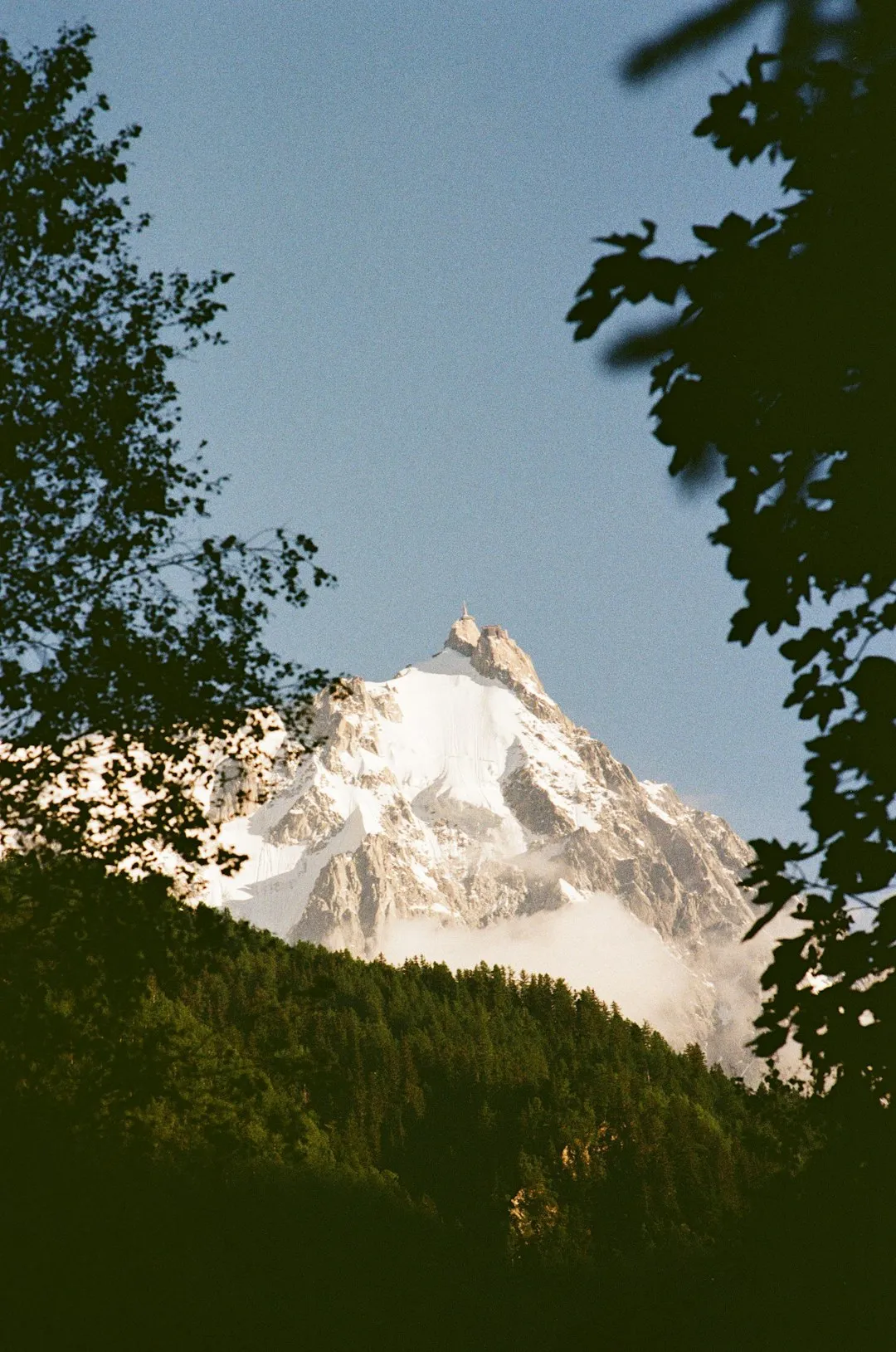
This demanding day hike offers a profound immersion into the high alpine environment of the Southern French Alps. Beginning at the Col de la Cayolle (2,634 metres), a dramatic mountain pass that forms part of the iconic Route des Grandes Alpes, the trail immediately plunges you into a world of stark beauty and rugged terrain. The initial section involves a significant ascent, often on rocky and uneven paths, as you climb towards the higher reaches of the surrounding peaks. This strenuous start is rewarded with increasingly spectacular vistas, encompassing vast mountain ranges, deep valleys, and the occasional glimpse of glacial lakes nestled in cirques.
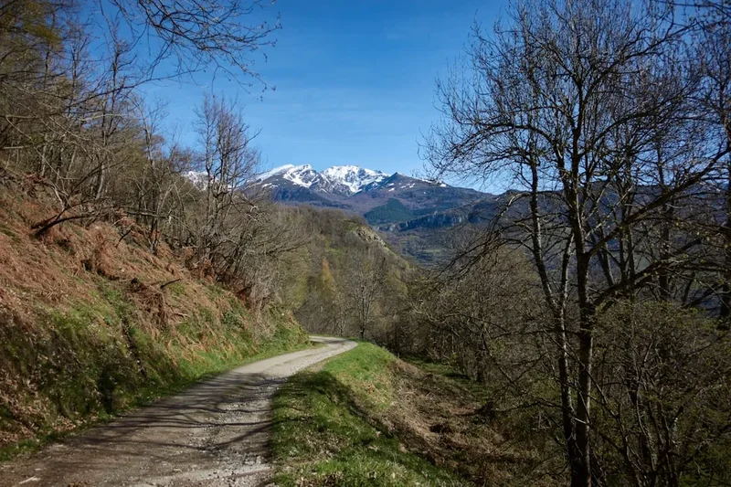
As the trail progresses, it often follows ancient shepherd's paths and military tracks, hinting at the historical significance of this high-altitude region. You'll traverse scree slopes, cross alpine meadows dotted with wildflowers in the summer months, and navigate through areas shaped by glacial activity. The highest points of the hike offer truly awe-inspiring 360-degree views, where the scale of the landscape is almost overwhelming. The descent towards the Bachelard valley is equally engaging, transitioning from exposed alpine ridges to more sheltered slopes, eventually leading you through forests and alongside the Bachelard River.
The Col de la Cayolle to Bachelard walk is a journey that tests physical endurance and navigational skills, but the payoff is immense. It’s an opportunity to experience the raw, untamed beauty of the Alps, far from the crowds, and to connect with a landscape that feels both ancient and alive. The changing scenery, from barren rock and scree to vibrant meadows and dense forests, ensures that every kilometre offers a new perspective and a fresh challenge.
History and Cultural Context
The region surrounding the Col de la Cayolle and the Bachelard valley has a rich history intertwined with pastoralism, military strategy, and early tourism. For centuries, these high mountain pastures have been used by shepherds to graze their flocks during the summer months. The trails that crisscross the area were often established by these shepherds, connecting grazing lands and providing access to water sources. The presence of old stone shelters and remnants of shepherd's huts in some areas serves as a testament to this long-standing tradition.
The Col de la Cayolle itself has historically been a strategic mountain pass, facilitating movement between the Ubaye Valley (where Barcelonnette is located) and the Champsaur region. During periods of conflict, such passes were vital for military movements and communication. The construction of the Route des Grandes Alpes in the early 20th century, which includes the road over the Col de la Cayolle, transformed the pass into a popular scenic route for motorists, bringing a new wave of visitors to the area and contributing to the development of local tourism infrastructure.
The Bachelard valley, while perhaps less historically prominent than the pass itself, has also been shaped by human activity, primarily through agriculture and forestry. The river that gives the valley its name has been a vital resource for the communities living there, providing water for irrigation and power. The trails you walk today often follow routes that have been used for generations, connecting communities and providing access to the natural resources of the mountains. The area's transition from a purely functional landscape to one appreciated for its natural beauty and recreational potential reflects broader trends in alpine tourism over the last century.
Seasonal Highlights and Weather Reality
The optimal season for hiking the Col de la Cayolle to Bachelard trail is from June to October. During these months, the snow typically recedes from the higher passes, making the route accessible and safer for hikers.
Spring (June): Early June can still see significant snow cover at higher elevations, particularly on north-facing slopes. While the lower sections may be clear, the pass itself might be impassable or require snow gear and advanced navigation skills. Wildflowers begin to bloom, adding vibrant colours to the alpine meadows. The weather can be unpredictable, with a risk of late snowfalls and thunderstorms.
Summer (July-August): This is the peak season for hiking. The weather is generally more stable, though thunderstorms are still a common occurrence, especially in the afternoons. The alpine meadows are at their most spectacular, bursting with a diverse array of wildflowers. The days are long, allowing ample time for hiking and enjoying the views. This is also the busiest period, so expect to encounter other hikers, particularly on weekends and holidays.
Autumn (September-October): September often offers crisp, clear days with excellent visibility and fewer crowds. The larch trees begin to turn golden, creating a stunning contrast with the evergreen pines and the rocky mountain landscape. The air is fresh, and the risk of afternoon thunderstorms decreases. By late October, snow can begin to fall again at higher altitudes, potentially making the trail impassable. It is crucial to check weather forecasts and trail conditions before heading out during this period.
Weather Considerations: Alpine weather is notoriously changeable. Even in summer, conditions can shift rapidly from sunshine to heavy rain, fog, or even snow. Temperatures can drop significantly with altitude and wind chill. It is essential to be prepared for all types of weather, regardless of the season.
Recommended Itinerary
Col de la Cayolle to Bachelard Day Hike
Start: Col de la Cayolle (2,634 m)
- Early Morning (approx. 8:00 AM): Arrive at the Col de la Cayolle. Park your vehicle. Ensure you have all your gear, water, and food. Take a moment to acclimatise to the altitude and admire the initial panoramic views. The air will be crisp and cool.
- Morning (approx. 8:30 AM - 12:00 PM): Begin the hike. The initial section involves a steady climb from the col, often on a well-trodden but sometimes rocky path. You will ascend through alpine meadows and potentially cross scree fields. The gradient is significant, so maintain a steady pace. Keep an eye out for marmots and chamois.
- Midday (approx. 12:00 PM - 1:00 PM): Reach a high point or a suitable plateau for a lunch break. This is an excellent opportunity to enjoy the expansive mountain vistas. You might be near a small glacial lake or a saddle offering commanding views of both the Ubaye and Bachelard valleys.
- Afternoon (approx. 1:00 PM - 4:00 PM): Commence the descent towards the Bachelard valley. The terrain will likely change, becoming less exposed and potentially leading through patches of forest. The path may be steeper in sections, requiring careful footing. You will start to hear the sound of the Bachelard River as you get closer to the valley floor.
- Late Afternoon (approx. 4:00 PM - 5:00 PM): Arrive in the Bachelard valley. The trail will likely end near a road or a small hamlet within the valley, where you can arrange for pick-up or connect with onward transport.
Key Waypoints and Features:
- Col de la Cayolle: Starting point, high mountain pass.
- Alpine meadows: Abundant wildflowers in summer, potential wildlife sightings.
- Scree slopes: Require careful footing and good balance.
- High viewpoints: Offering panoramic views of surrounding mountain ranges.
- Glacial lakes (potential): Small, pristine bodies of water in cirques.
- Forest sections: Transitioning from open alpine to more sheltered woodland.
- Bachelard River: The river guiding you into the valley.
- End point: Near a road or hamlet in the Bachelard valley.
Important Notes:
- This is a one-way hike; ensure you have arranged transportation from the Bachelard valley back to your starting point or accommodation.
- Carry sufficient water and food, as there are no facilities along the route.
- Be prepared for rapidly changing weather conditions.
- Wear sturdy hiking boots with good ankle support.
- Inform someone of your hiking plans and expected return time.
Planning and Bookings
Book Your Trip
Everything you need to plan your journey
Accommodation
Find places to stay near Barcelonnette
Flights
Search flights to Barcelonnette
Essential Preparation
The Col de la Cayolle to Bachelard hike is a significant undertaking that requires careful planning. Given its remote alpine location, logistical arrangements are paramount. The closest major town is Barcelonnette, which serves as the primary hub for accessing the Col de la Cayolle via the D902 road. This road is paved but can be narrow and winding, especially as it ascends to the col. Allow ample driving time from Nice Airport (NCE), which is approximately a 3-4 hour drive, depending on traffic and road conditions.
Fitness Requirements: This hike is rated as moderate to challenging due to the significant elevation gain (750 metres) and the distance (15.5 km). Hikers should have a good level of cardiovascular fitness and be accustomed to walking for 6-7 hours with varied terrain. Experience with mountain hiking, including navigating rocky paths and scree, is highly recommended. Acclimatisation to altitude is also important, especially if arriving from sea level.
Logistics: The most critical logistical consideration is transportation. As this is a one-way hike, you will need to arrange for a vehicle to be waiting at the end point in the Bachelard valley, or have a taxi or shuttle service booked in advance. Public transport options are extremely limited in this region. Consider hiring a car in Nice or Barcelonnette for maximum flexibility. If you are not driving yourself, pre-booking a taxi or shuttle service from Barcelonnette to the Col de la Cayolle and arranging for a pick-up in the Bachelard valley is essential.
Base Town: Barcelonnette is the ideal base town. It offers a range of accommodation options, from budget-friendly hotels and guesthouses to more comfortable inns. You will also find supermarkets for stocking up on supplies, outdoor gear shops, restaurants, and tourist information centres. Spending a night or two in Barcelonnette before and after your hike can help with acclimatisation and provide a comfortable base for your alpine adventure.
Trail Accommodation
This is a day hike requiring no overnight accommodation. Hikers will start at the Col de la Cayolle and finish in the Bachelard valley, completing the route within a single day.
Required Gear
- Sturdy Hiking Boots: Waterproof, with good ankle support and a well-worn sole for grip on varied terrain (rock, scree, soil).
- Waterproof Jacket and Trousers: Essential for protection against sudden rain, wind, and cold. Look for breathable, waterproof materials.
- Warm Layers: Including a fleece or insulated jacket, and a base layer made of merino wool or synthetic material. Temperatures can drop significantly at altitude, even in summer.
- Hat and Gloves: A warm hat (beanie) and gloves are crucial for protection against wind chill and cold.
- Navigation Tools: A detailed topographic map of the area, a compass, and a GPS device or smartphone with offline maps downloaded. Familiarity with using these tools is vital.
- First-Aid Kit: Comprehensive kit including blister treatment, bandages, antiseptic wipes, pain relievers, and any personal medications.
- Sun Protection: High SPF sunscreen, sunglasses, and a wide-brimmed hat or cap. The sun's intensity is amplified at higher altitudes.
- Head Torch: With spare batteries, in case of unexpected delays or an early start/late finish.
- Trekking Poles: Highly recommended for stability on ascents and descents, and to reduce strain on knees.
What to Bring
- Sufficient Water: Carry at least 2-3 litres of water per person. There are no reliable water sources on the upper sections of the trail, and any water found should be treated.
- Water Treatment: A water filter or purification tablets are advisable if you plan to refill from streams lower down the valley.
- High-Energy Food: Pack plenty of snacks and a substantial lunch. Options include energy bars, nuts, dried fruit, sandwiches, and trail mix.
- Toiletries: Biodegradable soap, toothbrush, toothpaste, and hand sanitiser. Pack out all used toilet paper.
- Emergency Shelter: A lightweight emergency bivvy bag or space blanket can be a lifesaver in an unexpected situation.
- Mobile Phone: Fully charged, though signal coverage is likely to be intermittent or non-existent in many parts of the trail. Consider a portable power bank.
- Small Backpack: A comfortable daypack (25-35 litres) to carry all your essentials.
- Camera: To capture the stunning scenery.
- Cash: For any small purchases in Barcelonnette or for potential taxi fares.
Permits
No specific permits are required to hike the Col de la Cayolle to Bachelard trail. The route traverses public land and national park areas where day hiking is permitted without the need for special authorisation. However, it is always advisable to check for any local regulations or temporary restrictions that may be in place, especially during periods of high fire risk or for specific conservation efforts.
While no permits are needed for the hike itself, it is crucial to be aware of the regulations concerning camping. Overnight camping is generally not permitted along the trail or in the immediate vicinity of the Col de la Cayolle or within the Bachelard valley, as this is a day hike. If you intend to undertake multi-day treks in the wider Mercantour National Park, specific camping rules and designated areas will apply, and these should be researched separately.
Important Considerations:
- Respect for the Environment: Although no permits are required, hikers are expected to adhere to Leave No Trace principles and respect the natural environment.
- Access Roads: The roads leading to the Col de la Cayolle (D902) and within the Bachelard valley are public roads. During peak season, parking at the Col de la Cayolle can become busy, so arriving early is recommended.
- National Park Regulations: The trail may pass through or near the boundaries of the Mercantour National Park. Familiarise yourself with the park's general rules regarding waste disposal, fire safety, and wildlife interaction.
Other Activities in the Area
The region around Barcelonnette and the Ubaye Valley offers a wealth of activities for outdoor enthusiasts:
- Driving the Route des Grandes Alpes: The Col de la Cayolle is part of this legendary scenic drive. Continue your journey to explore other high passes like the Col d'Allos and Col de Vars, enjoying spectacular mountain scenery and charming alpine villages.
- Hiking in the Mercantour National Park: The area is a hiker's paradise with numerous trails ranging from easy valley walks to challenging multi-day treks. Explore other routes within the park, such as those leading to Lac d'Allos (Europe's largest natural high-altitude lake) or the trails around the Vallée de la Vésubie.
- Cycling: The mountain passes are a popular challenge for road cyclists. The D902 road offers demanding climbs and exhilarating descents. Mountain biking trails are also available in the surrounding forests and valleys.
- Water Sports: The Ubaye River and its tributaries offer opportunities for white-water rafting, kayaking, and canyoning, particularly in the spring and early summer when water levels are high.
- Paragliding and Hang Gliding: The thermal conditions in the Ubaye Valley are excellent for paragliding, with several schools offering tandem flights and courses.
- Visiting Barcelonnette: Explore the unique town of Barcelonnette, known for its distinctive architecture influenced by Mexican émigrés who made their fortunes in the early 20th century. Visit the museum dedicated to this fascinating history.
- Skiing and Snowboarding: During the winter months, the nearby ski resorts of Pra-Loup and Sauze-Super Sauze offer excellent opportunities for winter sports.
Safety and Conditions
Pre-Hike Checks:
- Weather Forecast: Always check the most up-to-date mountain weather forecast for the Col de la Cayolle and surrounding areas before you set out. Websites like Météo-France provide detailed regional forecasts. Be prepared for rapid changes.
- Trail Conditions: Inquire locally in Barcelonnette or at tourist information centres about current trail conditions, especially early or late in the season when snow might still be present.
- Road Conditions: Verify the status of the D902 road to the Col de la Cayolle, particularly outside of the main summer season, as it can be subject to closures due to snow or maintenance.
On the Trail:
- Altitude: The hike reaches significant altitudes (over 2,600 metres). Be aware of the symptoms of altitude sickness, such as headache, nausea, and dizziness. Ascend gradually and stay hydrated.
- Navigation: While the main trail is generally well-marked, it can be faint in places, especially on scree slopes or in poor visibility. Always carry and know how to use your map and compass. Do not rely solely on mobile phone GPS, as signal can be unreliable.
- Weather Changes: Alpine weather can change dramatically and without warning. Be prepared for sudden drops in temperature, strong winds, heavy rain, fog, and even snow, regardless of the season. Hypothermia is a risk.
- Terrain: The trail involves steep ascents and descents, rocky sections, and scree. Wear appropriate footwear and use trekking poles for stability. Take your time and watch your footing.
- Water: Carry sufficient water. While streams may be present lower down, water sources at higher altitudes can be scarce or unreliable. Treat any water collected from natural sources.
- Wildlife: You may encounter wildlife such as marmots, chamois, and various bird species. Observe them from a distance and do not feed them. Be aware of potential encounters with vipers, though they are generally shy.
- Communication: Mobile phone coverage is likely to be very limited or non-existent for much of the hike. Consider carrying a personal locator beacon (PLB) or satellite messenger for emergencies.
- Emergency Contact: Inform a reliable person of your hiking plans, including your intended route, start time, and expected finish time. Provide them with contact details for local emergency services. The emergency number in France is 112.
Side Trips and Points of Interest
Lac d'Allos (Detour): While not directly on the Col de la Cayolle to Bachelard route, the Lac d'Allos is a significant natural landmark in the broader Mercantour National Park and can be accessed via a separate hike from the village of Allos or via a longer route from the Col d'Allos. It is the largest natural high-altitude lake in France, situated at 2,200 metres. Its pristine waters and surrounding alpine scenery make it a popular destination for hikers seeking a different perspective on the region's natural beauty.
Remnants of Military Structures: Along the higher sections of the trail, particularly near the Col de la Cayolle, you may encounter remnants of old military fortifications or observation posts. These structures, often built from stone, speak to the historical strategic importance of this mountain pass and offer a glimpse into past conflicts and border defence.
Alpine Flora and Fauna: The trail passes through diverse ecological zones, offering opportunities to observe a rich variety of alpine plant life and wildlife. In the summer months, the meadows are carpeted with wildflowers such as gentians, edelweiss (though rare), alpine roses, and various species of orchids. Keep an eye out for marmots whistling their alarm calls, chamois grazing on steep slopes, and a variety of birds, including eagles and vultures soaring overhead.
Panoramic Viewpoints: The entire hike is punctuated by numerous viewpoints offering breathtaking panoramas. As you ascend from the Col de la Cayolle, the views open up to reveal the vastness of the Southern Alps. The highest points of the trail provide truly spectacular 360-degree vistas, allowing you to survey distant peaks, deep valleys, and the winding roads that snake through the landscape. These viewpoints are ideal for photography and for appreciating the sheer scale of the alpine environment.
Leave No Trace
The Col de la Cayolle to Bachelard trail traverses a sensitive alpine environment. Adhering to Leave No Trace principles is crucial to preserve its natural beauty and ecological integrity for future generations. As you hike, remember that you are a visitor in a wild and fragile ecosystem.
Your responsibility as a hiker:
- Plan Ahead and Prepare: Understand the trail, weather conditions, and any regulations before you go. Pack appropriately for the conditions and carry sufficient supplies.
- Travel and Camp on Durable Surfaces: Stick to the marked trail at all times. Avoid cutting switchbacks, as this causes erosion. If you need to rest or take a break, do so on established paths or rocky areas.
- Dispose of Waste Properly: Pack out everything you pack in. This includes all food scraps, wrappers, and any other litter. Use designated toilets where available, or if not, dig a cathole at least 60 metres away from water sources, trails, and campsites, and bury human waste. Pack out used toilet paper.
- Leave What You Find: Do not pick wildflowers, disturb wildlife, or remove natural objects such as rocks or plants. Let others enjoy the natural beauty as you found it.
- Minimise Campfire Impacts: Campfires are generally not permitted on this day hike. If you are undertaking longer treks in the area and choose to use a stove, ensure it is used responsibly and away from flammable materials.
- Respect Wildlife: Observe wildlife from a distance. Never feed animals, as this can disrupt their natural behaviours and diets, and can be harmful to their health.
- Be Considerate of Other Visitors: Keep noise levels down, yield to other hikers, and be courteous. The goal is to enjoy the wilderness and allow others to do the same.
By following these principles, you help ensure that the stunning alpine landscapes of the Col de la Cayolle and Bachelard valley remain pristine and enjoyable for all.