Col d'Aubisque Loop - Pyrenean Peaks and Pastoral Charm
The Col d'Aubisque Loop is a captivating multi-day walk nestled in the heart of the French Pyrenees, offering a rich tapestry of dramatic mountain scenery, traditional Basque culture, and challenging yet rewarding terrain. This circular route, primarily traversing the Ossau Valley and the iconic Col d'Aubisque, provides a quintessential Pyrenean experience. Hikers will traverse high mountain pastures dotted with grazing sheep and cattle, ascend to windswept passes offering panoramic vistas, and descend into verdant valleys dotted with charming villages. The loop is renowned for its accessibility to stunning alpine environments without requiring extreme mountaineering skills, making it a popular choice for those seeking a substantial mountain adventure with a touch of local flavour.
- Distance: 70.0 km
- Elevation Gain: 1500 m
- Duration: 4-5 days (flexible)
- Season: June to September
- Difficulty: Moderate
- Base Town: Laruns
- Trailhead Access: Laruns is the primary access point. Nearest major airport is Pau Pyrénées Airport (PUF). From Pau, take the D934 towards Laruns. The Col d'Aubisque itself is accessible by road, with parking available at the summit and in Laruns.
Overview
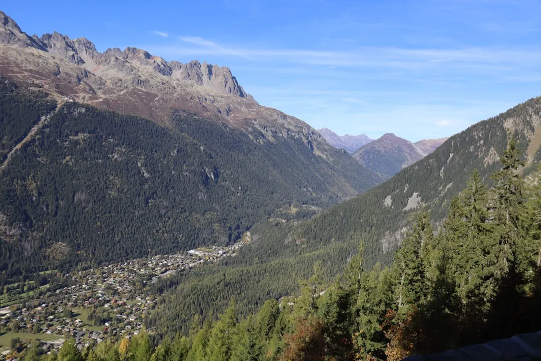
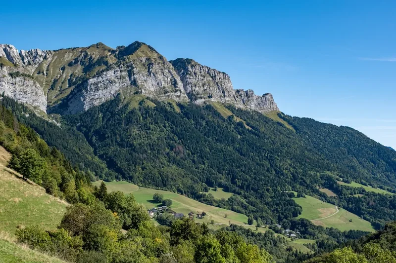
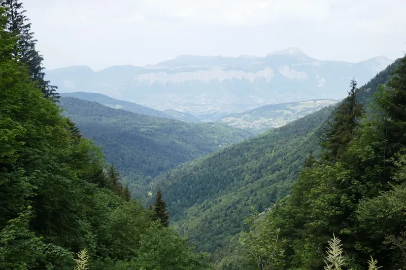
The Col d'Aubisque Loop is a journey through a landscape that has been shaped by both nature and centuries of human interaction. The route offers a compelling blend of high-altitude exposure and gentle valley walking. Expect to encounter vast, open mountain pastures, often referred to as "estives," where livestock graze freely during the summer months. These high meadows are a defining feature, providing a sense of wildness and a connection to the pastoral traditions of the Pyrenees.
The Col d'Aubisque itself is a famous cycling climb, and walking over it offers a different perspective. The views from the col are expansive, stretching across the surrounding peaks and valleys. The route often follows well-maintained GR (Grande Randonnée) paths, interspersed with more rugged sections that require careful navigation. The elevation gain, while not extreme, is spread across several days, making it a manageable challenge for fit hikers. The descent into the Ossau Valley reveals a different character of the Pyrenees, with more sheltered forests, rushing rivers, and picturesque villages that offer a glimpse into the Basque and Béarnaise cultures.
The loop is designed to be flexible, allowing for variations in daily mileage and overnight stops. This adaptability is a key feature, enabling hikers to tailor the experience to their fitness levels and preferences. The presence of mountain refuges and gîtes d'étape (hiker's hostels) along the route provides comfortable resting points, though wild camping is also an option in designated areas, offering a more immersive wilderness experience.
History and Cultural Context
The Pyrenees, and specifically the Ossau Valley, have a long and rich history of human settlement and transhumance—the seasonal movement of livestock between summer pastures in the mountains and wintering grounds in the lowlands. For centuries, shepherds have guided their flocks to the high "estives" of the Col d'Aubisque and surrounding plateaus, a practice that continues to this day and shapes the landscape you will traverse. The stone shelters and shepherd's huts found in these high pastures are testaments to this enduring tradition.
The Col d'Aubisque itself gained significant fame through cycling, particularly its inclusion in the Tour de France. Its challenging gradients and dramatic setting have made it a legendary ascent for professional cyclists and amateur enthusiasts alike. The presence of the "Fontaine de Jouvence" (Fountain of Youth) at the col, a natural spring that has been a site of pilgrimage and local legend for generations, adds a layer of mystique to the area.
The villages along the route, such as Laruns, are steeped in Béarnaise and Basque culture. These communities have historically relied on agriculture, pastoralism, and, more recently, tourism. The architecture, local cuisine, and traditions reflect a unique blend of influences from both the French and Spanish sides of the Pyrenees. The GR (Grande Randonnée) network, which forms a significant part of this loop, is a testament to the French tradition of marking and maintaining long-distance hiking trails, making them accessible to a wide range of walkers.
Seasonal Highlights and Weather Reality
The prime season for hiking the Col d'Aubisque Loop is from June to September. During these months, the weather is generally most favourable, with longer daylight hours and a higher probability of clear skies.
June: The mountains begin to awaken. Wildflowers are abundant in the lower and mid-altitudes, creating a vibrant carpet of colour. Snow may still linger at higher elevations, particularly on north-facing slopes, potentially requiring careful route selection or early season adjustments. Days are long, offering ample time for hiking.
July and August: These are the warmest months, ideal for high-altitude trekking. The "estives" are fully active with grazing livestock, and the mountain refuges are typically open. This is also the busiest period, so booking accommodation in advance is highly recommended. Expect warm days, but be prepared for sudden thunderstorms, which are common in the Pyrenees during summer afternoons. Temperatures can still drop significantly at night, especially at higher elevations.
September: The autumn colours begin to emerge, offering a different kind of beauty to the landscape. The crowds thin out, and the weather can be very pleasant, with crisp air and clear skies. However, the days are shorter, and the possibility of early snow increases towards the end of the month. Some mountain refuges may begin to close towards the end of September.
Weather Considerations: The Pyrenees are known for their rapidly changing weather. Even in summer, conditions can shift from warm sunshine to heavy rain, fog, and strong winds within a matter of hours. It is crucial to be prepared for all eventualities, regardless of the season. Hypothermia is a risk, even in summer, at higher altitudes.
Recommended Itinerary
4-Day Col d'Aubisque Loop Itinerary (Moderate Pace)
Day 1: Laruns to Refuge de la Pène de Blachère (or nearby gîte)
- Distance: 15 km
- Elevation gain: 800 m
- Time: 5-6 hours
- Start in Laruns, following signs for GR10 towards the mountains
- Ascend through forests and then open pastures
- Pass through traditional shepherd's hamlets
- Reach the high plateau and the vicinity of Refuge de la Pène de Blachère
- Enjoy expansive views back towards the Ossau Valley
Day 2: Refuge de la Pène de Blachère to Col d'Aubisque
- Distance: 12 km
- Elevation gain: 400 m
- Time: 4-5 hours
- Continue traversing high mountain pastures
- Reach the iconic Col d'Aubisque
- Explore the summit area, visit the "Fontaine de Jouvence"
- Option to stay at a gîte or hotel at the col, or descend slightly to a more basic refuge
- Enjoy panoramic views across the Pyrenean range
Day 3: Col d'Aubisque to Refuge de Labérouat (or nearby)
- Distance: 18 km
- Elevation gain: 300 m (with some descents)
- Time: 6-7 hours
- Descend from the Col d'Aubisque into a different valley system
- Follow trails through varied terrain, including forests and open slopes
- Pass through smaller hamlets and potentially encounter more livestock
- Aim for Refuge de Labérouat or a similar accommodation option in the vicinity
- This day offers a change of scenery as you move away from the immediate col area
Day 4: Refuge de Labérouat to Laruns
- Distance: 25 km
- Elevation loss: 1000 m
- Time: 7-8 hours
- A longer day, primarily descending back towards the Ossau Valley
- Follow well-marked trails, often following river valleys
- Pass through more populated areas and traditional villages
- Re-enter Laruns, completing the loop
- This day requires good stamina for the sustained descent
Notes:
- This itinerary is a suggestion; daily distances and overnight stops can be adjusted.
- Accommodation options include mountain refuges (often basic, shared dormitories, sometimes with meals available) and gîtes d'étape (more comfortable, often with private rooms and meals). Booking is essential, especially during peak season.
- Wild camping is possible in some areas, but always check local regulations and practice Leave No Trace principles.
- Water sources are generally plentiful, but treatment is recommended.
- The GR10 path is well-marked with red and white blazes.
Planning and Bookings
Book Your Trip
Everything you need to plan your journey
Accommodation
Find places to stay near Pau
Flights
Search flights to Pau
Essential Preparation
The Col d'Aubisque Loop is a moderate multi-day hike that requires good physical fitness and preparation. Before embarking, ensure you have a solid understanding of the route, weather conditions, and available accommodation. The nearest major city with an airport is Pau. From Pau, you can take a bus or hire a car to reach Laruns, the primary gateway town for this loop. Laruns offers a range of amenities, including accommodation, restaurants, and outdoor gear shops. It's advisable to spend at least one night in Laruns before starting your hike to finalise preparations and acclimatise.
Logistics involve planning your daily stages, booking accommodation in advance (especially during July and August), and arranging transport to and from Laruns. Consider the time of year carefully, as snow can persist at higher elevations well into June, and early snow can occur in September.
Trail Accommodation
Accommodation along the Col d'Aubisque Loop varies from basic mountain refuges to more comfortable gîtes d'étape and village hotels. Booking in advance is strongly recommended, particularly during the peak summer months of July and August.
Mountain Refuges (e.g., Refuge de la Pène de Blachère, Refuge de Labérouat):
- Booking Requirements: Essential to book in advance, often via telephone or online booking systems. Some refuges offer half-board (dinner and breakfast).
- Facilities Provided: Dormitory-style bunk beds with mattresses, blankets (sleeping bags are usually required), communal dining areas, and sometimes basic kitchen facilities. Toilets and showers may be available, but can be basic.
- What's NOT Provided: Towels, toiletries, personal cooking equipment (unless specified), electricity for charging devices (limited availability in some).
- Seasonal Availability: Generally open from June to September/October. Some may have shorter seasons or be closed outside peak times.
- Costs: Varies, but expect approximately €30-€50 per night for a dorm bed, with half-board costing extra.
Gîtes d'Étape and Village Hotels (e.g., in Laruns, at Col d'Aubisque):
- Booking Requirements: Recommended to book in advance, especially in popular villages or at the col.
- Facilities Provided: Private rooms or dormitories, often with en-suite bathrooms, communal lounges, and restaurant services offering local cuisine.
- What's NOT Provided: Specific items depend on the establishment; generally more comprehensive than refuges.
- Seasonal Availability: Most are open year-round, but services may be reduced outside the main hiking season.
- Costs: Varies significantly, from €40-€80+ for a room, with meals extra.
Wild Camping: Permitted in some areas, but always check local regulations. If camping, ensure you are discreet, leave no trace, and camp away from water sources and marked trails.
Required Gear
- Sturdy hiking boots: Waterproof, with good ankle support and well broken-in.
- Waterproof and windproof jacket: Essential for protection against sudden mountain weather changes.
- Waterproof overtrousers: To complement your jacket.
- Warm layers: Fleece or down jacket, thermal base layers (merino wool or synthetic).
- Hiking trousers: Quick-drying and comfortable.
- Backpack: 40-60 litre capacity, with a rain cover.
- Sleeping bag: A 3-season bag is recommended, as huts are unheated.
- Head torch: With spare batteries, for use in refuges and for early starts/late finishes.
- Navigation tools: Map of the area (e.g., IGN 1:25,000 scale), compass, and a GPS device or smartphone with offline maps.
- First-aid kit: Including blister treatment, pain relievers, antiseptic wipes, bandages, and any personal medications.
- Sun protection: High SPF sunscreen, sunglasses, and a wide-brimmed hat.
- Insect repellent: Especially for lower altitudes and evenings.
What to Bring
- Food: While some refuges offer meals, it's wise to carry high-energy snacks (nuts, dried fruit, energy bars) and potentially lunches for days when you won't have access to food services.
- Water bottles or hydration reservoir: Capacity for at least 2 litres.
- Water purification method: Filter or purification tablets, as stream water should be treated.
- Toiletries: Biodegradable soap, toothbrush, toothpaste, small towel, hand sanitiser.
- Personal items: Camera, phone, power bank, book, trekking poles (optional but recommended for descents).
- Cash: For refuges, small villages, and transport where card payments may not be accepted.
- Duct tape and cordage: For emergency repairs.
- Whistle: For signalling in emergencies.
Permits
The Col d'Aubisque Loop, as a marked hiking trail primarily utilising GR routes and public land, generally does not require specific permits for hiking or wild camping in designated areas. However, it is crucial to be aware of local regulations and any potential restrictions, especially concerning camping.
General Guidelines:
- Hiking: No permit is required to walk the trails.
- Accommodation: For refuges and gîtes d'étape, advance booking is essential, particularly during peak season. These are paid services, not permits.
- Wild Camping: Regulations vary. In many parts of the French Pyrenees, wild camping is tolerated at high altitudes, away from roads and villages, and for a single night. However, it is always best to check with local tourist offices or park authorities (e.g., Parc National des Pyrénées) for specific rules in the areas you plan to traverse. Always practice Leave No Trace principles if camping wild.
- National Parks: While parts of the route may pass through or near the Parc National des Pyrénées, the GR routes themselves are generally accessible. Specific regulations within the park boundaries should be observed if you venture off the main trails.
Recommendation: Before your trip, it is advisable to contact the local tourist office in Laruns or the Parc National des Pyrénées for the most up-to-date information on any specific regulations or recommendations for the areas you intend to hike and camp.
Other Activities in the Area
The Ossau Valley and the surrounding Pyrenean region offer a wealth of activities beyond hiking:
- Cycling: The Col d'Aubisque is a legendary cycling climb. Rent a road bike in Laruns or Pau and tackle the iconic ascent, experiencing the same challenge as Tour de France legends.
- Via Ferrata: Several routes are available in the Ossau Valley, offering a thrilling way to experience the cliffs and rock faces with fixed cables and ladders.
- Canyoning: Guided canyoning trips are popular in the summer months, allowing you to descend through gorges, waterfalls, and natural pools.
- Paragliding: For the adventurous, tandem paragliding flights offer spectacular aerial views of the Pyrenean landscape.
- Exploring Villages: Wander through the charming streets of Laruns, Eaux-Bonnes, and other local villages, sampling regional cuisine and experiencing the unique Béarnaise and Basque culture.
- Thermal Spas: The spa towns of Eaux-Bonnes and Eaux-Chaudes offer opportunities for relaxation and rejuvenation.
- Rock Climbing: Numerous climbing routes are available for all skill levels in the surrounding mountains.
- Fishing: The rivers and lakes in the Ossau Valley are popular for trout fishing.
Safety and Conditions
Weather: The Pyrenean weather can be unpredictable. Be prepared for rapid changes, including sudden thunderstorms, fog, and strong winds, even in summer. Always check the mountain forecast before setting out each day. Temperatures can drop significantly at higher altitudes, and hypothermia is a risk.
Navigation: While the GR routes are generally well-marked, it is essential to carry a map and compass and know how to use them. Visibility can be severely reduced in fog or bad weather, making navigation challenging. Offline maps on a GPS device or smartphone are also highly recommended.
Terrain: The loop involves varied terrain, from well-maintained paths to rocky and uneven sections. Good hiking boots are crucial for ankle support and grip. Be mindful of loose scree and slippery surfaces, especially after rain.
Water: Water sources are generally available along the route, particularly in valleys and near refuges. However, it is always recommended to treat water from natural sources using a filter or purification tablets to avoid waterborne illnesses.
Livestock: You will likely encounter grazing livestock, including cattle and sheep, especially in the high mountain pastures ("estives"). Maintain a safe distance, do not disturb them, and keep dogs under close control if you have one. Rams can be protective of their flocks.
Emergency: In case of an emergency, know how to contact local rescue services. The European emergency number is 112. Carry a fully charged mobile phone, but be aware that mobile signal can be intermittent in mountainous areas. Consider carrying a personal locator beacon (PLB) for remote sections.
Physical Fitness: This is a moderate-difficulty hike with significant elevation changes. Ensure you have adequate fitness and have trained for multi-day trekking with a backpack. Pace yourself and take regular breaks.
Side Trips and Points of Interest
Fontaine de Jouvence (Fountain of Youth): Located at the Col d'Aubisque, this natural spring is a local legend. It's said to have healing properties and has been a site of pilgrimage for centuries. Take a moment to drink from it and soak in the history and mystique of the col.
Shepherd's Huts and Hamlets: As you traverse the "estives," you'll encounter numerous stone shepherd's huts and small hamlets. These offer a glimpse into the traditional pastoral life of the Pyrenees. Many are still used during the summer months.
Panoramic Viewpoints: The Col d'Aubisque itself offers spectacular 360-degree views. Throughout the hike, particularly on the high ridges and passes, you will find numerous viewpoints offering breathtaking vistas of the surrounding Pyrenean peaks, valleys, and the Ossau Valley stretching out below.
Local Villages: Detouring into villages like Laruns, Eaux-Bonnes, or Eaux-Chaudes can be a rewarding experience. These villages offer a chance to sample local cuisine, visit traditional markets, and admire the distinctive Béarnaise and Basque architecture.
Pic du Midi d'Ossau: While not directly on the loop, the majestic Pic du Midi d'Ossau is a prominent landmark visible from many points along the route. For experienced mountaineers, it's a challenging but rewarding climb.
Leave No Trace
The Col d'Aubisque Loop traverses beautiful and sensitive mountain environments. Adhering to Leave No Trace principles is crucial to preserving the natural beauty and ecological integrity of the Pyrenees for future generations.
Plan Ahead and Prepare: Research your route, understand the terrain and weather, and pack appropriately. Know the regulations regarding camping and fires.
Travel and Camp on Durable Surfaces: Stick to marked trails to avoid damaging fragile vegetation. If camping, choose established campsites or durable surfaces like rock or gravel, well away from water sources.
Dispose of Waste Properly: Pack out everything you pack in, including all food scraps, wrappers, and toilet paper. Use designated toilets where available. If wild camping, dig a cathole at least 60 metres from water, trails, and campsites for human waste, and pack out all toilet paper.
Leave What You Find: Do not remove rocks, plants, or any natural or cultural artifacts. Take only photographs and memories.
Minimize Campfire Impacts: Campfires are often prohibited in mountain areas due to fire risk and environmental impact. If permitted and necessary, use established fire rings and keep fires small. Ensure fires are completely extinguished before leaving.
Respect Wildlife: Observe wildlife from a distance. Never feed animals, as it can disrupt their natural behaviours and diets. Store food securely to prevent attracting animals.
Be Considerate of Other Visitors: Keep noise levels down, especially in refuges and natural areas. Yield to other hikers on narrow trails. Respect the local culture and traditions.