Coire Lagan and Sgurr Alasdair - The Cuillin Traverse
The Coire Lagan and Sgurr Alasdair route, often considered the heart of the Cuillin traverse on the Isle of Skye, offers a profoundly challenging and rewarding mountain experience. This is not a casual hike but a serious mountain scramble that demands a high level of fitness, excellent navigation skills, and a head for heights. The route takes you through the dramatic landscapes of Coire Lagan, a vast corrie cradling three stunning lochs, before ascending to the summit of Sgurr Alasdair, the highest peak in the Black Cuillin range. The terrain is rugged, featuring scree slopes, boulder fields, and exposed ridges, with sections requiring hands-on climbing. The views from the summit are unparalleled, offering a breathtaking panorama of Skye and the surrounding islands. This is a true test of mountain endurance and skill, suitable only for experienced hillwalkers and scramblers.
- Distance: 14.0 km
- Elevation Gain: 1100 m
- Duration: 6-7 hours
- Difficulty: Very Challenging
- Best Time: April-October
- Closest City: Portree
- Trailhead Access: Nearest airport: Inverness (INV). Drive to Sligachan Hotel (approx. 3 hours). Limited bus service available. Road conditions generally good. Parking available at Sligachan Hotel. Trailhead near hotel, no permits required. GPS: 57.27253547, -6.24558950
- Coordinates: 57.2173, -6.2233
Overview
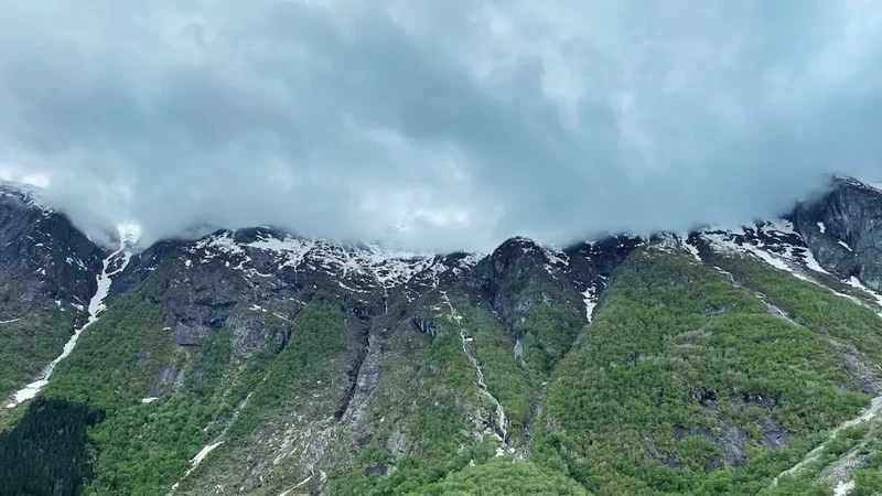
The Coire Lagan and Sgurr Alasdair route is a quintessential Skye mountain adventure, epitomising the raw, untamed beauty of the Black Cuillin. This circuit, typically starting and finishing near the Sligachan Hotel, is a demanding day out that immerses you in some of the most spectacular scenery the UK has to offer. The journey begins with an approach to Coire Lagan, a magnificent glacial corrie that shelters three pristine lochs: Lochan Coire Lagan, Lochan an Easa, and Lochan Dubh. The scale of the corrie, with its towering gabbro cliffs and the imposing presence of Sgurr Alasdair, is awe-inspiring.
The ascent to Sgurr Alasdair is the crux of the route. It involves navigating steep, loose scree slopes and boulder fields, followed by a scramble up the summit ridge. This section requires careful footwork, balance, and the use of hands for stability and ascent. The summit itself, at 992 metres, is a relatively small plateau offering 360-degree views that, on a clear day, stretch across the Inner Hebrides, including the mainland, the Outer Hebrides, and the smaller islands like Rum and Eigg. The descent is equally challenging, often involving a careful descent down the same scree or an alternative route via the Bealach a' Bhasteir, depending on conditions and the walker's preference.
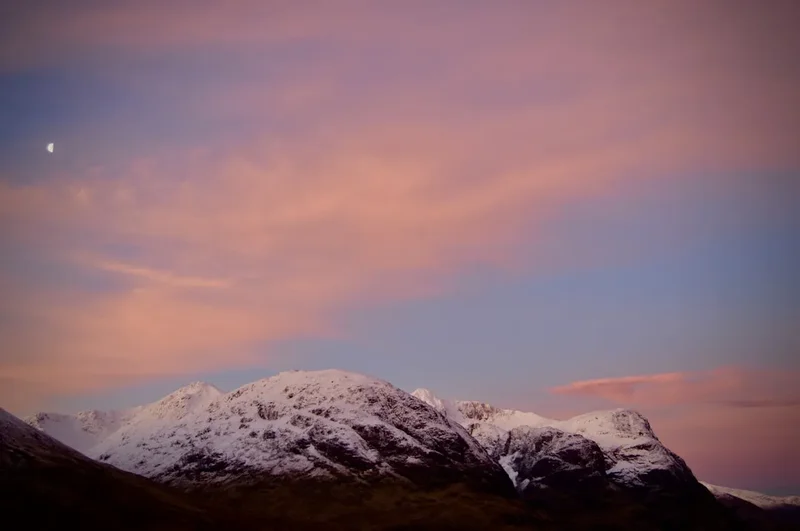
The Cuillin are geologically unique, formed from gabbro and basalt, which gives them their distinctive jagged appearance and challenging terrain. Unlike the softer, rounded mountains of the mainland, the Cuillin are sharp, dramatic, and unforgiving. This route is a true test of a mountain walker's capabilities, rewarding them with an unforgettable experience of wild, rugged beauty. The weather on Skye is notoriously changeable, and conditions can shift from bright sunshine to thick mist and driving rain within minutes, adding an extra layer of challenge and requiring constant vigilance.
History and Cultural Context
The Cuillin mountains have a long and storied history, deeply intertwined with the human settlement and folklore of Skye. For centuries, these formidable peaks have been a natural barrier and a source of awe and respect for the local inhabitants. The name "Cuillin" itself is thought to derive from the Old Norse "Kjölr," meaning "keel," referring to the distinctive shape of the mountain range.
The first recorded ascent of Sgurr Alasdair was made by the Rev. John Macleod in 1873. However, it is likely that local shepherds and hunters had reached the summit long before this, utilising the mountain's resources and navigating its treacherous paths for generations. The name "Sgurr Alasdair" is believed to honour Alexander Nicolson, a local scholar and Gaelic enthusiast who was instrumental in documenting the history and culture of Skye.
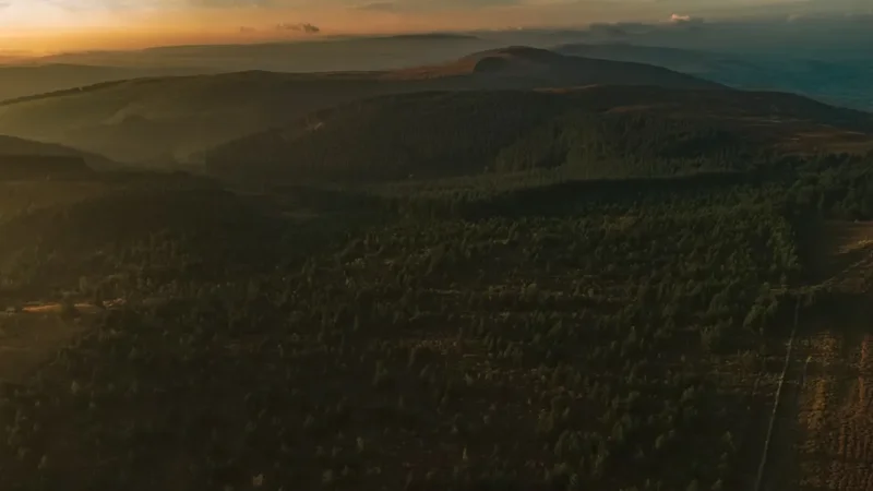
The Sligachan area, near the trailhead, has been a focal point for travellers for centuries. The Sligachan Hotel, a prominent landmark, has hosted climbers and walkers for over a century, becoming a legendary base for exploring the Cuillin. The construction of the road through Glen Sligachan in the 19th century made the mountains more accessible, paving the way for modern mountaineering and hillwalking.
The Cuillin are also steeped in Gaelic mythology and legend. Tales of giants, fairies, and ancient battles are woven into the fabric of the landscape, adding a layer of mystique to the already dramatic scenery. The ruggedness of the terrain has historically made settlement difficult, but the area has always been valued for its sheep grazing and, more recently, its appeal to outdoor enthusiasts.
Seasonal Highlights and Weather Reality
The best time to tackle the Coire Lagan and Sgurr Alasdair route is generally from April to October, when daylight hours are longer and the risk of snow and ice on the higher sections is significantly reduced. However, even during these months, the weather on Skye can be highly unpredictable.
Spring (April-May): The landscape begins to awaken, with wildflowers appearing in the lower glens. Snow may still linger on the higher reaches of the Cuillin, particularly in shaded gullies, making early ascents potentially hazardous without appropriate winter gear and experience. Days are getting longer, offering more time for the challenging route.
Summer (June-August): This is the most popular time for visitors. Daylight hours are at their longest, providing ample time for the ascent and descent. However, summer also brings the highest chance of midges, tiny biting insects that can make exposed areas uncomfortable. The weather can be warm and sunny, but heavy rain showers and thick mist are always a possibility. The scree slopes can be particularly loose and challenging in dry, hot conditions.
Autumn (September-October): The colours of the landscape can be spectacular, with heather and bracken turning shades of gold and russet. The midges are usually less prevalent. However, daylight hours are decreasing, and the weather can become more unsettled, with increased wind and rain. Early snowfalls are possible, especially towards the end of October.
Winter (November-March): This period is strictly for experienced winter mountaineers. The Cuillin are transformed into a serious alpine environment, with snow, ice, and high winds posing significant dangers. The route to Sgurr Alasdair would require ice axe, crampons, and advanced navigation skills. Many sections become impassable or extremely hazardous without winter expertise.
Regardless of the season, always check the mountain forecast and be prepared for rapid changes in weather. The Cuillin are known for their microclimates, and conditions can vary significantly between the coast and the higher peaks.
Recommended Itinerary
Coire Lagan and Sgurr Alasdair Circuit (Day Hike)
Early Morning (Approx. 8:00 AM): Start from Sligachan
- Begin at the Sligachan Hotel car park.
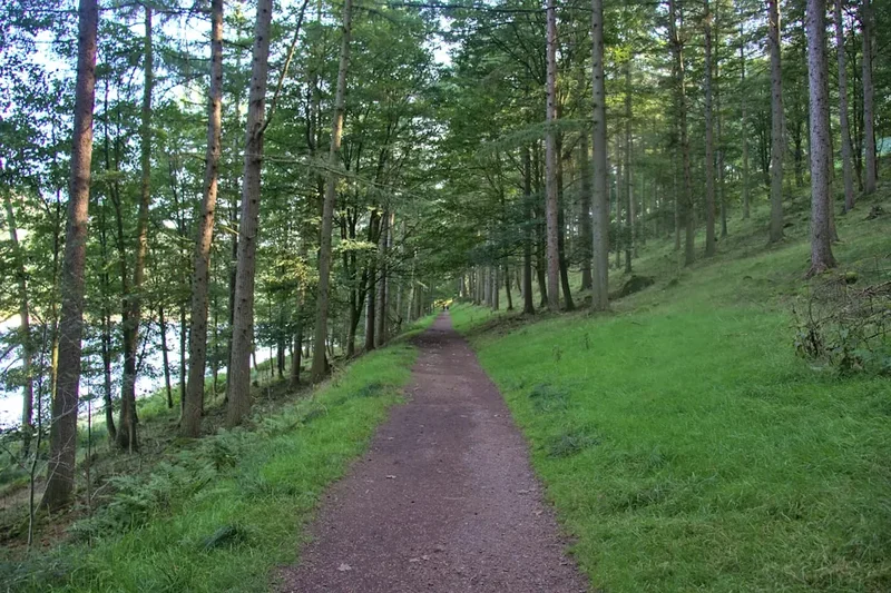
- Follow the path heading south-west towards the Cuillin ridge.
- The initial section is a well-trodden path across moorland, gradually ascending towards the mountains.
- Aim to reach the start of the Coire Lagan approach.
Morning (Approx. 9:00 AM - 11:00 AM): Ascent to Coire Lagan
- The path becomes rougher as you approach Coire Lagan.
- Navigate across boulder fields and potentially boggy sections.
- The dramatic landscape of the corrie begins to unfold, with the imposing peaks of Sgurr Alasdair, Sgurr na Banachdich, and Sgurr Mhic Choinnich dominating the skyline.
- Reach the shores of Lochan Coire Lagan, a stunning loch offering iconic views of the surrounding peaks.
Late Morning (Approx. 11:00 AM - 1:00 PM): Ascent to Sgurr Alasdair Summit
- From Lochan Coire Lagan, the route turns towards the ascent of Sgurr Alasdair.
- The path becomes a steep, loose scree slope. This is a physically demanding section requiring careful footing.
- As you gain altitude, the terrain transitions to larger boulders and requires scrambling.
- Use your hands for balance and to aid your ascent.
- Navigate the final scramble to the summit plateau of Sgurr Alasdair (992 m).
Midday (Approx. 1:00 PM - 2:00 PM): Summit and Lunch Break
- Enjoy the panoramic views from the summit (weather permitting).
- Take a well-deserved break and have lunch.
- Be aware of rapidly changing weather conditions.
Afternoon (Approx. 2:00 PM - 5:00 PM): Descent and Return to Sligachan
- Begin the descent. The scree slope is challenging to descend, requiring careful control of your speed and footing.
- Option 1 (Direct Descent): Descend the same scree path back towards Coire Lagan.
- Option 2 (Via Bealach a' Bhasteir): For a slightly different route, you can descend towards the Bealach a' Bhasteir, a col between Sgurr Alasdair and Sgurr na Banachdich. This involves more scrambling and can be exposed. From the Bealach, descend back towards the Coire Lagan path.
- Rejoin the main path leading back to Sligachan.
- The return journey can feel long after a strenuous ascent and descent.
Late Afternoon (Approx. 5:00 PM - 6:00 PM): Arrival back at Sligachan
- Arrive back at the Sligachan Hotel car park.
- Celebrate your achievement with a well-earned rest and refreshment.
Important Considerations:
- This is a strenuous mountain route requiring excellent fitness and scrambling ability.
- Navigation skills are essential, especially in poor visibility.
- Always check the mountain weather forecast before setting out.
- Carry all necessary safety equipment, including a map, compass, and first-aid kit.
- Wear sturdy, broken-in hiking boots with good ankle support.
- Be prepared for all weather conditions, including rain, wind, and cold, even in summer.
- Sandflies can be a nuisance, particularly in calm, damp conditions.
Planning and Bookings
Book Your Trip
Everything you need to plan your journey
Accommodation
Find places to stay near Isle of Skye
Flights
Search flights to Isle of Skye
Essential Preparation
This route is a serious undertaking and requires thorough preparation. Your fitness level is paramount; you must be comfortable with sustained uphill and downhill walking, often on uneven and steep terrain, for several hours. The ability to scramble and use your hands for balance and ascent is crucial. Familiarise yourself with basic scrambling techniques and ensure you have a good head for heights, as some sections are exposed.
Logistics are straightforward for this day hike. The trailhead is at the Sligachan Hotel, which has ample parking. The nearest major town is Portree, approximately a 30-minute drive away, offering a range of accommodation, shops, and services. Inverness is the nearest airport, about a 3-hour drive from Sligachan. Public transport to Sligachan is limited, so a car is highly recommended for flexibility. Book accommodation in Portree or nearby villages well in advance, especially during peak season.
Trail Accommodation
This is a day hike requiring no overnight accommodation.
Required Gear
- Sturdy Hiking Boots: Waterproof, with good ankle support and a well-worn sole for grip on rock and scree.
- Waterproof Jacket and Trousers: Essential for Skye's unpredictable weather. Ensure they are breathable and have taped seams.
- Warm Layers: Including a fleece or insulated jacket, and a hat and gloves. Even in summer, the summit can be cold and windy.
- Navigation Equipment: A detailed map of the Cuillin (e.g., OS Landranger or Explorer series), a compass, and the knowledge to use them. A GPS device or smartphone with offline maps is a useful backup.
- Head Torch: With spare batteries, in case of unexpected delays or early starts/late finishes.
- First-Aid Kit: Including blister plasters, pain relievers, antiseptic wipes, and any personal medications.
- Sun Protection: Sunscreen, sunglasses, and a sun hat, as the sun can be intense at altitude, even on cloudy days.
- Emergency Shelter: A lightweight emergency bivvy bag or survival blanket.
What to Bring
- Food: High-energy snacks and a packed lunch. Ensure you have enough for the duration of the hike, plus extra in case of delays.
- Water: At least 2 litres per person. Water sources are available in Coire Lagan, but it is advisable to treat or filter water if you plan to refill.
- Sandfly Repellent: Especially important during summer months.
- Mobile Phone: For emergencies, though signal can be intermittent in the mountains. Consider a portable power bank.
- Walking Poles: Optional, but can be helpful for stability on the scree slopes, both uphill and downhill.
- Camera: To capture the spectacular scenery.
- Small Backpack: To carry all your gear comfortably.
Permits
No permits are required for hiking in the Cuillin mountains or accessing the Coire Lagan and Sgurr Alasdair route. The land is largely accessible to the public under the Scottish Outdoor Access Code. However, it is crucial to remember that this is a wild and challenging mountain environment, and responsible access is expected.
While no formal booking or permit is needed, it is highly recommended to inform someone of your plans, including your intended route and estimated return time. This is a standard safety precaution for any serious mountain excursion.
Parking: Parking is available at the Sligachan Hotel. During peak season, this car park can become very busy, so arriving early is advisable.
Access: The route starts directly from the Sligachan area, with no need for boat transfers or special access arrangements. The path is generally clear from the Sligachan Hotel towards Coire Lagan, though it becomes rougher and less defined as you ascend.
Other Activities in the Area
The Isle of Skye offers a wealth of activities for visitors, complementing a challenging mountain day:
- Explore Portree: Visit the colourful harbour, browse local craft shops, and enjoy fresh seafood.
- Visit the Old Man of Storr: A famous rock pinnacle offering iconic views and a rewarding hike.
- Hike to the Quiraing: A dramatic landscape of pinnacles, cliffs, and hidden plateaus.
- Discover the Fairy Pools: Crystal-clear pools and waterfalls in Glen Brittle, popular for wild swimming (for the brave!).
- Visit Dunvegan Castle: The ancestral home of the Clan MacLeod, with beautiful gardens and a rich history.
- Explore Neist Point Lighthouse: Skye's most westerly point, offering dramatic coastal scenery and excellent sunset views.
- Boat trips: Take a wildlife-watching tour from Portree or Elgol to see seals, dolphins, and potentially whales.
- Talisker Distillery: Tour the famous Skye whisky distillery and sample their renowned single malt.
Safety and Conditions
Mountain Weather: The weather in the Cuillin is notoriously fickle. Be prepared for rapid changes, including sudden fog, heavy rain, strong winds, and even snow at higher elevations, regardless of the season. Always check the Met Office mountain forecast for Skye and the Western Highlands before you set out.
Navigation: This route requires good navigation skills. In poor visibility (mist or fog), it is very easy to become disoriented on the scree slopes and boulder fields. A map, compass, and the ability to use them are essential. GPS devices or smartphone apps with downloaded offline maps can be valuable backups.
Terrain: The terrain is challenging and varied, including rough moorland, boggy sections, loose scree, and large boulders. The ascent to Sgurr Alasdair involves significant scrambling, where you will need to use your hands. Be aware of the risk of slips, trips, and falls, especially on descents.
Exposure: The summit of Sgurr Alasdair and some of the ridges are exposed. If you have a fear of heights, this route may not be suitable. Be mindful of wind chill, which can make even mild temperatures feel much colder at altitude.
Sandflies: During warmer, damp conditions, sandflies can be a significant nuisance. They are most active at dawn and dusk and in sheltered, still air. Carry effective insect repellent (containing DEET) and consider wearing long sleeves and trousers.
Emergency: In case of an emergency, dial 999 or 112, ask for Police, then Mountain Rescue. Provide your location as accurately as possible. It is advisable to carry a fully charged mobile phone and a portable power bank. Consider hiring a Personal Locator Beacon (PLB) for remote areas.
Fitness: This is a strenuous route. Ensure you are physically fit enough to undertake a long day in the mountains with significant ascent and descent on difficult terrain.
Side Trips and Points of Interest
Coire Lagan Lochs: The three lochs within Coire Lagan – Lochan Coire Lagan, Lochan an Easa, and Lochan Dubh – are stunning natural features. Lochan Coire Lagan, in particular, offers iconic photographic opportunities with the imposing peaks of the Cuillin reflected in its waters on a calm day. Taking time to appreciate these serene spots is a highlight of the approach.
The Inaccessible Pinnacle (Sgurr Mhic Choinnich): While not part of the direct Sgurr Alasdair route, the neighbouring Sgurr Mhic Choinnich (often referred to as the Inaccessible Pinnacle, though this is technically Sgurr nan Gillean's pinnacle) is a prominent peak in the vicinity. For experienced climbers, it offers a more technical challenge. Its jagged ridges and dramatic appearance contribute to the overall awe-inspiring landscape of the corrie.
Bealach a' Bhasteir: This col, situated between Sgurr Alasdair and Sgurr na Banachdich, offers an alternative descent route. It involves more scrambling and can be more exposed than the direct scree descent. The views from the Bealach are also spectacular, providing a different perspective on the surrounding peaks.
Sgurr na Banachdich: The second highest peak in the Cuillin, Sgurr na Banachdich (973 m), is often visible and accessible from the Coire Lagan area. While not the primary objective of this route, its imposing presence adds to the grandeur of the corrie.
The Sligachan River and Bridge: The historic Sligachan Bridge, a picturesque stone structure, is a landmark at the start and end of the walk. The river itself, flowing from the mountains, adds to the scenic beauty of the Glen Sligachan.
Leave No Trace
The Cuillin mountains are a precious natural environment, and it is vital to minimise your impact. Adhering to Leave No Trace principles ensures that this wild landscape remains pristine for future generations.
Plan Ahead and Prepare: Research your route thoroughly, check weather forecasts, and be prepared for all conditions. Inform someone of your plans.
Travel and Camp on Durable Surfaces: Stick to established paths and trails. Avoid walking on fragile vegetation, especially in Coire Lagan where the ground can be sensitive.
Dispose of Waste Properly: Pack out everything you pack in, including all litter, food scraps, and toilet paper. There are no bins on the mountain. If you need to go to the toilet, dig a small cathole at least 60 metres away from water sources, trails, and campsites, and bury your waste.
Leave What You Find: Do not remove rocks, plants, or any other natural objects. Take only photographs and memories.
Minimise Campfire Impacts: Campfires are not permitted on this route as it is a day hike. If camping elsewhere on Skye, use a lightweight stove and avoid fires.
Respect Wildlife: Observe wildlife from a distance and never feed animals. The Cuillin are home to various bird species and other wildlife; give them space.
Be Considerate of Other Visitors: Keep noise levels down, especially in popular areas. Yield to others on narrow paths. The Cuillin are a place for quiet enjoyment of nature.