
Clouds Rest Trail Description
The Clouds Rest Trail is a challenging and rewarding day hike located in the heart of Yosemite National Park, California, USA. This iconic trail offers unparalleled panoramic views of Yosemite Valley, Half Dome, and the High Sierra. It is renowned for its dramatic granite landscapes, alpine meadows, and the exhilarating final ascent to the summit ridge. The trail is a true test of endurance, demanding significant physical effort but delivering breathtaking vistas that make every step worthwhile. It's a journey into the raw, majestic beauty of Yosemite, culminating in a perspective that few other day hikes can match.
- Distance: 22.5 km (round trip)
- Elevation Gain: 1450 m
- Duration: 5-7 hours (challenging pace)
- Season: July to October (snow-free conditions)
- Difficulty: Challenging
- Trailhead: Tenaya Lake Trailhead (Tioga Road, CA-120)
- Closest City: Yosemite Valley, California
Overview
The Clouds Rest Trail is a quintessential Yosemite experience, offering a spectacular journey from the serene shores of Tenaya Lake to the dizzying heights of its namesake summit. This hike is not for the faint of heart; it involves a substantial elevation gain and a demanding final approach along a narrow, exposed ridge. However, the rewards are immense. As you ascend, the landscape transforms from the subalpine beauty of Tenaya Lake to rugged granite domes and sweeping mountain vistas.
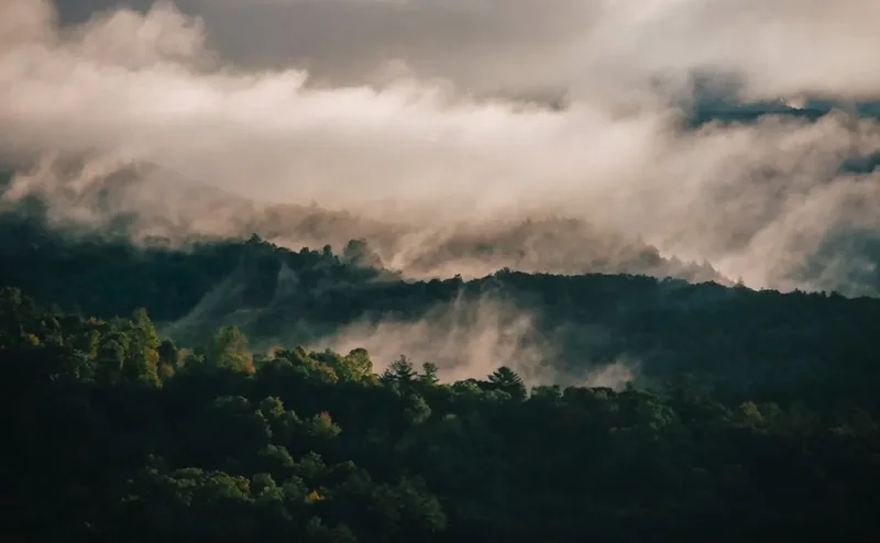
The trail begins with a relatively gentle introduction, winding through forests and alongside Tenaya Creek. As the elevation increases, the terrain becomes steeper and more exposed, offering glimpses of the grandeur that awaits. The final push to the summit is a thrilling scramble along a granite spine, with sheer drop-offs on either side. This section, while exhilarating, requires a good head for heights and careful foot placement. Reaching the summit of Clouds Rest (3,168 m) provides an awe-inspiring 360-degree panorama. You'll see the entirety of Yosemite Valley spread out below, with Half Dome appearing almost at eye level, a truly unique perspective. The vast expanse of the High Sierra stretches out in every direction, a sea of granite peaks and alpine lakes.
This hike is a testament to the raw power and beauty of Yosemite's granite wilderness. It demands respect for the mountain environment, a good level of fitness, and a spirit of adventure. The combination of challenging terrain, stunning scenery, and the sheer scale of the landscape makes Clouds Rest one of the most memorable day hikes in the Sierra Nevada.
History and Cultural Context
The granite monolith known as Clouds Rest has been a significant landmark for millennia. Indigenous peoples, including the Miwok tribes, have inhabited the Yosemite region for thousands of years. They utilized the high country for hunting, gathering, and spiritual practices, traversing routes that would eventually become part of modern hiking trails. The name "Clouds Rest" itself likely reflects the mountain's tendency to be shrouded in mist and clouds, a common occurrence in the Sierra Nevada.
The modern exploration and development of the Yosemite high country began in the mid-19th century with the arrival of European-American settlers and explorers. Figures like John Muir, a passionate advocate for wilderness preservation, were instrumental in popularizing the region and advocating for its protection. Muir himself explored the high country extensively, marveling at the granite formations and the pristine alpine environment. Clouds Rest, with its commanding views, would have undoubtedly captured his attention.
The establishment of Yosemite National Park in 1890 and the subsequent development of roads and trails, including Tioga Road (which provides access to the Tenaya Lake trailhead), opened up the high country to a wider range of visitors. The trail to Clouds Rest, while challenging, became a popular objective for those seeking the ultimate Yosemite vista. The trail's construction and maintenance reflect the ongoing effort to balance public access with the preservation of this fragile alpine ecosystem. Today, Clouds Rest stands as a symbol of Yosemite's wild grandeur, a testament to both its natural history and the human desire to explore and connect with the wilderness.
Seasonal Highlights and Weather Reality
The optimal season for hiking Clouds Rest is from July to October, when the snow has typically melted from the trail and the high country is most accessible. During these months, the weather is generally more stable, though still prone to rapid changes characteristic of alpine environments.
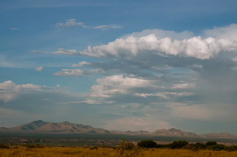
Summer (July to August): This is the peak season for hiking in the Yosemite high country. Days are long, and the weather is often warm and sunny. Wildflowers bloom in the alpine meadows, adding vibrant colour to the landscape. However, summer also brings the highest number of visitors, so expect the trailhead and trail to be busy. Afternoon thunderstorms are common and can develop quickly, bringing lightning and heavy rain. It is crucial to start early to avoid the heat and the risk of afternoon storms.
Autumn (September to October): This is often considered the best time to hike Clouds Rest. The crowds thin out, the air is crisp, and the autumn colours in the forests can be spectacular. The risk of afternoon thunderstorms decreases, and the days are still long enough for a comfortable hike. However, early snowfalls are possible, especially in late October, which can make the trail hazardous or impassable. Always check current conditions before heading out.
Winter and Spring (November to June): Tioga Road, which provides access to the Tenaya Lake trailhead, is typically closed due to snow from November through May or early June. Even when the road is open, snow can linger on the trail well into July, particularly in shaded areas and at higher elevations. Attempting the hike during these months without proper winter mountaineering experience and equipment is extremely dangerous due to avalanche risk, deep snow, and extreme cold.
Weather Considerations: Yosemite's high country weather is notoriously unpredictable. Temperatures can fluctuate significantly, even within a single day. Be prepared for a wide range of conditions, including sun, wind, rain, and even snow, regardless of the season. Always check the forecast before you go and be ready to turn back if conditions deteriorate.
Recommended Itinerary
Clouds Rest Day Hike Itinerary
Early Morning (Approx. 6:00 AM - 7:00 AM): Trailhead Arrival and Preparation
- Arrive at the Tenaya Lake Trailhead (located on Tioga Road, CA-120). Parking can be limited, especially during peak season, so an early start is highly recommended.
- Ensure you have all your gear organised and ready.
- Check the weather forecast one last time.
- Fill water bottles and ensure you have enough for the initial ascent.
Morning (Approx. 7:00 AM - 11:00 AM): Ascent to the Saddle
- Begin the hike from the Tenaya Lake Trailhead (elevation approx. 2,400 m).
- The trail initially follows the western shore of Tenaya Lake before turning east and beginning a steady climb.
- You will traverse through forests of pine and fir, with occasional open granite slabs.
- The trail gains elevation gradually but consistently, offering increasingly expansive views of Tenaya Lake and the surrounding peaks.
- The goal is to reach the saddle between Clouds Rest and the surrounding granite formations. This section involves significant elevation gain.
Midday (Approx. 11:00 AM - 1:00 PM): Summit Ridge Approach and Lunch
- Upon reaching the saddle, the terrain becomes more rugged and exposed.
- You will encounter the start of the narrow granite ridge that leads to the summit.
- Take a break here for lunch and to hydrate. This is a good point to assess your energy levels and the weather.
- The views from the saddle are already spectacular, providing a preview of the summit panorama.
Afternoon (Approx. 1:00 PM - 3:00 PM): Summit Push and Exploration
- The final ascent to the summit of Clouds Rest involves navigating the exposed granite spine.
- This section requires careful foot placement and a good head for heights. The ridge is wide enough in most places, but the drop-offs are significant.
- Take your time and enjoy the exhilarating feeling of walking along the "spine."
- Reach the summit of Clouds Rest (3,168 m). Spend time soaking in the 360-degree views of Yosemite Valley, Half Dome, Tenaya Canyon, and the vast High Sierra.
- Take photos and enjoy the unparalleled perspective.
Late Afternoon (Approx. 3:00 PM - 6:00 PM): Descent and Return to Trailhead
- Begin your descent back along the summit ridge and down to the saddle.
- The descent can be as challenging as the ascent, especially on your knees. Take it slow and steady.
- Continue descending through the forest back towards Tenaya Lake.
- Arrive back at the Tenaya Lake Trailhead, tired but exhilarated.
Important Notes:
- Start as early as possible to avoid crowds and afternoon thunderstorms.
- Carry plenty of water (at least 3-4 litres per person) and high-energy snacks.
- Wear sturdy, broken-in hiking boots with good ankle support.
- Be prepared for rapidly changing weather conditions.
- The summit ridge is exposed; a fear of heights may make this hike unsuitable.
- Check Tioga Road status before your trip, as it is seasonally closed.
Planning and Bookings
Book Your Trip
Everything you need to plan your journey
Accommodation
Find places to stay near Yosemite Valley, California
Flights
Search flights to Yosemite Valley, California
Essential Preparation
The Clouds Rest hike is a significant undertaking that requires careful planning. The primary logistical challenge is accessing the trailhead, as Tioga Road (CA-120) is a seasonal road, typically open from late May or early June through October or November, depending on snow conditions. It's crucial to check the road status with Yosemite National Park before your trip. The nearest major airport is Fresno Yosemite International Airport (FAT), from which you will need to drive approximately 2-3 hours to reach the Tenaya Lake trailhead. Alternatively, if flying into San Francisco (SFO) or Oakland (OAK), the drive is considerably longer, around 4-5 hours.
Yosemite Valley serves as a primary base for exploring the park, offering a wide range of accommodation options from campgrounds to hotels. However, for the Clouds Rest hike, staying closer to the Tioga Road corridor, such as in the Tuolumne Meadows area or even in gateway towns like Lee Vining (on the eastern side of Tioga Pass), can reduce driving time to the trailhead. Ensure you have a valid Yosemite National Park entrance pass. For day hikes, a wilderness permit is not typically required, but always verify current park regulations. If planning an overnight stay in the backcountry, a wilderness permit is mandatory and must be reserved well in advance.
Trail Accommodation
This is a day hike requiring no overnight accommodation.
Required Gear
- Hiking Boots: Sturdy, waterproof hiking boots with good ankle support are essential. Ensure they are well broken-in to prevent blisters.
- Backpack: A comfortable daypack (20-35 litres) to carry essentials.
- Navigation: A detailed map of the area, a compass, and a GPS device or smartphone with offline maps downloaded. While the trail is generally well-marked, it's crucial to be prepared for navigation in case of unexpected conditions.
- Sun Protection: Wide-brimmed hat, sunglasses, and high-SPF sunscreen. The sun at this elevation is intense, and there is little shade on the summit ridge.
- Headlamp/Torch: With extra batteries. Essential for early morning starts or if your hike extends beyond daylight hours.
- First-Aid Kit: Comprehensive kit including blister treatment, pain relievers, bandages, antiseptic wipes, and any personal medications.
- Trekking Poles: Highly recommended for stability on ascents and descents, and to reduce strain on knees.
- Waterproof/Windproof Jacket: Weather can change rapidly in the mountains. A breathable, waterproof jacket is crucial.
- Warm Layers: Even in summer, temperatures can drop significantly at higher elevations and on the exposed summit ridge. Bring a fleece or insulated jacket.
What to Bring
- Water: Carry at least 3-4 litres of water per person. Water sources are scarce and unreliable on the trail, especially during dry periods. Consider a water filter or purification tablets as a backup, but do not rely on finding potable water.
- Food: High-energy snacks and a substantial lunch. Examples include trail mix, energy bars, sandwiches, fruit, and jerky. Pack more food than you think you'll need.
- Toiletries: Hand sanitiser, toilet paper (and a bag to pack it out), and any personal hygiene items.
- Insect Repellent: Mosquitoes and biting flies can be present, especially near Tenaya Lake and in forested areas.
- Camera: To capture the incredible scenery.
- Binoculars: For wildlife viewing and appreciating distant peaks.
- Emergency Shelter: A lightweight emergency bivy or space blanket.
- Identification and Park Pass: Keep your park entrance pass and identification readily accessible.
Permits
For day hikes on the Clouds Rest Trail, a wilderness permit is generally not required. However, Yosemite National Park has implemented a peak-hours reservation system for entry into the park during busy periods. This system requires visitors to obtain a reservation to drive into the park between specific hours, even if they are only planning a day hike. It is essential to check the official Yosemite National Park website (nps.gov/yose) for the most current information regarding entry requirements, reservation systems, and any potential changes to permit policies.
If you plan to undertake an overnight backpacking trip to Clouds Rest or in the surrounding wilderness, a wilderness permit is mandatory. These permits are highly sought after and are typically issued through a lottery system or on a first-come, first-served basis via recreation.gov. Reservations for overnight trips should be made months in advance, especially for popular trailheads like Tenaya Lake.
Key Points for Permits:
- Day Hikes: Generally do not require a specific trail permit, but a park entrance reservation may be necessary during peak season.
- Overnight Hikes: Wilderness permits are mandatory and must be obtained in advance.
- Check NPS Website: Always consult the official Yosemite National Park website for the latest information on entry requirements, permits, and reservation systems.
- Recreation.gov: This is the primary platform for reserving wilderness permits for overnight trips.
Other Activities in the Area
The area surrounding the Clouds Rest Trailhead at Tenaya Lake offers numerous opportunities for exploration and recreation:
- Tenaya Lake: This stunning alpine lake is a popular spot for swimming, picnicking, and photography. Its clear, cool waters are inviting on a warm summer day.
- Tuolumne Meadows: A vast subalpine meadow dotted with granite domes and crisscrossed by the Tuolumne River. It's a hub for hiking, backpacking, and ranger programs.
- Lembert Dome: A prominent granite dome near Tuolumne Meadows offering a shorter, but still rewarding, hike with excellent views.
- Cathedral Lakes: A classic Yosemite high-country hike leading to two beautiful alpine lakes nestled beneath Cathedral Peak.
- Mono Lake: Located just east of Yosemite over Tioga Pass, Mono Lake is a unique saline lake famous for its tufa towers and diverse birdlife.
- Tioga Pass Scenic Drive: The entire stretch of Tioga Road (CA-120) offers breathtaking scenery, with numerous pull-offs and short walks to viewpoints.
- Stargazing: The high country, with its clear skies and minimal light pollution, is an exceptional location for stargazing.
Safety and Conditions
Altitude Sickness: The trailhead is at approximately 2,400 metres, and the summit reaches 3,168 metres. Be aware of the symptoms of altitude sickness, which can include headache, nausea, dizziness, and fatigue. Acclimatise by spending a night at a higher elevation before attempting the hike if possible. Stay hydrated and avoid alcohol and strenuous activity on your first day at altitude.
Weather: Alpine weather is unpredictable. Be prepared for sudden changes, including thunderstorms, high winds, rain, and even snow, especially at higher elevations. Start your hike early in the morning to avoid afternoon storms, which are common in the Sierra Nevada during summer. If you hear thunder or see lightning, descend immediately to a lower elevation and seek shelter away from exposed ridges and tall trees.
Trail Conditions: The trail is generally well-maintained, but sections can be steep, rocky, and exposed. The final ascent to Clouds Rest involves a narrow granite ridge with sheer drop-offs on both sides. This section requires a good head for heights and careful footing. If you are uncomfortable with heights or exposed terrain, this hike may not be suitable.
Water: Water sources are scarce on the trail, particularly during dry periods. Carry sufficient water for the entire hike (at least 3-4 litres per person). Do not rely on finding potable water; if you plan to filter water, carry a reliable filter or purification tablets and know how to use them.
Wildlife: Yosemite is home to black bears, deer, marmots, and various bird species. While encounters are usually harmless, it's important to maintain a safe distance, never feed wildlife, and store food properly if camping. Be aware of your surroundings.
Emergency Preparedness: Carry a fully charged mobile phone, but be aware that reception is unreliable in many parts of the park. Consider carrying a personal locator beacon (PLB) or satellite messenger for emergencies. Inform someone of your hiking plans, including your intended route and expected return time.
Side Trips and Points of Interest
Tenaya Lake: The starting point of the hike, Tenaya Lake is a beautiful alpine lake offering stunning reflections of the surrounding granite peaks. It's a perfect spot for a pre-hike photo opportunity or a post-hike dip.
Clouds Rest Summit Ridge: The final approach to the summit is along a narrow, exposed granite spine. This exhilarating section offers dramatic drop-offs and unparalleled 360-degree views. It's a highlight for many hikers, providing a true sense of adventure.
Panoramic Summit Views: The summit of Clouds Rest (3,168 m) provides one of the most comprehensive and breathtaking views in Yosemite. You'll have an unobstructed vista of Yosemite Valley, Half Dome (appearing almost at eye level), Vernal and Nevada Falls, Tenaya Canyon, and the vast expanse of the High Sierra stretching towards the horizon.
Granite Formations: The entire hike traverses through a landscape dominated by massive granite formations, characteristic of the Sierra Nevada. The trail itself often follows natural granite slabs and features, showcasing the geological artistry of the region.
Alpine Meadows: Depending on the season, you may pass through small alpine meadows dotted with wildflowers, offering a contrast to the rugged granite terrain.
Leave No Trace
The Clouds Rest Trail traverses a sensitive alpine environment within Yosemite National Park. Adhering to Leave No Trace principles is crucial to preserving this pristine wilderness for future generations. As a visitor, you play a vital role in protecting the natural and cultural resources of the park.
Follow these seven principles:
- Plan Ahead and Prepare: Know the regulations, check weather forecasts, and be prepared for varying conditions. Research the trail and trailhead access, especially regarding seasonal road closures and potential entry reservation systems.
- Travel and Camp on Durable Surfaces: Stay on the marked trail at all times. The vegetation in the high country is fragile and slow to recover. Avoid cutting switchbacks, which causes erosion. On the summit ridge, stay within the established path.
- Dispose of Waste Properly: Pack it in, pack it out. This includes all trash, food scraps, and even fruit peels. Use designated restrooms where available, or if not, dig a cathole at least 60 m (60 metres) from water, trails, and campsites. Pack out all toilet paper.
- Leave What You Find: Do not remove or disturb natural objects such as rocks, plants, or cultural artifacts. Take only photographs and leave only footprints.
- Minimize Campfire Impacts: Campfires are generally prohibited in the Yosemite high country. If permitted in specific areas, use established fire rings and keep fires small. Always ensure fires are completely extinguished. (Note: This is a day hike, so campfire impact is less of a concern unless picnicking).
- Respect Wildlife: Observe wildlife from a distance. Never feed animals, as this can harm their health, alter their natural behaviours, and put them in danger. Store food securely if camping overnight.
- Be Considerate of Other Visitors: Respect the experience of others. Yield to uphill hikers, keep noise levels down, and allow others to enjoy the solitude of the wilderness.
By following these principles, you help ensure that the beauty and wildness of Clouds Rest and Yosemite National Park are preserved.
Useful Links
- Yosemite National Park - Clouds Rest Trail
- Yosemite National Park - Tioga Road Status
- Yosemite National Park - Entrance Reservations
- Yosemite National Park - Wilderness Permits
- Yosemite National Park - Weather Information
- Recreation.gov - Wilderness Permit Reservations
- Fresno Yosemite International Airport (FAT)