
Cirque de Troumouse Hike
The Cirque de Troumouse Hike is a spectacular day walk located in the French Pyrenees, offering breathtaking views of a vast glacial cirque, towering peaks, and alpine meadows. This route is renowned for its accessibility to a dramatic high-mountain landscape without requiring technical climbing skills or overnight stays. It provides a profound sense of immersion in the raw beauty of the Pyrenean Alps, making it a popular choice for hikers seeking grand vistas and a challenging yet rewarding day out.
- Distance: 19.3 km one-way
- Elevation Gain: 850 m
- Duration: 6–8 hours
- Difficulty: Moderate
- Best Time: June to October
- Closest City: Gavarnie
- Trailhead Access: Nearest airport: Tarbes-Lourdes-Pyrénées (TLD). Drive from Gavarnie (~20 min) on D921 then D118. Road is paved but narrow. Parking available at the trailhead (fee may apply). No permits required.
- Coordinates: 42.8365, 0.1478
Overview
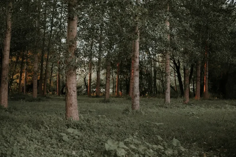
The Cirque de Troumouse is one of the largest glacial cirques in the Pyrenees, a colossal amphitheatre carved by ancient ice, now cradling a vast expanse of alpine terrain. The hike to and around this magnificent natural wonder is a journey through diverse landscapes, starting from the valley floor and ascending steadily towards the dramatic mountain walls. The trail is well-defined for much of its length, though it can be rocky and uneven in places, demanding good footwear and a reasonable level of fitness.
The ascent typically follows a path that gradually gains altitude, offering increasingly expansive views of the surrounding peaks, including the iconic Pic de Troumouse and the imposing Taillon massif. As you climb, the vegetation changes from lush mountain pastures dotted with wildflowers in early summer to more rugged scree slopes and rocky outcrops higher up. The air becomes crisper, and the silence of the high mountains envelops you.
The highlight is undoubtedly reaching the rim of the cirque, where the sheer scale of the geological formation becomes apparent. You are surrounded by a horseshoe of jagged peaks, many exceeding 3,000 metres, their slopes often streaked with snow even in mid-summer. Numerous waterfalls cascade down the sheer rock faces, fed by snowmelt and glacial streams, creating a dynamic and awe-inspiring spectacle. The path may continue to explore the upper reaches of the cirque, offering different perspectives and opportunities for further exploration, before descending back to the starting point.
This hike is a testament to the power of glacial erosion and the enduring beauty of alpine environments. It offers a genuine mountain experience, with the potential for rapidly changing weather conditions, requiring careful preparation and respect for the natural elements. The reward is an unforgettable encounter with one of the Pyrenees' most dramatic natural landmarks.
History and Cultural Context
The Cirque de Troumouse, like its more famous neighbour the Cirque de Gavarnie, is a product of immense geological forces that shaped the Pyrenean mountain range over millions of years. The dramatic U-shaped valley and sheer rock walls are the unmistakable signature of glacial erosion. Ancient glaciers, kilometres thick, once scoured this landscape, carving out the vast amphitheatre that we see today. The process of glaciation left behind a dramatic topography of steep cliffs, hanging valleys, and moraines, all contributing to the cirque's imposing grandeur.
Human history in this region is deeply intertwined with pastoralism and transhumance. For centuries, shepherds have driven their flocks to these high mountain pastures during the summer months to graze. The meadows surrounding the Cirque de Troumouse would have been vital grazing grounds, supporting local communities and economies. Evidence of this long-standing relationship with the land can be seen in the remnants of old shepherd's huts and the well-trodden paths that crisscross the lower slopes.
The exploration and mapping of the Pyrenees by naturalists and geologists in the 18th and 19th centuries brought these spectacular natural formations to wider attention. The sheer scale and dramatic beauty of the cirques, particularly Gavarnie, captured the imagination of travellers and artists, leading to their designation as significant natural heritage sites. While Troumouse might be less frequently visited than Gavarnie, its geological significance and raw beauty are equally profound. The area is part of the Pyrénées-Mont Perdu World Heritage Site, recognised by UNESCO for its outstanding universal value, encompassing both its natural and cultural landscapes, including the unique system of high-altitude pastoralism.
Today, the Cirque de Troumouse is a protected natural area, managed to balance conservation with the increasing popularity of hiking and mountaineering. The trails are maintained to allow access while minimising environmental impact, preserving the pristine character of this remarkable glacial landscape for future generations.
Seasonal Highlights and Weather Reality
The best time to hike the Cirque de Troumouse is generally from June to October, when the snow has largely receded from the main trails, and the weather is typically more stable. However, the Pyrenean climate is notoriously unpredictable, and visitors should always be prepared for a wide range of conditions.
Spring (June): Early June can still see significant snow cover at higher elevations, particularly on north-facing slopes. However, the lower meadows burst into vibrant life with an abundance of wildflowers, creating a colourful spectacle. Waterfalls are at their most powerful due to snowmelt. The weather can be mixed, with sunny days interspersed with rain or even late snow showers.
Summer (July–August): This is the peak season for hiking. The trails are generally clear of snow, and the days are long, offering ample time for exploration. The alpine meadows are at their most lush, and the weather is often warm and sunny. However, summer also brings the highest risk of thunderstorms, which can develop rapidly in the afternoons. It is crucial to start hikes early to avoid the most intense periods of storm activity.
Autumn (September–October): September often brings crisp, clear days with cooler temperatures and fewer crowds. The autumn colours in the lower valleys can be spectacular. The risk of early snow increases as the season progresses, especially in October. The waterfalls may be less powerful than in spring or early summer but the overall atmosphere of the mountains can be serene and dramatic.
Weather Reality: Regardless of the season, mountain weather can change with alarming speed. Temperatures can drop significantly with altitude and with the onset of cloud or rain. Wind can be a major factor, especially at higher elevations and on exposed ridges. It is essential to check the weather forecast immediately before setting out and to be prepared for all eventualities, including rain, wind, and cold, even on a seemingly clear summer day.
Recommended Itinerary
Cirque de Troumouse Day Hike Itinerary
Early Morning (Approx. 8:00 AM): Departure from Gavarnie
- Begin your journey from the village of Gavarnie.
- Drive or take a shuttle towards the Troumouse car park (Parking de Troumouse). The road is paved but can be narrow and winding.
- Allow approximately 20-30 minutes for the drive.
- Pay any applicable parking fees.
Morning (Approx. 8:30 AM - 12:30 PM): Ascent to the Cirque Rim
- Start the hike from the parking area. The initial section is often a relatively gentle path through meadows.
- The trail begins to gain elevation steadily, following the course of a mountain stream.
- You will pass through areas of alpine pasture, potentially encountering grazing livestock.
- The landscape opens up, revealing increasingly dramatic views of the surrounding peaks and the approaching cirque.
- The path can become rocky and steeper as you ascend towards the base of the cirque walls.
- Key Waypoints: Follow the marked trail signs for "Cirque de Troumouse" or "Refuge de la Prade".
- Distance covered: Approximately 7-9 km.
- Elevation gain: Approximately 500-600 m.
Midday (Approx. 12:30 PM - 2:00 PM): Exploration of the Cirque
- Arrive at the main area of the Cirque de Troumouse.
- Take time to absorb the immense scale of the glacial amphitheatre.
- Admire the towering peaks, including Pic de Troumouse (3,081 m) and the Taillon massif.
- Observe the numerous waterfalls cascading down the sheer rock faces.
- Find a suitable spot for a picnic lunch, enjoying the panoramic views.
- Consider a short exploration of the immediate cirque floor or a slight detour along the base of the cliffs.
- Elevation: Approximately 2,100 - 2,200 m.
Afternoon (Approx. 2:00 PM - 5:30 PM): Descent and Return
- Begin the descent back towards the parking area.
- The descent follows a similar route to the ascent, but care must be taken on rocky or steep sections.
- Enjoy the changing perspectives of the landscape as you lose altitude.
- The afternoon light can offer different photographic opportunities.
- Distance covered: Approximately 7-9 km.
- Elevation loss: Approximately 500-600 m.
Late Afternoon (Approx. 5:30 PM onwards): Return to Gavarnie
- Arrive back at the Troumouse car park.
- Drive or take transport back to Gavarnie village.
- Reflect on the day's incredible mountain experience.
Important Notes:
- This is a demanding day hike requiring good physical condition.
- Carry sufficient water or a reliable water filter, as water sources can be scarce at higher elevations.
- Be prepared for rapidly changing weather conditions.
- Wear sturdy hiking boots with good ankle support.
- Inform someone of your hiking plans and expected return time.
- Mobile phone reception can be unreliable in the mountains.
Planning and Bookings
Book Your Trip
Everything you need to plan your journey
Accommodation
Find places to stay near Gavarnie
Flights
Search flights to Gavarnie
Essential Preparation
The Cirque de Troumouse hike is a day walk, meaning no overnight accommodation is required on the trail itself. However, thorough preparation is crucial for a safe and enjoyable experience. The nearest significant town and logistical hub is Gavarnie, which offers a range of accommodation options, from hotels and gîtes to campsites. It's advisable to base yourself in or near Gavarnie for at least one night before and after your hike to allow for travel, acclimatisation, and flexibility in case of weather delays.
Access to the trailhead is via a road from Gavarnie. This road can be narrow and winding, especially as it ascends towards the parking area. During peak season, there may be restrictions on private vehicle access to the upper parking areas, with shuttle services operating from Gavarnie village. It is essential to check local conditions and advisories regarding road access and parking availability before your visit. The parking area itself may have a fee.
Given that this is a high-mountain environment, checking the weather forecast meticulously is paramount. Mountain weather can change rapidly, and conditions can be significantly different from those in the valley. Ensure you have a reliable source for mountain forecasts and be prepared to postpone your hike if conditions are unfavourable.
Trail Accommodation
This is a day hike requiring no overnight accommodation.
Required Gear
- Sturdy Hiking Boots: Waterproof and with good ankle support are essential for navigating rocky and uneven terrain. Ensure they are well broken-in to prevent blisters.
- Waterproof Jacket and Trousers: Even in summer, rain is common in the mountains. A breathable, waterproof outer layer is vital.
- Warm Layers: A fleece or insulated jacket, and thermal base layers are recommended, as temperatures can drop significantly with altitude and wind chill.
- Hat and Gloves: For protection against sun, wind, and cold.
- Sun Protection: High SPF sunscreen, sunglasses, and a wide-brimmed hat are necessary, as the sun's intensity is greater at altitude.
- Backpack: A comfortable daypack (20-30 litres) to carry essentials.
- Navigation Tools: A map of the area, a compass, and a GPS device or smartphone with offline maps are highly recommended. While the main trail is generally well-marked, it's wise to be prepared for navigation challenges.
- First-Aid Kit: Including blister treatment, pain relievers, antiseptic wipes, bandages, and any personal medications.
- Head Torch: With spare batteries, in case of unexpected delays or early starts/late finishes.
What to Bring
- Sufficient Water: Carry at least 2-3 litres of water per person. A water filter or purification tablets are advisable if you plan to refill from streams, but ensure you know how to use them effectively and that the water source is reliable.
- Food: High-energy snacks and a substantial packed lunch are essential. Options include sandwiches, fruit, nuts, energy bars, and chocolate.
- Toiletries: Biodegradable toilet paper, hand sanitiser, and any personal hygiene items. Pack out all waste.
- Emergency Shelter: A lightweight emergency blanket or bivvy bag can be a lifesaver in an unexpected situation.
- Trekking Poles: Highly recommended for stability on ascents and descents, and to reduce strain on knees.
- Camera: To capture the spectacular scenery.
- Mobile Phone: Fully charged, with a power bank if possible, though reception is unreliable.
- Cash: For parking fees, potential shuttle services, or purchases in Gavarnie.
Permits
No specific permits are required to hike the Cirque de Troumouse. The trails are generally open to the public, and access to the national park area is free. However, it is important to be aware of any local regulations or restrictions that may be in place, particularly concerning parking and access roads during peak season.
Parking: The primary access point is the Parking de Troumouse. Fees may apply for parking, especially during the summer months. It is advisable to check the latest information on parking charges and availability before your visit. In some periods, private vehicle access to the upper parking areas might be restricted, with shuttle buses operating from Gavarnie village. This is done to manage traffic flow and environmental impact in the sensitive high-mountain environment.
National Park Regulations: While no specific hiking permits are needed, visitors are expected to adhere to the general rules and guidelines of the Pyrénées National Park. This includes staying on marked trails, not disturbing wildlife, not lighting fires, and packing out all rubbish. Respecting the natural environment is crucial to preserving its beauty and ecological integrity.
Shuttle Services: If private vehicle access is restricted, shuttle services may operate from Gavarnie. These services typically run during the main tourist season and will have their own fare structure. It's wise to inquire about these services in Gavarnie before heading to the trailhead.
Other Activities in the Area
The region surrounding Gavarnie and the Cirque de Troumouse offers a wealth of activities for outdoor enthusiasts and those seeking to experience the Pyrenean culture:
- Cirque de Gavarnie: A UNESCO World Heritage site and arguably the most famous glacial cirque in the Pyrenees. It's a shorter, more accessible walk than Troumouse, leading to the impressive Grande Cascade waterfall.
- Hikes to Lac de Gaube: A beautiful high-altitude lake accessible via a moderate hike or a cable car and a shorter walk from the Pont d'Espagne. Offers stunning views of the Vignemale massif.
- Climbing and Mountaineering: The area is a mecca for climbers, with numerous routes ranging from beginner to expert levels on the surrounding peaks, including the Taillon massif and Vignemale.
- Via Ferrata: Several well-equipped via ferrata routes are available in the vicinity, offering a thrilling way to experience the cliffs and gain elevation with safety cables.
- Cycling: The mountain roads around Gavarnie are popular with road cyclists, offering challenging climbs and spectacular scenery.
- Exploring Gavarnie Village: The charming village itself is worth exploring, with its traditional Pyrenean architecture, local crafts, and restaurants serving regional cuisine.
- Horse Riding: Guided horse riding tours are available, offering a different perspective on the mountain landscapes.
- Winter Sports: In winter, the area transforms into a ski resort, offering opportunities for skiing, snowboarding, and snowshoeing.
Safety and Conditions
Weather Preparedness: The most critical safety aspect for this hike is being prepared for rapidly changing mountain weather. Always check the forecast from a reliable source (e.g., Météo-France) specifically for the high Pyrenees region before you set out. Be ready for sunshine, rain, strong winds, and even snow or hail, regardless of the season. Hypothermia is a risk even in summer if you get wet and cold.
Trail Conditions: While the main trail to the Cirque de Troumouse is generally well-maintained, it can be rocky, uneven, and steep in places. Ensure you have appropriate footwear. Snow can linger on shaded sections or higher slopes well into early summer (June), potentially making the trail slippery or difficult to follow. Always stay on the marked path to avoid getting lost and to protect the fragile alpine environment.
Altitude: The hike reaches an altitude of over 2,000 metres. While this is not extremely high, some individuals may experience mild altitude sickness. Ascend gradually, stay hydrated, and be aware of symptoms such as headache, nausea, and dizziness. If symptoms persist or worsen, descend.
Water Sources: While streams are present, it is always recommended to treat or filter water from natural sources to avoid waterborne illnesses. Carry enough water to start your hike, and know where reliable refill points are located. Do not drink directly from streams without purification.
Wildlife: You may encounter grazing livestock (cows, sheep) in the lower meadows. Keep a safe distance and do not disturb them. Wild animals are generally shy, but be aware of your surroundings. Marmots are common at higher altitudes.
Emergency Procedures:
- Inform Someone: Always let someone know your hiking plans, including your intended route, start time, and expected return time.
- Mobile Phone: Carry a fully charged mobile phone, but be aware that reception is often poor or non-existent in the mountains. Consider a power bank.
- Emergency Numbers: In France, the general emergency number is 112. For mountain rescue, specific numbers may be available through local authorities or park services.
- First-Aid: Be prepared to administer basic first aid to yourself or others in your group.
Respect the Environment: Adhere to Leave No Trace principles. Pack out everything you pack in, stay on marked trails, and do not disturb plants or wildlife.
Side Trips and Points of Interest
Refuge de la Prade: Located at a lower elevation before the main ascent into the cirque, this refuge can serve as a useful waypoint or a place to rest. It's a good indicator of how far you've progressed and offers a different perspective on the valley.
Pic de Troumouse (3,081 m): For experienced hikers with appropriate mountaineering skills and equipment, ascending Pic de Troumouse offers an unparalleled panoramic view of the entire cirque and the surrounding Pyrenean peaks. This is a significant undertaking, requiring a very early start, excellent fitness, and comfort with exposed terrain and potential snow/ice. It is not part of the standard Cirque de Troumouse hike.
Taillon Massif: The imposing massif forming the western wall of the cirque. While direct ascents are for experienced mountaineers, the views of its jagged peaks and glaciers from the cirque floor are spectacular.
Waterfalls: The cirque is renowned for its numerous waterfalls, especially in spring and early summer when snowmelt is at its peak. These cascades, tumbling down hundreds of metres of sheer rock, are a constant and dynamic feature of the landscape. The sheer volume and power of the water are awe-inspiring.
Alpine Meadows and Flora: During the summer months, the lower slopes and meadows are carpeted with a vibrant array of alpine wildflowers. Depending on the season, you might see gentians, saxifrages, orchids, and various other species. The biodiversity of the high pastures is a significant point of interest for nature lovers.
Geological Features: Observe the distinct U-shape of the valley, the sheer cliff faces, and the scree slopes, all evidence of the powerful glacial forces that shaped this landscape over millennia. The scale of the cirque itself is a point of interest, being one of the largest in the Pyrenees.
Leave No Trace
The Cirque de Troumouse is a pristine natural environment, part of the Pyrénées National Park and the Pyrénées-Mont Perdu World Heritage Site. To ensure its preservation for future generations, it is essential to practice Leave No Trace principles during your hike.
Plan Ahead and Prepare: Research the trail, check weather forecasts, and be prepared for all conditions. Know the regulations of the national park.
Travel and Camp on Durable Surfaces: Stay on the marked trails at all times. This prevents erosion and protects fragile alpine vegetation, which can take decades to recover if damaged. Avoid cutting switchbacks.
Dispose of Waste Properly: Pack out everything you pack in. This includes all food scraps, wrappers, and any other litter. Use designated toilets where available, or if not, dig a cathole at least 60 metres away from water sources, trails, and campsites, and bury human waste. Pack out used toilet paper.
Leave What You Find: Do not take rocks, plants, or any other natural objects. Leave them for others to enjoy and for the ecosystem to thrive.
Minimise Campfire Impacts: Campfires are generally not permitted in this high-mountain environment. If you are camping (though this is a day hike), use a lightweight stove for cooking.
Respect Wildlife: Observe wildlife from a distance. Never feed animals, as this can disrupt their natural behaviours and diets, and can be harmful to their health. Secure your food properly to prevent attracting animals.
Be Considerate of Other Visitors: Keep noise levels down, yield to others on the trail, and be courteous. The goal is to enjoy the natural environment without negatively impacting the experience of others or the environment itself.