
Chirripó Trek - Standing on the Roof of Central America
The Chirripó Trek is the ultimate mountaineering challenge in Costa Rica, a demanding journey that leads hikers to the summit of Cerro Chirripó, the highest point in the country at 3,820 metres above sea level. Located within the Cordillera de Talamanca, this trek is far removed from the tropical beaches and humid lowlands typically associated with the region. Instead, it offers a rugged, high-altitude odyssey through ancient cloud forests and the unique, wind-swept páramo ecosystem. The trail is a relentless ascent, gaining over 2,200 metres of elevation from the trailhead in San Gerardo de Rivas to the base camp at Los Crestones, followed by a final push to a summit that, on rare clear days, offers the extraordinary sight of both the Pacific Ocean and the Caribbean Sea simultaneously.
- Distance: 19.5 km one-way (14.5 km to base camp, 5 km to summit)
- Duration: 2–3 days
- Season: December–April (Dry season is best; bookings essential year-round)
- Accommodation: Crestones Base Camp (El Albergue) - mandatory booking
- Highest point: Cerro Chirripó Summit (3,820 m)
- Elevation Gain: 2,200 m to base camp; 2,600 m total to summit
- Difficulty: Challenging (High physical fitness and altitude acclimatisation required)
Overview
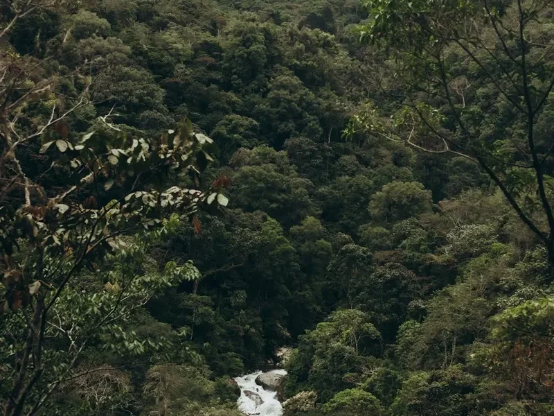
The Chirripó Trek is not merely a hike; it is a vertical pilgrimage through the diverse ecological zones of the Talamanca Range. The journey begins at approximately 1,350 metres in the village of San Gerardo de Rivas, where the air is cool and the vegetation is lush. As you ascend, the landscape undergoes a dramatic transformation. You first traverse the lower montane forest, characterised by towering oaks and a dense understory of ferns and bromeliads. This transitions into the mystical cloud forest, where moisture-laden winds from the oceans create a perpetual mist, draping every branch in thick moss and supporting a staggering array of epiphytes and rare birdlife, including the Resplendent Quetzal.
Beyond 3,000 metres, the forest thins and gives way to the sub-alpine páramo. This is a landscape of stunted shrubs, hardy grasses, and high-altitude bamboo, reminiscent of the Andean highlands. The Chirripó páramo is the northernmost occurrence of this ecosystem in the Americas and is home to endemic species found nowhere else on Earth. The terrain here is dominated by glacial features—U-shaped valleys, moraines, and shimmering glacial lakes (lagunas) that serve as a reminder of the ice that carved these peaks during the last glacial period.
The physical demand of the trek is significant. The primary trail, known as the Sendero Mainba, is a well-maintained but steep path that tests the endurance of even seasoned hikers. The ascent is often broken into two or three days to manage the risk of altitude sickness and to allow for the exploration of the surrounding peaks and valleys. Reaching the summit of Cerro Chirripó is the crowning achievement, providing a 360-degree panorama of the rugged Talamanca peaks, the Valle del General, and the distant coastlines. It is a place of profound silence and immense scale, where the tropical heat of Costa Rica feels like a distant memory.
History and Cultural Context
The name "Chirripó" is derived from the indigenous Cabécar language, meaning "Land of Eternal Waters," a reference to the numerous lakes and streams that originate in these high mountains. For the indigenous peoples of the region, the Talamanca Range has always been a sacred space, a realm of spirits and a source of life-giving water. While there is no evidence of permanent indigenous settlements at the highest elevations, the mountains were certainly known and respected by the Cabécar and Bribri peoples long before European arrival.
The first recorded ascent of Cerro Chirripó by a non-indigenous person occurred in 1904, led by the explorer and geographer Agustín Blessing Presinger. However, it wasn't until the mid-20th century that the mountain began to attract significant interest from scientists and mountaineers. In 1975, the Costa Rican government established the Chirripó National Park to protect this unique high-altitude environment and its critical watersheds. The park was later designated as part of the Talamanca Range-La Amistad Reserves / La Amistad National Park UNESCO World Heritage site, recognising its global importance for biodiversity and geological history.
The development of the trail system and the construction of the Crestones Base Camp have made the summit accessible to a wider range of hikers, but the park remains strictly regulated to preserve its ecological integrity. The local community of San Gerardo de Rivas has become the gateway to the park, with many residents working as guides, porters, and park rangers. The relationship between the mountain and the community is deep, with the annual "Carrera de Chirripó" (Chirripó Race) seeing elite runners sprint from the village to the base camp and back in record-breaking times, a testament to the local reverence for these peaks.
Want more background? Read extended notes on history and cultural context → Learn more
Seasonal Highlights and Weather Reality
Weather on Chirripó is notoriously unpredictable and can change from bright sunshine to freezing rain within minutes. The trek is generally divided into two main seasons: the dry season and the green (wet) season.
Dry Season (December to April): This is the most popular time to hike. The skies are generally clearer, providing the best chance of seeing both oceans from the summit. However, this is also the coldest time of year. Nighttime temperatures at the Crestones Base Camp frequently drop below freezing (0°C to -5°C), and frost is common in the páramo. Strong winds are also a factor during these months, particularly on the ridges and the summit. Bookings for this period often sell out months in advance.
Green Season (May to November): During the wet season, mornings are often clear, but heavy afternoon rains are the norm. The landscape is at its most vibrant and lush, and the waterfalls are in full flow. While the rain makes the trail muddier and more challenging, there are fewer hikers, and the cloud formations can be spectacular. Hikers during this season should aim for very early starts to reach their destination before the daily rains begin. October is typically the wettest month and can see trail closures if conditions become dangerous.
Regardless of the season, hikers must be prepared for "eternal waters." High humidity in the cloud forest means gear rarely dries, and the temperature gradient from the trailhead to the summit is extreme. You may start in 25°C heat in San Gerardo and stand in -2°C wind chill at the summit. Proper layering and high-quality waterproof gear are non-negotiable requirements for a safe and successful trek.
Recommended Itinerary
3-Day Chirripó Summit Itinerary
Day 1: San Gerardo de Rivas to Crestones Base Camp
- Distance: 14.5 km
- Elevation gain: 2,050 m
- Time: 7–10 hours
- Start at the Chirripó National Park trailhead (Sector San Gerardo) at dawn (5:00 AM recommended)
- The trail begins with a steep climb through lush forest
- Pass the "Termómetro" (The Thermometer) sign at 4 km, marking a significant elevation gain
- Reach the halfway point at "Llano Bonito" (7.5 km), where there is a small shelter and potable water
- Conquer the "Cuesta de los Arrepentidos" (Hill of the Repentant), the steepest section of the trail between 12 km and 14 km
- Arrive at Crestones Base Camp (3,400 m) in the afternoon
- Check into the hostel, rest, and acclimatise to the altitude
- Evening meal at the hostel (pre-booked) and early sleep
Day 2: Base Camp to Chirripó Summit and Side Trips
- Distance: 10–12 km (round trip depending on side trips)
- Elevation gain: 420 m to summit
- Time: 5–8 hours
- Pre-dawn start (3:00 AM or 4:00 AM) to reach the summit for sunrise
- Hike 5 km from the base camp through the Valle de los Conejos (Rabbit Valley)
- Final steep scramble over rocky terrain to the summit of Cerro Chirripó (3,820 m)
- Enjoy sunrise views of the Talamanca Range and, if clear, both the Pacific and Caribbean
- Descend back to the Valle de los Conejos
- Optional: Visit the Valle de los Lagos (Valley of the Lakes) to see glacial tarns
- Optional: Hike to Los Crestones, the iconic rock formations overlooking the base camp
- Return to Crestones Base Camp for a second night to recover and enjoy the high-altitude environment
Day 3: Crestones Base Camp to San Gerardo de Rivas
- Distance: 14.5 km
- Elevation loss: 2,050 m
- Time: 4–6 hours
- Early breakfast at the hostel
- Begin the long descent back down the same trail
- The descent is taxing on the knees and toes; trekking poles are highly recommended
- Pass back through Llano Bonito for a final rest stop
- Arrive back in San Gerardo de Rivas by midday
- Check out at the park office and enjoy a celebratory meal in the village
- Optional: Visit the local hot springs (Aguas Termales) to soothe tired muscles
Important Notes:
- The 2-day itinerary combines Day 2 and Day 3, descending immediately after the summit. This is only recommended for very fit hikers.
- All stays at Crestones Base Camp must be reserved months in advance via the SINAC website and the CRC Chirripó consortium.
- Water is available at Llano Bonito and the Base Camp; treat all other water sources.
- Pack weight should be minimised; porter services are available from the village.
Planning and Bookings
Book Your Trip
Everything you need to plan your journey
Accommodation
Find places to stay near San Isidro de El General
Flights
Search flights to San Isidro de El General
Essential Preparation
The Chirripó Trek requires meticulous planning, often starting six months in advance. The primary challenge is securing a permit and a bed at the base camp. You must first create an account on the SINAC (Sistema Nacional de Áreas de Conservación) website to purchase park entry permits. Once permits are secured, you must separately book accommodation and meals through the CRC Chirripó consortium, which manages the Crestones Base Camp. Coordination is vital; do not book one without the other.
Physical preparation is equally important. This is a high-altitude trek with significant vertical gain. Training should focus on cardiovascular endurance and leg strength, ideally involving hikes with a weighted pack and significant elevation changes. San Isidro de El General is the nearest major city, located about 20 km from the trailhead. It serves as the main transport hub where you can find supermarkets, pharmacies, and banks. From San Isidro, regular buses and taxis run to San Gerardo de Rivas, the base village for the trek. It is highly recommended to arrive in San Gerardo at least one day before your hike to check in at the park office and organise any porter services.
Trail Accommodation
There is only one official accommodation option on the trail: the Crestones Base Camp (El Albergue). Camping is strictly prohibited within the National Park boundaries to protect the fragile ecosystem.
Hut Facilities:
- Shared dormitory-style rooms with bunk beds and mattresses
- Shared bathrooms with cold-water showers (extremely cold at this altitude)
- A dining hall serving pre-booked hot meals (breakfast, lunch, and dinner)
- Small shop selling snacks, coffee, and basic supplies
- Electricity provided by solar panels (limited hours, usually for lighting only)
- Potable water available for refilling bottles
- Basic medical kit and emergency radio communication
What the Hut Doesn't Provide:
- Sleeping bags or blankets (you must bring your own or rent them in the village)
- Towels or toiletries
- Personal charging outlets (bring a power bank)
- Heating (the building is unheated and can be very cold at night)
- WiFi or mobile phone signal
Booking Requirements:
- Park permits must be booked via the SINAC website (up to 6 months in advance)
- Hostel beds and meals must be booked via the CRC Chirripó website
- Costs: Park entry is approximately US$18 per day for foreigners; hostel beds are approximately US$35 per night
- Check-in at the San Gerardo park office is mandatory the day before your trek starts
Required Gear
- Hiking boots - sturdy, waterproof, and well broken-in with good ankle support
- Backpack - 40-50L capacity with a waterproof rain cover
- Sleeping bag - rated for at least 0°C (the hostel is cold)
- Waterproof jacket - high-quality breathable shell (Gore-Tex or similar)
- Insulating layers - fleece or down jacket for the cold evenings and summit push
- Moisture-wicking base layers - avoid cotton; use merino wool or synthetic fabrics
- Trekking poles - essential for saving your knees on the 2,000 m descent
- Head torch - with spare batteries for the pre-dawn summit hike
- First aid kit - including blister pads, ibuprofen, and altitude sickness medication
- Sun protection - high SPF sunscreen, lip balm, and polarised sunglasses
What to Bring
- Water treatment - purification tablets or a lightweight filter for trail water
- High-energy snacks - nuts, dried fruit, energy bars, and chocolate
- Personal toiletries - biodegradable soap, toothbrush, and small towel
- Power bank - to keep your phone/camera charged for photos
- Dry bags - to keep your clothes and sleeping bag dry inside your pack
- Earplugs - for the shared dormitory environment
- Cash - in Costa Rican Colones for tips, snacks, or porter services
- Identification - passport or a clear copy for park check-in
- Reusable water bottles - at least 2-3 litres capacity
Permits
Securing permits for Chirripó is a two-step process that requires patience and quick action. The National Park limits the number of visitors to approximately 52 people per day to prevent overcrowding and environmental degradation. Permits are released on the SINAC website in blocks, usually six months in advance. During the peak dry season (January to March), these permits can sell out within minutes of being released.
Booking Strategy:
- Register your account on the SINAC website (serviciosenlinea.sinac.go.cr) well before the booking date
- Monitor the SINAC social media pages or local forums for announcements on when the next block of dates will be released
- Be ready to book at midnight (Costa Rica time) on the release day
- Have your passport details and credit card ready
- Once you have the SINAC confirmation, immediately visit the CRC Chirripó website to book your bed and meals at the Crestones Base Camp
- If the hostel is full for your dates, you cannot stay in the park, and your entry permit will be useless
Check-in Process: You must physically check in at the SINAC office in San Gerardo de Rivas the day before your trek begins. This is usually done between 8:00 AM and 4:00 PM. You will also need to check in at the CRC Chirripó office (located nearby) to confirm your hostel reservation and meal plan. Failure to check in during these hours may result in the cancellation of your permit.
Costs:
- Park Entry (Foreigners): US$18 per person, per day
- Park Entry (Nationals/Residents): 4,000 Colones per day
- Hostel Bed: Approximately US$35 per night
- Meal Plans: Approximately US$10–$15 per meal
- Porter Service: Approximately US$4 per kilogram (optional)
Other Activities in the Area
San Gerardo de Rivas and the surrounding Talamanca region offer several excellent activities for those looking to extend their stay or recover after the trek:
- Cloudbridge Nature Reserve: A private reforestation project adjacent to the National Park. It offers beautiful hiking trails, spectacular waterfalls, and excellent birdwatching opportunities without the need for a permit.
- Aguas Termales Gevi: Natural hot springs located just outside the village. These are the perfect way to soothe sore muscles after descending 2,000 metres.
- Birdwatching Tours: The area is one of the best places in Costa Rica to see the Resplendent Quetzal, especially between March and July. Local guides offer specialised tours in the early morning.
- Talamanca Chocolate Tour: Learn about the traditional process of cacao cultivation and chocolate making in the high-altitude tropical climate.
- San Isidro de El General Market: Visit the large farmers' market (Feria del Productor) on Thursdays and Fridays to experience local culture and sample fresh tropical fruits.
- Cerro de la Muerte: For those who haven't had enough of the high altitudes, this nearby area offers more páramo hiking and is famous for its high-altitude oak forests.
Safety and Conditions
Altitude Sickness (AMS): The most significant health risk on the Chirripó Trek is Acute Mountain Sickness. You are ascending from 1,350 m to 3,400 m in a single day, which is a rapid gain. Symptoms include headache, nausea, dizziness, and fatigue. To mitigate this, stay well-hydrated, eat plenty of carbohydrates, and ascend slowly. If symptoms become severe, the only cure is to descend immediately. Many hikers find that spending an extra night at the base camp before summiting helps with acclimatisation.
Hypothermia: Despite being in the tropics, the temperatures on Chirripó are cold. Wet clothing combined with high winds on the ridges can lead to hypothermia very quickly. Always carry a dry set of clothes in a waterproof bag and put on your insulating layers as soon as you stop moving. The summit push in the dark is particularly cold; ensure your extremities (hands, feet, head) are well-protected.
Trail Conditions: The trail is well-marked but can be extremely muddy and slippery, especially during the green season. The "Cuesta de los Arrepentidos" is a loose, rocky section where slips are common. Trekking poles provide essential stability. Be aware that there are no emergency services on the trail; in the event of an injury, evacuation is usually by horse or on foot, which can be slow and painful.
Water and Nutrition: Dehydration exacerbates altitude sickness. Drink at least 3–4 litres of water per day. While water is available at the base camp and Llano Bonito, it should be treated. Ensure you are consuming enough calories to fuel the massive physical effort; the hostel meals are hearty, but you will need snacks for the trail.
Communication: Mobile phone signal is non-existent for most of the trek. There is limited signal at certain points on the summit and near the base camp, but it is unreliable. Inform someone of your itinerary and expected return time before you start.
Side Trips and Points of Interest
Los Crestones: These iconic, jagged rock formations are the symbol of the National Park and were declared a National Symbol of Costa Rica in 2011. Located a short hike from the base camp, they offer incredible views and are a popular spot for photography, especially at sunset when the rocks glow with a golden hue.
Cerro Ventisqueros: The second-highest peak in Costa Rica (3,812 m) is accessible via a trail from the base camp. It is often less crowded than Chirripó and offers a different perspective of the glacial valleys. The trail is steep and exposed, providing a true alpine experience.
Valle de los Conejos: A beautiful, high-altitude valley that you traverse on the way to the summit. It is named for the rabbits that were once common here. The valley is a prime example of the páramo ecosystem, with unique flora like the *Puya dasylirioides* (a giant bromeliad).
Valle de los Lagos: This "Valley of the Lakes" contains several glacial tarns, including Lago Chirripó, the highest lake in the country. The area is hauntingly beautiful and offers a glimpse into the glacial history of the Talamanca Range. It is a peaceful detour for those with an extra day at the base camp.
Sabana de los Leones: A vast, high-altitude savannah located on a different trail branch. It is a wide, flat expanse that feels completely different from the rugged peaks, offering a sense of isolation and immense space.
Leave No Trace
Chirripó National Park is a fragile wilderness area. The high-altitude páramo is particularly sensitive to human impact; plants grow very slowly here, and a single footstep off the trail can destroy decades of growth. Hikers are expected to adhere to strict Leave No Trace principles to ensure the park remains pristine for future generations.
Your Responsibility:
- Pack out all trash, including organic waste like banana peels or orange skins, which decompose very slowly in the cold, high-altitude environment.
- Stay strictly on the designated trails. Do not create "social trails" or shortcuts, especially on the switchbacks.
- Do not collect plants, rocks, or any other natural items. The endemic flora is protected by law.
- Use the toilet facilities at the base camp or Llano Bonito. If you must go on the trail, follow proper backcountry procedures (bury waste 15–20 cm deep and at least 60 m from water).
- Do not feed or approach wildlife. This includes the birds and the small mammals around the base camp.
- Respect the silence of the mountains. Avoid loud music or shouting, which can disturb both wildlife and other hikers.
- Wash yourself and your gear at least 60 m away from lakes and streams, using only biodegradable soap.