Chiltern Way - The Green Heart of Southern England
The Chiltern Way is a magnificent 214.4-kilometre circular route that showcases the very best of the Chiltern Hills, a designated Area of Outstanding Natural Beauty (AONB) in South East England. Created by the Chiltern Society to celebrate the millennium in 2000, this trail offers an immersive journey through a landscape defined by ancient beech woodlands, rolling chalk downland, hidden valleys, and quintessential English villages built from local flint and brick. Unlike many linear national trails, the Chiltern Way provides a complete circuit, allowing walkers to experience the full diversity of this historic region without the logistical complexity of a point-to-point journey. Starting and ending in the picturesque riverside village of Goring-on-Thames, the route weaves through four counties—Oxfordshire, Buckinghamshire, Hertfordshire, and Bedfordshire—offering a profound sense of escape just a stone's throw from the urban sprawl of London.
- Distance: 214.4 km circular loop
- Duration: 7–14 days (depending on pace and extensions)
- Season: Year-round, but best from April to October
- Accommodation: Pubs, B&Bs, and local inns (wild camping is not permitted)
- Highest point: Dunstable Downs (243 m)
- Total Elevation Gain: Approximately 4,200 m
- Difficulty: Moderate (rolling hills, well-marked paths, but significant distance)
Overview
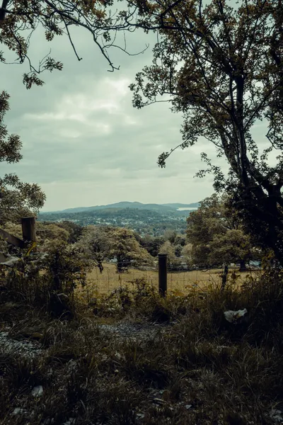
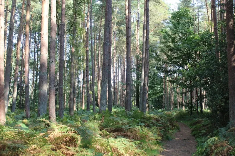
The Chiltern Way is often described as the "Green Lung" of London, providing a vital corridor of wilderness and traditional agricultural land for those seeking respite from the city. The trail is a masterclass in English lowland scenery. It avoids the major towns of the region, instead threading a needle through quiet hamlets, across vast estates, and along the ridges of the chalk escarpment. The landscape is characterised by its "sunken lanes"—ancient tracks worn deep into the chalk by centuries of use—and its world-famous beech woods, which were once the backbone of the local furniture-making industry in High Wycombe. In spring, these woods are carpeted in a sea of bluebells, while in autumn, the canopy turns a fiery copper, making it one of the most visually stunning walks in the United Kingdom.
Physically, the trail is accessible but demanding due to its cumulative elevation. While no single climb is particularly high—the highest point at Dunstable Downs is only 243 metres above sea level—the route is constantly undulating. Walkers will find themselves descending into "bottoms" (dry valleys) and climbing back onto ridges multiple times a day. This constant movement provides a dynamic hiking experience where the view changes every few kilometres. One moment you are walking through a dense, silent forest; the next, you are standing on a breezy ridge with views stretching across the Vale of Aylesbury or towards the skyline of London in the far distance.
The trail is also a haven for wildlife. The reintroduction of the Red Kite in the 1980s has been a spectacular success; these majestic birds of prey with their distinctive forked tails are now a constant companion, soaring effortlessly on the thermals above the hills. You are also likely to encounter fallow deer, muntjac, and a variety of rare butterflies that thrive on the chalk grasslands. The Chiltern Way is not just a walk; it is a deep dive into a managed landscape where nature and human history have co-existed for millennia.
History and Cultural Context
The Chiltern Way is a relatively modern creation with ancient roots. It was devised by volunteers from the Chiltern Society, one of the UK's largest and most active amenity groups, to mark the year 2000. The goal was to create a route that linked existing public rights of way into a cohesive journey that highlighted the specific character of the Chilterns. Unlike the Ridgeway, which follows a prehistoric trackway, the Chiltern Way is a curated experience designed to show off the region's heritage, from Roman villas and medieval churches to the "bodgers" who once lived and worked in the beech woods making chair legs.
The cultural heritage of the Chilterns is visible in every village the trail passes through. The use of "flint and brick" architecture is a signature of the region, reflecting the geology of the hills. Flint, a hard stone found in the chalk, was used for walling, while local clay was fired into the deep red bricks used for decorative "dressings" around windows and doors. The trail passes through Ewelme, home to the oldest primary school in the UK still in its original building (founded in 1437), and near Great Missenden, the home of author Roald Dahl, whose stories were often inspired by the local woods and countryside.
The land itself has been farmed for thousands of years. The "strip lynchets" (terraced field systems) visible on some hillsides date back to the Middle Ages, and the trail frequently crosses the Icknield Way, often cited as the oldest road in Britain. Walking the Chiltern Way is an exercise in historical layers; you are walking on paths that have been used by pilgrims, farmers, and craftsmen for over a thousand years, all while enjoying the protection afforded by its status as a National Landscape.
Want more background? Read extended notes on history and cultural context → Learn more
Seasonal Highlights and Weather Reality
The Chiltern Way is a four-season trail, but the experience changes dramatically with the months. Because the trail sits on chalk, it can become notoriously muddy during the winter months (November to March). The "Chiltern Clay" has a habit of sticking to boots, making the undulating sections more physically taxing. However, winter also offers the clearest views, as the lack of foliage on the trees opens up panoramas that are hidden during the summer.
Spring (April to May): This is arguably the best time to walk. The beech woods come alive with fresh, lime-green leaves, and the bluebell displays are world-class. The weather is generally mild, though "April showers" are a reality. Temperatures typically range from 8°C to 15°C.
Summer (June to August): The trail is at its driest, and the long daylight hours allow for flexible walking schedules. The chalk grasslands are in full bloom with rare orchids and wildflowers. However, the Chilterns can experience heatwaves where temperatures exceed 30°C. Shade is plentiful in the woods, but the ridge sections can be exposed.
Autumn (September to October): The "season of mists and mellow fruitfulness" is spectacular here. The beech forests turn vibrant shades of orange, gold, and copper. The ground is usually still firm, and the air is crisp. This is the peak time for fungi spotting in the damp woodland hollows.
Winter (November to March): Expect grey skies, rain, and significant mud. Temperatures often hover between 2°C and 7°C, with occasional frosts and rare snow. While the trail remains open, it requires high-quality waterproof footwear and a resilient attitude toward damp conditions.
Recommended Itinerary
12-Day Chiltern Way Itinerary
Day 1: Goring-on-Thames to Ewelme
- Distance: 18.5 km
- Elevation gain: 320 m
- Time: 5–6 hours
- Start at Goring station, crossing the River Thames
- Climb onto the chalk ridge with views back to the Goring Gap
- Pass through the village of Woodcote and ancient oak woodlands
- Descend into the historic village of Ewelme, famous for its watercress beds and 15th-century almshouses
- A gentle introduction to the rolling terrain of the Oxfordshire Chilterns
Day 2: Ewelme to Stokenchurch
- Distance: 21.2 km
- Elevation gain: 410 m
- Time: 6–7 hours
- Follow the Icknield Way for a section, an ancient prehistoric trackway
- Pass through Swyncombe with its beautiful Norman church
- Climb towards Watlington Hill, a prime spot for viewing Red Kites
- Cross the M40 via a dedicated footbridge (a rare moment of modern infrastructure)
- Arrive in Stokenchurch, a village historically known for chair-making
Day 3: Stokenchurch to Lacey Green
- Distance: 19.5 km
- Elevation gain: 380 m
- Time: 5–6 hours
- Enter the heart of the Buckinghamshire beech woods
- Pass through Radnage and the scenic Hughenden Valley
- Visit the windmill at Lacey Green, the oldest smock mill in England (built c. 1650)
- The route becomes more undulating with several short, sharp climbs
Day 4: Lacey Green to Great Missenden
- Distance: 17.8 km
- Elevation gain: 340 m
- Time: 5 hours
- Walk through the Hampden Estate, home to the historic Hampden House
- Traverse quiet valleys and ancient hedgerows
- Arrive in Great Missenden, a charming village with strong literary connections
- Time to visit the Roald Dahl Museum or enjoy a local pub meal
Day 5: Great Missenden to Bovingdon
- Distance: 20.5 km
- Elevation gain: 310 m
- Time: 6 hours
- Cross into Hertfordshire
- Pass through the Chess Valley, following the crystal-clear chalk stream
- Walk through Flaunden, often cited as one of the prettiest villages in the county
- Arrive in Bovingdon, known for its historic airfield and traditional village green
Day 6: Bovingdon to Harpenden
- Distance: 23.8 km
- Elevation gain: 290 m
- Time: 7 hours
- A longer day through more open agricultural landscape
- Pass through Hemel Hempstead's "Old Town" and Gadebridge Park
- Follow the River Ver towards Redbourn
- Finish in the affluent town of Harpenden with its extensive common land
Day 7: Harpenden to Whitwell
- Distance: 16.2 km
- Elevation gain: 220 m
- Time: 4–5 hours
- A shorter, flatter day allowing for recovery
- Pass through the Mimram Valley, another classic Chiltern chalk stream
- Walk through the grounds of historic estates and parklands
- Arrive in the quiet village of Whitwell
Day 8: Whitwell to Sharpenhoe
- Distance: 20.8 km
- Elevation gain: 350 m
- Time: 6 hours
- Cross into Bedfordshire
- Climb onto the Barton Hills, a National Nature Reserve with steep chalk slopes
- Spectacular views across the Bedfordshire plains
- Arrive at Sharpenhoe Clappers, an ancient hill fort site with iconic beech hangers
Day 9: Sharpenhoe to Dunstable Downs
- Distance: 18.4 km
- Elevation gain: 420 m
- Time: 5–6 hours
- Follow the dramatic northern escarpment of the Chilterns
- Pass through the village of Chalton and over the M1 motorway
- Climb to the summit of Dunstable Downs (243 m), the highest point in the East of England
- Watch gliders from the London Gliding Club soaring on the ridge lift
Day 10: Dunstable Downs to Wigginton
- Distance: 21.5 km
- Elevation gain: 390 m
- Time: 6–7 hours
- Descend from the downs and pass through the Whipsnade Estate
- Walk through the Ashridge Estate, managed by the National Trust
- Pass the Bridgewater Monument, a massive Doric column in the woods
- Arrive in Wigginton, perched on a high ridge above Tring
Day 11: Wigginton to Marlow
- Distance: 24.2 km
- Elevation gain: 450 m
- Time: 7–8 hours
- A challenging day with significant undulation
- Pass through the Hambleden Valley, a popular filming location for period dramas
- Walk through the village of Fingest with its unique twin-towered church
- Descend into the vibrant riverside town of Marlow on the Thames
Day 12: Marlow to Goring-on-Thames
- Distance: 23.5 km
- Elevation gain: 320 m
- Time: 7 hours
- Follow the final stretch of the loop through the southern Chilterns
- Pass through Henley-on-Thames, the world capital of rowing
- Climb back into the woods above Rotherfield Greys
- Final descent into Goring-on-Thames to complete the circuit
Important Notes:
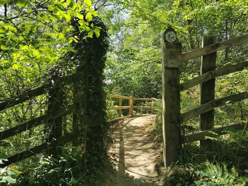
- The route is marked with distinctive "Chiltern Way" waymarks (white disc with green text)
- Public transport (trains) connects Goring, Great Missenden, Harpenden, and Tring, allowing for section hiking
- Water is generally not available on the trail; carry at least 2 litres
- Many sections pass through active farmland; keep dogs on leads around livestock
Planning and Bookings
Book Your Trip
Everything you need to plan your journey
Accommodation
Find places to stay near London
Flights
Search flights to London
Essential Preparation
The Chiltern Way requires careful logistical planning, particularly regarding accommodation. Unlike national trails with dedicated baggage transfer services, the Chiltern Way is often walked by locals or those who organise their own logistics. Fitness requirements are moderate; you should be comfortable walking 20 kilometres per day on undulating terrain for several consecutive days. Training on hills is highly recommended to prepare your calves and quads for the constant "up and down" of the chalk valleys.
Navigation is a key part of preparation. While the trail is waymarked, some signs may be obscured by summer growth or missing. Carrying the relevant Ordnance Survey (OS) Landranger or Explorer maps is essential. The route is covered by OS Explorer maps 171, 172, 181, 182, and 193. Alternatively, a dedicated GPS device or a reliable mobile app with offline maps (such as OS Maps or AllTrails) is highly recommended, as mobile signal can be patchy in deep valleys.
Trail Accommodation
There is no "official" trail accommodation like mountain huts. Instead, walkers rely on a network of village pubs, Bed & Breakfasts, and local hotels. Because the trail avoids large towns, accommodation can be sparse in certain sections, and booking well in advance (2–4 months) is crucial, especially for weekend stays.
Accommodation Types:
- Village Pubs: The classic Chiltern experience. Many historic inns offer "rooms at the inn" with breakfast included. Expect to pay £80–£130 per night for a double room.
- B&Bs: Often found in private homes or farmhouses near the trail. These offer a more personal experience and excellent local knowledge.
- Campsites: Very limited. There are a few commercial campsites near Goring, Henley, and Ashridge, but wild camping is illegal in England without the landowner's express permission.
- Glamping: Increasingly popular in the Chilterns, with shepherd's huts and pods available near the route.
What's Provided: Most B&Bs and pubs provide bedding, towels, and a full English breakfast. Many will also provide a packed lunch for a small additional fee if requested the night before.
Required Gear
- Walking Boots: Waterproof and well-broken-in. The terrain is a mix of grass, woodland tracks, and some paved lanes. Ankle support is beneficial for the steeper chalk slopes.
- Waterproofs: A high-quality waterproof jacket and overtrousers. British weather is notoriously unpredictable, and even a summer day can turn wet quickly.
- Backpack: A 25–35 litre daypack if you are staying in B&Bs; a 50–65 litre pack if you are carrying camping gear (though camping is difficult to arrange).
- Socks: Merino wool or synthetic moisture-wicking socks to prevent blisters. Carry spares.
- Navigation: OS Maps (paper) and a compass, or a GPS device with spare batteries/power bank.
- First Aid: Blister plasters (Compeed), antiseptic cream, ibuprofen, and any personal medications.
What to Bring
- Water Filtration: While you will mostly refill at pubs or B&Bs, a small filter (like a Sawyer Squeeze) is a good backup, though chalk streams should be treated with caution due to agricultural runoff.
- Sun Protection: Sunscreen, sunglasses, and a wide-brimmed hat. The ridge sections offer very little shade.
- Power Bank: Essential for keeping your phone charged for navigation and emergency calls.
- Snacks: High-energy food like nuts, dried fruit, and cereal bars. While there are pubs, they may not be open or serving food when you pass through.
- Cash: While most places take cards, some small village shops or honesty stalls (selling eggs or fruit) may only take cash.
- Gaiters: Highly recommended for winter or spring walking to keep mud and dew off your trousers.
Permits
No permits are required to walk the Chiltern Way. The entire route follows public rights of way, which are legally protected paths across private and public land in England. You are free to walk the trail at any time of year without charge.
Access Rights:
- Public Footpaths: Open to walkers only.
- Bridleways: Open to walkers, cyclists, and horse riders.
- Byways: Open to all traffic, including motorised vehicles (though these are rare on the Chiltern Way).
- Open Access Land: Certain areas, like Dunstable Downs and Barton Hills, allow you to wander off the path, but you must follow the Countryside Code.
The Chiltern Society: While the trail is free, it is maintained by the Chiltern Society. Consider joining the society or making a donation to support their work in keeping the paths clear, replacing waymarks, and protecting the landscape. They also sell the official guidebooks, which are the most detailed resources available for the route.
Other Activities in the Area
The Chilterns offer a wealth of attractions that can be integrated into your walking trip or visited as day trips from a base town:
- Roald Dahl Museum and Story Centre: Located in Great Missenden, this award-winning museum is a must-visit for fans of the author. It features his original writing hut and interactive exhibits.
- Hughenden Manor: The former home of Victorian Prime Minister Benjamin Disraeli. Managed by the National Trust, it features beautiful gardens and a fascinating history of secret map-making during WWII.
- Chiltern Open Air Museum: Located near Chalfont St Peter, this museum rescues and rebuilds historic buildings from the region, including an Iron Age roundhouse and a 1940s prefab.
- Bekonscot Model Village: The world's oldest original model village, located in Beaconsfield. A quirky and charming look at 1930s England in miniature.
- Vineyard Tours: The chalky soil of the Chilterns is similar to that of the Champagne region. Visit Chiltern Valley Winery & Brewery near Hambleden for a tour and tasting.
- Steam Railways: The Chinnor & Princes Risborough Railway offers a nostalgic journey through the hills on vintage steam and diesel trains.
Safety and Conditions
Navigation and Pathfinding: The Chiltern Way is generally well-marked, but it is not a "National Trail" (like the Ridgeway), meaning the maintenance of waymarks can vary between counties. Always carry a map. Be particularly careful in large fields where the path may not be visible on the ground; aim for the waymark on the opposite hedge or gate.
Road Crossings: The trail crosses several busy A-roads and motorways (via bridges). Always use designated crossing points and be extremely cautious on narrow country lanes where there may be no pavement and limited visibility for drivers.
Livestock: You will frequently walk through fields containing cattle, sheep, or horses. Generally, they will ignore you. However, if you have a dog, keep it on a short lead. If cattle approach you aggressively, let the dog off the lead so it can run to safety, and move calmly to the nearest exit. Never get between a cow and her calf.
Weather Extremes: While the UK climate is temperate, heat exhaustion in summer and hypothermia in winter are genuine risks. Always check the Met Office forecast before setting out. In summer, the chalk reflects heat, making the ridges significantly hotter than the valleys.
Emergency Services: In an emergency, dial 999 or 112. Be prepared to give your location using a grid reference from your map or a "What3Words" address. Note that mobile signal can be non-existent in the deeper "bottoms" of the Chilterns.
Side Trips and Points of Interest
The Chiltern Way Extensions: For those who find 214 km insufficient, the Chiltern Society has created several extensions. The North Loop adds 35 km through the northern Bedfordshire hills, while the South Loop adds 32 km through the Berkshire Chilterns. There is also a Hemel Hempstead Loop. Completing all sections brings the total distance to over 300 km.
Coombe Hill: A short detour from the main trail near Wendover leads to the summit of Coombe Hill. At 260 metres, it is one of the highest points in the Chilterns and features a massive Boer War memorial. On a clear day, you can see as far as the Cotswolds.
Ivinghoe Beacon: Located near the Ashridge Estate, this iconic hill marks the start/end of both the Ridgeway and the Icknield Way. It offers some of the most dramatic views in the region and is a popular spot for kite flying and model aircraft enthusiasts.
The Hellfire Caves: Located in West Wycombe, these man-made chalk caverns were excavated in the 18th century for Sir Francis Dashwood, founder of the notorious Hellfire Club. They are a fascinating, if slightly eerie, underground diversion.
Leave No Trace
The Chilterns are a fragile landscape under immense pressure from the surrounding urban populations. Following the Countryside Code and Leave No Trace principles is essential to ensure the trail remains beautiful for everyone.
Key Principles for the Chiltern Way:
- Respect the Farming Community: Always close gates behind you unless they are propped open. Stick to the edges of cropped fields and do not trample growing plants.
- Protect the Chalk Grassland: These areas are home to rare orchids and butterflies. Avoid lighting fires or barbecues, which can easily start wildfires on dry grass.
- Manage Your Waste: There are no bins on the trail. Pack out all litter, including fruit peels and nut shells, which can take a long time to decompose and attract vermin.
- Keep Dogs Under Control: The Chilterns are a stronghold for ground-nesting birds and rare livestock. Keep your dog on a lead near animals and always pick up dog waste—it can spread diseases to farm animals.
- Stay on the Path: In woodland areas, staying on the path prevents the compaction of soil around the roots of ancient beech trees and protects delicate wildflowers like bluebells.