Chemin de Saint-Jacques (GR65) - The Way of Saint James
The Chemin de Saint-Jacques, specifically the Via Podiensis or GR65, is the most renowned and historically significant pilgrimage route in France. Stretching approximately 740 kilometres from the volcanic heights of Le Puy-en-Velay to the foothills of the Pyrenees in Saint-Jean-Pied-de-Port, this trail is a profound journey through the heart of French history, architecture, and landscape. Unlike many wilderness treks, the GR65 is a cultural odyssey that weaves through medieval villages, UNESCO-listed cathedrals, and diverse agricultural regions. It is a path where the physical challenge of walking 20 to 30 kilometres a day meets the spiritual and social heritage of a thousand-year-old tradition. Whether walked as a religious pilgrimage or a long-distance hike, the "Way" offers an unparalleled immersion into the rural soul of France, crossing the Massif Central, the high plateaus of the Aubrac, the limestone causses of Quercy, and the rolling hills of Gascony before reaching the Basque Country.
- Distance: 740 kilometres (Le Puy-en-Velay to Saint-Jean-Pied-de-Port)
- Duration: 4–6 weeks (typically 30 to 35 walking days)
- Season: April–June and September–October (avoiding the peak summer heat and winter snow)
- Accommodation: Gîtes d'étape, religious hostels, chambres d'hôtes, and small hotels
- Highest point: Col d'Aubrac (1,340 metres)
- Difficulty: Moderate (well-marked, but requires endurance for consecutive long days)
- Direction: East to West (traditionally towards Santiago de Compostela)
Overview
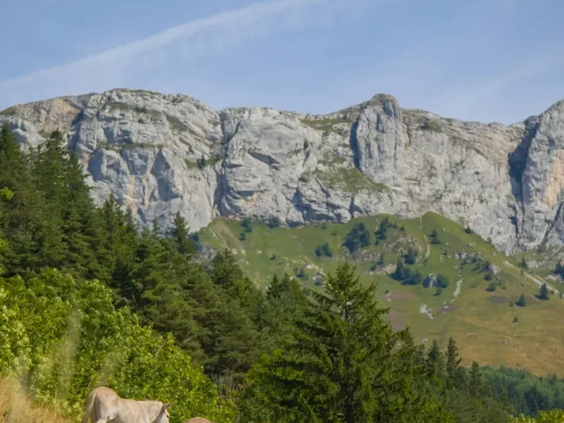
The Chemin de Saint-Jacques (GR65) is not merely a hiking trail; it is a living museum of European heritage. Known as the Via Podiensis, it is one of the four main routes described by the 12th-century Codex Calixtinus, the world's first "travel guide" for pilgrims heading to the shrine of Saint James the Apostle in Galicia, Spain. The route is celebrated for its extraordinary variety of landscapes. It begins in the Velay region, characterised by dramatic volcanic "puys" (peaks), before ascending into the wild, windswept granite plateau of the Aubrac. From there, it descends into the lush Lot Valley and climbs onto the arid, limestone "causses" of Quercy, where the white stone of the villages contrasts sharply with the deep green of the oak forests. As the trail moves west, it enters the fertile plains of Gascony, famous for its vineyards and duck-based gastronomy, before the final ascent into the Pyrenean foothills.
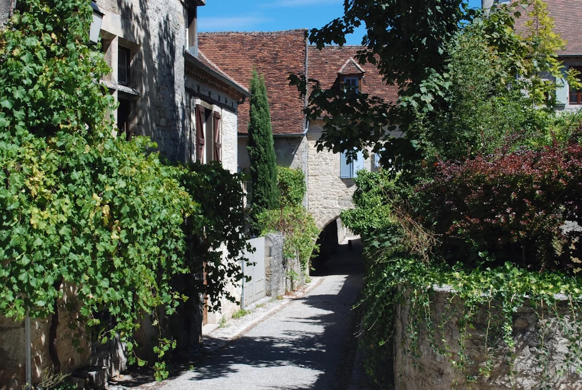
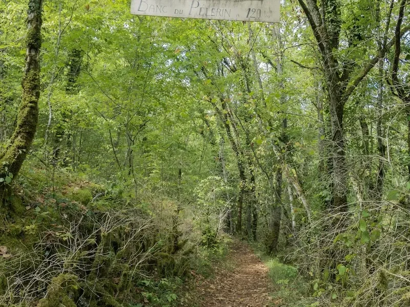
The experience of the GR65 is defined by its infrastructure and community. The trail passes through a succession of "Plus Beaux Villages de France" (The Most Beautiful Villages of France), such as Saint-Côme-d'Olt, Estaing, and the breathtaking Conques. Each evening, walkers—known as "pèlerins" (pilgrims)—gather in gîtes d'étape to share a communal meal, often featuring local specialities like Aligot (cheesy mashed potatoes) or Confit de Canard. This social aspect is a cornerstone of the journey, fostering a sense of camaraderie that transcends language and nationality. The path is meticulously maintained and marked with the iconic red-and-white blazes of the Grande Randonnée (GR) network, making navigation straightforward even for those new to long-distance trekking.
While the terrain is never truly alpine, the cumulative elevation gain of approximately 10,000 metres over the course of the journey demands respect. The challenge lies in the repetition: waking up day after day to cover significant distances regardless of weather. However, the reward is a slow-motion discovery of France's hidden corners, where the pace of life is dictated by the stride of a walker and the ringing of medieval church bells. For many, the GR65 is a transformative experience, providing a rare opportunity for reflection and a total disconnection from the pressures of modern life.
History and Cultural Context
The history of the Chemin de Saint-Jacques dates back to the early 9th century, following the discovery of the tomb of Saint James the Great in Santiago de Compostela. However, the Via Podiensis specifically owes its prominence to Bishop Godescalc of Le Puy-en-Velay, who in 950 AD became the first recorded non-Spanish pilgrim to make the journey. His pilgrimage established Le Puy as a primary starting point, and over the subsequent centuries, thousands of faithful followed in his footsteps, leading to the construction of hospitals, bridges, and magnificent Romanesque churches to serve the growing tide of travellers.
During the Middle Ages, the pilgrimage was one of the three great "peregrinationes maiores," alongside those to Rome and Jerusalem. The route was a conduit for ideas, art, and architecture, which is why one sees a remarkable consistency in the Romanesque style of the abbeys and cathedrals along the path. The decline of the pilgrimage began with the Reformation and the French Revolution, but the late 20th century saw a spectacular revival. In 1987, the Council of Europe designated the Way of Saint James as the first European Cultural Route, and in 1998, UNESCO inscribed the "Routes of Santiago de Compostela in France" on the World Heritage List, recognising 71 monuments and seven sections of the GR65 for their outstanding universal value.
Today, the trail is walked by a diverse mix of people. While some are motivated by religious faith, many others are drawn by the historical interest, the physical challenge, or a desire for a "secular pilgrimage" of self-discovery. The cultural tradition of the "Credencial" (pilgrim passport) remains central; walkers collect stamps (tampons) from churches, town halls, and gîtes along the way, serving as both a souvenir and proof of their journey to secure accommodation in pilgrim-specific hostels. This continuity of tradition ensures that the GR65 remains a bridge between the medieval past and the contemporary world.
Want more background? Read extended notes on history and cultural context → Learn more
Seasonal Highlights and Weather Reality
The timing of a GR65 trek is critical for both comfort and the availability of services. The trail is best experienced during the shoulder seasons of spring and autumn.
Spring (April to June): This is arguably the most beautiful time to walk. The Aubrac plateau is covered in a carpet of wild narcissus and yellow broom, and the temperatures are generally mild (15–22°C). However, April can still see late snow on the higher sections of the Aubrac and the Pyrenees, and May is often the wettest month in France. Walkers should be prepared for frequent rain and muddy paths in the clay-heavy regions of Gascony.
Summer (July and August): While the days are long, the heat in the Lot Valley and the plains of Gascony can be punishing, often exceeding 35°C. This is also the peak holiday season in France, meaning gîtes are crowded and must be booked weeks in advance. Many experienced walkers avoid this period due to the lack of shade on the limestone causses and the physical strain of walking in high humidity.
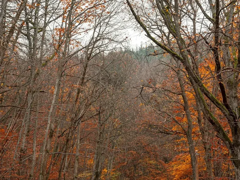
Autumn (September to October): September is a favourite month for many. The weather is often stable and warm, the summer crowds have thinned, and the autumn colours begin to transform the beech and oak forests. The grape harvest (vendange) in the Armagnac and Béarn regions adds a festive atmosphere to the final stages of the walk. By late October, many gîtes begin to close for the season, and the days become significantly shorter and cooler.
Winter (November to March): Walking the GR65 in winter is a serious undertaking. Many gîtes d'étape are closed, and the higher sections of the trail (Aubrac and the Pyrenees) are frequently covered in deep snow. This season is only recommended for self-sufficient hikers comfortable with cold-weather camping or those who have meticulously researched the few year-round accommodation options.
Recommended Itinerary
32-Day Chemin de Saint-Jacques Itinerary
Stage 1: Le Puy-en-Velay to Conques (Days 1–10)
- Distance: 252 km
- Elevation: Significant climbs out of Le Puy and across the Aubrac
- Key Waypoints: Saint-Privat-d'Allier, Saugues, Saint-Alban-sur-Limagnole, Aumont-Aubrac, Nasbinals, Saint-Chély-d'Aubrac, Saint-Côme-d'Olt, Espalion, Estaing, Conques
- Highlights: The volcanic peaks of Velay, the wild granite plateau of Aubrac, and the descent into the medieval masterpiece of Conques
- Note: This is often considered the most scenic and physically demanding section of the entire route
Stage 2: Conques to Cahors (Days 11–18)
- Distance: 165 km
- Elevation: Moderate, with steep descents into river valleys
- Key Waypoints: Decazeville, Figeac, Cajarc, Limogne-en-Quercy, Mas-de-Vers, Cahors
- Highlights: The Cele Valley variant (optional), the historic town of Figeac, and the iconic Pont Valentré in Cahors
- Note: The terrain transitions from the lush Lot Valley to the dry, stony limestone causses of Quercy
Stage 3: Cahors to Lectoure (Days 19–24)
- Distance: 132 km
- Elevation: Rolling hills and agricultural plateaus
- Key Waypoints: Montcuq, Lauzerte, Moissac, Auvillar, Miradoux, Lectoure
- Highlights: The hilltop village of Lauzerte, the UNESCO-listed cloister at Moissac, and the beautiful village of Auvillar
- Note: This section enters the Tarn-et-Garonne and Gers departments, where the landscape becomes more agricultural and the food more decadent
Stage 4: Lectoure to Saint-Jean-Pied-de-Port (Days 25–32)
- Distance: 191 km
- Elevation: Gentle hills followed by the final ascent into the Pyrenean foothills
- Key Waypoints: Condom, Montréal-du-Gers, Eauze, Nogaro, Aire-sur-l'Adour, Arzacq-Arraziguet, Navarrenx, Saint-Palais, Saint-Jean-Pied-de-Port
- Highlights: The vineyards of Armagnac, the fortified town of Navarrenx, and the emotional arrival in the Basque town of Saint-Jean-Pied-de-Port
- Note: The final days offer views of the Pyrenees on the horizon, building anticipation for the end of the French section
Important Notes:
- The itinerary above assumes an average of 23–25 km per day. Fit walkers may complete it faster, while those wishing to sightsee may take 40 days
- The "Credencial" is essential for staying in pilgrim gîtes
- Water is generally available in villages, but a 2-litre capacity is recommended for the causses
- Booking accommodation 1–2 days in advance is highly recommended, even in shoulder season
- The trail is marked with red and white stripes; if you see a red and white "X", you have taken a wrong turn
Planning and Bookings
Book Your Trip
Everything you need to plan your journey
Accommodation
Find places to stay near Saint-Jean-Pied-de-Port
Flights
Search flights to Saint-Jean-Pied-de-Port
Essential Preparation
Preparation for the GR65 focuses more on endurance and logistics than technical mountaineering skills. Physical training should involve walking consecutive days with a weighted pack (8–10 kg) to condition the feet and joints. Most walkers start in Le Puy-en-Velay, which is well-connected by train from Lyon or Paris. It is essential to obtain a "Credencial" (Pilgrim Passport) before starting; these can be ordered online from various associations or purchased at the Cathedral in Le Puy. This document is required to access communal pilgrim gîtes and to receive the "Compostela" certificate if you continue into Spain.
Logistically, the "Miam Miam Dodo" guide is the "bible" for this route, providing up-to-date listings of all accommodation, water points, bakeries, and grocery stores. While the trail is well-marked, having an offline GPS map (such as AllTrails or Gaia GPS) is a useful backup. If you do not wish to carry your full pack, several companies (e.g., La Malle Postale) offer daily luggage transfer services between gîtes for a fee of approximately €8–10 per bag per stage.
Trail Accommodation
The GR65 offers a unique hierarchy of accommodation designed to suit different budgets and social preferences. The most common is the Gîte d'étape, which provides dormitory-style bunk beds, shared bathrooms, and often a communal kitchen. Many gîtes offer "demi-pension" (half-board), which includes a multi-course dinner and breakfast, providing an excellent opportunity to meet fellow walkers.
Accommodation Types:
- Gîtes Communaux: Run by the local municipality, these are basic and affordable (€15–20 per night).
- Gîtes Privés: Privately owned, often more comfortable, with smaller dorms or private rooms (€25–45 for half-board).
- Religious Accommodation: Monasteries and convents (e.g., in Conques or Moissac) offer a traditional, often reflective atmosphere. Some operate on a "donativo" (pay what you can) basis, though a contribution of €20–30 is standard.
- Chambres d'hôtes: French B&Bs offering private rooms and high-quality meals (€60–100 per night).
Facilities Provided: Most gîtes provide blankets or duvets, but for hygiene reasons, a "sac à viande" (silk or cotton sleeping bag liner) is mandatory. Full kitchens are common in communal gîtes, but private gîtes often prefer you to eat their prepared meals. WiFi is increasingly common but can be slow in rural areas. Laundry facilities (hand-wash basins or machines) are available at most stops.
Required Gear
- Footwear: Lightweight hiking boots or high-quality trail running shoes. The terrain is mostly gravel paths and tarmac, so heavy alpine boots are unnecessary and can cause blisters.
- Backpack: A 35–45 litre pack is sufficient if staying in gîtes. Ensure it has a high-quality hip belt and a rain cover.
- Clothing: Moisture-wicking base layers, a lightweight fleece or down jacket for evenings, and high-quality merino wool socks (bring 3 pairs).
- Rain Gear: A lightweight, breathable waterproof jacket and overtrousers, or a high-quality trekking poncho that covers both you and your pack.
- Sleeping Bag Liner: Silk or cotton liner is essential for gîtes; a full sleeping bag is only needed if camping or walking in winter.
- Trekking Poles: Highly recommended to save the knees on the descents into the Lot and Célé valleys.
What to Bring
- Credencial: Your pilgrim passport for stamps and gîte access.
- Navigation: Miam Miam Dodo guide or a dedicated GR65 guidebook.
- First Aid: Extensive blister care (Compeed, leukotape), antiseptic cream, needle and thread (for blisters), and anti-inflammatory medication.
- Toiletries: Biodegradable soap/shampoo, quick-dry travel towel, and earplugs (essential for dormitories).
- Water: A 2-litre hydration bladder or two 1-litre bottles. Water is generally potable in villages unless marked "non-potable."
- Electronics: Phone, power bank, and a European plug adapter.
- Sun Protection: SPF 50+ sunscreen, a wide-brimmed hat, and sunglasses.
- Knife and Spork: For picnic lunches (baguettes, cheese, and fruit) purchased from local markets.
Permits
One of the great appeals of the Chemin de Saint-Jacques in France is that no official "permit" or "entry fee" is required to walk the trail. The GR65 is a public right-of-way. However, the Credencial (Pilgrim Passport) acts as a functional permit for the infrastructure of the trail. Without it, you may be refused entry to communal pilgrim gîtes or charged a higher "tourist" rate in others.
How to obtain a Credencial:
- Order online from the Société Française des Amis de Saint Jacques or your national pilgrim association.
- Purchase at the Cathedral of Notre-Dame in Le Puy-en-Velay before you start.
- Cost is typically €5–10.
Booking Strategy:
- While no permit is needed, "booking" your bed is essential during peak months (May, June, September).
- In the Aubrac and around Conques, accommodation is limited; book at least 3–5 days in advance.
- For the rest of the trail, calling the night before or the morning of your walk is usually sufficient.
- If you are travelling in a group of 4 or more, you should book your entire first week in advance.
Costs: Budget approximately €40–€60 per day for a "classic" pilgrim experience (gîte bed, half-board meal, and a picnic lunch). If staying in private hotels and using luggage transfer, budget €80–€120 per day.
Other Activities in the Area
The GR65 passes through some of France's most culturally rich regions. Consider taking a "rest day" in these locations to explore further:
- Le Puy-en-Velay: Spend a day before you start to climb the Rocher Saint-Michel d'Aiguilhe, a chapel perched atop a volcanic needle, and visit the UNESCO-listed Cathedral.
- Conques: This is the architectural highlight of the trip. Spend time admiring the "Last Judgment" tympanum of the Abbey-Church of Sainte-Foy and the contemporary stained-glass windows by Pierre Soulages.
- Figeac: Visit the Musée Champollion, dedicated to the man who deciphered Egyptian hieroglyphs, located in his birthplace.
- Cahors: Explore the medieval old town and take a boat trip on the Lot River to see the Pont Valentré from the water.
- Moissac: The cloister of the Abbey of Saint-Pierre is one of the most beautiful and best-preserved Romanesque cloisters in the world.
- Wine Tasting: The trail passes through the vineyards of Cahors (famous for Malbec) and Armagnac. Many "domaines" offer tastings to passing walkers.
Safety and Conditions
General Safety: The GR65 is a very safe trail. Crime against hikers is extremely rare. The primary risks are physical: blisters, tendonitis, and heat exhaustion. The trail is well-marked, but always carry a map or GPS, as it is possible to miss a turn in forested areas or when entering larger towns.
Weather Hazards:
- Heat: In July and August, temperatures can reach 35–40°C. Start walking at dawn (5:00 or 6:00 AM) to finish before the midday heat. Carry at least 2 litres of water.
- Storms: Summer thunderstorms can be violent, especially on the Aubrac plateau. If you hear thunder, seek lower ground and avoid standing under isolated trees.
- Mud: In the Gers region, the soil is heavy clay. After rain, it becomes "amoureuse" (loving)—it sticks to your boots and makes walking incredibly heavy and slippery.
Health and Pests:
- Ticks: Common in the woods of Quercy and Gascony. Check your body every evening for ticks to prevent Lyme disease.
- Bedbugs (Punaises de lit): A common issue in pilgrim hostels worldwide. Use a silk liner, keep your pack off the bed, and inspect mattresses before settling in. If bitten, inform the gîte owner immediately.
- Road Safety: While most of the GR65 is on trails, there are sections on narrow departmental roads. Always walk facing oncoming traffic and wear reflective gear if walking in low light.
Side Trips and Points of Interest
The Célé Valley Variant (GR651): Between Béduer and Cahors, many walkers choose to leave the main GR65 for the GR651. This 3-4 day variant follows the Célé River through a dramatic limestone canyon. It passes through the stunning village of Saint-Cirq-Lapopie (often voted France's favourite village) and the Pech Merle cave, which contains authentic prehistoric paintings. It is slightly more rugged but significantly more scenic than the main route.
Rocamadour (GR6): From Figeac, a popular detour leads to Rocamadour, a spectacular medieval pilgrimage site built into a cliff face. After visiting, you can rejoin the GR65 at Cahors. This adds about 2-3 days to the journey but is highly rewarding for those interested in religious history and dramatic landscapes.
The Abbey of Sainte-Foy, Conques: Even if you are not religious, the nightly organ concert and the illumination of the abbey's facade are unmissable. The treasury of Conques also holds the "Majesty of Sainte-Foy," a gold and jewel-encrusted reliquary from the 9th century.
The Pont Valentré, Cahors: A 14th-century fortified bridge with three towers. Legend says the architect made a pact with the devil to finish the bridge; look for the small stone devil carved into one of the towers.
Leave No Trace
The GR65 passes through many private farms and fragile ecosystems. Maintaining the goodwill of local farmers is essential for the trail's continued existence. As an "eco-pilgrim," you are expected to follow the principles of Leave No Trace.
Your responsibility as a walker:
- Waste: Pack out all rubbish. Do not leave fruit peels or nut shells on the trail, as they take a long time to decompose in dry climates.
- Sanitation: Use toilets in villages or gîtes. If you must go on the trail, bury waste at least 15 cm deep and 50 metres from water sources. Pack out your toilet paper in a zip-lock bag.
- Gates: Many sections of the Aubrac pass through active cattle pastures. Always leave gates exactly as you found them (open or closed).
- Noise: Respect the silence of the countryside and the peace of the villages you pass through.
- Flora and Fauna: Do not pick wildflowers, especially on the Aubrac, where many species are protected. Keep a respectful distance from the famous Aubrac cattle.