Trilha da Chapada dos Guimarães - Heart of the Cerrado
The Trilha da Chapada dos Guimarães is a captivating multi-day trek through the heart of Brazil's unique Cerrado biome, a vast tropical savanna region renowned for its incredible biodiversity, dramatic sandstone formations, and crystal-clear rivers. This trail offers an immersive experience into a landscape of rolling grasslands, scattered woodlands, and breathtaking canyons, culminating in the iconic viewpoints of the Chapada dos Guimarães National Park. It's a journey that reveals the raw beauty and ecological richness of central Brazil, providing a stark contrast to the more commonly visited coastal or Amazonian regions.
- Distance: 45.0 km one-way
- Duration: 3-4 days
- Season: May to September (dry season)
- Difficulty: Moderate
- Highest point: Varies, but significant elevation changes occur throughout
- Daily walkers: No strict limit, but responsible tourism encouraged
- Direction: Typically walked from south to north, ending at the park's main visitor area
Overview
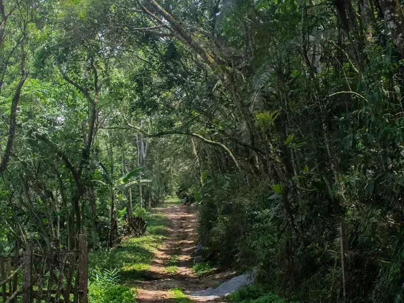
The Trilha da Chapada dos Guimarães is more than just a walk; it's an exploration of a vibrant ecosystem teeming with life. The trail winds through landscapes that shift from open savannas, where hardy grasses and scattered trees dominate, to denser gallery forests lining the riverbanks. The geological features are a highlight, with ancient sandstone formations sculpted by millennia of wind and water erosion, creating dramatic cliffs, arches, and hidden grottos. The soundscape is equally rich, filled with the calls of exotic birds, the rustling of unseen wildlife, and the soothing murmur of flowing water.
The dry season, from May to September, is the prime time to undertake this trek. During these months, the weather is generally stable, with sunny days and cooler nights, making for comfortable walking conditions. The landscape, while drier, still retains its beauty, and the reduced vegetation density can offer better wildlife viewing opportunities. Water sources are more reliable and accessible during this period, though always treat water before consumption.
This trail is suitable for those with a moderate level of fitness, as it involves sustained walking over varied terrain, including some ascents and descents. The moderate difficulty rating reflects the need for endurance and the ability to navigate potentially uneven paths. The reward for this effort is an intimate connection with a unique natural environment, far from the usual tourist crowds, offering a profound sense of discovery and tranquility.
History and Cultural Context
The Chapada dos Guimarães region has a rich history, deeply intertwined with indigenous cultures and early Brazilian exploration. For centuries, indigenous peoples, such as the Bororo and Xavante, inhabited these lands, utilising the natural resources and respecting the spiritual significance of the canyons and rivers. Their presence is etched into the landscape through ancient rock art found in some of the caves and overhangs, though much of this is fragile and protected.
European settlement began in the 18th century, driven by the search for gold and other minerals. The town of Chapada dos Guimarães itself grew around these early mining activities. Over time, the region's stunning natural beauty became increasingly recognised, leading to the establishment of the National Park in 1976. This designation aimed to protect the unique Cerrado biome, its geological formations, and its rich biodiversity from unchecked development and exploitation.
The trail itself follows ancient routes, likely used by indigenous peoples for hunting and gathering, and later by prospectors and settlers. Today, the Trilha da Chapada dos Guimarães is managed by the ICMBio (Instituto Chico Mendes de Conservação da Biodiversidade), the Brazilian federal agency responsible for protected areas. Efforts are ongoing to balance conservation with sustainable tourism, ensuring that the trail remains a pristine natural experience while supporting the local communities that depend on the park's resources.
Seasonal Highlights and Weather Reality
The Trilha da Chapada dos Guimarães is best experienced during the dry season, which typically runs from May to September. This period offers the most favourable conditions for trekking.
Dry Season (May to September):
- Weather: Characterised by abundant sunshine, low humidity, and minimal rainfall. Daytime temperatures are pleasant, often ranging from 20°C to 28°C, while nights can be cooler, dropping to 10°C to 15°C. This makes for comfortable walking and camping.
- Landscape: The savanna grasses turn golden, and the vegetation appears more subdued, but the dramatic sandstone formations are fully visible. Rivers and streams are generally lower, making crossings easier and more predictable.
- Wildlife: While some animals may be less active due to the drier conditions, this season can offer good opportunities to spot birds of prey, various mammals, and reptiles.
- Crowds: This is the peak season for tourism in the region, so expect more visitors at popular viewpoints and trailheads.
Wet Season (October to April):
- Weather: Marked by high humidity and frequent, often heavy, afternoon thunderstorms. Daytime temperatures can reach 30°C to 35°C, with high humidity making it feel hotter.
- Landscape: The Cerrado bursts into vibrant green. Waterfalls are at their most spectacular, and rivers are fuller, which can make some trail sections impassable or require significant detours. The lush vegetation can also make navigation more challenging.
- Wildlife: Many species are more active during the wet season, and the abundance of water and food attracts a wider variety of fauna.
- Crowds: Generally fewer tourists during the wet season, offering a more solitary experience. However, the challenging weather conditions can lead to trail closures or reduced accessibility.
For the Trilha da Chapada dos Guimarães, the dry season is highly recommended for its predictable weather and easier trail conditions.
Recommended Itinerary

3-Day Trilha da Chapada dos Guimarães Itinerary
Day 1: Trailhead to Cachoeira Véu de Noiva Area
- Distance: Approximately 15 km
- Elevation gain: Moderate, with rolling hills
- Time: 5–6 hours
- Start at a designated trailhead south of Chapada dos Guimarães town.
- Initial section traverses open Cerrado savanna, offering expansive views.
- Pass through areas with scattered rock formations and unique flora.
- Potential for wildlife sightings, especially birds and smaller mammals.
- Arrive near the iconic Cachoeira Véu de Noiva (Bride's Veil Waterfall) area for camping.
- Set up camp and explore the immediate surroundings, including viewpoints of the impressive waterfall (note: direct access to the base of Véu de Noiva may be restricted for safety).
Day 2: Cachoeira Véu de Noiva Area to Rio Claro
- Distance: Approximately 18 km
- Elevation gain: Varied, including descents into canyons and ascents to plateaus.
- Time: 6–7 hours
- Continue through diverse Cerrado landscapes, transitioning into more rugged canyon terrain.
- Explore smaller, less-known waterfalls and natural pools along the route.
- Navigate through areas with significant sandstone formations, including potential arches or unique rock sculptures.
- The trail may follow sections of riverbeds or canyon rims.
- Arrive at the Rio Claro area, known for its clear waters and beautiful swimming spots.
- Set up camp by the river, offering opportunities for swimming and relaxation.
Day 3: Rio Claro to Park Entrance/Chapada dos Guimarães
- Distance: Approximately 12 km
- Elevation gain: Mostly gradual descent towards the park entrance.
- Time: 3–4 hours
- Follow the Rio Claro downstream for a portion of the morning.
- Pass through areas with more pronounced canyon walls and unique geological features.
- The trail may lead to viewpoints overlooking the vast Chapada plateau.
- Final section leads towards the main entrance of the Chapada dos Guimarães National Park or a designated exit point near the town.
- Opportunity for a final dip in a natural pool before reaching the end of the trek.
- Upon completion, arrange transport back to Chapada dos Guimarães town or Cuiabá.
Important Notes:
- This itinerary is a guideline; actual distances and times may vary based on specific route choices and conditions.
- Camping is typically in designated or suitable wild camping spots. Always check park regulations.
- Water sources are available but must be treated.
- Navigation skills or a guide are essential, as the trail can be unmarked in sections.
- The dry season (May-September) is highly recommended for this trek.
Planning and Bookings
Book Your Trip
Everything you need to plan your journey
Accommodation
Find places to stay near Cuiabá
Flights
Search flights to Cuiabá
Essential Preparation
The Trilha da Chapada dos Guimarães is located in a region with a developing tourism infrastructure. While the town of Chapada dos Guimarães offers good amenities, the trail itself is more remote. It is crucial to be self-sufficient and well-prepared. Cuiabá is the closest major city and international airport (CGB). From Cuiabá, you can take a bus or hire a taxi/transfer to Chapada dos Guimarães, a journey of approximately 65 km that takes about 1.5 hours on paved roads.
Chapada dos Guimarães town serves as the primary base for exploring the national park and surrounding areas. It offers a range of accommodation options, from budget guesthouses to more comfortable hotels, as well as restaurants, supermarkets for supplies, and outdoor gear shops. It is advisable to spend at least one night in Chapada dos Guimarães before and after your trek to finalise preparations and recover.
Given the nature of the trail, it is highly recommended to hire a local guide. Guides are invaluable for navigation, safety, understanding the local flora and fauna, and accessing the most rewarding parts of the landscape. They can also assist with logistics such as transport to trailheads and arranging permits if required.
Trail Accommodation
This is a multi-day trek that requires overnight accommodation. There are no formal huts or lodges along the Trilha da Chapada dos Guimarães. Accommodation consists of camping in designated or suitable wild camping locations.
Camping:
- Booking Requirements: While there are no formal booking systems for campsites along the trail itself, it is advisable to check with the ICMBio (Instituto Chico Mendes de Conservação da Biodiversidade) or local park authorities regarding any specific regulations or designated camping zones within the National Park. Some areas near popular attractions like Cachoeira Véu de Noiva might have informal camping spots or require prior notification.
- Facilities Provided: Typically, no facilities are provided at wild camping spots. You will need to be entirely self-sufficient. This means carrying your own tent, sleeping bag, sleeping mat, cooking equipment, and all necessary supplies.
- What's NOT Provided: No toilets, running water, cooking shelters, electricity, or waste disposal facilities. You must carry out all your waste.
- Seasonal Availability: Camping is possible year-round, but the dry season (May to September) is significantly more comfortable due to lower rainfall and more stable temperatures. During the wet season, camping can be challenging due to rain, humidity, and potential flooding.
- Costs: There are generally no direct costs for wild camping on the trail itself, provided you are within permitted areas. However, park entrance fees may apply, and hiring a guide will incur costs.
Base Town Accommodation: In Chapada dos Guimarães town, you will find a variety of hotels, pousadas (guesthouses), and hostels. These range from basic to comfortable and should be booked in advance, especially during peak season.
Required Gear
- Sturdy Hiking Boots: Waterproof and well broken-in, with good ankle support for varied terrain.
- Backpack: A comfortable trekking backpack (50-70 litres) with a rain cover.
- Tent: A lightweight, durable, and waterproof tent suitable for camping in potentially exposed areas.
- Sleeping Bag: Rated for temperatures down to 10°C, as nights can be cool, especially in the dry season.
- Sleeping Mat: For insulation and comfort.
- Waterproof Jacket and Trousers: Essential for protection against rain, even in the dry season, as weather can change.
- Head Torch: With spare batteries, for use in camp and during early morning or late evening walks.
- Navigation Tools: A reliable map of the area, a compass, and a GPS device or smartphone with offline maps. A guide is highly recommended.
- First-Aid Kit: Comprehensive kit including blister treatment, pain relievers, antiseptic wipes, bandages, and any personal medications.
- Sun Protection: High SPF sunscreen, wide-brimmed hat, and sunglasses. The sun can be intense, especially in open savanna areas.
- Insect Repellent: Effective against mosquitoes and other biting insects, particularly important during dawn and dusk.
What to Bring
- Food: Sufficient non-perishable food for 3-4 days, including breakfast, lunch, dinner, and snacks. Lightweight, high-energy meals are ideal.
- Water Bottles/Hydration Reservoir: Capacity for at least 2-3 litres per person.
- Water Purification Method: Water filter, purification tablets, or the ability to boil water. All natural water sources should be treated.
- Cooking Equipment: Lightweight camping stove, fuel, cooking pot, utensils, mug, and plate/bowl.
- Toiletries: Biodegradable soap, toothbrush, toothpaste, toilet paper, hand sanitiser, and any personal hygiene items.
- Trowel and Toilet Paper Bags: For properly disposing of human waste when no facilities are available (Leave No Trace principles).
- Trekking Poles: Optional but recommended for stability on uneven terrain and descents.
- Camera: To capture the stunning landscapes and wildlife.
- Power Bank: For charging electronic devices if needed.
- Small Towel: Quick-drying.
- Cash: For any small purchases in town or for guide fees.
Permits
Access to the Trilha da Chapada dos Guimarães and the surrounding National Park typically requires an entrance fee. The specific regulations and fees can change, so it is essential to verify the latest requirements with the ICMBio (Instituto Chico Mendes de Conservação da Biodiversidade) or the park's official visitor centre before your trek.
National Park Entrance Fee:
- Visitors are usually required to pay a daily entrance fee to access the Chapada dos Guimarães National Park. The exact cost varies, but it is generally a modest amount.
- It is advisable to check the current fee structure on the ICMBio website or inquire at the park's visitor centre in Chapada dos Guimarães town.
Camping Regulations:
- While there are no formal campsite bookings for wild camping along the trail, it is crucial to understand and adhere to park regulations regarding where camping is permitted. Some areas might be off-limits for environmental protection.
- Always practice Leave No Trace principles and ensure you are not camping in sensitive ecological zones.
Guide Requirements:
- For safety and navigation, especially on less-marked sections of the Trilha da Chapada dos Guimarães, hiring a local, certified guide is strongly recommended and may be mandatory for certain routes or areas within the park.
- Guides can assist with understanding any specific permit requirements for their planned itinerary.
Booking in Advance:
- For the Trilha da Chapada dos Guimarães, advance booking of specific campsites is generally not required as it is not a developed trail with assigned sites. However, if you plan to visit popular attractions within the park that have specific access times or require guided tours (e.g., some caves or specific viewpoints), it is wise to book these in advance, especially during peak tourist seasons.
- It is always best to contact the Chapada dos Guimarães National Park visitor centre or the ICMBio regional office a few weeks prior to your planned trek to confirm all current regulations, fees, and any necessary permits.
Other Activities in the Area
The region surrounding Chapada dos Guimarães offers a wealth of natural attractions and activities beyond the Trilha da Chapada dos Guimarães itself:
- Cachoeira Véu de Noiva: The iconic "Bride's Veil" waterfall is a must-see. While direct access to its base is often restricted for safety, the viewpoints offer spectacular vistas of the 86-metre cascade plunging into a deep canyon.
- Parque Nacional da Chapada dos Guimarães: Explore other trails and attractions within the national park, such as the Cidade de Pedra (Stone City) with its impressive sandstone formations, and various other waterfalls and natural pools like Cachoeira do Mutum and Poço Encantado.
- Caverna do Lago Azul: A stunning cave featuring a subterranean lake whose waters exhibit an intense blue hue due to mineral composition. Access is typically via guided tour.
- Mirante do Centro Geodésico da América do Sul: Visit the geographical centre of South America, marked by a monument, offering panoramic views of the surrounding landscape.
- Adventure Sports: The region is popular for activities like rappelling (abseiling), rock climbing, and paragliding, with several operators offering guided experiences.
- Indigenous Culture: Engage with local indigenous communities (e.g., the Xavante) to learn about their traditions, crafts, and way of life, often through organised cultural tours.
- Cuiabá: Explore the capital of Mato Grosso, known for its vibrant culture, historical sites, and as a gateway to the Amazon and the Pantanal wetlands.
Safety and Conditions
Pre-Trek Checks:
- Weather Forecast: Always check the local weather forecast for Chapada dos Guimarães and the surrounding park area before you depart. Be prepared for sudden changes, especially during the wet season.
- Park Alerts: Consult the ICMBio website or the park visitor centre for any trail closures, warnings, or specific conditions within the National Park.
- Road Conditions: Ensure your transport to the trailhead is reliable. Roads leading to some trailheads might be unpaved and can become challenging during the wet season.
Trail Hazards:
- Navigation: The Trilha da Chapada dos Guimarães is not always well-marked. It is crucial to have reliable navigation tools (map, compass, GPS) and ideally a local guide. Getting lost in the vast Cerrado or canyon systems can be dangerous.
- Terrain: The trail involves varied terrain, including rocky paths, sandy sections, river crossings, and potentially steep ascents and descents. Sturdy footwear is essential.
- Water Crossings: Rivers and streams can swell significantly during the wet season, making crossings hazardous or impossible. Always assess the depth and current before attempting to cross.
- Wildlife: While large dangerous animals are rare, be aware of snakes, scorpions, and biting insects. Maintain a safe distance from all wildlife.
- Sun Exposure: The open savanna areas offer little shade. Protect yourself from the sun to prevent heatstroke and sunburn. Stay hydrated.
- Dehydration and Heatstroke: Carry ample water and drink regularly, especially during warmer periods. Recognise the symptoms of dehydration and heatstroke.
Sandflies and Insects: Sandflies and mosquitoes can be prevalent, particularly at dawn and dusk and near water sources. Use effective insect repellent and consider wearing long sleeves and trousers.
Emergency Preparedness: Carry a fully stocked first-aid kit and know how to use it. Consider carrying a personal locator beacon (PLB) or satellite phone for remote areas where mobile signal is unavailable. Inform someone of your trekking plans, including your intended route and expected return time.
Guides: Hiring a local, experienced guide is highly recommended for this trek. They possess invaluable knowledge of the terrain, weather patterns, local flora and fauna, and emergency procedures.
Side Trips and Points of Interest
Cachoeira Véu de Noiva: While the main trail may pass near it, taking time to visit the designated viewpoints of this spectacular 86-metre waterfall is essential. Its sheer drop into a dramatic canyon is one of the most iconic sights in the region.
Rio Claro Swimming Spots: Day 2 of the itinerary often leads to the Rio Claro, a river renowned for its exceptionally clear waters. The trail may pass by several natural pools perfect for a refreshing swim and a break amidst the wilderness.
Cidade de Pedra (Stone City): Located within the National Park, this area features a labyrinth of towering sandstone formations that resemble ancient ruins or a city carved from rock. It's a fascinating geological site accessible via short walking trails.
Caverna do Lago Azul (Blue Lake Cave): A guided tour into this cave reveals a breathtaking subterranean lake whose waters possess an intense azure colour. The phenomenon is caused by light refraction through mineral-rich water and is a unique natural spectacle.
Mirante do Centro Geodésico da América do Sul: Visit the monument marking the geographical centre of the South American continent. It offers expansive panoramic views of the Chapada plateau and the surrounding landscape, providing a sense of the region's vastness.
Smaller Waterfalls and Pools: Throughout the trek, especially along the Rio Claro and its tributaries, you will encounter numerous smaller waterfalls, cascades, and natural pools. These offer opportunities for rest, photography, and enjoying the serene beauty of the Cerrado's water features.
Leave No Trace
The Trilha da Chapada dos Guimarães traverses a fragile ecosystem within the Cerrado biome and the Chapada dos Guimarães National Park. Adhering to Leave No Trace principles is paramount to preserving this unique environment for future generations.
Your responsibility as a walker:
- Pack It In, Pack It Out: Carry out all your rubbish, including food scraps, wrappers, and any other waste. Do not bury or burn trash.
- Dispose of Waste Properly: Use designated toilets where available. If not, dig a cathole at least 60 metres (60 m) away from water sources, trails, and campsites. Pack out all toilet paper.
- Leave What You Find: Do not remove plants, rocks, or any natural objects. Take only photographs and memories.
- Minimise Campfire Impacts: Use a lightweight stove for cooking. If a campfire is absolutely necessary and permitted, use existing fire rings and ensure it is completely extinguished before leaving. Be aware of fire restrictions, especially during the dry season.
- Respect Wildlife: Observe animals from a distance. Never feed them, as it can alter their natural behaviour and diet, and can be harmful to their health.
- Be Considerate of Other Visitors: Keep noise levels down and yield to other hikers. Respect the tranquility of the natural environment.
- Stay on the Trail: Stick to marked paths to avoid damaging fragile vegetation and to prevent erosion. The Cerrado ecosystem is slow to recover from disturbance.
- Protect Water Sources: Wash yourself, your dishes, and your clothes at least 60 metres away from rivers and streams. Use biodegradable soap sparingly.
By following these principles, you help ensure that the Trilha da Chapada dos Guimarães remains a pristine and awe-inspiring experience for all who follow.