
Cervino Base Loop - A High Alpine Adventure
The Cervino Base Loop is a spectacular day walk encircling the iconic Matterhorn, offering unparalleled views of this majestic peak from various vantage points. This route is a celebration of alpine grandeur, traversing diverse landscapes from lush meadows to rugged moraines, all under the watchful gaze of one of the world's most recognisable mountains. It's a journey that immerses you in the heart of the Swiss Alps, providing a profound connection with nature's raw beauty and the enduring power of glacial forces.
- Distance: 14.0 km
- Elevation Gain: 900 m
- Duration: 5-6 hours
- Difficulty: Moderate
- Best Time: June to September
- Closest City: Zermatt
- Trailhead Access: Nearest airport: Zurich (ZRH). Train to Zermatt (car-free). From Zermatt train station, walk to trailhead (approx. 10 min). No cars allowed in Zermatt. Parking available in Täsch. No permits needed.
- Coordinates: 45.9765, 7.6585
Overview
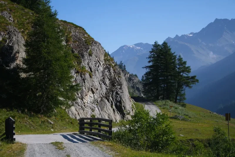
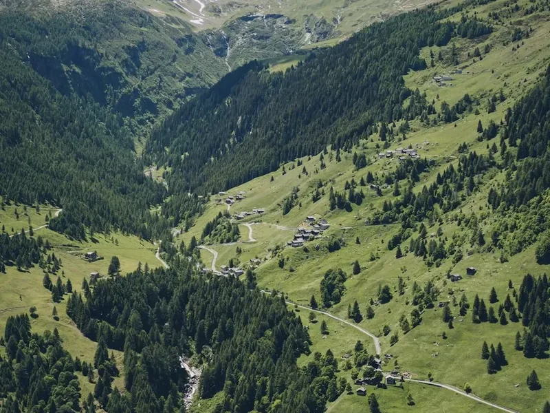
The Cervino Base Loop is a moderately challenging day walk that circumnavigates the base of the mighty Matterhorn, known locally as Cervino. This route is designed to offer a comprehensive visual experience of the mountain, showcasing its iconic pyramidal shape from multiple angles. The trail begins in the charming, car-free village of Zermatt, quickly ascending through alpine meadows dotted with wildflowers in the summer months. As the path climbs, the vegetation thins, giving way to scree slopes and rocky terrain, bringing you closer to the mountain's imposing granite walls.
The loop is structured to provide a dynamic perspective. You'll experience the Matterhorn from its sun-drenched southern faces and its shadowed northern aspects, each offering a unique character and photographic opportunity. Key sections of the trail pass by glacial lakes that mirror the surrounding peaks, providing moments of serene beauty amidst the rugged alpine environment. The elevation gain of 900 metres means this is a walk that requires a reasonable level of fitness, but the well-maintained paths and the sheer visual reward make every step worthwhile. The duration of 5-6 hours allows for ample time to pause, absorb the breathtaking scenery, and capture memories of this extraordinary landscape.
The best time to undertake the Cervino Base Loop is from June to September, when the snow has largely receded from the higher sections of the trail, and the weather is generally more stable. Even during these months, however, alpine weather can change rapidly, so preparedness is key. The loop is a testament to the enduring allure of the Alps, offering a tangible connection to the forces of nature that have shaped this dramatic terrain over millennia.
History and Cultural Context
The Matterhorn, or Cervino, has a history deeply intertwined with human endeavour and the spirit of exploration. For centuries, the local Walser communities, who settled in the Zermatt valley, viewed the mountain with a mixture of awe and trepidation. Its formidable appearance and challenging slopes meant it remained unclimbed for a long time, a silent sentinel watching over the valley.
The first ascent of the Matterhorn in 1865 by Edward Whymper and his party marked a pivotal moment in mountaineering history. However, the tragic descent that claimed the lives of four climbers also cast a long shadow, highlighting the mountain's inherent dangers. This event, while dramatic, cemented the Matterhorn's status as a legendary peak and a symbol of alpine adventure.
The development of Zermatt as a tourist destination began in earnest after the first ascent. Trails were gradually established, initially for shepherds and hunters, and later for the burgeoning number of climbers and tourists. The Cervino Base Loop, while not a historical pilgrimage route in the same vein as some ancient trails, follows paths that have been trodden for generations, evolving from rudimentary tracks to the well-maintained hiking routes of today. The infrastructure around Zermatt, including the cogwheel railway and cable cars, has made the surrounding alpine environment accessible to a wider audience, yet the Base Loop offers a more intimate and physically engaging experience of the mountain's immediate surroundings.
The cultural significance of the Matterhorn extends beyond mountaineering. It is a powerful symbol of Switzerland, appearing on countless postcards, souvenirs, and even chocolate wrappers. Its distinctive shape has inspired artists, writers, and adventurers for generations, making it a global icon of the Alps.
Seasonal Highlights and Weather Reality
The Cervino Base Loop is a trail best enjoyed during the warmer months when the alpine environment is most accessible and visually vibrant. The period from June to September offers the most favourable conditions for this moderate day walk.
June: The early summer sees the alpine meadows bursting into bloom. Wildflowers carpet the lower slopes, creating a colourful spectacle against the backdrop of snow-capped peaks. While higher sections of the trail may still have lingering snow patches, the main loop is generally clear and navigable. The air is crisp, and the days are long, providing ample time for exploration.
July and August: These are the peak months for hiking in the Zermatt region. The weather is typically at its most stable, with warm temperatures and clear skies being common. The Matterhorn is often at its most dramatic, bathed in sunlight. This is also the busiest period, so expect to encounter other hikers on the trail. The meadows are at their most lush, and the glacial lakes are often at their most reflective.
September: Autumn brings a different kind of beauty to the Alps. The crowds begin to thin, and the air takes on a sharper, cooler quality. The foliage in the lower valleys may start to turn golden, offering a beautiful contrast to the evergreen pines and the stark grey of the mountain rock. While generally still pleasant, the possibility of early snowfall increases towards the end of the month, so checking forecasts is crucial.
Weather Reality: It is imperative to remember that alpine weather is notoriously unpredictable. Even during the summer months, conditions can change rapidly. Sudden thunderstorms can develop, bringing heavy rain, hail, and a significant drop in temperature. Wind can also be a factor, especially at higher elevations. Always be prepared for a range of conditions, including cold temperatures, rain, and strong winds, regardless of the season.
Recommended Itinerary
Cervino Base Loop - Day Walk Itinerary
Early Morning: Zermatt Village to Trailhead
- Depart from your accommodation in Zermatt.
- Walk towards the southern edge of the village, following signs for the Matterhorn trails.
- The trailhead is easily accessible from the village centre, typically a 10-15 minute walk.
- Enjoy the crisp morning air and the first views of the Matterhorn as you begin your day.
Morning: Ascent through Alpine Meadows
- Begin the ascent from Zermatt (approx. 1,600 m).
- The initial part of the trail winds through picturesque alpine meadows.
- Observe the diverse flora and fauna, with wildflowers in abundance during summer.
- The path is well-marked and generally of moderate gradient, allowing for acclimatisation.
- Gain approximately 400-500 metres in elevation during this phase.
- Key waypoints may include small hamlets or viewpoints offering early panoramic vistas.
Midday: Reaching Higher Elevations and Glacial Lakes
- The trail transitions to a more rugged terrain, with scree and rocky sections becoming more prevalent.
- You will approach areas with glacial moraines, evidence of the mountain's icy past.
- Several glacial lakes are situated along this part of the route. These often provide stunning reflections of the Matterhorn.
- Take a break at one of these lakes for lunch and to soak in the magnificent scenery.
- Elevation at this stage can reach up to 2,200-2,400 metres.
- The Matterhorn appears larger and more imposing as you get closer.
Afternoon: Traverse and Descent towards Zermatt
- Continue the loop, traversing the base of the Matterhorn.
- The trail may involve some steeper descents and ascents as it navigates the undulating terrain.
- Views will shift, offering new perspectives of the mountain's iconic ridges and faces.
- The final section of the loop begins to descend more steadily back towards the Zermatt valley.
- You may pass through areas with more sparse vegetation, characteristic of higher alpine environments.
- The descent will lead you back towards the outskirts of Zermatt.
Late Afternoon: Return to Zermatt
- Complete the loop, arriving back in Zermatt village.
- Total distance covered: approximately 14.0 km.
- Total elevation gain: approximately 900 m.
- Estimated time: 5-6 hours, including breaks.
- Enjoy a well-deserved rest and reflect on the incredible alpine experience.
Important Notes:
- This is a day hike; no overnight accommodation is required.
- Carry sufficient water and snacks, as facilities are limited on the trail.
- Wear sturdy hiking boots with good ankle support.
- Be prepared for rapidly changing weather conditions.
- Check the weather forecast before setting out.
Planning and Bookings
Book Your Trip
Everything you need to plan your journey
Accommodation
Find places to stay near Zermatt
Flights
Search flights to Zermatt
Essential Preparation
The Cervino Base Loop is a day walk, meaning the primary planning revolves around logistics for a single day's excursion. Zermatt, the closest city and the starting point for the hike, is a car-free village accessible primarily by train. Visitors typically fly into Zurich Airport (ZRH) and then take a scenic train journey to Zermatt. Parking is available in the nearby town of Täsch for those who prefer to drive, with shuttle trains connecting Täsch to Zermatt. It is advisable to book train tickets in advance, especially during peak tourist seasons.
Accommodation in Zermatt ranges from luxury hotels to budget-friendly hostels and apartments. Booking your stay in Zermatt in advance is highly recommended, particularly during the summer months (June-September) when the region is most popular. Ensure you have adequate time in Zermatt to prepare for your hike, purchase any last-minute supplies, and acclimatise to the altitude if necessary.
The trailhead for the Cervino Base Loop is easily accessible from Zermatt village. A short walk from the train station or your accommodation will lead you to the starting point. No specific permits are required for this day walk, as it is part of the general hiking network in the region.
Trail Accommodation
This is a day hike requiring no overnight accommodation.
Required Gear
- Hiking Boots: Sturdy, waterproof hiking boots with good ankle support are essential for navigating the varied terrain, including rocky paths and scree. Ensure they are well broken-in to prevent blisters.
- Waterproof Jacket: A lightweight, breathable waterproof jacket is crucial. Alpine weather can change rapidly, and sudden rain showers or thunderstorms are common, even in summer.
- Waterproof Overtrousers: Recommended for protection against rain and wind, especially during ascents and descents where you may be more exposed.
- Backpack: A daypack (20-30 litres) is sufficient to carry essentials. Ensure it has a comfortable harness and hip belt for stability.
- Navigation Tools: While the trail is generally well-marked, a map of the Zermatt hiking area and a compass or GPS device are advisable. A smartphone with offline maps downloaded is also a useful backup.
- Head Torch: Essential in case of unexpected delays or if you start very early or finish late. Carry spare batteries.
- First Aid Kit: A basic kit including plasters, blister treatment, antiseptic wipes, pain relievers, and any personal medications.
- Sun Protection: High SPF sunscreen, sunglasses, and a wide-brimmed hat are vital due to the intense alpine sun at higher altitudes.
- Trekking Poles: Highly recommended for stability on ascents and descents, and to reduce strain on knees.
What to Bring
- Food: Pack enough high-energy snacks and a substantial lunch to sustain you for the 5-6 hour hike. Options include sandwiches, fruit, nuts, energy bars, and chocolate.
- Water: Carry at least 1.5-2 litres of water per person. While there may be streams, it is advisable to treat or filter water if you plan to refill, or carry enough for the entire duration.
- Toiletries: Biodegradable soap, toothbrush and toothpaste, hand sanitiser, and toilet paper (in a waterproof bag).
- Personal Items: Mobile phone (fully charged), portable power bank, camera, identification, and a small amount of cash for any unexpected purchases or emergencies.
- Warm Layers: Even in summer, temperatures at higher elevations can be significantly cooler. Pack a fleece or insulating jacket and a warm hat and gloves.
- Insect Repellent: While not as prevalent as in some other alpine regions, midges or mosquitoes can be present, especially near water sources.
- Emergency Shelter: A lightweight emergency blanket or bivvy bag can be a lifesaver in an unexpected situation.
Permits
No specific permits are required to hike the Cervino Base Loop. The trails in the Zermatt region are part of the public hiking network and are generally accessible without charge. However, it is always advisable to check local regulations or any temporary notices posted by the Zermatt tourism office or local authorities, especially if there are any specific conservation efforts or temporary closures in place.
The primary requirement for undertaking this hike is proper preparation and adherence to safety guidelines. Ensure you have appropriate gear, sufficient food and water, and are aware of the weather conditions. The beauty of this hike lies in its accessibility, allowing anyone with a reasonable level of fitness and the right equipment to experience the grandeur of the Matterhorn up close.
Other Activities in the Area
Zermatt offers a wealth of activities beyond the Cervino Base Loop, catering to a wide range of interests:
- Gornergrat Railway: Take a scenic cogwheel train ride to Gornergrat (3,089 m) for breathtaking panoramic views of the Matterhorn and surrounding peaks, including the Gornergletscher glacier.
- Matterhorn Glacier Paradise: Ascend via cable car to Europe's highest cable car station (3,883 m) for stunning glacier views, an ice palace, and a viewing platform offering 360-degree vistas.
- Hiking and Trekking: Zermatt boasts an extensive network of hiking trails, from gentle valley walks to challenging high-alpine routes. Other popular options include the Five Lakes Walk (5-Seenweg) and the Hörnlihütte trail (base camp for Matterhorn ascents).
- Mountain Biking: Numerous trails are suitable for mountain biking, with options for all skill levels.
- Skiing and Snowboarding: Zermatt is a world-renowned ski resort, offering year-round skiing on the glaciers.
- Zermatt Village Exploration: Wander through the charming streets of Zermatt, visit the Matterhorn Museum (Zermatlantis) to learn about the mountain's history and the first ascent, and enjoy the local cuisine in one of the many restaurants.
- Paragliding: For the adventurous, tandem paragliding flights offer an unforgettable aerial perspective of the Matterhorn and the Zermatt valley.
Safety and Conditions
Weather Preparedness: The most critical safety aspect for the Cervino Base Loop is being prepared for rapid weather changes. Always check the local Zermatt weather forecast from reliable sources like MeteoSwiss or local tourist information before setting out. Be aware of potential thunderstorms, especially in the afternoon, which can bring lightning, heavy rain, and strong winds. If a storm is forecast or develops, descend to a safer elevation or seek shelter.
Altitude Considerations: While this is a day hike, the maximum elevation reached can be around 2,400 metres. Most people tolerate this altitude well, but it's wise to be aware of the symptoms of altitude sickness, such as headache, nausea, and dizziness. If symptoms occur, descend immediately. Staying hydrated and avoiding strenuous activity on your first day in Zermatt can help.
Trail Conditions: The trail is generally well-maintained, but sections can be rocky, uneven, and steep. Loose scree can be present, requiring careful footing. Ensure your hiking boots provide good grip and ankle support. Trekking poles can significantly improve stability and reduce the risk of slips and falls.
Navigation: Although the trail is usually well-marked, it is essential to carry a map and compass or a GPS device with offline maps. Familiarise yourself with the route before you start. Do not rely solely on mobile phone reception, as it can be unreliable in mountainous areas.
Emergency Procedures: Know the emergency contact numbers for the region. In Switzerland, the general emergency number is 144 for medical emergencies and 112 for general emergencies. Inform someone of your hiking plans, including your intended route and estimated return time. Carry a fully charged mobile phone.
Wildlife: While large predators are rare in this area, be aware of local wildlife. Respect their space and do not attempt to feed any animals. The marmots and chamois are common sights, and observing them from a distance is part of the alpine experience.
Side Trips and Points of Interest
Stellisee Lake: One of the most iconic and photographed spots along the Cervino Base Loop is the Stellisee lake. This small, crystal-clear alpine lake is renowned for its near-perfect reflection of the Matterhorn on calm days. It's an ideal spot for a mid-hike break and for capturing stunning photographs. The lake is typically reached during the midday section of the hike.
Riffelsee Lake: Another beautiful glacial lake that often features in Matterhorn photography. While the exact route of the "Base Loop" can vary slightly depending on interpretation, Riffelsee is a common and highly recommended detour or inclusion. Its reflections are particularly striking in the morning light.
Gorner Glacier Views: As you traverse the higher sections of the loop, you will gain vantage points overlooking the vast Gorner Glacier. This impressive glacier is one of the largest in the Alps and offers a stark reminder of the powerful glacial forces that have shaped the landscape.
Alpine Flora and Fauna: The lower sections of the trail, particularly in early to mid-summer, are alive with alpine wildflowers. Keep an eye out for species like gentians, edelweiss (though rare), and various alpine roses. You may also spot marmots whistling from their burrows or chamois grazing on the slopes.
Matterhorn Museum (Zermatlantis): Although not directly on the trail, a visit to the Matterhorn Museum in Zermatt before or after your hike provides invaluable context. It details the history of Zermatt, the early mountaineering expeditions, and the cultural significance of the Matterhorn.
Leave No Trace
The pristine alpine environment surrounding the Matterhorn is a precious natural resource that requires careful stewardship. Adhering to Leave No Trace principles ensures that this spectacular landscape remains unspoiled for future generations of hikers and nature enthusiasts.
Plan Ahead and Prepare: Research the trail, understand its challenges, and be prepared for all weather conditions. Pack appropriate gear and sufficient supplies.
Travel and Camp on Durable Surfaces: Stick to marked trails to avoid damaging fragile alpine vegetation. The paths are designed to withstand foot traffic, but off-trail travel can cause erosion and harm delicate plant life. Avoid walking on moss or lichen-covered rocks.
Dispose of Waste Properly: Pack out everything you pack in. This includes all food scraps, wrappers, tissues, and any other litter. There are no bins on the trail, so you must carry your waste back to Zermatt for disposal.
Leave What You Find: Do not remove any natural objects, such as rocks, flowers, or plants. Take only photographs and memories.
Minimise Campfire Impacts: Not applicable for this day hike, as camping is not permitted on the trail.
Respect Wildlife: Observe wildlife from a distance. Do not feed animals, as this can disrupt their natural behaviours and diets, and can be harmful to their health. Keep dogs under control if you bring them on the hike.
Be Considerate of Other Visitors: Yield to other hikers, especially on narrow sections. Keep noise levels down to appreciate the natural sounds of the mountains and to avoid disturbing others.
By following these principles, you contribute to the preservation of the Matterhorn's natural beauty and ensure a positive experience for everyone who visits.