Cerro Toco Ascent - High Altitude Day Walk
The Cerro Toco Ascent is a challenging yet rewarding day walk located in the Atacama Desert of northern Chile. This route takes you to the summit of Cerro Toco, a dormant volcano standing at an impressive 5,604 metres (5,604 m) above sea level. It is one of the highest accessible peaks in the region, offering an unparalleled high-altitude experience for fit and well-prepared hikers. The trail winds through a stark, volcanic landscape, characterised by barren slopes, volcanic rock, and breathtaking panoramic views of the surrounding Andean altiplano. Due to its extreme altitude, this hike is not for the faint-hearted and requires careful acclimatisation and preparation. The summit provides a commanding vista of salt flats, distant volcanoes, and the vast, arid expanse of the Atacama, making it a truly unforgettable adventure for those seeking a high-altitude challenge.
- Category: Day Walk
- Distance: 12.0 km (return)
- Elevation Gain: 550 m
- Duration: 4-6 hours (round trip)
- Difficulty: Moderate to Difficult (due to altitude)
- Season: April to November (dry season)
- Highest Point: 5,604 m
- Closest City: San Pedro de Atacama
- Trailhead Access: Via Route B-241 towards Paso Jama; 4x4 recommended
Overview
The Cerro Toco Ascent is a journey into the extreme environment of the high Andes, a place where the air is thin and the landscape is sculpted by volcanic forces. This day walk is renowned for its accessibility to a significant altitude, making it a popular objective for travellers visiting San Pedro de Atacama who wish to experience the sensation of standing atop a major peak without the need for multi-day expeditions or advanced mountaineering skills. The trail itself is relatively straightforward in terms of navigation, primarily following an old mining track that zigzags its way up the volcano's flank. However, the primary challenge lies in the altitude. At over 5,000 metres, the reduced oxygen levels can significantly impact physical performance, making even moderate exertion feel strenuous. Proper acclimatisation is paramount to enjoying this hike safely and successfully.
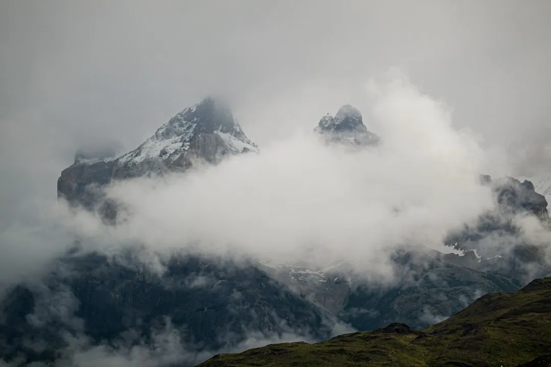
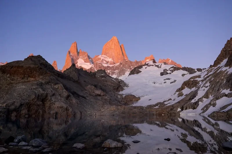
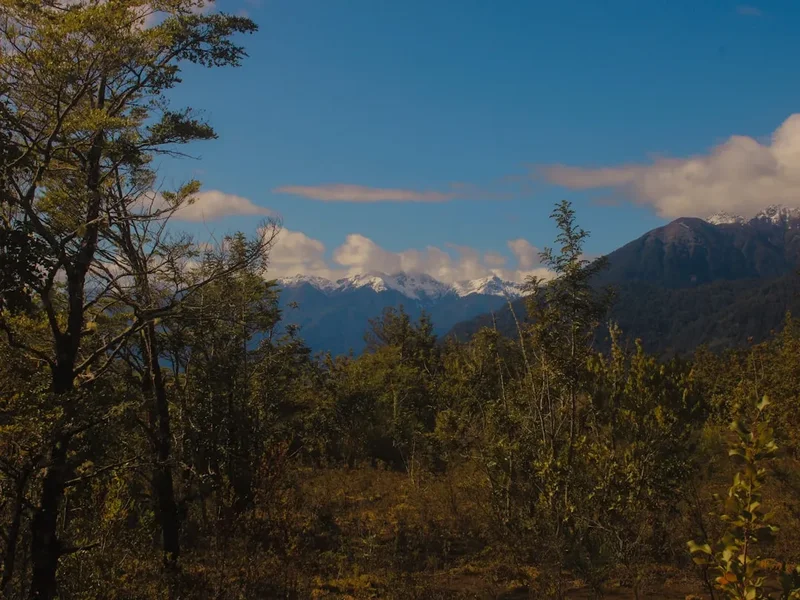
The scenery is classic high-altitude desert. As you ascend, the vegetation, sparse as it is at lower elevations, disappears entirely, replaced by a stark, rocky terrain. The colours are muted—ochres, greys, and blacks of volcanic rock dominate, contrasted by the brilliant blue of the high-altitude sky. The views that unfold with every metre gained are spectacular. To the west, the vast Salar de Atacama stretches out, a shimmering expanse of salt that appears almost otherworldly. To the east and north, a formidable array of volcanoes punctuate the horizon, including Licancabur, Juriques, and Acamarachi, many of which are themselves significant peaks. The summit of Cerro Toco offers a 360-degree panorama that is both humbling and awe-inspiring, a testament to the raw power and beauty of the Andean landscape.
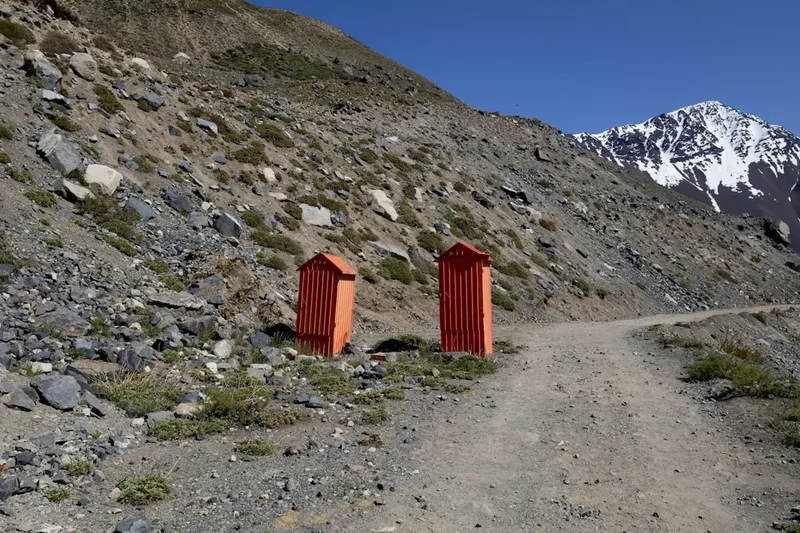
The trail is essentially a well-trodden path, often used by vehicles accessing the summit area for telecommunications equipment. This means the path is generally clear, though it can be loose and rocky in places. The ascent is steady, with the gradient increasing as you get higher. The final push to the summit is often the most demanding, as the altitude takes its toll. Reaching the top is a significant achievement, and the sense of accomplishment, coupled with the breathtaking views, makes the effort entirely worthwhile. It's a hike that demands respect for the environment and for your own physical limits, offering a profound connection to one of the planet's most extreme and beautiful natural settings.
History and Cultural Context
Cerro Toco, like many peaks in the Atacama region, has a history intertwined with both natural processes and human activity. As a dormant volcano, its geological past is one of fiery eruptions and slow cooling, shaping the very land that hikers now traverse. The volcanic rock and ash that form its slopes are a direct result of these ancient geological events, creating the unique, arid environment that characterises the Atacama Desert.
Human interaction with Cerro Toco and its surroundings dates back millennia. Indigenous peoples of the altiplano, such as the Atacameños, have long inhabited these high-altitude regions. For them, mountains were often sacred places, imbued with spiritual significance. Peaks like Cerro Toco may have been important for religious ceremonies, astronomical observation, or as sources of resources. The presence of ancient trails and potential archaeological sites in the broader region hints at a long history of human presence and movement across these challenging terrains.
In more recent history, the discovery of mineral wealth in the Atacama region led to increased human activity. Cerro Toco itself has been subject to mining exploration. An old mining track, which now forms the basis of the hiking trail, was established to facilitate access to the summit area for mining operations. While large-scale mining may not be active on the summit itself today, the remnants of this industrial past are visible in the track and occasional debris, serving as a reminder of the human endeavour to extract resources from this harsh environment. The peak's proximity to the border with Bolivia also places it within a historically significant geopolitical area, though the primary focus for hikers remains the natural and geological aspects of the ascent.
Seasonal Highlights and Weather Reality
The best time to undertake the Cerro Toco Ascent is during the dry season, which generally runs from April to November. This period offers the most stable weather conditions, with clear skies and minimal precipitation, making the high-altitude hike more predictable and enjoyable.
April to June (Autumn): This is an excellent time to hike. The summer heat has subsided, and the days are often clear and sunny, though temperatures can start to drop significantly, especially at night and at higher elevations. The air is typically dry, and the risk of rain is low. This period offers a good balance of pleasant daytime temperatures and cooler evenings.
July to September (Winter): While technically winter, the Atacama Desert experiences very little snowfall at these altitudes. The days are often bright and sunny, but temperatures can be very cold, particularly in the early morning and late afternoon. Frost and ice are common at the summit. The dry conditions persist, making it a viable hiking season, but warm clothing is essential. This is also a popular time for stargazing due to the clear skies.
October to November (Spring): As the dry season draws to a close, temperatures begin to warm up. The days remain largely clear, and the risk of rain is still low. This period can be ideal for hiking, with comfortable daytime temperatures and excellent visibility. However, as the season progresses towards December, the possibility of the "Bolivian Winter" (Altiplanic Winter) increases, bringing occasional thunderstorms and rain, though these are less common at the specific altitude of Cerro Toco compared to lower regions.
December to March (Summer): This is the wet season in the altiplano, known as the "Altiplanic Winter." While the Atacama Desert is famously arid, this period can bring occasional heavy rainfall, thunderstorms, and even hail at higher elevations. These conditions can make the trail hazardous, with slippery surfaces and reduced visibility. While it is still possible to hike, it is advisable to check weather forecasts very carefully and be prepared for sudden changes. The intense sun at this time of year can also be a factor, even with cloud cover.
Weather Considerations: Regardless of the season, weather at high altitudes can change rapidly. Expect strong winds, especially near the summit. Temperatures can fluctuate dramatically between day and night, and even within a single day. It is crucial to be prepared for all conditions, including cold, wind, and intense sun, even if the forecast appears favourable.
Recommended Itinerary
Cerro Toco Ascent - Day Walk Itinerary
Early Morning (Approx. 5:00 AM - 6:00 AM): Departure from San Pedro de Atacama
- Depart from your accommodation in San Pedro de Atacama.
- Travel time to the trailhead is approximately 1.5 hours.
- A 4x4 vehicle is highly recommended due to the rough and unpaved nature of the access road (Route B-241).
- Ensure you have had a light breakfast and are well-hydrated before departure.
Morning (Approx. 7:30 AM - 8:00 AM): Arrival at Trailhead and Acclimatisation
- Arrive at the Cerro Toco trailhead (GPS: -22.9598, -67.7719).
- The trailhead is at an elevation of approximately 5,050 metres (5,049 m).
- Spend 15-30 minutes at the trailhead to allow your body to adjust to the altitude.
- Perform final gear checks and apply sunscreen and insect repellent.
- Begin the ascent.
Morning to Midday (Approx. 8:00 AM - 11:00 AM): Ascent to the Summit
- Distance: Approximately 6.0 km (one way)
- Elevation Gain: Approximately 550 m
- Time: 3-4 hours
- The trail is an old mining track, generally well-defined but can be loose and rocky.
- The gradient is steady, with some steeper sections as you approach the summit.
- Pace yourself slowly and take frequent short breaks.
- Drink water regularly.
- Observe the changing landscape and the vast panoramic views unfolding.
- Key Waypoints: The trail is largely self-evident, following the most established path upwards.
Midday (Approx. 11:00 AM - 12:00 PM): Summit Experience
- Reach the summit of Cerro Toco (5,604 m / 5,604 m).
- Spend approximately 30-45 minutes at the summit.
- Take in the breathtaking 360-degree views of the Atacama Desert, including the Salar de Atacama, surrounding volcanoes (Licancabur, Juriques, etc.), and distant mountain ranges.
- Take photos and celebrate your achievement.
- Be mindful of the altitude; avoid strenuous activity and descend if you experience any symptoms of altitude sickness.
Afternoon (Approx. 12:00 PM - 2:00 PM): Descent to Trailhead
- Distance: Approximately 6.0 km (return)
- Elevation Loss: Approximately 550 m
- Time: 1.5-2 hours
- The descent is generally faster than the ascent but can be hard on the knees.
- Be cautious of loose scree and rocks.
- Continue to hydrate.
- Arrive back at the trailhead.
Late Afternoon (Approx. 2:00 PM - 3:30 PM): Return to San Pedro de Atacama
- Begin the drive back to San Pedro de Atacama.
- Allow time for a stop at a viewpoint or for photos along the way if desired.
- Upon arrival in San Pedro, rehydrate and consider a light meal.
Important Notes:
- This itinerary is a guideline; actual times may vary based on individual fitness, weather, and acclimatisation.
- Altitude sickness is a serious risk. If you experience symptoms (headache, nausea, dizziness), descend immediately.
- Carry sufficient water (at least 2-3 litres per person).
- Wear layers of clothing, including warm outer layers, as temperatures can drop significantly.
- Sun protection (hat, sunglasses, high SPF sunscreen) is essential due to the intense solar radiation at altitude.
- A 4x4 vehicle is strongly recommended for accessing the trailhead.
Planning and Bookings
Book Your Trip
Everything you need to plan your journey
Accommodation
Find places to stay near San Pedro de Atacama
Flights
Search flights to San Pedro de Atacama
Essential Preparation
The Cerro Toco Ascent is a high-altitude day hike that demands careful planning and preparation. The most critical aspect is acclimatisation. It is strongly advised to spend at least two to three days in San Pedro de Atacama (elevation approx. 2,400 m) before attempting this hike. During this time, engage in light activities such as visiting the Valle de la Luna or the Pukará de Quitor, and drink plenty of water. Avoid alcohol and heavy meals. Ensure you are in good physical condition; while the hike is only 12 km, the altitude makes it significantly more challenging than a similar-distance hike at sea level. Booking a guided tour is highly recommended, as guides are experienced with altitude management, provide necessary transport (often in 4x4 vehicles), and carry essential safety equipment. If self-driving, ensure your vehicle is suitable for rough terrain and that you have a reliable GPS device or map and compass.
Trail Accommodation
This is a day hike requiring no overnight accommodation. All activities are completed within a single day, returning to San Pedro de Atacama in the late afternoon.
Required Gear
- Sturdy hiking boots: Broken-in, waterproof, with good ankle support.
- Layered clothing: Essential for managing temperature fluctuations. Include a moisture-wicking base layer (merino wool or synthetic), an insulating mid-layer (fleece or down jacket), and a windproof and waterproof outer shell.
- Warm hat and gloves: Even in summer, temperatures at the summit can be near freezing.
- Sun hat: Wide-brimmed for maximum protection against intense solar radiation.
- Sunglasses: High UV protection is crucial.
- Headlamp or torch: With spare batteries, for early morning starts or unexpected delays.
- Backpack: A comfortable daypack (20-30 litres) to carry essentials.
- Navigation: GPS device or reliable offline map app on a smartphone, and a physical map and compass as backup.
- First-aid kit: Including personal medications, blister treatment, pain relievers, and altitude sickness medication (consult your doctor).
- Trekking poles: Highly recommended for stability on loose terrain and to reduce strain on knees during descent.
What to Bring
- Water: At least 2-3 litres per person. Hydration is critical at altitude. Consider an electrolyte supplement.
- Food: High-energy snacks such as nuts, dried fruit, energy bars, and sandwiches. Pack more than you think you'll need.
- Sunscreen: High SPF (50+) and broad-spectrum, applied liberally and reapplied often.
- Lip balm with SPF.
- Toilet paper and hand sanitiser.
- Camera: To capture the incredible views.
- Personal identification and any necessary permits (if applicable).
- Cash: For any unexpected expenses or small purchases.
Permits
Typically, no specific permits are required for hiking Cerro Toco as a day walk. The trail is generally considered public access, often following old mining tracks. However, it is always advisable to check with local authorities or your tour operator in San Pedro de Atacama for the most up-to-date information regarding access regulations or any potential changes. The area is part of a vast, arid landscape, and while not a formally managed national park in the same way as some other Chilean attractions, local regulations can exist. If you are visiting with a guided tour, they will be aware of any requirements.
Important Considerations:
- Private Land: While the main track is generally accessible, be aware that some areas might be privately owned or have specific mining concessions. Stick to established paths to avoid trespassing.
- Vehicle Access: If you are driving yourself, ensure you are aware of any road access rules or restrictions. The road can be rough, and a 4x4 is strongly recommended.
- Environmental Protection: Even without a formal permit, visitors are expected to adhere to Leave No Trace principles and respect the fragile desert environment.
Other Activities in the Area
San Pedro de Atacama and its surroundings offer a wealth of unique experiences that complement the Cerro Toco Ascent:
- Valle de la Luna (Moon Valley) and Valle de la Muerte (Death Valley): Explore surreal landscapes of sand dunes, salt formations, and canyons that resemble the surface of the moon. Ideal for sunset viewing.
- Salar de Atacama: Visit the vast salt flats, home to flamingos and other wildlife in the Chaxa Lagoon.
- Geysers del Tatio: Witness an impressive geothermal field with steaming geysers at sunrise. This is another high-altitude experience (4,320 m) and requires an early start.
- Lagunas Altiplánicas (Miscanti and Miñiques): Stunning high-altitude lagoons set against dramatic volcanic backdrops, offering incredible photographic opportunities and a chance to see vicuñas and other Andean fauna.
- Stargazing Tours: The Atacama Desert is one of the best places in the world for astronomical observation due to its high altitude, clear skies, and low light pollution. Numerous observatories and tour operators offer guided stargazing experiences.
- Pukará de Quitor: Explore an ancient Atacameño fortress offering panoramic views of the San Pedro oasis.
- Termas de Puritama: Relax in natural hot springs nestled in a canyon, a perfect way to soothe muscles after a strenuous hike.
Safety and Conditions
Altitude Sickness (Acute Mountain Sickness - AMS): This is the primary safety concern for the Cerro Toco Ascent. Symptoms can include headache, nausea, dizziness, fatigue, and shortness of breath. The best prevention is gradual acclimatisation in San Pedro de Atacama for 2-3 days before the hike. Ascend slowly, drink plenty of water, avoid alcohol and strenuous activity on ascent day, and descend immediately if symptoms worsen. Consult your doctor about preventative medication like Diamox (acetazolamide).
Weather: High-altitude desert weather is unpredictable. Be prepared for strong winds, rapid temperature drops, and intense solar radiation. Even on a clear day, the summit can be very cold. Always check the weather forecast before you go.
Trail Conditions: The trail is an old mining track, which can be loose, rocky, and uneven. Trekking poles are highly recommended for stability and to reduce impact on your knees during the descent. The path is generally well-defined, but in poor visibility (rare but possible), navigation could become challenging.
Vehicle Access: The road to the trailhead is rough and unpaved. A 4x4 vehicle is strongly recommended. If driving yourself, ensure you have adequate fuel, a spare tyre, and basic repair tools. If using a tour operator, ensure they use appropriate vehicles and experienced drivers.
Isolation: While the trail is relatively popular, you may encounter few other hikers, especially if you start very early. Ensure you have a reliable way to communicate in an emergency (e.g., satellite phone if venturing far off the main track, though unlikely for this hike). Inform someone of your plans and expected return time.
Sun Protection: The sun's rays are extremely intense at this altitude. Use high SPF sunscreen, wear a wide-brimmed hat and sunglasses, and cover exposed skin. Sunburn can occur rapidly.
Hydration: Dehydration is a significant risk at altitude. Drink water consistently throughout the hike, even if you don't feel thirsty.
Emergency Contacts: In San Pedro de Atacama, emergency services can be contacted through local police or tour operators. It's wise to have these numbers readily available.
Side Trips and Points of Interest
Summit Views: The primary "point of interest" is the summit itself and the unparalleled 360-degree panoramic views it offers. From 5,604 metres, you can see:
- Salar de Atacama: The vast salt flat stretching to the horizon, a shimmering white expanse.
- Volcanoes: A dramatic ring of volcanoes encircles the region, including the iconic Licancabur, Juriques, Acamarachi, and many others, some of which are active or dormant giants.
- Andean Altiplano: The rugged, high-altitude plateau with its unique desert flora and fauna.
- Distant Landscapes: On exceptionally clear days, you may be able to see far into Argentina and Bolivia.
Old Mining Track: The trail itself is a point of interest, a testament to past human endeavour in this extreme environment. You'll see remnants of mining activity, including the track itself, which was carved out to access the summit area. This provides a historical context to the landscape.
Volcanic Geology: The entire ascent is a journey through volcanic geology. You'll observe different types of volcanic rock, ash deposits, and the erosional forces that have shaped the volcano's slopes over millennia. The stark, barren beauty of the volcanic terrain is a key feature.
Flora and Fauna (Limited): While the higher reaches are largely barren, you might spot some hardy desert plants clinging to life at lower elevations. Keep an eye out for Andean condors soaring overhead or vicuñas grazing in the distance on the surrounding plains. However, significant wildlife sightings are rare at this altitude.
Leave No Trace
The Atacama Desert, particularly at high altitudes like Cerro Toco, is a fragile ecosystem. Adhering to Leave No Trace principles is crucial to preserving its unique environment for future visitors and for the indigenous cultures that have long inhabited this region.
Plan Ahead and Prepare: Research the hike, understand the altitude challenges, and prepare adequately. Ensure you have the right gear and sufficient water and food. If possible, acclimatise properly in San Pedro de Atacama.
Travel and Camp on Durable Surfaces: Stick to the established mining track. Avoid creating new paths, as this can lead to erosion and damage fragile desert vegetation. The track is already a durable surface.
Dispose of Waste Properly: Pack out everything you pack in. This includes all food scraps, wrappers, and any other litter. There are no bins on the trail. Use designated toilet facilities where available (though unlikely on this trail) or dig a cathole at least 60 metres from water sources, trails, and campsites (if applicable, though this is a day hike). Pack out all toilet paper.
Leave What You Find: Do not take rocks, plants, or any natural or historical artefacts. The landscape's beauty lies in its natural state.
Minimise Campfire Impacts: Campfires are not permitted on this day hike and are generally discouraged in the Atacama due to the arid environment and fire risk.
Respect Wildlife: Observe wildlife from a distance. Do not feed animals, as this can disrupt their natural behaviours and diets. While wildlife is scarce at this altitude, be mindful of any creatures you encounter.
Be Considerate of Other Visitors: Keep noise levels down, especially if you encounter other hikers. Allow faster hikers to pass. The goal is to enjoy the solitude and natural beauty.