
Cerro Castillo Circuit - Patagonia’s Rugged Masterpiece
The Cerro Castillo Circuit is often whispered about by seasoned trekkers as the "new Torres del Paine," but such a comparison does a disservice to its unique, raw character. Located in the heart of the Aysén Region in Chilean Patagonia, this 51-kilometre trek is a formidable journey through a landscape that feels significantly more wild and less commercialised than its famous southern counterparts. The circuit circumnavigates the majestic Cerro Castillo, a 2,675-metre basalt monolith whose jagged spires resemble a medieval fortress rising from the earth. This is a trek of extremes: from the dense, emerald-green Nothofagus (Southern Beech) forests and rushing glacial rivers to the stark, wind-scoured alpine passes and turquoise lagoons that cradle ancient ice. Unlike the highly regulated paths of the Magallanes region, the Cerro Castillo Circuit offers a sense of profound isolation, demanding self-sufficiency, physical resilience, and a deep respect for the unpredictable Patagonian climate. It is a journey that rewards the adventurous with some of the most dramatic mountain scenery on the planet, including hanging glaciers that thunder into hidden valleys and the rare opportunity to spot the endangered Huemul (South Andean Deer) in its natural habitat.
- Distance: 51.0 km loop (typically walked point-to-point from Las Horquetas)
- Duration: 4–5 days
- Season: December to March (Patagonian summer)
- Difficulty: Challenging (steep scree slopes, high alpine passes, and river crossings)
- Elevation Gain: 2,700 m total
- Highest Point: Paso Peñón (approx. 1,600 m)
- Closest City: Coyhaique, Chile
- Trailhead: Las Horquetas Ranger Station (Carretera Austral)
Overview
The Cerro Castillo Circuit is a masterclass in Patagonian geography, offering a condensed yet comprehensive experience of the region's diverse ecosystems. The trek typically begins at Las Horquetas, a remote point on the iconic Carretera Austral (Route 7), and concludes in the small village of Villa Cerro Castillo. Over the course of four to five days, hikers transition from the low-lying Patagonian steppe into ancient forests of Lenga and Coihue trees, eventually emerging above the treeline into a world of rock and ice. The defining feature of the trek is the "Castle" itself—a massive basaltic formation that dominates the skyline. The geology here is striking; the dark, volcanic rock contrasts sharply with the brilliant white of the hanging glaciers and the milky turquoise of the glacial lakes, such as Laguna Cerro Castillo and Laguna Turbia.
Physically, the circuit is demanding. It is not a "walk in the park" in the traditional sense. The terrain is often rugged, with sections of deep mud in the forests and long, unstable scree slopes on the mountain passes. The ascent to Paso Peñón and the subsequent traverse toward the Morro Negro are particularly taxing, requiring steady footing and a head for heights. However, the infrastructure has improved in recent years since the area was designated a National Park in 2017. While the trails are better marked than they once were, they remain far more primitive than those in Torres del Paine. There are no luxury lodges or heated huts here; instead, you will find basic backcountry campsites that offer little more than a flat spot for a tent and access to a stream. This lack of development is precisely what draws many to Cerro Castillo—it is a place where the wilderness still feels untamed.
The weather is perhaps the most significant factor for any trekker. The Aysén region is notorious for its "four seasons in one day" weather patterns. Even in the height of summer, hikers must be prepared for gale-force winds, torrential rain, and even snow at higher elevations. The wind, in particular, can be humbling, sometimes reaching speeds that make walking with a heavy pack a genuine struggle. Yet, when the clouds part and the sun illuminates the basalt spires of the mountain, the visual reward is unparalleled. The sight of the hanging glacier above Laguna Cerro Castillo, with ice calving into the water below, is an experience that stays with a person for a lifetime. This is a trek for those who seek to test themselves against the elements and find beauty in the raw, unpolished corners of the world.
History and Cultural Context
The history of the Cerro Castillo area is a tapestry of indigenous heritage, colonial exploration, and modern conservation. Long before the arrival of European settlers, the region was the ancestral home of the Tehuelche (Aonikenk) people. These nomadic hunter-gatherers roamed the Patagonian steppe, following the seasonal migrations of guanacos. While they did not typically establish permanent settlements in the high mountains, the valleys surrounding Cerro Castillo were vital corridors for their movement. Evidence of their presence can still be found in the region, most notably at the Paredón de las Manos (Wall of Hands) near Villa Cerro Castillo, where rock paintings dating back thousands of years serve as a silent testament to their enduring connection to this land.
In the early 20th century, the landscape began to change as Chilean and European settlers arrived, driven by the promise of vast tracts of land for sheep and cattle ranching. This era of "colonisation" was brutal and transformative. To create grazing land, massive swathes of native forest were cleared through intentional fires—some of which burned for years, leaving behind the "ghost forests" of bleached white trunks that are still visible along parts of the Carretera Austral today. The village of Villa Cerro Castillo was established during this period, serving as a remote outpost for gauchos (Patagonian cowboys) who braved the harsh climate to tend their herds. The gaucho culture remains a cornerstone of the local identity; even today, it is common to see men in traditional berets and sheepskin leggings riding through the village or along the dusty roads.
The modern era of Cerro Castillo is defined by a shift toward conservation. For decades, the area was managed as a National Reserve, but in 2017, it was officially elevated to National Park status as part of a historic land donation by the Tompkins Conservation foundation (founded by Douglas and Kristine Tompkins). This move was part of a larger vision to create a "Route of Parks" spanning the length of Chilean Patagonia. The transition to a National Park has brought increased funding for trail maintenance and the protection of endangered species, most notably the Huemul deer. The Huemul is a national symbol of Chile, yet it is one of the most endangered deer species in the world. The Cerro Castillo National Park is one of its last strongholds, and the circuit offers one of the best chances for hikers to see these elusive creatures. Today, the trek stands as a bridge between the region's rugged pastoral past and a future focused on preserving its extraordinary natural heritage.
Want more background? Read extended notes on history and cultural context → Learn more
Seasonal Highlights and Weather Reality
Timing is everything when planning a trek in Aysén. The window for completing the Cerro Castillo Circuit is relatively narrow, dictated by the harsh Patagonian winter and the accessibility of the high alpine passes. Outside of the peak summer months, the trail can be dangerous or entirely impassable due to deep snow and extreme weather conditions.
Summer (December to March): This is the primary trekking season. During these months, the days are long, with daylight lasting until 10:00 PM, providing ample time to navigate the challenging terrain. Temperatures in the valleys can reach a pleasant 18°C to 22°C, though they can drop to near freezing at night. This is also the time when the wildflowers are in bloom, and the Nothofagus forests are at their most vibrant. However, summer also brings the infamous Patagonian winds, which can be relentless. January and February are the busiest months, though "busy" here is a relative term compared to other major world treks.
Shoulder Seasons (October to November and April): These months offer a quieter experience but come with significant risks. In late spring (October–November), snow often remains on the high passes, particularly Paso Peñón, requiring crampons, an ice axe, and advanced navigation skills. In autumn (April), the forests turn spectacular shades of red and orange, but the weather becomes increasingly unstable, with a higher frequency of rain and the first dustings of winter snow. Many of the park's services and transport options begin to wind down during this time.
Winter (May to September): Trekking the full circuit in winter is strictly for expert mountaineers with specialised equipment and experience in sub-zero conditions. The trail is often buried under several metres of snow, and the risk of avalanches on the steep slopes is high. Most independent hikers should avoid the circuit during this period, as the park rangers may officially close the higher sections of the trail for safety.
Regardless of the season, the "Weather Reality" of Cerro Castillo is that you must be prepared for anything. Rain is a constant possibility, and it is often horizontal due to the wind. The high passes act as funnels for weather systems coming off the Pacific Ocean, meaning conditions can change from clear blue skies to a whiteout in less than thirty minutes. Proper layering and high-quality waterproof gear are not just recommendations; they are essential for survival and comfort.
Recommended Itinerary
4-Day Cerro Castillo Circuit Itinerary
Day 1: Las Horquetas to Campamento Turbio
- Distance: 15 km
- Elevation gain: 450 m
- Time: 5–7 hours
- Start at the Las Horquetas Ranger Station on the Carretera Austral.
- The trail begins with a relatively flat walk through the Patagonian steppe and open grasslands.
- Enter the Nothofagus forest, following the Rio Horquetas upstream.
- Expect several river crossings; depending on recent rainfall, these can range from ankle-deep to knee-deep.
- The gradient remains gentle for most of the day, serving as a good warm-up for the days ahead.
- Arrive at Campamento Turbio, situated in a forested area near the river.
- This section offers the first glimpses of the surrounding peaks and the chance to spot local birdlife, including the Magellanic Woodpecker.
Day 2: Campamento Turbio to Campamento El Peñón
- Distance: 11 km
- Elevation gain: 750 m
- Time: 6–8 hours
- This is one of the most challenging days of the trek, involving the ascent of Paso Peñón.
- The trail climbs steeply out of the forest and onto a massive, unstable scree slope.
- Navigate the "zig-zags" up to the pass (1,600 m), where you will be rewarded with views of the Turbio Glacier and the surrounding spires.
- The wind at the pass can be extreme; take care with your footing and pack balance.
- Descend the other side of the pass, which is equally steep and requires careful navigation through rocky terrain.
- Pass by the stunning Laguna Turbia, a milky-grey glacial lake.
- Arrive at Campamento El Peñón, a basic site located in a high alpine valley.
Day 3: Campamento El Peñón to Campamento La Tronador (or Neozelandés)
- Distance: 10 km
- Elevation gain: 600 m
- Time: 5–7 hours
- The day begins with a traverse across high alpine plateaus and rocky ridges.
- Ascend toward the Morro Negro, another high point offering panoramic views of the Ibáñez River valley and the village below.
- The trail follows a dramatic ridgeline before descending toward the iconic Laguna Cerro Castillo.
- Spend time at the Laguna, marveling at the hanging glacier and the basalt towers that give the mountain its name.
- Continue to Campamento La Tronador, or push on another 1.5 hours to Campamento Neozelandés if you wish to do the side trip the following morning.
- This section is arguably the most scenic part of the entire circuit.
Day 4: Campamento La Tronador to Villa Cerro Castillo
- Distance: 15 km (including side trip)
- Elevation loss: 1,100 m
- Time: 6–8 hours
- If staying at Neozelandés, take the morning to hike up to the Laguna Neozelandés, a pristine alpine cirque surrounded by granite walls.
- Return to the main trail and begin the long, knee-jarring descent toward the village.
- The trail drops steeply through the forest, offering final views of the Ibáñez Valley.
- Pass the park exit gate and walk the final few kilometres along a dusty road into Villa Cerro Castillo.
- Celebrate the completion of the trek with a traditional Chilean meal and a cold drink in the village.
- Arrange transport back to Coyhaique or continue your journey along the Carretera Austral.
Important Notes:
- The trail is point-to-point; ensure you have arranged transport to Las Horquetas.
- Water is generally abundant from streams, but treatment is recommended near campsites.
- Campsites are basic; there are no showers or cooking facilities.
- The descent on Day 4 is very steep; trekking poles are highly recommended to protect your knees.
- Always check in with the rangers at Las Horquetas for the latest trail conditions and weather alerts.
Planning and Bookings
Book Your Trip
Everything you need to plan your journey
Accommodation
Find places to stay near Coyhaique
Flights
Search flights to Coyhaique
Essential Preparation
Preparation for the Cerro Castillo Circuit begins in Coyhaique, the regional capital of Aysén. This is the last place to purchase specialised outdoor gear, fuel canisters, and high-quality trekking food. Most hikers fly into Balmaceda Airport (BBA) and take a shuttle to Coyhaique (approx. 50 minutes). You should spend at least one or two days in Coyhaique to finalise logistics, check weather forecasts, and register your trek with the CONAF (Corporación Nacional Forestal) office if required, although registration is usually done at the trailhead.
Physical fitness is a prerequisite. You will be carrying a full pack (15–20 kg) over steep, uneven terrain for multiple days. Training should focus on leg strength and cardiovascular endurance, ideally with weighted hikes. Logistics-wise, you must coordinate your transport to the trailhead at Las Horquetas. Local buses heading south from Coyhaique toward Cochrane or Puerto Rio Tranquilo can drop you at the Las Horquetas gate, but you must inform the driver in advance. Alternatively, private transfers can be arranged from Villa Cerro Castillo or Coyhaique.
Trail Accommodation
Accommodation on the Cerro Castillo Circuit is limited to designated backcountry campsites. There are no "refugios" or huts with beds on this trail. Hikers must be entirely self-sufficient, carrying their own tent, sleeping bag, and cooking equipment.
Campsite Facilities:
- Flat clearings for tents (often limited in number).
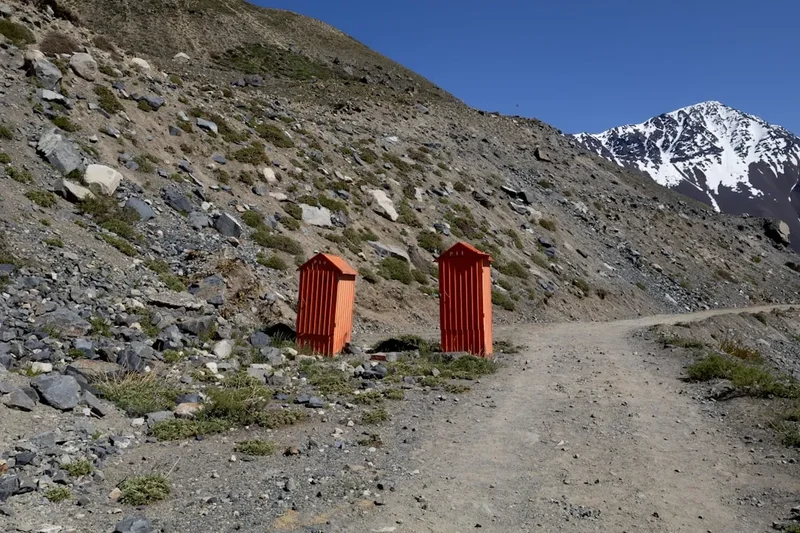
- Basic pit toilets (latrines) at most sites.
- Access to a nearby stream or river for water.
- Some sites have basic wooden windbreaks or rustic tables, but these are not guaranteed.
- No electricity, no rubbish bins, and no showers.
Key Campsites:
- Campamento Turbio: Located in the forest, providing good shelter from the wind.
- Campamento El Peñón: A high-altitude site; can be very cold and exposed.
- Campamento La Tronador: Situated near the base of the main towers; popular and scenic.
- Campamento Neozelandés: Tucked away in a beautiful valley; the best base for exploring the upper cirque.
Booking and Costs:
- As of the current season, there is no advanced online booking system for individual campsites.
- You pay an entrance fee at the Las Horquetas Ranger Station, which covers your stay at the campsites within the park.
- The fee is approximately 30,000 CLP (Chilean Pesos) for international visitors, though prices are subject to change.
- Keep your receipt, as rangers may check it at various points along the trail or upon exit.
Required Gear
- Tent: A high-quality, 3-season or 4-season tent capable of withstanding high winds and heavy rain.
- Sleeping Bag: Rated to at least -5°C comfort level. Even in summer, alpine temperatures can drop significantly.
- Sleeping Mat: Essential for insulation from the cold ground.
- Footwear: Sturdy, waterproof trekking boots with good ankle support. The terrain is rocky and often muddy.
- Trekking Poles: Highly recommended for the steep scree ascents and the long descent on the final day.
- Backpack: 50–70L capacity with a waterproof cover and a comfortable harness system.
- Clothing: A robust layering system including moisture-wicking base layers, a fleece or down mid-layer, and a high-quality Gore-Tex (or equivalent) waterproof shell.
- Navigation: A detailed topographic map and a compass or GPS device. The trail is marked but can be obscured by snow or low cloud.
What to Bring
- Food: All meals and snacks for 4–5 days. Focus on lightweight, high-calorie options (dehydrated meals, nuts, chocolate). There is nowhere to buy food on the trail.
- Stove and Fuel: A lightweight camping stove (e.g., Jetboil or MSR). Ensure you buy the correct gas canisters in Coyhaique.
- Water Treatment: While many streams are pristine, it is safer to use a filter or purification tablets, especially near campsites.
- Cooking Utensils: A lightweight pot, mug, spoon, and a pocket knife.
- First Aid Kit: Including blister care (moleskin/Compeed), antiseptic wipes, bandages, and personal medications.
- Sun Protection: High SPF sunscreen, lip balm with SPF, and sunglasses. The Patagonian sun is exceptionally strong due to the thin ozone layer.
- Headlamp: With spare batteries.
- Toiletries: Biodegradable soap, a small trowel (if toilets are unavailable), and a "pack-it-out" bag for used toilet paper.
- Cash: Chilean Pesos for the park entrance fee and the bus/shuttle back to Coyhaique.
Permits
The permit system for the Cerro Castillo Circuit is relatively straightforward compared to other major treks, but it requires adherence to local regulations. There is no "lottery" or months-long waiting list, but you must register and pay your fees at the official entry points.
Registration Process:
- All hikers must register at the Las Horquetas Ranger Station (if starting there) or the CONAF office in Villa Cerro Castillo (if doing a day hike or entering from the village side).
- You will be asked to provide your passport details, planned itinerary, and emergency contact information.
- Rangers will provide a brief orientation on trail conditions, weather forecasts, and park rules.
- You will receive a paper permit/receipt. It is vital to keep this in a waterproof sleeve, as you will need to present it to rangers at the exit or if you are checked on the trail.
Fees and Regulations:
- The entrance fee for the full circuit is approximately 30,000 CLP for international adults. Chilean residents pay a reduced rate.
- Fees must usually be paid in cash (Chilean Pesos) at the trailhead, as credit card machines are unreliable in remote areas.
- The park has strict "No Fire" regulations. Use of camping stoves is permitted only in designated campsites.
- Drones are generally prohibited within the National Park to protect wildlife and the experience of other hikers.
- You must pack out all of your rubbish; there are no bins on the trail.
Group Size and Guides:
- There is currently no mandatory requirement to hire a guide for the Cerro Castillo Circuit. Experienced independent trekkers are welcome.
- However, for those less confident in alpine navigation or Patagonian weather, several reputable guiding companies in Coyhaique and Villa Cerro Castillo offer all-inclusive tours.
- Maximum group sizes may be enforced during peak periods to minimise environmental impact.
Other Activities in the Area
The Aysén region is one of the most spectacular parts of Chile, and it is worth spending extra time exploring the surrounding attractions before or after your trek:
- Capillas de Mármol (Marble Caves): Located on General Carrera Lake near Puerto Rio Tranquilo (about 3 hours south of Villa Cerro Castillo). These extraordinary calcium carbonate formations have been sculpted by the water over thousands of years. Boat and kayak tours are available.
- Carretera Austral Road Trip: Rent a 4x4 vehicle and drive sections of this 1,240-kilometre road. The scenery is a constant parade of glaciers, fjords, and turquoise rivers.
- Fly Fishing: The rivers and lakes around Coyhaique are world-renowned for trout and salmon fishing. Many lodges offer guided day trips.
- Paredón de las Manos: A short walk from Villa Cerro Castillo leads to this archaeological site featuring ancient indigenous rock art.
- Laguna San Rafael Glacier: Take a full-day boat excursion from Puerto Chacabuco to see one of the most impressive tidewater glaciers in the Northern Patagonian Ice Field.
- Villa Cerro Castillo Village Life: Spend a day in the village enjoying a "cordero al palo" (spit-roasted lamb), visiting the local museum, and soaking in the authentic gaucho atmosphere.
Safety and Conditions
Weather and Exposure: The primary safety concern on the Cerro Castillo Circuit is the weather. Hypothermia is a real risk, even in summer, if you are caught in a storm without adequate gear. The wind on Paso Peñón can be strong enough to knock a person over; if conditions are too severe, it is better to wait at a lower elevation or turn back. Always check the forecast before heading over the high passes.
Terrain Hazards: The trail involves significant sections of loose scree and talus. These slopes are unstable and can lead to slips or falls. Trekking poles provide essential stability. Additionally, the river crossings on Day 1 can be dangerous after heavy rain. If the water is above knee-height and flowing fast, do not attempt to cross; wait for the water level to drop or find a wider, shallower section.
Wildlife: While the Huemul deer are harmless, you should maintain a respectful distance (at least 20 metres) to avoid stressing them. Pumas are present in the park but are extremely elusive and rarely encountered by hikers. If you do see one, do not run; stand your ground, make yourself look large, and shout. Keep your food secured to avoid attracting smaller scavengers like foxes or mice.
Navigation and Communication: Mobile phone signal is non-existent on the trail. It is highly recommended to carry a satellite communication device (like a Garmin inReach or Zoleo) for emergencies. Ensure someone outside the park knows your itinerary and expected return date. The trail is marked with yellow and blue paint on rocks and trees, but these can be hard to see in fog or snow.
Water Safety: While the water in the park is generally very clean, there is a risk of "Dimo" (Didymosphenia geminata), an invasive algae, in some regional waterways. To protect the ecosystem and your health, use a filter and avoid washing dishes or yourself directly in the streams.
Side Trips and Points of Interest
Laguna Neozelandés: This is the most popular side trip on the circuit and is highly recommended. From Campamento Neozelandés, a steep 1-hour climb leads to a stunning alpine cirque. The lake is surrounded by sheer granite walls and hanging glaciers, offering a more intimate and rugged version of the scenery found at Laguna Cerro Castillo. It is a perfect spot for photography and quiet reflection.
Laguna Cerro Castillo: While part of the main circuit, many people treat this as a destination in itself. The viewpoint from the moraine wall offers the classic "postcard" view of the turquoise water backed by the basalt towers. If you have extra time, you can walk along the shore of the lake to get a closer look at the ice calving from the glacier.
Morro Negro Viewpoint: During the traverse on Day 3, the trail passes near the Morro Negro. Taking a few extra minutes to scramble to the highest accessible point provides a 360-degree panorama that includes the Ibáñez River valley, the Northern Patagonian Ice Field in the far distance, and the entire Cerro Castillo massif.
The "Ghost Forest": On the approach to Las Horquetas and in certain valleys, you will pass through areas of bleached, dead trees. These are the remnants of the great fires of the mid-20th century. While somber, they are a fascinating and photogenic part of the region's environmental history.
Leave No Trace
The Cerro Castillo National Park is a fragile ecosystem that is still recovering from the impacts of the past century. As a visitor, it is your responsibility to ensure that your presence does not further degrade this wilderness. The "Leave No Trace" principles are strictly enforced by park rangers and are essential for the preservation of the park.
Core Principles for Cerro Castillo:
- Plan Ahead and Prepare: Know the regulations and be ready for extreme weather to avoid emergency situations that put rescuers at risk.
- Travel and Camp on Durable Surfaces: Stay on the marked trails to avoid trampling sensitive alpine vegetation. Use only the designated campsites.
- Dispose of Waste Properly: Pack out ALL rubbish, including organic waste like banana peels or apple cores, which do not decompose quickly in this climate and can harm wildlife.
- Leave What You Find: Do not pick wildflowers or remove rocks or fossils. Respect the archaeological sites like the Paredón de las Manos.
- Minimise Campfire Impacts: Fires are strictly prohibited. Use a lightweight stove for all cooking.
- Respect Wildlife: Observe Huemul deer from a distance. Never feed any animals.
- Be Considerate of Other Visitors: Keep noise levels down and respect the solitude that others have come to find.
By following these guidelines, you help ensure that the Cerro Castillo Circuit remains a pristine and wild destination for generations to come. The Aysén region is a treasure; walk through it with care and humility.