Ceredigion Coast Path - The Wild Heart of Cardigan Bay
The Ceredigion Coast Path is a spectacular 96.5 km long-distance trail that traces the undulating shoreline of Mid-Wales, offering some of the most diverse and dramatic coastal scenery in the United Kingdom. Stretching from the historic town of Cardigan in the south to the expansive sand dunes of Ynyslas in the north, this segment of the 1,400 km Wales Coast Path is widely considered its most rewarding section. The route traverses high, jagged cliffs, hidden smugglers' coves, expansive sandy beaches, and colourful Georgian harbour towns. Unlike the more famous Pembrokeshire Coast Path to the south, Ceredigion offers a sense of profound solitude and "wildness," where the Welsh language is still the heartbeat of the local communities and the Atlantic Grey Seals outnumber the walkers. This is a journey through a landscape defined by the sea, where the horizon is dominated by the vast curve of Cardigan Bay and the distant peaks of Snowdonia/Eryri.
- Distance: 96.5 km one-way
- Duration: 6–8 days
- Season: May to September (best weather and wildlife viewing)
- Total Elevation Gain: Approximately 3,500 m
- Highest Point: Pen y Badell (near Llanrhystud, 150 m)
- Difficulty: Moderate (frequent steep ascents and descents)
- Direction: South to North (Cardigan to Ynyslas) is traditional, but can be walked in either direction
Overview
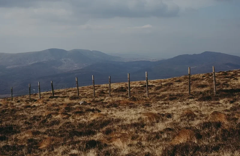
The Ceredigion Coast Path is a masterclass in coastal variety. It is not merely a walk along the sea; it is a journey through geological time and cultural heritage. The path is characterised by its "switchback" nature—frequent, short, but often steep climbs from sea level to cliff tops that reach heights of over 100 metres. These undulations provide a physical challenge that belies the trail's relatively modest total distance, but the reward is a constant rotation of breathtaking vistas. From the southern reaches near Cardigan, where the Teifi estuary meets the sea, to the northern terminus at the Dyfi estuary, the landscape shifts from rugged Silurian gritstone cliffs to soft glacial till and eventually to the vast, shifting sands of the Ynyslas dunes.
One of the defining features of this trail is its status as a premier wildlife corridor. Cardigan Bay is home to the UK's largest resident population of Bottlenose Dolphins, which are frequently spotted from the cliff tops, particularly between New Quay and Aberporth. In the autumn, the secluded coves like Cwmtydu become nurseries for Atlantic Grey Seals, whose white-coated pups can be seen resting on the shingle. The birdlife is equally impressive; the rare Red Chough, with its distinctive red beak and legs, performs aerial acrobatics along the cliffs, while Razorbills and Guillemots nest in their thousands on the sheer rock faces of the Ceredigion Heritage Coast.
Culturally, the path connects a series of unique Welsh settlements. You will walk through Cardigan, once the most important port in Wales; New Quay, the inspiration for Dylan Thomas’s "Under Milk Wood"; Aberaeron, a jewel of planned Georgian architecture with its multi-coloured houses; and Aberystwyth, the historic university town and cultural capital of Mid-Wales. The trail is well-marked with the iconic dragon-shell logo of the Wales Coast Path, yet it retains an air of discovery. Whether you are navigating the narrow, gorse-lined paths of the high cliffs or strolling along the promenade at Aberystwyth, the Ceredigion Coast Path offers a profound connection to the maritime soul of Wales.
History and Cultural Context
The history of the Ceredigion coastline is inextricably linked to the sea. For centuries, these waters were the primary highways for trade and communication. Cardigan (Aberteifi) was once a bustling maritime hub, at one point surpassing Cardiff in its volume of trade. The town was a major departure point for Welsh emigrants seeking a new life in North America during the 18th and 19th centuries. As you walk the path, you will see the remnants of this maritime past: old lime kilns tucked into the cliffs where limestone was brought by sea to be burnt for fertiliser, and small, secluded coves that once served as the perfect landing spots for smugglers dealing in salt, spirits, and tobacco.
The landscape is also dotted with even older history. Iron Age hillforts, such as Castell Bach near Llangrannog, sit precariously on coastal promontories, their defensive earthworks still visible after two millennia. These sites offer a glimpse into a time when the sea was both a source of sustenance and a threat from invaders. The spiritual history of the region is represented by sites like the Church of the Holy Cross at Mwnt, a simple, white-washed 14th-century chapel that served as a sanctuary for pilgrims travelling to St Davids or Bardsey Island.
Ceredigion is also a stronghold of the Welsh language (Cymraeg). In many of the villages along the route, Welsh is the first language of the majority of residents. This linguistic heritage adds a rich layer to the walking experience, from the place names on the maps to the conversations overheard in local pubs. The trail is not just a physical path but a journey through the "Cynefin"—a Welsh word that describes a sense of belonging and the historical, cultural, and social connections that bind a person to their environment.
Want more background? Read extended notes on history and cultural context → Learn more
Seasonal Highlights and Weather Reality
The Ceredigion Coast Path is accessible year-round, but the experience changes dramatically with the seasons. The prevailing weather comes from the Atlantic, meaning the coast is subject to rapid changes in conditions, often experiencing "four seasons in one day."
Spring (March to May): This is perhaps the most beautiful time to walk. The cliffs are carpeted in a vibrant display of wildflowers, including sea pinks (thrift), spring squill, and yellow gorse. The air is filled with the scent of coconut from the gorse and the calls of returning seabirds. Temperatures are mild, typically ranging from 10°C to 15°C, though the wind can still be biting.
Summer (June to August): The most popular time for the trail. The weather is generally drier and warmer (18°C to 22°C), making it ideal for swimming in the hidden coves. This is the peak season for dolphin sightings, especially on calm, sunny days. However, the path can be busier near the main towns, and accommodation should be booked well in advance.
Autumn (September to November): A season of dramatic light and wildlife spectacles. September is the best time to see seal pups in the secluded coves. The summer crowds disperse, and the landscape takes on golden hues. However, the risk of Atlantic storms increases, and the path can become muddy and slippery after heavy rain.
Winter (December to February): Only for the hardy and well-equipped. The coast is battered by powerful gales and heavy rain, but on clear, crisp days, the views across the bay to the snow-capped peaks of Eryri (Snowdonia) are unparalleled. Many local amenities and seasonal buses close during this period, and daylight hours are short (sunset as early as 4:00 PM).
Recommended Itinerary
7-Day Ceredigion Coast Path Itinerary
Day 1: Cardigan to Aberporth
- Distance: 19 km
- Elevation gain: 450 m
- Time: 5–6 hours
- Start at the historic Cardigan Bridge and follow the Teifi estuary towards St Dogmaels
- Pass the ruins of St Dogmaels Abbey before heading towards Poppit Sands
- The path climbs steeply onto the cliffs, offering views back towards Pembrokeshire
- Visit the iconic white-washed church at Mwnt, a perfect spot for dolphin watching
- Continue along the high cliffs to the seaside village of Aberporth
- Key Waypoints: St Dogmaels, Poppit Sands, Mwnt, Aberporth
Day 2: Aberporth to Llangrannog
- Distance: 8.5 km
- Elevation gain: 300 m
- Time: 3–4 hours
- A shorter but physically demanding day with several steep "V" shaped valleys
- Pass the beautiful beaches of Tresaith, featuring a rare coastal waterfall plunging onto the sand
- Navigate the rugged cliffs of Penbryn, managed by the National Trust
- Arrive in the picturesque, narrow valley of Llangrannog, famous for the "Carreg Bica" rock stack
- Key Waypoints: Tresaith, Penbryn, Llangrannog
Day 3: Llangrannog to New Quay
- Distance: 15 km
- Elevation gain: 550 m
- Time: 5–6 hours
- One of the most spectacular sections of the entire Wales Coast Path
- Pass the Iron Age hillfort of Castell Bach, perched on a dramatic promontory
- Descend into the secluded cove of Cwmtydu, a known haunt for smugglers and now a seal nursery
- The path climbs to the highest cliffs in Ceredigion before descending into the harbour town of New Quay
- Key Waypoints: Castell Bach, Cwmtydu, Birds Rock, New Quay
Day 4: New Quay to Aberaeron
- Distance: 10.5 km
- Elevation gain: 250 m
- Time: 3–4 hours
- A gentler day following the lower cliffs and shoreline
- Pass through the village of Llanina with its ancient church tucked in the woods
- The route follows the coast closely, offering constant views of the dolphin-rich waters
- Finish in the colourful Georgian town of Aberaeron, famous for its harbour and honey ice cream
- Key Waypoints: Llanina, Cei Bach, Aberaeron
Day 5: Aberaeron to Llanrhystud
- Distance: 12 km
- Elevation gain: 200 m
- Time: 4–5 hours
- The terrain becomes flatter, following a series of raised storm beaches and pebble ridges
- Pass the remains of several historic lime kilns along the shore
- The path passes through the village of Aberarth, known for its traditional stone-built fishing weirs
- Arrive in Llanrhystud, a quiet village with a long shingle beach and a historic church
- Key Waypoints: Aberarth, Llanon, Llanrhystud
Day 6: Llanrhystud to Aberystwyth
- Distance: 17 km
- Elevation gain: 600 m
- Time: 6–7 hours
- The path returns to the high cliffs, offering some of the most strenuous climbing of the trip
- Ascend Pen y Badell for panoramic views of the entire Cardigan Bay
- Pass the dramatic Monk’s Cave and the rugged cliffs of Penderi, a dedicated nature reserve
- Descend into the vibrant university town of Aberystwyth, passing the castle ruins and the Victorian pier
- Key Waypoints: Pen y Badell, Penderi Cliffs, Constitution Hill, Aberystwyth
Day 7: Aberystwyth to Ynyslas
- Distance: 14.5 km
- Elevation gain: 350 m
- Time: 5–6 hours
- Climb Constitution Hill for a final view of the town before heading north
- Pass the seaside resort of Borth, famous for its 4,000-year-old submerged forest (visible at low tide)
- The final stretch traverses the vast sand dunes of the Dyfi National Nature Reserve at Ynyslas
- The trail ends at the Dyfi estuary, with views across the water to Aberdyfi and the mountains beyond
- Key Waypoints: Constitution Hill, Clarach Bay, Borth, Ynyslas
Important Notes:
- The path is well-signposted with the Wales Coast Path logo (yellow shell on a blue background)
- Tides are a critical factor, especially at Tresaith, Cei Bach, and Borth; always check tide tables
- The "Cardi Bach" and "T5" bus services are excellent for jumping between sections or returning to base
- Mobile signal can be intermittent on the lower sections of the cliffs
- Public toilets are available in most villages, but rare on the cliff sections
Planning and Bookings
Book Your Trip
Everything you need to plan your journey
Accommodation
Find places to stay near Aberystwyth
Flights
Search flights to Aberystwyth
Essential Preparation
The Ceredigion Coast Path requires a moderate level of fitness. While the maximum elevation is not high, the cumulative ascent over several days is significant. Walkers should be comfortable with multiple days of 15–20 km distances on uneven terrain. Logistics are relatively straightforward thanks to the excellent local bus network, particularly the T5 service which connects the major towns along the coast. Aberystwyth serves as the primary transport hub, with direct train links to Birmingham and Shrewsbury.
Before starting, it is essential to coordinate your accommodation with the bus schedules if you plan to stay in one location and "commute" to the trailheads. If walking point-to-point, ensure your luggage transfer is organised in advance if you do not wish to carry a full pack. Most walkers base themselves in Cardigan, New Quay, or Aberystwyth for a few nights to explore the surrounding areas.
Trail Accommodation
Ceredigion offers a wide range of accommodation, from luxury hotels to basic campsites. However, because the trail passes through several small villages, capacity can be limited during the peak summer months.
Accommodation Types:
- B&Bs and Guesthouses: The most common option. Many are located in historic buildings and offer a traditional Welsh breakfast. Expect to pay £80–£120 per night for a double room.
- Hotels: Larger towns like Aberystwyth and Aberaeron have several high-quality hotels.
- Youth Hostels: There are YHA hostels at Poppit Sands (near the start) and Borth (near the end). These offer budget-friendly dormitory or private rooms.
- Campsites: Numerous campsites are located along the route, many with spectacular sea views. Some, like Morfa Farm in Llanrhystud, are located directly on the path.
- Bunkhouses: A few independent bunkhouses exist, such as the Blaencamel Bunkhouse near New Quay, providing simple, low-cost accommodation for groups.
Booking Requirements:
- Advance booking is highly recommended for June, July, and August.
- Many B&Bs have a two-night minimum stay during the peak season.
- Wild camping is not legally permitted in Wales without the landowner's permission.
Required Gear
- Walking Boots: Sturdy, waterproof boots with good ankle support are essential. The path can be rocky, muddy, and steep.
- Waterproof Jacket: A high-quality, breathable waterproof shell is mandatory. The Welsh coast is notorious for sudden horizontal rain.
- Waterproof Overtrousers: Essential for keeping legs dry and warm during Atlantic squalls.
- Walking Socks: Merino wool or synthetic blends to prevent blisters.
- Backpack: A 25–35L daypack if using luggage transfers, or 50–65L if carrying all gear.
- Navigation: OS Explorer Maps (198 and 213) or a reliable GPS app with offline maps (e.g., OS Maps or AllTrails).
- Sun Protection: Even on overcast days, the coastal wind can mask the intensity of the sun. Bring SPF 30+ sunscreen and a hat.
What to Bring
- Water: At least 2 litres per day. There are few natural water sources on the cliffs that are safe to drink without heavy filtration.
- Food: High-energy snacks (nuts, dried fruit, chocolate) and a packed lunch. While villages have cafés, they may be closed on certain days or during the off-season.
- First Aid Kit: Include plenty of blister plasters (Compeed), antiseptic wipes, and any personal medications.
- Power Bank: To keep your phone charged for navigation and emergencies.
- Tide Timetable: Crucial for sections where the path drops to the beach.
- Binoculars: Highly recommended for spotting dolphins, seals, and rare seabirds.
- Cash: Some smaller cafés and local buses may still prefer cash, though card acceptance is increasing.
Permits
No permits are required to walk the Ceredigion Coast Path. The trail is a public right of way and is free for all to enjoy. However, walkers must adhere to the Countryside Code: respect other people, protect the natural environment, and enjoy the outdoors responsibly.
While the path itself is free, you should budget for the following costs:
- Accommodation: £20 (camping) to £120+ (hotels) per night.
- Transport: Local bus fares are generally inexpensive (approx. £5–£10 for a day ticket).
- Parking: If you are leaving a car at the trailhead, expect to pay £5–£10 per day in long-stay car parks.
- Luggage Transfers: Several companies offer luggage moving services for approximately £15–£20 per bag, per move.
Other Activities in the Area
Ceredigion offers a wealth of experiences beyond the coast path. Consider adding a few days to your itinerary to explore these local highlights:
- Dolphin Watching Trips: Take a boat trip from New Quay harbour for the best chance of seeing the resident Bottlenose Dolphins and Atlantic Grey Seals up close.
- Vale of Rheidol Railway: A historic narrow-gauge steam train that runs from Aberystwyth to Devil's Bridge, climbing through the spectacular Rheidol Valley.
- Devil's Bridge Falls: A world-famous tourist attraction featuring three stacked bridges and a 90-metre waterfall in a deep wooded gorge.
- National Library of Wales: Located in Aberystwyth, this imposing building houses the nation's literary treasures and offers rotating exhibitions and stunning views over the town.
- Aberystwyth Cliff Railway: The longest funicular electric railway in Britain, taking you to the summit of Constitution Hill for a panoramic view of Cardigan Bay.
- Centre for Alternative Technology (CAT): Located near Machynlleth (just north of the trail's end), this world-renowned eco-centre offers inspiration for sustainable living.
- Borth Station Museum: A charming local museum located in the historic railway station, detailing the maritime and rail history of the area.
Safety and Conditions
Cliff Safety: The most significant hazard on the Ceredigion Coast Path is the cliff edge. Erosion is a constant process, and edges can be unstable. Always stay on the marked path, keep dogs on short leads, and be particularly careful in high winds or misty conditions. Never attempt to climb down the cliffs to reach secluded coves unless there is a clearly marked and maintained path.
Tidal Awareness: Several sections of the path, particularly near Tresaith, Cei Bach, and Borth, involve walking on the beach or crossing estuaries. These can be cut off by the tide. Always check the tide times before setting out and aim to pass these sections during a falling tide. If in doubt, use the high-level cliff-top alternatives where available.
Weather Extremes: The coast is exposed to the full force of the Atlantic. Heat exhaustion can be a risk in summer due to the lack of shade on the cliffs, while hypothermia is a genuine threat in winter or during prolonged wet weather. Always carry appropriate layers and check the Met Office coastal forecast before starting your day.
Livestock: Much of the path passes through active farmland. You will encounter sheep, cattle, and occasionally ponies. Give animals plenty of space, especially if they have young. Always close gates behind you and keep dogs under strict control.
Emergency Services: In the event of an emergency, dial 999 or 112 and ask for the Coastguard. Be prepared to give your location using a grid reference or a "What3Words" address.
Side Trips and Points of Interest
The Submerged Forest at Borth: At low tide, the remains of a 4,000-year-old forest can be seen on the beach at Borth. Preserved in peat, the stumps of oak, pine, and birch trees emerge from the sand, a haunting reminder of rising sea levels and the inspiration for the Welsh legend of "Cantre'r Gwaelod"—the Sunken Hundred.
Mwnt: This iconic conical hill and its tiny white church are a must-visit. The beach below is a regular haunt for dolphins, and the climb to the top of the "Foel" (the hill) provides one of the best vantage points on the entire coast. It is a place of profound peace and historical significance as a site of a 12th-century battle against Flemish invaders.
Tresaith Waterfall: One of the few places in the UK where a river plunges directly onto a beach. The waterfall is located at the northern end of Tresaith beach and is most impressive after heavy rain. It is accessible only at low to mid-tide.
The Penderi Cliffs: Located between Llanrhystud and Aberystwyth, this section of the path passes through a unique sessile oak woodland that grows directly on the steep sea cliffs. The trees are stunted and twisted by the salt spray and wind, creating a prehistoric, "fairytale" atmosphere. This area is a dedicated SSSI (Site of Special Scientific Interest).
Ynyslas Sand Dunes: The northern terminus of the path is a vast landscape of shifting dunes and salt marshes. The visitor centre provides excellent information on the unique flora and fauna of the dunes, including rare orchids and the elusive sand lizard. The views across the Dyfi estuary to the mountains of Southern Eryri are a fitting finale to the journey.
Leave No Trace
The Ceredigion Coast Path passes through several sensitive ecological areas, including Special Areas of Conservation (SAC) and Sites of Special Scientific Interest (SSSI). It is vital that walkers minimise their impact to preserve this landscape for future generations.
Guidelines for Responsible Walking:
- Take your litter home: There are no bins on the cliff sections. Even biodegradable items like banana skins and orange peels can take years to decompose in the salty coastal environment and can harm local wildlife.
- Stay on the path: The cliff-top vegetation is fragile. Trampling can lead to erosion and the destruction of rare plants like the spring squill.
- Respect wildlife: Do not approach or feed seals or dolphins. During the seal pupping season (September–October), keep a significant distance from pups on beaches; if a mother senses a human presence, she may abandon her pup.
- Keep dogs on leads: To protect nesting birds (such as the Chough) and to prevent disturbance to livestock.
- No fires: The coastal heathland is highly flammable, especially in the summer months. Use a small camping stove if necessary, but only in designated camping areas.
- Use public toilets: Plan your stops at the villages along the route to avoid polluting the natural environment.