
Carpathian Mountains Trail - The Wild Heart of Europe
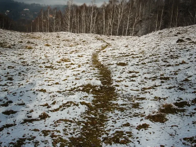
The Carpathian Mountains Trail is one of Europe's last great wilderness frontiers—a staggering 1,400-kilometre thru-hike that traces the massive semi-circular arc of the Romanian Carpathians. This journey is not merely a walk; it is an expedition through a landscape that remains largely unchanged by the rapid modernisation of the continent. Traversing the "Transylvanian Alps," the trail takes hikers through ancient primary forests, over jagged limestone massifs, and across high-altitude alpine plateaus where the only other inhabitants are traditional shepherds and their flocks. Starting in the mountain resort of Poiana Brasov and winding through the most iconic ranges of Romania, this route demands exceptional physical endurance, navigational skill, and a deep respect for the raw power of nature. It is a journey that connects the hiker with the primal spirit of the European wilderness, offering a level of solitude and biological diversity that is increasingly rare in the 21st century.
- Distance: 1,400.0 km (approximate thru-hike length)
- Duration: 50–70 days
- Elevation Gain: 147,390 m (cumulative)
- Difficulty: Challenging / Expert
- Best Time: June to September
- Closest City: Brasov, Romania
- Key Ranges: Bucegi, Făgăraș, Retezat, Rodna, Apuseni
Overview
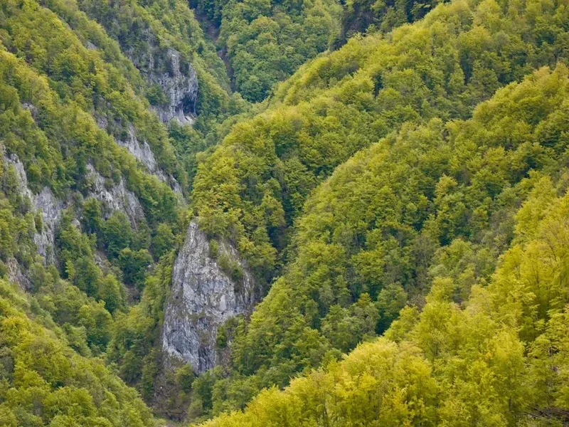
The Carpathian Mountains Trail represents the ultimate challenge for the dedicated thru-hiker in Europe. Unlike the highly manicured and signposted trails of the Alps, the Romanian Carpathians offer a more rugged, authentic, and often unpredictable experience. The trail follows the spine of the mountain range, which forms a great arc through the centre of Romania, dividing the historical provinces of Transylvania, Moldavia, and Wallachia. The terrain is incredibly varied: from the dramatic, vertical limestone walls of Piatra Craiului to the vast, wind-swept ridges of the Făgăraș Mountains, where the peaks frequently exceed 2,500 metres. This is a landscape of extremes, where a morning of gentle meadow walking can quickly transition into a technical scramble across a narrow, exposed ridge.
What truly sets this trail apart is its status as a sanctuary for wildlife. Romania is home to the largest populations of brown bears, wolves, and lynx in Europe (outside of Russia). Walking the Carpathian spine means sharing the path with these apex predators, requiring a level of situational awareness and safety protocol not found on most other European routes. Furthermore, the trail is a living museum of pastoral culture. Hikers will frequently encounter "stâne" (sheepfolds), where shepherds continue the centuries-old tradition of transhumance, guarding their sheep against predators with the help of formidable Carpathian Shepherd dogs. The interaction between the wild landscape and this ancient human presence creates a unique atmosphere that is both humbling and deeply moving.
Logistically, the trail is a test of self-sufficiency. While there are mountain huts (cabane) in the more popular ranges like Bucegi and Făgăraș, large sections of the trail are remote, requiring hikers to carry several days of food and rely on wild camping or basic mountain shelters (refugii). The weather is a constant factor; the Carpathians are notorious for sudden, violent thunderstorms and rapid temperature drops, even in the height of summer. For those who persevere, the reward is a profound sense of accomplishment and a connection to a landscape that feels truly infinite. This is not just a hike; it is a pilgrimage through the wild heart of the continent.
History and Cultural Context
The history of the Carpathian Mountains is inextricably linked to the identity of the Romanian people. For millennia, these mountains served as a natural fortress and a place of refuge. The ancient Dacians, the ancestors of modern Romanians, established their capital, Sarmizegetusa Regia, deep within the Orăștie Mountains, utilizing the rugged terrain for defence against the Roman Empire. Throughout the Middle Ages, the mountain passes were vital trade routes connecting the principalities, while the high ridges remained the domain of shepherds. The tradition of transhumance—the seasonal movement of livestock—has shaped the ecology and the culture of the Carpathians for over a thousand years. The paths used by hikers today are often the same trails blazed by generations of shepherds and their flocks.
In the 19th and early 20th centuries, the Carpathians became a focal point for the burgeoning European interest in mountaineering and natural sciences. Early explorers and botanists were drawn to the region's unique flora and fauna, much of which is endemic to the range. During the Communist era, mountain hiking was encouraged as a form of national physical education, leading to the construction of many of the "cabane" (huts) that still stand today. However, large swathes of the mountains remained restricted or undeveloped, preserving the primary forests that are now recognised as UNESCO World Heritage sites. Today, the trail represents a bridge between this storied past and a future focused on conservation and sustainable eco-tourism. Walking the Carpathians is an immersion into a land where folklore, history, and nature are woven into a single, complex tapestry.
Want more background? Read extended notes on history and cultural context → Learn more
Seasonal Highlights and Weather Reality
The window for a successful thru-hike of the Carpathian Mountains is relatively narrow, dictated by the heavy snowpack that lingers on the high ridges well into the spring. The primary season runs from June to September, with each month offering a distinct character.
June: This is the month of the "Alpine Spring." The high meadows are carpeted in wildflowers, including rhododendrons and gentians. However, June is also the wettest month, with frequent afternoon thunderstorms and lingering snow patches on north-facing slopes and in deep couloirs. Hikers must be prepared for wet gear and potentially difficult snow crossings in the Făgăraș and Retezat ranges.
July and August: These are the most stable months for weather, though heat in the valleys can be intense. On the ridges, the air is crisp and clear, providing the best visibility for the vast panoramas. This is the peak season for the "stâne" (sheepfolds), and hikers will see the pastoral life in full swing. Afternoon thunderstorms remain a daily threat and should be taken seriously, especially when on exposed ridges.
September: Many experienced hikers consider this the best time to be in the Carpathians. The weather becomes more stable, the air is exceptionally clear, and the autumn colours begin to transform the beech and oak forests in the lower elevations. The nights become significantly colder, and the first dustings of snow can appear on the highest peaks by late September.
Winter (October to May): Outside of the summer window, the Carpathians transform into a serious mountaineering environment. The high ridges are prone to extreme winds, temperatures far below freezing, and significant avalanche risk. A thru-hike during this period is not a trekking endeavour but a full-scale winter expedition requiring specialised equipment, advanced navigation, and expert-level winter survival skills. Most mountain huts are closed or operate on a very limited basis during these months.
Recommended Itinerary
The Carpathian Spine: A Stage-by-Stage Breakdown
Stage 1: The Curvature Carpathians (Poiana Brasov to Cheia)
- Distance: 120 km
- Key Ranges: Postăvaru, Piatra Mare, Ciucaș
- Highlights: The bizarre conglomerate rock formations of Ciucaș, which look like prehistoric ruins.
- Terrain: Moderate forest trails transitioning into sub-alpine meadows.
- Logistics: Good access to supplies in Brasov before heading into the more remote Ciucaș area.
Stage 2: The Bucegi Massif and Piatra Craiului
- Distance: 150 km
- Key Ranges: Bucegi, Leaota, Piatra Craiului
- Highlights: The "Sphinx" and "Babele" rock formations on the Bucegi plateau; the razor-sharp limestone ridge of Piatra Craiului.
- Terrain: High alpine plateaus followed by technical, exposed limestone ridgelines.
- Note: Piatra Craiului requires steady footing and a head for heights; it is one of the most beautiful but demanding sections.
Stage 3: The Făgăraș Mountains (The Transylvanian Alps)
- Distance: 100 km (The main ridge)
- Key Peaks: Moldoveanu (2,544 m), Negoiu (2,535 m)
- Highlights: Crossing the highest peaks in Romania; glacial lakes like Bâlea and Capra.
- Terrain: Extremely rugged, constant elevation change, narrow ridges, and steep descents.
- Logistics: This is the most sustained high-altitude section. Resupply is difficult without descending deep into the valleys.
Stage 4: Parâng, Căpățânii, and Lotrului
- Distance: 180 km
- Key Ranges: Parâng, Căpățânii, Lotrului, Șureanu
- Highlights: The wild, expansive ridges of Parâng; the remote and rarely visited Lotrului forests.
- Terrain: Long, undulating ridges and deep, ancient forests.
- Note: This section feels significantly more remote than the Făgăraș, with fewer hikers and more wildlife encounters.
Stage 5: Retezat and Godeanu
- Distance: 140 km
- Key Ranges: Retezat, Godeanu, Tarcu
- Highlights: Retezat National Park, known as the "Land of Blue Lakes" for its 80+ glacial tarns.
- Terrain: Granite peaks, massive boulder fields, and pristine alpine lakes.
- Note: Retezat is a strictly protected area; camping is only allowed in designated spots near huts or refuges.
Stage 6: The Banat Mountains and the Danube Defile
- Distance: 200 km
- Key Ranges: Semenic, Almăj, Cernei
- Highlights: The Iron Gates of the Danube; the unique Mediterranean-influenced flora of the southwest.
- Terrain: Lower elevation but very dense forest and limestone gorges.
- Logistics: Water can be scarce in the limestone sections during late summer.
Stage 7: The Apuseni (Western Carpathians)
- Distance: 250 km
- Key Ranges: Bihor, Vlădeasa, Trascău
- Highlights: Scărișoara Ice Cave; the traditional "Moți" villages; spectacular karst landscapes.
- Terrain: A labyrinth of caves, gorges, and sinkholes interspersed with high pastoral meadows.
- Note: This section offers the best cultural immersion, as the trail passes through many remote hamlets.
Stage 8: The Northern Carpathians and Rodna
- Distance: 260 km
- Key Ranges: Rodna, Maramureș, Călimani
- Highlights: The volcanic landscape of Călimani; the massive alpine ridge of the Rodna Mountains.
- Terrain: A mix of volcanic plateaus and high alpine ridges.
- Logistics: The final push through Maramureș offers a glimpse into the most traditional corner of Romania.
Important Notes:
- This is a conceptual thru-hike; many hikers choose to complete specific sections over several years.
- Navigation is difficult; GPS and high-quality topographic maps are essential.
- Water sources are generally reliable but must be treated due to livestock.
- The total distance and elevation gain are estimates based on the primary ridge route.
Planning and Bookings
Book Your Trip
Everything you need to plan your journey
Accommodation
Find places to stay near Brasov
Flights
Search flights to Brasov
Essential Preparation
A thru-hike of the Carpathians requires months of physical and logistical preparation. Fitness is paramount; the cumulative elevation gain is nearly 17 times the height of Mount Everest, and the terrain is often unforgiving. Hikers should be comfortable with long days (20–30 km) carrying a full pack (15–20 kg) in steep terrain. Mental resilience is equally important, as you will face isolation, challenging weather, and the constant presence of large carnivores.
Logistically, Brasov is the best base for starting. It is a major city with excellent transport links to Bucharest and the rest of the country. You can find high-quality outdoor gear, fuel canisters, and bulk food supplies here. It is also the headquarters for many mountain rescue (Salvamont) units, where you can get up-to-date information on trail conditions. Learning basic Romanian phrases is highly recommended, especially for interacting with shepherds and locals in remote villages where English is rarely spoken.
Trail Accommodation
Accommodation on the Carpathian Mountains Trail is a mix of mountain huts, unstaffed shelters, and wild camping. The availability varies significantly between mountain ranges.
Mountain Huts (Cabane): Found mostly in the Bucegi, Făgăraș, and Retezat ranges.
- Facilities: Usually provide a bunk in a dormitory, basic meals (soup, mămăligă), and sometimes hot water.
- Booking: Essential during weekends and peak summer months. Most do not have online booking; you must call ahead.
- Cost: Approximately 60–120 RON (Romanian Leu) per night for a bunk.
- Note: Electricity is often limited to a few hours in the evening via generators.
Mountain Shelters (Refugii): These are unstaffed, basic structures intended for emergency use or for hikers in remote areas.
- Facilities: Usually just wooden or metal bunks. No water, heat, or food.
- Cost: Free, but they operate on a first-come, first-served basis.
- Condition: Varies from brand-new igloo-style pods to dilapidated wooden shacks. Always carry a tent as a backup.
Wild Camping: Allowed in most areas of the Carpathians, with the exception of certain core zones in National Parks (like Retezat).
- Requirements: You must follow Leave No Trace principles and be extremely "bear-aware" with food storage.
- Note: Camping near a "stână" (sheepfold) is generally discouraged due to the protective nature of the shepherd dogs.
Required Gear
- Footwear: Sturdy, waterproof trekking boots with excellent ankle support and a stiff sole for rocky terrain.
- Navigation: A dedicated GPS device with offline maps, a compass, and physical topographic maps (Bel Alpin or Muntii Nostri series).
- Backpack: 60–75L capacity with a high-quality suspension system and a waterproof rain cover.
- Shelter: A lightweight, 3-season tent capable of withstanding high winds and heavy rain.
- Sleeping System: A sleeping bag rated to at least -5°C (even in summer, ridge temperatures can plummet) and a high-R-value sleeping pad.
- Clothing: A robust layering system including a Gore-Tex hardshell, a down or synthetic insulated jacket, and moisture-wicking base layers (merino wool is ideal).
- Safety: A Personal Locator Beacon (PLB) or satellite messenger (Garmin inReach), as mobile signal is non-existent in many valleys.
- Bear Protection: Bear spray (where legal and available) and a bear-resistant food container or a reliable system for hanging food.
What to Bring
- Food: High-calorie, lightweight dehydrated meals. Resupply points can be 5–7 days apart. Carry extra "emergency" rations.
- Water Treatment: A high-quality filter (Sawyer Squeeze or Katadyn BeFree) and purification tablets. Water sources are often contaminated by sheep.
- Cooking: A multi-fuel or canister stove. Note that screw-top canisters (Primus/MSR style) are common in Romania, but Piercable canisters are still found in some rural shops.
- First Aid: A comprehensive kit including blister care, NSAIDs, antiseptic, and any personal medications. Include a "tick remover" tool.
- Power: A large capacity power bank (20,000mAh+) and a portable solar charger for long remote stretches.
- Hygiene: Biodegradable soap, trowel for waste, and plenty of sun protection (the alpine sun is intense).
- Cash: Romanian Leu (RON) in small denominations. Huts and rural shops rarely accept cards.
Permits
For the majority of the Carpathian Mountains Trail, no formal trekking permit is required. Access to the mountains is generally free and open to the public. However, there are specific regulations within the National and Natural Parks that hikers must respect to avoid fines and protect the environment.
National Park Fees: Some parks, most notably Retezat National Park and Piatra Craiului National Park, require a small entry fee. This is usually around 10–20 RON and can often be paid at the park entrance, at certain mountain huts, or via SMS/online in some cases. These funds go directly toward trail maintenance and conservation efforts.
Camping Regulations: In National Parks, wild camping is strictly limited to designated areas, usually located near mountain huts or specific "refugii." Rangers do patrol these areas, especially in Retezat, and they are strict about enforcing these rules to prevent erosion and wildlife disturbance. Outside of National Parks, wild camping is generally permitted, provided you are not on private agricultural land.
Group Sizes: Large organised groups (usually 10+ people) may need to notify park authorities in advance, especially if planning to stay in huts or designated camping areas. For the solo thru-hiker or small group, this is rarely an issue.
Border Zone Permits: If your route takes you very close to the northern border with Ukraine (in the Maramureș Mountains), it is technically required to notify the Border Police (Poliția de Frontieră). This is a straightforward process but is important for your safety and to avoid being questioned by patrols.
Other Activities in the Area
Romania offers a wealth of cultural and natural attractions that are perfect for "zero days" or post-hike recovery:
- Medieval Cities: Explore the historic centres of Brasov, Sibiu, and Sighișoara. These Saxon cities feature stunning architecture, vibrant town squares, and excellent restaurants.
- Bran Castle: Often associated with the Dracula legend, this dramatic fortress near Brasov is a must-visit for history and folklore enthusiasts.
- Peleș Castle: Located in Sinaia, this Neo-Renaissance masterpiece was the summer residence of the Romanian royal family and is one of the most beautiful castles in Europe.
- Transfăgărășan Highway: Often called "the best road in the world," this winding mountain pass offers incredible views and access to the high Făgăraș ridges for those not thru-hiking.
- Bear Watching: Several eco-tourism operators near Brasov offer guided trips to hides where you can safely observe brown bears in their natural habitat.
- Traditional Villages: Visit the villages of Magura or Pestera near Piatra Craiului to experience traditional rural life and sample local cheeses like "brânză de burduf."
Safety and Conditions
Large Carnivores: Romania has the highest density of brown bears in Europe. While bears generally avoid humans, encounters are common. Always make noise while hiking (talking, singing, or using trekking poles), especially in dense forest or near rushing water. Never keep food in your tent; use a bear bag or canister and cook at least 50 metres away from your sleeping area. If you encounter a bear, do not run. Speak in a calm, firm voice and back away slowly.
Shepherd Dogs: The Carpathian Shepherd dogs (Ciobănesc Românesc) are bred to protect flocks from wolves and bears. They can be extremely aggressive toward hikers. If approached by barking dogs, stop immediately. Do not run or throw stones. Wait for the shepherd to intervene. Keeping your trekking poles between you and the dogs can help maintain a boundary.
Weather Extremes: The Carpathians are prone to sudden, violent thunderstorms. If you see clouds building, descend from the ridge immediately. Lightning strikes on the exposed ridges are a genuine and frequent danger. Hypothermia is a risk even in summer if you are caught in a cold rain without proper gear.
Mountain Rescue (Salvamont): Romania has an excellent mountain rescue service called Salvamont. They are highly professional and often volunteer-based. In case of emergency, the national emergency number is 112. It is highly recommended to download the "Salvamont" app, which allows you to send your GPS coordinates to rescuers.
Terrain Hazards: Many sections of the trail involve steep scrambles, loose scree, and exposed ridges. In the Făgăraș and Piatra Craiului, some sections have fixed cables (similar to via ferrata but often less maintained). Always test a cable before trusting your weight to it.
Side Trips and Points of Interest
Moldoveanu Peak: At 2,544 metres, this is the highest point in Romania. While the thru-hike route usually passes over or near it, taking the time for a sunrise summit is a highlight of the entire journey. The view across the "sea of peaks" of the Făgăraș is unforgettable.
The Sphinx and Babele: Located on the Bucegi Plateau, these natural rock formations have been shaped by wind and rain into shapes resembling a human face and elderly women. They are shrouded in local legends and are a popular spot for photography.
Scărișoara Ice Cave: Located in the Apuseni Mountains, this cave houses the second-largest underground glacier in south-eastern Europe. It is a fascinating detour into the karst underworld of the Carpathians.
The Seven Ladders Canyon (Canionul Șapte Scări): A spectacular gorge in the Piatra Mare Mountains featuring a series of metal ladders and bridges that take you directly through a series of waterfalls. It is a thrilling side trip near Brasov.
Lake Sfânta Ana: The only volcanic crater lake in Romania, located in the Harghita Mountains. It is a place of immense serenity and geological interest, surrounded by dense forests.
Leave No Trace
The Carpathians contain some of the last remaining primary forests in Europe. These ecosystems are incredibly fragile and are under constant threat from illegal logging and irresponsible tourism. As a thru-hiker, you have a responsibility to minimise your impact.
Core Principles:
- Pack it in, pack it out: This includes all organic waste like orange peels and apple cores, which do not decompose quickly in the alpine environment and can attract bears to campsites.
- Respect the water: Never wash yourself or your dishes directly in glacial lakes or streams. Carry water 30 metres away and use biodegradable soap.
- Stick to the trail: In alpine meadow areas, "braided" trails cause significant erosion. Stay on the main path even if it is muddy.
- Fire Safety: Avoid campfires. Use a stove for cooking. If you must have a fire (only where permitted), use existing fire rings and ensure it is completely extinguished before leaving.
- Wildlife: Observe animals from a distance. Never feed wildlife, as this habituates them to humans and often leads to the animal being destroyed by authorities (especially bears).