Cape Wrath Trail - Britain's Ultimate Wilderness Challenge
The Cape Wrath Trail is widely regarded as the most challenging long-distance hike in the United Kingdom. Stretching approximately 397.1 kilometres through the rugged heart of the Scottish Highlands, it is not an officially sanctioned or waymarked route. Instead, it is a connoisseur’s journey, a self-selected odyssey that links ancient drovers' roads, mountain passes, and coastal paths from the outdoor capital of Fort William to the northwesternmost tip of mainland Britain: Cape Wrath. Unlike the well-trodden West Highland Way, the Cape Wrath Trail demands high-level navigational competence, physical resilience, and an appetite for true isolation. It traverses some of the most dramatic landscapes in Europe, including the "Rough Bounds" of Knoydart, the Torridon giants, and the vast, peat-stained wilderness of Sutherland. This is a trail for those who seek to test themselves against the elements in a landscape where the weather is as much a character as the mountains themselves.
- Distance: 397.1 km one-way
- Duration: 2–3 weeks
- Season: May to September (avoiding peak midge season and winter conditions)
- Accommodation: Bothies, wild camping, and limited remote hostels/hotels
- Highest point: Various mountain passes exceeding 750 m
- Difficulty: Very Challenging (requires advanced navigation and river crossing skills)
- Direction: South to north (Fort William to Cape Wrath)
Overview
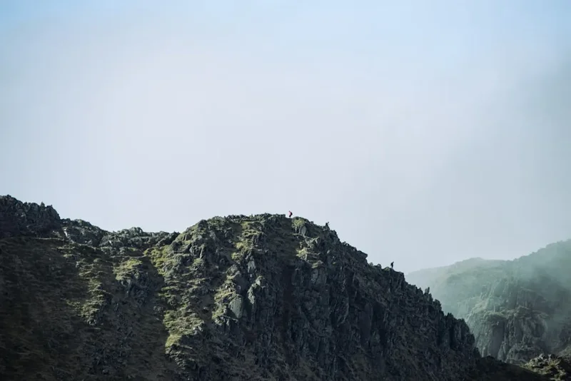
The Cape Wrath Trail is often described as "the toughest walk in Britain," a title it earns not through sheer elevation alone, but through the complexity of its terrain and the unpredictability of the Scottish climate. There are no signposts, no official trail markers, and frequently, no discernible path. Walkers must rely on map-and-compass skills or GPS to navigate through vast bogs, across unbridged rivers, and over high mountain cols. The route is a masterclass in Scottish geology and ecology, taking hikers from the shadows of Ben Nevis through the glaciated glens of the west coast and into the ancient Lewisian gneiss landscapes of the far north.
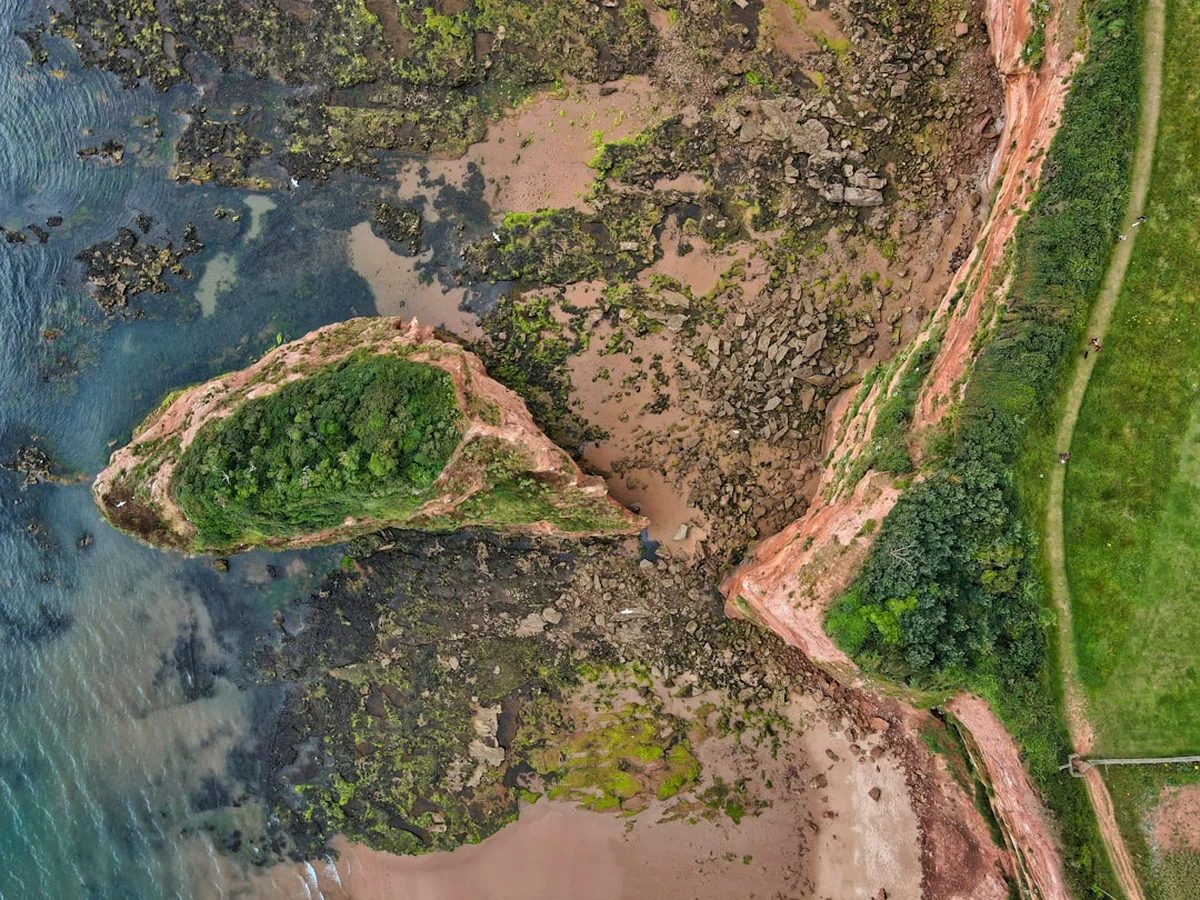
The journey is defined by its remoteness. In sections like the Fisherfield Forest—often called "The Great Wilderness"—hikers can be several days' walk from the nearest road or permanent settlement. This isolation provides a profound sense of solitude that is increasingly rare in the modern world. The terrain is notoriously "heavy"; the Scottish "bog" is a legendary obstacle that can slow progress to a crawl, while the river crossings can become impassable or even life-threatening after heavy rainfall. However, the rewards are commensurate with the effort. The sight of the sun setting over the Atlantic from the cliffs of Sandwood Bay, or the silhouette of An Teallach against a stormy sky, offers a level of aesthetic and emotional satisfaction that few other trails can provide.
Logistically, the trail is a puzzle. Resupply points are few and far between, requiring careful planning of food and fuel. Most hikers choose to stay in "bothies"—basic, unstaffed stone shelters maintained by the Mountain Bothies Association (MBA)—or to wild camp in the spectacular glens. The final destination, the Cape Wrath Lighthouse, is a fittingly dramatic conclusion. Perched on 100-metre cliffs where the Atlantic meets the North Sea, it is accessible only by foot or by a seasonal ferry and minibus service, ensuring that the sense of wilderness remains intact until the very last step.
History and Cultural Context
The Cape Wrath Trail does not have a single "founder" in the traditional sense; rather, it evolved from the explorations of hillwalkers and mountaineers seeking a continuous route through the Highlands. It was first popularised in the 1990s by David Paterson and later by Rex Braid, whose guidebooks helped codify the various options into a cohesive journey. The name "Cape Wrath" itself is a testament to the region's Norse history. It derives from the Old Norse word Hvarf, meaning "turning point," as Viking sailors would turn their ships east here to head toward the Northern Isles or back to Scandinavia.
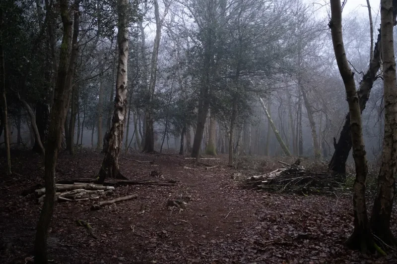
The land the trail traverses is steeped in the history of the Highland Clearances of the 18th and 19th centuries. Many of the ruined "shielings" and abandoned stone cottages seen along the route were once vibrant communities before the inhabitants were forcibly removed to make way for large-scale sheep farming. This history gives the trail a haunting, melancholic atmosphere, as hikers walk through "empty" glens that were once populated. The paths themselves often follow ancient "coffins roads" or "drovers' roads," used for centuries to move cattle from the Highlands to markets in the south.
Culturally, the trail passes through areas where Scottish Gaelic was once the primary language, and many of the geographical features—the bealachs (passes), bens (mountains), and lochs (lakes)—retain their Gaelic names, which often describe the landscape with poetic precision. Today, the trail is a vital part of Scotland's "Right to Roam" culture, enshrined in the Land Reform (Scotland) Act 2003, which allows for responsible non-motorised access to most land and water in Scotland. This legal framework is what makes a journey like the Cape Wrath Trail possible, allowing hikers to traverse vast private estates and wild moorlands with a freedom found in few other countries.
Want more background? Read extended notes on history and cultural context → Learn more
Seasonal Highlights and Weather Reality
Timing is everything on the Cape Wrath Trail. The Scottish weather is notoriously fickle, and the "best" time to go is a compromise between daylight, temperature, and the presence of the Highland midge.
Spring (May to June): This is widely considered the "golden window." The days are long, the weather is often at its driest and most stable, and the infamous midges have not yet emerged in force. Snow may still linger on the higher passes, requiring care, but the clarity of the air and the vibrant greens of the emerging spring growth make for spectacular photography. This is also the best time for river crossings, as the winter snowmelt has usually subsided but the heavy autumn rains have not yet begun.
Summer (July to August): While temperatures are warmer (averaging 15–20°C), this is the peak season for the Highland midge—a tiny biting insect that can make camping or stopping for breaks a miserable experience. Summer also brings more frequent "Atlantic fronts," which can result in days of persistent rain and low cloud (clag), making navigation difficult. However, the long daylight hours (up to 18 hours in June/July) allow for flexible trekking schedules.
Autumn (September to October): September can be a beautiful month, with the midges dying off and the hills turning a magnificent burnt orange and deep purple as the heather blooms and the grasses turn. However, the weather becomes increasingly unpredictable, with stronger winds and shorter days. By October, the risk of early winter storms and heavy rainfall increases significantly, which can make river crossings dangerous.
Winter (November to April): The Cape Wrath Trail in winter is a serious mountaineering undertaking. It requires proficiency with ice axe and crampons, high-level winter navigation skills, and the ability to survive in sub-zero temperatures and gale-force winds. Many bothies are at their most welcoming in winter, but the short daylight hours (as little as 6 hours in December) and the high probability of being "weathered in" make this a season only for the most experienced and well-equipped winter adventurers.
Recommended Itinerary
16-Day Cape Wrath Trail Itinerary
Day 1: Fort William to Glenfinnan
- Distance: 28 km
- Elevation gain: 450 m
- Time: 7–9 hours
- Start at the Old Fort in Fort William
- Follow the shores of Loch Eil and cross the Caledonian Canal at Corpach
- Pass the famous Glenfinnan Viaduct (of Harry Potter fame)
- Stay at Corryhully Bothy (has electricity!) or wild camp nearby
Day 2: Glenfinnan to Sourlies
- Distance: 27 km
- Elevation gain: 950 m
- Time: 8–10 hours
- Enter the "Rough Bounds" of Knoydart
- Cross the high pass of Streap Comhlaidh
- Descend into the remote and beautiful Glen Dessary
- Arrive at Sourlies Bothy, situated on the shores of Loch Nevis
Day 3: Sourlies to Barrisdale
- Distance: 18 km
- Elevation gain: 700 m
- Time: 6–7 hours
- A shorter but very rugged day through the heart of Knoydart
- Cross the Carnoch River (can be difficult after rain)
- Climb over Mam Barrisdale for stunning views of Loch Hourn
- Stay at the managed campsite or bothy at Barrisdale
Day 4: Barrisdale to Shiel Bridge
- Distance: 24 km
- Elevation gain: 850 m
- Time: 7–9 hours
- Follow the coastal path along Loch Hourn to Kinloch Hourn
- Climb the steep "stalkers' path" over to Glen Shiel
- Arrive at Shiel Bridge (campsite, shop, and hotel available)
Day 5: Shiel Bridge to Maol-bhuidhe
- Distance: 30 km
- Elevation gain: 1,100 m
- Time: 9–11 hours
- A long, remote day heading north into the wilds of Monar
- Optional detour to the Falls of Glomach (one of Britain's highest waterfalls)
- Stay at Maol-bhuidhe Bothy, one of the most isolated shelters in the UK
Day 6: Maol-bhuidhe to Bendronaig Lodge
- Distance: 15 km
- Elevation gain: 400 m
- Time: 5–6 hours
- A shorter day to recover from the previous long stretch
- Traverse remote moorland and cross the River Ling
- Stay at the excellent Bendronaig Lodge Bothy
Day 7: Bendronaig Lodge to Strathcarron
- Distance: 18 km
- Elevation gain: 500 m
- Time: 6–7 hours
- Cross the pass of Bealach Bhearnais
- Descend into the village of Strathcarron
- Resupply point with a train station and hotel
Day 8: Strathcarron to Kinlochewe
- Distance: 28 km
- Elevation gain: 900 m
- Time: 8–10 hours
- Enter the Torridon mountains, some of the oldest rock on Earth
- Pass beneath the mighty peaks of Beinn Eighe and Liathach
- Arrive at Kinlochewe (campsite, bunkhouse, and hotel)
Day 9: Kinlochewe to Shenavall
- Distance: 18 km
- Elevation gain: 600 m
- Time: 6–7 hours
- Head into the Fisherfield Forest, "The Great Wilderness"
- Climb over the Gleann na Muice pass
- Stay at Shenavall Bothy, famously situated beneath An Teallach
Day 10: Shenavall to Inverlael
- Distance: 25 km
- Elevation gain: 750 m
- Time: 8–9 hours
- Cross the rivers at the head of Loch na Sealga (dangerous in spate)
- Traverse the "Destitution Road" area
- Descend to Inverlael near the head of Loch Broom
Day 11: Inverlael to Oykel Bridge
- Distance: 35 km
- Elevation gain: 600 m
- Time: 9–11 hours
- A long day on forest tracks and estate roads
- Pass through the remote Glen Achall
- Arrive at Oykel Bridge (famous salmon fishing hotel)
Day 12: Oykel Bridge to Inchnadamph
- Distance: 32 km
- Elevation gain: 700 m
- Time: 8–10 hours
- Follow the River Oykel into the heart of Assynt
- Pass beneath the unique peaks of Conival and Ben More Assynt
- Stay at Inchnadamph (bunkhouse and hotel)
Day 13: Inchnadamph to Kylesku
- Distance: 34 km
- Elevation gain: 900 m
- Time: 9–11 hours
- Traverse the spectacular limestone landscapes of Assynt
- Pass the Eas a' Chual Aluinn (Britain's highest waterfall)
- Arrive at the picturesque village of Kylesku
Day 14: Kylesku to Rhiconich
- Distance: 32 km
- Elevation gain: 800 m
- Time: 8–10 hours
- A rugged day through the "cnoc and lochan" landscape of Sutherland
- Pass through the remote settlement of Scourie
- Arrive at Rhiconich (hotel and limited camping)
Day 15: Rhiconich to Sandwood Bay
- Distance: 19 km
- Elevation gain: 400 m
- Time: 5–6 hours
- Walk to the remote and legendary Sandwood Bay
- Widely considered the most beautiful beach in the UK
- Wild camp in the dunes (no bothy here, but a truly magical spot)
Day 16: Sandwood Bay to Cape Wrath
- Distance: 14.1 km
- Elevation gain: 350 m
- Time: 4–5 hours
- The final push across "The Parph" moorland
- Navigate through the MOD firing range (check access!)
- Finish at the Cape Wrath Lighthouse
- Take the minibus and ferry to Durness to celebrate
Planning and Bookings
Book Your Trip
Everything you need to plan your journey
Accommodation
Find places to stay near Fort William
Flights
Search flights to Fort William
Essential Preparation
The Cape Wrath Trail is not a hike to be taken lightly. Physical fitness is paramount, as you will be carrying a heavy pack (15–20 kg) over boggy, pathless terrain for up to 10 hours a day. However, mental resilience and navigational skill are even more critical. You must be proficient with a map and compass; GPS is a useful tool, but batteries fail and signals can be lost in deep glens. You should also be comfortable with the concept of "self-reliance," as you may go days without seeing another person.
Logistically, you need to coordinate your start in Fort William and your finish at Cape Wrath. Fort William is easily reached by train (including the Caledonian Sleeper from London) or bus. The finish is more complex: you must take a small ferry across the Kyle of Durness, which is met by a minibus from the lighthouse. This service is seasonal and highly weather-dependent. If the ferry isn't running, you face a very long walk out or a wait in the Kearvaig bothy.
Trail Accommodation
Accommodation on the Cape Wrath Trail is a mix of bothies, wild camping, and occasional hostels or hotels. There is no formal booking system for the majority of the route.
Bothies: These are basic stone shelters maintained by the Mountain Bothies Association (MBA). They are free to use and cannot be booked. Facilities are minimal: usually just a dry floor or wooden sleeping platform, a fireplace (bring your own fuel), and a roof. There is no running water, no electricity (except Corryhully), and no toilet facilities (you must bury waste far from the bothy). Notable bothies include Sourlies, Maol-bhuidhe, Shenavall, and Kearvaig.
Wild Camping: Under the Scottish Outdoor Access Code, wild camping is legal on most unenclosed land. This offers the ultimate flexibility. You must follow "Leave No Trace" principles: camp in small groups, stay only one or two nights, and remove all litter.
Hostels and Hotels: In villages like Shiel Bridge, Kinlochewe, Strathcarron, and Inchnadamph, you can find bunkhouses and hotels. These should be booked well in advance, especially during the summer months, as they are popular with Munro baggers and North Coast 500 tourists.
Required Gear
- Footwear: Sturdy, waterproof leather or high-quality synthetic boots with good ankle support. The terrain is exceptionally wet; some hikers prefer "seal skin" waterproof socks combined with breathable boots.
- Navigation: Full set of OS Landranger (1:50,000) or Explorer (1:25,000) maps covering the entire route. A reliable baseplate compass and the knowledge to use it for micro-navigation in fog.
- Waterproofs: A high-quality hardshell jacket and overtrousers (Gore-Tex or similar). Scottish rain is often horizontal and persistent.
- Shelter: A lightweight, 3-season tent capable of withstanding high winds. Even if you plan to use bothies, a tent is an essential safety backup.
- Sleep System: A 3-season sleeping bag (comfort rating to 0°C) and a well-insulated sleeping mat. Bothy floors are cold and hard.
- Safety: A Personal Locator Beacon (PLB) or satellite messenger (like a Garmin inReach) is highly recommended due to the lack of mobile signal.
What to Bring
- Food: High-calorie, lightweight dehydrated meals. You will need to carry up to 5–7 days of food between resupply points (Fort William, Shiel Bridge, Kinlochewe, Ullapool/Inverlael, Oykel Bridge, Inchnadamph, Rhiconich).
- Midge Protection: A fine-mesh midge head net and a reliable repellent (Smidge is a local favourite). This is non-negotiable from June to September.
- Water Treatment: While Highland water is often pure, sheep and deer are present everywhere. Use a lightweight filter (like a Sawyer Squeeze) or chlorine dioxide tablets.
- Stove and Fuel: A reliable canister or liquid fuel stove. Wood for bothy fires is rare; do not cut live trees.
- First Aid: Including blister care (Compeed), antiseptic wipes, and any personal medications. Tick tweezers are essential, as Lyme disease is present in the Highlands.
Permits
There are no permits required to walk the Cape Wrath Trail itself, thanks to Scotland's generous access laws. However, the final section of the trail passes through a Ministry of Defence (MOD) live-firing range at Cape Wrath (the Garvie Island range). This is one of the few places in Europe where multi-service live-fire exercises are conducted, including naval bombardment and aerial bombing.
MOD Access: You MUST check the firing programme before attempting the final leg from Sandwood Bay to the lighthouse. When the range is active, access is strictly prohibited for safety reasons. Red flags are flown, and sentries may be posted. You can check the firing times on the UK Government website or by calling the 24-hour automated information line. If the range is closed, you will need to wait in Durness or Sandwood Bay until it opens.
Ferry and Minibus: The ferry across the Kyle of Durness and the minibus to the lighthouse are operated by local contractors. There is no booking system; you simply turn up at the ferry slipway (Durness side) or the lighthouse (Cape side). The service usually runs from May to September, but it is tide and weather-dependent. Carry cash (Great British Pounds) for these transfers, as card machines rarely work in such remote locations.
Other Activities in the Area
If you have extra time or energy, the Highlands offer world-class outdoor opportunities:
- Munro Bagging: The trail passes close to dozens of "Munros" (mountains over 914 m / 914.4 m). Ben Nevis, An Teallach, and the Torridon peaks are all accessible for those with the legs for extra climbing.
- Sea Stacks: Near the end of the trail, you can view the Oldshoremore sea stacks or take a boat trip from Kylesku to see the impressive 200-metre cliffs of Handa Island, a major seabird colony.
- Durness Exploration: Visit Smoo Cave, a massive sea cave with an internal waterfall, or enjoy the pristine white sands of Sango Bay.
- The North Coast 500: If you have a support vehicle or are renting a car after the hike, this famous driving route offers a more relaxed way to see the northern coastline.
- Wildlife Watching: Keep an eye out for red deer, golden eagles, sea eagles, and otters. The waters around Cape Wrath are also excellent for spotting minke whales and dolphins.
Safety and Conditions
The Cape Wrath Trail is a serious undertaking where help can be many hours or even days away. Safety is a matter of preparation and good judgment.
River Crossings: This is the single greatest objective hazard on the trail. Many rivers are unbridged. In normal conditions, they are knee-deep and manageable. However, after heavy rain, these rivers can turn into raging torrents (spate) within an hour. Never attempt to cross a river that is above mid-thigh height or moving too fast to maintain balance. If in doubt, wait for the water to subside (usually 12–24 hours) or find an alternative route. The River Carron and the rivers in Fisherfield are particularly notorious.
Hypothermia: Even in summer, temperatures can drop toward freezing, especially when combined with wind and rain. The "Scottish Chill" is a real threat. Always keep a set of dry clothes in a waterproof dry bag inside your pack, and eat regularly to maintain metabolic heat.
Bogs and Terrain: The "Great Scottish Bog" is more than just a nuisance; it is physically exhausting. Deep peat hags can be difficult to navigate, and "bright green" moss often indicates deep, liquid mud. Watch your footing to avoid ankle injuries, which are the most common reason for "DNF" (Did Not Finish) on this trail.
Communication: Mobile phone signal is non-existent for large portions of the trail. Do not rely on your phone for emergency calls. Carry a PLB and leave a detailed route plan (and expected return date) with a trusted contact.
Side Trips and Points of Interest
Falls of Glomach: Located near Shiel Bridge, this is one of the most impressive waterfalls in Britain, with a single drop of 113 metres. The approach is via a narrow, airy path that requires a steady head for heights, but the view into the deep, misty gorge is unforgettable.
Sandwood Bay: Often cited as the most beautiful beach in the British Isles, Sandwood Bay is a mile of pinkish sand flanked by high cliffs and the "Am Buachaille" sea stack. There is no road access, meaning you will likely share this paradise with only a handful of other hikers.
Kearvaig Bothy: Located in a stunning bay just a few kilometres east of the Cape Wrath lighthouse, Kearvaig is often called the "best bothy in the world." It is a beautifully maintained white cottage sitting on a white sand beach, providing a perfect final night's stay before finishing the trail.
The Bone Caves of Inchnadamph: A short detour from the trail leads to these limestone caves where the remains of lynx, reindeer, and even polar bears have been found, dating back to the last Ice Age.
Leave No Trace
The Highlands are a fragile ecosystem. The thin soils and harsh climate mean that vegetation takes a long time to recover from damage. As a hiker, you are a guest in this landscape.
- Human Waste: With no toilets in bothies, you must follow strict hygiene. Dig a hole at least 15 cm deep and at least 50 metres from any water source or path. Pack out all toilet paper and sanitary products.
- Bothy Etiquette: Follow the Bothy Code. Leave the bothy cleaner than you found it. If you use fuel from the store, replace it if possible. Always ensure the fire is out and the door is securely latched when you leave.
- Litter: Pack out everything. This includes "organic" waste like banana skins or orange peels, which do not decompose quickly in the cold Highland climate and can be harmful to local wildlife.
- Fires: Avoid lighting open fires on the ground, as this scars the landscape and can ignite peat fires. Use a stove for cooking.