Cape to Cape Track - A Coastal Odyssey Through the South West
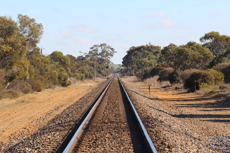
The Cape to Cape Track is Western Australia's most iconic coastal long-distance walk, stretching 135 kilometres along the Leeuwin-Naturaliste Ridge in the state's world-renowned Margaret River region. This journey connects two historic lighthouses—Cape Naturaliste in the north and Cape Leeuwin in the south—traversing a landscape of staggering geological diversity and biological richness. Walkers are treated to a sensory symphony: the thunderous roar of the Indian Ocean crashing against ancient granite headlands, the serene silence of towering karri forests, and the delicate fragrance of coastal heathland that erupts into a kaleidoscope of colour during the wildflower season. Unlike many wilderness trails that retreat into the interior, the Cape to Cape remains intimately tethered to the coastline, offering a profound connection to the maritime heritage and raw natural power of the Australian edge.
- Distance: 135.0 km one-way
- Duration: 6–8 days
- Season: March–May and September–November (Spring and Autumn)
- Accommodation: Four dedicated wild campsites, numerous commercial caravan parks, and luxury lodges
- Highest point: Approximately 200 m (Leeuwin-Naturaliste Ridge)
- Total Elevation Gain: 3,200 m
- Direction: Traditionally walked North to South (Cape Naturaliste to Cape Leeuwin)
Overview
The Cape to Cape Track is a masterclass in coastal geography, following the narrow strip of the Leeuwin-Naturaliste National Park. The trail is defined by the Leeuwin Complex, a geological formation of granite and gneiss that dates back over 600 million years, topped by a younger layer of Tamala Limestone. This unique foundation creates a landscape of dramatic contrasts: sheer limestone cliffs that drop vertically into turquoise waters, rugged granite outcrops that have withstood the battering of the "Roaring Forties" for eons, and vast, sweeping beaches of fine white sand that challenge the endurance of even the most seasoned hiker.
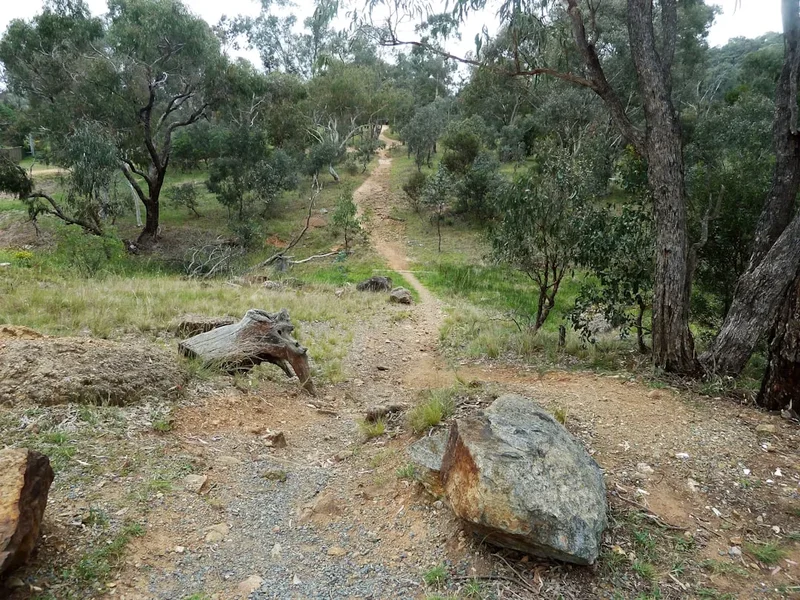
The experience of walking the Cape to Cape is one of constant transition. One hour you may be navigating a narrow, wind-swept path through shoulder-high peppermint trees and coastal scrub; the next, you are descending into the Boranup Forest, where the world turns emerald green and the massive trunks of karri trees—the third tallest flowering trees in the world—reach toward the sky. The track does not shy away from the beach; approximately 25 to 30 kilometres of the route is spent walking directly on the sand. These sections, while physically demanding, offer a meditative rhythm and the opportunity to witness the raw power of the Southern and Indian Oceans meeting at the continent's edge.
While the track is classified as moderate, its challenges are subtle. The elevation gain is cumulative rather than concentrated in a single mountain pass. The "pumping" of the legs comes from the soft sand of the beaches and the constant undulation of the limestone ridge. However, the rewards are immense. The Margaret River region is a global biodiversity hotspot, and the track provides a front-row seat to this ecological marvel. From the breaching of humpback whales on their annual migration to the intricate orchids hidden in the undergrowth, the Cape to Cape is a journey that demands you slow down and observe the intricate details of the Australian bush.
History and Cultural Context
The land traversed by the Cape to Cape Track is the traditional country of the Wardandi Noongar people, who have lived in harmony with this coastline for over 50,000 years. To the Wardandi people, the ridge is a place of deep spiritual significance, with many sites along the track—including caves, freshwater springs, and headlands—holding ancestral stories and cultural importance. The track passes near several significant archaeological sites, including Devil’s Lair, which has provided some of the earliest evidence of human occupation in Australia. Walkers are encouraged to travel with an awareness of this ancient heritage, recognising that they are following paths that have been trodden for millennia.
European history in the area is inextricably linked to the sea. The two lighthouses that bookend the track were built to protect mariners from the treacherous reefs and powerful currents of the "Cape of Shipwrecks." Cape Leeuwin Lighthouse, at the southern terminus, was opened in 1895 and remains the tallest mainland lighthouse in Australia. It marks the point where the Indian and Southern Oceans officially meet. Cape Naturaliste Lighthouse, at the northern end, was completed in 1903. Between these two beacons, the coastline is littered with the remains of vessels that failed to navigate these waters, and names like "Geographe Bay" and "Cape Freycinet" reflect the early French and British maritime exploration of the region.
The track itself is a relatively modern creation, first envisioned in the late 1970s and officially opened in 2001. It was the result of a collaborative effort between the Department of Conservation and Land Management (now DBCA) and the "Friends of the Cape to Cape Track," a dedicated volunteer group that continues to maintain and improve the route. Today, the track stands as a testament to the community's desire to preserve this narrow coastal corridor from development, ensuring that the wild beauty of the Margaret River coast remains accessible to all.
Want more background? Read extended notes on history and cultural context → Learn more
Seasonal Highlights and Weather Reality
Timing is everything on the Cape to Cape Track. The region enjoys a Mediterranean climate, but the exposure to the Indian Ocean means weather can be a significant factor in the success and enjoyment of the walk.
Spring (September to November): This is arguably the "goldilocks" season for the track. The weather is mild, with daytime temperatures typically ranging between 18°C and 24°C. Most importantly, this is the peak of the wildflower season. The heathlands are transformed into a vibrant tapestry of colour, with banksias, wattles, and dozens of species of terrestrial orchids in bloom. This is also the best time for whale watching, as humpback and southern right whales migrate close to the shore. However, spring can bring occasional "cold fronts" with brisk winds and rain, so good wet-weather gear is still essential.
Autumn (March to May): Autumn offers stable weather, clear blue skies, and calm seas. The heat of summer has dissipated, and the winter rains have not yet arrived in earnest. The ocean remains warm enough for swimming in the many sheltered bays along the route. While the wildflowers are less prolific than in spring, the light is often softer and more beautiful for photography, and the flies—a notorious Australian nuisance—are less active.
Winter (June to August): Walking in winter is for the hardy. The region receives the bulk of its rainfall during these months, often delivered by powerful mid-latitude cyclones. The track can become muddy, and several river crossings (notably the Margaret River and Wilyabrup Brook) can become dangerous or impassable after heavy rain. However, the landscape is at its most dramatic, with massive swells and lush, green vegetation. If you choose winter, be prepared for wet feet and flexible plans.
Summer (December to February): Walking the full track in summer is generally discouraged. Temperatures frequently exceed 30°C and can spike above 40°C. There is very little shade on the coastal sections, and water sources are scarce. The risk of bushfires is high, and the heat makes the long beach sections punishingly difficult. If visiting in summer, stick to short early-morning walks near the coastal towns.
Recommended Itinerary
7-Day Cape to Cape Track Itinerary
Day 1: Cape Naturaliste to Yallingup
- Distance: 14 km
- Elevation gain: 250 m
- Time: 4–5 hours
- Start at the Cape Naturaliste Lighthouse after exploring the maritime museum
- Follow the easy, paved "access for all" section to Sugarloaf Rock, one of the most photographed landmarks in WA
- Traverse high limestone cliffs with expansive views over the Indian Ocean
- Descend to the popular surfing beach of Yallingup
- Key Waypoints: Sugarloaf Rock, Three Bears Surf Break, Yallingup Beach
- Stay: Yallingup caravan park or local guesthouses
Day 2: Yallingup to Moses Rock
- Distance: 18 km
- Elevation gain: 400 m
- Time: 5–6 hours
- Walk along the beach at Smith's Beach before climbing back onto the ridge
- Pass the dramatic granite formations of Canal Rocks (a short detour)
- Navigate the rugged terrain around Injidup, including the "natural spa" rock pool
- Experience the first significant beach walking sections
- Key Waypoints: Smith's Beach, Canal Rocks, Injidup Beach, Quinninup Falls (side trip)
- Stay: Moses Rock campsite (wild camping)
Day 3: Moses Rock to Gracetown
- Distance: 16 km
- Elevation gain: 350 m
- Time: 4–5 hours
- Follow the cliff tops south of Moses Rock, offering some of the best elevated views on the track
- Pass the Wilyabrup Cliffs, a popular spot for rock climbers
- Cross Wilyabrup Brook (can be deep in winter)
- Arrive in the quiet seaside village of Gracetown, situated on Cowaramup Bay
- Key Waypoints: Wilyabrup Cliffs, North Point, Cowaramup Bay
- Stay: Gracetown caravan park or local holiday homes
Day 4: Gracetown to Prevelly
- Distance: 19 km
- Elevation gain: 450 m
- Time: 6–7 hours
- A diverse day featuring coastal heath, granite headlands, and the mouth of the Margaret River
- Pass through the historic Ellensbrook Homestead, a 19th-century farmstead
- Visit Meekadarabee Falls, a sacred site for the Wardandi people
- Cross the Margaret River mouth (sandbar usually closed in summer/autumn, open in winter)
- Key Waypoints: Ellensbrook, Meekadarabee Falls, Surfers Point, Margaret River Mouth
- Stay: Prevelly caravan park or Margaret River town (10-minute drive)
Day 5: Prevelly to Boranup
- Distance: 25 km
- Elevation gain: 600 m
- Time: 7–9 hours
- The longest and most challenging day of the track
- Includes a significant 6 km stretch of soft sand walking along Boodjidup Beach
- Climb into the spectacular Boranup Karri Forest, a complete change in scenery
- Walk among the massive white-trunked karri trees
- Key Waypoints: Boodjidup Brook, Redgate Beach, Contos Campground, Boranup Forest
- Stay: Boranup campsite (wild camping)
Day 6: Boranup to Cosy Corner
- Distance: 21 km
- Elevation gain: 500 m
- Time: 6–7 hours
- Continue through the southern end of the Boranup Forest before returning to the coast
- Pass through the "Boranup Maze" of coastal scrub
- Walk along the massive dunes of Boranup Beach
- Reach the rugged granite coastline of Cosy Corner
- Key Waypoints: Boranup Lookout, Hamelin Bay (famous for friendly stingrays), Cosy Corner
- Stay: Cosy Corner campsite (wild camping)
Day 7: Cosy Corner to Cape Leeuwin
- Distance: 22 km
- Elevation gain: 650 m
- Time: 7–8 hours
- A final push through some of the most remote and rugged sections of the track
- Navigate the limestone platforms and blowholes of the Deepdene coast
- A long, final beach walk on Deepdene Beach (can be very soft)
- The final climb to the Cape Leeuwin Lighthouse, the south-western tip of Australia
- Key Waypoints: Deepdene Beach, Water Wheel, Cape Leeuwin Lighthouse
- Finish: Celebrate at the lighthouse café
Planning and Bookings
Book Your Trip
Everything you need to plan your journey
Accommodation
Find places to stay near Margaret River
Flights
Search flights to Margaret River
Essential Preparation
The Cape to Cape Track requires a moderate level of fitness. While there are no mountains to climb, the combination of soft sand walking and daily distances of 15–25 km can be taxing on the joints and muscles. It is highly recommended to undertake several training walks with a weighted pack in the weeks leading up to your trip. Focus on walking on uneven surfaces and, if possible, sand.
Logistically, the track is well-supported. The town of Margaret River serves as the primary hub, located roughly halfway along the track's length but slightly inland. Most walkers base themselves here before or after the trek. There are several shuttle services that operate in the region, which can be booked to drop you at the start or pick you up at the end. If you are self-driving, you can leave your car at one end and use a shuttle to return to it, though many people prefer to use the commercial accommodation providers who often offer "slackpacking" packages (luggage transfers and daily pickups).
Trail Accommodation
Accommodation on the Cape to Cape Track falls into three main categories: wild camping, commercial caravan parks, and luxury lodges.
Wild Campsites: There are four dedicated, low-impact campsites managed by the Department of Biodiversity, Conservation and Attractions (DBCA): Mt Duckworth, Moses Rock, Boranup, and Cosy Corner.
- Facilities: These sites are basic. They typically provide a cleared area for tents, a rainwater tank (must be treated), and a long-drop (composting) toilet. There are no showers, bins, or cooking facilities.
- Booking: No bookings are required for these specific track campsites, but a small overnight camping fee is payable via the self-registration stations or online via the Parkstay WA website.
- Availability: These are available year-round but can be busy during school holidays and peak spring weekends.
Commercial Accommodation: The track passes through or near several coastal settlements (Yallingup, Gracetown, Prevelly, Hamelin Bay).
- Caravan Parks: These offer powered/unpowered sites, hot showers, camp kitchens, and often small kiosks for basic supplies. These MUST be booked in advance, especially during peak seasons.
- Lodges and Guesthouses: For those seeking comfort, there are numerous high-end options. Some companies offer fully guided tours where you stay in luxury villas each night and are shuttled to and from the track.
Required Gear
- Footwear: Sturdy, waterproof hiking boots with good ankle support are recommended. Some walkers prefer lightweight trail runners, but be aware that sand ingress can be an issue. High-quality gaiters are essential for keeping sand out of your boots and providing protection against snakes.
- Pack: A 50–65L pack if camping, or a 20–30L daypack if using luggage transfer services. Ensure it has a waterproof cover.
- Navigation: While the track is generally well-marked with "Cape to Cape" posts (featuring a white lighthouse icon), a dedicated map or GPS app (like FarOut or AllTrails) is essential. The official "Cape to Cape Track Guidebook" by Jane Scott is the gold standard for navigation and local info.
- Emergency Gear: A basic first aid kit (including snake bite bandages), a whistle, and a multi-tool. A Personal Locator Beacon (PLB) is highly recommended as mobile reception is patchy in the deeper valleys and southern sections.
What to Bring
- Water Treatment: Rainwater tanks at campsites are not monitored for purity. Bring a lightweight filter (like a Sawyer Squeeze) or purification tablets. You should be able to carry at least 3 litres of water, especially on the long Day 5 and Day 7 sections.
- Food: All food must be carried if you are camping. There are very few opportunities to resupply directly on the track (small general stores exist at Yallingup, Gracetown, and Hamelin Bay, but their stock is limited). Focus on lightweight, high-calorie dehydrated meals.
- Sun Protection: The WA sun is fierce. Bring SPF 50+ sunscreen, a wide-brimmed hat, and polarised sunglasses. Long-sleeved UPF-rated shirts are a wise choice.
- Clothing: Use a layering system. Even in summer, the coastal wind can be chilly. Include a moisture-wicking base layer, a fleece or down mid-layer, and a high-quality waterproof shell.
- Toiletries: Biodegradable soap, trowel (for when not near a campsite toilet), and all personal medications.
Permits
One of the great appeals of the Cape to Cape Track is its accessibility. Unlike many of the world's great walks, there is no "permit" required simply to walk the track. You can start and finish whenever you like without a formal registration process.
Camping Fees: While there is no hiking permit, there are fees for staying overnight at the DBCA-managed campsites. As of 2024, these fees are approximately $10–$15 per adult per night. These can be paid at the campsites using self-registration envelopes (bring exact cash) or, increasingly, via the DBCA website. If you are staying in commercial caravan parks or private accommodation, you will pay their standard rates, which vary significantly by season.
National Park Entry: If you are parking a vehicle at the trailheads (such as Cape Naturaliste or Cape Leeuwin), a National Park Pass is required. You can purchase a day pass, but if you are spending a week in the region, a "Holiday Pass" (4 weeks) or an "Annual All Parks Pass" is much better value. These can be purchased online or at the visitor centres in Margaret River, Busselton, or Dunsborough.
Group Sizes: If you are organising a large group (typically 8 or more people) for a commercial or organised event, you may need to contact the DBCA Blackwood District office to ensure your group doesn't clash with other events or exceed campsite capacities.
Other Activities in the Area
The Margaret River region is one of Australia's premier tourism destinations. It is well worth adding a few days to your itinerary to explore the surrounding attractions:
- Wine and Dine: You are in the heart of a world-class wine region. Visit famous estates like Vasse Felix, Cullen, or Leeuwin Estate for tastings and award-winning lunches.
- Cave Exploration: The Leeuwin-Naturaliste Ridge is honeycombed with over 100 limestone caves. Ngilgi Cave, Lake Cave, and Jewel Cave offer spectacular guided tours of underground crystal formations.
- Surfing: The region is home to some of the world's most consistent big-wave surf breaks. Watch the pros at Main Break in Prevelly or take a lesson at the more mellow Smith's Beach.
- Whale Watching: From June to November, thousands of whales pass by the coast. Boat tours depart from Augusta (winter) and Dunsborough (spring).
- Busselton Jetty: A short drive north, this 1.8 km wooden jetty is the longest in the Southern Hemisphere and features an underwater observatory at the end.
- Mountain Biking: The Margaret River area has an extensive network of world-class mountain bike trails, particularly in the Bramley Forest and the "Wharncliffe" area.
Safety and Conditions
Snake Safety: The South West is home to several species of venomous snakes, most notably the Dugite and the Tiger Snake. They are most active in spring and summer. Always wear gaiters, stay on the path, and watch where you step, especially in sunny patches on the trail. Carry a dedicated snake bite bandage (compression bandage) and know how to apply it using the Pressure Immobilisation Technique (PIT).
Water Scarcity: This is the most significant risk on the track. Do not rely on finding freshwater streams; most are seasonal and many are brackish. Always fill your bottles at every available tank or commercial stop. In hot weather, 4–5 litres per day may be necessary.
Cliff Edges and Tides: The limestone cliffs can be unstable. Stay well back from the edges, especially in windy conditions. On beach sections, be aware of the tide. Some sections (like the crossing of the Margaret River or the walk around certain headlands) can be cut off at high tide or during heavy swells. Check the tide charts before setting out each day.
Dieback (Phytophthora cinnamomi): This soil-borne pathogen kills many native plant species. Use the boot-cleaning stations provided at various points along the track to prevent the spread of spores. Never venture off-track into the bush.
Emergency Contact: In a true emergency, dial 000. Be aware that 112 is the international emergency number that may work even when your provider has no signal, by roaming onto any available network. However, a PLB is the only guaranteed way to signal for help in the more remote southern sections.
Side Trips and Points of Interest
Quinninup Falls: Located between Yallingup and Moses Rock, this is a stunning winter and spring highlight. A short, sandy side-trail leads to a 10-metre waterfall that tumbles over red granite rocks directly onto the coastal heath. It is a sacred site for the Wardandi people and a place of great tranquility.
Hamelin Bay Stingrays: At the Hamelin Bay boat ramp, a population of friendly smooth stingrays and eagle rays often swim right up to the shore. They are accustomed to humans (due to years of fish scraps from fishermen), but they are still wild animals—observe them from the water's edge and do not touch or feed them.
The Water Wheel: Located near the finish line at Cape Leeuwin, this historic wooden water wheel was built in 1895 to provide fresh water to the lighthouse builders. Over the decades, the calcium-rich water has encrusted the wheel in limestone, "freezing" it in place as a beautiful, salt-sprayed monument to the area's history.
Boranup Lookout: While the track goes through the forest, a short detour up to the Boranup Lookout provides a breathtaking perspective of the forest canopy meeting the turquoise waters of Hamelin Bay. It is the best place to appreciate the scale of the karri forest.
Leave No Trace
The Cape to Cape Track passes through a fragile coastal environment that is under increasing pressure from tourism. Practising Leave No Trace principles is essential to ensure the track remains pristine for future walkers.
- Plan Ahead and Prepare: Ensure you have enough water and food so you aren't tempted to take shortcuts or forage.
- Travel and Camp on Durable Surfaces: Stay on the marked track. Walking on the dunes destroys the vegetation that holds them in place, leading to rapid erosion. Use the designated campsites.
- Dispose of Waste Properly: Pack out EVERYTHING. This includes fruit peels, nut shells, and tissues. If you must go between campsites, bury human waste at least 15 cm deep and 100 m from water and the trail. Pack out your toilet paper.
- Leave What You Find: Do not pick wildflowers or remove shells and rocks. Leave the "natural spa" and other rock pools as you found them.
- Minimise Campfire Impacts: Campfires are strictly prohibited on the Cape to Cape Track and within the National Park. Use a lightweight gas stove for cooking.
- Respect Wildlife: Observe whales, birds, and kangaroos from a distance. Never feed them.
- Be Considerate of Others: Keep noise levels down at the wild campsites. Many people walk the track for the solitude and the sound of the ocean.