Cape Brett Track - Coastal Wilderness Adventure
The Cape Brett Track is a spectacular coastal walk located in the Northland region of New Zealand, offering a rugged and rewarding experience for those seeking dramatic ocean vistas and a sense of remote wilderness. This track winds its way through native bush and along exposed headlands, culminating at the historic Cape Brett Lighthouse, perched precariously on the edge of the Pacific Ocean. It's a journey that tests your endurance with its steep ascents and descents, but the unparalleled views and the feeling of accomplishment make every step worthwhile. The track is known for its challenging terrain, diverse flora and fauna, and the sheer beauty of its coastal environment, making it a must-do for experienced trampers.
- Distance: 16.3 km one-way
- Duration: 1-2 days
- Season: October to April (best weather, but accessible year-round with caution)
- Accommodation: Basic hut at the lighthouse (booking essential)
- Highest point: Approximately 300 m
- Difficulty: Moderate to Challenging
- Trailhead Access: Rawhiti Road, near Rawhiti village
Overview
The Cape Brett Track is a true Northland gem, offering a challenging yet incredibly scenic coastal tramp. Unlike the manicured paths of some national parks, this track is raw and untamed, reflecting the wild nature of the Pacific coastline. The journey begins in dense native bush, where the air is thick with the scent of damp earth and the calls of native birds. As you ascend, the canopy opens up, revealing glimpses of the turquoise waters below and the rugged islands scattered across the horizon. The track is characterised by its relentless ups and downs, with steep climbs that demand good fitness and careful footing, followed by exhilarating descents that offer brief respite before the next ascent.
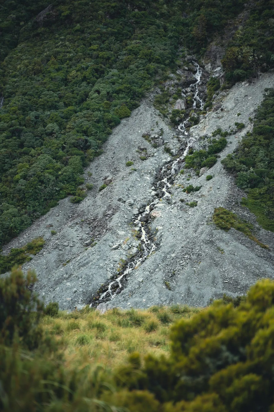
The terrain varies significantly. You'll traverse well-formed paths through regenerating forest, navigate rocky outcrops, and cross open, windswept headlands where the full force of the ocean can be felt. The vegetation changes with elevation and exposure, from lush ferns and mosses in sheltered gullies to hardy coastal shrubs and trees clinging to the exposed slopes. The views are the undeniable highlight. From the higher points, you can see the vast expanse of the Pacific Ocean, the Bay of Islands stretching out to the west, and the iconic Poor Knights Islands in the distance. The destination, the historic Cape Brett Lighthouse, is a beacon of human endeavour against the wild backdrop of nature, offering a sense of arrival and achievement.
This track is not for the faint-hearted. It requires a good level of fitness, sturdy footwear, and preparedness for changeable weather. However, for those who embrace the challenge, the Cape Brett Track delivers an unforgettable wilderness experience, a true immersion in the rugged beauty of New Zealand's northern coastline.
History and Cultural Context
The land around Cape Brett has a rich history, deeply intertwined with Māori culture and early European exploration. For centuries, Māori have navigated and utilised these coastal areas, with the cape serving as a significant landmark for navigation and a source of food and resources. The area holds cultural significance for local iwi, with stories and traditions passed down through generations relating to the sea, the land, and the ancestral connections to this coastline.
European settlement brought new developments. The construction of the Cape Brett Lighthouse was a crucial undertaking in the early 20th century to aid maritime navigation in the treacherous waters of the Hauraki Gulf and the Bay of Islands. Completed in 1909, the lighthouse was initially manned by keepers who lived in isolation, maintaining the light and signalling passing ships. The track itself likely evolved from the paths used by lighthouse keepers and their supplies, as well as earlier Māori trails. The isolation and challenging conditions faced by the lighthouse keepers are a testament to the ruggedness of the environment.
The lighthouse was automated in 1978, ending the era of resident keepers. Today, the lighthouse stands as a historic monument, a reminder of the maritime past and the enduring power of the natural landscape. The track is managed by the Department of Conservation (DOC) and local iwi, ensuring its preservation while allowing public access for trampers to experience its unique beauty and historical significance.
Seasonal Highlights and Weather Reality
The Cape Brett Track is accessible year-round, but the experience varies significantly with the seasons. The best time to undertake this walk is generally during the warmer months, from October to April, when the weather is more predictable and the days are longer.
Spring (October–November): The landscape begins to awaken. Native trees and shrubs start to flower, and birdlife becomes more active. The weather can be variable, with a mix of sunny days and occasional rain showers. Temperatures are mild, making for comfortable walking conditions. Sandflies can start to become noticeable towards the end of spring.
Summer (December–February): This is the peak season for visitors. Days are long and warm, ideal for enjoying the coastal scenery. However, summer also brings the highest risk of heat and humidity, and sandflies can be at their most bothersome, especially in sheltered, damp areas. Storms can still occur, bringing heavy rain and strong winds, so always check the forecast.
Autumn (March–April): Often considered one of the best times to walk the track. The weather is typically settled and mild, with less humidity and fewer sandflies than in summer. The autumn colours in the bush can be beautiful, and the ocean views are often spectacular. This is a great time for photography and enjoying the solitude.
Winter (May–September): While accessible, winter presents the greatest challenges. Days are shorter, and the weather is more unpredictable, with a higher chance of rain, strong winds, and cooler temperatures. The track can become muddy and slippery, increasing the risk of falls. However, winter can also offer dramatic stormy seascapes and a greater sense of solitude for those who brave the conditions. If walking in winter, ensure you have appropriate gear for wet and cold weather.
Weather Considerations: Northland's weather can change rapidly. Coastal areas are exposed to strong winds and sudden squalls. Always check the MetService forecast for the specific area before you go and be prepared for all conditions, regardless of the season.
Recommended Itinerary
Cape Brett Track - 1-Day Option (Challenging)
This option is for very fit and experienced hikers who are comfortable with a long, demanding day.
- Early Morning (approx. 7:00 AM): Depart from Rawhiti. Drive or arrange transport to the trailhead on Rawhiti Road. Ensure you have ample water and food.
- Morning (approx. 8:00 AM): Begin the hike from the trailhead. The initial section is through dense native bush, with steady ascents.
- Midday (approx. 12:00 PM - 1:00 PM): Reach the first major viewpoints. Take a break for lunch and enjoy the expansive ocean vistas. The track will involve significant elevation changes.
- Afternoon (approx. 2:00 PM - 4:00 PM): Continue towards the lighthouse. The terrain becomes more exposed and rugged.
- Late Afternoon (approx. 4:00 PM - 5:00 PM): Arrive at Cape Brett Lighthouse. Spend time exploring the area and taking in the panoramic views.
- Evening (approx. 5:00 PM onwards): Begin the return journey. This will be a challenging descent, especially in fading light. Ensure you have a head torch.
- Late Evening: Arrive back at the trailhead.
Cape Brett Track - 2-Day Option (Recommended)
This option allows for a more relaxed pace and the opportunity to stay overnight at the lighthouse.
Day 1: Rawhiti to Cape Brett Lighthouse
- Morning (approx. 9:00 AM): Start from the trailhead on Rawhiti Road.
- Late Morning/Midday: Ascend through the bush, enjoying intermittent coastal views.
- Afternoon: Reach the lighthouse. Explore the surroundings and settle into the hut.
- Evening: Enjoy the sunset from the lighthouse viewpoint.
Day 2: Cape Brett Lighthouse to Rawhiti
- Morning: Wake up to the sunrise over the ocean. Enjoy a final exploration of the lighthouse area.
- Late Morning: Begin the descent back to Rawhiti.
- Afternoon: Arrive back at the trailhead.
Important Notes:
- The track is steep and can be slippery, especially after rain.
- Water sources are unreliable; carry all the water you need.
- Sandflies can be prevalent, particularly in summer.
- Bookings for the lighthouse hut are essential and can be made through DOC.
- Consider a water taxi for a one-way trip if logistics allow, but this is not a standard option for this track.
Planning and Bookings
Book Your Trip
Everything you need to plan your journey
Accommodation
Find places to stay near Paihia
Flights
Search flights to Paihia
Essential Preparation
The Cape Brett Track is a challenging walk that requires careful planning. Given its remote location and rugged terrain, thorough preparation is paramount. The closest town with comprehensive services is Paihia, which is about a 45-minute drive from the trailhead at Rawhiti. Rawhiti itself is a small settlement with limited facilities, so stocking up on supplies in Paihia or Kerikeri is advisable. Ensure your vehicle can handle unsealed roads, as Rawhiti Road is unsealed for a significant portion.
Logistics:
- Transport to Trailhead: Rawhiti Road is unsealed and can be rough. A 2WD vehicle is generally suitable in dry conditions, but a 4WD is recommended if conditions are wet or if you are concerned about road quality.
- Accommodation: If not staying at the lighthouse hut, consider accommodation in Paihia or Russell. These towns offer a range of options from backpacker hostels to hotels.
- Food and Water: There are no facilities along the track. You must carry all your food and water.
- Communication: Mobile phone coverage is unreliable along the track and at the lighthouse. Inform someone of your plans and expected return time.
Trail Accommodation
The primary accommodation option on the Cape Brett Track is the historic lighthouse keeper's cottage, now operated as a basic hut by the Department of Conservation (DOC). This is a unique opportunity to stay in a remote and iconic location.
Cape Brett Lighthouse Hut:
- Booking Requirements: Mandatory booking through the DOC website is required. This hut is very popular due to its unique location, so book well in advance, especially during peak season.
- Facilities Provided: The hut offers basic sleeping platforms (bring your own sleeping bag), a wood-burning stove for heating, a gas hob for cooking, a composting toilet, and a rainwater tank (treatment recommended). There is a basic kitchen area with a table and benches.
- What's NOT Provided: No bedding, cooking utensils, pots, pans, cutlery, plates, or fuel for the stove (though a gas hob is provided). You must bring all your own food, cooking equipment, and sleeping gear. There is no electricity or running water beyond the rainwater tank.
- Seasonal Availability: Available year-round, but booking is essential. Winter conditions can make access more challenging.
- Costs: Costs vary but are typically around NZ$30-50 per person per night. Check the DOC website for current pricing.
Alternative: For those not staying at the hut, the track can be completed as a very long day hike, returning to accommodation in Paihia or Russell.
Required Gear
- Sturdy Tramping Boots: Waterproof and with good ankle support. The track is uneven, rocky, and can be slippery.
- Waterproof Jacket and Trousers: Essential for protection against rain and wind, which can be strong and unpredictable on the coast.
- Warm Layers: Including a fleece or wool mid-layer and a thermal base layer. Temperatures can drop, especially in the evenings or if the weather turns.
- Sun Protection: A wide-brimmed hat, sunglasses, and high SPF sunscreen are crucial, as the coastal exposure can be intense.
- Navigation: A map of the track and a compass or GPS device. While the track is generally well-marked, it's always wise to have navigation aids.
- First-Aid Kit: Including blister treatment, pain relievers, antiseptic wipes, bandages, and any personal medications.
- Head Torch: With spare batteries, essential for the 1-day option or if staying overnight and moving around after dark.
- Insect Repellent: Particularly effective against sandflies (DEET-based is recommended).
What to Bring
- Food: Sufficient high-energy food for the duration of your trip. For a 1-day hike, pack plenty of snacks and a substantial lunch. For an overnight stay, pack meals for dinner and breakfast, plus snacks.
- Water: Carry at least 2-3 litres of water per person for a day hike. For an overnight stay, carry enough for the hike in and for use at the hut, plus purification methods for the rainwater tank.
- Water Treatment: Water filter or purification tablets are recommended for the rainwater at the hut.
- Cooking Equipment: Lightweight stove, fuel, pot, utensils, plate, cup, and lighter/matches if staying overnight.
- Sleeping Bag: Essential for the lighthouse hut.
- Toiletries: Biodegradable soap, toothbrush, toothpaste, toilet paper, hand sanitiser.
- Trekking Poles: Highly recommended for the steep ascents and descents, to reduce strain on knees and improve stability.
- Small Backpack: For day trips or carrying essentials if staying overnight.
- Camera: To capture the stunning coastal scenery.
Permits

Access to the Cape Brett Track and the lighthouse hut requires booking through the Department of Conservation (DOC). Unlike some of New Zealand's Great Walks, the Cape Brett Track does not have a daily walker limit in the same way, but the limited capacity of the lighthouse hut means bookings are essential for overnight stays.
Booking the Lighthouse Hut:
- Online Booking: Bookings are made via the official DOC website. Search for "Cape Brett Lighthouse Hut" to find the booking portal.
- Advance Booking: Due to the popularity of this unique accommodation, it is highly recommended to book as far in advance as possible, especially for weekends, public holidays, and the peak summer season (December to February).
- Availability: Check the DOC website for real-time availability. Dates can fill up months in advance.
- Cost: Hut fees are typically around NZ$30-50 per person per night. These fees contribute to the maintenance and upkeep of the track and hut.
- Cancellation Policy: Familiarise yourself with the DOC's cancellation policy before booking.
Day Use: While booking is primarily for the hut, it's good practice to check the DOC website for any track alerts or closures before you go, even if you are only planning a day hike. There are no permits required for day use of the track itself, but adherence to DOC's visitor guidelines is expected.
Access to Rawhiti Road: The road to the trailhead is a public road, but it is unsealed and can be rough. Ensure your vehicle is suitable for these conditions. There is limited parking at the trailhead, so arrive early, especially during busy periods.
Other Activities in the Area
The Bay of Islands region surrounding Cape Brett offers a wealth of activities for visitors:
- Bay of Islands Cruises: Explore the stunning coastline, visit islands like Urupukapuka, and enjoy activities such as swimming, kayaking, and wildlife spotting. Many tours depart from Paihia or Russell.
- Hole in the Rock Cruise: A popular boat trip that takes you through the iconic geological formation and often includes stops for dolphin watching and exploring nearby islands.
- Kayaking: The sheltered waters of the Bay of Islands are perfect for kayaking. Explore hidden coves, paddle to nearby islands, or join a guided tour.
- Paihia and Russell: These historic towns offer a range of dining options, boutique shops, art galleries, and museums. Visit the Waitangi Treaty Grounds for a significant cultural and historical experience.
- Dolphin Watching Tours: The waters around the Bay of Islands are home to a variety of marine life, including dolphins and whales. Numerous operators offer dedicated tours.
- Fishing Charters: The area is renowned for its excellent fishing opportunities, with charters available for deep-sea or inshore fishing.
- Walking Tracks: Explore other shorter walks in the wider Bay of Islands area, such as the Urupukapuka Island Coastal Walk or tracks around the Opua Forest.
Safety and Conditions
Track Conditions: The Cape Brett Track is a challenging route. It is steep, often uneven, and can be very slippery, especially after rain. Expect loose rocks, exposed roots, and muddy sections. The track is not fully developed and requires careful footing.
Weather: Coastal weather in Northland can change rapidly. Be prepared for strong winds, heavy rain, and sudden temperature drops, even in summer. Always check the MetService forecast for the Northland region before you depart and be aware of any severe weather warnings.
Sandflies: Sandflies are a significant nuisance in this area, particularly during warmer months and in damp, sheltered spots. They are most active at dawn and dusk. Use a strong insect repellent (containing DEET) and wear long sleeves and trousers when stationary, especially in the evenings.
Water: There are no reliable water sources along the track. You must carry all the water you need for the duration of your hike. The lighthouse hut has a rainwater tank, but this water should be treated before drinking.
Navigation: While the track is generally marked, it is essential to carry a map and compass or GPS device. Do not rely solely on mobile phone reception, as it is unreliable in many parts of the track and at the lighthouse.
Fitness: This track is rated moderate to challenging due to its steep ascents and descents. Ensure you have a good level of fitness and are prepared for sustained uphill and downhill walking. Trekking poles are highly recommended to aid stability and reduce strain on your knees.
Emergency: Inform someone of your hiking plans, including your intended route and expected return time. In case of an emergency, mobile phone reception is limited. Consider carrying a personal locator beacon (PLB) if you are hiking alone or in remote areas.
Lighthouse Hut Safety: If staying overnight, be aware of the hut's basic facilities. Ensure the wood stove is operated safely, and be mindful of the limited resources. The environment around the lighthouse is exposed and can be hazardous in strong winds.
Side Trips and Points of Interest
Cape Brett Lighthouse: The primary destination and a significant point of interest. This historic lighthouse, built in 1909, offers panoramic views of the Pacific Ocean, the Bay of Islands, and the surrounding coastline. It's a testament to the maritime history of the region and a rewarding sight after a challenging hike.
Coastal Vistas: Throughout the track, numerous viewpoints offer breathtaking vistas of the rugged coastline, the deep blue Pacific, and the scattered islands of the Bay of Islands. These are perfect spots for short breaks and photography.
Native Bush: The track passes through areas of native New Zealand bush, including regenerating forest. Keep an eye out for native birds such as tūī, fantails (pīwakawaka), and kererū. The diverse plant life, including ferns and coastal shrubs, adds to the ecological interest of the walk.
Rocky Headlands: The exposed headlands provide a dramatic contrast to the sheltered bush sections. Here, you can experience the full force of the ocean winds and observe hardy coastal vegetation adapted to the harsh environment.
Potential for Marine Wildlife: While not guaranteed, keep an eye on the ocean for signs of marine life. Dolphins are often seen in the waters around the Bay of Islands, and seals may be spotted on coastal rocks.
Leave No Trace
The Cape Brett Track traverses a beautiful and ecologically sensitive coastal environment. Practising Leave No Trace principles is crucial to preserving its natural state for future visitors and protecting the local flora and fauna.
Plan Ahead and Prepare: Understand the track's challenges, weather conditions, and facilities before you go. Pack appropriately and carry all necessary supplies, including food and water, to minimise impact.
Travel and Camp on Durable Surfaces: Stick to the marked track at all times. Avoid walking on fragile vegetation, especially on the exposed headlands where plants are slow-growing and easily damaged. If staying overnight, use the designated hut facilities.
Dispose of Waste Properly: Pack out everything you pack in. This includes all food scraps, wrappers, and any other rubbish. Use the composting toilet facilities at the lighthouse hut and carry out any toilet paper. Do not bury waste.
Leave What You Find: Do not remove any natural items, such as rocks, plants, or shells. Take only photographs and memories.
Minimise Campfire Impacts: Campfires are not permitted on the Cape Brett Track. Use a portable stove for cooking if staying overnight.
Respect Wildlife: Observe wildlife from a distance. Do not feed birds or other animals, as this can disrupt their natural behaviours and diets. Be aware of nesting birds and avoid disturbing them.
Be Considerate of Other Visitors: Keep noise levels down, especially if staying overnight at the hut. Yield to other walkers on narrow sections of the track. Respect the history and cultural significance of the area.