Canterbury Pilgrims Way - A Journey Through Faith and History
The Canterbury Pilgrims Way is one of Europe’s most storied long-distance paths, a 193.1-kilometre odyssey that traverses the rolling chalk ridges and ancient woodlands of Southern England. Stretching from the historic Great Hall of Winchester to the soaring Gothic spires of Canterbury Cathedral, this route follows the footsteps of medieval seekers who journeyed to the shrine of Saint Thomas Becket. It is a walk that transcends mere physical exertion, offering a profound connection to the English landscape, from the "Hampshire Highlands" through the Surrey Hills Area of Outstanding Natural Beauty, and finally across the fertile orchards of the "Garden of England" in Kent. Unlike many modern trails, the Pilgrims Way is a palimpsest of history, where Roman roads, Iron Age trackways, and medieval footpaths converge to create a corridor of cultural heritage that has remained relevant for over eight centuries.
- Distance: 193.1 km one-way
- Duration: 10–14 days
- Season: May to September (best for wildflowers and dry underfoot conditions)
- Accommodation: Historic inns, bed and breakfasts, and designated campsites
- Highest point: Botley Hill (270 m)
- Total Elevation Gain: 2,500 m
- Direction: West to East (Winchester to Canterbury)
Overview
The Canterbury Pilgrims Way is not a single, isolated track but a corridor of movement that has evolved over millennia. While the modern walking route often aligns with the North Downs Way National Trail, the historical "Pilgrims Way" typically hugs the lower slopes of the chalk escarpment, avoiding the exposed ridges while staying above the once-impenetrable mud of the Weald. This journey offers a masterclass in the English pastoral aesthetic: walkers will find themselves moving through ancient yew forests, past Norman flint churches, and across vast fields of hops and lavender. The route is moderately challenging, not due to extreme altitude, but because of its undulating nature and the sheer distance required to complete the full traverse from the ancient capital of Wessex to the ecclesiastical heart of England.
The landscape is defined by the geology of the North Downs, a ridge of chalk hills that provides excellent drainage and spectacular views across the southern counties. On clear days, the views from the escarpment extend across the Weald to the South Downs, offering a sense of the immense scale of the English countryside. However, the trail is equally defined by its intimate moments: the quiet rustle of leaves in King’s Wood, the scent of wild garlic in the damp valleys of the Stour, and the sudden appearance of a medieval tithe barn around a bend in the path. It is a route that rewards the patient observer, with layers of history visible in every hedgerow and hollow way.
Logistically, the trail is well-supported by the dense network of English villages, providing ample opportunities for refreshment and rest. However, the popularity of the region means that planning is essential. The walk is a journey through time, where the modern world—visible in the distant hum of a motorway or the glint of a train line—is constantly juxtaposed with the timeless rhythm of the trail. For those seeking a walk that combines physical challenge with deep intellectual and spiritual resonance, the Canterbury Pilgrims Way remains an unsurpassed experience in the British Isles.
History and Cultural Context
The history of the Pilgrims Way is inextricably linked to the dramatic events of 29 December 1170, when four knights of King Henry II murdered Archbishop Thomas Becket inside Canterbury Cathedral. Becket’s subsequent canonisation transformed Canterbury into one of the four great pilgrimage sites of Christendom, alongside Rome, Jerusalem, and Santiago de Compostela. For nearly four centuries, until the Reformation, hundreds of thousands of pilgrims from across Europe landed at Southampton and walked through Winchester to reach Becket’s shrine, seeking miracles, penance, or spiritual renewal.
Geoffrey Chaucer’s "The Canterbury Tales," written in the late 14th century, immortalised this journey in English literature. While Chaucer’s pilgrims famously started in Southwark, London, the Winchester route (often called the "Old Way") was the primary artery for international travellers. The path itself, however, is far older than the medieval cult of Becket. Archaeological evidence suggests that the route follows the "Harroway," an ancient trackway used by Neolithic traders to transport flint and tin across Southern Britain. Roman engineers later utilised sections of this corridor, and the Saxons established many of the villages that still serve as waypoints today.
The Reformation in the 16th century saw the destruction of Becket’s shrine and the official suppression of pilgrimages, leading the path to fall into a period of purely local use. It wasn't until the late 19th and early 20th centuries that the route was "rediscovered" by Victorian antiquarians and romantic walkers. Today, the trail represents a modern revival of the pilgrimage tradition, attracting not only the religious but also those seeking a "slow travel" experience that connects them to the deep history of the land. The path is a living museum, where every village church and ancient boundary stone tells a story of English identity and European connection.
Want more background? Read extended notes on history and cultural context → Learn more
Seasonal Highlights and Weather Reality
The Canterbury Pilgrims Way is accessible year-round, but the experience varies dramatically with the seasons. The maritime climate of Southern England means that weather is unpredictable, and walkers should be prepared for rain in any month. However, the chalk soil of the Downs provides better drainage than the clay-heavy valleys, making it one of the more reliable long-distance paths during the wetter months.
Spring (April to May) is arguably the most beautiful time to walk. The ancient woodlands of the North Downs, particularly around the Surrey-Kent border, are carpeted in bluebells and wood anemones. The weather is generally mild, with temperatures ranging from 10°C to 18°C, though "April showers" are a frequent reality. This is also the time when the orchards of Kent burst into blossom, creating a spectacular white and pink canopy over the final stages of the trail.
Summer (June to August) offers the longest daylight hours and the highest probability of dry weather. Temperatures typically hover between 20°C and 25°C, though heatwaves can occasionally push mercury above 30°C. The trail can be busy during the school holidays, and accommodation in popular villages like Chilham or Alresford should be booked well in advance. The shade of the beech and yew forests provides a welcome respite from the sun on the exposed ridge sections.
Autumn (September to October) brings a different charm, as the beech forests turn to shades of copper and gold. September is often a "golden month" with stable weather and fewer crowds. This is the harvest season in Kent, and walkers will pass through vineyards and hop gardens in full production. By late October, the trail can become muddy, and the days shorten significantly.
Winter (November to March) is for the hardy. While the landscape has a stark, minimalist beauty, the trail can be exceptionally muddy in the lower sections. Many smaller B&Bs may close for the season, and daylight is limited to around eight hours. However, the sight of Winchester or Canterbury Cathedral illuminated against a crisp winter dusk is a powerful reward for those who brave the cold.
Recommended Itinerary
12-Day Canterbury Pilgrims Way Itinerary
Day 1: Winchester to Alresford
- Distance: 14.5 km
- Elevation gain: 180 m
- Time: 4–5 hours
- Start at Winchester Cathedral, visiting the shrine of St Swithun
- Follow the River Itchen through water meadows
- Pass through the historic village of Itchen Abbas
- Arrive in the Georgian market town of New Alresford
- A gentle introduction to the trail with minimal climbing
Day 2: Alresford to Alton
- Distance: 19 km
- Elevation gain: 220 m
- Time: 5–6 hours
- Walk through the rolling Hampshire countryside
- Pass through Chawton, home to Jane Austen’s House Museum
- Follow the "St Swithun’s Way" markers
- Arrive in Alton, a historic market town with Saxon origins
- The route begins to feel more rural as you leave the Itchen Valley
Day 3: Alton to Farnham
- Distance: 17.5 km
- Elevation gain: 210 m
- Time: 5 hours
- Cross the border from Hampshire into Surrey
- Pass through the village of Bentley
- Enter Farnham, dominated by its 12th-century castle
- Farnham marks the official start of the North Downs Way National Trail
- Excellent local pubs and historic architecture in the town centre
Day 4: Farnham to Guildford
- Distance: 18 km
- Elevation gain: 310 m
- Time: 5–6 hours
- Ascend onto the Hog’s Back, a narrow chalk ridge
- Spectacular views north towards London and south to the Weald
- Pass the Watts Gallery and the Arts and Crafts Mortuary Chapel in Compton
- Descend into the Wey Valley to reach Guildford
- Visit the ruins of Guildford Castle and the medieval High Street
Day 5: Guildford to Dorking
- Distance: 21 km
- Elevation gain: 450 m
- Time: 6–7 hours
- Climb to St Martha-on-the-Hill, a lonely church with 360-degree views
- Walk through the Silent Pool and the Albury Estate
- Traverse the Tillingbourne Valley
- Arrive in Dorking, nestled between Box Hill and Ranmore Common
- A more strenuous day with significant undulating terrain
Day 6: Dorking to Merstham
- Distance: 16 km
- Elevation gain: 380 m
- Time: 5 hours
- Climb the famous Box Hill (steep but rewarding)
- Cross the River Mole via the iconic stepping stones
- Follow the ridge through Colley Hill and Reigate Hill
- Pass the Inglis Folly and Victorian fort ruins
- Arrive in Merstham, a historic transport hub on the edge of the Downs
Day 7: Merstham to Otford
- Distance: 24 km
- Elevation gain: 420 m
- Time: 7–8 hours
- Cross the M25 via a dedicated footbridge (a modern pilgrim reality)
- Walk through the Titsey Estate and Oxted Downs
- Enter Kent, the "Garden of England"
- Descend into the Darent Valley to reach Otford
- Otford features a unique solar system model and the ruins of an Archbishop’s Palace
Day 8: Otford to Wrotham
- Distance: 12 km
- Elevation gain: 250 m
- Time: 3–4 hours
- A shorter day allowing for recovery or exploration of Otford
- Climb back onto the escarpment with views over Sevenoaks
- Walk through Kemsing, home to a holy well dedicated to St Edith
- Arrive in the hilltop village of Wrotham
- Wrotham has been a stopping point for travellers since the Roman era
Day 9: Wrotham to Rochester (Cuxton)
- Distance: 18.5 km
- Elevation gain: 300 m
- Time: 5–6 hours
- Pass through the Trosley Country Park
- Visit the Coldrum Long Barrow (Neolithic burial site)
- Descend to the River Medway
- Cross the Medway via the motorway bridge (separate pedestrian path)
- Arrive in Cuxton or continue to Rochester for its Cathedral and Castle
Day 10: Rochester to Detling
- Distance: 17 km
- Elevation gain: 280 m
- Time: 5 hours
- Climb back onto the Kent Downs
- Pass the "White Horse Stone," a megalithic sarsen stone
- Walk through Blue Bell Hill with views over the Medway Valley
- Arrive in Detling, a small village on the ancient trackway
- The route here is very close to the historical prehistoric path
Day 11: Detling to Charing
- Distance: 19.5 km
- Elevation gain: 240 m
- Time: 6 hours
- Follow the "Pilgrims Way" road and track sections
- Pass through Hollingbourne and Lenham
- View the Lenham Cross carved into the chalk hillside
- Arrive in Charing, featuring the remains of another Archbishop’s Palace
- The landscape opens up into wide agricultural vistas
Day 12: Charing to Canterbury
- Distance: 25 km
- Elevation gain: 310 m
- Time: 7–8 hours
- The final push through the Great Stour Valley
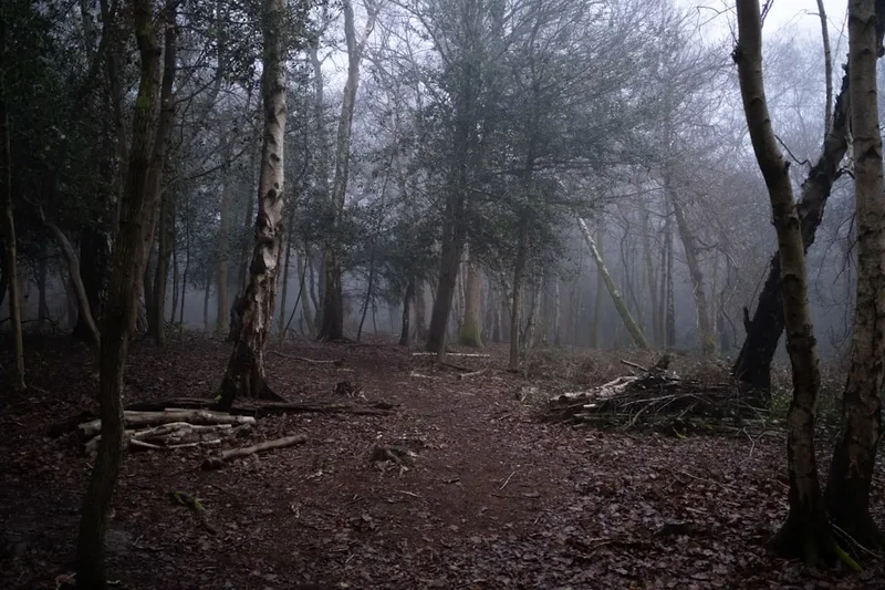
- Pass through the ancient King’s Wood (look for fallow deer)
- Arrive in the picturesque village of Chilham
- First glimpse of Canterbury Cathedral from Harbledown
- Enter Canterbury through the Westgate and finish at the Cathedral
Important Notes:
- The route is well-signposted but a map or GPS is essential for forest sections
- Accommodation should be booked in advance, especially in Kent
- Water points are available in villages, but carry at least 2 litres
- The trail crosses several major roads; use designated crossings carefully
- Public transport (trains) runs parallel to much of the route, allowing for easy section hiking
Planning and Bookings
Book Your Trip
Everything you need to plan your journey
Accommodation
Find places to stay near Canterbury
Flights
Search flights to Canterbury
Essential Preparation
The Canterbury Pilgrims Way requires a moderate level of fitness. While there are no mountains, the cumulative effect of walking 15–25 kilometres daily for nearly a fortnight is significant. It is recommended to undertake several back-to-back training walks with a weighted pack before starting. Logistics are simplified by the excellent rail connections between London and major trail hubs like Winchester, Farnham, Guildford, and Canterbury.
Winchester is the ideal base for the night before you start. As the ancient capital of England, it offers a range of accommodation from boutique hotels to hostels. Ensure you visit the Cathedral to collect your "Pilgrim Passport" or first stamp. Canterbury, at the other end, is a major tourist destination; booking your final night’s stay well in advance is crucial, particularly during the summer months or around religious festivals.
Trail Accommodation
There is no "hut system" on the Pilgrims Way. Instead, walkers rely on a network of commercial accommodation. This requires careful planning as some villages have limited options.
Accommodation Types:
- Inns and Pubs: The most traditional option. Many historic pubs along the route offer "rooms at the inn." Expect to pay £80–£120 per night for a double room including breakfast.
- Bed and Breakfasts (B&Bs): Often located in private homes or farmhouses. These provide a more personal experience and excellent local knowledge.
- Campsites: Available in some areas (e.g., near Dorking, Otford, and Hollingbourne). Wild camping is illegal in England without the landowner's permission and is generally not recommended on this route due to the proximity of farmland and private estates.
- Youth Hostels (YHA): Limited on this specific route, but YHA Holmbury St Mary and YHA Canterbury are useful options.
Booking Requirements:
- Book 3–6 months in advance for peak season (May–September).
- Use platforms like Booking.com or the National Trail website’s accommodation guide.
- Check if your accommodation offers luggage transfer services; several companies (e.g., Brigantes or Celtic Trails) can move your main bags between stops for a fee.
Required Gear
- Walking Boots: Waterproof and well-broken-in. The terrain is a mix of gravel, grass, and some tarmac. Mid-weight boots or high-quality trail shoes are sufficient.
- Waterproofs: A high-quality breathable waterproof jacket and overtrousers. English weather can change in minutes.
- Navigation: OS Landranger or Explorer maps (paper or digital). The North Downs Way National Trail guide is highly recommended.
- Socks: Merino wool or synthetic blends to prevent blisters. Carry at least three pairs.
- Backpack: 30–40L if using luggage transfer; 50–65L if carrying all gear. Ensure it has a rain cover.
- First Aid: Focus on blister care (Compeed, zinc oxide tape), antiseptic cream, and ibuprofen.
What to Bring
- Water Treatment: While tap water is safe, a reusable bottle with a filter (like a LifeStraw) is useful if you need to top up from outdoor taps.
- Sun Protection: Sunscreen, sunglasses, and a wide-brimmed hat. The ridge sections offer little shade.
- Power Bank: To keep your phone/GPS charged, as you will likely use it for navigation and photos.
- Clothing Layers: The "onion" principle—base layer, fleece mid-layer, and outer shell. Avoid cotton.
- Snacks: High-energy food (nuts, dried fruit, chocolate) for the stretches between villages.
- Pilgrim Passport: Available from Winchester Cathedral, used to collect stamps at churches along the way.
Permits
No formal permits or fees are required to walk the Canterbury Pilgrims Way. The route follows established Public Rights of Way, which are free for all to use. However, there are several considerations for the modern pilgrim regarding access and costs.
Access and Rights of Way:
- The route is a combination of Public Footpaths (pedestrians only), Bridleways (pedestrians, cyclists, and horses), and quiet country lanes.
- Always follow the "Countryside Code": leave gates as you find them and keep dogs under control, especially near livestock.
- Some sections pass through private estates (like the Titsey Estate); stay strictly to the marked path to maintain access rights.
Cathedral Entry:
- While the trail is free, both Winchester and Canterbury Cathedrals charge an entry fee for tourists. However, if you are a bona fide pilgrim, you can often enter for prayer or to have your passport stamped without charge—enquire at the welcome desk.
- Canterbury Cathedral entry is approximately £17 for adults (2024 rates), which includes access to the entire precinct and the crypt.
Luggage Transfers:
- If you choose to use a luggage transfer service, this must be booked and paid for in advance. Costs typically range from £10 to £15 per bag, per move.
Other Activities in the Area
The route passes through some of the most culturally rich areas of England. Consider these detours or extensions:
- Winchester Great Hall: Home to the legendary "Round Table" of King Arthur. A must-see before you leave the starting city.
- Jane Austen’s House (Chawton): A short detour on Day 2. The house where Austen wrote her most famous novels is now a fascinating museum.
- Vineyard Tours: The North Downs are home to world-class sparkling wine producers. Denbies Wine Estate in Dorking and Chapel Down near Tenterden (a longer detour) offer tours and tastings.
- Rochester Cathedral and Castle: On Day 9/10, take time to explore Rochester. The castle has one of the tallest Norman keeps in England, and the cathedral is the second oldest in the country.
- Chilham Village: Often cited as the most beautiful village in Kent, its square has been used as a filming location for numerous period dramas.
- Canterbury Roman Museum: Built around the remains of an original Roman townhouse, it provides context for the city’s pre-Christian history.
Safety and Conditions
Road Safety:
The Pilgrims Way occasionally follows or crosses busy roads, including the A3, M25, and M20. While pedestrian bridges and underpasses are provided for motorways, some country lanes have no pavements. Always walk facing oncoming traffic and wear high-visibility gear if walking in low light or fog.
Weather Extremes:
While England’s weather is rarely "extreme" in a global sense, hypothermia is a risk in wet, windy conditions even in summer. Conversely, heat exhaustion can occur on the exposed chalk ridges. Always carry sufficient water (at least 2 litres) and check the Met Office forecast daily. The chalk can become incredibly slippery when wet—trekking poles are highly recommended for the steeper descents like Box Hill or Reigate Hill.
Navigation:
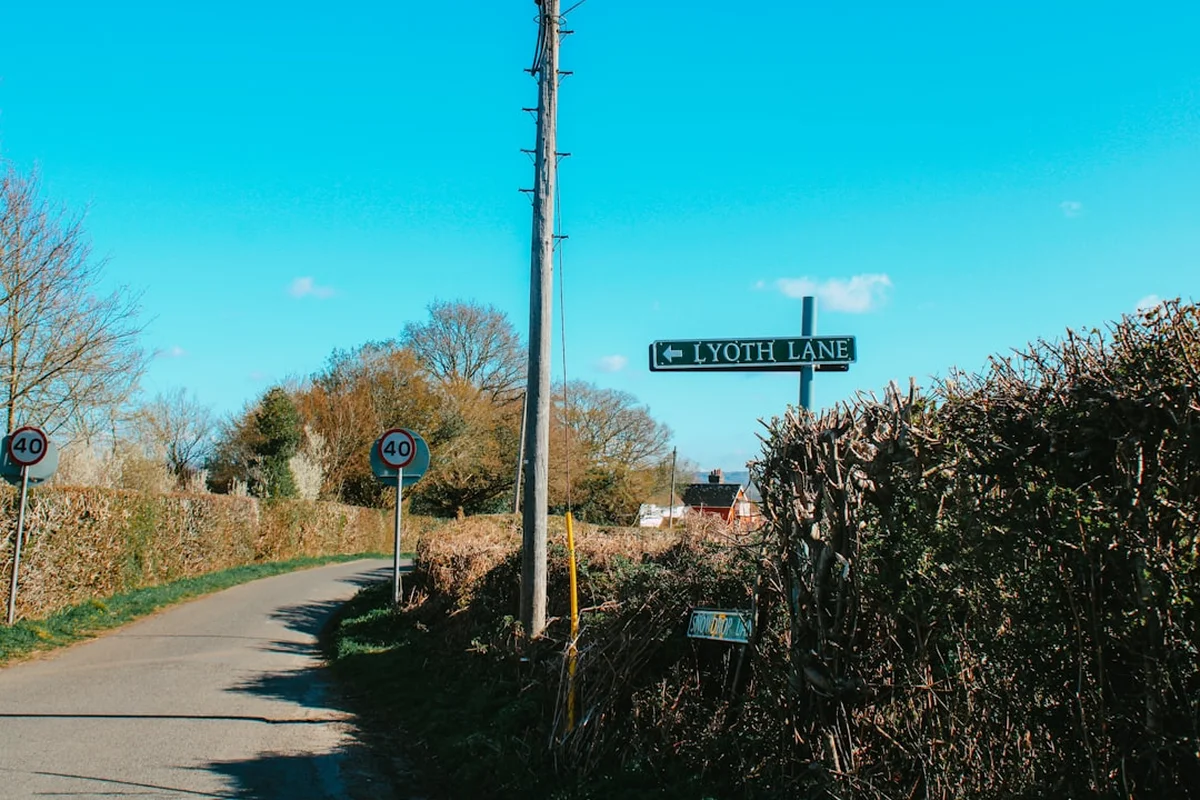
The trail is generally well-marked with the acorn symbol of the National Trails (where it follows the North Downs Way) or the scallop shell/St Swithun’s markers. However, in dense woodland like King’s Wood or around complex farmyards, it is easy to lose the path. Always carry a backup paper map and a compass, and do not rely solely on a mobile phone, as battery life can fail and signal is patchy in deep valleys.
Livestock:
You will frequently walk through fields containing cattle or sheep. Give them a wide berth, especially if they have young. If you have a dog, keep it on a short lead. If cattle approach you aggressively, let the dog off the lead—it can run faster than you and will draw the cattle away.
Side Trips and Points of Interest
St Martha-on-the-Hill: Located between Guildford and Dorking, this 12th-century church sits at the summit of a steep hill. It is only accessible on foot. The graveyard contains the tomb of Bernard Freyberg, a famous World War I hero and Governor-General of New Zealand. The views from the porch are among the best on the entire trail.
The Silent Pool: A spring-fed lake at the foot of the North Downs near Albury. Legend says a woodcutter’s daughter drowned here while escaping the unwanted advances of King John. Today, it is a site of Special Scientific Interest and home to a popular local gin distillery.
Coldrum Long Barrow: A short detour near Wrotham. This is the best-preserved Neolithic tomb in Kent, predating Stonehenge. It consists of a central burial chamber surrounded by a sarsen stone circle. It is a hauntingly beautiful spot, especially at sunrise, and offers a glimpse into the prehistoric "Harroway" that preceded the Pilgrims Way.
The Medway Megaliths: A group of Neolithic chambered long barrows, including Kits Coty House and the Little Kits Coty House. These are located near Blue Bell Hill and represent the only megalithic group in Eastern England.
Harbledown: Just outside Canterbury, this was the site of a leper hospital founded by Lanfranc in the 11th century. Pilgrims would stop here to wash and prepare themselves before entering the holy city. The "Black Prince’s Well" is still visible here.
Leave No Trace
The Canterbury Pilgrims Way passes through some of the most densely populated parts of England, yet it maintains a sense of wilderness and peace. To preserve this, all walkers must adhere to the principles of Leave No Trace and the UK Countryside Code.
Your responsibility as a walker:
- Protect the Chalk Grassland: This is a rare and fragile habitat. Stay on the marked paths to avoid trampling delicate orchids and disturbing ground-nesting birds.
- Litter: There are no bins on the trail. Pack out everything, including biodegradable items like banana skins or orange peels, which take a long time to decompose in the English climate and look unsightly.
- Sanitation: Use public toilets in villages. If caught short, ensure you are at least 50 metres from any water source and bury waste deep in a "cat hole." Carry out all toilet paper and sanitary products.
- Gates and Fences: Leave gates as you find them (usually closed). Do not climb over stone walls or hedges; use the provided stiles or kissing gates.
- Respect Local Communities: The trail passes through many quiet residential areas. Keep noise to a minimum and respect the privacy of those living along the route.