Camino dos Faros - The Lighthouse Way
The Camino dos Faros, or The Lighthouse Way, is a spectacular 200-kilometre hiking route that clings to the rugged coastline of the Costa da Morte (Coast of Death) in Galicia, Northwest Spain. Connecting the port of Malpica with the iconic Cape Finisterre, this eight-day journey traverses one of Europe’s most dramatic maritime landscapes. Unlike the more famous Camino de Santiago, which often moves inland, the Camino dos Faros is a dedicated coastal path that remains within sight of the Atlantic Ocean for nearly its entire duration. It is a route defined by its namesake lighthouses, which have stood for centuries as sentinels against the treacherous waters that gave this coast its fearsome name. The trail winds through secret beaches, over towering granite cliffs, across ancient hillforts, and through traditional Galician fishing villages where the rhythm of life is still dictated by the sea. This is a journey for those who seek the raw, unvarnished beauty of the Atlantic, where the wind, the salt, and the granite create a landscape of profound solitude and power.
- Distance: 200.0 km
- Duration: 8 days
- Elevation Gain: 5,500 m
- Difficulty: Moderate (with some strenuous cliff-side sections)
- Best Time: April to October
- Closest City: A Coruña
- Trailhead: Malpica de Bergantiños
- End Point: Cabo Finisterre (The End of the World)
Overview
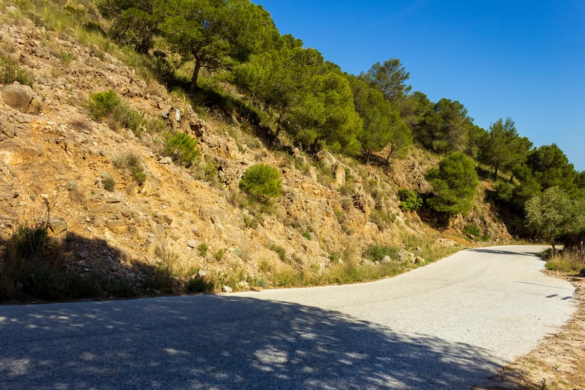
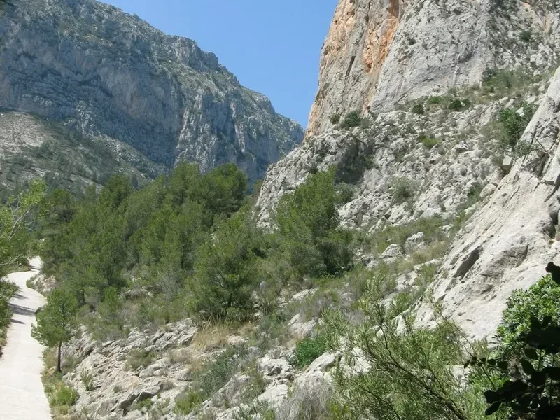
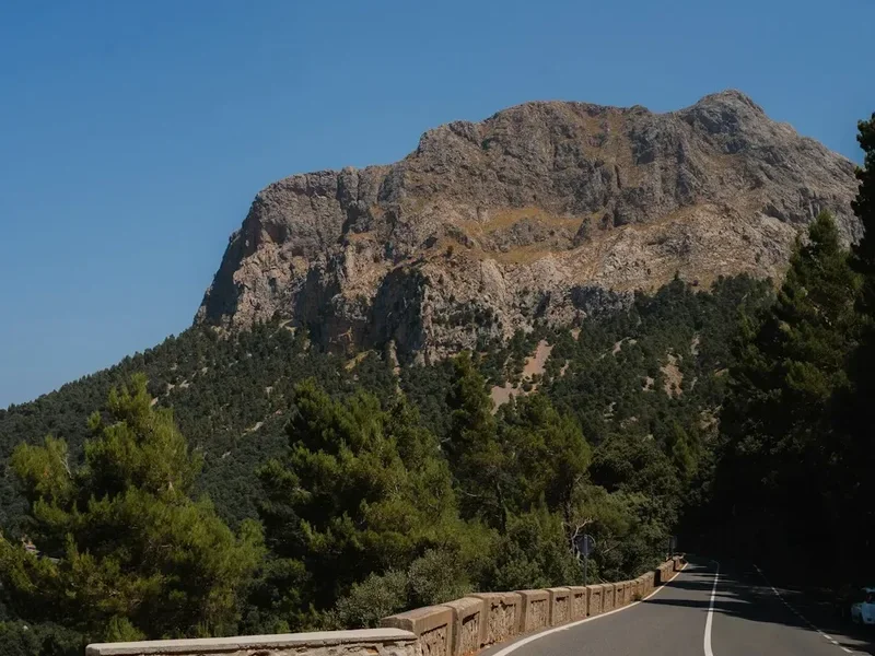
The Camino dos Faros is a masterclass in coastal geography. The "Costa da Morte" has long been feared by sailors, a graveyard for hundreds of ships caught in its jagged rocks and fierce Atlantic swells. For the hiker, however, this treacherous history translates into a landscape of unparalleled drama. The trail is not a flat coastal stroll; it is a demanding trek that involves constant elevation changes as the path drops down to sea-level beaches before climbing steeply back up to cliff-tops that soar 150 metres above the surf. The total elevation gain of 5,500 metres over 200 kilometres is a testament to the undulating nature of the Galician coastline.
The route is divided into eight distinct stages, each designed to end in a village or town with available accommodation. The journey begins in the bustling fishing port of Malpica and moves westward, passing through the municipalities of Ponteceso, Laxe, Vimianzo, Camariñas, Muxía, and Cee, before finally reaching the lighthouse at Cape Finisterre. Along the way, hikers encounter seven major lighthouses, each with its own architectural character and history, from the modern tower at Punta Nariga to the hauntingly beautiful Vilán Lighthouse, the first in Spain to be powered by electricity.
What sets the Camino dos Faros apart is its authenticity. The trail was not created by a government tourism board but by a group of local enthusiasts known as "Os Trasnos" (The Goblins), who sought to link existing fisherman’s paths and coastal tracks into a continuous route. As a result, the trail feels organic and wild. You will walk through "fervenzas" (waterfalls) that tumble into the sea, traverse "furnas" (sea caves), and stand atop "castros" (Iron Age hillforts) that offer 360-degree views of the horizon. The weather is a central character in the experience; the Galician mist (brétema) can transform the landscape into a Celtic dreamscape in minutes, while the bright Atlantic sun illuminates the turquoise waters of hidden coves that look more Caribbean than European. This is a trail that demands physical fitness and a spirit of adventure, rewarding the hiker with a deep connection to the maritime soul of Galicia.
History and Cultural Context
The history of the Camino dos Faros is inextricably linked to the maritime heritage of Galicia and the tragic legacy of the Costa da Morte. For millennia, this coastline was considered the "Finis Terrae"—the end of the known world. Ancient Celtic tribes built their fortified villages (castros) on the headlands, many of which, like the Castro de Borneiro, are still visible along the trail today. These early inhabitants looked out at the Atlantic not just as a source of food, but as a mystical boundary to the afterlife.
In the modern era, the coast became a vital but deadly corridor for international shipping. The name "Costa da Morte" was coined in the late 19th century following a series of high-profile shipwrecks, most notably the HMS Serpent in 1890, a British Royal Navy cruiser that ran aground near Camariñas, resulting in the loss of 172 lives. The "English Cemetery" (Cemiterio dos Ingleses), which hikers pass on Stage 4, stands as a somber memorial to this event and a reminder of the ocean's power. The lighthouses were built as a direct response to these tragedies, evolving from simple beacons to the sophisticated structures seen today.
The trail itself has a much younger history. In 2012, a small group of friends from the region decided to walk the entire coast from Malpica to Finisterre, following the shoreline as closely as possible. They called themselves "Os Trasnos" and began marking the route with small green arrows. Their grassroots movement grew into a non-profit association that now maintains the trail. Unlike the Camino de Santiago, which is a religious pilgrimage, the Camino dos Faros is a "secular pilgrimage" to nature. However, it still intersects with deep-seated Galician traditions, such as the lace-making (palilladas) of Camariñas and the cult of the Virgin of the Boat (Nosa Señora da Barca) in Muxía, where pre-Christian megaliths are integrated into Catholic ritual. Walking this path is an immersion into a culture where the boundary between the land, the sea, and the supernatural has always been thin.
Want more background? Read extended notes on history and cultural context → Learn more
Seasonal Highlights and Weather Reality
Galicia is famously the greenest part of Spain, a direct result of its high rainfall. When planning a trek on the Camino dos Faros, understanding the Atlantic climate is essential for safety and enjoyment. The trail is technically open year-round, but the experience varies dramatically between seasons.
Spring (April to June): This is arguably the best time to walk. The coastal gorse and heather are in full bloom, painting the cliffs in vibrant yellows and purples. Temperatures are mild, typically ranging from 12°C to 20°C, making the steep climbs manageable. However, spring is also unpredictable; heavy rain showers are common, and the "brétema" (sea mist) can frequently obscure the lighthouses.
Summer (July to August): These are the driest and warmest months, with temperatures often reaching 25°C to 28°C. While the sea breezes keep the coast cooler than the Spanish interior, the sun can be intense on the exposed cliff-tops where there is little shade. This is the peak season for local tourism, so beaches will be busier and accommodation in small villages like Laxe or Camariñas should be booked well in advance. The Atlantic water remains brisk, but a swim in a hidden cove is a highlight of the summer trek.
Autumn (September to October): September offers stable weather and warm seas, often providing the most pleasant walking conditions. By October, the Atlantic storms begin to roll in. While the sight of massive waves crashing against the cliffs is spectacular, the wind can make the narrow cliff-side paths dangerous. This is the season of the harvest, and the local gastronomy—particularly the seafood and chestnuts—is at its peak.
Winter (November to March): Walking the Camino dos Faros in winter is only recommended for experienced hikers prepared for extreme conditions. Gale-force winds, torrential rain, and limited daylight hours make the 200-kilometre journey a significant challenge. Many seasonal hotels and restaurants in the smaller villages close during this period, making logistics difficult. However, for those who brave the elements, the raw power of the "Coast of Death" in winter is an unforgettable sight.
Recommended Itinerary
8-Day Camino dos Faros Itinerary
Day 1: Malpica to Niñóns
- Distance: 21.9 km
- Elevation gain: 715 m
- Time: 6–7 hours
- Start at the port of Malpica and climb to the Chapel of San Adrián for views of the Sisargas Islands
- Pass the first lighthouse, Cabo San Adrián, and continue along rugged cliffs
- Visit the modern, wind-sculpted lighthouse of Punta Nariga
- Finish at the remote beach of Niñóns
- Note: Niñóns has no accommodation; most hikers arrange a taxi back to Malpica or forward to Ponteceso
Day 2: Niñóns to Ponteceso
- Distance: 26.1 km
- Elevation gain: 515 m
- Time: 7–8 hours
- A demanding stage with constant ups and downs along the coastline
- Pass the cliffs of O Roncudo, famous for the world's best barnacles (percebes)
- Visit the simple white lighthouse of O Roncudo
- Walk along the Anllóns estuary, a protected area for birdlife
- Finish in the town of Ponteceso, the birthplace of the author of the Galician anthem
Day 3: Ponteceso to Laxe
- Distance: 25.2 km
- Elevation gain: 425 m
- Time: 6–7 hours
- Climb to the Monte Branco for a panoramic view of the Estuary of Corme and Laxe
- Traverse the spectacular beach of O Trece and its climbing dunes
- Visit the Castro de Borneiro, an exceptionally well-preserved Iron Age village
- Descend into the beautiful seaside town of Laxe with its white sand beach
Day 4: Laxe to Arou
- Distance: 17.7 km
- Elevation gain: 200 m
- Time: 4–5 hours
- The shortest and flattest stage, providing a much-needed recovery
- Visit the Laxe Lighthouse and the "Crystal Beach" (Praia dos Cristais)
- Follow the coast to the Camelle, where you can see the open-air museum of "Man," a German hermit artist
- Finish in the tiny, authentic fishing village of Arou
Day 5: Arou to Camariñas
- Distance: 22.7 km
- Elevation gain: 295 m
- Time: 6–7 hours
- The heart of the Costa da Morte; wild and desolate
- Pass the English Cemetery, memorialising the 1890 shipwreck of the HMS Serpent
- Reach the majestic Vilán Lighthouse, one of the most iconic landmarks on the trail
- Walk into Camariñas, famous for its traditional bobbin lace
Day 6: Camariñas to Muxía
- Distance: 32.0 km
- Elevation gain: 470 m
- Time: 8–10 hours
- The longest stage, requiring an early start
- Circumnavigate the Enseada da Basa and walk through the pine forests of Pasarela
- Pass the beaches of Lago and Merexo
- Arrive in Muxía and visit the Sanctuary of Nosa Señora da Barca, perched on the rocks above the Atlantic
Day 7: Muxía to Nemiña
- Distance: 24.3 km
- Elevation gain: 915 m
- Time: 7–8 hours
- The most physically demanding stage due to significant elevation gain
- Climb Monte do Facho for incredible views of the coastline
- Pass the Touriñán Lighthouse, the westernmost point of mainland Spain
- Finish at the surf-friendly beach of Nemiña
Day 8: Nemiña to Cabo Finisterre
- Distance: 26.2 km
- Elevation gain: 815 m
- Time: 7–9 hours
- The final push to the "End of the World"
- Pass the massive beach of O Rostro and the cliffs of Arnela
- Climb Monte de San Guillermo for a final view of the Cape
- Finish at the Finisterre Lighthouse, watching the sunset over the Atlantic
Planning and Bookings
Book Your Trip
Everything you need to plan your journey
Accommodation
Find places to stay near A Coruña
Flights
Search flights to A Coruña
Essential Preparation
The Camino dos Faros requires more logistical planning than the traditional Camino de Santiago. Because it is a coastal route through some remote areas, accommodation is not always available at the exact end of a stage. Hikers must be prepared to use local taxis to reach nearby towns or arrange luggage transfers. Fitness is a key requirement; while the maximum altitude is only 274 metres, the cumulative elevation gain is significant, and the terrain is often rocky, sandy, or muddy.
The closest major city is A Coruña, which has an airport (LCG) and excellent train and bus connections to the rest of Spain. From A Coruña, the ALSA bus service runs regularly to Malpica (approximately 1.5 hours). It is highly recommended to spend a night in Malpica before starting to soak in the atmosphere of this traditional fishing port. Language can be a barrier in smaller villages; while Spanish is spoken everywhere, the local language is Galician (Galego). Learning a few basic phrases in Galego is greatly appreciated by the locals.
Trail Accommodation
There are no dedicated "pilgrim hostels" (albergues) specifically for the Camino dos Faros, though you will find them in Muxía and Finisterre where the trail overlaps with the Camino de Santiago. Instead, hikers rely on a mix of small hotels, "pensiones" (guesthouses), and "turismo rural" (country cottages).
Accommodation Types:
- Hotels and Pensions: Found in larger towns like Malpica, Ponteceso, Laxe, Camariñas, Muxía, and Finisterre. Prices range from €40 to €80 per night for a double room.
- Turismo Rural: Often located a few kilometres inland from the trail. These offer high-quality accommodation in restored stone houses, often including excellent home-cooked meals. Many owners will provide a pick-up service from the trail.
- Hostels: Available in Muxía and Finisterre. These are budget-friendly (€15-€25) but can be crowded during the summer months.
- Camping: There are official campsites in Malpica, Laxe, and Finisterre. Wild camping is technically illegal in Spain and is not recommended due to the fragile coastal ecosystem.
Booking Advice: During the peak months of July and August, booking at least 2-3 months in advance is essential. In the shoulder seasons, a few days' notice is usually sufficient. Use the official Camino dos Faros website to find a list of "Trasno-friendly" establishments that support the trail.
Required Gear
- Hiking Boots: Mid-cut boots with good ankle support and a Vibram-style sole are essential. The trail involves rocky descents and sandy sections where trail runners may lack sufficient stability.
- Rain Gear: A high-quality waterproof jacket (minimum 10,000mm hydrostatic head) is mandatory regardless of the season. Waterproof trousers are also recommended for the frequent Atlantic squalls.
- Backpack: A 30-40L pack is sufficient if you are using a luggage transfer service. If carrying all your gear, a 50-60L pack is required. Ensure it has a waterproof cover.
- Trekking Poles: Highly recommended for the steep, often slippery descents on Stages 2, 7, and 8. They significantly reduce the impact on knees.
- Socks: Merino wool blend socks to prevent blisters and manage moisture in the humid Galician climate.
- Navigation: The trail is marked with green arrows, but these can be missed. Download the official GPS tracks or use an offline mapping app like Wikiloc or Gaia GPS.
What to Bring
- Water Filtration: While there are fountains (fontes) in villages, some remote sections have no potable water. A filter bottle or purification tablets provide peace of mind.
- Sun Protection: High SPF sunscreen, a wide-brimmed hat, and polarised sunglasses. The Atlantic glare is powerful even on cloudy days.
- First Aid Kit: Focus on blister care (Compeed, athletic tape), antiseptic wipes, and anti-inflammatory medication.
- Snacks: High-energy food (nuts, dried fruit, chocolate) for the long stretches between villages, particularly on Stages 1, 5, and 7.
- Power Bank: To ensure your phone/GPS remains charged, as navigation is critical on the cliff-side sections.
- Swimwear: For the many beautiful beaches you will encounter. The water is cold but incredibly refreshing.
- Cash: Many small bars and guesthouses in the villages do not accept credit cards. Carry at least €50 in cash at all times.
Permits
One of the great appeals of the Camino dos Faros is its accessibility. Currently, no permits, fees, or registrations are required to walk the trail. It is a public route maintained by the Asociación Camiño dos Faros and local municipalities. Unlike the Camino de Santiago, there is no official "credencial" (pilgrim passport) required to stay in accommodation, although some hikers carry a generic passport to collect stamps from lighthouses and bars as souvenirs.
Key Considerations:
- Group Size: While there is no limit, groups larger than 10 should notify guesthouses well in advance, as many villages have very limited capacity.
- Organised Tours: Several companies offer self-guided packages that include accommodation bookings and luggage transfers. This is a popular option for those who want to focus on the hike without the logistical stress of finding beds in remote areas.
- Environmental Regulations: The trail passes through several Natura 2000 protected sites. While no permit is needed to walk, you must stay on the marked path to protect the fragile dune systems and nesting birds.
Other Activities in the Area
Galicia is a region of deep culture and incredible gastronomy. Consider adding a few days to your trip to explore the surrounding area:
- Santiago de Compostela: Only an hour from Finisterre or A Coruña, the capital of Galicia is a UNESCO World Heritage site and the end point of the famous pilgrimage. The cathedral and the medieval old town are unmissable.
- Seafood Tasting: The Costa da Morte is world-famous for its seafood. Try "percebes" (goose barnacles) in Corme, "pulpo á feira" (octopus with paprika), and the local "longueiróns" (razor clams) in Finisterre.
- A Coruña: Visit the Tower of Hercules, the oldest working Roman lighthouse in the world, and explore the "City of Glass" with its famous enclosed balconies (galerías).
- Surfing: The beaches of Nemiña and Rostro offer some of the best and most consistent surf breaks in Northern Spain. Several local schools offer lessons for beginners.
- Lace-making Demonstrations: In Camariñas, you can visit the Museum of Lace and watch the "palilleiras" (lace-makers) work their bobbins with incredible speed and skill.
Safety and Conditions
Coastal Hazards: The primary safety concern on the Camino dos Faros is the proximity to cliff edges. In several sections, the path is narrow and exposed to high winds. If you suffer from severe vertigo, some parts of Stages 1, 2, and 7 may be challenging. Always check the wind forecast; if gusts exceed 60 km/h, it is safer to take an inland road alternative.
Tides: A few sections of the trail, particularly near the Anllóns estuary and certain beaches like O Trece, can be affected by high tides. While the path is generally designed to be above the high-water mark, storm surges can make beach crossings dangerous. Always consult a tide table before starting Stages 2 and 3.
Weather Changes: The Atlantic weather can change with startling rapidity. A sunny morning can turn into a foggy, rainy afternoon in less than thirty minutes. Hypothermia is a genuine risk if you are caught in a cold rain without proper gear, even in the shoulder seasons. Always carry a whistle and a space blanket in your daypack.
Emergency Services: The national emergency number in Spain is 112. Mobile phone coverage is generally good along the coast, but there are "dead zones" in the deep valleys and remote cliffs between Arou and Camariñas. Ensure someone knows your intended itinerary for the day.
Road Walking: While 95% of the trail is on paths, there are short sections where you must walk on local roads. Galician country roads are narrow and often have no shoulder. Always walk facing the traffic and wear bright or reflective clothing.
Side Trips and Points of Interest
The Sisargas Islands: Visible from Stage 1, these three uninhabited islands are a sanctuary for seagulls and the rare European shag. During the summer, small boats run from Malpica to the islands, allowing you to hike to the Sisargas Lighthouse for a unique perspective of the mainland cliffs.
The English Cemetery (Cemiterio dos Ingleses): Located on Stage 5, this is one of the most moving spots on the trail. It is a simple stone enclosure where the victims of the HMS Serpent were buried. The site is hauntingly beautiful, overlooking the treacherous "Baixo do Boi" rocks where the ship foundered.
Monte Branco: The "White Mountain" near Ponteceso is home to one of the highest climbing dunes in Europe. The climb is sandy and difficult, but the reward is the best view on the entire trail, looking down over the turquoise waters of the Enseada da Insua.
The Sanctuary of Muxía: The Santuario da Virxe da Barca is built on a rocky outcrop where, according to legend, the Virgin Mary appeared in a stone boat to encourage St. James. The "Pedra de Abalar" (Rocking Stone) and "Pedra dos Cadrís" (Kidney Stone) are ancient megaliths nearby that are still used in local healing rituals.
Touriñán Lighthouse: Often overlooked in favour of Finisterre, Touriñán is actually the westernmost point of the Spanish mainland. It is a wild, wind-blasted headland that feels significantly more remote and "undiscovered" than the end of the trail.
Leave No Trace
The Camino dos Faros traverses some of the most pristine coastal environments in Spain. The "Trasnos" who created the trail did so with a philosophy of minimal impact, and it is the responsibility of every hiker to maintain this. The Galician coast is home to rare flora, such as the "herba de namorar" (sea pink), and provides critical nesting habitat for the Kentish Plover.
Your responsibility as a hiker:
- Stay on the Path: The dunes and cliff-top heathers are extremely fragile. Stepping off the path causes erosion and destroys micro-habitats.
- Waste Management: There are no bins on the trail. Pack out all your rubbish, including organic waste like fruit peels, which can take a long time to decompose in the salty air.
- Respect the Wildlife: Do not disturb nesting birds or marine life in the rock pools. Keep dogs on a lead, especially during the spring nesting season.
- Water Sources: Do not use soap or detergents in the natural springs or streams that cross the path.
- Gate Etiquette: You will pass through many grazing areas for local cattle and horses. Always leave gates as you found them.
By following these principles, you ensure that the "Lighthouse Way" remains a wild and beautiful experience for the generations of hikers who will follow your green arrows.