Camino de San Salvador - The Mountain Passage to Oviedo
The Camino de San Salvador is a spectacular and historically profound pilgrimage route in northern Spain, stretching approximately 120 kilometres from the city of León to the city of Oviedo. While many modern pilgrims follow the popular Camino Francés toward Santiago de Compostela, the San Salvador offers a rugged, mountainous alternative that serves as a vital link between the high plains of the Meseta and the lush, emerald valleys of Asturias. This trail is defined by its crossing of the Cantabrian Mountains, specifically the formidable Puerto de Pajares, which stands at 1,378 metres. It is a journey of dramatic transitions—from the golden sandstone of León’s Gothic architecture to the mist-shrouded limestone peaks and pre-Romanesque treasures of the north. The route is encapsulated by the ancient medieval rhyme: "Quien va a Santiago y no al Salvador, visita al criado y deja al señor" (He who goes to Santiago and not to the Saviour, visits the servant and leaves the Master). This refers to the belief that a pilgrimage to the relics of Christ in Oviedo’s Cathedral was as essential as visiting the tomb of Saint James.
- Distance: 120.0 km
- Duration: 5–7 days
- Elevation Gain: 3,500 m
- Difficulty: Moderate to Challenging (due to mountain terrain and steep descents)
- Best Time: April to June and September to October
- Highest Point: Puerto de Pajares / Canto de la Tusa (1,568 m on high variant)
- Starting Point: León, Castile and León
- Ending Point: Oviedo, Asturias
Overview
The Camino de San Salvador is often described as the "connoisseur’s Camino." It is a trail that demands more physical exertion than the standard stages of the Camino Francés but rewards the walker with some of the most breathtaking mountain scenery in the Iberian Peninsula. Unlike the relatively flat stretches of the Castilian plateau, the San Salvador is a vertical journey. Over the course of five to seven days, pilgrims ascend from the river banks of the Bernesga, climb through narrow limestone gorges, and eventually crest the Cantabrian divide before plunging into the deep, humid valleys of Asturias.
The trail is characterised by its solitude. While thousands of people walk the Francés every month, the San Salvador remains a quiet path where you may walk for hours without seeing another soul. This isolation enhances the spiritual and reflective nature of the pilgrimage. The terrain is varied: the first two days out of León involve steady climbing through oak forests and along river paths; the middle stages are pure alpine adventure, requiring navigation through rocky passes and high-altitude meadows; and the final stages transition into the industrial and agricultural heartland of Asturias, where the path follows ancient Roman roads and medieval bridges.
Logistically, the trail is well-marked with the iconic yellow arrows and bronze scallop shells, though the markings in the high mountain sections require closer attention, especially in low visibility. The infrastructure for pilgrims—known as albergues—is present but more sparse than on the major routes, requiring a degree of daily planning and coordination. For those seeking a bridge between the Camino Francés and the Camino Primitivo (which begins in Oviedo), the San Salvador is the perfect geographical and spiritual connector, offering a rigorous test of fitness and a deep immersion into the wilder side of Spanish geography.
History and Cultural Context
The origins of the Camino de San Salvador are inextricably linked to the very beginning of the pilgrimage phenomenon in Europe. In the 9th century, King Alfonso II of Asturias (known as Alfonso the Chaste) travelled from his capital in Oviedo to the newly discovered tomb of Saint James in Galicia, effectively becoming the first pilgrim and establishing the Camino Primitivo. However, Oviedo itself was already a major religious centre. During the Moorish conquest of the Iberian Peninsula, many sacred relics were moved north to the safety of the Asturian mountains. These relics, including the Sudarium (the cloth believed to have covered the face of Jesus after his death), were housed in the Cámara Santa (Holy Chamber) of the Cathedral of San Salvador in Oviedo.
Throughout the Middle Ages, Oviedo became a "must-visit" destination for pilgrims. Many travellers walking the Camino Francés would divert north from León to pay homage to the relics of Christ before continuing west to Santiago. This created a north-south corridor across the mountains that became known as the Camino de San Salvador. The route was not merely a religious path but a vital commercial and military artery connecting the Kingdom of León with the coast. Along the way, hospitals and monasteries were established to protect and house travellers, such as the historic hospital at the Puerto de Pajares, which provided refuge during the treacherous winter months.
Culturally, the trail is a living museum of Spanish history. In León, walkers encounter the pinnacle of Gothic and Romanesque art. As they move north, they enter the realm of Asturian Pre-Romanesque architecture—a unique style that predates the Romanesque and is found nowhere else in the world. Sites like Santa Cristina de Lena, a 9th-century church perched on a hilltop overlooking the trail, serve as silent witnesses to the ancient roots of this path. The transition from the Leonese culture of the plains to the Asturian culture of the mountains is also reflected in the language, the food (moving from cured meats to hearty bean stews like Fabada), and the folklore of the region.
Want more background? Read extended notes on history and cultural context → Learn more
Seasonal Highlights and Weather Reality
The Camino de San Salvador crosses a significant mountain range, meaning weather is the primary factor in planning. The Cantabrian Mountains act as a barrier between the dry interior of Spain and the humid, Atlantic-influenced north, creating highly unpredictable conditions.
Spring (April to June): This is arguably the best time to walk. The mountain meadows are carpeted in wildflowers, and the peaks are often still capped with snow, providing stunning visual contrast. However, late-season snow can still block the higher passes in April, and rain is frequent in Asturias. Temperatures are generally mild, ranging from 10°C to 20°C in the valleys, but can drop to near freezing at the Puerto de Pajares.
Summer (July to August): While the rest of Spain swelters in 40°C heat, the San Salvador remains relatively cool due to its altitude. This makes it a popular escape for Spanish pilgrims. However, the climb out of León can still be very hot and exposed. The main challenge in summer is the "Orvallo"—a fine, persistent Asturian mist that can reduce visibility to a few metres in the mountains, making navigation difficult.
Autumn (September to October): September offers stable weather and beautiful autumnal colours as the beech and oak forests turn gold and red. The temperatures are crisp and ideal for hiking. By late October, the risk of early snow increases, and many mountain albergues begin to prepare for winter closure.
Winter (November to March): This route is not recommended for standard trekking during winter. The Puerto de Pajares receives heavy snowfall, and the trail can become dangerous without crampons, ice axes, and advanced winter navigation skills. Many albergues are closed, and the short daylight hours make the long mountain stages risky.
Recommended Itinerary
6-Day Camino de San Salvador Itinerary
Day 1: León to La Robla
- Distance: 27 km
- Elevation gain: 250 m
- Time: 6–7 hours
- Start at the Cathedral of León and head north through the city
- Follow the Bernesga River valley on relatively flat terrain
- Pass through the industrial outskirts before reaching the quieter countryside
- Key waypoints: Carbajal de la Legua, Cascantes
- Arrive in La Robla, a town dominated by its large thermal power plant but offering full services
- This stage serves as a warm-up for the legs before the mountain ascent begins
Day 2: La Robla to Poladura de Tercia
- Distance: 24 km
- Elevation gain: 650 m
- Time: 6–7 hours
- The landscape begins to shift from plains to foothills
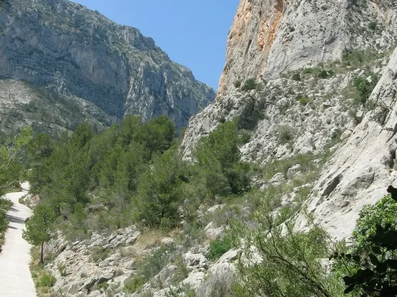
- Pass through the spectacular limestone gorge of the Hoces de Alba
- Steady climb toward the mountain village of Buiza
- Cross the Forcada Pass (1,270 m) with expansive views back toward the south
- Descend into the Tercia valley, a high-altitude pastoral region
- Stay at the municipal albergue in Poladura de Tercia, a tiny, atmospheric mountain hamlet
Day 3: Poladura de Tercia to Pajares
- Distance: 16 km
- Elevation gain: 550 m
- Time: 5–6 hours
- The "Queen Stage" of the route, crossing the Cantabrian divide
- Steep climb from Poladura to the Canto de la Tusa (1,568 m), the highest point of the trail
- Follow the ridge line marking the border between the provinces of León and Asturias
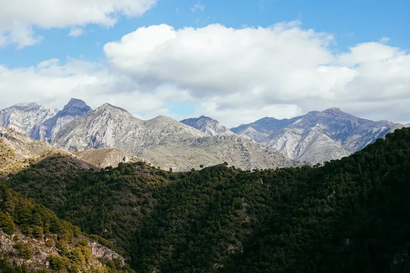
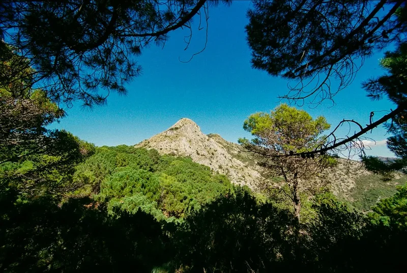
- Spectacular 360-degree views of the Ubiña Massif and the Central Asturian mountains
- Descend steeply to the Puerto de Pajares (mountain pass road)
- Continue down to the village of Pajares, perched on a steep hillside
- This is a short but physically demanding day requiring good weather
Day 4: Pajares to Pola de Lena
- Distance: 26 km
- Elevation: 150 m gain, 1,100 m descent
- Time: 7–8 hours
- A long, knee-jarring descent from the high mountains into the lush Asturian valleys
- Follow ancient paths through dense beech and chestnut forests
- Pass through traditional stone villages like Puente de los Fierros and Campomanes
- Visit the 9th-century Pre-Romanesque church of Santa Cristina de Lena (short detour)
- Arrive in Pola de Lena, a bustling Asturian town with all amenities
- The change in climate is palpable here—expect higher humidity and greener landscapes
Day 5: Pola de Lena to Mieres
- Distance: 15 km
- Elevation: 300 m gain
- Time: 4–5 hours
- A shorter stage following the Caudal River valley
- The path weaves between small hills and the valley floor, avoiding the main highway
- Pass through the village of Ujo with its Romanesque church of Santa Eulalia
- Arrive in Mieres, a town with a deep coal-mining heritage and excellent cider houses (sidrerías)
- This stage allows for recovery after the mountain descent of the previous day
Day 6: Mieres to Oviedo
- Distance: 18 km
- Elevation: 450 m gain
- Time: 5–6 hours
- The final push toward the Asturian capital
- Climb over the Padún Pass, offering the first distant views of Oviedo
- Descend through suburban villages and green belts
- Enter Oviedo through the historic quarter, finishing at the Cathedral of San Salvador
- Visit the Cámara Santa to see the relics and receive your "Salvadorana" certificate
- Celebrate with a glass of local cider poured from a height in the Plaza de la Catedral
Important Notes:
- The high variant between Poladura and Pajares should only be attempted in clear weather
- Water sources are frequent in the valleys but scarce on the high ridges
- The descent on Day 4 is very steep; trekking poles are highly recommended to protect knees
- Ensure you have the "Credencial" (pilgrim passport) to access albergues
- The route is well-marked, but a GPS track is useful for the mountain sections
Planning and Bookings
Book Your Trip
Everything you need to plan your journey
Accommodation
Find places to stay near León
Flights
Search flights to León
Essential Preparation
The Camino de San Salvador requires a higher level of physical fitness than the more famous Camino Francés. You should be comfortable walking 20–30 kilometres per day on consecutive days, with significant elevation changes. Training should include hill repeats and walking with a weighted pack (8–10 kg). Because the route is less travelled, you must be self-sufficient and comfortable with a degree of solitude.
León is the primary logistical base. It is well-connected to Madrid by high-speed train (AVE) and has its own regional airport. Before starting, visit the Benedictine Monastery of Santa María de Carbajal in León to pick up your Credencial and receive your first stamp. Ensure you have a basic grasp of Spanish, as English is less commonly spoken in the mountain villages than on the major Camino routes.
Trail Accommodation
Accommodation on the San Salvador consists of a mix of municipal albergues, private hostels, and small pensions. Because the route is not overcrowded, you generally do not need to book municipal albergues in advance, but it is wise to call ahead to private establishments during the peak summer months.
Albergue Facilities:
- Dormitory-style bunk beds (usually 6–20 people per room)
- Shared bathrooms with hot showers (usually)
- Basic kitchen facilities (microwave, hob, sink)
- Laundry sinks and occasionally washing machines
- Blankets are sometimes provided, but a sleeping bag or liner is essential
- Costs: Municipal albergues are typically €5–€10; private albergues €12–€18
What is NOT Provided:
- Towels and toiletries
- Food (though some albergues offer a communal dinner for a small fee)
- WiFi (available in towns, but rare in mountain albergues)
- Privacy (dorms are communal)
Key Accommodation Stops:
- León: Numerous hostels and hotels.
- La Robla: Municipal albergue and several hostals.
- Buiza: A small, basic municipal albergue (key often held at the local bar).
- Poladura de Tercia: A highly-rated municipal albergue in a converted schoolhouse.
- Pajares: A municipal albergue with stunning views and several private rural houses.
- Pola de Lena/Mieres: Full range of urban accommodation options.
Required Gear
- Footwear: Sturdy hiking boots or high-quality trail runners with good grip. The limestone can be slippery when wet.
- Trekking Poles: Essential for the 1,100 m descent into Asturias to save your joints.
- Rain Gear: A high-quality waterproof jacket and overtrousers. Asturias is famously wet.
- Backpack: 30–40L pack with a proper hip belt and rain cover.
- Sleeping Bag: A lightweight 2-season bag (comfort 5–10°C) is sufficient for albergues.
- Clothing: Moisture-wicking layers (merino wool or synthetic). Avoid cotton. Include a warm fleece or down jacket for the mountain evenings.
- Navigation: A physical map or a reliable offline GPS app (e.g., Buen Camino or Mapy.cz).
What to Bring
- Credencial: Your pilgrim passport, essential for staying in albergues and getting the Salvadorana.
- Water Filtration: While tap water is safe, a filter bottle is useful for mountain springs.
- First Aid: Blister plasters (Compeed), antiseptic cream, ibuprofen, and sunblock.
- Power Bank: To keep your phone charged for navigation.
- Earplugs and Eye Mask: Essential for sleeping in communal dormitories.
- Cash: Many small bars and albergues in the mountains do not accept credit cards.
- Food: Carry emergency snacks (nuts, chocolate, energy bars). Shops are infrequent between major towns.
Permits
There are no formal "permits" or entry fees required to walk the Camino de San Salvador. The trail follows public rights of way and ancient paths. However, to utilise the pilgrim infrastructure, you must carry a Credencial del Peregrino (Pilgrim Passport).
The Credencial:
- This document identifies you as a legitimate pilgrim.
- It is required to stay in municipal and parochial albergues.
- You must collect stamps (sellos) from albergues, churches, or bars along the way to prove your progress.
- You can obtain one at the Cathedral of León or the San Isidoro Basilica for a nominal fee (usually €2).
The Salvadorana:
- Upon reaching Oviedo, you can present your stamped Credencial at the Cathedral to receive the "Salvadorana."
- This is a certificate of completion, similar to the "Compostela" given in Santiago.
- To qualify, you must have walked at least the final 100 km (which effectively means the entire San Salvador route).
Access and Logistics:
- Transport: León is easily reached from Madrid via the RENFE high-speed train (2 hours). Oviedo is connected to the rest of Spain by train and bus (ALSA).
- Parking: If driving, it is best to park in a long-term garage in León and return from Oviedo by train (the journey takes about 2.5 hours).
Other Activities in the Area
The regions of Castile and León and Asturias offer a wealth of experiences beyond the trail:
- León Cathedral: Famous for its 1,800 square metres of stained glass, some of the finest in the world.
- San Isidoro Basilica: Known as the "Sistine Chapel of the Romanesque" for its incredibly preserved 12th-century frescoes.
- Cider Culture in Oviedo: Visit "Calle de la Gascona" (Cider Boulevard) to experience the traditional pouring of Asturian sidra.
- Pre-Romanesque Architecture: Visit Santa María del Naranco and San Miguel de Lillo on the outskirts of Oviedo—UNESCO World Heritage sites from the 9th century.
- Picos de Europa: If you have extra days, the Picos de Europa National Park is a short bus ride from Oviedo and offers world-class alpine hiking.
- Mining Museums: Explore the industrial heritage of the region at the Mining and Industry Museum (MUMI) near Mieres.
Safety and Conditions
Mountain Weather: The primary danger on the San Salvador is the weather at the Puerto de Pajares. Conditions can change from bright sunshine to freezing fog or heavy rain in less than thirty minutes. If the "Orvallo" (mist) descends, visibility can drop to zero. If you cannot see the next yellow arrow, do not proceed; wait for the mist to clear or use a GPS track to stay on the path.
Terrain Hazards: The descent from Pajares to Pola de Lena is exceptionally steep and can be very muddy after rain. Slips and falls are the most common cause of injury. Use trekking poles and take your time. In the high sections, the limestone rock can be sharp and unstable.
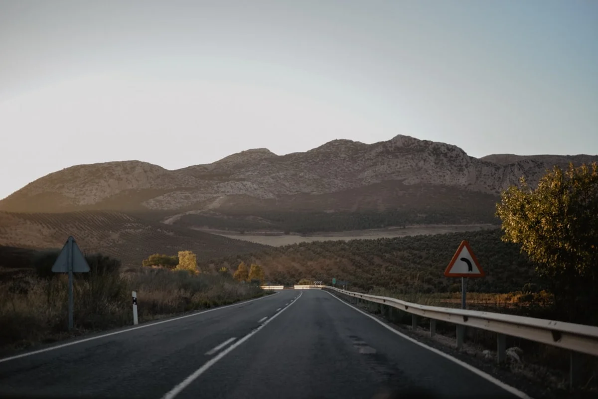
Road Walking: While much of the trail is on dirt paths, there are sections where you must walk along or cross the N-630 highway. Always walk facing traffic and wear high-visibility gear or attach a reflector to your pack.
Isolation: Because the trail is quiet, you may go hours without seeing another person. Always inform your albergue host of your intended destination for the day, and ensure your phone is fully charged. Carry a basic whistle for emergencies.
Water and Sun: On the high ridges, there is no shade and no water. Dehydration and heatstroke are risks in summer. Carry at least 2 litres of water when leaving Poladura de Tercia.
Side Trips and Points of Interest
Santa Cristina de Lena: Located about 4 km before Pola de Lena, this 9th-century church is a masterpiece of Asturian Pre-Romanesque architecture. It sits on a grassy knoll with commanding views of the valley. The interior features a unique "iconostasis" (a stone screen) that is one of the best-preserved examples of its kind. It is a UNESCO World Heritage site and a place of profound peace.
The Roman Road of La Carisa: For those interested in ancient history, a variant of the trail follows parts of the Via Romana de la Carisa, built by the Romans to conquer the Asturian tribes. It runs along the mountain ridges and offers a different perspective on the landscape.
The Bernesga Gorges: On Day 2, the path passes through the Hoces de Alba. These narrow limestone canyons are a geological marvel, with vertical walls rising hundreds of metres above the trail. It is a prime spot for birdwatching, with griffon vultures often seen circling overhead.
The Holy Chamber (Cámara Santa): The ultimate goal of the pilgrimage. Located inside Oviedo Cathedral, this 9th-century chapel houses the Cross of Victory, the Cross of the Angels, and the Sudarium of Oviedo. It is one of the most important reliquaries in the Christian world.
Leave No Trace
The Camino de San Salvador passes through sensitive mountain ecosystems and traditional farming lands. It is vital that pilgrims respect the environment to ensure the trail remains pristine for future generations.
Core Principles:
- Pack it in, pack it out: There are no rubbish bins in the mountains. Carry all your litter, including fruit peels and tissues, to the next town.
- Respect Livestock: You will pass through many grazing areas for cattle and horses. Close all gates behind you and do not disturb the animals.
- Stay on the Path: Avoid creating "social trails" or shortcuts, especially in the high meadows where the soil is thin and easily eroded.
- Water Protection: Do not use soap or detergents in mountain streams. Even biodegradable soap can harm aquatic life.
- Sanitation: Use the toilets in bars and albergues. If you must go in the wild, bury waste at least 15 cm deep and 60 metres from water sources. Pack out your toilet paper.
- No Fires: Wildfires are a massive risk in Spain during the summer. Never light a fire and dispose of cigarette butts responsibly.