Camino de Madrid - The High Road to Santiago
The Camino de Madrid is a hidden gem of the Spanish pilgrimage network, offering a profound transition from the vibrant, cosmopolitan energy of Spain's capital to the silent, expansive beauty of the Castilian Meseta. Stretching approximately 325 kilometres, this route begins at the Church of Santiago in the heart of Madrid and travels northwards, crossing the formidable Sierra de Guadarrama mountain range before descending into the historic plains of Castilla y León. It eventually joins the famous Camino Francés at Sahagún. Unlike the more crowded coastal or northern routes, the Camino de Madrid provides a solitary and contemplative experience, where pilgrims can walk for hours without seeing another soul, surrounded by pine forests, medieval castles, and endless fields of golden wheat. It is a journey of physical challenge and spiritual stillness, demanding respect for the high-altitude passes and rewarding the traveller with some of the most authentic cultural landscapes in the Iberian Peninsula.
- Distance: 325.0 km total
- Duration: 12–14 days
- Season: Spring (April–May) and Autumn (September–October) are ideal
- Accommodation: Municipal and private albergues, hostals, and rural hotels
- Highest point: Puerto de la Fuenfría (1,796 m)
- Daily walkers: Low density, often fewer than 10–15 pilgrims per day
- Direction: South to North (Madrid to Sahagún)
Overview
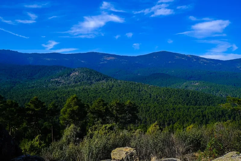
The Camino de Madrid is often described as the "Vertical Camino" due to its dramatic initial ascent over the Guadarrama mountains. While many pilgrims associate the Spanish pilgrimage with the flat plains of the Meseta, this route forces an immediate confrontation with high-altitude terrain. Within the first three days, walkers transition from the urban sprawl of Madrid to the rugged granite peaks of the Sierra. The crossing of the Puerto de la Fuenfría is a highlight of the journey, following an ancient Roman road that has served travellers for two millennia. This section requires good physical conditioning and a keen eye on weather patterns, as snow can linger on the pass well into May.
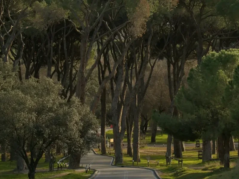
Once the mountains are conquered, the landscape shifts dramatically. The descent into Segovia reveals a city of fairy-tale architecture, dominated by its Roman aqueduct and the Alcázar. From here, the trail enters the heart of Old Castile. The terrain becomes a rhythmic sequence of rolling hills and vast horizons. This is the land of "Tierra de Pinares" (Land of Pines) and "Tierra de Campos" (Land of Fields). The silence here is heavy and peaceful, broken only by the sound of wind through the wheat or the occasional chime of a village church bell. The route passes through historic towns like Coca, with its stunning brick Gothic-Mudéjar castle, and Medina de Rioseco, known as the "City of the Admirals."
The Camino de Madrid is not merely a physical path but a cultural immersion. Because it is less commercialised than the Camino Francés, the hospitality found in the small villages is exceptionally warm and genuine. Pilgrims are often treated as honoured guests rather than tourists. However, this lack of commercialisation also means that infrastructure is more spread out. Planning is essential, as distances between water points and shops can be significant, particularly in the latter half of the journey. For those seeking a Camino that balances mountain adventure with the meditative solitude of the Spanish plains, the Madrid route is unsurpassed.
History and Cultural Context
The origins of the Camino de Madrid date back to the Middle Ages, though it was never as heavily trafficked as the routes from France or the northern ports. It served primarily as a link for pilgrims from the centre of the peninsula—including the court at Madrid and the surrounding agricultural hubs—to join the main artery of the Camino Francés. The route follows a combination of ancient Roman roads, medieval livestock paths known as "cañadas reales," and traditional trade routes that connected the southern plains with the northern kingdoms of León and Galicia.
The cultural significance of the route is deeply tied to the Reconquista and the subsequent consolidation of the Spanish identity. As you walk, you pass through territories that were once the frontier between Christian and Moorish lands. This history is etched into the architecture of the region, particularly the Mudéjar style—a unique blend of Christian and Islamic artistic influences seen in the brickwork of churches in towns like Alcazarén and Cuéllar. The route also pays homage to the Roman legacy of Hispania; the ascent to the Fuenfría pass follows the Via XXIV of the Antonine Itinerary, which connected Titulcia with Septimancae (Simancas).
In the late 20th century, the Camino de Madrid fell into relative obscurity as the Camino Francés became the primary focus of the modern pilgrimage revival. However, in the 1990s, dedicated associations of "Amigos del Camino" in Madrid and Segovia began the painstaking work of researching historical documents, waymarking the path with the iconic yellow arrows, and establishing a network of albergues. Today, the route is fully recognised and supported, maintaining a perfect balance between historical authenticity and modern safety. It remains a testament to the enduring pull of Santiago de Compostela, drawing people from the capital toward the distant Atlantic coast for over eight centuries.
Want more background? Read extended notes on history and cultural context → Learn more
Seasonal Highlights and Weather Reality
The climate of central Spain is famously described as "nine months of winter and three months of hell." While this is a slight exaggeration, the Camino de Madrid does experience extreme temperature fluctuations that dictate the best times to walk. The high altitude of the Sierra de Guadarrama and the exposed nature of the Castilian plateau make weather a primary consideration for any pilgrim.
Spring (April to May) is arguably the most beautiful time to undertake the journey. The Meseta, usually a parched yellow, is transformed into a vibrant sea of green wheat and red poppies. Temperatures are generally mild, ranging from 10°C to 22°C, though the mountains can still be quite cold. This is also the time when the mountain streams are at their fullest from the snowmelt. However, pilgrims must be prepared for "April showers," which can turn the clay-heavy paths of the plains into sticky mud.
Autumn (September to October) offers stable weather and the golden hues of the harvest season. The intense heat of the summer has dissipated, and the air becomes crisp and clear, providing exceptional visibility in the mountains. Daytime temperatures are comfortable, though nights begin to get chilly as October progresses. This is a popular time for local festivals in the villages along the route, providing a unique window into Spanish rural life.
Summer (June to August) is extremely challenging on the Camino de Madrid. Temperatures on the Meseta frequently exceed 35°C, and there is very little shade for long stretches. The risk of heatstroke and dehydration is high. Conversely, Winter (November to March) brings the risk of heavy snow in the Sierra de Guadarrama, which can make the Puerto de la Fuenfría impassable without specialised alpine equipment. Many albergues in smaller villages may also close during the deepest winter months.
Recommended Itinerary
13-Day Camino de Madrid Itinerary
Day 1: Madrid to Tres Cantos
- Distance: 25.0 km
- Elevation gain: 150 m
- Time: 6–7 hours
- Start at the Church of Santiago in central Madrid
- Navigate through the northern districts of the city toward Fuencarral
- Transition from urban pavement to gravel tracks alongside the railway
- Cross the M-40 ring road via pedestrian bridges
- Arrive in the modern satellite city of Tres Cantos
- Key waypoint: Plaza de Castilla (the official trailhead for many)
Day 2: Tres Cantos to Manzanares el Real
- Distance: 25.0 km
- Elevation gain: 250 m
- Time: 6–7 hours
- Walk through the Dehesa de Viñuelas, a beautiful oak forest
- Gentle ascent with the Sierra de Guadarrama growing larger on the horizon
- Pass through the town of Colmenar Viejo (good spot for lunch)
- Enter the foothills of the mountains
- Arrive in Manzanares el Real, famous for its stunning 15th-century castle
- Key waypoint: Ermita de Nuestra Señora de los Remedios
Day 3: Manzanares el Real to Cercedilla
- Distance: 20.0 km
- Elevation gain: 300 m
- Time: 5–6 hours
- Follow the path along the base of the Pedriza granite formations
- Walk through fragrant pine and rockrose scrubland
- Pass through the village of Mataelpino
- Steady climb toward the mountain resort town of Cercedilla
- Prepare for the high-altitude crossing the following day
- Key waypoint: Navacerrada valley views
Day 4: Cercedilla to Segovia
- Distance: 30.0 km
- Elevation gain: 650 m (to the pass), then 800 m descent
- Time: 8–10 hours
- The "Queen Stage" of the route
- Climb the ancient Roman road to the Puerto de la Fuenfría (1,796 m)
- Cross the divide from the Community of Madrid into Castilla y León
- Long, scenic descent through the pine forests of Valsaín
- Enter Segovia with a dramatic view of the Cathedral and Aqueduct
- Key waypoint: Roman milestones on the Fuenfría pass
Day 5: Segovia to Santa María la Real de Nieva
- Distance: 33.0 km
- Elevation gain: 100 m
- Time: 8–9 hours
- Leave the mountains behind and enter the vast Castilian plains
- Walk through the "Tierra de Pinares" (pine forests)
- Pass through the small villages of Zamarramala and Valseca
- Long stretches of flat, exposed gravel tracks
- Arrive at the historic monastery town of Santa María
- Key waypoint: The Romanesque cloister of the Monastery of Santa María
Day 6: Santa María la Real de Nieva to Coca
- Distance: 22.0 km
- Elevation gain: 50 m
- Time: 5–6 hours
- Continue through the pine forests, which provide some welcome shade
- The terrain is sandy in places, making for slower walking
- Pass through the village of Nava de la Asunción
- Arrive in Coca, home to one of Spain's most spectacular castles
- Key waypoint: Castillo de Coca (Mudéjar style)
Day 7: Coca to Alcazarén
- Distance: 24.0 km
- Elevation gain: 50 m
- Time: 6–7 hours
- Cross the Voltoya River
- Walk through a mix of pine forests and agricultural fields
- Pass through the village of Villeguillo
- Enter the province of Valladolid
- Arrive in Alcazarén, known for its Mudéjar church ruins
- Key waypoint: Church of Santiago in Alcazarén
Day 8: Alcazarén to Puente Duero
- Distance: 25.0 km
- Elevation gain: 50 m
- Time: 6–7 hours
- Walk toward the Duero River valley
- Pass through the town of Valdestillas
- Follow the banks of the Adaja River
- Arrive in Puente Duero, a strategic crossing point since Roman times
- Key waypoint: The medieval bridge over the Duero River
Day 9: Puente Duero to Ciguñuela
- Distance: 22.0 km
- Elevation gain: 150 m
- Time: 5–6 hours
- Skirt the western edge of the city of Valladolid
- Pass through Simancas, famous for its royal archives and castle
- Climb a small ridge to the village of Ciguñuela
- Enjoy panoramic views back toward the Duero valley
- Key waypoint: Archivo General de Simancas
Day 10: Ciguñuela to Castromonte
- Distance: 26.0 km
- Elevation gain: 100 m
- Time: 6–7 hours
- Enter the "Montes Torozos," a limestone plateau
- Pass through the village of Wamba (named after a Visigothic king)
- Visit the Mozarabic church in Wamba with its famous ossuary
- Walk through quiet, undulating cereal fields
- Arrive in the small village of Castromonte
- Key waypoint: The ossuary of the Church of Santa María in Wamba
Day 11: Castromonte to Medina de Rioseco
- Distance: 23.0 km
- Elevation gain: 50 m
- Time: 5–6 hours
- Descend from the plateau into the valley of the Sequillo River
- Pass through the village of Valverde de Campos
- Arrive in Medina de Rioseco, a major historical and religious centre
- Explore the "Calle de la Rúa" and the town's magnificent churches
- Key waypoint: The Canal de Castilla (18th-century engineering marvel)
Day 12: Medina de Rioseco to Cuenca de Campos
- Distance: 25.0 km
- Elevation gain: 50 m
- Time: 6–7 hours
- Follow the Canal de Castilla for several kilometres
- Enter the "Tierra de Campos," the heart of the Meseta
- Pass through the village of Tamariz de Campos
- Arrive in Cuenca de Campos, a quiet village with traditional adobe architecture
- Key waypoint: The locks of the Canal de Castilla
Day 13: Cuenca de Campos to Sahagún
- Distance: 30.0 km
- Elevation gain: 50 m
- Time: 7–9 hours
- The final push to join the Camino Francés
- Pass through the villages of Santervás de Campos and Grajal de Campos
- Visit the impressive castle and palace in Grajal
- Arrive in Sahagún, the end of the Camino de Madrid
- Key waypoint: The Monastery of San Benito in Sahagún
Important Notes:
- The route is marked with yellow arrows and scallop shell symbols
- Water points can be scarce on the Meseta; always carry at least 2 litres
- The climb to Fuenfría is steep; check mountain weather before leaving Cercedilla
- Many villages are very small with limited services; check shop opening hours
- The "Credencial" (Pilgrim Passport) is required to stay in albergues
Planning and Bookings
Book Your Trip
Everything you need to plan your journey
Accommodation
Find places to stay near Madrid
Flights
Search flights to Madrid
Essential Preparation
The Camino de Madrid requires a higher level of self-sufficiency than the more popular routes. Because the number of pilgrims is low, you cannot always rely on following a crowd or finding an open café every five kilometres. Physical preparation should focus on endurance and hill climbing, particularly to handle the 30-kilometre day over the Fuenfría pass. It is highly recommended to learn basic Spanish phrases, as English is not widely spoken in the rural villages of Castilla y León.
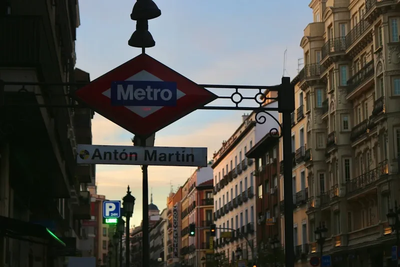
Logistically, the journey begins in Madrid. Most pilgrims arrive via Madrid-Barajas Airport (MAD). From the airport, you can take the Metro or Cercanías train to the city centre. The official starting point is the Church of Santiago (Iglesia de Santiago y San Juan Bautista) near the Royal Palace, where you can get your first stamp. However, many choose to start at Plaza de Castilla to avoid the initial 10 kilometres of urban walking. Ensure you have your Pilgrim Passport (Credencial) before starting, as it is essential for accessing albergues.
Trail Accommodation
Accommodation on the Camino de Madrid is a mix of municipal albergues (pilgrim hostels), private albergues, and small hostals. In the larger towns like Segovia and Valladolid, there are numerous hotels and guesthouses.
Albergue Facilities:
- Dormitory-style rooms with bunk beds (literas)
- Shared bathroom and shower facilities (usually hot water available)
- Common kitchen areas (facilities vary; some have stoves, others only microwaves)
- Laundry sinks and sometimes washing machines/dryers (paid)
- WiFi is increasingly common but not guaranteed in municipal albergues
- Blankets are sometimes provided, but a sleeping bag or liner is essential
What Albergues Don't Provide:
- Toiletries (soap, shampoo, towels)
- Food (though some offer a communal breakfast for a small donation)
- Privacy (dorms are shared, often mixed-gender)
- Late check-ins (most albergues close their doors by 10:00 PM)
Booking Requirements:
- Municipal albergues generally do not accept bookings; beds are allocated on a first-come, first-served basis
- Private albergues and hostals usually accept bookings via phone, email, or apps like WhatsApp
- Costs: Municipal albergues range from €5 to €10 (or "donativo"); private albergues range from €12 to €20; hostals range from €30 to €60 for a private room
- During peak spring and autumn months, it is wise to call ahead to private albergues a day in advance
Required Gear
- Walking boots or trail shoes - must be well broken-in; trail shoes are often preferred for the flat Meseta sections
- Backpack - 30–40L is sufficient; ensure it has a good hip belt and rain cover
- Sleeping bag or liner - a lightweight 1-season bag or silk liner is usually enough for albergues
- Waterproof jacket - lightweight and breathable for sudden mountain storms
- Sun hat and sunglasses - essential for the exposed plains of Castile
- Flip-flops or sandals - for use in showers and to let feet breathe in the evenings
- Earplugs and eye mask - crucial for sleeping in shared dormitories
- First aid kit - focus on blister care (Compeed, needle/thread, antiseptic), ibuprofen, and rehydration salts
What to Bring
- Pilgrim Passport (Credencial) - to collect stamps and access albergues
- Water containers - capacity for at least 2 litres (refill at village fountains marked "Agua Potable")
- High-calorie snacks - nuts, dried fruit, and energy bars for long stretches between towns
- Sunscreen - SPF 50+ is recommended due to high UV levels on the plateau
- Toiletries - biodegradable soap/shampoo, toothbrush, and a quick-dry travel towel
- Mobile phone and power bank - for navigation and emergency calls (signal is generally good)
- Cash - many small village bars and albergues do not accept credit cards
- Spanish phrasebook or translation app - to communicate with local hospitaleros and shopkeepers
Permits
No formal permits or "entry fees" are required to walk the Camino de Madrid. The trail is a public right of way. However, to utilise the network of pilgrim-specific accommodation (albergues), you must carry a "Credencial del Peregrino" (Pilgrim Passport).
The Credencial:
- This document identifies you as a genuine pilgrim. It is a folding cardboard booklet where you collect stamps (sellos) from churches, albergues, bars, and town halls along the route.
- You can obtain a Credencial at the Church of Santiago in Madrid, from the "Asociación de Amigos del Camino de Madrid," or by ordering one online from various Camino associations before you travel.
- The cost is usually nominal (€2 to €5).
- In Sahagún, your stamps will prove you have walked the route, allowing you to continue on the Camino Francés or receive a certificate of completion if you finish your journey there.
Mountain Safety and Regulations:
- While no permit is needed for the Sierra de Guadarrama, the area is part of a National Park. Strict regulations apply regarding camping (generally prohibited) and staying on marked trails to protect the alpine ecosystem.
- If you are travelling in a large group (more than 10 people), it is polite to notify the albergues in advance, as they have limited capacity.
Other Activities in the Area
The Camino de Madrid passes through some of Spain's most culturally rich regions. Consider spending extra time in these locations:
- Madrid Sightseeing: Before starting, visit the Prado Museum, the Royal Palace, and the Retiro Park. The city's culinary scene, from traditional tapas in La Latina to Michelin-starred dining, is world-class.
- Segovia Exploration: Spend a full day here to see the Roman Aqueduct, the Gothic Cathedral, and the Alcázar (which famously inspired Walt Disney's Cinderella Castle). Walk the city walls for views of the Eresma valley.
- Castillo de Coca: This is one of the finest examples of Gothic-Mudéjar brick architecture in the world. Take a guided tour to see the interior courtyards and defensive battlements.
- Valladolid Wine Tasting: The route passes near the Ribera del Duero and Rueda wine regions. Many bars in Valladolid and surrounding towns offer exceptional local wines by the glass.
- Canal de Castilla: In Medina de Rioseco, you can take a boat trip on this 18th-century canal, which was built to transport grain from the plains to the northern ports.
- Simancas Archives: Visit the General Archive of Simancas, housed in a medieval castle, which contains the most important collection of documents from the Spanish Monarchy from the 15th to the 19th centuries.
Safety and Conditions
Pre-Departure Checks:
- Check the AEMET (Spanish Meteorological Agency) forecast for both Madrid and Segovia, paying close attention to the "Puerto de Navacerrada" station for mountain conditions.
- Ensure your footwear is broken in; the combination of mountain rocks and hard-packed Meseta tracks is brutal on feet.
- Download offline maps (such as Buen Camino or Gronze) as waymarking can occasionally be confusing in urban areas or deep forests.
Heat and Hydration: The most significant danger on the Camino de Madrid is heat exhaustion. On the Meseta, there are stretches of 15–20 kilometres with no shade and no water fountains. You must carry sufficient water and wear high-factor sunscreen. Start your walking days at dawn (6:00 AM or earlier) to finish before the peak heat of the afternoon (2:00 PM – 5:00 PM).
Mountain Hazards: The crossing of the Puerto de la Fuenfría reaches nearly 1,800 metres. Even in summer, weather can change rapidly. Thunderstorms are common in the afternoons. In spring, snow patches can make the Roman road slippery. If visibility is low or a storm is approaching, do not attempt the pass; stay in Cercedilla or take the train to Segovia.
Road Safety: While most of the trail is on tracks, there are sections where you must walk along or cross busy roads, particularly near Madrid and Valladolid. Always walk facing oncoming traffic and wear reflective gear if walking in low light.
Emergency Services: The general emergency number in Spain is 112. Mobile coverage is excellent along 95% of the route, though it may dip in the deep valleys of the Sierra.
Side Trips and Points of Interest
Wamba and the Mozarabic Church: A short distance from the main path on Day 10 lies the village of Wamba. It is home to the Church of Santa María, a stunning 10th-century Mozarabic structure. The real draw, however, is the ossuary—a small chapel filled with thousands of human skulls and bones, a sobering and historic "memento mori" from the medieval period.
The Roman Road of Fuenfría: This is not just a path but a historical monument. Built in the 1st century AD, the road still retains large sections of its original stone paving. Walking this stretch allows you to literally step in the footprints of Roman legionaries, medieval merchants, and centuries of pilgrims.
Grajal de Campos: Just before reaching Sahagún, the village of Grajal de Campos offers a surprising concentration of Renaissance architecture. The Palace of the Counts of Grajal and the massive 16th-century castle are well worth a detour. The castle is unique for its four massive circular towers and its transition from a defensive fortress to a palatial residence.
The Mudéjar Route: For those interested in architecture, the churches of Alcazarén and Coca provide a masterclass in Mudéjar art. This style, unique to the Iberian Peninsula, uses brick and plaster to create intricate geometric patterns, reflecting the cultural synthesis of Christian and Muslim Spain.
Leave No Trace
The Camino de Madrid traverses sensitive agricultural lands and protected mountain ecosystems. As a pilgrim, you are a guest in these landscapes, and it is your responsibility to ensure the trail remains pristine for those who follow.
Your responsibility as a walker:
- Pack out all trash, including fruit peels and tissues. The dry climate of the Meseta means organic waste decomposes very slowly.
- Use established toilets in bars and albergues. If you must go outdoors, ensure you are at least 50 metres from the trail and water sources, and bury waste deeply.
- Respect private property. Much of the route passes through working farms and vineyards; do not pick grapes or crops.
- Keep gates as you find them. Livestock management is crucial in the Dehesa and mountain regions.
- Do not create new "cairns" or stone stacks, as these can mislead other pilgrims and disturb the soil.
- Be mindful of noise in small villages, especially during the "siesta" hours (2:00 PM – 5:00 PM).
- Support the local economy by buying supplies in village shops, helping to sustain the communities that host the Camino.
The spirit of the Camino is one of gratitude and simplicity. Walk with a light footprint and a heavy respect for the Castilian heritage.