La Caldera de Taburiente Hike
La Caldera de Taburiente National Park, located on the island of La Palma in Spain's Canary Islands, is a geological marvel and a hiker's paradise. At its heart lies the Caldera, a vast, ancient volcanic crater over 8 kilometres in diameter and 1,800 metres deep. This dramatic landscape, sculpted by erosion over millennia, is a tapestry of rugged ravines, towering rock formations, pine forests, and a unique microclimate that supports diverse flora and fauna. The hike into and around the Caldera offers breathtaking vistas, a profound sense of wilderness, and a challenging yet rewarding experience for those seeking to explore one of the most spectacular natural amphitheatres in the Canary Islands.
- Distance: 27.0 km (full circuit)
- Elevation Gain: 1600 m
- Duration: 8-10 hours
- Difficulty: Challenging
- Best Time: April to October
- Closest City: Los Llanos de Aridane
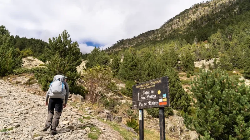
- Trailhead Access: Mirador de Los Brecitos
- Permits: Not required for general access, but registration may be required at the park entrance.
Overview
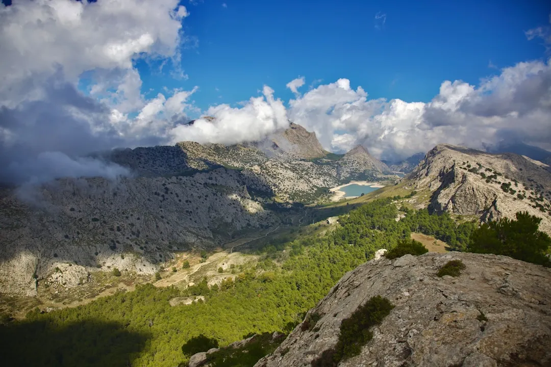
The hike around La Caldera de Taburiente is a journey into the heart of a colossal volcanic caldera, a landscape of immense scale and raw beauty. This is not a gentle stroll; it is a demanding trek that circumnavigates the rim and delves into the depths of this ancient geological formation. The trail offers a constant interplay of dramatic vistas and intimate encounters with the park's unique ecosystems. From the high viewpoints offering panoramic sweeps of the crater and the surrounding island, to the shaded pine forests and the sound of water trickling through ravines, the experience is multi-faceted.
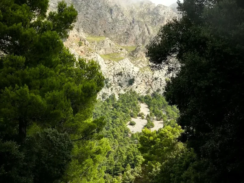
The route typically begins at the Mirador de Los Brecitos, a popular viewpoint accessible by road. From here, the trail descends into the Caldera, following ancient paths that were once used by the indigenous Guanches. The descent is steep and can be challenging, especially in dry conditions where loose scree can make footing precarious. As you descend, the scale of the Caldera becomes more apparent, with sheer rock faces and deep, winding ravines stretching out before you. The air grows cooler and more humid as you approach the valley floor, where the Río de Taburiente, a seasonal river, carves its path through the ancient volcanic rock.
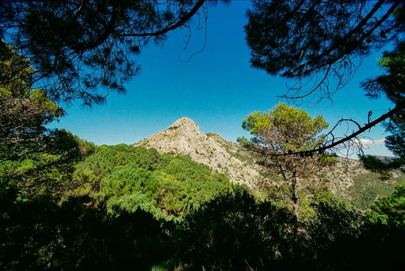
The full circuit is a substantial undertaking, often completed over two days for a more immersive experience, but it can be tackled as a very long day hike by experienced and fit individuals. The trail involves significant elevation changes, both up and down, and requires good navigation skills, particularly in the more remote sections. The landscape is dominated by Canary Island pine (Pinus canariensis), which thrives in the arid conditions and provides welcome shade. The undergrowth is sparse in many areas, revealing the stark beauty of the volcanic rock formations. Water sources are scarce and often seasonal, making water management a critical aspect of planning.
The Caldera is a place of profound natural power and beauty. Its sheer size and the dramatic geological processes that formed it are awe-inspiring. The silence, broken only by the wind, the call of birds, or the distant sound of water, contributes to a feeling of remoteness and wildness. This is a hike that demands respect for the environment and a thorough understanding of one's own capabilities.
History and Cultural Context
La Caldera de Taburiente holds a significant place in the history and culture of La Palma. Before the arrival of European settlers, the area was inhabited by the Guanches, the indigenous people of the Canary Islands. Archaeological evidence suggests that the Caldera was a sacred site for the Guanches, used for rituals and as a refuge. The name "Taburiente" itself is believed to derive from the Guanche language, possibly meaning "place of the rocks" or "place of the springs," reflecting the dominant features of the landscape.
The Guanches were known for their pastoral lifestyle and their deep connection to the land. They likely used the trails within the Caldera for seasonal movements and for accessing water and resources. The rugged terrain provided natural defence, and the presence of water sources, though often seasonal, was crucial for survival. The discovery of ancient caves and burial sites within the Caldera attests to its long human history.
Following the Castilian conquest of the Canary Islands in the 15th century, the island of La Palma, including the Caldera region, underwent significant changes. The Guanche population was largely assimilated or died out, and new agricultural practices, such as the cultivation of sugar cane and later bananas, were introduced. The Caldera, however, remained largely wild and inaccessible, its rugged terrain protecting it from extensive development.
In the 20th century, there was a growing recognition of the unique ecological and geological importance of La Caldera de Taburiente. This led to its designation as a National Park in 1954, making it one of the oldest protected areas in the Canary Islands. The park's establishment aimed to preserve its pristine natural environment, its unique flora and fauna, and its geological heritage for future generations. Today, the park is a testament to the enduring power of nature and a reminder of the island's ancient past, attracting hikers and nature enthusiasts from around the world.
Seasonal Highlights and Weather Reality
The climate of La Caldera de Taburiente is influenced by its altitude and its location in the Atlantic Ocean. While the Canary Islands are known for their mild, spring-like weather year-round, the Caldera experiences more distinct seasonal variations and can be significantly cooler and wetter than the coastal areas.
Spring (April to June): This is an excellent time to visit. The weather is generally pleasant, with warm sunshine and cooler temperatures at higher altitudes. The pine forests are vibrant, and wildflowers may be in bloom in some areas. Rainfall is less frequent than in winter, making for more predictable hiking conditions. Temperatures typically range from 15°C to 25°C during the day.
Summer (July to September): Summer is the driest period, with warm to hot temperatures, especially at lower elevations. Daytime temperatures can reach 30°C or higher, making early morning or late afternoon hikes advisable. The risk of heatstroke and dehydration is significant, so carrying ample water is crucial. The Río de Taburiente may be dry or have very low water levels during these months.
Autumn (October to November): Autumn offers a transition period with cooler temperatures and an increased chance of rainfall. The landscape can be particularly beautiful after rain, with the pine forests appearing lush and vibrant. The risk of fog and cloud cover increases, which can obscure views from higher vantage points.
Winter (December to March): Winter is the wettest season, with frequent rainfall and cooler temperatures. Daytime temperatures can range from 10°C to 18°C. Snow is rare at lower elevations but can occur on the highest peaks within the park, though it rarely accumulates for long periods. The Río de Taburiente is more likely to have a consistent flow during these months. Fog and cloud are common, which can significantly reduce visibility and make navigation more challenging.
Weather Considerations: Regardless of the season, weather in mountainous regions can change rapidly. Always check the local forecast before setting out. The Caldera can experience strong winds, sudden downpours, and significant temperature drops, especially at higher altitudes. Fog can descend quickly, reducing visibility to mere metres and making navigation difficult. It is essential to be prepared for all conditions.
Recommended Itinerary
Challenging Day Hike Itinerary: La Caldera de Taburiente Circuit
This itinerary outlines a demanding full-day hike covering approximately 27 km with significant elevation changes. It is suitable for experienced hikers with excellent fitness and navigation skills.
Early Morning (07:00 - 08:00): Arrival and Preparation
- Arrive at the Mirador de Los Brecitos trailhead.
- Final gear check: water, food, navigation tools, sun protection, layers.
- Briefing on the day's route and potential hazards.
- GPS Coordinates: 28.6835, -17.8745
Morning (08:00 - 12:00): Descent into the Caldera
- Begin the descent from Mirador de Los Brecitos towards the Caldera floor.
- The initial section is steep and can be loose underfoot.
- Pass through pine forests with increasingly dramatic views of the Caldera's interior.
- Key Waypoints: Mirador de Los Brecitos, various unmarked descent paths.
- Distance covered: Approximately 6-8 km.
- Elevation change: Significant descent (approx. 800-1000 m).
Midday (12:00 - 14:00): Caldera Floor and Riverbed
- Reach the valley floor and the Río de Taburiente.
- Follow the riverbed or adjacent paths. This section can involve scrambling over rocks and crossing the river (water levels vary seasonally).
- Enjoy a packed lunch amidst the unique landscape of the Caldera's base.
- Key Waypoints: Río de Taburiente, various junctions.
- Distance covered: Approximately 4-6 km.
- Elevation change: Relatively flat with minor undulations.
Afternoon (14:00 - 18:00): Ascent and Rim Traverse
- Begin the strenuous ascent out of the Caldera.
- The climb is sustained and challenging, often on rocky or dusty trails.
- Navigate towards the western or northern rim, depending on the chosen circuit.
- Key Waypoints: Various ascent paths, junctions leading towards the rim.
- Distance covered: Approximately 8-10 km.
- Elevation change: Significant ascent (approx. 600-800 m).
Late Afternoon/Early Evening (18:00 - 20:00): Return to Trailhead
- Traverse the rim or descend towards the starting point.
- The final section may involve walking along access roads or well-marked trails.
- Arrive back at Mirador de Los Brecitos.
- Key Waypoints: Access roads, final descent paths.
- Distance covered: Approximately 3-5 km.
- Elevation change: Variable, potentially further descent or minor ascents.
Important Notes:
- This is a very challenging day hike. Consider splitting it into two days if time and fitness allow.
- Water sources are unreliable; carry at least 3-4 litres per person.
- Navigation is crucial; a GPS device or detailed map and compass are essential.
- The sun can be intense; wear a hat, sunglasses, and sunscreen.
- Be prepared for rapid weather changes.
- Inform someone of your hiking plans and expected return time.
Planning and Bookings
Book Your Trip
Everything you need to plan your journey
Accommodation
Find places to stay near Los Llanos de Aridane
Flights
Search flights to Los Llanos de Aridane
Essential Preparation
La Caldera de Taburiente National Park is a protected natural area, and while general access does not require permits, it is essential to be well-prepared for the challenging terrain and variable weather conditions. The closest major town and logistical hub is Los Llanos de Aridane, located on the western side of La Palma. Los Llanos offers a range of accommodation options, from budget guesthouses to hotels, as well as supermarkets, outdoor gear shops, and restaurants. It is advisable to base yourself here or in a nearby town for at least one night before and after your hike.
Access to the primary trailhead, Mirador de Los Brecitos, is via a narrow, winding mountain road. Driving yourself is possible, but parking is limited and can fill up early, especially during peak season. Consider arriving very early or arranging a taxi or pre-booked transfer from Los Llanos de Aridane. The drive from Los Llanos to Mirador de Los Brecitos takes approximately 1.5 hours. Public bus services to the trailhead are infrequent and may not align with hiking schedules, so private transport is often the most practical option.
Fitness is paramount for this hike. The significant elevation gain and loss, combined with the distance, require a high level of cardiovascular fitness and leg strength. It is recommended to have prior experience with long-distance, challenging hikes. Familiarise yourself with the route using maps and GPS data before you go.
Trail Accommodation
This is a day hike requiring no overnight accommodation within the National Park itself. The park is managed by the Spanish National Parks authority (Organismo Autónomo Parques Nacionales) and the Canary Islands Government. While there are no official campsites or refuges along the main hiking routes within the Caldera for day hikers, there are a few basic shelters or bivouac areas that may be used by those undertaking multi-day treks (which require specific permits and planning beyond the scope of this day hike description). For the purpose of this challenging day hike, no overnight accommodation is needed or provided on the trail.
Required Gear
- Sturdy hiking boots: Waterproof, with good ankle support and a well-worn sole for grip on rocky and uneven terrain.
- Backpack: A comfortable daypack (25-35 litres) with a rain cover.
- Navigation tools: A reliable GPS device or smartphone with offline maps (e.g., Maps.me, AllTrails, Komoot), and a physical map and compass as a backup. Ensure your device is fully charged and consider a portable power bank.
- Head torch: Essential, even for a day hike, in case of unexpected delays or if you start before dawn/finish after dusk. Carry spare batteries.
- First-aid kit: Comprehensive kit including blister treatment, pain relievers, antiseptic wipes, bandages, and any personal medications.
- Sun protection: High SPF sunscreen, wide-brimmed hat, sunglasses. The sun can be intense, especially at higher altitudes.
- Waterproof jacket and trousers: Weather can change rapidly; be prepared for rain and wind.
- Warm layers: A fleece or insulated jacket, even in summer, as temperatures can drop significantly at higher elevations or in shaded ravines.
- Trekking poles: Highly recommended for stability on descents and ascents, and to reduce strain on knees.
What to Bring
- Food: High-energy, non-perishable food for the entire day. This includes breakfast, lunch, and plenty of snacks (nuts, dried fruit, energy bars, sandwiches). There are no facilities to purchase food within the park.
- Water: Crucially important. Carry a minimum of 3-4 litres of water per person. Water sources within the Caldera are often seasonal and may be contaminated; purification tablets or a filter are recommended if you plan to refill, but relying on them is risky.
- Toiletries: Biodegradable toilet paper, hand sanitiser, and a small trowel for burying human waste if no facilities are available (though facilities are limited). Pack out all used toilet paper.
- Personal items: Mobile phone (though signal is unreliable), camera, identification, and a small amount of cash for emergencies or potential parking fees.
- Insect repellent: While not as prevalent as in some tropical regions, biting insects can be present, especially near water sources.
- Whistle: For emergency signalling.
Permits
For general day hiking and access to the main trails within La Caldera de Taburiente National Park, no specific permits are required. The park is open to the public, and the primary access point at Mirador de Los Brecitos does not have a formal entry gate or permit system for day visitors.
However, it is important to note that the park authorities may implement registration systems or require permits for specific activities or during periods of high visitor numbers to manage visitor impact and ensure safety. It is always advisable to check the official website of the National Parks of Spain (Organismo Autónomo Parques Nacionales) or the local park information centre for the most up-to-date information regarding any potential registration requirements or access restrictions before your visit.
Key points regarding access:
- General Access: No permit needed for day hiking.
- Registration: While not currently standard for day hikers, be aware that this can change. Check official sources.
- Multi-day Treks/Camping: If you intend to undertake multi-day treks or camp within the park (which is highly restricted and requires specific permits and designated areas), a permit is absolutely mandatory and must be obtained well in advance. This description focuses on a challenging day hike.
- Vehicle Access: The road to Mirador de Los Brecitos is narrow and winding. Parking is limited and can be full, especially during peak season and weekends. Arriving early is highly recommended.
Recommendation: Before your trip, visit the official website for La Caldera de Taburiente National Park or contact the park's information centre to confirm current access regulations and any potential registration requirements.
Other Activities in the Area
Beyond the challenging hike into La Caldera de Taburiente, the island of La Palma offers a wealth of other activities and attractions:
- Stargazing: La Palma is renowned for its exceptionally clear night skies, making it one of the best places in the world for astronomical observation. The Roque de los Muchachos Observatory, located at the island's highest point, is a world-class facility. Several viewpoints offer excellent opportunities for amateur stargazing.
- Exploring Los Llanos de Aridane: This vibrant town is the island's second-largest and offers a lively atmosphere with traditional Canarian architecture, bustling plazas, local markets, and a good selection of restaurants and shops.
- Beaches: La Palma has a variety of beaches, from the black volcanic sands of Puerto Naos and Tazacorte on the west coast to the more rugged, natural coves found elsewhere.
- Hiking in other areas: The island is crisscrossed with an extensive network of well-maintained hiking trails, including the famous "Ruta de los Volcanes" (Volcano Route) and the lush "Bosque de Los Tilos" (Tilos Forest), offering diverse landscapes from volcanic fields to ancient laurel forests.
- Cultural Tourism: Visit charming towns like Santa Cruz de La Palma (the island's historic capital) with its colourful wooden balconies, or the picturesque village of Garafía.
- Water Sports: Opportunities for diving, snorkelling, and boat trips are available along the coast, particularly from towns like Tazacorte.
- Local Gastronomy: Sample La Palma's unique cuisine, including its distinctive cheeses (queso palmero), fresh seafood, and local wines.
Safety and Conditions
Pre-Departure Checks:
- Weather Forecast: Always check the most up-to-date weather forecast for La Palma, specifically for the Caldera de Taburiente region and the Mirador de Los Brecitos. MetService or local Spanish meteorological agencies are good sources. Be prepared for rapid changes.
- Park Alerts: Check the official website of the Organismo Autónomo Parques Nacionales for any park alerts, trail closures, or specific advisories.
- Road Conditions: Ensure the road to Mirador de Los Brecitos is open and accessible.
Trail Hazards:
- Terrain: The trail is steep, rocky, and can be loose underfoot, especially on descents. Proper footwear and trekking poles are essential.
- Water: Water sources are scarce and unreliable. Carry more water than you think you will need. Dehydration is a serious risk, especially in summer.
- Sun Exposure: The sun is intense at altitude, and there is little shade in many sections. Protect yourself from sunburn and heatstroke.
- Navigation: While the main trails are generally marked, the Caldera is a vast and complex area. GPS and map/compass skills are vital, especially if you venture off the most common routes or in poor visibility.
- Weather Changes: Fiordland's weather can change dramatically and quickly. Be prepared for sudden rain, strong winds, fog, and temperature drops, even on a clear morning. Hypothermia is a risk if you get wet and cold.
- Rockfalls: While not common on the main paths, be aware of your surroundings, especially in steep ravines.
Emergency Procedures:
- Mobile Signal: Mobile phone reception is unreliable within the Caldera. Do not rely on it for emergencies.
- Emergency Number: The general emergency number in Spain is 112.
- Inform Someone: Always inform a reliable person of your hiking plans, your intended route, and your expected return time.
- Personal Locator Beacon (PLB): For remote hikes, consider carrying a PLB or satellite messenger.
Sandflies: While not the primary concern here, biting insects can be present, particularly near water. Carry repellent as a precaution.
Travel Insurance: Ensure you have adequate travel insurance that covers hiking and potential emergency evacuation.
Side Trips and Points of Interest
While the main circuit hike is a substantial undertaking, there are several points of interest and potential short detours within or near the Caldera de Taburiente that can enhance the experience:
Roque de los Muchachos: Although not directly on the Caldera circuit, this is the highest point on La Palma (2,426 m) and home to the Roque de los Muchachos Observatory. If you have a vehicle and time, a drive to the summit offers spectacular panoramic views of the island and the surrounding ocean, and on a clear night, unparalleled stargazing. Access is via a paved road from the west side of the island.
Cascada de la Reina (Queen's Waterfall): This impressive waterfall is located within the Caldera and is often a highlight for those hiking the full circuit or undertaking multi-day treks. Its accessibility depends on the chosen route and water flow. It's a beautiful spot to rest and appreciate the power of water in the arid landscape.
Guanche Settlements and Caves: Throughout the Caldera, there are remnants of ancient Guanche settlements and caves that were used for habitation or ritual purposes. While many are difficult to access or protected, their presence adds a layer of historical depth to the landscape. Look for signs of ancient terracing or rock carvings.
Mirador de Los Brecitos: The starting point itself offers a stunning introduction to the Caldera. Take time to absorb the immense scale of the crater before descending. The viewpoint provides a clear perspective on the vastness of the geological formation.
Pine Forests: The Canary Island pine (Pinus canariensis) is a unique species adapted to volcanic environments. The forests within the Caldera are ancient and provide a vital ecosystem. Take time to appreciate the resilience and beauty of these trees, especially their ability to regenerate after fires.
The Río de Taburiente: The riverbed itself is a point of interest. Depending on the season, it can be a dry, rocky channel or a flowing watercourse. The process of erosion that has shaped the Caldera is evident in the river's path and the surrounding rock formations.
Leave No Trace
La Caldera de Taburiente National Park is a precious natural and geological heritage site. Adhering to Leave No Trace principles is paramount to preserving its unique environment for future visitors and for the intrinsic value of the ecosystem itself. The park's fragile volcanic soils, unique flora, and the overall pristine nature of the landscape demand careful stewardship.
Your responsibility as a hiker:
- Pack It In, Pack It Out: This is the golden rule. Carry out absolutely everything you carry in, including all food wrappers, fruit peels, tissues, and any other waste. Do not bury waste; it can take years to decompose and can be dug up by animals.
- Stay on Marked Trails: The vegetation and soil in the Caldera are fragile. Straying from marked paths can cause erosion and damage delicate plant life that may take decades to recover. Stick to established routes.
- Dispose of Waste Properly: Use designated bins where available (rare within the park itself, more likely at trailheads or visitor centres). If no bins are present, pack all waste out with you.
- Leave What You Find: Do not take rocks, plants, or any natural or historical artefacts from the park. Leave the landscape as you found it.
- Minimise Campfire Impacts: Campfires are strictly prohibited within the National Park. Use a portable stove for any cooking if undertaking an overnight trip (which requires permits).
- Respect Wildlife: Observe wildlife from a distance. Do not feed any animals, as this can disrupt their natural behaviour and diet.
- Be Considerate of Other Visitors: Keep noise levels down to appreciate the natural sounds of the park. Yield to uphill hikers.
- Plan Ahead and Prepare: Proper planning, including carrying sufficient water and food, and understanding the trail conditions, helps minimise your impact and ensures a safer, more enjoyable experience.
By following these principles, you contribute to the long-term preservation of La Caldera de Taburiente, ensuring its wild beauty and ecological integrity are maintained.