
Booroomba Rocks Trail
The Booroomba Rocks Trail is a popular day walk located within Namadgi National Park, a vast wilderness area in the Australian Capital Territory. This trail offers a rewarding experience for hikers seeking stunning panoramic views, interesting rock formations, and a moderate physical challenge. It's a well-maintained path that leads to the impressive Booroomba Rocks, a prominent granite outcrop offering expansive vistas across the surrounding valleys and mountains, including the iconic Brindabella Range.
- Distance: 10.0 km return
- Duration: 3-4 hours
- Season: Autumn and Spring (March-May & September-November)
- Difficulty: Moderate
- Elevation Gain: 450 m
- Closest City: Canberra
- Trailhead Access: Sealed road access from Canberra
- Permits: Not required
Overview
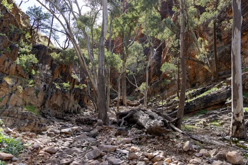
The Booroomba Rocks Trail is a quintessential Canberra day hike, offering a taste of the rugged beauty of Namadgi National Park without requiring an overnight commitment. The walk begins with a gentle ascent through mixed woodland, gradually increasing in gradient as it winds its way towards the prominent granite tors that give the trail its name. The path is generally well-defined and easy to follow, making it accessible for most reasonably fit walkers.
As you climb, the vegetation transitions from eucalypt forest to more open heathland, providing increasingly expansive views. The highlight of the trail is undoubtedly reaching Booroomba Rocks themselves. These weathered granite formations are a geological marvel, sculpted by millennia of wind and rain. They provide a fantastic natural playground for exploration and offer breathtaking 360-degree views. From the summit of the rocks, you can gaze out over the rolling hills of the Brindabella Range, the vast expanse of Namadgi National Park, and on a clear day, even catch glimpses of the distant Snowy Mountains.
The trail's moderate difficulty stems from the consistent elevation gain and the rocky terrain encountered in the latter stages. However, the well-constructed path and the relatively short duration make it an achievable goal for many. The best times to undertake this walk are during the cooler months of autumn and spring, when the weather is more pleasant and the risk of summer heat is minimised. The vibrant colours of autumn foliage and the fresh blooms of spring add an extra layer of beauty to the already spectacular scenery.
History and Cultural Context
The land that encompasses Namadgi National Park, including the area around Booroomba Rocks, has a rich and deep history stretching back tens of thousands of years. For millennia, this region was the traditional country of the Ngunnawal people, the Indigenous custodians of the Canberra region. They utilised the abundant natural resources of the area for sustenance, shelter, and cultural practices. The granite outcrops and the surrounding woodlands would have provided important seasonal food sources, water, and materials for tools and ceremonies. Evidence of their long-standing connection to the land can be found in the form of rock art sites, artefact scatters, and ceremonial grounds scattered throughout the park, though specific historical records directly tied to the Booroomba Rocks area for Indigenous use are not widely publicised for preservation reasons.
European settlement in the Canberra region began in the early 19th century, with pastoralists and selectors gradually moving into the surrounding hills and valleys. The Brindabella Range, visible from Booroomba Rocks, became a significant area for sheep grazing and timber milling. The rugged terrain presented challenges but also offered opportunities for those willing to work the land. The development of roads and tracks, such as the one leading to Booroomba Rocks, was often driven by the need to access these resources or to establish communication routes.
In the mid-20th century, there was a growing recognition of the need to preserve the unique natural and cultural heritage of the region. This led to the establishment of various protected areas, culminating in the declaration of Namadgi National Park in 1984. The park was named after the Indigenous Ngunnawal word for the Murrumbidgee River, reflecting its deep connection to the land and its traditional owners. The Booroomba Rocks Trail, as it exists today, is a testament to the park's dual heritage—a path that allows visitors to experience the natural beauty of the landscape while acknowledging its long history of human connection, both Indigenous and European.
Seasonal Highlights and Weather Reality
The Booroomba Rocks Trail is a year-round destination, but its appeal and the experience it offers vary significantly with the seasons. Understanding these seasonal nuances is crucial for planning a safe and enjoyable hike.
Autumn (March-May): This is arguably the prime season for walking the Booroomba Rocks Trail. The weather is typically mild and stable, with cooler temperatures making the ascent more comfortable. The deciduous trees in the lower sections of the trail often display beautiful autumn colours, adding a vibrant palette to the landscape. The air is crisp, and the skies are often clear, offering excellent visibility from the summit. The risk of bushfires is generally lower than in summer.
Spring (September-November): Spring is another excellent time to visit. The landscape bursts into life with wildflowers and new growth. The weather is generally pleasant, though it can be more unpredictable than in autumn, with occasional late frosts or unseasonably warm days. The Brindabella Range can still hold some snow on the higher peaks in early spring, adding a picturesque contrast to the emerging greenery.
Summer (December-February): Summer in this region can be very hot, with temperatures frequently exceeding 30 degrees Celsius. While the trail is shaded in parts, the exposed sections and the granite summit can become extremely hot, increasing the risk of heatstroke and dehydration. Bushfire risk is also at its highest during summer. If hiking during this period, it is essential to start very early in the morning, carry ample water, wear sun protection, and be aware of fire bans and park closures. The views can be spectacular on clear days, but the heat can make the walk challenging.
Winter (June-August): Winter offers a different kind of beauty. The air is cold and crisp, and frost is common in the mornings. Snowfall can occur on the higher peaks, transforming the landscape into a winter wonderland. While the trail itself is usually clear of snow, icy patches can form, especially in shaded areas. The granite rocks at the summit can be very cold and slippery. This season is best suited for experienced walkers who are prepared for cold weather conditions, including appropriate thermal clothing, waterproofs, and sturdy footwear. The views can be exceptionally clear on cold, crisp days.
Weather Reality: Namadgi National Park is known for its changeable weather. Even on a clear morning, conditions can deteriorate rapidly, especially in the higher elevations. Always check the weather forecast before you go and be prepared for a range of conditions, including wind, rain, and sudden temperature drops, regardless of the season.
Recommended Itinerary
Booroomba Rocks Trail - Day Walk Itinerary
Early Morning (Approx. 8:00 AM - 9:00 AM): Departure from Canberra
- Depart from Canberra, allowing approximately 1 hour for the drive to the trailhead.
- Ensure you have all necessary gear, water, and snacks packed.
- Check the weather forecast one last time before leaving the city.
Morning (Approx. 9:00 AM - 10:00 AM): Arrival at Trailhead and Start of Walk
- Arrive at the Booroomba Rocks Trailhead parking area.
- Locate the start of the trail, clearly marked with signage.
- Begin the walk, initially on a relatively gentle, well-formed track through eucalypt forest.
- Distance covered: Approximately 1.5 km.
- Elevation gain: Gradual, around 100 metres.
Mid-Morning (Approx. 10:00 AM - 11:30 AM): Ascent and Changing Scenery
- The trail begins to steepen, with more sustained uphill sections.
- Vegetation may start to change, with more open woodland and heath appearing.
- Keep an eye out for native flora and fauna.
- Distance covered: Approximately 2.0 km.
- Elevation gain: Approximately 200 metres.
Late Morning (Approx. 11:30 AM - 12:30 PM): Approaching Booroomba Rocks
- The terrain becomes rockier and more rugged as you approach the main rock formations.
- The gradient increases significantly in the final section leading to the summit.
- Follow the marked path, which may involve some scrambling over smaller rocks.
- Distance covered: Approximately 1.5 km.
- Elevation gain: Approximately 150 metres.
Midday (Approx. 12:30 PM - 2:00 PM): Exploration and Lunch at Booroomba Rocks
- Arrive at Booroomba Rocks.
- Spend time exploring the various rock formations and finding the best vantage points.
- Enjoy your packed lunch while taking in the panoramic views.
- Take photographs of the expansive landscape.
- Total distance covered to this point: Approximately 5.0 km.
- Total elevation gain: Approximately 450 metres.
Afternoon (Approx. 2:00 PM - 3:30 PM): Descent and Return to Trailhead
- Begin the descent back down the trail.
- Exercise caution on the steeper and rockier sections.
- The descent is generally quicker than the ascent.
- Distance covered: Approximately 5.0 km.
- Elevation loss: Approximately 450 metres.
Late Afternoon (Approx. 3:30 PM - 4:30 PM): Return to Canberra
- Arrive back at the trailhead parking area.
- Begin the drive back to Canberra.
Important Notes:
- This is a day hike; no overnight accommodation is required.
- Carry sufficient water (at least 2 litres per person) and snacks.
- Wear sturdy, closed-toe walking shoes or hiking boots.
- Be prepared for changing weather conditions.
- Inform someone of your hiking plans and expected return time.
Planning and Bookings
Book Your Trip
Everything you need to plan your journey
Accommodation
Find places to stay near Canberra
Flights
Search flights to Canberra
Essential Preparation
The Booroomba Rocks Trail is a popular day walk, easily accessible from Canberra, making it a convenient option for a half-day or full-day excursion. Essential preparation involves ensuring you have adequate water and food for the duration of the walk, as there are no facilities along the trail. Given its proximity to Canberra, logistics are straightforward. The nearest city is Canberra, and the drive to the trailhead takes approximately one hour. The road leading to the Booroomba Rocks trailhead is sealed and suitable for all vehicle types, eliminating the need for a 4WD. Parking is available at the trailhead. It's advisable to check the weather forecast for the Brindabella Range before you depart, as conditions can differ from those in the city. Informing a friend or family member of your hiking plans, including your intended return time, is a standard safety precaution for any hike.
Trail Accommodation
This is a day hike requiring no overnight accommodation.
Required Gear
- Footwear: Sturdy, closed-toe walking shoes or hiking boots with good grip are essential. Trails can be uneven and rocky, especially near the summit.
- Clothing: Wear comfortable, breathable clothing suitable for the weather. Layers are recommended, as temperatures can change throughout the day and with elevation. A waterproof and windproof jacket is advisable, even on clear days, due to the potential for rapid weather changes in the mountains.
- Navigation: While the trail is generally well-marked, a map of Namadgi National Park and a compass or GPS device are recommended, especially if you plan to explore off the main path or in less-than-ideal visibility. A charged mobile phone is useful for emergencies, though reception can be patchy.
- Safety Gear: A basic first-aid kit is crucial for treating minor injuries such as blisters, cuts, or scrapes. Include any personal medications. A whistle can be useful for signalling in an emergency.
What to Bring
- Water: Carry at least 2 litres of water per person. There are no water sources along the trail that can be reliably treated for drinking.
- Food: Pack plenty of snacks and a packed lunch. High-energy foods like trail mix, fruit, energy bars, and sandwiches are ideal.
- Sun Protection: A wide-brimmed hat, sunglasses, and sunscreen (SPF 30 or higher) are essential, especially during warmer months, as much of the trail is exposed.
- Insect Repellent: Depending on the season, insects such as flies and mosquitoes can be present.
- Backpack: A comfortable daypack to carry your water, food, extra clothing, and other essentials.
- Optional: Camera, binoculars, walking poles (can be helpful for the ascent and descent).
Permits
No permits are required to access and walk the Booroomba Rocks Trail. Namadgi National Park is managed by the ACT Parks and Conservation Service, and general access for day use does not necessitate a permit. However, it is always advisable to check the official Namadgi National Park website or contact the ACT Parks and Conservation Service for any last-minute alerts, track closures, or changes in park regulations, particularly concerning fire bans or seasonal access restrictions.
Important Considerations:
- Fire Bans: During periods of high fire danger, particularly in summer, parts of Namadgi National Park may be closed to the public. Always check the current fire restrictions and park status before your visit.
- Vehicle Access: While the road to the Booroomba Rocks trailhead is sealed, other areas within Namadgi National Park may require a 4WD vehicle. Ensure your vehicle is suitable for any other areas you plan to visit.
- Park Entry: There is no fee for entering Namadgi National Park for day use.
Other Activities in the Area
The region surrounding the Booroomba Rocks Trail offers a variety of other activities for visitors to Namadgi National Park and the wider Canberra area:
- Other Namadgi National Park Walks: Namadgi is crisscrossed with numerous other walking trails catering to various fitness levels and interests. Popular options include the Orroral Valley Heritage Track, the Mount Tennent Track (a challenging climb with rewarding views), and shorter nature walks.
- Brindabella Range Exploration: Drive along the scenic Brindabella Road, enjoying the mountain vistas and stopping at various lookouts. Note that some roads within the Brindabella Range may require a 4WD.
- Picnicking: Several designated picnic areas are available within Namadgi National Park, offering facilities such as tables and barbecues. The area around Booroomba Rocks itself is an ideal spot for a picnic with a view.
- Bushwalking and Hiking: Beyond the Booroomba Rocks Trail, the park offers extensive opportunities for longer bushwalks and multi-day hikes for experienced trekkers.
- Wildlife Spotting: Namadgi is home to a diverse range of native Australian wildlife, including kangaroos, wallabies, wombats, echidnas, and numerous bird species. Keep an eye out for them, especially during dawn and dusk.
- Stargazing: Due to its remote location and minimal light pollution, Namadgi National Park is an excellent spot for stargazing. On clear nights, the sky is a breathtaking spectacle of stars.
- Canberra Attractions: For those visiting from further afield, Canberra offers a wealth of attractions, including Parliament House, the Australian War Memorial, the National Gallery of Australia, and the National Museum of Australia.
Safety and Conditions
Pre-Departure Checks:
- Weather Forecast: Always check the latest weather forecast for the Brindabella Range and Namadgi National Park before you leave. Conditions can change rapidly in mountainous areas.
- Park Alerts: Visit the ACT Parks and Conservation Service website for any current park alerts, track closures, or fire bans.
- Bushfire Risk: Namadgi National Park is a high bushfire risk area, especially during warmer months. Be aware of fire danger ratings and any fire bans in place. If a Total Fire Ban is declared, the park may be closed.
- Inform Someone: Let a friend or family member know your hiking plans, including your intended route, departure time, and expected return time.
On the Trail:
- Stay on Marked Trails: Stick to the designated Booroomba Rocks Trail to avoid getting lost and to minimise your impact on the environment.
- Water: Carry sufficient water. There are no reliable water sources on the trail. Dehydration can occur quickly, especially on warm days.
- Footwear: Wear sturdy, closed-toe walking shoes or hiking boots. The terrain can be uneven and rocky, particularly near the summit.
- Sun Protection: The trail is exposed in many sections. Wear a hat, sunglasses, and apply sunscreen regularly.
- Navigation: While the trail is generally well-marked, it's wise to carry a map and compass or GPS device, especially if visibility is poor. Mobile phone reception can be unreliable.
- Wildlife: Observe wildlife from a distance and do not feed any animals. Be aware of snakes during warmer months.
- First Aid: Carry a well-stocked first-aid kit and know how to use it.
- Emergency: In case of an emergency, call 000 (Triple Zero). Be prepared to provide your location as accurately as possible.
Conditions: The trail surface can be rocky and uneven, especially in the upper sections. In wet weather, some sections may become slippery. During winter, frost and ice can form on shaded parts of the trail, making it hazardous. Always assess conditions and proceed with caution.
Side Trips and Points of Interest
Booroomba Rocks Summit: The primary point of interest is the Booroomba Rocks themselves. These impressive granite formations offer a unique geological landscape to explore. The summit provides a spectacular 360-degree panoramic view of the surrounding Brindabella Range, Namadgi National Park, and the ACT region. It's an ideal spot for photography, a picnic, or simply to soak in the expansive scenery.
Geological Formations: The weathered granite tors are a fascinating feature. Take time to observe the textures, colours, and shapes of the rocks, which have been sculpted by natural processes over thousands of years. You can often find small crevices and overhangs that offer shelter and interesting perspectives.
Flora and Fauna: As you ascend, you'll notice changes in the vegetation. The lower sections are typically dominated by eucalypt woodlands, while the higher elevations may feature more open heathland and hardy alpine shrubs. Keep an eye out for native Australian wildlife such as kangaroos, wallabies, and various bird species. The area is particularly beautiful in spring when wildflowers are in bloom.
Panoramic Views: The trail offers increasingly expansive views as you gain elevation. The summit of Booroomba Rocks provides the most comprehensive vista, allowing you to appreciate the vastness and rugged beauty of the Australian Capital Territory's mountain ranges.
Leave No Trace
The Booroomba Rocks Trail, like all natural areas, benefits greatly from visitors adhering to Leave No Trace principles. These principles help to minimise human impact and preserve the natural beauty and ecological integrity of Namadgi National Park for future generations.
Your responsibility as a walker:
- Plan Ahead and Prepare: Know the trail conditions, weather forecast, and any park regulations before you go. Pack appropriately for the conditions.
- Travel and Camp on Durable Surfaces: Stick to the marked trail. Avoid walking on fragile vegetation, especially near the rock formations, to prevent erosion and damage.
- Dispose of Waste Properly: Pack out everything you pack in. This includes all food scraps, wrappers, and any other litter. Use the toilet facilities at the trailhead if available, or carry out all human waste if necessary.
- Leave What You Find: Do not remove any natural objects, such as rocks, plants, or flowers. Take only photographs and memories.
- Minimise Campfire Impacts: Campfires are generally not permitted on day walks, and if permitted in designated areas for overnight stays, they must be managed responsibly. For this day walk, no campfires are involved.
- Respect Wildlife: Observe animals from a distance and never feed them. Feeding wildlife can alter their natural behaviour and diet, and can be harmful to their health.
- Be Considerate of Other Visitors: Keep noise levels down and yield to other walkers, especially on narrow sections of the trail.
By following these principles, you help ensure that the Booroomba Rocks Trail remains a beautiful and enjoyable place for everyone.