
Blorenge Circular Walk
The Blorenge Circular Walk is a rewarding mountain track located in South Wales, offering a moderate challenge with significant elevation gain over a relatively short distance. This route provides stunning panoramic views of the surrounding countryside, including the Usk Valley, the Black Mountains, and on a clear day, even the Bristol Channel. It's a popular choice for day hikers and experienced walkers looking for a substantial climb and a sense of accomplishment. The walk is known for its varied terrain, from well-trodden paths to more rugged sections, and its accessible trailhead near Abergavenny.
- Distance: 8.0 km (circular)
- Elevation Gain: 500 m
- Duration: 3 hours
- Difficulty: Moderate
- Best Time: April–October
- Closest City: Abergavenny
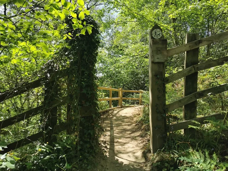
- Trailhead Access: Nearest city: Abergavenny. From Abergavenny, drive north on the B4246 towards Blaenavon. The trailhead car park is well signposted off the B4246. Road conditions are generally good. Driving time is approx. 15 minutes. Parking available. No permits needed. Trailhead GPS: 51.8133, -3.0331
Overview
The Blorenge Circular Walk is a classic ascent of one of South Wales' most prominent hills. Standing at 568 metres (568 m), the Blorenge offers a commanding presence over the landscape. The circular route typically starts from a well-established car park on the B4246, allowing for convenient access. The climb is steady, with sections that can be steep and rocky, demanding a reasonable level of fitness. As you ascend, the views begin to open up, rewarding your efforts with increasingly expansive vistas. The summit area is relatively flat, often featuring the distinctive television mast and a trig point, marking the highest point of your journey.
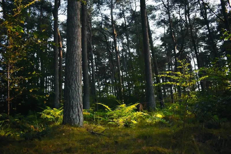
The descent follows a different path, often incorporating sections of moorland and woodland, providing a varied walking experience. This part of the walk can be less defined in places, requiring careful navigation, especially in poor weather. The Blorenge is part of the Brecon Beacons National Park, and its slopes are home to a variety of flora and fauna, with heather and gorse common on the higher, more exposed ground, and deciduous trees in the lower wooded sections. The geological makeup of the Blorenge, primarily Old Red Sandstone, contributes to its distinctive shape and the character of its slopes.
This walk is ideal for a half-day excursion, offering a significant physical challenge and spectacular scenery without requiring an overnight stay. Its proximity to Abergavenny makes it an excellent option for those visiting the region or seeking a challenging day out in the Welsh countryside. The circular nature of the route means you experience different perspectives of the hill and its surroundings throughout the walk, making it a dynamic and engaging experience.
History and Cultural Context
The Blorenge hill has a long history of human interaction, primarily linked to its mineral wealth and strategic location. For centuries, the slopes of the Blorenge have been exploited for iron ore, coal, and limestone. The industrial revolution saw significant mining activity in the area, particularly around Blaenavon, which is now a UNESCO World Heritage site. The remnants of this industrial past can still be seen in the landscape, with old mine workings and spoil heaps dotting the hillsides, though many have been reclaimed by nature.
The summit of the Blorenge has long been a landmark for travellers and locals alike. Historically, it would have served as a natural viewpoint and a reference point for navigation. The construction of the television mast in the latter half of the 20th century has altered the summit's appearance but also cemented its status as a prominent feature on the skyline. The area is part of the wider Brecon Beacons National Park, established in 1957, which aims to protect the natural beauty, wildlife, and cultural heritage of the region.
The circular walk itself follows paths that have likely been used for generations, whether by shepherds, miners, or early recreational walkers. The route often incorporates sections of ancient trackways and bridle paths, hinting at the long-standing human presence in this landscape. The cultural significance of the Blorenge is tied to the industrial heritage of the surrounding valleys and the enduring appeal of the Welsh hills as a place of natural beauty and outdoor pursuit.
Seasonal Highlights and Weather Reality
The Blorenge Circular Walk is accessible and enjoyable throughout the year, but each season offers a distinct experience. The best time for this walk is generally from April to October, when the weather is typically milder and daylight hours are longer.
Spring (April–May): This is a beautiful time to walk the Blorenge. The landscape begins to reawaken, with wildflowers appearing on the lower slopes and the heather starting to show signs of life. The weather can be variable, with a mix of sunshine and showers, but the air is fresh, and the crowds are usually smaller than in peak summer. The higher sections may still be damp from winter rains.
Summer (June–August): The most popular time for this walk. The days are long, and the weather is often at its warmest. The heather may be in bloom, creating swathes of purple across the hillsides, and the views from the summit can be spectacular on clear days. However, summer can also bring heatwaves, and the exposed summit can be very hot. Sandflies are generally not an issue on this particular walk, but it's always wise to be prepared for insects. The summit can be busy with other walkers.
Autumn (September–October): Autumn offers a different kind of beauty. The colours of the changing foliage in the surrounding valleys can be stunning, and the air is often crisp and clear, providing excellent visibility from the summit. The weather can become more unpredictable, with increased chances of rain and wind, so waterproofs are essential. The crowds thin out considerably, offering a more peaceful experience.
Winter (November–March): While possible, winter walking on the Blorenge requires caution. The paths can be muddy, icy, and slippery, especially on the steeper sections and the descent. Snowfall can occur, transforming the landscape into a winter wonderland, but it can also obscure the paths and make navigation challenging. Daylight hours are short, and the weather can change rapidly, with strong winds and freezing temperatures common. Only experienced walkers with appropriate winter gear and navigation skills should attempt the walk in winter conditions.
Weather Reality: The Blorenge is an exposed hill, and the weather can change very quickly. It is crucial to check the forecast before you set out and be prepared for all conditions, including strong winds, heavy rain, and mist, even on a seemingly clear day. Hypothermia is a risk, even in milder months, if you get wet and cold.
Recommended Itinerary
Blorenge Circular Walk - Day Hike Itinerary
Early Morning (Approx. 9:00 AM): Arrival and Start
- Arrive at the Blorenge Trailhead Car Park (off the B4246, near Abergavenny).
- Ensure you have all necessary gear, water, and snacks.
- Check the weather forecast one last time.
- Begin the ascent from the car park, following the well-marked path heading towards the summit.
Morning (Approx. 9:30 AM - 11:30 AM): Ascent to the Summit
- The initial part of the walk involves a steady climb, often on a clear track.
- As you gain elevation, the views of the Usk Valley and surrounding hills will start to open up.
- The terrain may become steeper and rockier in places.
- Continue following the main path upwards, keeping the summit in sight.
- Reach the summit plateau, marked by the television mast and a trig point.
Midday (Approx. 11:30 AM - 12:30 PM): Summit Break and Views
- Spend time at the summit enjoying the panoramic views.
- Identify landmarks such as the Black Mountains, Sugar Loaf, and potentially the Bristol Channel.
- Have your packed lunch and rehydrate.
- Take photographs of the expansive scenery.
Afternoon (Approx. 12:30 PM - 2:30 PM): Descent and Circular Route
- Begin the descent, taking a different path to complete the circular route.
- The descent route may involve sections of moorland, rougher terrain, and potentially some woodland.
- Navigate carefully, especially if the path is less defined or conditions are wet.
- Enjoy the changing perspectives of the landscape as you descend.
- The path will eventually lead you back towards the vicinity of the car park.
Late Afternoon (Approx. 2:30 PM onwards): Return to Car Park
- Arrive back at the trailhead car park.
- Ensure you have collected all your belongings.
- Consider a stop in Abergavenny for refreshments or a meal.
Important Notes:
- This is a guideline; actual timings will vary based on individual pace and weather conditions.
- Always carry a map and compass, and know how to use them, especially for the descent.
- Be prepared for rapid weather changes.
- Wear sturdy, broken-in walking boots.
Planning and Bookings
Book Your Trip
Everything you need to plan your journey
Accommodation
Find places to stay near Abergavenny
Flights
Search flights to Abergavenny
Essential Preparation
The Blorenge Circular Walk is a day hike, meaning no overnight accommodation is required. However, essential preparation is still key to a safe and enjoyable experience. The closest major town is Abergavenny, which offers a range of amenities including accommodation, shops, and places to eat. It's advisable to base yourself in or near Abergavenny for easy access to the trailhead. Ensure your vehicle is in good condition for the drive to the trailhead, as some minor roads may be narrow or winding. The car park at the trailhead is generally well-maintained, but it's wise to arrive early, especially on weekends or during peak season, to secure a parking spot. Familiarise yourself with the route using a map and compass or a reliable GPS device, as visibility can be poor on the summit in misty conditions.
Trail Accommodation
This is a day hike requiring no overnight accommodation.
Required Gear
- Sturdy walking boots: Waterproof and with good ankle support are essential for the varied and sometimes uneven terrain.
- Waterproof jacket and trousers: The weather on the Blorenge can change rapidly, and being caught in rain without adequate protection can be uncomfortable and dangerous.
- Warm layers: Even in summer, the summit can be cool and windy. Bring a fleece or warm jumper, and consider a hat and gloves.
- Navigation tools: A map of the area (e.g., Ordnance Survey Explorer map OL13) and a compass are highly recommended, especially for the descent. A GPS device or smartphone with offline maps can also be useful.
- First aid kit: Include blister plasters, bandages, antiseptic wipes, pain relievers, and any personal medication.
- Head torch: Essential if you plan to start early or finish late, or in case of unexpected delays.
- Mobile phone: For emergencies, though signal can be intermittent on the hill.
What to Bring
- Food and drink: Plenty of water (at least 1.5-2 litres per person) and high-energy snacks such as sandwiches, fruit, nuts, and energy bars.
- Sun protection: Sunscreen, sunglasses, and a hat, even on cloudy days, as the sun's rays can be strong at higher altitudes.
- Backpack: A comfortable day pack (20-30 litres) to carry your gear.
- Trekking poles: Optional, but can be helpful for stability on steep ascents and descents.
- Whistle: For signalling in an emergency.
- Small towel: Useful if you get wet.
Permits
No specific permits are required to walk the Blorenge Circular Walk. The land is generally accessible as part of the Brecon Beacons National Park, and the trailhead is a public car park. However, it is always advisable to check for any local notices or temporary restrictions that may be in place, particularly if there are any events or conservation work being undertaken in the area. Respect for the environment and adherence to the Countryside Code are expected from all visitors.
Other Activities in the Area
The region around Abergavenny and the Brecon Beacons National Park offers a wealth of activities for visitors:
- Exploring Abergavenny: Visit the historic market town, explore its castle ruins, browse the local shops, and enjoy its culinary offerings.
- Hiking in the Brecon Beacons: Numerous other trails exist within the National Park, including ascents of Pen y Fan (the highest peak), the Sugar Loaf, and the Black Mountains.
- Caving: The area is renowned for its limestone caves, with guided tours available for those interested in underground exploration.
- Cycling: Several cycling routes cater to various abilities, from scenic road rides to challenging mountain biking trails.
- Water Sports: Activities such as kayaking, canoeing, and paddleboarding are available on nearby reservoirs and rivers.
- Visiting UNESCO World Heritage Site: Explore the industrial heritage of Blaenavon, including Big Pit National Coal Museum and Blaenavon Ironworks.
- Scenic Drives: Enjoy the picturesque landscapes of the Usk Valley and the Black Mountains by car.
Safety and Conditions
Weather: The most significant safety consideration on the Blorenge is the unpredictable mountain weather. Always check the MetOffice forecast for the Brecon Beacons before you go and be prepared for rapid changes. Mist can descend quickly, reducing visibility to near zero, making navigation difficult. Strong winds can make exposed sections challenging, and rain can lead to slippery conditions underfoot.
Terrain: While the main ascent path is generally clear, the descent can be rougher and less defined. Be aware of loose scree, boggy patches, and slippery rocks, especially after rain. Ensure your footwear provides good grip and ankle support.
Navigation: Carry a map and compass and know how to use them. Do not rely solely on mobile phone GPS, as signal can be unreliable, and batteries can drain quickly. Familiarise yourself with the route beforehand.
Fitness: The Blorenge Circular Walk involves a significant climb (500m elevation gain) over a relatively short distance. Ensure you have an adequate level of fitness for this moderate challenge. Take regular breaks to rest and rehydrate.
Emergencies: In case of an emergency, dial 999 or 112 and ask for Mountain Rescue. Provide your location as accurately as possible. It is advisable to carry a fully charged mobile phone, but do not rely on it for communication.
Livestock: You may encounter sheep or other livestock on the hillsides. Keep a safe distance, do not disturb them, and ensure gates are closed behind you.
First Aid: Carry a well-stocked first aid kit and know how to treat common hiking injuries such as blisters, sprains, and cuts.
Side Trips and Points of Interest
The Summit Trig Point and TV Mast: The summit of the Blorenge is marked by a prominent triangulation pillar (trig point) and a large television transmission mast. These serve as excellent landmarks and offer a clear indication that you have reached the highest point. The trig point is a popular spot for photographs.
Panoramic Views: On a clear day, the summit provides breathtaking 360-degree views. To the north and west lie the rolling hills of the Black Mountains and the Brecon Beacons, including prominent peaks like Pen y Fan and Sugar Loaf. To the east, the Usk Valley stretches out, with the town of Abergavenny nestled below. On exceptionally clear days, you may even be able to see the Bristol Channel and the coast of Somerset.
Industrial Heritage Remnants: As you descend, particularly if you follow routes that skirt the edges of the former mining areas, you may encounter subtle signs of the Blorenge's industrial past. These could include old track beds, spoil heaps, or the remains of stone structures, though much of this has been reclaimed by nature.
Heather and Gorse: During the summer months, the slopes of the Blorenge are often carpeted with vibrant purple heather and yellow gorse, creating a spectacular display of colour and adding to the sensory experience of the walk.
Varied Descent Paths: The circular nature of the walk means the descent offers different scenery and terrain compared to the ascent. Depending on the chosen route, you might pass through patches of woodland, open moorland, or follow more defined tracks, providing a varied and interesting end to the hike.
Leave No Trace
The Blorenge Circular Walk traverses an area of natural beauty within the Brecon Beacons National Park. To help preserve this environment for future visitors and for the benefit of its wildlife, it is essential to practice Leave No Trace principles:
- Plan Ahead and Prepare: Know the route, check the weather, and pack appropriately.
- Travel and Camp on Durable Surfaces: Stick to the marked paths to avoid damaging fragile vegetation. Avoid walking on wet or boggy ground where possible.
- Dispose of Waste Properly: Pack out everything you pack in, including all litter, food scraps, and wrappers. Use designated bins where available, but be prepared to carry your rubbish home if bins are full or absent.
- Leave What You Find: Do not take any natural items such as rocks, plants, or flowers. Leave the landscape as you found it.
- Minimise Campfire Impacts: As this is a day hike, campfires are not applicable. However, if you were to stop for a picnic, ensure any discarded food is properly disposed of and does not attract wildlife.
- Respect Wildlife: Observe wildlife from a distance and do not feed any animals, including sheep. Feeding them can harm their health and alter their natural behaviour.
- Be Considerate of Other Visitors: Keep noise levels down, yield to other walkers on narrow paths, and be mindful of others enjoying the peace and quiet of the countryside.
By following these guidelines, you contribute to the protection of the Blorenge and the wider National Park.