
Blencathra via Sharp Edge
Blencathra, a majestic mountain in the English Lake District, offers a variety of routes to its summit. Among the most exhilarating and challenging is the ascent via Sharp Edge, a narrow, rocky arête that demands a head for heights and confident scrambling. This route is not for the faint-hearted; it is a serious mountain scramble that rewards experienced hikers with breathtaking views and a profound sense of accomplishment. The journey traverses rugged terrain, culminating in a dramatic ridge walk that is both exhilarating and technically demanding. Blencathra via Sharp Edge is a classic Lake District challenge, offering a true taste of fell walking at its most adventurous.
- Distance: 10.0 km
- Elevation Gain: 850 m
- Duration: 4-5 hours
- Difficulty: Challenging (Scramble)
- Best Time: April to October (weather dependent)
- Closest Village: Threlkeld
- Trailhead Access: Limited parking in Threlkeld; nearest major airport is Manchester (MAN), approximately 2.5 hours drive.
- Permits: Not required.
Overview
The ascent of Blencathra via Sharp Edge is a quintessential Lake District mountain experience, renowned for its dramatic ridge traverse. This route is a significant step up from a standard fell walk, incorporating a Grade 1 scramble that requires hands-on climbing and a good sense of balance. The journey begins from the charming village of Threlkeld, gradually ascending through moorland and then into more rugged, rocky terrain. The approach to Sharp Edge itself is steep and exposed, building anticipation for the main event.
Sharp Edge is a narrow, knife-like ridge that forms the eastern arête of Blencathra's summit plateau. Walking along it involves navigating a series of rocky steps and exposed sections, with steep drops on either side. The views from the ridge are spectacular, offering panoramic vistas across the northern Lake District, including Derwentwater, Bassenthwaite Lake, and the surrounding fells. The summit of Blencathra, known as Halls Fell Top, provides a commanding viewpoint. The descent typically follows the more straightforward, though still steep, Halls Fell Ridge or the Scales Tarn route, offering a different perspective on the mountain.
This route is best undertaken in dry, calm conditions. High winds, rain, or ice can make Sharp Edge extremely dangerous and impassable. It is a route that demands respect for the mountain and a high level of fitness and scrambling ability. The combination of challenging terrain, exposure, and stunning scenery makes Blencathra via Sharp Edge an unforgettable adventure for experienced mountain walkers.
History and Cultural Context
Blencathra, or Saddleback as it was historically known, has been a prominent landmark in the Cumbrian landscape for centuries. Its distinctive shape has made it a focal point for local communities and travellers alike. The mountain's name, Blencathra, is of Cumbric origin, likely meaning "place of the rushes" or "rushy hill," reflecting the vegetation found on its lower slopes.
The routes to its summit have been trodden for generations, initially by shepherds and farmers, and later by early fell walkers and climbers. The development of the railway to Threlkeld in the late 19th century made the mountain more accessible to a wider audience, contributing to the growth of tourism in the Lake District. The "Sharp Edge" route, while not a formal path, has long been recognised as a challenging and exciting way to ascend the mountain, attracting those seeking an adventurous experience.
The mountain has also featured in literature and art. William Wordsworth, a keen observer of the Lake District landscape, mentioned Blencathra in his poetry. The dramatic nature of the Sharp Edge ridge has undoubtedly inspired countless photographs and stories, cementing its reputation as a classic mountain challenge. The area around Blencathra, including Threlkeld, retains a strong connection to its agricultural past, with traditional farming practices still evident on the lower fells.
Seasonal Highlights and Weather Reality
The best time to tackle Blencathra via Sharp Edge is during the warmer, drier months, typically from April to October. During this period, the chances of encountering snow and ice on the higher sections are significantly reduced, making the scramble more manageable and safer.
Spring (April-May): The landscape begins to reawaken, with new growth appearing on the lower slopes. Days are lengthening, offering more daylight hours for the hike. However, spring weather can be highly unpredictable, with potential for late snowfalls on the higher ground and frequent rain showers. The mountain may still hold patches of snow, especially in shaded gullies, which can make the approach to Sharp Edge treacherous.
Summer (June-August): This is generally the most popular season due to longer daylight hours and the highest probability of settled weather. However, summer in the Lake District can still bring heavy rain and thunderstorms, which can make Sharp Edge extremely dangerous due to slippery rock and increased water flow. High winds are also a common summer hazard, particularly on exposed ridges.
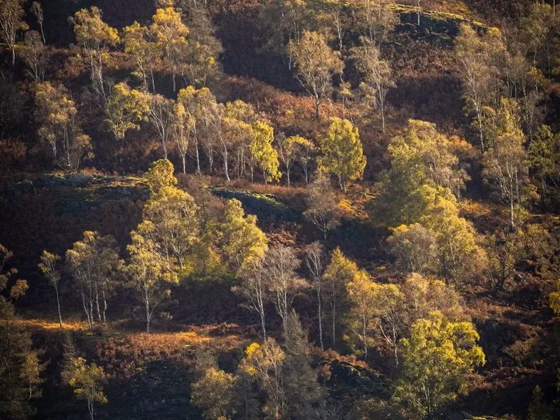
Autumn (September-October): The fells are often at their most beautiful in autumn, with vibrant colours painting the landscape. The weather can be crisp and clear, offering excellent visibility. However, days are shorter, and the risk of frost and early snow increases as the season progresses. The ground can become waterlogged after prolonged rain, making the approach and descent muddy and slippery.
Winter (November-March): Blencathra via Sharp Edge is generally considered impassable and extremely dangerous during winter months unless undertaken by highly experienced winter mountaineers equipped with ice axe, crampons, and extensive knowledge of snow and avalanche conditions. Snow and ice can transform the ridge into a serious hazard, with a high risk of slips and falls. Visibility can be reduced to near zero in fog and blizzards.
Weather is the paramount consideration for this route. Always check the mountain forecast (e.g., MetService) specifically for the Blencathra area before setting out. Be prepared for rapid changes; conditions can deteriorate quickly, especially at higher altitudes.
Recommended Itinerary
Blencathra via Sharp Edge - Day Hike Itinerary
Early Morning (Approx. 8:00 AM): Start in Threlkeld
- Begin at the village of Threlkeld, near the Blencathra Field Centre or the car park.
- Ensure you have checked the weather forecast and are prepared for the conditions.
- Confirm you have all necessary gear, including waterproofs, warm layers, food, water, and navigation equipment.
Morning (Approx. 8:30 AM - 11:00 AM): Approach to Sharp Edge
- Follow the path heading east out of Threlkeld, aiming towards the imposing mass of Blencathra.
- The initial section involves walking across farmland and moorland, gradually gaining elevation.
- The path becomes steeper and rockier as you approach the base of the eastern fells.
- You will pass Scales Tarn, a picturesque mountain lake, which serves as a good landmark.
- The ascent towards Sharp Edge becomes increasingly steep and rugged.
- The terrain transitions from grass and scree to more exposed rock.
Late Morning (Approx. 11:00 AM - 1:00 PM): Ascend Sharp Edge
- This is the most technically demanding part of the route.
- Sharp Edge is a narrow, rocky arête with significant exposure.
- Use hands and feet to scramble over the rocks, maintaining three points of contact where possible.
- Take your time, assess each move carefully, and be aware of your surroundings.
- The ridge offers spectacular views but demands concentration.
- Be prepared for potential queues if other walkers are on the ridge, especially during peak season.
- The scramble culminates at the summit plateau of Blencathra.
Midday (Approx. 1:00 PM - 2:00 PM): Summit and Lunch
- Reach Halls Fell Top, the highest point of Blencathra (861 m).
- Enjoy the panoramic views from the summit.
- Take a break for lunch and rehydrate.
- Be mindful of the weather; conditions can change rapidly at the summit.
Afternoon (Approx. 2:00 PM - 4:00 PM): Descent via Halls Fell Ridge or Scales Tarn
- Option 1 (Halls Fell Ridge): A steep but generally less exposed descent than Sharp Edge. It is still a scramble in places and requires careful footwork.
- Option 2 (Scales Tarn Route): Descend back towards Scales Tarn. This route is also steep and can be loose underfoot.
- Follow the established paths downwards, paying attention to navigation.
- The descent can be as tiring as the ascent, so maintain focus.
Late Afternoon (Approx. 4:00 PM - 5:00 PM): Return to Threlkeld
- Continue the descent back towards the village of Threlkeld.
- The terrain will gradually become less rugged as you approach the valley floor.
- Arrive back in Threlkeld, completing your challenging ascent of Blencathra.
Important Notes:
- This itinerary is a guideline; actual timings will vary based on fitness, weather, and pace.
- Always carry a map and compass and know how to use them.
- Inform someone of your route and expected return time.
- This route is not suitable for beginners or those with a fear of heights.
- Check the weather forecast immediately before setting off.
Planning and Bookings
Book Your Trip
Everything you need to plan your journey
Accommodation
Find places to stay near Threlkeld
Flights
Search flights to Threlkeld
Essential Preparation
Ascending Blencathra via Sharp Edge requires careful planning due to its challenging nature. Fitness is paramount; you should be comfortable with sustained uphill walking for several hours and possess good stamina. The scramble requires a degree of agility and strength, so a reasonable level of physical conditioning is essential. Familiarise yourself with scrambling techniques and safety considerations before attempting this route.
Logistics are relatively straightforward as Threlkeld is the primary access point. If travelling by car, there is limited parking available in the village. Consider arriving early, especially during peak season, to secure a spot. Public transport options include Stagecoach bus service X5, which runs between Keswick and Penrith, stopping at Threlkeld. This is a convenient option if you are staying in nearby towns like Keswick.
Threlkeld itself is a small, picturesque village with basic amenities, including a pub and a small shop. For more extensive services, including outdoor gear shops, supermarkets, and a wider range of accommodation, the larger town of Keswick is approximately 15 minutes away by car or bus.
Trail Accommodation
This is a day hike requiring no overnight accommodation. Hikers typically base themselves in nearby villages or towns such as Threlkeld, Keswick, or Grasmere, and undertake the Blencathra ascent as a single-day excursion.
Accommodation Options:
- Threlkeld: Offers a few local pubs with rooms and bed and breakfasts.
- Keswick: A larger tourist hub with a wide array of hotels, guesthouses, bed and breakfasts, and youth hostels.
- Grasmere: Another popular village with various accommodation choices.
Campsites: Several campsites are located in the wider Lake District area, though wild camping is generally discouraged and restricted in many popular areas, including the immediate vicinity of Blencathra. Always check local regulations and designated camping sites.
Required Gear
- Sturdy Hiking Boots: Waterproof, with good ankle support and a well-worn sole for grip on rock and uneven terrain.
- Waterproof Jacket and Trousers: Essential for protection against rain and wind. Ensure they are breathable.
- Warm Layers: Including a fleece or insulated jacket, and a base layer. The temperature can drop significantly at higher altitudes, even in summer.
- Gloves: Lightweight, grippy gloves are highly recommended for scrambling to protect hands and improve grip.
- Hat: A warm hat or beanie for cold weather, and a sun hat for sunny days.
- Backpack: A comfortable day pack (20-30 litres) to carry essentials.
- Navigation Tools: A detailed map of the Blencathra area (e.g., Ordnance Survey Explorer OL5 or OL7) and a compass. A GPS device or smartphone with offline maps is a useful supplement but should not be relied upon solely.
- Head Torch: With spare batteries, in case of unexpected delays or early starts/late finishes.
- First-Aid Kit: Including blister plasters, pain relievers, antiseptic wipes, and any personal medication.
- Whistle: For emergency signalling.
What to Bring
- Food: High-energy snacks such as energy bars, nuts, dried fruit, and sandwiches. Pack more than you think you will need.
- Water: At least 1.5-2 litres of water per person. Water sources on the mountain can be unreliable or contaminated, so carrying sufficient water is crucial. Water treatment tablets or a filter can be a backup.
- Sun Protection: Sunscreen (SPF 30+), sunglasses, and lip balm, even on cloudy days, as UV radiation can be strong at altitude.
- Mobile Phone: Fully charged, with a power bank if possible. Signal can be intermittent on the mountain.
- Emergency Shelter: A lightweight emergency bivvy bag or survival blanket.
- Trekking Poles: Optional, but can be helpful for the approach and descent, especially on steep or loose ground.
- Small Towel: For drying hands or wiping sweat.
- Rubbish Bag: To pack out all litter.
Permits
No specific permits are required to hike or scramble up Blencathra via Sharp Edge. The mountain and its surrounding land are largely accessible under the UK's 'right to roam' legislation, often referred to as the Countryside Code. This means you are generally free to walk across open country, provided you do so responsibly.
However, it is crucial to adhere to the principles of the Countryside Code:
- Respect the land: Stay on marked paths where they exist, especially on steep or eroded sections, to minimise environmental impact.
- Leave no trace: Take all litter with you, including food scraps and packaging.
- Respect livestock: If you encounter sheep or other farm animals, keep your distance and ensure dogs are kept under close control or on a lead.
- Be considerate: Avoid disturbing wildlife or residents.
While no formal booking or payment is necessary for this route, responsible behaviour and respect for the environment are paramount. The popularity of Blencathra means that adherence to these guidelines is essential to preserve the mountain's natural beauty and accessibility for all.
Other Activities in the Area
The Lake District offers a wealth of activities beyond Blencathra itself:
- Hiking and Fell Walking: Numerous other peaks and trails surround Threlkeld and Keswick, ranging from gentle lakeside strolls to challenging mountain ascents. Popular options include Helvellyn via Striding Edge (another famous scramble), Skiddaw, and Catbells.
- Watersports on Derwentwater: Enjoy rowing boat hire, kayaking, paddleboarding, or taking a cruise on the lake from Keswick.
- Exploring Keswick: Visit the Moot Hall, browse the outdoor gear shops, enjoy local pubs and cafes, or visit the Pencil Museum.
- Honister Slate Mine: Located near Borrowdale, this working slate mine offers tours, adventure activities like the Via Ferrata, and stunning mountain scenery.
- Castlerigg Stone Circle: An iconic prehistoric monument with a dramatic backdrop of the fells, located a short drive from Keswick.
- Whinlatter Forest Park: Offers walking trails, mountain biking routes, and a Go Ape treetop adventure course.
- Literary Connections: Visit Dove Cottage in Grasmere, the former home of William Wordsworth, and explore the landscapes that inspired him.
Safety and Conditions
Pre-Departure Checks:
- Weather Forecast: Always check the mountain weather forecast for Blencathra specifically (e.g., MetService, MWIS). Pay close attention to wind speed, visibility, and precipitation. Conditions can change rapidly.
- Route Assessment: Be honest about your experience and fitness level. Sharp Edge is a Grade 1 scramble and requires confidence on exposed rock. If you are unsure, consider an alternative route or a guided ascent.
- Gear Check: Ensure all your equipment is in good condition and suitable for mountain conditions.
- Inform Someone: Let a reliable person know your planned route, estimated return time, and what to do if you do not check in.
On the Mountain:
- Navigation: Carry a map and compass and know how to use them. Do not rely solely on mobile phone GPS, as signal can be lost and batteries can drain.
- Exposure: Sharp Edge is a narrow ridge with steep drops on either side. Maintain three points of contact when scrambling and be aware of your footing. Avoid this route in high winds, rain, or icy conditions.
- Slippery Conditions: Rock can become extremely slippery when wet, especially after rain or in damp conditions. Take extra care.
- Hypothermia: Even in summer, temperatures can be low at the summit, and wind chill can be significant. Carry sufficient warm layers and be aware of the symptoms of hypothermia.
- Daylight Hours: Be mindful of the time and ensure you have enough daylight to complete your descent safely.
- Emergency: In case of an emergency, call 999 or 112 and ask for Mountain Rescue. Provide your location as accurately as possible. A Personal Locator Beacon (PLB) can be a valuable safety device for remote mountain activities.
Specific Hazards for Sharp Edge:
- Exposure: The primary hazard. Significant drops on both sides require a good head for heights.
- Slippery Rock: Especially after rain or in damp conditions.
- High Winds: Can make traversing the ridge extremely difficult and dangerous.
- Poor Visibility: Fog can descend rapidly, making navigation challenging and increasing the risk of straying from the path.
- Loose Scree: Sections of the approach and descent can be loose underfoot.
Side Trips and Points of Interest
Scales Tarn: Located on the eastern flank of Blencathra, Scales Tarn is a beautiful mountain lake that serves as a key landmark on the approach to Sharp Edge. It offers a picturesque spot for a break and photography, providing a sense of the wild mountain environment you are entering.
Halls Fell Ridge: While Sharp Edge is the more dramatic ascent, Halls Fell Ridge offers a challenging and exciting descent. It is a steep, rocky ridge that requires careful footwork and some scrambling, providing a different perspective of Blencathra's rugged topography. It is a popular alternative descent route.
The Dodd: A smaller, subsidiary summit to the west of Blencathra's main peak, offering excellent views across the northern fells and towards Bassenthwaite Lake. It can be incorporated into longer walks or visited as a separate, less demanding outing.
Threlkeld Quarry: A former industrial site now managed as a nature reserve, offering walking trails and insights into the area's geological and industrial past. It's a good place to explore if you have extra time or are looking for a less strenuous activity.
Blencathra Summit Views: The summit plateau of Blencathra, particularly Halls Fell Top, offers expansive 360-degree views. On a clear day, you can see across to Skiddaw, the Helvellyn range, and out towards the Solway Firth. It's a rewarding vista after the challenging climb.
Leave No Trace
The Lake District is a cherished natural landscape, and it is vital that all visitors practice Leave No Trace principles to preserve its beauty and ecological integrity for future generations. Blencathra, being a popular fell, experiences significant footfall, making responsible behaviour even more critical.
Your responsibility as a walker:
- Pack it in, Pack it out: Take all your litter with you, including food wrappers, fruit peels, and any other waste. Do not bury it or leave it behind.
- Stay on the Path: Especially on steep, eroded, or vegetated sections, stick to the marked trails. This prevents further erosion and protects fragile plant life.
- Respect Wildlife: Observe animals from a distance and do not feed them. Blencathra is home to various bird species and sheep; ensure you do not disturb them. Keep dogs under control at all times.
- Minimise Campfire Impacts: If camping (where permitted), use a stove rather than an open fire. If a fire is absolutely necessary, use an established fire pit and ensure it is completely extinguished. However, open fires are generally discouraged in the Lake District.
- Be Considerate of Others: Keep noise levels down, especially in quieter areas. Yield to other walkers on narrow paths.
- Dispose of Waste Properly: Use designated toilet facilities in villages. If caught short in the countryside, dig a cathole at least 60 metres away from water sources, paths, and campsites, and bury human waste. Pack out used toilet paper.
- Respect Private Property: Stick to public rights of way and avoid trespassing on farmland or private land unless explicitly permitted.
By following these principles, you help ensure that Blencathra remains a wild and beautiful place for everyone to enjoy.