The Black Mountains Traverse
The Black Mountains Traverse is a challenging and rewarding mountain track in the heart of the Brecon Beacons National Park, Wales. This route offers a spectacular journey through some of the most rugged and remote terrain in South Wales, showcasing dramatic ridgelines, vast moorlands, and breathtaking panoramic views. It is a true test of endurance and navigation, suitable for experienced hikers seeking an authentic wilderness experience.
- Distance: 22.0 km
- Duration: 6-7 hours
- Season: April-October
- Closest City: Hay-on-Wye
- Elevation Gain: 950 m
- Difficulty: Challenging
- Trailhead Access: Limited parking at Gospel Pass (limited spaces). Road can be narrow.
Overview
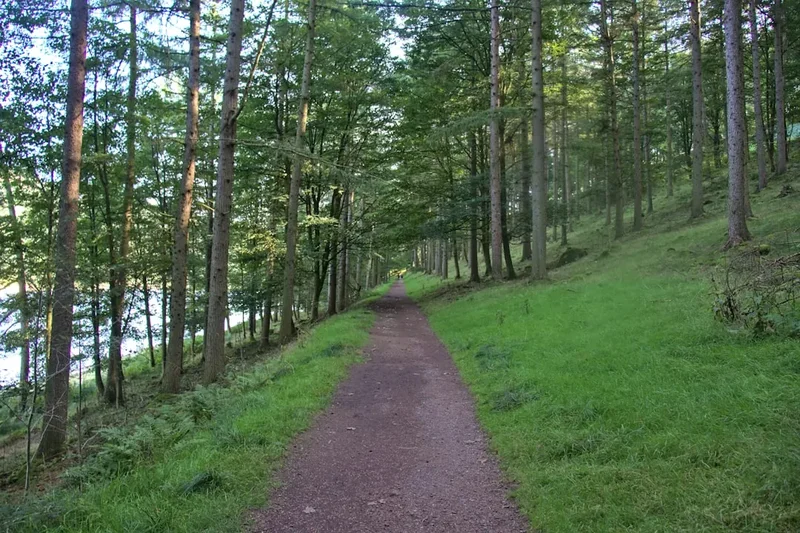
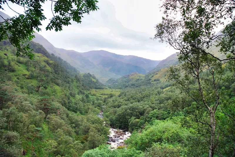
The Black Mountains Traverse is not a single, well-trodden path but rather a route that connects several key points and features within the Black Mountains range. This traverse typically starts at the historic Gospel Pass, a high mountain pass that has been a route for travellers for centuries, and winds its way across the undulating, often exposed, ridgelines. The terrain is varied, ranging from open moorland and heather-clad slopes to rocky outcrops and boggy sections, particularly after wet weather.
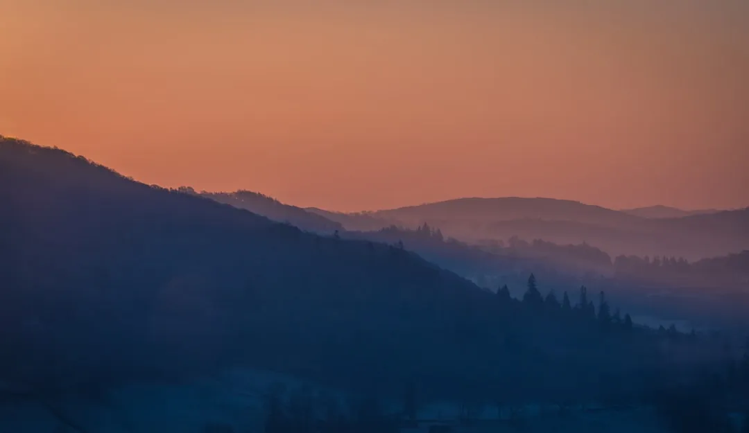
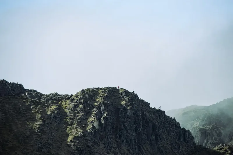
The route demands a good level of fitness and strong navigational skills, as much of the path is unmarked or faint, especially in poor visibility. Hikers will encounter significant ascents and descents, with the total elevation gain of 950 metres spread across the 22 kilometres. The reward for this effort is unparalleled. The views from the Black Mountains are expansive, stretching across the Welsh Marches to the Malvern Hills in England, and on a clear day, even to the Bristol Channel. The sense of solitude and wildness is profound, offering a stark contrast to more popular National Park routes.
Key features of the traverse include the iconic ridge of Twmpa (Lord Hereford's Table), with its distinctive flat summit plateau, and the rugged slopes leading towards Pen y Fan (not to be confused with the higher Pen y Fan in the central Beacons). The route often skirts or crosses the highest points of the Black Mountains, providing constant opportunities for stunning photography and a deep appreciation of the natural landscape. This is a walk for those who relish the challenge of the wild and the satisfaction of navigating their own way through a magnificent mountain environment.
History and Cultural Context
The Black Mountains have a long and rich history, shaped by millennia of human activity. The area has been inhabited since prehistoric times, with evidence of Bronze Age burial mounds and Iron Age hill forts scattered across the landscape. The Gospel Pass itself is believed to have been a route used by medieval pilgrims travelling between the abbeys of Wales and England, and later by drovers moving livestock.
The name "Black Mountains" is thought to derive from the dark, peaty soils that give the hills their characteristic colour, especially in winter. Historically, this region was a frontier zone, with settlements and fortifications reflecting periods of conflict and cooperation between Welsh and English peoples. The landscape bears the scars of ancient land use, from the remnants of medieval strip farming to the more recent impact of sheep grazing, which has shaped the vegetation and the very contours of the hills.
In more recent times, the Black Mountains have become a popular destination for walkers and climbers, drawn by their wild beauty and challenging terrain. The area retains a strong sense of rural tradition, with farming communities still playing a vital role in the life of the region. The Black Mountains Traverse offers a chance to connect with this deep history, walking through landscapes that have been trodden by countless generations before.
Seasonal Highlights and Weather Reality
The Black Mountains Traverse is best undertaken during the warmer, drier months, typically from April to October. During this period, the days are longer, and the weather is generally more favourable for high-level walking.
Spring (April-May): The landscape begins to awaken, with new growth appearing on the moorlands. Wildflowers, such as bluebells and various heathland species, can be seen. The weather can be unpredictable, with a mix of sunshine, rain, and wind. Temperatures are generally cool.
Summer (June-August): This is the most popular time for hiking. The days are at their longest, offering ample daylight for the traverse. The heather may be in bloom, creating swathes of purple across the hillsides. However, summer can also bring thunderstorms, and the exposed ridges of the Black Mountains can be buffeted by strong winds. Sandflies can be present, though less of an issue than in some other regions.
Autumn (September-October): The colours of the landscape change, with the heather turning russet and gold. The air is often crisp and clear, offering excellent visibility. This season can be particularly beautiful, but the weather can become more challenging, with increasing chances of rain and colder temperatures. Days are shorter, requiring careful time management.
Winter (November-March): While technically possible, winter is not recommended for the Black Mountains Traverse for most walkers. Snow and ice can make the ridgelines treacherous, and visibility can be extremely poor. The days are short, and the cold temperatures pose a significant risk of hypothermia. Only experienced winter mountaineers with appropriate gear and navigation skills should consider this route during winter.
Weather Reality: The Black Mountains are notorious for their changeable weather. Even in summer, conditions can shift rapidly from bright sunshine to driving rain and gale-force winds. Hikers must be prepared for all eventualities, regardless of the season. The exposed nature of the ridgelines means that wind chill can make temperatures feel significantly colder than they are.
Recommended Itinerary
The Black Mountains Traverse: A Challenging Day Hike
This traverse is best undertaken as a single, challenging day hike. The route described below is a typical progression, but variations are possible depending on starting point and desired endpoints.
Start: Gospel Pass (Limited Parking)
- Early Morning (Approx. 8:00 AM): Arrive at Gospel Pass. Ensure you have checked the weather forecast and are fully prepared with all necessary gear and supplies. Begin the ascent towards Twmpa (Lord Hereford's Table).
- Morning (Approx. 9:00 AM - 11:00 AM): Ascend Twmpa (812 m). The path can be indistinct in places, requiring careful navigation. Enjoy the expansive views from the summit plateau. Continue along the ridgeline, heading generally south-east.
- Midday (Approx. 12:00 PM - 2:00 PM): Traverse the undulating ridgelines, passing through areas of open moorland. This section requires constant attention to navigation, especially if visibility is reduced. You will likely encounter boggy sections, particularly after rain.
- Afternoon (Approx. 2:00 PM - 4:00 PM): Continue the traverse, aiming towards the higher ground of the Black Mountains. The route may involve descents into cols and subsequent ascents of further peaks. The exact path will depend on your chosen route, but the aim is to cover the most significant ridgeline features.
- Late Afternoon (Approx. 4:00 PM - 6:00 PM): Begin the descent towards your chosen endpoint. A common endpoint is near the village of Capel-y-ffin or further south towards Llanthony. The descent can be steep and rough.
- Evening (Approx. 6:00 PM - 7:00 PM): Arrive at your endpoint. Arrange for transport back to your starting point or accommodation.
Key Waypoints and Considerations:
- Gospel Pass: Starting point, high mountain pass with limited parking.
- Twmpa (Lord Hereford's Table): Prominent summit with a flat plateau, offering excellent views.
- Ridgeline Navigation: The majority of the route follows exposed ridgelines. Navigation is critical, especially in mist or fog. A GPS device or map and compass are essential.
- Terrain: Expect a mix of grassy paths, heather moorland, rocky sections, and potentially boggy ground.
- Water Sources: Reliable water sources can be scarce on the high ridges. Carry sufficient water for the entire duration of your hike.
- Endpoint: Common endpoints include Capel-y-ffin or Llanthony. Ensure you have pre-arranged transport.
Important Notes:
- This is a challenging route requiring excellent fitness and navigation skills.
- Weather can change rapidly; be prepared for all conditions.
- Carry sufficient food and water.
- Inform someone of your route and expected return time.
- Mobile phone signal can be intermittent.
Planning and Bookings
Book Your Trip
Everything you need to plan your journey
Accommodation
Find places to stay near Hay-on-Wye
Flights
Search flights to Hay-on-Wye
Essential Preparation
The Black Mountains Traverse is a demanding undertaking that requires meticulous planning. Given its remote nature and the potential for rapidly changing weather, thorough preparation is paramount. Before setting out, it is crucial to assess your fitness levels. The 950 metres of elevation gain over 22 kilometres, combined with the often rough and uneven terrain, will test your stamina. Ensure you are comfortable with long days of strenuous walking.
Logistics are key. The most common starting point is Gospel Pass, which has limited parking. Alternative starting or ending points may require pre-arranged transport. Consider basing yourself in or near Hay-on-Wye, a charming market town that offers a good range of accommodation, from guesthouses and B&Bs to pubs with rooms. Hay-on-Wye also provides essential services such as outdoor gear shops, supermarkets for supplies, and places to eat and drink. Public transport to the trailhead is extremely limited, so a private vehicle or pre-booked taxi service is highly recommended.
Trail Accommodation
This is a day hike requiring no overnight accommodation.
Required Gear
- Sturdy hiking boots: Waterproof and with good ankle support, well broken-in.
- Waterproof jacket and trousers: Essential for protection against rain and wind. Look for breathable materials.
- Warm layers: Including a fleece or insulated jacket, and a base layer made of merino wool or synthetic material.
- Hat and gloves: Even in summer, temperatures on the exposed ridges can be cold.
- Backpack: A comfortable day pack (25-35 litres) to carry essentials.
- Navigation equipment: A detailed map of the area (e.g., Ordnance Survey Explorer OL13), a compass, and a GPS device or smartphone with offline mapping capabilities. Ensure you know how to use them.
- Head torch: With spare batteries, in case of unexpected delays.
- First-aid kit: Including blister treatment, pain relievers, bandages, and any personal medications.
- Sun protection: Sunscreen, sunglasses, and a sun hat.
What to Bring
- Food: High-energy snacks and a packed lunch. Consider items like energy bars, nuts, dried fruit, sandwiches, and a flask of hot drink.
- Water: Carry at least 2-3 litres of water per person. Reliable water sources on the ridgeline are scarce. A water filter or purification tablets are advisable as a backup.
- Mobile phone: Fully charged, with a power bank if possible.
- Emergency whistle: For signalling in an emergency.
- Trekking poles: Highly recommended for stability on rough terrain and to reduce strain on knees during descents.
- Small trowel and toilet paper: For responsible disposal of human waste if away from designated facilities.
- Rubbish bag: To pack out all litter.
Permits
No specific permits are required to walk the Black Mountains Traverse. The route traverses open access land and public rights of way within the Brecon Beacons National Park. However, it is essential to be aware of and adhere to the National Park's byelaws and guidelines, particularly regarding responsible access and environmental protection.
Access Considerations:
- Gospel Pass Parking: Parking at Gospel Pass is limited and can be busy, especially on weekends and during peak season. Arrive early to secure a space.
- Private Land: While much of the route is open access, be mindful of any private land or farmland you may cross. Always respect boundaries and follow any signage.
- Livestock: You will likely encounter sheep grazing on the hillsides. Keep dogs under close control at all times, and do not disturb the animals.
National Park Guidelines:
- Leave No Trace: Pack out everything you pack in.
- Respect Wildlife: Do not disturb birds' nests or other wildlife.
- Campfires: Open fires are generally discouraged and may be prohibited in certain areas. Check local regulations.
- Respect the Landscape: Stick to paths where they exist to minimise erosion.
Other Activities in the Area
The Black Mountains and the surrounding Brecon Beacons National Park offer a wealth of activities for visitors:
- Walking and Hiking: Numerous other trails exist, from gentle valley walks to challenging mountain ascents. The nearby Pen y Fan and Corn Du offer iconic Beacons scenery.
- Cycling: The area has several designated cycle routes, including challenging off-road trails and scenic road routes.
- Horse Riding: Several stables offer guided rides through the hills and valleys.
- Caving: The Brecon Beacons are known for their limestone cave systems, with guided caving expeditions available for the adventurous.
- Water Sports: Activities such as kayaking, canoeing, and paddleboarding are available on nearby reservoirs like Llangorse Lake.
- Visiting Hay-on-Wye: Explore the famous "Town of Books," browse its independent bookshops, and enjoy its independent cafés and galleries.
- Exploring Llanthony Priory: Discover the atmospheric ruins of this medieval priory, located in a picturesque valley below the Black Mountains.
- Stargazing: The Brecon Beacons are an International Dark Sky Reserve, offering exceptional opportunities for stargazing on clear nights.
Safety and Conditions
Weather: The most significant safety concern on the Black Mountains Traverse is the unpredictable weather. Conditions can change rapidly, with fog, heavy rain, and strong winds posing serious risks. Always check the mountain weather forecast before you set out and be prepared to turn back if conditions deteriorate.
Navigation: The route is often unmarked, particularly on the higher ridges. A good map, compass, and the ability to use them are essential. GPS devices or smartphone apps can be valuable aids, but should not be relied upon solely. Poor visibility can make navigation extremely difficult.
Terrain: The ground can be uneven, rocky, and boggy. Sturdy footwear is crucial to prevent ankle injuries. Be aware of potential hazards such as steep drops, loose scree, and hidden watercourses.
Remoteness: Much of the traverse takes place in remote areas with limited mobile phone signal. It is vital to inform someone of your planned route and estimated return time. Consider carrying a personal locator beacon (PLB) for emergencies.
Fitness: This is a strenuous hike. Ensure you are physically fit enough to complete the distance and elevation gain. Pace yourself and take regular breaks.
Water: Carry sufficient water, as reliable sources can be scarce on the high ground. Treat any water from natural sources before drinking.
Livestock: If you encounter sheep or other livestock, keep a safe distance and do not disturb them. If you have a dog, keep it under strict control.
Emergency Procedures: In case of an emergency, dial 999 or 112 and ask for the Police, then Mountain Rescue. Provide your location as accurately as possible.
Side Trips and Points of Interest
Twmpa (Lord Hereford's Table): This prominent summit, with its distinctive flat, table-like plateau, is a highlight of the traverse. The views from the summit are exceptional, offering a panoramic vista of the surrounding Black Mountains and the Welsh Marches. It's an ideal spot for a break and photography.
Gospel Pass: The traditional starting point for many Black Mountains routes, Gospel Pass is a historic mountain pass with a rich past. It offers a sense of entering a wilder, more remote landscape.
Llanthony Priory: While not directly on the main ridgeline traverse, the atmospheric ruins of Llanthony Priory are located in the valley below the Black Mountains and can be a worthwhile detour or endpoint for some routes. The priory is a beautiful example of medieval architecture set in a tranquil valley.
Capel-y-ffin: A small hamlet that can serve as an endpoint or access point. It is located in a scenic valley and offers a glimpse into the rural life of the region.
Moorland Flora and Fauna: Keep an eye out for the diverse plant life of the moorlands, including various heathers, grasses, and wildflowers. Birdlife is also abundant, with opportunities to spot curlews, skylarks, and perhaps even birds of prey.
Leave No Trace
The Black Mountains are a precious natural environment, and it is the responsibility of every visitor to help preserve them. Adhering to Leave No Trace principles ensures that the landscape remains beautiful and healthy for future generations.
- Plan Ahead and Prepare: Understand the route, weather conditions, and any potential hazards. Pack appropriately and know your limits.
- Travel and Camp on Durable Surfaces: Stick to established paths and tracks where possible to minimise erosion. Avoid trampling vegetation, especially in sensitive areas like peat bogs.
- Dispose of Waste Properly: Pack out everything you pack in, including all litter, food scraps, and toilet paper. Use designated toilets where available, or dig a cathole at least 60 metres away from water sources, trails, and campsites.
- Leave What You Find: Do not remove natural objects such as rocks, plants, or flowers.
- Minimise Campfire Impacts: Campfires are generally discouraged on the Black Mountains due to the risk of wildfire and damage to the fragile moorland. If permitted and necessary, use a stove instead.
- Respect Wildlife: Observe wildlife from a distance and do not feed animals.
- Be Considerate of Other Visitors: Keep noise levels down and yield to other walkers on narrow paths.
By following these principles, you contribute to the conservation of the Black Mountains and ensure a positive experience for yourself and others.