Bibbulmun Track - Western Australia's Premier Thru-Hike
The Bibbulmun Track is one of the world's great long-distance walking trails, stretching 1,003 kilometres through the heart of Western Australia's South West. Linking the Perth hills at Kalamunda with the historic coastal town of Albany, the track traverses a diverse array of landscapes, from the ancient jarrah and marri forests of the Darling Range to the towering karri and tingle forests of the deep south, before concluding along the dramatic, windswept cliffs of the Southern Ocean. Marked by the iconic yellow "Waugal" (the Rainbow Serpent of Noongar Dreaming), the trail offers a profound immersion into the unique biodiversity of a global biodiversity hotspot. Whether tackled as a continuous "end-to-end" journey over six to eight weeks or enjoyed in shorter sectional bites, the Bibbulmun Track represents the pinnacle of Australian bushwalking, providing a sense of isolation and connection to country that is increasingly rare in the modern world.
- Distance: 1,003.0 km one-way
- Duration: 6–8 weeks (full thru-hike) or 1–10 days (sectional)
- Season: April to November (avoiding the extreme heat and fire risk of summer)
- Campsites: 49 purpose-built campsites with three-sided shelters
- Elevation Gain: Approximately 25,000 m (cumulative)
- Difficulty: Challenging (due to length and remote sections)
- Direction: Can be walked in either direction (North to South is most common)
Overview
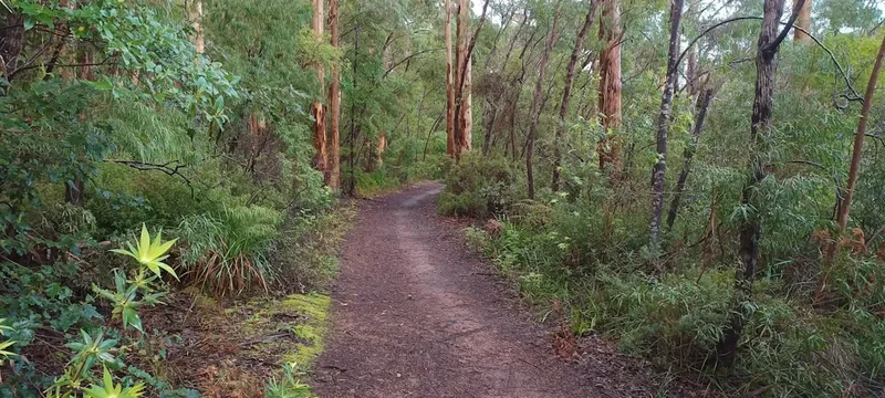
The Bibbulmun Track is a journey of transition. It begins in the dry, gravelly soils of the Darling Scarp, where the vegetation is dominated by jarrah (Eucalyptus marginata) and marri (Corymbia calophylla) trees. Here, the trail winds through granite outcrops and over rolling hills, offering views back toward the Perth coastal plain. As the track moves south, the rainfall increases and the landscape softens. The dry sclerophyll forest gives way to the magnificent karri (Eucalyptus diversicolor) forests—the third tallest hardwood trees in the world. Walking through these cathedral-like groves, where trees reach heights of over 80 metres, is a transformative experience, particularly in the misty mornings of late autumn.
Further south still, the track enters the realm of the giants: the red, yellow, and Rate's tingle trees. These ancient eucalypts, found only in a small pocket around Walpole, are famous for their massive, hollowed-out bases. Finally, the track breaks out onto the coast. The last 200 kilometres are a spectacular display of coastal heathlands, turquoise bays, and rugged granite headlands. The Southern Ocean provides a constant, roaring soundtrack as walkers navigate the final sections toward the southern terminus in Albany.
The track is designed to be accessible yet challenging. It passes through nine "track towns"—Mundaring Weir, Dwellingup, Collie, Balingup, Donnelly River Village, Pemberton, Northcliffe, Walpole, and Denmark—which serve as vital resupply points. Between these towns, walkers are self-sufficient, staying at dedicated campsites spaced roughly a day's walk apart (15–25 km). Each campsite features a timber or stone three-sided shelter, a rainwater tank, a pit toilet, and tent sites. This infrastructure makes the Bibbulmun Track an ideal introduction to multi-day hiking, while its sheer length ensures it remains a formidable challenge for even the most experienced trekkers.
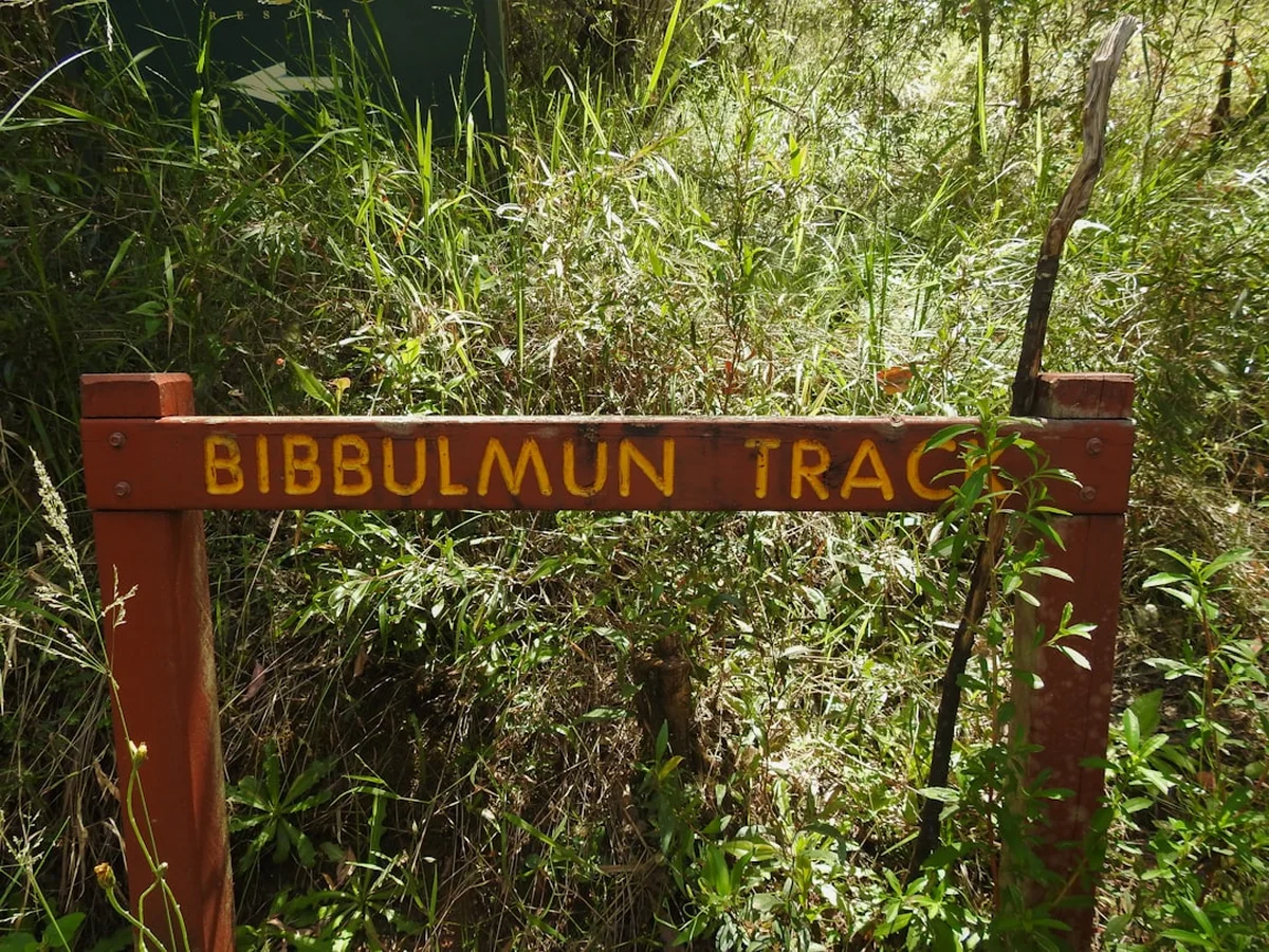
The experience of the Bibbulmun is defined by the "Waugal" markers. Following these yellow signs becomes a meditative practice, a constant reassurance that you are on the right path through the vast Western Australian bush. The trail is not just a physical challenge; it is a cultural journey through Noongar Boodja (Noongar Country), where the land's history is etched into every rock and tree.
History and Cultural Context
The Bibbulmun Track takes its name from the Bibbulmun people, a linguistic group of the Noongar Aboriginal people who traditionally inhabited the south-west of Western Australia. The Noongar people have a deep, spiritual connection to this land that spans tens of thousands of years. The track's symbol, the Waugal, represents the Rainbow Serpent, a powerful creator being in Noongar Dreaming responsible for creating the rivers, lakes, and landforms of the South West. Walking the track is, in many ways, following the path of the Waugal through its creation.
The modern history of the track began in the early 1970s. It was originally conceived by Geoff Schafer, who proposed a long-distance walking trail inspired by the Appalachian Trail in the United States. The first iteration of the track was opened in 1979 as part of Western Australia's 150th-anniversary celebrations. However, this original route relied heavily on existing forestry roads and lacked the dedicated wilderness feel of the current trail.
In the mid-1990s, a major realignment and upgrade project was undertaken, led by the Department of Conservation and Land Management (now DBCA) and the Bibbulmun Track Foundation. This project moved the track off roads and into the bush, constructed the iconic three-sided shelters, and extended the southern end from Northcliffe all the way to Albany. The "new" Bibbulmun Track was officially opened in 1998. Since then, it has become a world-class destination, maintained by a dedicated army of volunteers who "adopt" sections of the track to ensure the path remains clear and the shelters are well-kept. This community-led stewardship is a hallmark of the Bibbulmun experience.
Want more background? Read extended notes on history and cultural context → Learn more
Seasonal Highlights and Weather Reality
Timing is everything on the Bibbulmun Track. Unlike many alpine trails, the primary constraint here is not snow, but heat and fire. The South West of Australia experiences a Mediterranean climate, with hot, dry summers and cool, wet winters.
Autumn (April to May): This is arguably the best time to start a North-to-South thru-hike. The extreme heat of summer has faded, the first rains begin to settle the dust and dampen the forest floor, and the nights become crisp. The "break of the season" brings a fresh scent to the jarrah forest, and the deciduous trees in the southern towns begin to turn gold.
Winter (June to August): Winter is the wettest season, particularly in the southern sections. While the rain can be persistent, it brings the forest to life. Mosses and lichens glow emerald green, and the waterfalls are at their most spectacular. Walking in winter requires excellent waterproof gear, as temperatures can drop to near zero Celsius in the inland sections like Collie and Balingup. However, the lack of crowds and the lushness of the bush make it a favourite for many.
Spring (September to November): Spring is the most visually stunning time on the track. The South West is world-renowned for its wildflowers, and the Bibbulmun Track provides a front-row seat to this floral explosion. From the delicate orchids of the Darling Range to the vibrant banksias and wattles of the south coast, the colours are extraordinary. This is also the best time for birdwatching, as honeyeaters and cockatoos are highly active.
Summer (December to March): Walking the track in summer is strongly discouraged and can be life-threatening. Temperatures frequently exceed 35°C, and the risk of bushfires is extreme. Many water tanks may run dry, and the physical toll of walking in high heat with a heavy pack is immense. Most experienced walkers avoid the track entirely during these months.
Recommended Itinerary
The 10 Sections of the Bibbulmun Track
Section 1: Kalamunda to Mundaring Weir
- Distance: 21.5 km
- Elevation: Significant climbs out of Kalamunda and into the Helena Valley
- Time: 1–2 days
- Key Waypoints: Piesse Brook, Rocky Pool, Mundaring Weir Hotel
- Highlights: The "Northern Terminus" start, views of the Mundaring Weir dam wall, and the first taste of the Darling Scarp's granite-strewn jarrah forest.
Section 2: Mundaring Weir to Dwellingup
- Distance: 160 km
- Elevation: Rolling hills with several steep ascents (Mt Cooke, Mt Dale)
- Time: 7–9 days
- Key Waypoints: Mt Dale, Mt Cooke (highest point on the track), Goolamrup, North Bannister
- Highlights: Climbing Mt Cooke (582 m) for panoramic views, walking through the Monadnocks Conservation Park, and the transition into deeper jarrah forest.
Section 3: Dwellingup to Collie
- Distance: 125 km
- Elevation: Moderate, following the Murray River valley
- Time: 5–7 days
- Key Waypoints: Murray River, Long Gully Bridge (historic site), Harris Dam
- Highlights: Walking alongside the beautiful Murray River, crossing the site of the old Long Gully Bridge, and the approach into the coal-mining town of Collie.
Section 4: Collie to Balingup
- Distance: 82 km
- Elevation: Moderate, through undulating forest and plantation land
- Time: 3–4 days
- Key Waypoints: Wellington Dam, Mumballup, Grimwade
- Highlights: The massive mural on the Wellington Dam wall, the quirky "Mumby" Pub, and the descent into the picturesque town of Balingup.
Section 5: Balingup to Donnelly River Village
- Distance: 58 km
- Elevation: Steep, short climbs through the Blackwood Valley
- Time: 2–3 days
- Key Waypoints: Blackwood River, Southampton, Gregory Brook
- Highlights: The rolling hills of the Blackwood Valley, the transition from jarrah to the first karri trees, and arriving at the historic timber mill village of Donnelly River.
Section 6: Donnelly River Village to Pemberton
- Distance: 102 km
- Elevation: Moderate, through dense forest
- Time: 5–6 days
- Key Waypoints: Donnelly River, Karri Gully, Big Brook Dam
- Highlights: Walking through some of the most pristine karri forest on the track, the abundance of tame kangaroos and emus at Donnelly River, and the Gloucester Tree near Pemberton.
Section 7: Pemberton to Northcliffe
- Distance: 55 km
- Elevation: Relatively flat, following river systems
- Time: 2–3 days
- Key Waypoints: Warren River, Schafer Campsite (named after the track's founder)
- Highlights: The Warren River valley, swimming at Schafer Campsite, and the lush, fern-filled understory of the karri forest.
Section 8: Northcliffe to Walpole
- Distance: 132 km
- Elevation: Flat but challenging due to soft sand and potential flooding
- Time: 6–8 days
- Key Waypoints: Purnululu-style heathlands, Gardner River, Mt Chance, Tingle Forest
- Highlights: The remote "Purnululu" heathlands, the first sight of the Southern Ocean from Mt Chance, and entering the ancient Tingle forest near Walpole.
Section 9: Walpole to Denmark
- Distance: 125 km
- Elevation: Coastal cliffs and beach walking
- Time: 6–7 days
- Key Waypoints: Conspicuous Cliffs, Peaceful Bay, William Bay (Greens Pool)
- Highlights: The dramatic Conspicuous Cliffs, walking along the white sands of Peaceful Bay, and the stunning turquoise waters of Greens Pool and Elephant Rocks.
Section 10: Denmark to Albany
- Distance: 85 km
- Elevation: Coastal hills and final harbour approach
- Time: 4–5 days
- Key Waypoints: Nullaki Peninsula, West Cape Howe, Albany Wind Farm
- Highlights: The Nullaki Peninsula, the rugged cliffs of West Cape Howe (the southernmost point of the track), and the final walk into Albany overlooking Princess Royal Harbour.
Planning and Bookings
Book Your Trip
Everything you need to plan your journey
Accommodation
Find places to stay near Perth
Flights
Search flights to Perth
Essential Preparation
A thru-hike of the Bibbulmun Track requires significant logistical planning. Unlike many European trails, you cannot simply turn up and find a hotel every night. You must be prepared for multi-day stretches of self-sufficiency. Fitness is paramount; while the track is not technically difficult (no rock climbing or extreme altitudes), the cumulative effect of walking 20 kilometres a day with a 15–20 kg pack is significant. Training should involve long walks with a weighted pack in the months leading up to your start date.
Logistically, you need to decide on your resupply strategy. Most walkers use a combination of purchasing food in the nine track towns and sending "bounce boxes" (resupply parcels) to post offices or accommodation providers in those towns. The Bibbulmun Track Foundation provides excellent resources for planning these drops. You should also join the Foundation; their "Planning Diary" and maps are the gold standard for the trail.
Trail Accommodation
The primary accommodation on the track is the network of 49 campsites. These are spaced between 12 km and 25 km apart. Each campsite is free to use and operates on a first-come, first-served basis. There is no booking system for individual walkers.
Campsite Facilities:
- Three-sided timber or stone shelter (usually sleeps 8–15 people on wooden platforms)
- Rainwater tank (fed from the shelter roof; must be treated)
- Pit toilet (toilet paper is NOT provided)
- Picnic tables and benches
- Cleared tent sites for those who prefer privacy or if the shelter is full
- Fire pit (only usable outside of restricted fire seasons; many campsites are now "no fire" year-round)
Town Accommodation: In the track towns, you will find a range of options from caravan parks and YHA hostels to motels and luxury B&Bs. It is highly recommended to book town accommodation in advance, especially during the peak spring season, as these towns are popular tourist destinations.
Required Gear
- Footwear: High-quality hiking boots or trail runners. The terrain varies from soft sand to sharp granite and pea gravel (which is notoriously slippery). Ensure they are well broken-in.
- Backpack: A 50–70L pack with a high-quality harness system. A pack cover or internal dry bags are essential for winter rains.
- Navigation: The official Bibbulmun Track maps (1-8) are essential. While the track is well-marked, maps are vital for identifying water sources, terrain, and emergency exit points. A GPS or smartphone with offline maps (e.g., FarOut) is a great supplement.
- Emergency Communication: A Personal Locator Beacon (PLB) is non-negotiable. Large sections of the track have zero mobile phone coverage.
- Snake Bandage: A compression bandage specifically for snake bites (and the knowledge of how to use it).
- Sleep System: A 3-season sleeping bag (comfort rating to 0°C) and a sleeping mat (even if staying in shelters, the wooden platforms are hard).
What to Bring
- Water Treatment: Rainwater tanks can contain bacteria or debris. Use a filter (like a Sawyer Squeeze), UV purifier, or chemical tablets.
- Stove and Fuel: Lightweight gas or liquid fuel stove. Open fires are often banned, and many campsites do not have fire pits.
- Food: Lightweight, high-calorie dehydrated meals. Aim for 700g–1kg of food per day. Don't forget electrolytes for hot days.
- Clothing: The layering system is key. Moisture-wicking base layers, a warm fleece or down jacket for evenings, and a high-quality waterproof shell.
- Hygiene: Trowel (for emergency use between campsites), biodegradable soap, hand sanitiser, and a small first-aid kit.
- Sun Protection: SPF 50+ sunscreen, a broad-brimmed hat, and sunglasses. The Australian sun is exceptionally harsh.
- Insect Repellent: Essential for march flies in the forest and mosquitoes near the coast.
Permits

One of the greatest aspects of the Bibbulmun Track is that it is free to walk. There are no permit fees for individuals or small groups (under 8 people) to use the track or stay at the campsites. This makes it one of the most accessible long-distance trails in the world.
Registration: While no permit is required, all walkers are strongly encouraged to register their journey. There are "Green Books" (trail registers) at every campsite and in the visitor centres of track towns. Filling these in is vital for search and rescue operations and helps the Foundation gather statistics to secure funding for track maintenance. If you are planning a full thru-hike (End-to-End), you should register your intent with the Bibbulmun Track Foundation in Perth before you start.
Group Bookings: If you are part of an organised group of 8 or more people, you MUST notify the Department of Biodiversity, Conservation and Attractions (DBCA) and the Bibbulmun Track Foundation. Large groups can overwhelm the small campsites, so there is a notification system to ensure groups are spread out and do not clash with each other or with individual walkers.
Vehicle Access: If you are being dropped off or picked up at various points, be aware that some access roads require a National Park Entry Pass if they fall within a designated National Park (like Gloucester National Park or William Bay). These can be purchased online or at visitor centres.
Other Activities in the Area
The South West of Western Australia is a world-class tourism destination. If you have extra time before or after your hike, consider these activities:
- Wine Tasting: The track passes through or near several premium wine regions, including the Perth Hills, Geographe, and Denmark. The Margaret River region is also a short drive from the Balingup/Pemberton sections.
- The Valley of the Giants Tree Top Walk: Located near Walpole, this spectacular walkway takes you 40 metres up into the canopy of the ancient tingle forest.
- Climbing the Fire Trees: Near Pemberton, you can climb the Gloucester Tree or the Dave Evans Bicentennial Tree. These were once used as fire lookouts and offer terrifyingly beautiful views from the top.
- Whale Watching: If you are in Albany or Denmark between June and October, the coastal sections offer incredible opportunities to see Humpback and Southern Right whales migrating.
- Surfing and Swimming: The beaches near Denmark and Albany, such as Ocean Beach and Middleton Beach, are iconic. Greens Pool is a must-visit for a calm, turquoise swim.
- Munda Biddi Trail: For those who prefer two wheels, the Munda Biddi is a world-class long-distance mountain bike trail that runs roughly parallel to the Bibbulmun Track.
Safety and Conditions
Bushfires: This is the single greatest danger on the Bibbulmun Track. During the summer months and shoulder seasons, fire risk can be extreme. Always check the "Parks and Wildlife Service" alerts and the "Emergency WA" website for active fires. If a "Total Fire Ban" is declared, you cannot use any naked flame, including camping stoves. If you see smoke, move toward the nearest town or road access point immediately.
Snakes: Western Australia is home to several venomous snake species, most notably the Dugite and the Tiger Snake. They are common on the track, especially in spring and summer. Snakes are generally shy and will move away if they hear you coming. Wear gaiters, watch where you step, and always carry a compression bandage. Never attempt to kill or handle a snake.
Water Scarcity: While the campsites have tanks, they rely on rainfall. In dry years, tanks can run low or empty. Always carry at least 3–4 litres of water capacity, and check the Bibbulmun Track Foundation's "Latest Track Conditions" online for reports of dry tanks.
Dieback (Phytophthora cinnamomi): This is a deadly plant pathogen that kills many of the native species in the South West. It is spread through infected soil on boots and tyres. You will encounter "boot cleaning stations" on the track. Use them religiously. Scrape all mud off your boots and spray them with the provided disinfectant to help save the forest.
Pea Gravel: The northern sections of the track are covered in small, round ironstone stones known as "pea gravel." It acts like ball bearings underfoot, making descents particularly treacherous. Take your time and consider using trekking poles for stability.
Side Trips and Points of Interest
Mt Cooke Summit: At 582 metres, Mt Cooke is the highest point on the entire 1,003 km track. The trail goes over the shoulder, but a short, marked side trip takes you to the actual summit. On a clear day, you can see the skyscrapers of Perth to the north-west and the vast expanse of the Darling Range forest in every other direction.
The Gloucester Tree: Located just outside Pemberton, the track passes right by this 53-metre tall karri tree. It was rigged with metal pegs in 1947 to serve as a fire lookout. While it is no longer used for fire spotting, it remains open for the public to climb. It is a heart-pounding side activity for those not afraid of heights.
Conspicuous Cliffs: In the Walpole to Denmark section, the track winds along the top of these massive limestone and granite cliffs. There is a dedicated lookout that offers some of the best coastal views in Australia. It is a prime spot for whale watching during the migration season.
The Giant Tingle Tree: Near Walpole, a short detour leads to a massive, hollowed-out Red Tingle tree. You can walk right inside the base of the tree, which has been hollowed out by fire over centuries but remains alive and towering above. It is a testament to the resilience of these ancient giants.
Leave No Trace

The Bibbulmun Track passes through some of the most biodiverse and fragile ecosystems on Earth. Maintaining the integrity of this wilderness requires every walker to adhere strictly to Leave No Trace principles.
Key Responsibilities:
- Plan Ahead and Prepare: Know the fire regulations and water availability.
- Travel and Camp on Durable Surfaces: Stay on the marked Waugal trail. Do not create new paths or "shortcuts" which cause erosion. Use the provided tent sites or shelters.
- Dispose of Waste Properly: Pack out EVERYTHING you pack in. This includes organic waste like apple cores and orange peels, which do not belong in this ecosystem and can harm native wildlife. Use the pit toilets at campsites; if you must go between camps, bury waste 20cm deep and at least 100m from water.
- Leave What You Find: Do not pick wildflowers or remove rocks or cultural artefacts.
- Minimise Campfire Impacts: Use a fuel stove. Only use fire pits where permitted and keep fires small. Never leave a fire unattended.
- Respect Wildlife: Do not feed the animals. Feeding kangaroos or birds disrupts their natural diet and makes them aggressive toward future walkers.
- Be Considerate of Others: Keep noise levels down in the shelters. The Bibbulmun is a place for quiet reflection.