Bealey Spur Track
The Bealey Spur Track is a rewarding day walk located in the heart of Arthur's Pass National Park, offering spectacular alpine scenery and a taste of the high country without the commitment of an overnight trek. This track ascends steadily through diverse vegetation zones, from tussock grasslands to subalpine shrubland, culminating in panoramic views of the surrounding peaks and valleys. It's a popular choice for those seeking a challenging yet accessible hike with significant elevation gain in a relatively short distance.
- Distance: 6.0 km one-way
- Elevation gain: 550 m
- Duration: 3-4 hours return
- Difficulty: Moderate
- Season: All year round, but best in summer and autumn
- Closest City: Arthur's Pass
- Trailhead Access: Nearest airport: Christchurch. Drive west on SH73 for ~2 hours. Trailhead is signposted off SH73, ~10km east of Arthur's Pass village. Parking available. No permits usually needed. Road is generally sealed, check conditions in winter. GPS: -43.0333, 171.6000
- Coordinates: -43.0333, 171.6000
Overview
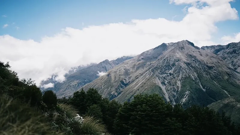
The Bealey Spur Track is a classic day hike that provides a substantial challenge and immense scenic reward. Starting from a well-marked trailhead just off State Highway 73, the track immediately begins its ascent. The initial section winds through open tussock slopes, offering expansive views back towards the highway and the dramatic peaks of the Southern Alps. As you climb, the vegetation transitions, with hardy alpine shrubs and grasses becoming more prevalent. The path is well-maintained but can be steep in places, requiring a good level of fitness.
The higher you climb, the more dramatic the vistas become. You'll gain perspective over the Bealey River valley and the surrounding mountain ranges, including views towards Mount Rolleston. The track continues to ascend, often following the contours of the spur, with occasional rocky outcrops and scree slopes. The summit area, while not a distinct peak, offers a broad plateau-like section where you can truly appreciate the alpine environment. This is an excellent spot for a picnic lunch, provided you've packed appropriately for the changeable mountain weather.
The descent follows the same path, offering a different perspective on the landscape you've just conquered. While the climb is demanding, the relatively short distance means it's achievable for most reasonably fit hikers within a half-day. The track is exposed in many sections, so be prepared for wind and sun, and always check the weather forecast before you set off. The Bealey Spur Track is a fantastic introduction to the alpine environment of Arthur's Pass National Park.
History and Cultural Context
The Bealey Spur Track, like much of the Arthur's Pass region, has a history intertwined with early exploration and the development of transport routes through the Southern Alps. The area was historically traversed by Māori, who used routes through the mountains for seasonal journeys and access to resources. The Bealey River itself is named after Samuel Bealey, a Canterbury politician and pastoralist who explored the region in the mid-19th century.
The construction of the road and later the railway through Arthur's Pass in the late 19th and early 20th centuries opened up the region to more widespread exploration and tourism. The Bealey Spur would have been a natural feature for early surveyors and adventurers to investigate, offering a vantage point over the developing infrastructure and the vast wilderness beyond. The track's development into a formal walking track likely occurred as part of the broader efforts to establish and maintain hiking routes within the newly formed national park system.
Today, Arthur's Pass National Park is a protected area managed by the Department of Conservation (DOC), preserving the natural and cultural heritage of the region. The Bealey Spur Track stands as a testament to the enduring appeal of the high country, offering a accessible yet challenging experience that connects modern hikers with the spirit of exploration that characterised the area's past.
Seasonal Highlights and Weather Reality
The Bealey Spur Track is accessible year-round, but each season offers a distinct experience and requires different preparations.
Summer (December to February): This is generally the most popular time to hike the Bealey Spur. Days are longer, and the weather is typically warmer, though still highly unpredictable. Wildflowers can be abundant in the tussock and alpine meadows. Sandflies can be present, especially in sheltered, damp areas, so insect repellent is advisable. The higher sections of the track may still hold patches of snow in early summer.
Autumn (March to May): Autumn offers crisp, clear days and stunning golden hues in the tussock grasslands. The air is often still, and the risk of sandflies is significantly reduced. This season provides excellent visibility for the panoramic views. However, temperatures can drop considerably, especially at higher elevations, and early snowfalls are possible from April onwards.
Winter (June to August): Winter hiking on the Bealey Spur is for experienced individuals with appropriate winter mountaineering skills and equipment. Snow and ice can make the track treacherous, and avalanche risk is a serious consideration. The upper sections of the track may be completely obscured by snow. Access to the trailhead can also be affected by snow on the highway. If attempting in winter, always check avalanche forecasts and track conditions with DOC.
Spring (September to November): Spring brings a mix of conditions. While snowmelt can make some sections muddy and boggy, the landscape begins to reawaken. Wildflowers start to appear, and the days gradually lengthen. However, spring weather is notoriously changeable, with the potential for late snowfalls, strong winds, and rain. It's a transitional period where careful planning and flexibility are key.
Weather Reality: Arthur's Pass is renowned for its rapidly changing weather. Even on a clear summer day, conditions can deteriorate quickly. Be prepared for wind, rain, and a significant drop in temperature, especially at higher elevations. Always check the MetService mountain forecast before you go.
Recommended Itinerary
Bealey Spur Track - Day Walk Itinerary
Early Morning: Arrival and Preparation
- Drive to Arthur's Pass National Park via SH73.
- Locate the Bealey Spur Track trailhead, approximately 10 km east of Arthur's Pass village.
- Park your vehicle in the designated parking area.
- Final gear check: ensure you have water, snacks, appropriate clothing layers, and rain protection.
- Consult any available track information boards at the trailhead.
Morning: Ascent to the Spur
- Begin the hike from the trailhead.
- The track immediately starts climbing, initially through open tussock country.
- Enjoy expansive views of the Bealey River valley and surrounding mountains.
- The gradient is steady but can be steep in sections.
- Distance covered: Approximately 2.0 km.
- Time taken: 1–1.5 hours.
Midday: Reaching the Alpine Zone
- Continue ascending, with vegetation changing to hardy alpine shrubs and grasses.
- The views become increasingly panoramic as you gain elevation.
- You will likely encounter more exposed sections, so be mindful of wind.
- Reach the broader, more open spur area.
- Distance covered: Approximately 3.0 km from the start.
- Time taken: 1.5–2 hours from the start.
Afternoon: Summit Views and Descent
- Explore the upper reaches of the spur. This area offers excellent vantage points for photography and a chance to rest.
- Enjoy your packed lunch with spectacular 360-degree views of the Southern Alps.
- Begin your descent, retracing your steps back down the track.
- Be cautious on the descent, especially on steeper or potentially slippery sections.
- Distance covered: 6.0 km (total return).
- Time taken: 3-4 hours return (including stops).
Late Afternoon: Return to Trailhead
- Arrive back at the trailhead parking area.
- Ensure you have collected all your belongings and left the area tidy.
- Continue your journey or return to Arthur's Pass village.
Important Notes:
- This is a day hike; no overnight accommodation is available or required.
- Weather can change rapidly; always be prepared for all conditions.
- Carry sufficient water and food, as there are no facilities on the track.
- Wear sturdy, broken-in hiking boots.
- Inform someone of your hiking plans and expected return time.
Planning and Bookings
Book Your Trip
Everything you need to plan your journey
Accommodation
Find places to stay near Arthur's Pass
Flights
Search flights to Arthur's Pass
Essential Preparation
The Bealey Spur Track is a day walk, meaning overnight accommodation is not a factor. However, thorough preparation is still crucial for a safe and enjoyable experience. The closest major town and logistical hub is Arthur's Pass village, which offers basic amenities, including a visitor centre, a few accommodation options (motels, holiday parks), and a general store. Christchurch is the nearest major city, approximately a 2-hour drive away, and is the primary gateway for most visitors flying into the region.
Before heading out, it's essential to check the weather forecast specifically for Arthur's Pass National Park. Mountain weather can be volatile, and conditions can change dramatically within hours. Ensure you have adequate clothing layers, including waterproof and windproof outer shells, as well as sun protection. Inform someone of your hiking plans, including your intended route and expected return time. While the track is generally well-marked, carrying a map and compass or a GPS device is always recommended, especially if you plan to explore beyond the main spur.
Trail Accommodation
This is a day hike requiring no overnight accommodation.
Required Gear
- Sturdy hiking boots: Waterproof and well broken-in, with good ankle support.
- Backpack: A comfortable day pack (20-30 litres) to carry essentials.
- Waterproof jacket: Essential for protection against rain and wind.
- Waterproof overtrousers: Recommended, especially during cooler months or if rain is forecast.
- Warm layers: Fleece or wool mid-layers, thermal base layers. Avoid cotton.
- Hat: A warm beanie for cold weather and a sun hat for protection.
- Gloves: Lightweight gloves for cooler conditions.
- Navigation: Map of Arthur's Pass National Park, compass, or GPS device with downloaded map.
- First aid kit: Including blister treatment, pain relief, and any personal medications.
- Head torch: With spare batteries, in case of unexpected delays.
- Sun protection: Sunscreen (SPF 30+), sunglasses.
What to Bring
- Water: At least 1.5-2 litres per person. There are no water sources on the track that are guaranteed safe to drink without treatment.
- Food: High-energy snacks (nuts, dried fruit, energy bars) and a packed lunch.
- Insect repellent: Especially important during warmer months to ward off sandflies.
- Toilet paper and a small trowel: For emergencies, and to pack out all waste.
- Hand sanitiser: For hygiene.
- Camera: To capture the stunning scenery.
- Trekking poles: Optional, but can be helpful for stability on steep ascents and descents.
Permits
No permits are typically required for day walks on the Bealey Spur Track. Arthur's Pass National Park is managed by the Department of Conservation (DOC), and most day hiking routes are open to the public without the need for booking or fees. However, it is always advisable to check the official DOC website for any temporary track closures or alerts that may be in effect due to weather, maintenance, or other safety concerns.
While no specific permits are needed for this track, it is part of a national park, and visitors are expected to adhere to the general park rules and guidelines. These include staying on marked tracks, not feeding wildlife, and packing out all rubbish.
For any longer or more remote hikes within Arthur's Pass National Park, or for overnight stays in backcountry huts, permits and booking systems may apply. Always consult the DOC website for the most up-to-date information regarding specific requirements for any trail you plan to hike.
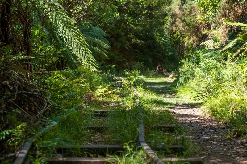
Other Activities in the Area
Arthur's Pass National Park offers a wealth of activities for visitors, catering to a range of interests and fitness levels:
- Arthur's Pass Village: Explore the small alpine village, visit the Arthur's Pass Visitor Centre for local information and displays on the park's natural and human history, and enjoy a meal or coffee at one of the local establishments.
- Devil's Punchbowl Falls: A short, well-maintained walk from Arthur's Pass village leads to the impressive Devil's Punchbowl Falls, a powerful cascade dropping over 130 metres.
- Avalanche Peak Track: For experienced hikers seeking a significant challenge, the Avalanche Peak Track offers steep ascents and incredible alpine views, though it is a much more demanding day hike than Bealey Spur.
- Otira Viaduct Lookout: A scenic viewpoint offering impressive views of the Otira Viaduct, a remarkable feat of engineering spanning a deep gorge.
- Castle Hill (Kura Tāwhiti): Located a short drive east of Arthur's Pass, this area is famous for its unique limestone rock formations, popular with climbers and photographers.
- Biking: Sections of the old highway and some designated tracks may be suitable for mountain biking, though always check local regulations and track conditions.
- Wildlife Spotting: Keep an eye out for native birds such as the kea (alpine parrot), tūī, bellbird, and fantail.
- Scenic Drives: The drive through Arthur's Pass National Park on SH73 itself is incredibly scenic, with numerous pull-offs and viewpoints to appreciate the dramatic mountain landscapes.
Safety and Conditions
Weather: The most significant safety consideration for the Bealey Spur Track is the unpredictable mountain weather. Conditions can change rapidly, with strong winds, heavy rain, fog, and even snow possible at any time of year. Always check the MetService mountain forecast for Arthur's Pass before you depart and be prepared to turn back if conditions deteriorate.
Terrain: The track is well-formed but steep in places. Loose scree and rocky sections can be present, especially higher up. Wear sturdy, ankle-supporting hiking boots and use trekking poles if you find them helpful for stability.
Exposure: The Bealey Spur is largely exposed to the elements. There is limited shelter once you are on the spur itself. Be prepared for sun exposure, wind chill, and rain. Sunscreen, a wide-brimmed hat, and sunglasses are essential, even on cloudy days.
Sandflies: Sandflies can be prevalent, particularly during warmer months and in damp conditions. Carry effective insect repellent containing DEET or picaridin and apply it liberally to exposed skin.
Navigation: While the Bealey Spur Track is generally well-marked, it is crucial to carry a map and compass or a GPS device with a downloaded map. Familiarise yourself with the route before you start. In poor visibility (fog or heavy rain), it can be easy to lose the track.
Fitness: The track involves a significant elevation gain of 550 metres over 3 km, making it a moderately strenuous hike. Ensure you have a reasonable level of fitness and are prepared for a sustained climb.
Communication: Mobile phone reception can be unreliable in Arthur's Pass National Park. Consider carrying a personal locator beacon (PLB) for emergencies, especially if hiking alone or planning to venture off the main track.
Inform Someone: Always let a friend, family member, or the Arthur's Pass Visitor Centre know your hiking plans, including your intended route and estimated return time.
Side Trips and Points of Interest
While the Bealey Spur Track itself is the primary focus, the journey offers several points of interest and opportunities for minor detours:
Trailhead Views: Even before you begin the main ascent, the area around the trailhead offers excellent views of the Bealey River and the surrounding alpine landscape. Take a moment to appreciate the scale of the mountains you are about to climb.
Vegetation Zones: As you ascend, observe the distinct changes in vegetation. You'll transition from open tussock grasslands to hardy alpine shrubs and grasses, each adapted to the harsh mountain environment. This provides a fascinating insight into the ecological zones of the Southern Alps.
Panoramic Vista Points: Throughout the climb, there are numerous natural vantage points offering increasingly spectacular views. These are ideal spots to pause, catch your breath, and take photographs. The higher you go, the more expansive the panoramas become, encompassing the wider Arthur's Pass region.
The Spur Itself: The broad, open nature of the spur at its upper reaches provides a unique sense of being immersed in the alpine environment. Unlike narrow ridge tracks, the Bealey Spur offers a more open plateau-like experience, allowing for a 360-degree appreciation of the surrounding peaks and valleys.
Wildlife Encounters: Keep an eye out for native alpine birds. The kea, New Zealand's famously intelligent and mischievous alpine parrot, is often seen in the Arthur's Pass region and may be encountered on the track or at the trailhead. Other common birds include the fantail, bellbird, and tūī.
Leave No Trace
The Bealey Spur Track, like all natural areas, benefits greatly from visitors practising Leave No Trace principles. These principles help to minimise human impact and preserve the natural beauty and integrity of the landscape for future generations.
Plan Ahead and Prepare: Before your hike, check weather forecasts, know the terrain, and pack appropriate gear. Inform someone of your plans.
Travel and Camp on Durable Surfaces: Stick to the marked track. Avoid walking on fragile vegetation, especially alpine meadows, which can take a long time to recover from damage.
Dispose of Waste Properly: Pack out everything you pack in. This includes all food scraps, wrappers, and any other litter. Use the toilet facilities at the trailhead if available, or dig a cathole at least 10 metres away from water sources and the track if necessary, and bury human waste. Pack out toilet paper.
Leave What You Find: Do not remove or disturb natural objects such as rocks, plants, or flowers. Take only photographs and memories.
Minimise Campfire Impacts: Campfires are not permitted on the Bealey Spur Track, as it is a day walk and fires pose a significant risk in the alpine environment.
Respect Wildlife: Observe wildlife from a distance. Never feed animals, as it can disrupt their natural behaviours and diets. Be particularly mindful of the kea; do not leave food unattended.
Be Considerate of Other Visitors: Keep noise levels down, yield to other hikers on the track, and be respectful of the natural environment.