Awa'awapuhi Trail - The Cathedral Peaks of Kauai
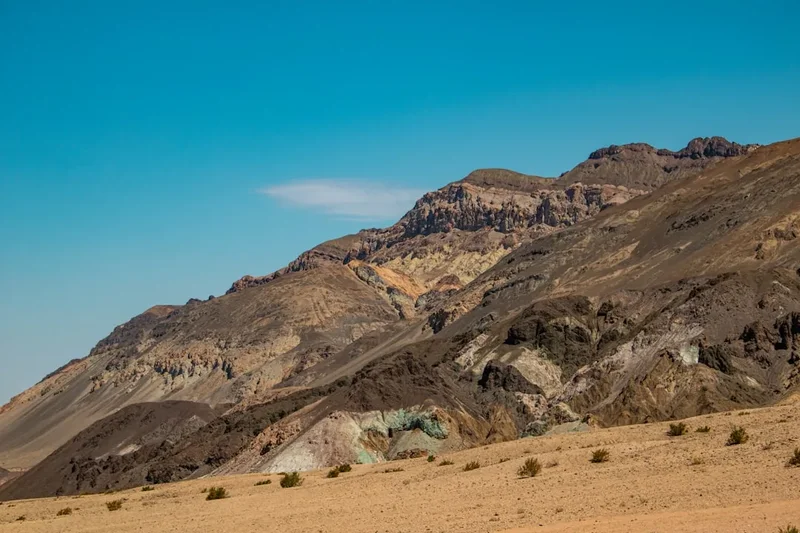
The Awa'awapuhi Trail is arguably the most spectacular day hike on the island of Kauai, offering a profound window into the geological soul of the Na Pali Coast. This 10.3-kilometre return journey is not merely a walk through the woods; it is a descent from the high-altitude montane forests of Koke'e State Park to the very edge of the world. As you traverse the ridgeline, the dense canopy of native koa and ohia trees gradually thins, revealing a landscape of staggering verticality. The trail culminates at a narrow, rocky promontory suspended 610 metres above the Pacific Ocean, where the fluted emerald "cathedrals" of the Awa'awapuhi and Nu'alolo valleys drop precipitously into the turquoise depths below. It is a place where the scale of nature feels incomprehensible, and the silence is broken only by the distant roar of the surf and the cry of the white-tailed tropicbird.
- Distance: 10.3 km return
- Duration: 3–5 hours
- Season: Year-round (mornings highly recommended for visibility)
- Elevation Gain: 610 m (all on the return leg)
- Highest Point: 1,255 m (Trailhead)
- Difficulty: Challenging (due to elevation gain and potential mud)
- Direction: Out-and-back (with optional loop via Nu'alolo Cliff Trail)
Overview
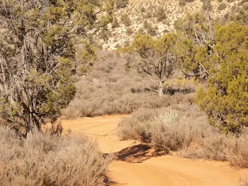
Located within the rugged uplands of Koke'e State Park, the Awa'awapuhi Trail offers a unique perspective on Kauai’s world-famous Na Pali Coast. Unlike the Kalalau Trail, which skirts the coastline at sea level, the Awa'awapuhi approaches the cliffs from above, providing a bird's-eye view of the dramatic erosion that has shaped this island over five million years. The trail is a masterclass in ecological transition. You begin in a cool, often mist-shrouded forest where the air is thick with the scent of damp earth and wild ginger. As you descend, the environment shifts from a lush, high-rainfall rainforest to a drier, more exposed shrubland, reflecting the dramatic rain-shadow effects of the island's central peaks.
The physical profile of the hike is deceptive. The first half of the journey is a continuous, steady descent. While this feels effortless at the start, it serves as a psychological trap for the unprepared. Every metre of elevation lost must be regained on the return journey, often in the heat of the midday sun. The path itself is frequently slick with the notorious "Koke'e mud"—a fine, red volcanic clay that becomes as slippery as ice after the frequent mountain showers. Navigating this terrain requires concentration and sturdy footwear, but the reward at the 5.15-kilometre mark is a panoramic vista that has been featured in countless films and nature documentaries. Standing at the final overlook, you are flanked by two of the most majestic valleys in the Hawaiian archipelago, their ridges serrated like the spine of an ancient dragon.
This is a landscape defined by the relentless power of water and wind. The Na Pali Coast receives some of the highest rainfall on Earth, and the Awa'awapuhi Trail allows you to see the results of this erosive force firsthand. The deep, V-shaped valleys and razor-sharp ridges are the product of millions of years of tropical storms carving into the basaltic shield of the Waialeale volcano. For the hiker, the experience is one of profound isolation; despite the trail's popularity, the sheer scale of the cliffs makes one feel small and insignificant. It is a journey that demands respect for the elements and offers, in return, a visual experience that is frequently described as life-changing.
History and Cultural Context
The Awa'awapuhi Valley, which the trail overlooks, holds deep significance in Hawaiian history and mythology. Long before the arrival of European explorers, the Na Pali Coast was home to thriving communities of Native Hawaiians who lived in the deep valleys, sustained by the rich resources of the sea and the fertile valley floors where they cultivated taro (kalo). The name "Awa'awapuhi" translates to "Ginger Valley," a reference to the native and Polynesian-introduced ginger species that once carpeted the forest floor. These valleys were not isolated; they were connected by a sophisticated network of trails that traversed the high ridges, allowing for trade and communication between the coastal settlements and the upland forests.
Archaeological surveys of the Awa'awapuhi and neighbouring Nu'alolo valleys have revealed extensive stone-walled terraces, house sites, and religious structures (heiau), some dating back over 600 years. The people of Na Pali were master navigators and farmers, adapting to a landscape where the cliffs provided a natural fortress against invaders. The ridges you walk upon today were likely used by ancient bird catchers and gatherers of medicinal plants. The high-altitude forests of Koke'e were a sacred realm, the home of the gods, where the feathers of the mamo and o'o birds were collected to create the magnificent cloaks and helmets of the Hawaiian royalty (ali'i).
In the late 19th and early 20th centuries, the character of the region began to change as the upland forests were utilised for cattle ranching and later for timber. However, the ruggedness of the Na Pali cliffs ensured that the valleys themselves remained largely untouched by modern development. Koke'e State Park was formally established to protect these unique ecosystems and the vital watershed they provide for the island. Today, the trail is managed by the Hawaii Department of Land and Natural Resources (DLNR), which works to balance recreational access with the preservation of endangered native species. Walking the Awa'awapuhi Trail is, in many ways, a walk through a living museum of Hawaiian natural and cultural heritage.
Want more background? Read extended notes on history and cultural context → Learn more
Seasonal Highlights and Weather Reality
Kauai is known as the "Garden Isle" for a reason: it is one of the wettest places on Earth. Consequently, weather is the primary factor in determining the quality and safety of your hike on the Awa'awapuhi Trail. While the trail is open year-round, the experience varies significantly depending on the season and the time of day.
The "dry" season (May to September) offers the highest probability of clear views at the overlook. During these months, the trade winds are more consistent, often blowing away the clouds that tend to congregate around the Koke'e peaks. However, even in summer, afternoon clouds are a common occurrence. The golden rule for Awa'awapuhi is to start early—ideally before 9:00 AM. By midday, the "orographic lift" often causes clouds to rise from the valleys, completely obscuring the view in a thick white mist known locally as "the white-out."
The "wet" season (October to April) brings more frequent and intense rainfall. During this time, the trail can become a quagmire of red mud, making the descent treacherous and the ascent exhausting. However, the winter months also bring a different kind of beauty. The waterfalls in the distant valleys flow with greater volume, and the air is exceptionally crisp and clear between storms. If you are lucky enough to catch a clear window after a rain event, the colours of the cliffs—deep ochre, burnt orange, and vibrant emerald—are at their most intense.
Temperature-wise, Koke'e is significantly cooler than the coastal areas of Kauai. At an elevation of over 1,200 metres, temperatures can be 10 to 15 degrees Celsius lower than in Lihue or Poipu. In the winter, early morning temperatures can drop to 5 or 10 degrees Celsius, and even in summer, the wind at the overlook can be surprisingly chilly. Hikers should always carry a lightweight, waterproof shell, regardless of how warm it feels at the trailhead.
Recommended Itinerary
Awa'awapuhi Day Hike Itinerary
Early Morning: The Forest Descent
- Distance: 0 km – 3 km
- Elevation: 300 m loss
- Time: 45–60 minutes
- Start at the trailhead off Highway 550 (Koke'e Road) near the 17-mile marker.
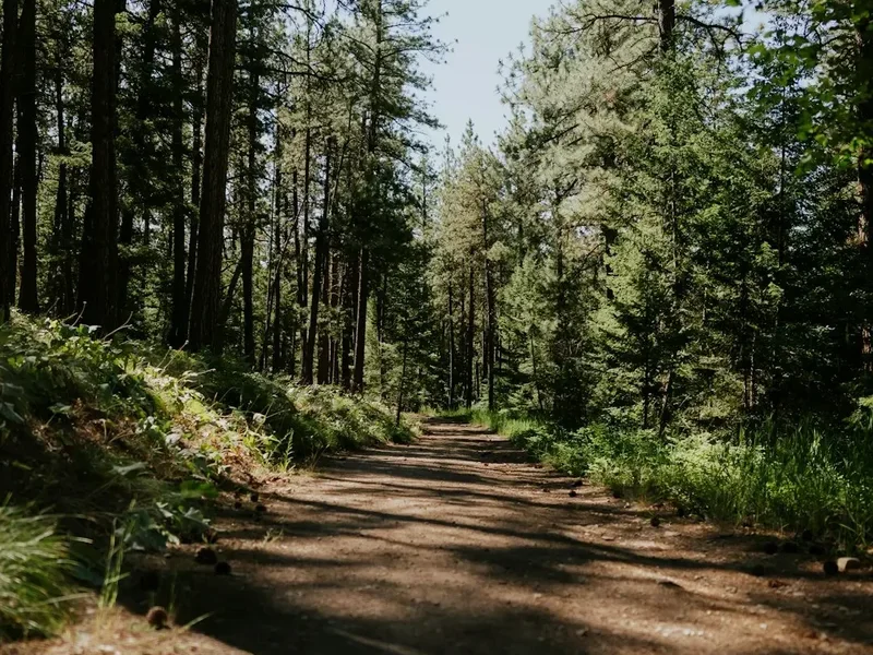
- The trail begins in a dense montane forest dominated by Ohia Lehua and Koa trees.
- The path is wide but can be extremely muddy; use the edges of the trail where vegetation provides better traction.
- Listen for the songs of native honeycreepers like the 'Apapane and 'I'iwi.
- This section is a steady downhill grade through a series of long switchbacks.
Mid-Morning: The Ridge Transition
- Distance: 3 km – 4.5 km
- Elevation: 200 m loss
- Time: 30–45 minutes
- The canopy begins to open up, and the vegetation shifts to smaller shrubs and ferns (Uluhe).
- You will catch your first glimpses of the ocean and the surrounding ridges through the trees.
- The air becomes drier and the temperature may rise as you lose elevation and move out of the dense forest.
- The trail narrows as it follows the spine of the ridge.
Late Morning: The Awa'awapuhi Overlook
- Distance: 4.5 km – 5.15 km
- Elevation: 110 m loss
- Time: 20–30 minutes
- The final approach to the overlook is the most dramatic part of the hike.
- The trail emerges onto a narrow, rocky point. Exercise extreme caution here, as there are no guardrails and the drops are vertical.
- Spend time at the 5.15 km marker (the official end of the maintained trail).
- Enjoy the 270-degree views of Awa'awapuhi and Nu'alolo valleys.
- This is the ideal spot for a rest and a snack before the arduous return journey.
Midday: The Return Ascent
- Distance: 5.15 km – 10.3 km
- Elevation: 610 m gain
- Time: 1.5–2.5 hours
- The return journey is a relentless uphill climb. Pace yourself and take frequent water breaks.
- The humidity in the forest can make the ascent feel more taxing than the gradient suggests.
- Watch your footing on the muddy sections, as slipping is common when legs are tired.
- Finish back at the trailhead and head to the Koke'e Lodge for a well-earned meal.
Important Notes:
- There is no water available anywhere on the trail; you must carry all you need.
- The "end" of the trail is a narrow ridge; if you have a severe fear of heights, the final 100 metres may be challenging.
- Cell phone service is non-existent for most of the hike.
- If the clouds have rolled in at the overlook, wait 15–20 minutes; the wind often creates temporary windows in the mist.
- Check your boots for mud before getting back into your vehicle; the red clay stains everything.
Planning and Bookings
Book Your Trip
Everything you need to plan your journey
Accommodation
Find places to stay near Kekaha
Flights
Search flights to Kekaha
Essential Preparation
The Awa'awapuhi Trail requires a moderate to high level of physical fitness, primarily due to the 610-metre elevation gain on the return leg. Unlike many hikes where the challenge is spread out, this trail saves all its difficulty for the second half. Hikers should be prepared for humid conditions and potentially slippery terrain. Before heading out, ensure your vehicle is capable of the drive; while the road to Koke'e is paved, it is steep and winding, which can be hard on brakes and engines.
The nearest town for supplies is Kekaha, located at the base of the Waimea Canyon Road. It is essential to fuel up and purchase all food and water in Kekaha or Waimea, as there are no shops or petrol stations within Koke'e State Park. The Koke'e Lodge offers a restaurant and a small gift shop, but their hours can be irregular and they do not stock hiking supplies. Coordination with weather reports is vital; check the forecast for "Koke'e" specifically, as coastal weather is often completely different from the mountain weather.
Trail Accommodation
This is a day hike requiring no overnight accommodation on the trail itself. Camping is strictly prohibited along the Awa'awapuhi Trail and at the overlook. However, for those wishing to stay in the area to ensure an early start, there are several options within Koke'e State Park.
Koke'e State Park Cabins:
- Managed by a private concessionaire (The Lodge at Koke'e).
- Rustic, cedar-log cabins with basic kitchens and wood-burning stoves.
- Must be booked well in advance, especially during summer and holidays.
- Costs range from US$100 to US$150 per night.
Koke'e State Park Campsites:
- Located near the Koke'e Pavilion.
- Requires a permit from the Hawaii DLNR (State Parks division).
- Facilities include cold showers, toilets, and picnic tables.
- Cost: US$20–$30 per night for non-residents.
What is NOT provided:
- There are no shelters or huts on the Awa'awapuhi Trail.
- No potable water is available at the trailhead or on the path.
- No rubbish bins are provided; you must pack out all waste.
Required Gear
- Hiking boots or trail shoes - Deep lugs are essential for the red mud. Do not attempt in flip-flops or smooth-soled sneakers.
- Waterproof jacket - A lightweight, breathable shell is mandatory for sudden tropical downpours.
- Trekking poles - Highly recommended for stability on the slippery descent and to assist with the 610 m climb back up.
- Day pack - 15–25L capacity with a rain cover.
- Sun protection - High SPF sunscreen and a wide-brimmed hat; the ridge sections are very exposed.
- Offline maps - Download GPS maps (such as AllTrails or Gaia) as there is no mobile signal.
- First aid kit - Include blister plasters, antiseptic wipes, and a whistle.
What to Bring
- Water - Minimum 2–3 litres per person. The humidity makes dehydration a significant risk.
- High-energy snacks - Trail mix, energy bars, and fruit for the overlook.
- Electrolytes - Powdered drink mixes to help with hydration during the ascent.
- Insect repellent - Mosquitoes can be prevalent in the forested sections, especially after rain.
- Emergency blanket - A lightweight space blanket in case of an unexpected injury or weather delay.
- Camera/Smartphone - For the spectacular views, but ensure they are in a waterproof bag.
- Change of clothes - Leave a clean set of clothes and shoes in your car for after the hike to avoid staining your vehicle with red mud.
Permits
As of recent regulations, non-residents of Hawaii are required to pay for parking and entry to Koke'e State Park and Waimea Canyon State Park. While a specific "hiking permit" is not required for the Awa'awapuhi Trail itself, you must comply with the park entry requirements.
Parking and Entry Fees:
- Non-residents: US$10 per vehicle for parking and US$5 per person for entry.
- Hawaii residents: Free with a valid state ID.
- Payment is made via automated kiosks located at major viewpoints and trailhead parking lots.
- The permit is valid for both Waimea Canyon and Koke'e State Parks for the day of purchase.
Camping Permits: If you intend to stay overnight at the Koke'e State Park campgrounds, you must obtain a permit in advance through the Hawaii State Parks online reservation system. These permits are often released 30 to 90 days in advance and sell out quickly during peak seasons. Note that these permits are for the designated campground only, not for the trail.
Commercial Use: Any commercial activity, including guided tours or professional photography/filming, requires a special use permit from the DLNR. Unauthorised commercial activity is strictly monitored and subject to heavy fines.
Other Activities in the Area
Koke'e and Waimea Canyon offer a wealth of other experiences that can be combined with your hike:
- Waimea Canyon Viewpoints: Stop at the Waimea Canyon Lookout and Pu'u Hinahina Lookout for views of the "Grand Canyon of the Pacific." The scale and colours are a perfect contrast to the green ridges of Awa'awapuhi.
- Kalalau Lookout: Located at the very end of Highway 550, this lookout offers a view into the famous Kalalau Valley without the 35-kilometre trek. It is often cloudy, so patience is required.
- Pihea Trail: A relatively flat trail that follows the rim of the Kalalau Valley, offering different angles of the Na Pali Coast and access to the Alaka'i Swamp.
- Koke'e Natural History Museum: A small but excellent museum near the Lodge that provides context on the island's geology, flora, and fauna.
- Waipo'o Falls: A popular hike in Waimea Canyon that leads to the top of a 244-metre waterfall.
- Bird Watching: Koke'e is one of the best places in Hawaii to see rare endemic forest birds. Bring binoculars and look for the bright red 'I'iwi.
Safety and Conditions
The "Koke'e Mud": The most common cause of injury on the Awa'awapuhi Trail is slipping on the wet volcanic clay. This mud acts like a lubricant on the hard-packed trail surface. To stay safe, maintain three points of contact when necessary, use trekking poles, and avoid stepping on exposed tree roots, which become incredibly slick when wet. If you do fall, try to fall "uphill" to minimise the distance of your slide.
Cliff Edges and Vertigo: The overlook at the end of the trail is a natural rock formation with sheer drops of over 600 metres on three sides. There are no fences or safety rails. The rock can be crumbly and unstable, especially after rain. Do not venture beyond the official end of the trail, and keep a safe distance (at least 2 metres) from the edge. Strong gusts of wind are common at the point and can easily knock a person off balance.
Dehydration and Heat Exhaustion: While the forest is cool, the humidity is often 80% or higher. This prevents sweat from evaporating efficiently, leading to rapid overheating during the 610-metre climb back to the trailhead. Drink water regularly, even if you don't feel thirsty, and use electrolyte replacements. If you begin to feel dizzy, nauseous, or develop a headache, stop in the shade immediately and rest.
Flash Flooding: While the Awa'awapuhi is a ridge trail and not subject to river flooding, heavy rain can cause "sheet flooding" across the trail, making it impassable. More importantly, heavy rain increases the risk of landslides on the steep valley walls. If a heavy rain warning is in effect, it is best to postpone the hike.
Emergency Services: There is no mobile phone reception on the trail. In the event of an emergency, someone will need to hike back to the trailhead or the Koke'e Lodge to call for help. Rescue operations in this area usually involve helicopters and are extremely expensive. Ensure you have travel insurance that covers search and rescue.
Side Trips and Points of Interest
Nu'alolo Cliff Trail (The Loop): For experienced hikers looking for a full-day adventure, the Awa'awapuhi Trail can be connected to the Nu'alolo Trail via the Nu'alolo Cliff Trail. This creates a spectacular 15-kilometre loop. The connector trail is narrow and traverses some very exposed sections with dramatic views into the Nu'alolo Valley. This route should only be attempted in dry conditions and by those with a good head for heights. It adds significant elevation and time to the journey but offers the most comprehensive view of the Na Pali ridges available on foot.
The "Cathedral" Viewpoint: About 100 metres before the final rocky point, there is a small clearing to the left. This spot offers a perfectly framed view of the "cathedrals"—the sharp, fluted ridges of the Awa'awapuhi Valley. This is often a better spot for photography than the very end of the trail, as it provides more foreground and a safer environment for setting up a tripod.
Native Flora Identification: The Awa'awapuhi Trail is an excellent place to see the Metrosideros polymorpha (Ohia Lehua) in bloom. These trees have distinctive pom-pom-like red flowers (sometimes yellow) and are sacred in Hawaiian culture. You will also see the Acacia koa, Kauai's largest native tree, and various species of native ferns. Identifying these plants adds a layer of depth to the hiking experience.
The Alaka'i Swamp Extension: While not directly connected to the Awa'awapuhi, many hikers choose to visit the Alaka'i Swamp boardwalk (via the Pihea Trail) on the same day. This is the highest rainforest and swampland in the world, offering a completely different ecosystem of stunted trees and rare bogs. It is a 15-minute drive from the Awa'awapuhi trailhead.
Leave No Trace
The ecosystems of Koke'e are among the most fragile in the world. Many of the plants and birds you see on the Awa'awapuhi Trail are found nowhere else on Earth. Because Hawaii is an island chain, its native species evolved in isolation and have few natural defences against introduced pests and diseases.
Rapid Ohia Death (ROD): This is a critical issue on Kauai. ROD is a fungal disease that is killing tens of thousands of native Ohia trees. The fungus can be spread through infected soil on your boots. You must clean all mud off your boots and spray them with 70% isopropyl alcohol before and after your hike. Most trailheads in Koke'e have boot-brush stations; please use them.
Your responsibility as a walker:
- Pack out all rubbish, including organic waste like orange peels or apple cores. These do not belong in the native forest and can attract invasive rats and cats that prey on native birds.
- Stay on the designated trail. Short-cutting switchbacks causes massive erosion in the soft volcanic soil and destroys rare ground-cover plants.
- Do not pick flowers or remove any plants. Many are endangered and protected by law.
- Respect the silence. Avoid using speakers or shouting; the sound of the wind and birds is part of the wilderness experience.
- If you encounter a Nene (Hawaiian Goose), do not feed it or approach it. They are an endangered species and human food makes them lose their natural foraging instincts.
By following these principles, you help ensure that the Awa'awapuhi Trail remains a pristine wilderness for future generations of hikers and a safe haven for Kauai's unique wildlife.