The Arizona Trail: A Desert Traverse
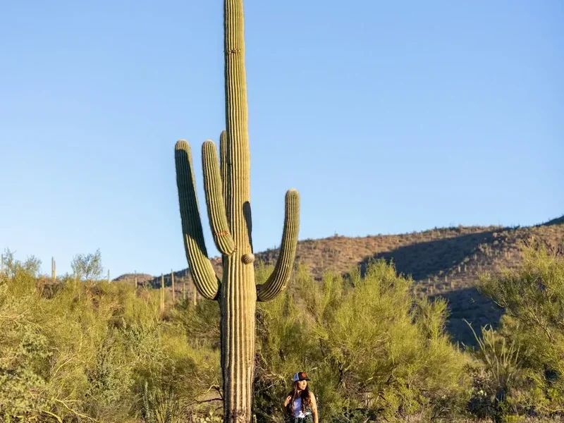
The Arizona Trail (AZT) is a 1,287.5 km (1287.5 km) long-distance hiking and equestrian trail stretching from the Mexican border to the Utah border, traversing the diverse landscapes of Arizona. This monumental trail offers an unparalleled journey through deserts, mountains, forests, and canyons, showcasing the state's incredible ecological and geological diversity. From the saguaro-studded Sonoran Desert to the ponderosa pine forests of the Mogollon Rim and the red rock country of northern Arizona, the AZT is a true adventure for those seeking a profound connection with the American Southwest. It is a challenging, often remote, and deeply rewarding experience that tests endurance, resilience, and the spirit of exploration.
- Distance: 1,287.5 km one-way
- Elevation Gain: 33,500 m
- Duration: 6–8 weeks (thru-hike)
- Difficulty: Very Challenging
- Best Time: Spring (March–April) or Fall (October–November)
- Category: Thru Hike, Backpacking, Horsepacking
- Trailheads: Multiple access points, with southern terminus near Canelo Hills and northern terminus at the Utah border
Overview
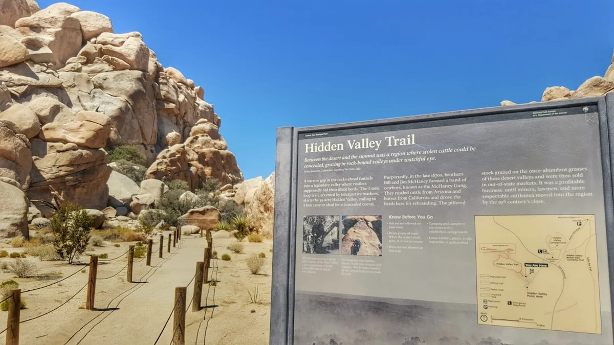
The Arizona Trail is a testament to the wild beauty and rugged character of the American Southwest. Conceived by Dale Sheldrake, the trail was completed in 2009 and is managed by the Arizona Trail Association (ATA). It is divided into 43 segments, allowing for shorter backpacking trips or a full thru-hike. The trail's path is a masterclass in geographical diversity. It begins in the arid grasslands and saguaro forests of southern Arizona, gradually ascending into the sky islands—isolated mountain ranges that rise like islands from the desert floor, supporting unique ecosystems. As the trail moves north, it climbs onto the Mogollon Rim, a dramatic escarpment that forms the southern edge of the Colorado Plateau. Here, hikers walk through vast ponderosa pine forests, experiencing cooler temperatures and a dramatic shift in scenery.
Further north, the trail navigates the rugged terrain of central Arizona, crossing canyons and remote wilderness areas. The final section leads through the iconic red rock landscapes of northern Arizona, including areas near Flagstaff and the San Francisco Peaks, before reaching its northern terminus at the Utah border. The AZT is known for its remoteness, requiring significant self-sufficiency, navigation skills, and careful planning for water sources, which can be scarce and unreliable in many sections.
The trail is not always a single, well-defined path; it often follows old jeep roads, forest service roads, and sometimes requires navigation through open country. This variability adds to its challenge and adventure. The AZT is a journey through a land of extremes—scorching deserts, high alpine forests, and vast, silent canyons. It offers a profound immersion into the natural world, a chance to disconnect from modern life and reconnect with the raw, untamed beauty of Arizona.
History and Development
The vision for the Arizona Trail began in the late 1980s with Dale Sheldrake, a retired Air Force Colonel and avid outdoorsman. Sheldrake envisioned a continuous trail that would connect Arizona's diverse natural landscapes, from the Mexican border to the Utah border. His goal was to create a pathway that would allow people to experience the state's varied ecosystems on foot or horseback, fostering appreciation for its natural beauty and encouraging conservation.
Sheldrake spent years scouting routes, working with land managers, and rallying support for his ambitious project. The Arizona Trail Association (ATA) was founded in 1994 to champion the trail's development, construction, and maintenance. The ATA worked tirelessly with federal agencies (including the U.S. Forest Service and Bureau of Land Management), state agencies, local communities, and volunteers to establish the trail's corridor.
The trail was officially completed and opened in 2009, marking a significant achievement in trail building. Since its completion, the ATA has continued to refine the route, improve signage, and maintain the trail, ensuring its long-term viability. The AZT is a testament to the power of collaboration and volunteerism, a project that brought together diverse groups with a shared passion for the outdoors and the preservation of Arizona's natural heritage. It has since become a premier long-distance trail, attracting hikers and equestrians from around the world.
Seasonal Considerations and Weather
The Arizona Trail presents a significant challenge due to its extreme temperature variations and the scarcity of water, making seasonal planning paramount. The trail traverses multiple climate zones, from the scorching heat of the Sonoran Desert to the potentially snow-covered peaks of the San Francisco Mountains.
Spring (March–April): This is widely considered the prime season for thru-hiking the Arizona Trail. Temperatures in the southern desert sections are pleasant, typically ranging from 15°C to 25°C during the day, with cooler nights. As hikers progress north, they encounter increasingly mild temperatures in the forests. However, spring can bring unpredictable weather, including late-season snowstorms in the higher elevations and potential flash floods in desert washes. Water sources are generally more reliable in spring due to winter snowmelt and occasional rains.
Fall (October–November): Another excellent season for thru-hiking. Similar to spring, fall offers moderate temperatures in the desert and cooler, crisp air in the mountains. The changing autumn colours in the northern sections can be spectacular. However, water sources may be less abundant than in spring, and early winter storms can bring snow to higher elevations, potentially making sections impassable.
Summer (June–August): Thru-hiking the Arizona Trail in summer is extremely challenging and generally not recommended due to extreme heat, particularly in the southern and central sections. Daytime temperatures can regularly exceed 40°C, posing a severe risk of heatstroke and dehydration. Monsoon season (July–August) brings intense thunderstorms, lightning, and flash floods, which can make river crossings dangerous and washes impassable. While some hikers attempt sections during summer, it requires meticulous planning for water, shade, and avoiding the hottest parts of the day.
Winter (December–February): Winter hiking is feasible for experienced individuals, especially in the southern desert sections where temperatures are mild. However, the northern sections, including the Mogollon Rim and San Francisco Peaks, can experience significant snowfall, making them difficult or impossible to traverse without winter mountaineering skills and equipment. Water sources may be frozen at higher elevations.
Recommended Itinerary (Thru-Hike)
Arizona Trail Thru-Hike: A Segmented Journey
The Arizona Trail is typically hiked from south to north, starting at the Mexican border and finishing at the Utah border. This direction generally allows hikers to tackle the hottest desert sections first when temperatures are more manageable in spring, and finish in the cooler northern climes.
Segment 1: Southern Arizona Desert (Mexican Border to Superior)
- Distance: Approximately 400 km
- Duration: 14–21 days
- Key Features: Saguaro forests, desert grasslands, sky islands (e.g., Santa Rita Mountains, Galiuro Mountains), remote water sources, potential for extreme heat.
- Waypoints: Montezuma Canyon, Patagonia, Greaterville, Rincon Mountains, Galiuro Wilderness, Pinal Mountains.
- Challenges: Water scarcity, heat, navigation through rugged terrain.
Segment 2: Central Arizona Mountains (Superior to Flagstaff)
- Distance: Approximately 560 km
- Duration: 20–28 days
- Key Features: Mogollon Rim, ponderosa pine forests, canyons, wilderness areas (e.g., Superstition Wilderness, Mazatzal Wilderness), potential for snow at higher elevations.
- Waypoints: Superstition Mountains, Mazatzal Mountains, Four Peaks Wilderness, Payson, Mogollon Rim, Coconino National Forest.
- Challenges: Significant elevation changes, remote sections, water availability can be sporadic, potential for monsoon storms.
Segment 3: Northern Arizona (Flagstaff to Utah Border)
- Distance: Approximately 327.5 km
- Duration: 10–14 days
- Key Features: San Francisco Peaks, volcanic landscapes, ponderosa pine and mixed conifer forests, red rock country, high desert.
- Waypoints: San Francisco Peaks, Kendrick Mountain, Grand Canyon National Park (trail passes near, but not through), Kaibab National Forest, North Rim of the Grand Canyon (trail passes nearby), Vermilion Cliffs National Monument, Utah border.
- Challenges: High elevation, potential for snow and cold, wind, remote sections, water sources can be scarce.
Important Considerations for Thru-Hikers:
- Water: This is the most critical element. Water sources are often unreliable, seasonal, or require significant detours. Hikers must carry large amounts of water and plan resupply points meticulously.
- Resupply: Towns are spaced far apart. Hikers must arrange mail drops or plan resupply stops in towns like Patagonia, Superior, Payson, and Flagstaff.
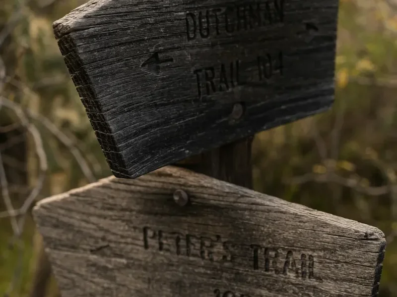
- Navigation: While sections are marked, the trail often follows primitive roads or requires cross-country navigation. A GPS device, map, and compass are essential.
- Permits: Wilderness areas may require permits for overnight stays. Check with the relevant land management agencies (USFS, BLM).
- Physical Demands: The AZT is a strenuous hike with significant elevation changes and challenging terrain. A high level of fitness and backpacking experience is required.
Planning and Bookings
Book Your Trip
Everything you need to plan your journey
Accommodation
Find places to stay near Phoenix
Flights
Search flights to Phoenix
Essential Preparation
Thru-hiking the Arizona Trail is a significant undertaking that demands meticulous planning and preparation. The trail's length, remoteness, and varied terrain mean that logistics are paramount. Hikers must consider their physical conditioning, mental fortitude, and ability to manage resources in challenging environments. Base towns like Phoenix (for access to southern and central sections) and Flagstaff (for northern sections) offer essential services, accommodation, and transportation hubs. Phoenix Sky Harbor International Airport (PHX) is the primary gateway for most hikers. From Phoenix, rental cars or shuttle services can be used to reach trailheads. For the southern terminus, driving south on I-10 E to AZ-83 S towards Parker Canyon Lake is a common route. Parking is available, but it's crucial to check current conditions and any local regulations. For the northern terminus, access is typically from the Utah side, often involving shuttle services from towns like Kanab, Utah.
Trail Accommodation
This is a long-distance, backcountry trail. There are no established lodges or hotels along the route. Accommodation consists primarily of dispersed camping in designated wilderness areas and national forests, or primitive camping along the trail corridor. Some sections may pass near established campgrounds or dispersed camping areas, but these are not guaranteed.
Huts, Lodges, Campsites, Shelters:
- Dispersed Camping: The vast majority of overnight stays will be dispersed camping. Hikers must be prepared to camp in remote locations, adhering to Leave No Trace principles.
- Designated Campgrounds: Some sections may pass through or near established campgrounds within National Forests or Parks. These may require reservations and fees.
- No Formal Huts/Lodges: Unlike some other long-distance trails, the Arizona Trail does not have a system of managed huts or lodges.
- Seasonal Availability: Camping is generally available year-round, but weather conditions (extreme heat, snow, monsoons) can make certain areas unsafe or inaccessible during specific seasons.
- Costs: Dispersed camping is typically free. Fees may apply for designated campgrounds.
This is a backcountry trail requiring self-sufficiency. Hikers must carry all necessary camping gear and be prepared to camp in primitive conditions.
Required Gear
- Backpack: 50–70 litre capacity, comfortable and well-fitting, with a rain cover.
- Tent: Lightweight, durable, and waterproof backpacking tent suitable for various weather conditions.
- Sleeping Bag: Rated for temperatures ranging from below freezing (at higher elevations in winter/spring/fall) to potentially warm desert nights. A -9°C to -1°C (-9°C to -1°C) bag is a common choice for thru-hikers.
- Sleeping Pad: Insulated for warmth and comfort.
- Hiking Boots: Sturdy, broken-in, waterproof hiking boots with good ankle support.
- Socks: Wool or synthetic hiking socks (multiple pairs).
- Clothing: Moisture-wicking base layers (synthetic or merino wool), insulating mid-layers (fleece or down jacket), waterproof and windproof outer shell jacket and trousers. Sun-protective clothing (long sleeves, wide-brimmed hat).
- Navigation: GPS device or smartphone with reliable GPS app (e.g., Gaia GPS, CalTopo), downloaded offline maps, physical map and compass, and knowledge of how to use them.
- Headlamp: With extra batteries.
- First-Aid Kit: Comprehensive kit including blister treatment, pain relievers, antiseptic wipes, bandages, gauze, medical tape, and any personal medications.
- Trekking Poles: Highly recommended for stability, reducing joint impact, and aiding in water crossings.
- Sun Protection: High SPF sunscreen, sunglasses, lip balm with SPF.
- Insect Repellent: Especially for warmer months and areas near water.
What to Bring
- Food: Lightweight, high-calorie backpacking meals, snacks, and electrolytes for the duration between resupply points. Plan for 5–7 days of food between resupplies.
- Water Treatment: Water filter or purification tablets/drops. A backup method is essential.
- Water Bottles/Reservoir: Capacity to carry at least 4–6 litres of water per person, especially in desert sections. Hydration reservoir (bladder) and/or sturdy water bottles.
- Stove and Fuel: Lightweight backpacking stove and sufficient fuel for cooking meals and boiling water.
- Cookware: Pot, mug, spoon/spork.
- Toiletries: Biodegradable soap, toothbrush, toothpaste, trowel for digging catholes, toilet paper, hand sanitizer.
- Repair Kit: Duct tape, cordage, multi-tool, tent pole repair sleeve, patch kit.
- Knife or Multi-tool.
- Fire Starter: Waterproof matches or lighter.
- Bear Canister/Food Storage: While black bears are present, they are not as prevalent or aggressive as in some other regions. However, proper food storage to protect against rodents and other wildlife is crucial. Check local regulations for specific requirements.
- Personal Locator Beacon (PLB) or Satellite Messenger: Highly recommended for remote sections with no cell service.
- Trash Bags: To pack out all trash.
Permits
Permits for the Arizona Trail are managed by various land management agencies depending on the section of the trail. For thru-hikers, understanding these requirements is crucial for a smooth journey.
General Requirements:
- Wilderness Permits: Many sections of the AZT pass through designated Wilderness Areas (e.g., Superstition Wilderness, Mazatzal Wilderness, Coconino National Forest Wilderness). Overnight stays in these areas typically require a wilderness permit. These are often self-issued at trailheads or can be obtained in advance from the relevant Forest Service or BLM district offices.
- National Forest/BLM Land: Camping on most National Forest and Bureau of Land Management (BLM) lands is permitted, often with dispersed camping rules (e.g., camping a certain distance from water sources or trails).
- National Parks: The AZT does not pass through any National Parks, but it does pass near Grand Canyon National Park and Vermilion Cliffs National Monument. Hikers should be aware of regulations if venturing near these areas.
- Private Land: The trail corridor is designed to avoid private property where possible, but hikers must respect all private land boundaries.
- Fire Restrictions: Fire restrictions are common, especially during dry seasons. Always check current fire restrictions with the relevant land management agency before having a campfire. Many areas prohibit campfires altogether.
Specific Agencies and Resources:
- U.S. Forest Service (USFS): The majority of the trail traverses National Forests (e.g., Coronado, Tonto, Coconino, Kaibab). Permits for wilderness areas within these forests are typically obtained from the local Ranger District offices.
- Bureau of Land Management (BLM): Some sections of the trail are on BLM land, particularly in the southern and northern parts. Permits for these areas are managed by the relevant BLM Field Offices.
- Arizona Trail Association (ATA): The ATA website (aztrail.org) is an invaluable resource for detailed information on permits, segment-specific regulations, and contact information for land management agencies. They often provide guidance on obtaining necessary permits for different sections.
Thru-Hiker Considerations:
- It is highly recommended to contact the USFS Ranger Districts and BLM Field Offices for the specific areas you will be hiking through well in advance of your trip.
- Many permits are free, but some may have a small fee.
- Always carry a copy of your permits with you on the trail.
- Be aware of any specific regulations regarding camping locations, group size, and waste disposal.
Other Activities in the Area
While the Arizona Trail is primarily a hiking and backpacking destination, the diverse regions it traverses offer numerous other activities for those looking to extend their stay or explore off-trail:
- Grand Canyon National Park: The AZT passes near the South Rim and the North Rim of the Grand Canyon. Day hikes into the canyon or exploring the rim viewpoints are popular activities.
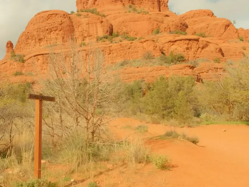
- Sedona Red Rock Country: While not directly on the AZT, the iconic red rock formations of Sedona are accessible from sections of the trail in central Arizona. Hiking, mountain biking, and jeep tours are popular here.
- Flagstaff and the San Francisco Peaks: Flagstaff is a vibrant mountain town offering hiking, skiing (in winter), breweries, and a gateway to the San Francisco Peaks, Arizona's highest mountain range.
- Mogollon Rim Exploration: The Rim offers scenic drives, hiking trails, fishing in nearby lakes, and stunning overlooks.
- Sky Island Exploration: The mountain ranges of southern Arizona (e.g., Santa Ritas, Chiricahuas) are unique ecosystems with diverse wildlife and hiking opportunities.
- Phoenix Metropolitan Area: For those starting or ending their hike in the south, Phoenix offers a wide range of urban attractions, including museums, dining, and cultural sites.
- Payson Area: Known as the "Heart of Arizona," Payson offers access to Tonto Natural Bridge State Park, hiking trails, and outdoor recreation.
Safety and Conditions
Water Scarcity: This is the most significant safety concern on the Arizona Trail. Water sources can be miles apart, unreliable, or contaminated. Hikers must carry ample water (4–6 litres per person is common) and have a reliable water treatment system. Researching current water reports from the ATA and other hikers is essential.
Extreme Temperatures: Desert sections can reach extreme temperatures (over 40°C) in warmer months. Heatstroke and dehydration are serious risks. Hiking during the cooler parts of the day (early morning and late evening) and seeking shade is crucial. Higher elevations can experience freezing temperatures and snow, especially in spring and fall.
Navigation: While many sections are marked, the trail often follows primitive roads or requires navigation through open country. GPS devices, maps, compasses, and the ability to use them are vital. Getting lost in remote areas can be dangerous.
Wildlife: Arizona is home to various wildlife, including rattlesnakes, scorpions, javelinas, coyotes, and black bears. Be aware of your surroundings, store food properly, and know how to react if you encounter wildlife. Rattlesnakes are venomous; give them a wide berth.
Flash Floods: Desert washes and canyons are prone to flash floods, especially during the monsoon season (July–August). Never attempt to cross a flooded wash. Seek higher ground immediately if you hear or see signs of a flash flood.
Trail Conditions: Sections can be rough, rocky, and steep. Uneven terrain increases the risk of sprains and falls. Trekking poles are highly recommended.
Remoteness and Communication: Large portions of the trail have no cell service. Carrying a satellite messenger or Personal Locator Beacon (PLB) is highly recommended for emergencies.
Physical and Mental Preparedness: The AZT is a demanding thru-hike. Hikers must be in excellent physical condition and mentally prepared for solitude, challenges, and potential setbacks.
Side Trips and Points of Interest
The Arizona Trail passes through or near numerous areas of significant natural beauty and interest, offering opportunities for side trips and exploration:
Superstition Mountains: This rugged and iconic mountain range in central Arizona is a major highlight of the southern section. The trail traverses through or near the Superstition Wilderness, offering dramatic desert landscapes, canyons, and unique rock formations. Day hikes into the heart of the mountains are possible from trail access points.
Four Peaks Wilderness: Located north of the Superstitions, this area features dramatic peaks and diverse desert flora. The trail offers stunning views and challenging terrain.
Mogollon Rim: This immense escarpment forms the southern edge of the Colorado Plateau. The AZT follows the Rim for a significant distance, providing breathtaking panoramic views of the forests and canyons below. Numerous overlooks and short hiking trails branch off from the main trail.
San Francisco Peaks: The highest mountain range in Arizona, home to Humphreys Peak (3,850 m / 3,851 m). The AZT passes through the forests surrounding these peaks, offering a dramatic change in scenery and cooler temperatures. Day hikes to the summit of Humphreys Peak are a popular side activity for those near Flagstaff.
Grand Canyon National Park Vicinity: While the AZT does not enter the Grand Canyon, it passes relatively close to both the South Rim and the North Rim. Hikers can arrange for side trips to experience this natural wonder.
Vermilion Cliffs National Monument: The northern terminus of the AZT is near this spectacular area, known for its colourful sandstone cliffs, slot canyons, and the famous Paria Canyon-Vermilion Cliffs Wilderness. While the trail itself doesn't go through the most famous parts, it provides access to the region.
Sky Islands: The southern sections of the AZT traverse Arizona's unique "sky islands"—isolated mountain ranges that rise from the desert floor and host distinct ecosystems. These offer opportunities for wildlife viewing and exploring different ecological zones.
Leave No Trace
The Arizona Trail traverses fragile desert ecosystems, high alpine forests, and remote wilderness areas. Adhering to Leave No Trace (LNT) principles is paramount to preserving these environments for future generations and ensuring the safety of all trail users.
Plan Ahead and Prepare: Research the trail, water sources, weather, and regulations. Be prepared for self-sufficiency and potential challenges. Know your limits and plan your trip accordingly.
Travel and Camp on Durable Surfaces: Stick to the trail corridor, which often includes primitive roads and established paths. When camping, choose established campsites or durable surfaces like sand, gravel, or dry grasses. Avoid camping on fragile vegetation or in riparian areas.
Dispose of Waste Properly: Pack it in, pack it out. This includes all food scraps, wrappers, toilet paper, and any other trash. Use designated toilets where available, or dig catholes 6–8 inches deep and at least 60 m (70 paces) from water sources, trails, and campsites. Pack out all toilet paper.
Leave What You Find: Do not remove or disturb natural objects, plants, or cultural artifacts. Leave them for others to enjoy.
Minimize Campfire Impacts: Campfires are often prohibited on the AZT due to fire danger and the fragile nature of desert and forest ecosystems. If fires are permitted in a specific area, use established fire rings and keep fires small. Ensure fires are completely extinguished before leaving.
Respect Wildlife: Observe wildlife from a distance. Never feed animals, as this can disrupt their natural behaviours and diets, and can be harmful to them. Store food securely to prevent attracting animals.
Be Considerate of Other Visitors: Yield to other hikers and equestrians. Keep noise levels down, especially in remote areas. Respect the solitude of the trail.