Annapurna Sanctuary Trek - A Journey into the Heart of the Himalayas
The Annapurna Sanctuary Trek is one of the most iconic and visually spectacular high-altitude journeys in the world. Located in the Gandaki Province of north-central Nepal, this 115-kilometre trek leads into a natural amphitheatre of staggering proportions. Known locally as the "Annapurna Base Camp" (ABC) trek, the route penetrates deep into the heart of the Annapurna Massif, a glacial basin surrounded by a ring of peaks that all exceed 6,000 metres in height, with several surpassing 7,000 and 8,000 metres. Unlike many other Himalayan treks that follow long, linear valleys, the Sanctuary trek culminates in a 360-degree panorama of ice and granite that feels like standing in a cathedral of the giants. The journey is a profound transition through ecological zones, beginning in the lush, subtropical rhododendron forests and terraced farmland of the lower foothills and ascending into the stark, monochromatic world of the high alpine tundra and glacial moraine.
- Distance: 115.0 km (approximate round trip from Nayapul)
- Elevation Gain: 4,130 m (cumulative)
- Highest Point: Annapurna Base Camp (4,130 m)
- Duration: 10–12 days
- Difficulty: Challenging (requires high physical fitness and acclimatisation)
- Best Time: October–November (autumn) or March–May (spring)
- Closest City: Pokhara, Nepal
- Accommodation: Teahouses (mountain lodges)
- Permits: ACAP (Annapurna Conservation Area Project) and TIMS (Trekkers' Information Management System)
Overview
The Annapurna Sanctuary is a unique geographical phenomenon. It is a high-altitude plateau that sits at an elevation of over 4,000 metres, encircled by a formidable ring of mountains including Annapurna I (8,091 m), Annapurna South (7,219 m), Machhapuchhre (6,993 m), and Hiunchuli (6,441 m). Because of the narrow entrance between the peaks of Hiunchuli and Machhapuchhre, the sanctuary remained hidden from the outside world for centuries, known only to local Gurung and Magar shepherds who considered the basin sacred ground. It was not until the mid-20th century that Western explorers and mountaineers began to map the interior of this "Sanctuary," a name bestowed upon it because of its sheltered, serene, and spiritually significant nature.
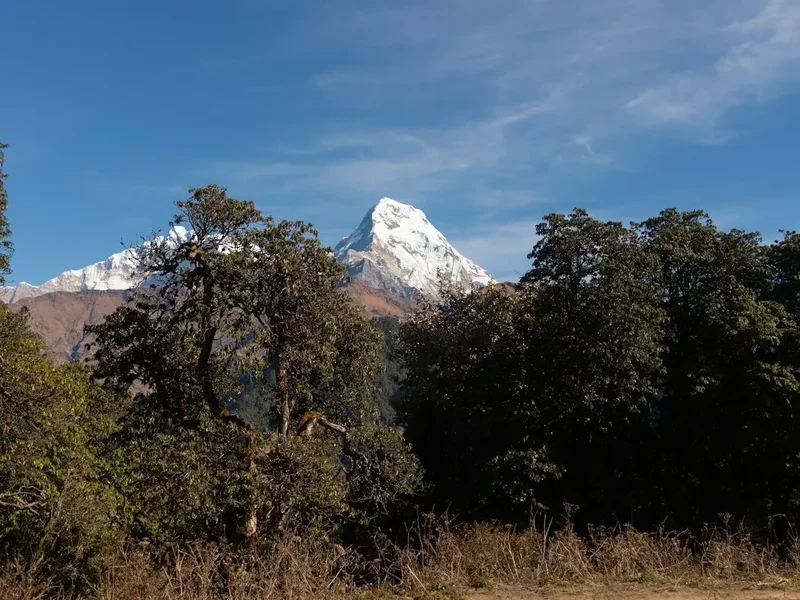
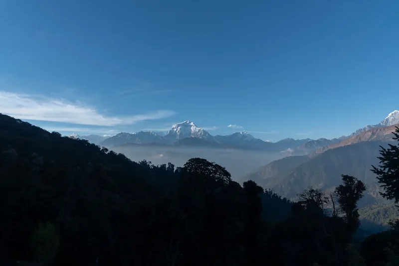
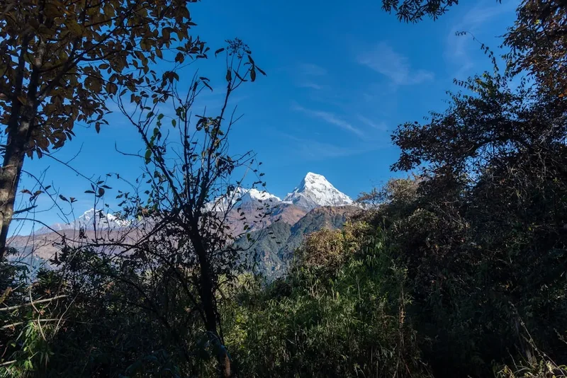
The trek is a masterclass in Himalayan diversity. The first few days are spent traversing the lower foothills, where the trail winds through vibrant Gurung villages like Ghandruk and Chhomrong. Here, the landscape is defined by meticulously carved green terraces where millet, wheat, and potatoes are grown. As you ascend, the humid subtropical air gives way to ancient forests of oak and rhododendron—Nepal’s national flower—which erupt in shades of crimson, pink, and white during the spring months. The sound of the Modi Khola river is a constant companion, its glacial meltwater thundering through deep gorges as you climb higher.
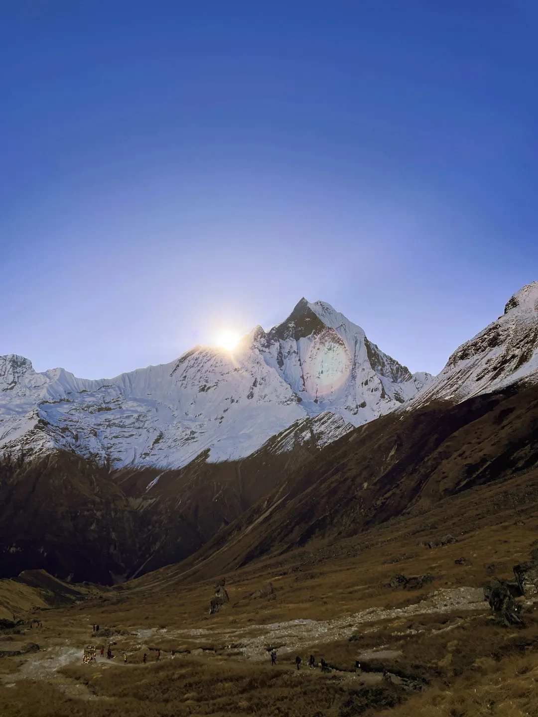
The physical challenge of the Annapurna Sanctuary Trek lies not just in the distance, but in the relentless "Nepali flat"—a local euphemism for a trail that consists of thousands of stone steps going up and down. The ascent from Chhomrong involves a notorious descent to the river followed by an immediate, punishing climb up the other side. However, the reward for this exertion is unparalleled. Upon reaching Machhapuchhre Base Camp (MBC) and finally Annapurna Base Camp, the valley opens up into a vast, white expanse. Standing at ABC at sunrise, watching the first light hit the south face of Annapurna I—the first 8,000-metre peak ever summited—is an experience that defines the very essence of mountain adventure. This trek is more than a physical feat; it is a cultural immersion into the lives of the mountain people and a spiritual encounter with the world's highest peaks.
History and Cultural Context
The history of the Annapurna region is a blend of ancient indigenous traditions and the golden age of Himalayan mountaineering. For the Gurung and Magar ethnic groups who inhabit the southern slopes of the Annapurna Massif, these mountains are not merely geological features but the abodes of deities. The "Sanctuary" itself was traditionally considered a sacred space where the shedding of blood (the slaughter of animals) was strictly forbidden. Even today, trekkers are asked to respect local customs by refraining from bringing meat products beyond certain points in the upper sanctuary to honour the sanctity of the mountains.
In the context of modern exploration, Annapurna I holds a special place in history. On 3 June 1950, French climbers Maurice Herzog and Louis Lachenal became the first humans to reach the summit of an 8,000-metre peak. Their expedition was a harrowing ordeal of frostbite and endurance, famously chronicled in Herzog's book "Annapurna." While they climbed from the northern side, their success turned the world's eyes toward this massif. The route into the Sanctuary itself was pioneered in the late 1950s and early 1960s by explorers like Colonel Jimmy Roberts, who is often credited with founding the trekking industry in Nepal. Roberts recognised that the spectacular beauty of the Sanctuary could be shared with walkers, not just elite climbers.
The cultural fabric of the trek is woven through the villages you pass. Ghandruk, one of the largest Gurung settlements in the region, is famous for providing many of the soldiers for the British Gurkha regiments. The wealth brought back by these soldiers helped build the sturdy stone houses and well-maintained trails that trekkers enjoy today. Every "chorten" (Buddhist shrine), prayer flag, and mani stone encountered along the path is a reminder of the deep-seated Buddhist and Hindu syncretism that defines life in the Nepalese Himalayas. Walking this trail is as much a journey through time and tradition as it is through the mountains.
Want more background? Read extended notes on history and cultural context → Learn more
Seasonal Highlights and Weather Reality
The Annapurna region experiences a distinct four-season climate, and choosing the right window is critical for both safety and enjoyment. The weather in the Himalayas is notoriously fickle, and conditions can change from sun-drenched warmth to life-threatening blizzards within hours.
Autumn (October to November): This is widely considered the "gold standard" for trekking in Nepal. Following the monsoon rains, the atmosphere is washed clean of dust, resulting in the sharpest, most crystal-clear views of the peaks. The weather is generally stable, with warm days in the lower elevations and cold, crisp nights at base camp. This is also the busiest season, meaning teahouses will be at capacity and the trails will be social and bustling.
Spring (March to May): The second most popular window. While the mornings are usually clear, clouds often build up in the afternoons. The highlight of spring is the flora; the rhododendron forests are in full bloom, creating a spectacular contrast against the snow-capped mountains. Temperatures are slightly warmer than in autumn, making the high-altitude nights more bearable. However, there is a higher risk of lingering winter snow on the high passes and avalanche danger in the "avalanche chute" between Deurali and MBC.
Winter (December to February): For those seeking solitude and who possess high-level cold-weather experience, winter offers stunningly clear skies. However, the temperatures at Annapurna Base Camp can drop to -20°C or lower. Many teahouses in the upper sanctuary may close due to heavy snow, and the risk of avalanches on the steep slopes leading into the sanctuary is at its highest. This season requires professional-grade gear and a flexible itinerary.
Monsoon (June to September): Trekking during the monsoon is generally discouraged. The mountains are frequently obscured by clouds, the trails become incredibly slippery and muddy, and leeches are a significant nuisance in the forest sections. Furthermore, the risk of landslides and flight cancellations to Pokhara increases significantly. However, the landscape is at its most lush and green during this time.
Recommended Itinerary
11-Day Annapurna Sanctuary Itinerary
Day 1: Pokhara to Nayapul and Trek to Tikhedhunga
- Distance: 9 km
- Elevation gain: 540 m
- Time: 4–5 hours
- Drive from Pokhara to Nayapul (1.5–2 hours) to begin the trek
- Follow the Modi Khola river through sub-tropical forest
- Pass through the village of Birethanti where permits are checked
- Steady climb on a well-defined dirt track and stone steps
- Stay overnight in Tikhedhunga (1,540 m)
Day 2: Tikhedhunga to Ghorepani
- Distance: 13 km
- Elevation gain: 1,320 m
- Time: 6–7 hours
- The day begins with the infamous "Ulleri Stairs"—over 3,000 stone steps
- Ascend through dense rhododendron and oak forests
- Enter the Annapurna Conservation Area proper
- Ghorepani is a major hub with spectacular views of Dhaulagiri and Annapurna South
- Stay overnight in Ghorepani (2,860 m)
Day 3: Ghorepani to Tadapani (via Poon Hill)
- Distance: 11 km (including Poon Hill)
- Elevation: 350 m gain (Poon Hill), then various ups and downs
- Time: 6–7 hours
- Pre-dawn hike to Poon Hill (3,210 m) for a world-famous sunrise over the Himalayas
- Return to Ghorepani for breakfast, then trek toward Tadapani
- The trail follows a ridgeline with constant mountain views before descending into deep forest
- Stay overnight in Tadapani (2,630 m)
Day 4: Tadapani to Chhomrong
- Distance: 10 km
- Elevation: 500 m descent, 300 m gain
- Time: 5 hours
- A steep descent through forest to the Kimrong Khola river
- A steady climb back up to the village of Chhomrong, perched on a hillside
- Chhomrong offers the last "luxury" teahouses and incredible views of Machhapuchhre (Fishtail)
- Stay overnight in Chhomrong (2,170 m)
Day 5: Chhomrong to Dovan
- Distance: 11 km
- Elevation: 400 m descent, 800 m gain
- Time: 6 hours
- Descend 2,500 stone steps to the Chhomrong Khola bridge
- Climb steeply to Sinuwa, then enter the upper Modi Khola valley
- The forest becomes thicker and more temperate (bamboo and ferns)
- Stay overnight in Dovan (2,600 m)
Day 6: Dovan to Deurali
- Distance: 8 km
- Elevation gain: 630 m
- Time: 4–5 hours
- A shorter day to allow for acclimatisation as you pass the 3,000 m mark
- Pass the "Himalayan Hotel" and the sacred Hinku Cave
- The valley narrows significantly into a dramatic gorge
- Stay overnight in Deurali (3,230 m)
Day 7: Deurali to Annapurna Base Camp (via MBC)
- Distance: 10 km
- Elevation gain: 900 m
- Time: 5–6 hours
- Trek through the "gate" of the sanctuary between Hiunchuli and Machhapuchhre
- Brief stop at Machhapuchhre Base Camp (3,700 m) for tea
- Final gentle ascent over glacial moraine to Annapurna Base Camp
- 360-degree views of the Annapurna Massif
- Stay overnight in Annapurna Base Camp (4,130 m)
Day 8: Annapurna Base Camp to Bamboo
- Distance: 15 km
- Elevation loss: 1,800 m
- Time: 7–8 hours
- Sunrise at ABC is mandatory—watch the peaks turn gold
- Long descent back down the same valley
- The air becomes noticeably thicker and warmer as you descend
- Stay overnight in Bamboo (2,310 m)
Day 9: Bamboo to Jhinu Danda
- Distance: 12 km
- Elevation: Various ups and downs
- Time: 5–6 hours
- Retrace steps to Chhomrong, involving a final punishing climb up the stairs
- Descend steeply to Jhinu Danda
- Visit the natural riverside hot springs to soothe tired muscles
- Stay overnight in Jhinu Danda (1,780 m)
Day 10: Jhinu Danda to Nayapul and return to Pokhara
- Distance: 16 km (or shorter if taking a jeep from Siwai)
- Elevation loss: 700 m
- Time: 5–6 hours
- Follow the river valley out toward the road head
- Cross the longest suspension bridge in the region near Jhinu
- Catch a jeep or bus from Siwai or walk all the way to Nayapul
- Return drive to Pokhara for a celebratory meal
Important Notes:
- Itinerary can be shortened by 1–2 days by skipping Poon Hill or using jeeps for the final section
- Acclimatisation is key; do not rush the ascent from Deurali to ABC
- Water becomes more expensive the higher you go; use purification tablets
- Charging electronics and hot showers usually incur a small fee in teahouses
- Always give way to mule trains and yaks on the trail (stay on the mountain side, not the cliff side)
Planning and Bookings
Book Your Trip
Everything you need to plan your journey
Accommodation
Find places to stay near Pokhara
Flights
Search flights to Pokhara
Essential Preparation
The Annapurna Sanctuary Trek requires a high level of cardiovascular fitness. While you do not need technical mountaineering skills, you will be walking for 5 to 8 hours a day for nearly two weeks, often on steep, uneven stone stairs. Preparation should include hiking with a weighted pack, stair climbing, and aerobic exercises like running or cycling. It is highly recommended to arrive in Pokhara at least one or two days before your trek to organise permits, meet your guide or porter, and purchase any last-minute gear.
Pokhara is the gateway to the Annapurnas and is a much more relaxed environment than Kathmandu. The Lakeside area is filled with trekking agencies, gear shops, and laundries. You can easily store your non-trekking luggage at your hotel in Pokhara for free or a nominal fee. Ensure you have a comprehensive travel insurance policy that specifically covers trekking up to 4,500 metres and includes emergency helicopter evacuation—this is a non-negotiable safety requirement for the Himalayas.
Trail Accommodation
Accommodation on the Annapurna Sanctuary Trek is provided by "teahouses"—locally run mountain lodges. These have evolved from basic family homes into dedicated trekking hostels, though they remain rustic.
Hut Facilities:
- Twin-share rooms with two single beds and foam mattresses
- Common dining hall, usually heated by a central wood or dung-burning stove in the evening
- Blankets are usually provided, but a high-quality sleeping bag is essential for hygiene and warmth
- Toilets are often shared and can be a mix of Western-style and squat toilets
- Showers are available in most villages (gas or solar-heated) for a fee of 200–500 NPR
- Menus are surprisingly extensive, featuring Dal Bhat (lentil soup, rice, and curry), pasta, pancakes, and even "yak burgers"
What Teahouses Don't Provide:
- Toilet paper (must be purchased or brought with you)
- Towels and toiletries
- Consistent electricity (solar power is common, but charging devices costs 100–500 NPR)
- Heating in the bedrooms (only the dining hall is heated)
- Free drinking water (boiled or bottled water must be purchased, or tap water treated)
Booking Requirements:
- During peak season (October/November), teahouses can fill up. If you are trekking with a guide, they will usually phone ahead to secure rooms
- If trekking independently, aim to reach your destination by 2:00 PM or 3:00 PM to ensure you get a room
- Costs: A room typically costs 500–1,000 NPR per night, provided you eat breakfast and dinner at the lodge. If you don't eat there, the room price increases significantly
Required Gear
- Trekking boots: High-quality, waterproof, and well-broken-in. Ankle support is vital for the stone steps
- Down jacket: A "puffer" jacket rated for sub-zero temperatures is essential for evenings at ABC
- Hard-shell waterproof jacket: Breathable (Gore-Tex) to protect against wind and rain
- Sleeping bag: 4-season rated (comfort level -10°C). Even with blankets, the rooms are freezing
- Trekking pack: 35–50L if carrying your own gear; 15–25L daypack if using a porter
- Trekking poles: Highly recommended to save your knees on the thousands of descending steps
- Head torch: Essential for the Poon Hill sunrise hike and navigating teahouses at night
- First aid kit: Include Diamox (for altitude), rehydration salts, blister pads, and broad-spectrum antibiotics
What to Bring
- Water purification: Chlorine/iodine tablets or a UV filter (LifeStraw/Sawyer). Avoid buying plastic bottles to protect the environment
- Snacks: Energy bars, nuts, and chocolate. These are expensive on the trail
- Cash: There are no ATMs beyond Chhomrong (and the ones in villages often fail). Carry enough Nepalese Rupees for your entire trek (approx. 3,000–5,000 NPR per day)
- Sun protection: SPF 50+ sunscreen, lip balm with SPF, and polarised sunglasses (snow blindness is a risk at ABC)
- Clothing layers: Merino wool base layers, fleece mid-layer, and quick-dry trekking trousers. Avoid cotton
- Personal hygiene: Wet wipes (for "dry showers"), hand sanitiser, and a quick-dry travel towel
- Power bank: To keep your phone and camera charged when solar power is unavailable
- Flip-flops/Crocs: To wear inside the teahouses after taking off your boots
Permits
To trek in the Annapurna Sanctuary, you require two specific permits. These must be obtained before you reach the trailhead, as they are checked at various checkpoints (Birethanti, Chhomrong, etc.).
1. ACAP (Annapurna Conservation Area Project) Permit:
- Cost: 3,000 NPR (approx. 23 USD) for foreigners; 1,000 NPR for SAARC nationals
- Validity: Single entry, valid for the duration of your trek
- Where to get it: Nepal Tourism Board offices in Kathmandu or Pokhara
2. TIMS (Trekkers' Information Management System) Card:
- Cost: 2,000 NPR (approx. 15 USD)
- Purpose: This is a safety system that tracks trekkers in case of emergencies or natural disasters
- Where to get it: Nepal Tourism Board offices or through a registered trekking agency
Important Permit Notes:
- You will need at least four passport-sized photographs to complete the permit applications
- As of 2023, the Nepal government has implemented a rule requiring all foreign trekkers to hire a licensed guide for most trekking regions, including Annapurna. While enforcement can vary, it is best to check the latest regulations with the Nepal Tourism Board or a reputable agency before departure
- Keep your permits in a waterproof bag and easily accessible in your daypack, as you will need to show them multiple times
Other Activities in the Area
The region around Pokhara and the Annapurna foothills offers numerous ways to relax or extend your adventure:
- Paragliding in Pokhara: Take off from Sarangkot and soar over Phewa Lake with the Annapurna range as your backdrop. Pokhara is one of the world's premier paragliding destinations.
- Peace Pagoda (Shanti Stupa): A brilliant white monument on a ridge overlooking Phewa Lake. It offers a stunning view of the city and the mountains you just climbed.
- Mountain Biking: Rent a bike in Pokhara and explore the trails around the lake or the more challenging tracks in the surrounding hills.
- Yoga and Meditation Retreats: Pokhara is a hub for spiritual wellness. Many centres offer multi-day retreats to help you recover from the physical toll of the trek.
- Tibetan Refugee Camps: Visit the Tashiling or Tashi Palkhel settlements to learn about Tibetan culture, see traditional carpet weaving, and visit monasteries.
- Boating on Phewa Lake: Rent a "doonga" (colourful wooden boat) and paddle out to the Tal Barahi Temple situated on a small island in the centre of the lake.
Safety and Conditions
Acute Mountain Sickness (AMS): This is the most significant risk on the Annapurna Sanctuary Trek. As you ascend above 3,000 metres, the air becomes thinner. Symptoms include headache, nausea, dizziness, and loss of appetite. The golden rule is: if symptoms persist or worsen, descend immediately. Do not take sleeping pills at altitude, and avoid alcohol. Drink 3–4 litres of water daily and consider taking Diamox (Acetazolamide) after consulting with a doctor.
Avalanche Risk: The section of trail between Deurali and Machhapuchhre Base Camp passes through a narrow gorge with steep walls. This area is a known avalanche zone, particularly after heavy snowfall or during the spring melt. Always check with the ACAP office in Chhomrong or your guide about current conditions before proceeding past Deurali.
Weather Extremes: Even in the "best" seasons, temperatures at ABC can plummet after sunset. Hypothermia is a real risk if you are not properly layered. Conversely, the sun at high altitudes is incredibly strong; heat exhaustion and severe sunburn can occur even on cold days.
Trail Hazards: The stone steps can be extremely slippery when wet or icy. Yak and mule trains have right of way; always stand on the "inside" (mountain side) of the trail when they pass to avoid being accidentally bumped off the edge. Ensure your travel insurance covers helicopter evacuation, as there are no roads in the upper sanctuary and evacuation by porters is slow and difficult.
Side Trips and Points of Interest
Poon Hill (3,210 m): While technically part of the "Ghorepani" loop, Poon Hill is the most famous viewpoint in the Annapurna region. Most trekkers wake up at 4:00 AM to hike the 45 minutes from Ghorepani to the summit. From the top, you can see two 8,000-metre peaks (Dhaulagiri and Annapurna I) and a dozen other giants. It is often crowded, but the sunrise is undeniably spectacular.
Jhinu Danda Hot Springs: Located a 20-minute steep descent from the village of Jhinu Danda, these natural hot springs sit right on the banks of the roaring Modi Khola. There are three cement pools of varying temperatures. It is the ultimate reward for your legs on the way down from the sanctuary.
Ghandruk Village: If your itinerary allows, spend a night in Ghandruk. It is a beautifully preserved Gurung village with a local museum that showcases traditional mountain life, tools, and costumes. The views of Annapurna South and Hiunchuli from the village squares are some of the best on the trek.
Hinku Cave: A massive overhanging rock between Himalayan Hotel and Deurali. Historically, it was used as a shelter by porters and shepherds. It serves as a dramatic landmark indicating that you are entering the high-altitude, treeless zone of the upper sanctuary.
Leave No Trace
The Annapurna Conservation Area is a fragile ecosystem under immense pressure from tourism. As a trekker, it is your responsibility to minimise your environmental footprint to ensure the "Sanctuary" remains pristine for future generations.
Guidelines for Responsible Trekking:
- Say No to Plastic: Do not buy bottled water. Use purification tablets or filters and refill your reusable bottles at teahouses. Carry out all your own plastic waste (snack wrappers, etc.) to Pokhara or Kathmandu, as there is no formal waste management in the mountains.
- Respect the Sanctity: The upper sanctuary is sacred. Do not litter, and avoid loud music or disruptive behaviour. Follow local requests regarding meat consumption in the highest reaches of the trek.
- Stick to the Path: The stone steps are there for a reason. Taking shortcuts on switchbacks causes massive soil erosion, especially during the monsoon.
- Conserve Energy: Hot showers use precious wood or expensive gas. Limit your showers and use wet wipes where possible. Dress warmly instead of asking for more heating in the dining halls.
- Do Not Feed Wildlife: You may see langur monkeys or Himalayan tahrs. Feeding them disrupts their natural diet and makes them dependent on humans.
- Support the Local Economy: Buy local handicrafts and eat local food. Tip your guides and porters fairly (usually 15–20% of the total trek cost is standard).