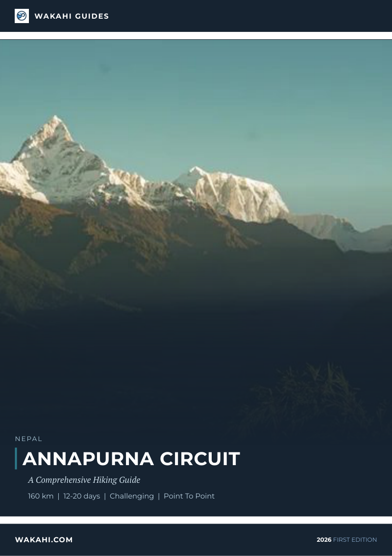
Annapurna Circuit - The Ultimate Himalayan Odyssey
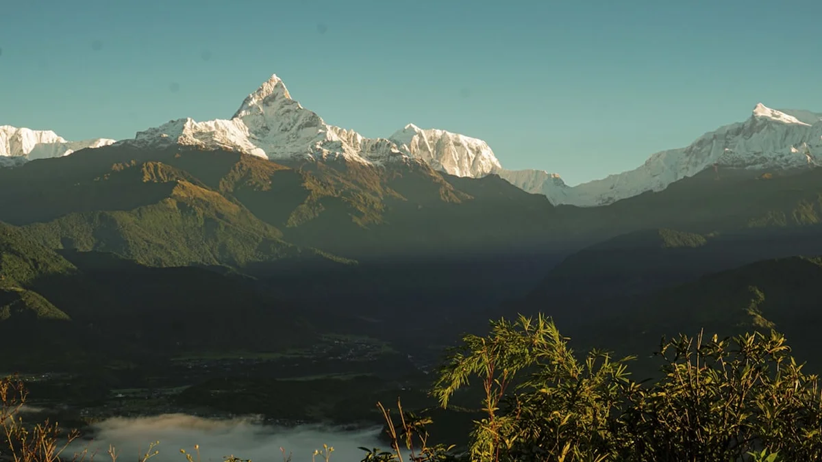
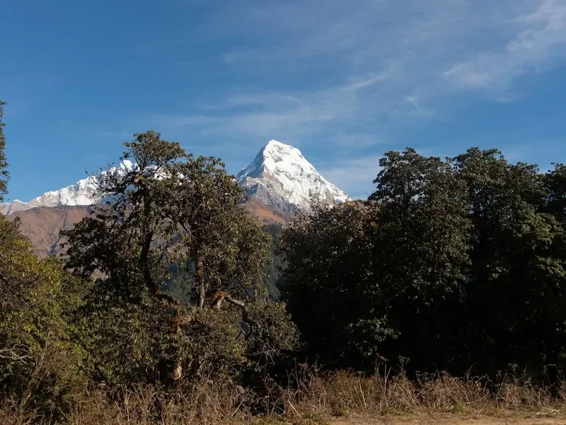
The Annapurna Circuit is widely regarded as one of the most diverse and spectacular long-distance treks on Earth. Spanning approximately 160 kilometres through the heart of the Nepalese Himalayas, this journey takes trekkers from the lush, subtropical lowlands of the Lamjung district, through the rugged alpine terrain of Manang, and over the formidable Thorong La Pass at an altitude of 5,416 metres. The route encircles the Annapurna Massif, offering constant, breathtaking views of some of the world's highest peaks, including Annapurna I (8,091 m), Dhaulagiri (8,167 m), and the iconic "Fishtail" mountain, Machhapuchhre. This is not merely a physical challenge; it is a profound cultural immersion into the lives of the Gurung, Thakali, and Manangi peoples, whose ancient villages and Buddhist monasteries line the trail. From the emerald rice paddies of the lower valleys to the stark, wind-swept high-altitude deserts of Mustang, the Annapurna Circuit provides a sensory experience that is unparalleled in the world of mountain travel.
- Distance: Approximately 160.0 km (varies based on side trips and road use)
- Duration: 12–20 days
- Elevation Gain: 5,416 m (cumulative gain is significantly higher)
- Highest Point: Thorong La Pass (5,416 m)
- Difficulty: Challenging (requires high fitness and altitude acclimatisation)
- Best Time: October–November (autumn) and April–May (spring)
- Closest City: Pokhara, Nepal
- Permits Required: ACAP (Annapurna Conservation Area Permit) and TIMS (Trekkers' Information Management System)
Overview
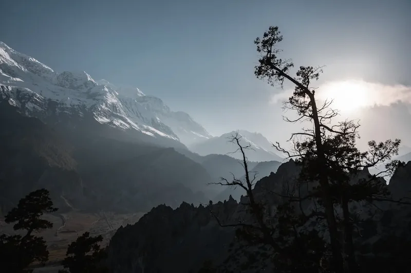
The Annapurna Circuit is a masterclass in ecological and cultural transition. The trek traditionally begins in the humid, green foothills where the air is thick with the scent of rhododendrons and the sound of rushing rivers. As you ascend, the landscape undergoes a dramatic metamorphosis. The broad-leafed forests give way to towering pines and hemlocks, which eventually thin out into the stunted junipers and hardy shrubs of the sub-alpine zone. By the time you reach the upper Manang valley, you have entered a rain-shadow region where the terrain resembles the Tibetan plateau—stark, arid, and hauntingly beautiful. The climax of the trek is the crossing of the Thorong La Pass, a high-altitude notch between the peaks of Khatung Kang and Yakawa Kang. The descent into the Mustang region reveals a different world entirely: a land of ancient caves, medieval villages like Kagbeni, and the sacred pilgrimage site of Muktinath.
In recent years, the construction of roads in the lower sections of the Marsyangdi and Kali Gandaki valleys has altered the traditional route. While some purists lament the encroachment of modernisation, the "New Annapurna Circuit" has adapted by utilising the NATT (Natural Annapurna Trekking Trails) system. These marked trails allow trekkers to bypass the dusty roads, ensuring the wilderness experience remains intact. The presence of teahouses—locally run mountain lodges—every few kilometres means that trekkers do not need to carry tents or heavy food supplies, making this one of the most accessible high-altitude adventures for independent walkers. However, the physical demands remain significant. The sheer scale of the elevation gain and the sustained time spent above 3,000 metres require respect, preparation, and a slow, methodical approach to acclimatisation.
The Annapurna Circuit is also a journey through a living museum of Himalayan spirituality. You will pass countless mani walls (stones carved with Buddhist mantras), spin prayer wheels at every village entrance, and see colourful prayer flags fluttering in the mountain breeze, carrying blessings to the heavens. The hospitality of the local people is legendary; a warm "Namaste" and a steaming bowl of dal bhat (lentil soup and rice) are the constants that sustain trekkers through the cold nights and thin air. Whether you are watching the sunrise hit the golden face of Annapurna South or navigating the scree slopes of the high pass, the circuit offers a sense of perspective that only the world's highest mountains can provide.
Wakahi Guide
Detailed route notes, maps, logistics & tips for the Annapurna Circuit (PDF).
History and Cultural Context
The trails that comprise the Annapurna Circuit have existed for centuries, long before the first Western trekker set foot in Nepal. Historically, these routes served as vital trade arteries between the lowlands of Nepal and the Tibetan plateau. Traders would lead caravans of mules and yaks laden with salt from the high-altitude lakes of Tibet to exchange for grain, spices, and cloth from the fertile southern valleys. The Kali Gandaki Gorge, which the trail follows in its later stages, is the deepest gorge in the world and was a primary corridor for this trans-Himalayan trade. The cultural tapestry of the region is a direct result of this history, with a blend of Hindu influences in the lower elevations and Tibetan Buddhist traditions in the higher reaches.
The Annapurna region was first opened to foreign trekkers in 1977, following the relaxation of travel restrictions by the Nepalese government. Before this, the area was largely unexplored by outsiders, except for mountaineering expeditions. The first successful ascent of an 8,000-metre peak occurred here in 1950, when Maurice Herzog and Louis Lachenal reached the summit of Annapurna I. This historic feat brought international attention to the massif, but it took several more decades for the trekking infrastructure to develop. The early pioneers of the circuit carried all their own supplies and camped in the wild; today's teahouse culture evolved from the local families offering space in their homes to these early adventurers.
The indigenous peoples of the Annapurna region have distinct identities. The Gurung and Magar people are famous for their service in the British and Indian Gorkha regiments, and their villages are known for their neat stone houses and terraced fields. In the higher Manang valley, the Manangi people have a long history of international trade, granted special privileges by the Nepalese monarchy in the 18th century. In the west, the Thakali people of the Kali Gandaki valley are renowned as the master hoteliers of the Himalayas, having perfected the art of hospitality through generations of hosting traders and now trekkers. Understanding this cultural heritage adds a layer of depth to the trek, transforming it from a physical feat into a journey of human connection.
Want more background? Read extended notes on history and cultural context → Learn more
Seasonal Highlights and Weather Reality
Timing is everything when planning an Annapurna Circuit trek. The weather in the Himalayas is governed by the monsoon cycle, which dictates the safety and visibility of the trail. There are two primary windows for trekking: autumn and spring.
Autumn (October to November): This is the peak trekking season and for good reason. Following the monsoon rains, the air is washed clean of dust, offering the most spectacular and consistent mountain views. The weather is generally stable, with clear blue skies and moderate temperatures during the day. However, this is also the busiest time on the trail. Teahouses can fill up quickly, and the Thorong La Pass can become crowded. Night-time temperatures at higher altitudes (above 4,000 m) will drop well below freezing, often reaching -10°C or -15°C.
Spring (April to May): The second most popular window. This is the season of rebirth; the lower forests erupt in a riot of colour as the rhododendrons—Nepal's national flower—bloom in shades of red, pink, and white. The temperatures are warmer than in autumn, making the high-altitude sections slightly more comfortable. However, the afternoons can be hazier, and there is a higher chance of afternoon clouds obscuring the peaks. This is also the season when mountaineering expeditions are active on the higher peaks.
Winter (December to February): For those who seek solitude and don't mind the extreme cold, winter trekking is possible but challenging. The skies are often crystal clear, but temperatures at Thorong Phedi can plummet to -25°C. The biggest risk in winter is the closure of the Thorong La Pass due to heavy snowfall. Many teahouses in the higher villages close for the season as the locals migrate to lower elevations. Only experienced trekkers with high-quality cold-weather gear should attempt the circuit in winter.
Monsoon (June to September): Generally avoided by trekkers. The lower sections of the trail become muddy and infested with leeches, and landslides can frequently block the roads and trails. While the Manang and Mustang regions lie in a rain shadow and remain relatively dry, getting to them involves travelling through the wet zones. Clouds usually hide the mountains, and the humidity makes for uncomfortable walking. However, the flora is at its most lush, and the waterfalls are in full, thunderous force.
Recommended Itinerary
15-Day Annapurna Circuit Itinerary
Day 1: Kathmandu/Pokhara to Besisahar and Bhulbhule
- Distance: 7 km (walking) / 180 km (drive)
- Elevation gain: 840 m
- Time: 6–7 hours driving, 2 hours walking
- Drive from Kathmandu or Pokhara to Besisahar via the Prithvi Highway
- Begin walking from Besisahar to Bhulbhule along the Marsyangdi River
- Views of Lamjung Himal begin to appear
- First night in a traditional teahouse
Day 2: Bhulbhule to Chamje
- Distance: 16 km
- Elevation gain: 1,430 m
- Time: 5–6 hours
- The trail follows the river, passing through terraced rice fields
- Cross several suspension bridges over the Marsyangdi
- Pass the impressive waterfall at Syange
- Steep climb to the village of Jagat before reaching Chamje
Day 3: Chamje to Dharapani
- Distance: 15 km
- Elevation gain: 1,860 m
- Time: 5–6 hours
- Enter the Manang district
- The valley narrows and the vegetation shifts from subtropical to temperate forest
- Climb a series of stone stairs to the plateau of Tal, a village situated on an old lakebed
- Arrive in Dharapani, the junction where the Manaslu Circuit meets the Annapurna Circuit
Day 4: Dharapani to Chame
- Distance: 15.5 km
- Elevation gain: 2,670 m
- Time: 5–6 hours
- Steady climb through pine and fir forests
- First clear views of Annapurna II (7,937 m)
- Pass through Bagarchhap and Danaque
- Arrive in Chame, the administrative headquarters of the Manang district, featuring natural hot springs
Day 5: Chame to Pisang
- Distance: 13.5 km
- Elevation gain: 3,200 m
- Time: 5 hours
- Walk through a dramatic, narrow valley carved through solid rock
- Pass the Paungda Danda, a massive curved rock face rising 1,500 m from the river
- Enter the rain shadow area; the landscape becomes noticeably drier
- Stay in Upper Pisang for superior views of the Annapurna range
Day 6: Pisang to Manang (Upper Route)
- Distance: 17 km
- Elevation gain: 3,540 m
- Time: 6–7 hours
- Take the high route via Ghyaru and Ngawal for better views and acclimatisation
- Spectacular panoramas of Annapurna II, III, IV, Gangapurna, and Tilicho Peak
- Visit ancient Buddhist monasteries in the villages
- Descend to the large, flat valley of Manang
Day 7: Manang (Acclimatisation Day)
- Distance: Variable
- Elevation: 3,540 m
- Essential rest day to allow the body to adjust to the altitude
- Optional hike to Ice Lake (4,600 m) or the Gangapurna Glacier viewpoint
- Attend the daily altitude sickness lecture provided by the Himalayan Rescue Association (HRA)
- Explore the narrow alleys and bakeries of Manang village
Day 8: Manang to Yak Kharka
- Distance: 10 km
- Elevation gain: 4,050 m
- Time: 4 hours
- Short walking day to manage altitude gain (limit to 500 m sleeping elevation gain)
- The trail leaves the Marsyangdi valley and heads north towards the pass
- Cross the Jarsang Khola and climb into alpine meadows where yaks graze
- Views of the Chulu peaks to the north
Day 9: Yak Kharka to Thorong Phedi
- Distance: 7 km
- Elevation gain: 4,450 m
- Time: 3–4 hours
- Gradual climb along the mountainside
- Cross a suspension bridge and navigate a scree slope (watch for rockfall)
- Arrive at Thorong Phedi, the base of the pass
- Some trekkers continue to High Camp (4,925 m) to shorten the next day, though this increases AMS risk
Day 10: Thorong Phedi to Muktinath via Thorong La Pass
- Distance: 15 km
- Elevation: 5,416 m (Pass), 3,760 m (Muktinath)
- Time: 8–10 hours
- Pre-dawn start (usually 4:00 AM) to avoid high winds on the pass
- Long, slow climb to the summit of Thorong La, marked by a forest of prayer flags
- Breathtaking views of the Annapurna and Dhaulagiri massifs
- Steep, knee-jarring descent of 1,600 m to the sacred village of Muktinath
Day 11: Muktinath to Marpha via Kagbeni
- Distance: 18 km
- Elevation: 2,670 m
- Time: 6–7 hours
- Walk through the arid, desert-like landscape of the Mustang region
- Visit the medieval village of Kagbeni, the gateway to Upper Mustang
- Follow the wide, windy Kali Gandaki riverbed
- Arrive in Marpha, the "Apple Capital of Nepal," famous for its brandy and white-washed houses
Day 12: Marpha to Ghasa
- Distance: 20 km (or take a local bus/jeep)
- Elevation: 2,010 m
- Time: 6 hours
- The trail descends through the deepest gorge in the world
- Transition back into green forests and warmer temperatures
- Pass through Tukuche and Larjung
- Views of the massive icefall of Dhaulagiri
Day 13: Ghasa to Tatopani
- Distance: 14 km
- Elevation: 1,190 m
- Time: 5 hours
- Continue the descent along the Kali Gandaki River
- Pass the beautiful Rupse Chhahara waterfall
- Arrive in Tatopani and soak tired muscles in the natural riverside hot springs
Day 14: Tatopani to Ghorepani
- Distance: 17 km
- Elevation gain: 2,860 m
- Time: 7–8 hours
- A challenging day with a significant ascent back into the hills
- Pass through the villages of Shikha and Chitre
- Enter dense rhododendron forests
- Arrive in Ghorepani, a village with stunning views of the Dhaulagiri range
Day 15: Ghorepani to Nayapul and Pokhara
- Distance: 12 km (walking) / 45 km (drive)
- Elevation: 1,070 m (Nayapul)
- Time: 5 hours walking, 2 hours driving
- Early morning hike to Poon Hill (3,210 m) for a world-famous sunrise over the Himalayas
- Descend through the forest and stone steps to Ulleri and Tikhedhunga
- Finish the trek at Nayapul and take a taxi or bus back to Pokhara
- Celebrate the completion of the circuit in the lakeside cafés of Pokhara
Planning and Bookings
Book Your Trip
Everything you need to plan your journey
Accommodation
Find places to stay near Pokhara
Flights
Search flights to Pokhara
Essential Preparation
The Annapurna Circuit requires a high level of physical fitness and mental resilience. You should be capable of walking 5–8 hours a day for multiple consecutive days, often on steep and uneven terrain. Cardiovascular training (running, cycling, swimming) and hill walking with a weighted pack are the best ways to prepare. Beyond fitness, logistics are key. Most trekkers fly into Kathmandu (KTM) and spend a few days organising permits and gear before taking a bus or private jeep to the trailhead at Besisahar. Pokhara is the usual end point and serves as a perfect place to recover. It is highly recommended to build at least two "buffer days" into your itinerary to account for flight delays, weather issues, or the need for extra acclimatisation.
Trail Accommodation
Accommodation on the Annapurna Circuit is provided by teahouses. These are small, family-run lodges that offer a bed and meals. While the quality of teahouses has improved significantly, they remain basic, especially at higher altitudes.
Hut Facilities:
- Twin-share rooms with two single beds and foam mattresses
- Common dining room, usually heated by a central wood or yak-dung stove in the evening
- Blankets are usually provided, but a high-quality sleeping bag is essential for hygiene and warmth
- Toilets are a mix of Western-style sit-down and Asian-style squat toilets (often shared)
- Showers are available in most villages (gas or solar-heated), though they may cost extra (200–500 NPR)
- Electricity for charging devices is available in most teahouses for a small fee
- WiFi is increasingly common but becomes unreliable and expensive as you go higher
What Teahouses Don't Provide:
- Toilet paper and toiletries
- Towels
- Heating in the bedrooms (rooms are uninsulated and very cold at night)
- Free drinking water (you must buy boiled water or treat your own)
Booking Requirements:
- During the peak seasons (October and April), teahouses can be very busy. While you cannot usually book ahead online for most remote lodges, your guide (if you have one) will call ahead to secure rooms
- If trekking independently, aim to arrive at your destination by early afternoon to ensure you get a room
- Costs: Rooms are very cheap (500–1,000 NPR) on the condition that you eat breakfast and dinner at the teahouse. The profit for the owners comes from the food, not the bed
Required Gear
- Trekking boots: High-quality, waterproof, and well broken-in. Ankle support is vital for the rocky descents
- Down jacket: Rated for -15°C or lower. Essential for evenings and the pass crossing
- Hard-shell waterproof jacket: Breathable (Gore-Tex) to protect against wind and rain
- Sleeping bag: 4-season rated (comfort level -10°C to -15°C)
- Backpack: 40–50L if carrying your own gear; 20–30L daypack if using a porter
- Trekking poles: Highly recommended to save your knees on the 1,600 m descent from the pass
- Head torch: Essential for the pre-dawn start on Day 10 and navigating teahouses at night
- Base layers: Merino wool or synthetic (avoid cotton as it stays wet and cold)
- Insulating layers: Fleece or heavy wool mid-layers
What to Bring
- Water purification: UV purifier (SteriPEN), chlorine dioxide tablets, or a high-quality filter (Sawyer Squeeze). Avoid buying plastic bottled water to protect the environment
- Cash: Sufficient Nepalese Rupees (NPR) for the entire trek. There are no ATMs between Jomsom and Besisahar (except for one unreliable machine in Manang)
- Sun protection: SPF 50+ sunscreen, lip balm with SPF, and Category 4 sunglasses (essential to prevent snow blindness on the pass)
- First aid kit: Including Diamox (for altitude), Ibuprofen, blister pads (Compeed), rehydration salts, and a broad-spectrum antibiotic
- Snacks: Energy bars, nuts, and chocolate. These are expensive to buy on the trail
- Toiletries: Biodegradable soap, wet wipes, hand sanitiser, and a quick-dry towel
- Power bank: To keep your phone and camera charged in cold temperatures
- Map and Compass: A physical map of the Annapurna Circuit and an offline GPS app (like Maps.me)
Permits

To trek the Annapurna Circuit, you require two specific documents. These must be obtained before you leave Kathmandu or Pokhara, as they are checked at various police checkpoints along the trail. Failure to produce these permits can result in heavy fines or being turned back.
1. Annapurna Conservation Area Permit (ACAP):
- Cost: 3,000 NPR (approx. 23 USD) for foreigners; 1,000 NPR for SAARC nationals
- Validity: Single entry, valid for the duration of your trek within the conservation area
- Where to get it: Nepal Tourism Board (NTB) offices in Kathmandu or Pokhara
- Requirements: Two passport-sized photos and your passport
2. Trekkers' Information Management System (TIMS) Card:
- Cost: 2,000 NPR (approx. 15 USD)
- Purpose: To ensure the safety and security of trekkers by maintaining a database of their whereabouts
- Where to get it: NTB offices or through a registered trekking agency
- Requirements: Two passport-sized photos and your passport
Important Note: As of April 2023, the Nepal Tourism Board announced that independent trekking (without a guide) is officially restricted in most national parks, including the Annapurna region. While enforcement can vary, it is highly recommended to hire a licensed guide or porter through a reputable agency. This not only ensures compliance with local regulations but also significantly enhances your safety and provides valuable cultural insight.
Other Activities in the Area
The Annapurna region and its surrounding cities offer numerous ways to extend your adventure:
- Tilicho Lake Side Trip: From Manang, take a 3-day detour to one of the highest lakes in the world (4,919 m). The scenery is stark and spectacular, though the trail is challenging.
- Poon Hill Sunrise: Even if you don't do the full circuit, the hike to Poon Hill from Ghorepani is a must for the panoramic view of the Dhaulagiri and Annapurna ranges.
- Pokhara Lakeside: After the trek, relax in Pokhara. You can go paragliding from Sarangkot, paddle a boat on Phewa Lake, or visit the World Peace Pagoda.
- Upper Mustang Trek: For those with a larger budget and more time, the restricted region of Upper Mustang offers a glimpse into a preserved Tibetan culture. Requires a special permit (500 USD).
- Hot Springs: Besides Tatopani, there are smaller, less-visited hot springs near Chame and Jhinu Danda.
- Yoga and Meditation: Many centres in Pokhara and Kathmandu offer retreats specifically designed for post-trek recovery.
Safety and Conditions
Altitude Sickness (AMS): This is the single greatest risk on the Annapurna Circuit. Acute Mountain Sickness can affect anyone, regardless of age or fitness level. The key to prevention is a slow ascent. Never skip the acclimatisation day in Manang. Follow the golden rule: "Climb high, sleep low." If you develop symptoms (severe headache, nausea, dizziness, loss of appetite), do not ascend further. If symptoms persist or worsen, descend immediately. High Altitude Pulmonary Oedema (HAPE) and High Altitude Cerebral Oedema (HACE) are life-threatening conditions that require emergency evacuation.
Water Safety: Never drink untreated tap or stream water. Use a reliable purification method. Staying hydrated is also crucial for altitude acclimatisation; aim to drink 3–4 litres of fluid per day.
Trail Conditions: The trail is generally well-maintained, but landslides can occur, particularly after heavy rain. Between Yak Kharka and Thorong Phedi, there is a notorious "landslide zone" where you must move quickly and watch for falling rocks. On the Thorong La Pass, snow and ice can make the trail slippery; micro-spikes are a useful addition to your gear list.
Weather Awareness: Mountain weather is unpredictable. A clear morning can turn into a blizzard by afternoon. Always check the forecast in Manang or Thorong Phedi before attempting the pass. If the locals or guides say the pass is closed, respect their decision.
Insurance: Ensure your travel insurance specifically covers trekking up to 6,000 metres and includes emergency helicopter evacuation. Most standard policies cap out at 2,500 or 3,000 metres.
Side Trips and Points of Interest
Ice Lake (Kicho Tal): A challenging but rewarding acclimatisation hike from Manang or Braga. Located at 4,600 m, the lake offers a mirror-like reflection of the Annapurna peaks. It takes about 6–7 hours return and is excellent preparation for the Thorong La Pass.
Braga Monastery: One of the oldest monasteries in the region, perched on a cliffside in the village of Braga (near Manang). It contains hundreds of ancient Buddha statues and offers a fascinating look into the spiritual history of the Manangi people.
The Kali Gandaki Gorge: As you descend from Muktinath to Tatopani, you are walking through the deepest gorge in the world, flanked by the 8,000-metre giants of Annapurna I and Dhaulagiri. The scale of the vertical relief here is staggering.
Milarepa’s Cave: Located near the village of Braka, this cave is associated with the famous Tibetan poet and saint Milarepa. It is a site of pilgrimage and offers a peaceful, spiritual atmosphere away from the main trail.
Leave No Trace
The Annapurna Conservation Area is a fragile ecosystem under significant pressure from tourism. It is the responsibility of every trekker to minimise their impact on this pristine environment.
Key Principles:
- Say No to Plastic: The disposal of plastic bottles is a major problem in the mountains. Use a refillable bottle and treat your own water.
- Pack It Out: Do not leave any rubbish on the trail or in the teahouses. This includes cigarette butts and food wrappers.
- Stay on the Trail: Cutting switchbacks causes erosion and destroys fragile alpine vegetation.
- Respect Wildlife: Observe animals from a distance. Do not feed the monkeys, marmots, or birds.
- Proper Sanitation: Use the toilets provided in teahouses. If you must go on the trail, ensure you are at least 50 metres from water sources and bury your waste deeply.
- Conserve Energy: Huts use limited resources for heating and cooking. Keep showers short and avoid asking for room heating where it is not provided.
- Cultural Respect: Always walk to the left of mani walls and stupas. Ask for permission before taking photos of local people.