Andringitra National Park Trek - The Granite Heart of Madagascar
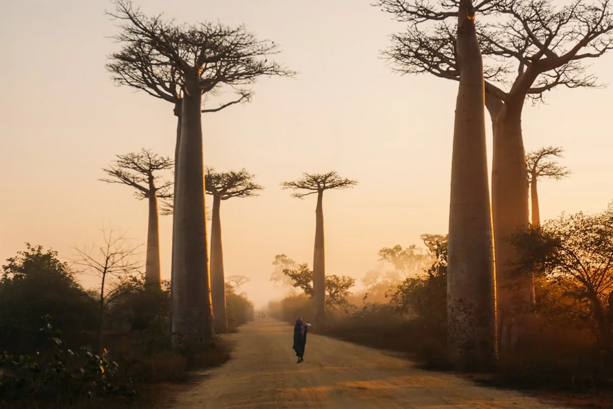
The Andringitra National Park Trek is arguably the most spectacular high-altitude journey in Madagascar, offering a profound contrast to the island's famous coastal rainforests and baobab-lined plains. Spanning approximately 45 kilometres through the rugged southern highlands, this trek culminates in the ascent of Pic d'Imarivolanitra (formerly Pic Boby), which at 2,658 metres stands as the highest accessible peak in the country. The route is a masterclass in ecological diversity, transitioning from the lush, humid eastern slopes through high-altitude heathlands and eventually into the stark, "lunar" landscapes of the granite massif. This is not merely a hike; it is a traverse through an ancient geological fortress that has remained largely unchanged for millions of years, providing a sanctuary for endemic flora and fauna found nowhere else on Earth.
Located approximately 47 kilometres south of the town of Ambalavao, Andringitra is a place of immense spiritual and cultural significance for the local Bara and Betsileo people. The trek typically takes between three and six days, depending on the chosen route and the inclusion of the dramatic Tsaranoro Valley. It demands a high level of physical fitness, as the elevation gain exceeds 2,500 metres over the course of the journey, often involving steep, technical scrambles and exposed ridgelines. However, the reward is a landscape of staggering scale: sheer granite walls that rival Yosemite, cascading waterfalls that drop hundreds of metres into hidden canyons, and the chance to see the resilient high-altitude ring-tailed lemurs that have adapted to the freezing night-time temperatures of the massif.
- Distance: 45.0 km (standard traverse)
- Duration: 3–6 days
- Elevation Gain: 2,500 m
- Difficulty: Challenging
- Highest Point: Pic d'Imarivolanitra (2,658 m)
- Best Time: April to October (dry season)
- Closest City: Ambalavao
- Permits: Mandatory (purchased at park office in Namoly or Antanifotsy)
Overview
Andringitra National Park is often described as the "Yosemite of Africa," a comparison that becomes immediately apparent as one approaches the massive granite domes of the central massif. The park covers over 31,000 hectares and is part of the UNESCO World Heritage site "Rainforests of the Atsinanana." Unlike the more frequented parks of the north, Andringitra offers a raw, wilderness experience where the infrastructure is minimal and the sense of isolation is profound. The trek is defined by its three distinct zones: the low-lying tropical rainforests of the east, the high-altitude montane prairies, and the sub-alpine "lunar" landscape of the summit plateau.
The journey typically begins in the Namoly Valley, a fertile basin where the Betsileo people have carved intricate rice terraces into the hillsides. As you ascend, the humid air of the valleys gives way to the crisp, thin air of the highlands. The vegetation shifts dramatically from dense ferns and orchids to hardy succulents, aloes, and the endemic *Pachypodium* (elephant's foot) plants that cling to the granite cracks. The central feature of the trek is the ascent of Pic d'Imarivolanitra. The climb is a test of endurance, involving a series of steep stone steps and rocky scrambles, but the 360-degree view from the summit—stretching across the southern plains of Madagascar—is unparalleled.
Beyond the summit, the trek descends into the "Lunar Landscape," a vast, undulating plateau of weathered granite that feels like another planet. Here, the silence is absolute, broken only by the wind or the occasional call of a bird. The final leg of the journey usually leads into the Tsaranoro Valley, famous for its 800-metre vertical granite walls that attract world-class rock climbers. This valley is also one of the best places to spot the iconic ring-tailed lemur (*Lemur catta*) in its natural habitat. The combination of physical challenge, geological wonder, and unique biodiversity makes the Andringitra trek a bucket-list destination for serious hikers and nature enthusiasts alike.
History and Cultural Context
The history of Andringitra is deeply intertwined with the spiritual beliefs of the local Malagasy tribes. For the Bara people, who are traditionally semi-nomadic pastoralists, the high peaks of the massif are sacred. They believe the mountains are the dwelling places of ancestral spirits, and many of the caves and high plateaus are used for traditional ceremonies and burials. The name "Imarivolanitra" itself translates to "close to the sky," reflecting the mountain's status as a bridge between the earthly and spiritual realms. Hikers are often reminded by their guides to respect local "fady" (taboos), which may include prohibitions against pointing at certain peaks or bringing specific foods into sacred areas.
The area was first formally recognised for its ecological importance in 1927 when it was established as a "Strict Nature Reserve" by the French colonial administration. However, it wasn't until 1999 that it was reclassified as a National Park, allowing for managed ecotourism and trekking. This transition was crucial for the local economy, as it provided an alternative to the traditional "slash-and-burn" agriculture (tavy) that had begun to encroach on the park's boundaries. Today, the park is managed by Madagascar National Parks (MNP), and the trekking industry is a vital source of income for the surrounding villages, with many locals working as guides, porters, and cooks.
The cultural landscape is as much a part of the trek as the physical one. Walking through the Namoly Valley, hikers pass through traditional Betsileo villages where life follows the rhythm of the rice harvest. The Betsileo are renowned for their masonry skills, which are evident in the beautifully constructed stone paths and terraces that line the lower sections of the trail. Understanding this cultural backdrop—the reverence for the land and the resilience of the people who live in its shadow—adds a layer of depth to the trekking experience that goes beyond mere physical exertion.
Want more background? Read extended notes on history and cultural context → Learn more
Seasonal Highlights and Weather Reality
The climate in Andringitra is characterised by two distinct seasons: the dry season and the wet season. Because of its high altitude, the park experiences some of the most extreme temperature fluctuations in Madagascar, and hikers must be prepared for conditions that can change from scorching sun to freezing rain within an hour.
The Dry Season (April to October): This is the optimal time for trekking. The skies are generally clear, providing the best visibility for the summit and the lunar landscape. However, this is also the Malagasy winter. Between June and August, night-time temperatures on the Andriampotsy plateau (the base camp for the summit) regularly drop below 0°C, and frost is common. During the day, the sun is intense, and temperatures can rise to 20°C or 25°C. The dry season is also the best time for photography, as the light is crisp and the granite massifs are not shrouded in mist.
The Wet Season (November to March): Trekking during this period is significantly more challenging and is generally discouraged for most hikers. Heavy rains make the granite paths extremely slippery and dangerous, particularly on the steep descent into the Tsaranoro Valley. Thunderstorms are frequent in the afternoons, and the summit is often obscured by thick clouds. However, the wet season is when the park's flora is at its most vibrant. The waterfalls, such as Riandahy and Rianbavy, are at their most powerful, and the orchids are in full bloom. If you choose to trek during the shoulder months (November or March), be prepared for wet gear and potential delays.
Regardless of the season, the wind is a constant factor on the high plateaus. Strong gusts can make the ridgeline sections feel precarious, and a high-quality windproof jacket is an essential piece of equipment year-round. Always check the local forecast in Ambalavao before heading into the park, as mountain weather can be unpredictable even in the height of the dry season.
Recommended Itinerary
4-Day Andringitra Traverse Itinerary
Day 1: Namoly Trailhead to Belambo / Andriampotsy
- Distance: 12 km
- Elevation gain: 800 m
- Time: 5–6 hours
- Start at the park office in Namoly (1,450 m) after completing permit formalities
- Ascend through the "Sacred Forest" and past the Riandahy and Rianbavy waterfalls
- The trail follows a well-constructed stone path built by the Betsileo people
- Pass through the "King's Gate," a natural rock formation that marks the entrance to the high massif
- Arrive at the Andriampotsy campsite (2,050 m), situated on a flat granite shelf beneath the towering cliffs
- Evening temperatures drop rapidly; prepare for a cold night
Day 2: Andriampotsy to Pic d'Imarivolanitra (Summit) and back to Camp
- Distance: 8 km (return)
- Elevation gain: 600 m
- Time: 4–5 hours
- Pre-dawn start is essential to reach the summit for sunrise and avoid mid-morning clouds
- The climb involves steep stone steps and some light scrambling over granite slabs
- Reach the summit of Pic d'Imarivolanitra (2,658 m), the highest point of the trek
- Enjoy panoramic views of the southern highlands and the distant Indian Ocean (on very clear days)
- Descend back to Andriampotsy for a late lunch and rest
- Optional afternoon exploration of the nearby caves used by local shepherds
Day 3: Andriampotsy to Iantaranomby (The Lunar Landscape)
- Distance: 15 km
- Elevation: 200 m gain, 600 m descent
- Time: 6–7 hours
- Traverse the "Lunar Landscape," a vast plateau of weathered granite domes and strange rock formations
- This is the most isolated part of the trek, with no permanent settlements
- Look for the endemic *Pachypodium* plants and high-altitude succulents
- The trail is less defined here; rely on your guide's knowledge of the cairns
- Descend towards the Iantaranomby River, where the campsite is located near a beautiful natural swimming hole
- The landscape begins to soften as you approach the edge of the massif
Day 4: Iantaranomby to Tsaranoro Valley
- Distance: 10 km
- Elevation: 800 m descent
- Time: 4–5 hours
- A steep and demanding descent off the granite massif into the Tsaranoro Valley
- The trail offers spectacular views of the "Le Caméléon" rock formation and the Tsaranoro Cliff
- Enter the transition forest where ring-tailed lemurs are frequently spotted
- Finish the trek at one of the eco-lodges in the Tsaranoro Valley (approx. 800 m elevation)
- Celebrate the completion of the trek with a cold drink and a view of the walls you just descended
Important Notes:
- A local guide is mandatory for all treks within the National Park
- Porters are highly recommended to carry camping gear and food, allowing you to focus on the terrain
- Water must be treated; while mountain streams are plentiful, they are often used by livestock upstream
- The descent on Day 4 is very hard on the knees; trekking poles are strongly advised
- Ensure your transport is arranged for pickup in the Tsaranoro Valley, as it is remote
Planning and Bookings
Book Your Trip
Everything you need to plan your journey
Accommodation
Find places to stay near Ambalavao
Flights
Search flights to Ambalavao
Essential Preparation
Planning a trek in Andringitra requires more logistical coordination than most other Malagasy parks. The primary hub for the park is the town of Ambalavao. Here, you should stock up on all food supplies, as nothing is available once you leave the town. Most hikers spend a night in Ambalavao to organise their guide and transport. The journey from Ambalavao to the Namoly trailhead requires a 4x4 vehicle and takes approximately two to three hours over a very rough, unpaved road. This transport must be arranged in advance, as there is no regular public transport to the park entrance.
Physical preparation is crucial. The trek involves significant elevation changes and sustained walking at altitudes above 2,000 metres. If you are coming from the coast, allow at least a day in Ambalavao (1,000 m) to begin acclimatising. While altitude sickness is rare at 2,600 metres, the thin air will make the steep climbs feel significantly more strenuous. Ensure you have a reliable way to communicate; while there is some mobile signal in Ambalavao, it is non-existent within the park's interior.
Trail Accommodation
Accommodation within Andringitra National Park is limited to designated campsites. There are no permanent huts or lodges along the main trekking route until you reach the Tsaranoro Valley at the end of the journey.
Campsite Facilities:
- Flat cleared areas for pitching tents
- Basic pit toilets (long-drops)
- Access to a nearby water source (stream or spring)
- Simple stone-walled cooking shelters (used by porters and guides)
- No electricity, showers, or rubbish disposal facilities
What is NOT Provided:
- Tents, sleeping bags, and mats (must be brought or hired in Ambalavao)
- Cooking equipment, stoves, and fuel
- Food and snacks
- Lighting (head torches are essential)
Tsaranoro Valley Accommodation: At the conclusion of the trek, the Tsaranoro Valley offers several excellent eco-lodges and permanent tented camps. These provide a high level of comfort, including hot showers, comfortable beds, and restaurant facilities. It is highly recommended to book these in advance, especially during the peak season (July–August), as they are popular with both trekkers and rock climbers.
Required Gear
- High-quality trekking boots - Must be waterproof with excellent grip for granite slabs. Ensure they are well broken-in.
- Four-season sleeping bag - Essential for the Andriampotsy camp where temperatures drop below freezing. A comfort rating of -5°C is recommended.
- Insulated sleeping mat - Crucial for thermal protection from the cold granite ground.
- Layered clothing system - Merino wool base layers, a fleece mid-layer, and a high-quality down or synthetic insulated jacket.
- Hard-shell waterproof jacket - Must be windproof and capable of handling heavy tropical downpours.
- Trekking poles - Highly recommended for the steep 800 m descent into the Tsaranoro Valley to protect knees.
- Head torch - With extra batteries; essential for the pre-dawn summit push and navigating camp at night.
- Sun protection - High-factor sunscreen, lip balm with SPF, and a wide-brimmed hat. The UV radiation at 2,500 m is intense.
What to Bring
- All food for the duration of the trek - High-calorie, lightweight meals (pasta, rice, dried beans) and plenty of snacks (nuts, chocolate, energy bars).
- Water purification - A high-quality filter (like a Sawyer Squeeze) or purification tablets (Chlorine Dioxide).
- Cooking stove and fuel - Multi-fuel or gas canister stoves. Note: Gas canisters can be difficult to find in Madagascar; check availability in Antananarivo or Ambalavao.
- Personal first aid kit - Including blister treatment (Compeed), rehydration salts, anti-diarrhoeal medication, and broad-spectrum antibiotics.
- Biodegradable toiletries - Soap, toothpaste, and wet wipes. Ensure all washing is done at least 30 metres from water sources.
- Dry bags - To keep your sleeping bag and spare clothes dry inside your pack during rain.
- Cash - Sufficient Malagasy Ariary (MGA) to pay your guide, porters, and park fees. There are no ATMs near the park.
Permits
Permits for Andringitra National Park are mandatory and are managed by Madagascar National Parks (MNP). Unlike some of the more commercialised parks, you do not need to book months in advance, but you must register and pay your fees at the park office before entering the trail.
Permit Process:
- The main park office is located in the village of Namoly. There is also an office in Antanifotsy.
- You must present your passport (or a clear photocopy) for registration.
- Fees are paid in cash (Malagasy Ariary).
- The permit is valid for the specific number of days you intend to stay in the park.
- You will be issued a paper permit which must be carried with you and shown to park rangers if requested.
Mandatory Guide Requirement: It is a strict regulation of Madagascar National Parks that all visitors must be accompanied by a certified local guide. This is both for safety and to ensure that local communities benefit from tourism. Guides can be hired at the park office in Namoly or pre-arranged through a tour operator in Ambalavao. Most guides speak French and Malagasy; English-speaking guides are available but should be requested in advance.
Estimated Costs (Subject to Change):
- Park Entry Fee: Approximately 65,000 MGA per adult for a 1-day pass, with reduced rates for subsequent days.
- Community Fund: A small daily fee (approx. 5,000 MGA) that goes directly to local village projects.
- Guide Fees: Expect to pay between 80,000 and 120,000 MGA per day, depending on the group size and the complexity of the route.
- Porter Fees: Approximately 40,000 to 60,000 MGA per day. Porters typically carry up to 15 kg of group gear.
Tipping Etiquette: Tipping is customary and highly appreciated in Madagascar. If your guide and porters have provided good service, a tip of 10–15% of the total fee is standard. It is best to give tips individually at the end of the trek.
Other Activities in the Area
The region surrounding Andringitra National Park offers a wealth of activities for those who wish to extend their stay or are looking for alternatives to the main trek:
- Rock Climbing in Tsaranoro: The Tsaranoro Valley is a world-renowned destination for big-wall climbing. The 800-metre granite faces offer routes ranging from intermediate to extremely difficult. Several eco-lodges in the valley provide climbing gear rental and can arrange local climbing guides.
- Lemur Watching: While the trek itself offers chances to see lemurs, the forests around the Tsaranoro Valley and the Anja Community Reserve (near Ambalavao) are the best places to see large troops of ring-tailed lemurs. Anja is particularly famous for its high density of lemurs and its successful community-led conservation model.
- Silk Weaving Workshops: Ambalavao is the centre of Madagascar's wild silk industry. You can visit local workshops to see the entire process, from the boiling of the cocoons to the intricate weaving of the "Lamba" (traditional Malagasy wraps).
- Antaimoro Paper Factory: Also in Ambalavao, you can see the traditional method of making paper from the bark of the Avoha tree, a craft introduced by Arab settlers centuries ago. The paper is often decorated with fresh flowers and is a unique local souvenir.
- Zebu Market: If you are in Ambalavao on a Wednesday or Thursday, the Zebu market is a must-see. It is one of the largest in the country, where thousands of cattle are traded by Bara herdsmen who have travelled for days to reach the town.
- Paragliding: The thermal conditions and massive cliffs of the Tsaranoro Valley make it a spectacular, albeit niche, location for paragliding. This usually requires bringing your own equipment and coordinating with local lodges.
Safety and Conditions
Pre-Departure Checks:
- Ensure you have a comprehensive travel insurance policy that covers high-altitude trekking and emergency medical evacuation by helicopter.
- Check the weather forecast in Ambalavao; if a tropical cyclone is approaching the east coast, postpone your trek, as Andringitra will experience heavy rain and dangerous winds.
- Inform your lodge in Ambalavao or your transport driver of your expected return date and route.
- Verify that your guide has a first aid kit and knows the emergency evacuation protocols.
Altitude and Exposure: While 2,658 metres is not high enough to cause severe High Altitude Pulmonary Edema (HAPE) for most people, the effects of altitude are still felt. Symptoms of mild Acute Mountain Sickness (AMS), such as headaches, nausea, and fatigue, can occur. The best prevention is to stay hydrated and ascend slowly. The granite terrain is extremely exposed; there is very little shade on the high plateaus, and the risk of heatstroke and severe sunburn is high. Conversely, the risk of hypothermia is genuine during the night or if you get wet and the wind picks up.
Terrain Hazards: The granite slabs of Andringitra are incredibly grippy when dry but become like ice when wet. Great care must be taken on the steep sections of the Pic Boby ascent and the Tsaranoro descent during or after rain. Some sections of the trail involve walking along narrow ridges with significant drops; if you suffer from severe vertigo, discuss the route options with your guide beforehand.
Health and Hygiene: Malaria is present in the lower valleys of Madagascar, although the risk is lower at the high altitudes of Andringitra. Use repellent in Ambalavao and the Tsaranoro Valley. Waterborne diseases are a risk; never drink untreated water from streams, as zebu (cattle) graze throughout the park. Ensure all food prepared by your crew is cooked thoroughly and that hand hygiene is maintained.
Emergency Communication: There is no reliable mobile phone coverage within the central massif. Some guides carry satellite phones or long-range radios, but this is not guaranteed. A Personal Locator Beacon (PLB) or Garmin inReach is a highly recommended piece of safety gear for independent groups.
Side Trips and Points of Interest
Riandahy and Rianbavy Waterfalls: Located near the start of the trek in the Namoly Valley, these twin waterfalls are steeped in local legend. "Riandahy" (The Male Fall) and "Rianbavy" (The Female Fall) cascade side-by-side down a 300-metre cliff. Local belief holds that couples who have difficulty conceiving can be blessed by bathing in the pools at the base of the falls. The view of these falls against the backdrop of the granite massif is one of the most iconic images of the park.
The Sacred Forest: As you begin the ascent from Namoly, the trail passes through a patch of dense, high-altitude rainforest known as the Sacred Forest. This area is a "fady" zone where hunting and wood-cutting are strictly prohibited. As a result, it is a haven for birdlife and several species of lemur, including the Milne-Edwards' sifaka. The forest is draped in old-man's-beard lichen and epiphytic orchids, creating a mystical, primeval atmosphere.
The King's Gate (Porte de l'Andringitra): This is a dramatic natural rock archway formed by two massive granite boulders leaning against each other. Historically, it served as a symbolic entrance to the high mountain pastures for the Bara kings. Passing through the gate marks the transition from the inhabited valleys to the wild, high-altitude wilderness of the massif.
The Lunar Landscape (Le Paysage Lunaire): This vast, high-altitude plateau is one of the most geologically unique areas in Madagascar. Millions of years of erosion have sculpted the granite into smooth domes, deep fissures, and balancing rocks. The vegetation here is minimal, consisting of hardy grasses and the strange, succulent *Pachypodium densiflorum*. Walking across this plateau at sunset, when the granite turns a deep orange and purple, is a highlight of the trek.
Le Caméléon: A massive rock formation in the Tsaranoro Valley that, when viewed from the correct angle, bears a striking resemblance to a giant chameleon sitting on the ridgeline. It is a popular side-hike for those staying in the Tsaranoro Valley and offers a different perspective on the main Andringitra massif.
Leave No Trace
Andringitra National Park is a fragile ecosystem that faces increasing pressure from climate change and human encroachment. As a trekker, you have a responsibility to minimise your impact on this pristine environment. The "Leave No Trace" principles are not just guidelines here; they are essential for the survival of the park's unique biodiversity.
Your responsibility as a walker:
- Pack it in, pack it out: There are no rubbish collection facilities in the park. You must carry out all your trash, including food scraps, cigarette butts, and plastic packaging. Encourage your porters and guides to do the same.
- Respect the Water: Do not use soap or detergent directly in the streams. Carry water 30 metres away from the source for washing. Even biodegradable soap can harm the delicate aquatic life in mountain pools.
- Stay on the Path: The high-altitude vegetation, particularly the mosses and succulents, is extremely slow-growing. Stepping off the trail can cause damage that takes decades to repair.
- No Campfires: Wood is scarce at high altitudes, and the risk of wildfire is high during the dry season. Use a camping stove for all cooking.
- Proper Waste Disposal: Use the pit toilets provided at campsites. If you are caught between camps, bury human waste in a "cathole" at least 15 cm deep and 60 metres from water sources. Pack out all used toilet paper in a sealed bag.
- Respect the Wildlife: Never feed lemurs or other animals. This disrupts their natural foraging behaviour and can make them aggressive towards humans.
- Cultural Respect: Always follow your guide's advice regarding "fady" (taboos). Do not take photos of people or sacred sites without asking permission.
By following these principles, you ensure that the "Granite Heart of Madagascar" remains as wild and sacred for future generations as it is today.