Amatola Trail - South Africa's Ultimate Mountain Challenge
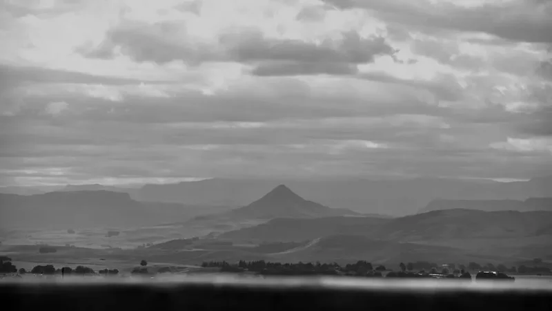
The Amatola Trail is widely regarded as the most physically demanding and rewarding multi-day trek in South Africa. Stretching approximately 100 kilometres through the ancient Amathole Mountains in the Eastern Cape, this journey is a profound immersion into a landscape of mist-belt forests, hidden waterfalls, and rugged alpine plateaus. Starting at Maden Dam near Qonce (King William's Town) and concluding in the mystical village of Hogsback, the trail traverses a wilderness that feels untouched by time. This is not a walk for the faint-hearted; with a cumulative elevation gain of over 6,000 metres, it tests the endurance of even the most seasoned hikers. However, for those who accept the challenge, the rewards are unparalleled: crystal-clear mountain pools, sightings of the rare Cape Parrot, and the silence of indigenous forests where yellowwood trees have stood for centuries. The Amatola is more than just a hike; it is a pilgrimage through one of Africa's most diverse and dramatic botanical corridors.
- Distance: 100.0 km one-way
- Duration: 5–6 days (Standard itinerary is 6 days; 5-day options for elite hikers)
- Season: Year-round, but April–May and September–October offer the most stable conditions
- Huts: Gwili Gwili, Dontsa, Cata, Mnyameni, Zingcuka
- Highest point: Geju Peak (1,880 m)
- Difficulty: Challenging / Extreme (High fitness and mountain experience required)
- Direction: East to West (Maden Dam to Hogsback)
Overview
The Amatola Trail is a masterclass in topographical diversity. Unlike many coastal or high-altitude treks that maintain a consistent character, the Amatola constantly shifts its identity. One hour you are navigating a dark, damp forest floor carpeted in emerald moss and ancient ferns; the next, you are emerging onto a windswept grassy ridge with views stretching toward the Indian Ocean. The trail is famous for its "verticality"—the route rarely follows contours, instead opting for direct ascents and descents that challenge the knees and the spirit. This relentless rhythm of climbing and descending is what gives the trail its reputation as the "toughest in South Africa," surpassing even the famous Otter Trail in terms of pure physical exertion.
Water is the defining element of the Amathole range. The mountains act as a massive sponge, capturing moisture from the Indian Ocean and releasing it through hundreds of streams and waterfalls. Hikers will cross dozens of rivers, many of which offer deep, icy pools perfect for a midday swim. The forest sections are particularly enchanting, home to the Outeniqua Yellowwood (Podocarpus falcatus), which can grow to over 40 metres in height. These forests are also the last stronghold of the endangered Cape Parrot, whose squawks often echo through the canopy. The transition from these lush forests to the high-altitude fynbos and grasslands of the upper plateaus provides a fascinating look at South Africa's unique floral kingdoms.
Logistically, the trail is a self-sufficient adventure. Hikers must carry all their gear, food, and supplies for the duration of the trek. The accommodation consists of basic mountain huts, which provide shelter and a sense of community at the end of each gruelling day. Because the trail is a point-to-point route, it requires careful planning regarding transport and shuttles. The isolation of the Amathole Mountains means that once you begin, there are very few "escape routes," making mental preparation as important as physical fitness. For those who complete the 100-kilometre journey, the arrival in Hogsback—a village said to have inspired J.R.R. Tolkien’s Middle-earth—is a moment of profound achievement.
History and Cultural Context
The Amathole Mountains, meaning "The Calves" in isiXhosa, hold deep spiritual and historical significance for the Xhosa people. The range served as a natural fortress during the 19th-century Frontier Wars, a series of nine conflicts between the Xhosa Kingdom and British colonial forces. The dense forests and hidden valleys provided cover for Xhosa warriors, most notably under the leadership of King Sandile, whose legacy is still felt throughout the region. Many of the peaks and valleys you traverse were once the sites of fierce battles and strategic retreats. Walking the Amatola is, in many ways, walking through a living museum of South African resistance and resilience.
The trail itself was formally established in 1984 by the Department of Forestry. It was designed to showcase the incredible biodiversity of the state-managed forests and to provide a world-class wilderness experience. Over the decades, the trail has gained a cult following among South African "peak baggers" and endurance athletes. The maintenance of the trail is a monumental task, involving the clearing of fast-growing forest vegetation and the upkeep of remote huts. In recent years, community-based tourism initiatives have become more integrated into the trail experience, particularly in the village of Cata, where hikers can learn about the history of land restitution and local Xhosa culture.
The geological history of the range is equally fascinating. The Amathole Mountains are part of the Great Escarpment of Southern Africa, formed primarily of sedimentary rocks of the Karoo Supergroup, intruded by dolerite sills. This geology creates the dramatic "table-top" mountains and the sheer cliffs that give rise to the trail's many waterfalls. The soil derived from these rocks, combined with the high rainfall, supports the unique mist-belt forest ecosystem that hikers spend much of their time exploring.
Want more background? Read extended notes on history and cultural context → Learn more
Seasonal Highlights and Weather Reality
The Amathole Mountains are notorious for their unpredictable weather. Even in the height of summer, a sudden cold front can bring mist, rain, and a dramatic drop in temperature. Understanding the seasonal nuances is critical for a safe and enjoyable trek.
Autumn (April to May): This is widely considered the "Golden Season" for the Amatola. The summer rains have usually subsided, leaving the waterfalls flowing strongly but the paths slightly drier. The temperatures are mild during the day and crisp at night, providing the most comfortable walking conditions. The air is often at its clearest, offering spectacular views from the high ridges.
Spring (September to October): Another excellent window for the trail. This is when the forest comes alive with new growth and the wildflowers on the plateaus begin to bloom. However, spring can be windy, and the first of the summer thunderstorms may begin to roll in during the afternoons. Hikers should be prepared for rapid changes in visibility as mist often blankets the peaks during this time.
Summer (November to March): Summer is hot and humid. While the forest canopy provides some shade, the climbs onto the exposed ridges can be punishing in the midday sun. This is also the peak rainfall season, meaning the trail can become extremely muddy and slippery. Thunderstorms are frequent and can be intense, with heavy rain and lightning. The benefit of summer is the abundance of water and the lush, vibrant green of the landscape.
Winter (June to August): Winter offers stable, dry weather and clear skies, but it is bitterly cold. Night-time temperatures frequently drop below freezing, and snow is a real possibility on the higher sections of the trail, such as Geju Peak. While the days are often sunny and pleasant for walking, the short daylight hours and the extreme cold in the unheated huts make this a season for experienced, well-equipped hikers only.
Recommended Itinerary
5-Day Amatola Trail Itinerary
Day 1: Maden Dam to Gwili Gwili Hut
- Distance: 11.5 km
- Elevation gain: 750 m
- Time: 5–6 hours
- Start at Maden Dam (near Qonce/King William's Town)
- Initial climb through indigenous forest onto the ridge
- Pass through beautiful sections of yellowwood and sneezewood trees
- First views of the Buffalo River valley
- Arrive at Gwili Gwili Hut, perched on a ridge with expansive views
- A shorter day distance-wise, but the steady climb is a wake-up call for the legs
Day 2: Gwili Gwili Hut to Dontsa Hut
- Distance: 18.5 km
- Elevation gain: 650 m
- Time: 7–9 hours
- Descend into deep forest valleys before climbing back out
- Cross several small streams (ideal for water refills)
- The trail follows the edge of the escarpment with dramatic drop-offs
- Pass through the "Stairway to Heaven"—a steep, challenging ascent
- Arrive at Dontsa Hut, located near a beautiful stream and waterfall
- A long day that requires an early start to avoid finishing in the dark
Day 3: Dontsa Hut to Cata Hut
- Distance: 19.5 km
- Elevation gain: 800 m
- Time: 8–10 hours
- Climb onto the high-altitude grasslands of the plateau
- Summit Geju Peak (1,880 m) for 360-degree views of the Eastern Cape
- Descend into the Cata Valley, passing through pine plantations and indigenous forest
- Pass the spectacular Cata Waterfall
- Arrive at Cata Hut, situated near a local community project
- This is often considered the "Queen Stage" of the trail due to the elevation and views
Day 4: Cata Hut to Mnyameni Hut
- Distance: 14.5 km
- Elevation gain: 700 m
- Time: 6–7 hours
- A steep climb out of the Cata Valley onto the next ridge
- Traverse high ridges with views of the Mnyameni Dam far below
- Descend through pristine forest into the Mnyameni Valley
- Multiple river crossings and hidden pools
- Arrive at Mnyameni Hut, the most remote and secluded hut on the trail
- A shorter day that allows for a relaxing afternoon by the river
Day 5: Mnyameni Hut to Hogsback (Tyume River)
- Distance: 36.0 km (Combining the traditional Day 5 and Day 6)
- Elevation gain: 1,100 m
- Time: 10–12 hours
- Climb out of Mnyameni Valley toward Zingcuka
- Pass through the "Enchanted Forest" with its moss-covered trees
- Final massive ascent toward the Hogsback peaks
- Pass the famous Madonna and Child Waterfall
- Finish at the Tyume River trailhead or walk directly into Hogsback village
- An epic final day that requires high fitness; many hikers choose to split this at Zingcuka Hut
Important Notes:
- The trail is traditionally walked in 6 days; combining the last two days is only for very fit groups
- Water is generally abundant, but always carry at least 2 litres
- The trail is marked with yellow footprints, but navigation can be tricky in thick mist
- Ensure your shuttle is booked for the correct finish time in Hogsback
- Cell phone signal is extremely limited throughout the route
Planning and Bookings
Book Your Trip
Everything you need to plan your journey
Accommodation
Find places to stay near King William's Town
Flights
Search flights to King William's Town
Essential Preparation
The Amatola Trail requires significant physical preparation. You should be comfortable carrying a 15–20 kg pack over steep, uneven terrain for 8 or more hours a day. Training should include weighted hill climbs and multi-day back-to-back hikes. Logistics are the next hurdle; the trail is not a loop, so you must arrange a shuttle between Hogsback and Maden Dam. Most hikers leave their vehicles in Hogsback (which is safer) and take a shuttle to the start at Maden Dam. This allows you to walk "back to your car."
Base yourself in Hogsback or East London the night before. East London (ELS) is the nearest airport, approximately 1.5 hours from the trailhead. Qonce (King William's Town) is the closest major town to the start, but Hogsback offers better accommodation options for hikers, ranging from backpackers like Away with the Fairies to more upscale lodges. Booking your shuttle at least a month in advance is highly recommended, as local operators are limited.
Trail Accommodation
Accommodation on the Amatola Trail consists of five overnight huts: Gwili Gwili, Dontsa, Cata, Mnyameni, and Zingcuka. These huts are managed by the Department of Forestry, Fisheries and the Environment (DFFE) and are basic but functional.
Hut Facilities:
- Wooden bunks with basic mattresses (sleeping bags are essential)
- Rainwater tanks (water should be treated)
- Basic indoor or outdoor braai (barbecue) areas
- Pit toilets or basic flush toilets (depending on the hut)
- Cold showers (some huts have "donkey boilers" for hot water, but wood is not always available)
- Basic tables and benches
What Huts Don't Provide:
Booking Requirements:
- Permits and hut bookings must be made through the DFFE or authorised agents like Amatola Trails
- The trail is popular, so book 3–6 months in advance, especially for peak seasons
- Costs are approximately R200–R300 per person per night (subject to change)
- Group sizes are usually limited to 12 people per day to prevent overcrowding
Required Gear
- Hiking boots: High-quality, waterproof boots with excellent ankle support are non-negotiable
- Backpack: 60–75L capacity with a proper harness system and rain cover
- Rain gear: A high-quality waterproof jacket (Gore-Tex or similar) and overtrousers
- Sleeping bag: A 3-season bag (rated to at least -5°C for winter or high-altitude nights)
- Navigation: A physical map (available from DFFE) and a GPS or offline map app (like Gaia or AllTrails)
- Head torch: With spare batteries (huts have no lights)
- First aid kit: Must include blister treatment, antihistamines, rehydration salts, and any personal meds
- Trekking poles: Highly recommended to save your knees on the 6,000 m of descent
- Dry bags: To keep your clothes and sleeping bag dry inside your pack during rain
What to Bring
- Food: Lightweight, high-calorie meals (dehydrated meals, nuts, biltong, energy bars) for 5–6 days
- Water treatment: Chlorine tablets or a portable filter (e.g., Sawyer Squeeze)
- Cooking system: A lightweight gas stove (Jetboil or MSR) and sufficient fuel
- Clothing: Moisture-wicking base layers, a fleece or down jacket for evenings, and spare socks
- Toiletries: Biodegradable soap, trowel (for emergencies), toilet paper, and sunblock
- Power bank: To keep your phone/GPS charged (no charging points on trail)
- Emergency whistle and space blanket: Essential for mountain safety
- Cash: For the shuttle driver and any tips in Hogsback
Permits
Permits are mandatory for the Amatola Trail and are checked by forestry officials. The permit system ensures that the huts do not exceed capacity and that the trail remains manageable. You cannot simply "show up" and hike; you must have a confirmed booking for each hut on your itinerary.
How to Book:
- Contact the Department of Forestry, Fisheries and the Environment (DFFE) regional office in Qonce (King William's Town)
- Alternatively, use a dedicated booking agent like Amatola Trails, who can handle the permits, shuttles, and logistics for a fee
- You will receive a permit via email, which you should print and carry with you in a waterproof sleeve
Permit Costs:
- The cost is calculated per person, per night. As of 2024, expect to pay around R1,200 to R1,500 for the full 6-day permit
- International visitors may pay a slightly higher rate, though currently, the pricing is generally uniform
- Refunds for cancellations are difficult to obtain, so ensure your dates are firm before paying
Logistical Coordination:
- Your permit is only valid for the specific dates and huts listed
- If you are forced to skip a hut due to weather or injury, you must notify the forestry office if possible, though signal is poor
- Always leave a copy of your permit and itinerary with a friend or family member before starting
Other Activities in the Area
The Eastern Cape is a region of immense beauty. Consider these activities before or after your hike:
- Explore Hogsback: Visit the many waterfalls (Madonna and Child, Kettle Spout), browse local pottery studios, and enjoy a craft beer at the local pubs.
- The Eco-Shrine: A stunning outdoor art installation in Hogsback overlooking the Tyume Valley, created by artist Diana Graham.
- Mountain Biking: Hogsback has a growing network of world-class MTB trails through the pine plantations and indigenous forests.
- East London Beaches: After the mountains, head to the coast to relax at Nahoon Beach or Cintsa, known for their vast dunes and surfing.
- Game Reserves: The Eastern Cape is home to several malaria-free Big Five reserves, such as Addo Elephant National Park or Mpongo Private Game Reserve, both within driving distance.
Safety and Conditions
Terrain Hazards: The Amatola Trail is notoriously slippery. The combination of steep gradients, wet roots, and mossy rocks makes falls a common occurrence. Trekking poles are essential for stability. Be particularly careful on the descent into Cata and the final sections near Hogsback, where the mud can be ankle-deep after rain.
Weather Extremes: Hypothermia is a genuine risk, even in summer, if you get wet and the wind picks up on the ridges. Always keep your "dry layers" in a waterproof bag. Conversely, heat exhaustion can occur on the exposed plateaus; stay hydrated and wear a wide-brimmed hat.
Navigation: While the trail is marked with yellow footprints, these can be obscured by overgrown vegetation or thick mist. Always carry a map and compass (and know how to use them) or a reliable GPS. If you lose the trail in the mist, stay put until it clears or backtrack to the last known marker.
Ticks and Insects: The Amathole forests are home to ticks, including those that carry tick-bite fever. Check your legs and body every evening at the hut. Use an insect repellent containing DEET on your shoes and socks.
Emergency Contacts: There is no formal mountain rescue service dedicated solely to the Amatola. In an emergency, contact the SAPS (South African Police Service) or the DFFE forestry office. A satellite communication device (like a Garmin inReach) is highly recommended due to the lack of cell signal.
Side Trips and Points of Interest
Geju Peak: While the trail passes near the summit, taking the short detour to the actual peak (1,880 m) is highly recommended on Day 3. On a clear day, you can see the Indian Ocean to the south and the Drakensberg mountains to the north.
Mnyameni Rock Pools: Near the Mnyameni Hut, there are several deep, crystal-clear pools in the river. These are some of the best swimming spots on the trail and offer a perfect way to soothe sore muscles on Day 4.
The "Enchanted Forest": The section of forest between Zingcuka and Hogsback is particularly dense and atmospheric, with old-growth yellowwoods draped in "Old Man's Beard" lichen. It is one of the most photogenic parts of the entire 100-kilometre journey.
Madonna and Child Waterfall: Located near the end of the trail in Hogsback, this iconic waterfall is a must-see. The trail passes right by it, and there is a wooden deck that provides an excellent vantage point for photos.
Leave No Trace
The Amatola Trail passes through sensitive indigenous forests and mountain catchments. It is our collective responsibility to ensure this wilderness remains pristine.
- Pack it in, pack it out: There are no trash cans on the trail or at the huts. Every piece of plastic, foil, and organic waste must be carried back to Hogsback.
- Fire Safety: Fire is a massive risk in the Amathole Mountains. Only use designated braai areas at the huts. Never light an open fire on the trail or plateaus. Ensure coals are completely extinguished before leaving.
- Water Protection: Do not use soap or detergent directly in the streams. Even biodegradable soap can harm aquatic life. Wash yourself and your dishes at least 30 metres away from the water source.
- Respect Wildlife: Do not feed the monkeys or birds. Feeding animals disrupts their natural behaviour and can make them aggressive toward future hikers.
- Stay on the Path: Avoid taking shortcuts on switchbacks, as this causes erosion and damages the fragile mountain soil.